Items Similar to [World War Two map] - Dunkirk to Berlin June 1940.


Want more images or videos?
Request additional images or videos from the seller
1 of 3
Unknown[World War Two map] - Dunkirk to Berlin June 1940.1947
1947
About the Item
[World War Two map]
Dunkirk to Berlin June 1940 - July 1945 - A Map of the Journeys Undertaken by The Rt. Hon. Sir Winston Churchill, K.G., O.M. C.H. in Defence of the British Commonwealth and Empire.
London, George Philip & Son Ltd., 1947.
The map provides a record of Winston Churchill's journeys in the Second World War and the means by which the travels were made. His journeyswere to numerous political conferences from New York to Moscow, beginning with the ‘Atlantic Charter’ in 1941, which was the product of his meeting at sea with Roosevelt that established the general desire on both sides for a democratic, progressive post-war world. After a number of intercontinental circuits the map brings his journeys to an end at the Potsdam Conference of 1945, the historic meeting of the ‘Big Three’ (Churchill, Roosevelt and Stalin), to negotiate the post-war treatment of Germany.
In addition, the map also illustrates Churchill's 1944 tours of the beaches of Normandy and the invasion coasts of Italy and Southern France. Featured at the bottom are illustrations of his travelling crafts, including the ships ‘King George V’ and the ‘Queen Mary’.
Folding map, general mild toning more so to some folds, otherwise very good. Framed and glazed, overall size: 9990 x 1240 mm (123.7cm by 98.5cm by 2.5cm).
- Creation Year:1947
- Dimensions:Height: 38.78 in (98.5 cm)Width: 48.71 in (123.7 cm)Depth: 0.99 in (2.5 cm)
- Period:
- Condition:Framed and glazed with acrylic/perspex.
- Gallery Location:London, GB
- Reference Number:
About the Seller
5.0
Vetted Seller
These experienced sellers undergo a comprehensive evaluation by our team of in-house experts.
Established in 1979
1stDibs seller since 2020
11 sales on 1stDibs
Typical response time: 7 hours
- ShippingRetrieving quote...Ships From: London, United Kingdom
- Return PolicyA return for this item may be initiated within 14 days of delivery.
More From This SellerView All
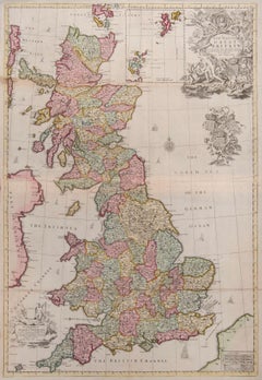
- Great BritainBy John SenexLocated in London, GBGreat Britain SENEX, John. A New Map of Great Britain Corrected from the Observations communicated to the Royal Society at London. By John Senex F.R.S. To the Right Hono[ra]ble William Connelly ESQ. One of the Commissioners of His Maj[es]ties Revenue, Speakerof the Hono[a]ble House of Commons, and one of His Maj[es]ties most Hono[ra]ble Privy Council for Ye Kingdom of Ireland. This Map is dedicated by John Senex. John Senex F.R.S. 1710 [-1728]. John Senex (1678-1740) was one of the foremost mapmakers in England in the early eighteenth century. He was also a surveyor, globemaker, and geographer. As a young man, he was apprenticed to Robert Clavell, a bookseller. He worked with several mapmakers over the course of his career, including Jeremiah Seller and Charles Price...Category
1710s Naturalistic More Art
MaterialsWatercolor, Engraving
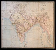
- Railway Map of India.Located in London, GBTHUILLIER, Colonel Henry Ravenshaw. Railway Map of India. Railways Brought up to October 1895. Scale 1 Inch = 48 miles or 1:3,041,280. [Calcutta], Published under the direction of Colonel H. Thuillier, R.E., Surveyor General of India, October 1890. A comprehensive railway map of British India, including the subcontinent and Burma, also displaying the main road networks, navigable canals, steamship routes, and telegraph connections across the peninsular. This publication by the Survey of India Office includes a useful ‘References’ key giving information on the differing gauges in use across the region, and a colour code highlighting the lands under direct British administration in pink, ‘Tributary States’ in yellow and ‘Independent & Foreign Possessions’ in Green. A notice records the price for colour as ‘Five Rupees’, as against ‘Four Rupees’ without. Prepared under the direction of Colonel Henry Ravenshaw Thuillier, who as his father before him, served as Surveyor General of India from 1887 to 1895. Here Baluchistan is shown as an enclave of the British Raj. This strategically important territory lies in modern-day Pakistan, and is situated around the natural fort town of Quetta located high in the Chiltan mountains. It came under direct British rule in 1876, securing the vital Bolan Pass though which British troops under the command of General Michael Biddulph passed during the Second Anglo-Afghan War...Category
1890s Other Art Style More Art
MaterialsLithograph
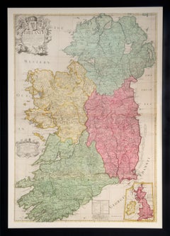
- IrelandBy John SenexLocated in London, GBIreland SENEX, John. Ireland Corrected from the Latest Observations Divided into its Provinces, Counties and Baronies. Shewing the Principal Roads, and the Distances of Places, in Common reputed Miles. by Inspection Where Barracks are Erected &c. By John Senex F.R.S. John Senex F.R.S., the Globe against St Dunstans Church, Fleetstreet, London 1712 [-1728]. John Senex (1678-1740) was one of the foremost mapmakers in England in the early eighteenth century. He was also a surveyor, globemaker, and geographer. As a young man, he was apprenticed to Robert Clavell, a bookseller. He worked with several mapmakers over the course of his career, including Jeremiah Seller and Charles Price. In 1728, Senex was elected as a Fellow of the Royal Society, a rarity for mapmakers. The Fellowship reflects his career-long association as engraver to the Society and publisher of maps by Edmund Halley...Category
1710s More Art
MaterialsEngraving
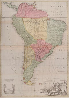
- South AmericaBy John SenexLocated in London, GBSouth America SENEX, John. South America Corrected from the Observations Communicated to the Royal Society’s of London & Paris. By John Senex. To Edmund Halley. LLD. Savilian Professor of Geometry in Oxford and Fellow of the Royal Society. This Map corrected from His own Discoveries In gratefull Acknowledgement of his Ready assistance to Encourage this Designe is Humbly Dedicated. John Senex, at the Globe against St Dunstans Church, Fleetstreet, London 1710 [-1728]. John Senex (1678-1740) was one of the foremost mapmakers in England in the early eighteenth century. He was also a surveyor, globemaker, and geographer. As a young man, he was apprenticed to Robert Clavell, a bookseller. He worked with several mapmakers over the course of his career, including Jeremiah Seller and Charles...Category
1710s Naturalistic More Art
MaterialsWatercolor, Engraving
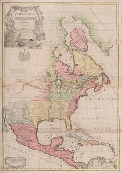
- one of the earliest large-scale English maps of North AmericaBy John SenexLocated in London, GBone of the earliest large-scale English maps of North America SENEX, John. North America Corrected from the Observations Communicated to the Royal Society at London, and the Royal Academy at Paris. By John Senex F.R.S. 1710. To the Honorable Anthony Hammond Esq. One of the Comissioners of Her Maj[es]ties Navy. This Map his humbly Dedicated and Presented by his Obliged Servants. John Senex F.R.S., 1710 [-1728]. A fine map of North and Central America, with the West Indies. One of the earliest large-scale English maps of North America. It represents a British attempt to consolidate new information about the region and borrows data from such recently published sources as Delisle’s landmark Carte du Mexique et de la Floride and Carte de la Canada. Senex improves upon De L'Isle's work with a fine depiction of the Great Lakes region and the most accurate definition of the lower Mississippi River and its delta by an English cartographer of the period. Several of the most important and controversial cartographic discoveries of the period are discussed at length, including Lahontan’s mythical Long River and the Salt Lake east of the Country of the Mozeemleck’s, both of which are also depicted in remarkable (albeit fanciful) detail. Sir William Phipps discovery of Spanish wrecks off the coast of the Caicos and Southern Bahamas is also noted. Senex also extended the map’s coverage to the Canadian Arctic and the Terra Incognita above Baffin’s Bay. Present-day Oklahoma and Texas are part of La Floride, considered at the time to be a possession of the French. The Red River and the Indian villages of East Texas are portrayed accurately, but Senex, following Delisle, incorrectly placed many Texas rivers...Category
1710s Naturalistic More Art
MaterialsWatercolor, Engraving
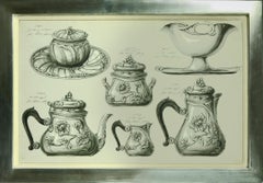
- Collection of Watercolour Designs for Silverware.Located in London, GB[ANON.] Collection of Watercolour Designs for Silverware. South Germany, [Late 19th century]. A series of 9 watercolours, each framed and glazed, ...Category
Late 19th Century Figurative Drawings and Watercolors
MaterialsPaper, Watercolor, Pencil
You May Also Like
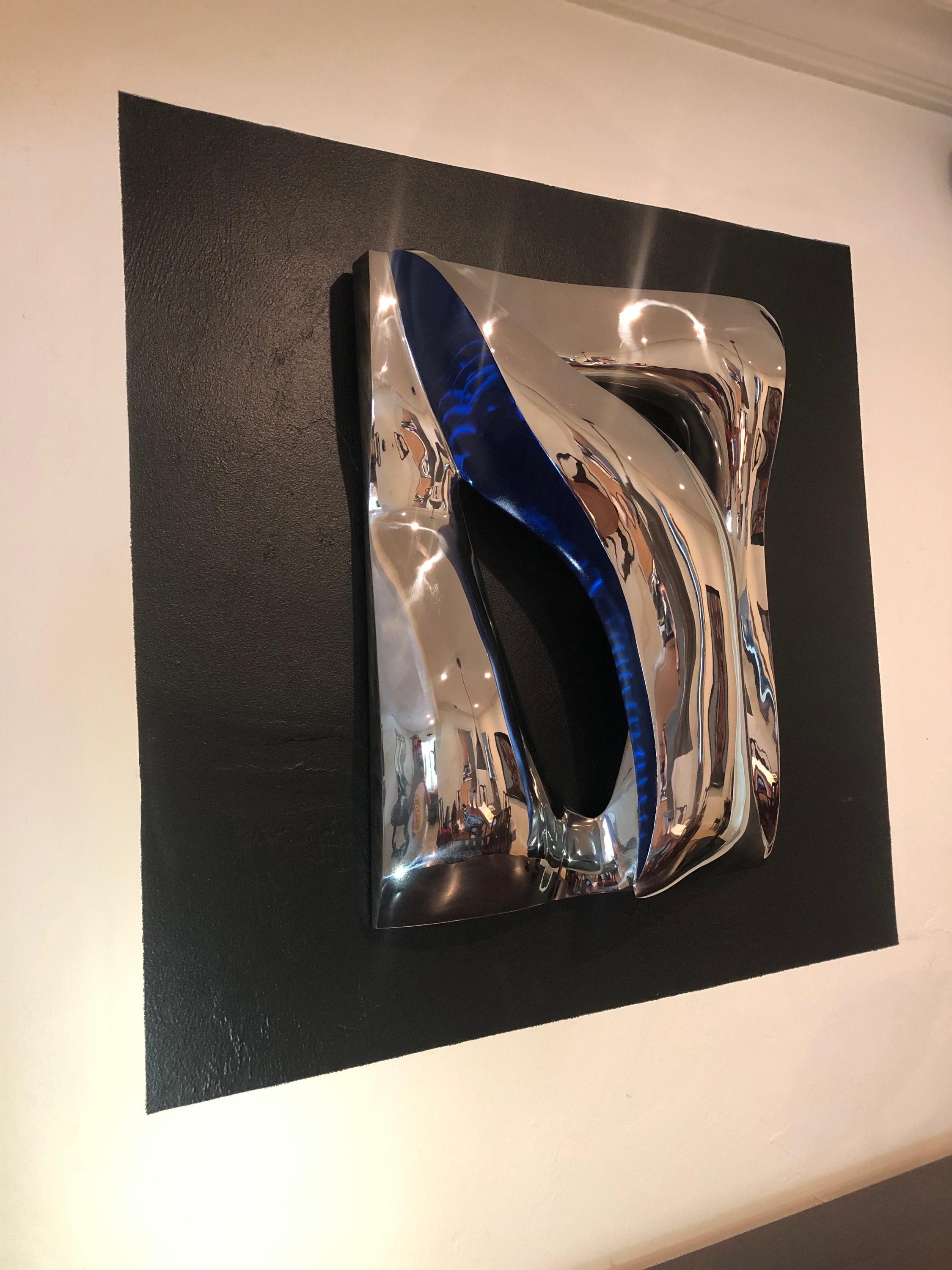
- Santiago Medina - Blue Illusion, Sculpture 2018By Santiago MedinaLocated in Greenwich, CTItalian stainless steel with blue tinting. Wall or table top sculpture. This sculpture will be shipped directly from the artist's studio.Category
2010s Abstract Abstract Sculptures
MaterialsStainless Steel
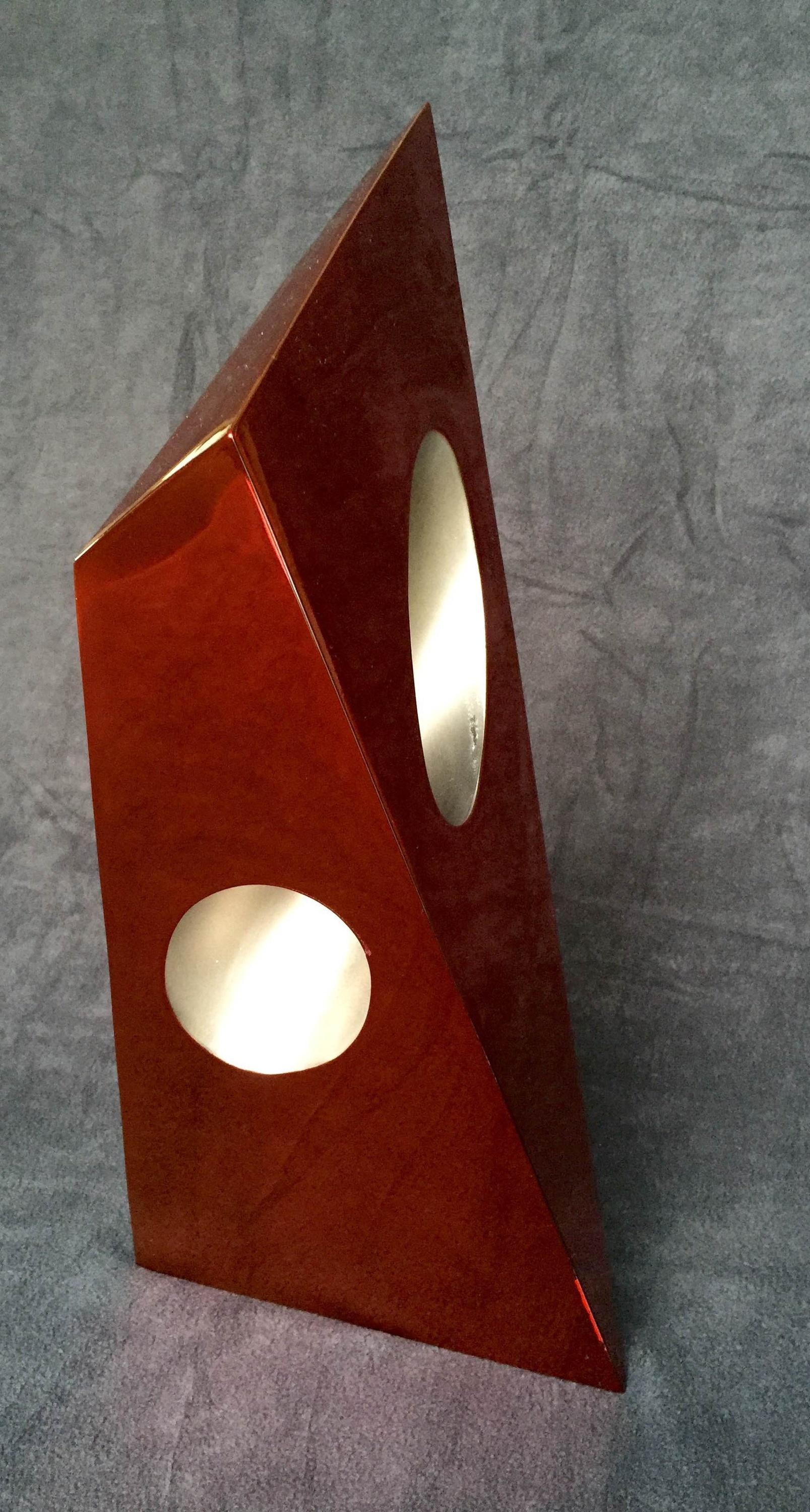
- Santiago Medina - Red Fortitude, Sculpture 2018By Santiago MedinaLocated in Greenwich, CTItalian stainless steel with red tinting. This sculpture will be shipped directly from the artist's studio.Category
2010s Abstract Abstract Sculptures
MaterialsStainless Steel
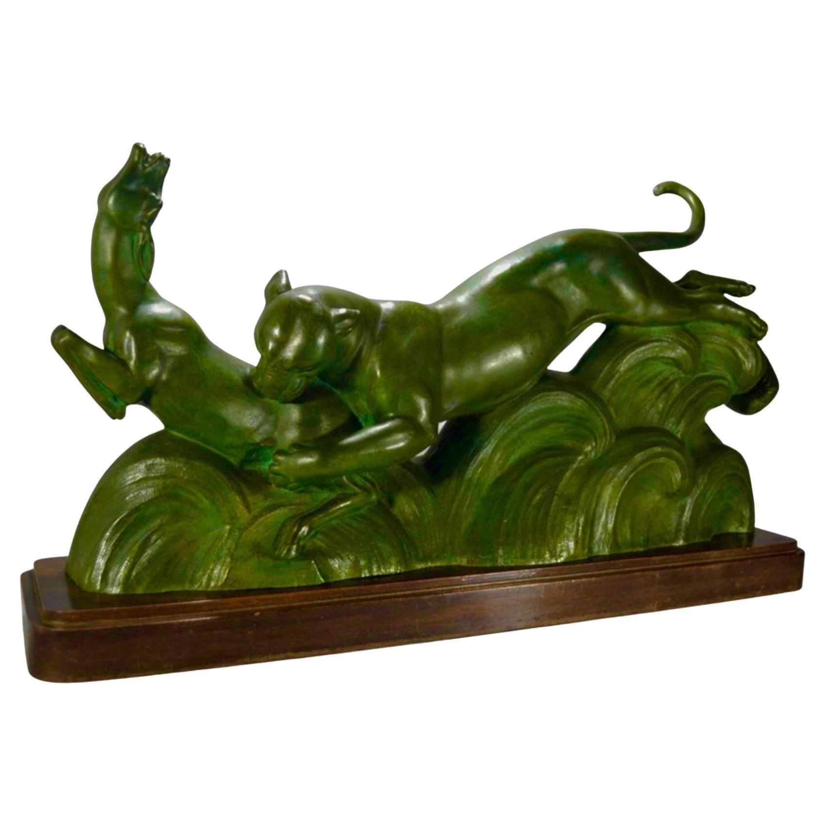
- Art Deco French Bronze Sculpture of Panther and Gazelle by OulineBy Alexandre OulineLocated in Oakland, CAArt Deco French bronze sculpture of panther and gazelle by Alexander Ouline portrays animals in action, a kind of abstract forest floor in bronze all mounted on a wooden base. Ouline...Category
1930s Art Deco More Art
MaterialsBronze
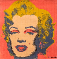
- Marilyn, Pop Art Woolen Tapestry after Andy WarholBy Andy WarholLocated in Long Island City, NYA monumental limited edition Woolen Tapestry of Andy Warhol's iconic "Marilyn" published by Museum Masters International in 1997. Artist: after Andy ...Category
1990s Pop Art Mixed Media
MaterialsWool
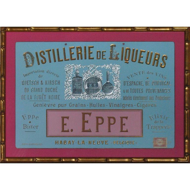
- Distillerie De Liqueurs E. Eppe c1898 Advert SignageLocated in Bristol, CTOriginal liqueur advert signage in bright pink & sky blue colours w/ silver bottles & a stamp (LR) dated 1898 Art Sz: 11 3/4"H x 17 1/2"W Frame Sz: 15 1/4"H x 21"WCategory
19th Century More Art
MaterialsPaper
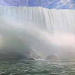
- "Waterfall with Spray" Small Landscape of Waterfall and Rocks, Beautiful LightBy Kimberly MacNeilleLocated in Wellesley, MA"Waterfall with Spray," 12 x 12 x 3/4 Inches, is a beautiful small painting of Niagara Falls, part of a larger series of 12 x 12 inch waterfall paintings as seen from various vantag...Category
2010s American Realist Landscape Paintings
MaterialsWood Panel, Oil