Items Similar to Three Varieties of Leucoium , Hortus Eystettensis, ( after ) Besler
Want more images or videos?
Request additional images or videos from the seller
1 of 5
(After) Basilius BeslerThree Varieties of Leucoium , Hortus Eystettensis, ( after ) Besler 1713
1713
About the Item
Three Varieties of Leucoium (I. Leucoium purpureum variegatum flore pleno. II Leucoium pleno flor album purpureis maculis signatum. III. Leucoium pleno flor album sanguine maculis signatum), from B. Besler, Hortus Eystettensis possibly (after) Basil Besler (German, 1561–1628) published 1713 with contemporary hand coloring.
- Creator:(After) Basilius Besler (1561 - 1629, German)
- Creation Year:1713
- Dimensions:Height: 21.5 in (54.61 cm)Width: 17 in (43.18 cm)
- Medium:
- Period:Early 17th Century
- Condition:
- Gallery Location:Paonia, CO
- Reference Number:1stDibs: LU78032590223
About the Seller
4.9
Vetted Seller
These experienced sellers undergo a comprehensive evaluation by our team of in-house experts.
Established in 1978
1stDibs seller since 2017
104 sales on 1stDibs
Typical response time: 11 hours
- ShippingRetrieving quote...Ships From: Paonia, CO
- Return PolicyA return for this item may be initiated within 7 days of delivery.
More From This SellerView All
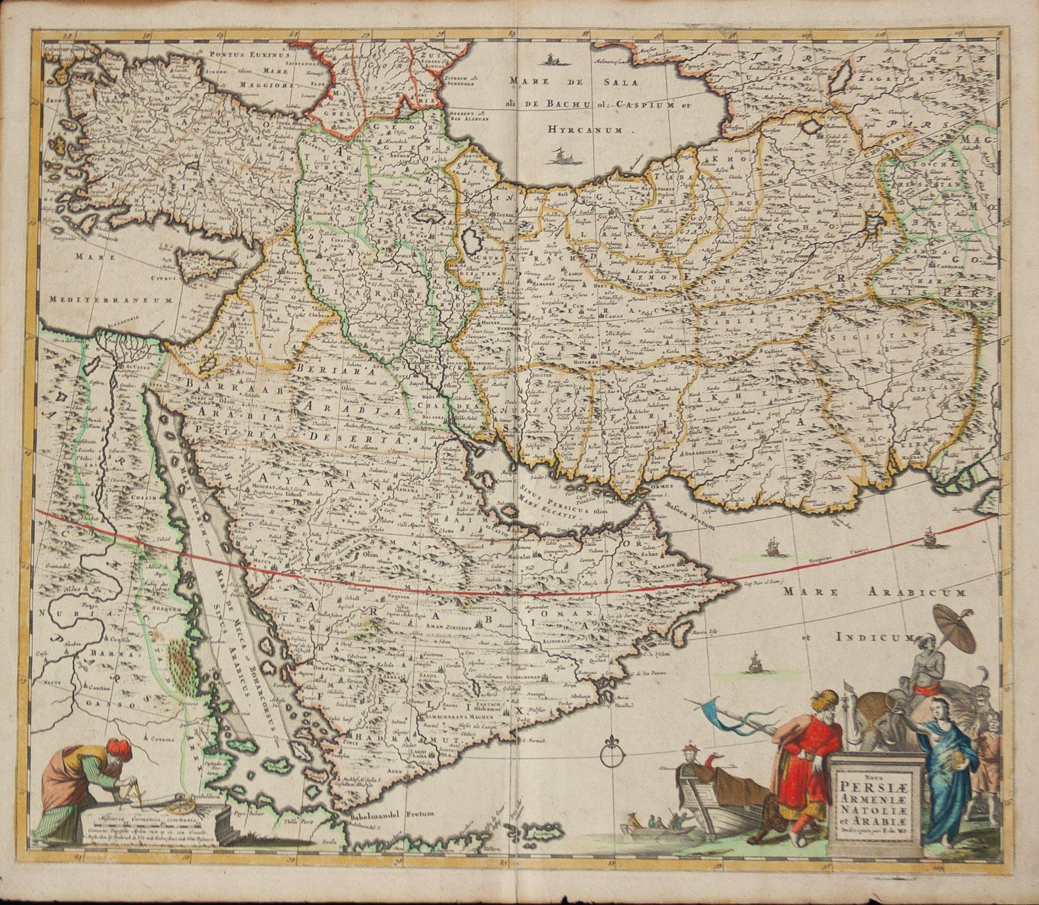
- Persiae, Armeniae, Natoliae et Arabiae Descriptio per Frederick deWit 1666 mapLocated in Paonia, COMap of Persiae, Armeniae, Natoliae et Arabiae Descriptio per F de Wit 1688 engraving from: Atlas Contractus Orbis Terrarum Praecipuas ac Novissimas Complectens Tabulas. Amsterdam, N. Visscher, 1656-77. (Koeman III, Vis5-8) This highly decorative map of the Middle East is by the Dutch engraver, publisher, and map seller...Category
1660s Realist Landscape Prints
MaterialsEngraving
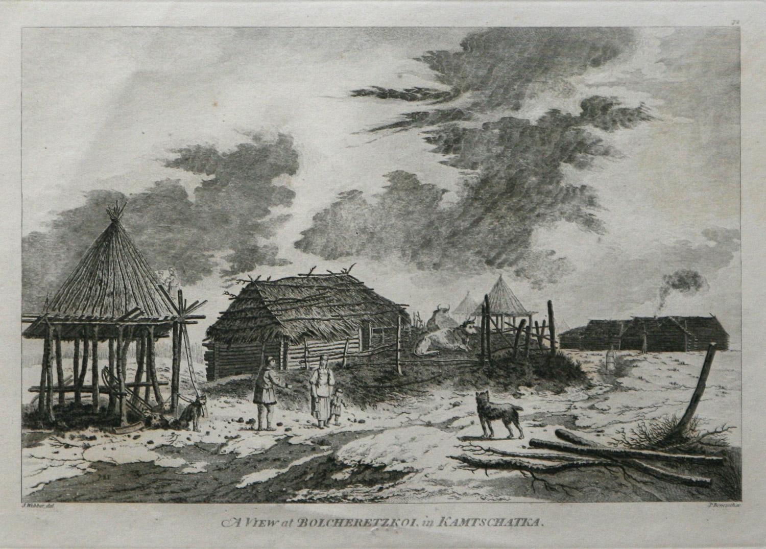
- A View at Bolcheretzko (Russia) 1784 Captains Cook Final Voyage by John WebberBy John WebberLocated in Paonia, COA View at Bolcheretzko (Russia) is from the 1784 First Edition Atlas Accompanying Capt. James Cook and King; Third and Final Voyage of Captain James Cook.John Webber (1752-1793) was ...Category
1780s Realist Landscape Prints
MaterialsEngraving
- Map of the County of Buckingham From an Actual SurveyLocated in Paonia, COCartographers Christopher (1786-1855) and John (1791-1867) Greenwood were surveyors from Yorkshire, who undertook an ambitious project to produce a series of large-scale maps of the counties of England, Wales and Scotland.The maps represent a remarkable and impressive surveying achievement forming an important record of the counties depicted. In the years 1817-1832 the Greenwood brothers published the Atlas of The Counties of England from an Actual Survey. This Atlas was finely drafted and engraved and decorated with large vignettes of prominent buildings of the county. This map of Buckingham County is beautifully hand colored and is in very good condition. There is a vignette of Stowe House...Category
19th Century Other Art Style More Prints
MaterialsEngraving
- England Map of the County of Southampton from an Actual SurveyLocated in Paonia, COCartographers Christopher (1786-1855) and John (1791-1867) Greenwood were surveyors from Yorkshire, who undertook an ambitious project to produce a series of large-scale maps of the counties of England, Wales and Scotland.The maps represent a remarkable and impressive surveying achievement forming an important record of the counties depicted. In the years 1817-1832 the Greenwood brothers published the Atlas of The Counties of England from an Actual Survey. This Atlas was finely drafted and engraved and decorated with large vignettes of prominent buildings of the county. This map of Southampton County is beautifully hand colored and is in very good condition. There is a vignette of Winchester Cathedral...Category
19th Century Other Art Style Landscape Prints
MaterialsEngraving
- AYX Map of Aix en Provence, France by J. Blaeu 17th c.By Joan (Johannes) BlaeuLocated in Paonia, CODetailed plan of Aix en Provence, in France. This print is a hand -colored double sheet engraving by the famous cartographer Joan (Johannes) Blaeu ( 1596 - 1673 ). The left side ...Category
Late 17th Century Other Art Style Landscape Prints
MaterialsEngraving
- Carte Particuliere Des Coste De Bretagne qui Comprend MorlaixBy Pierre MortierLocated in Paonia, COCarte Particuliere Des Costes De Bretagne qui Comprend Morlaix, Saint Paul de Leon, les Sept Isles, et L’Isle. Faite par ordre Exprez Du Roy de France is from the collection of ch...Category
1690s Landscape Prints
MaterialsEngraving


You May Also Like
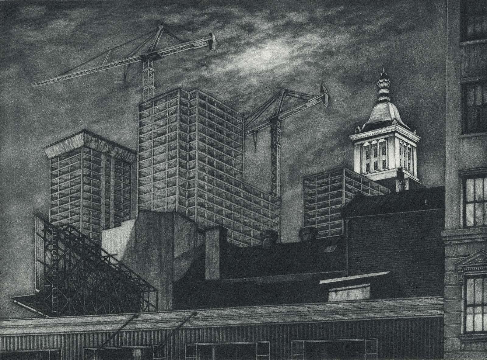
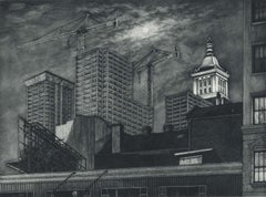
- Cranes and Concrete (in the 80s, a boom saw buildings racing into the sky?By Frederick MershimerLocated in New Orleans, LA"Cranes and Concrete" is Frederick Mershimer's mezzotint of the construction scene on Broadway between 13th and 14th streets. Mershimer is no strang...Category
1980s Contemporary Landscape Prints
MaterialsMezzotint
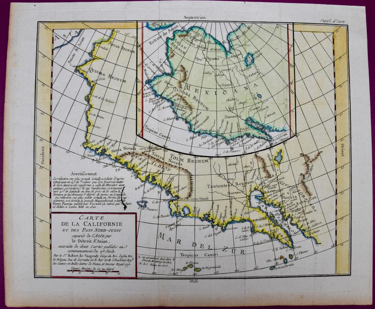
- California: 18th Century Hand-colored Map by de VaugondyBy Didier Robert de VaugondyLocated in Alamo, CAThis is an 18th century hand-colored map of the western portions of North America entitled "Carte de la Californie et des Pays Nord-Ouest separés de l'Asie par le détroit d'Anian, ex...Category
1770s Landscape Prints
MaterialsEngraving
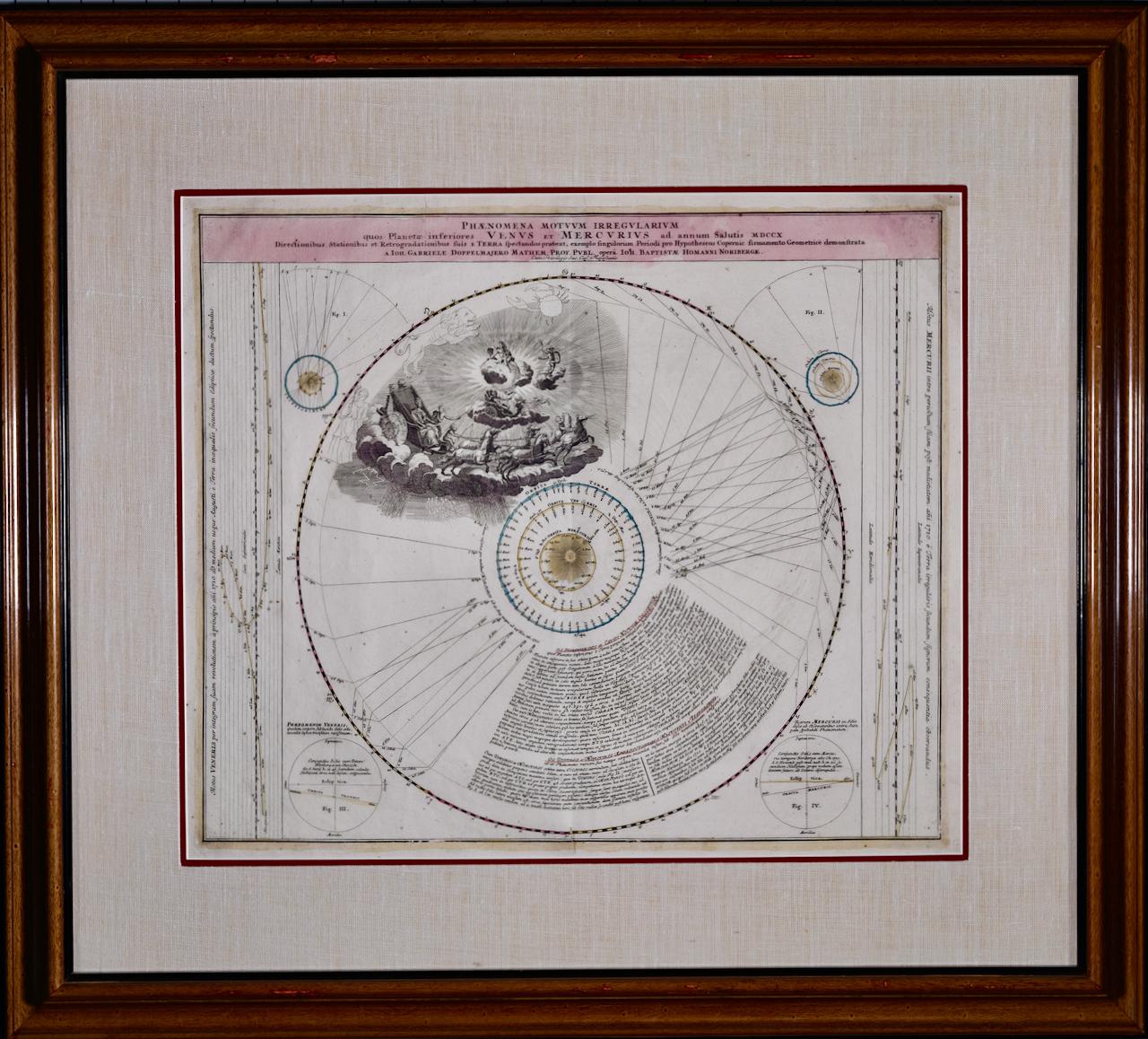
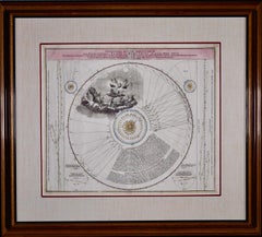
- The Orbits of Venus and Mercury: An 18th C. Framed Celestial Map by DoppelmayrBy Johann Gabriel Doppelmayr 1Located in Alamo, CAThis 18th century hand-colored copperplate celestial map by Johann Doppelmayr entitled "Phænomena Motuum Irregularium quos Planetar inferiores Venus et M...Category
Early 18th Century Landscape Prints
MaterialsEngraving
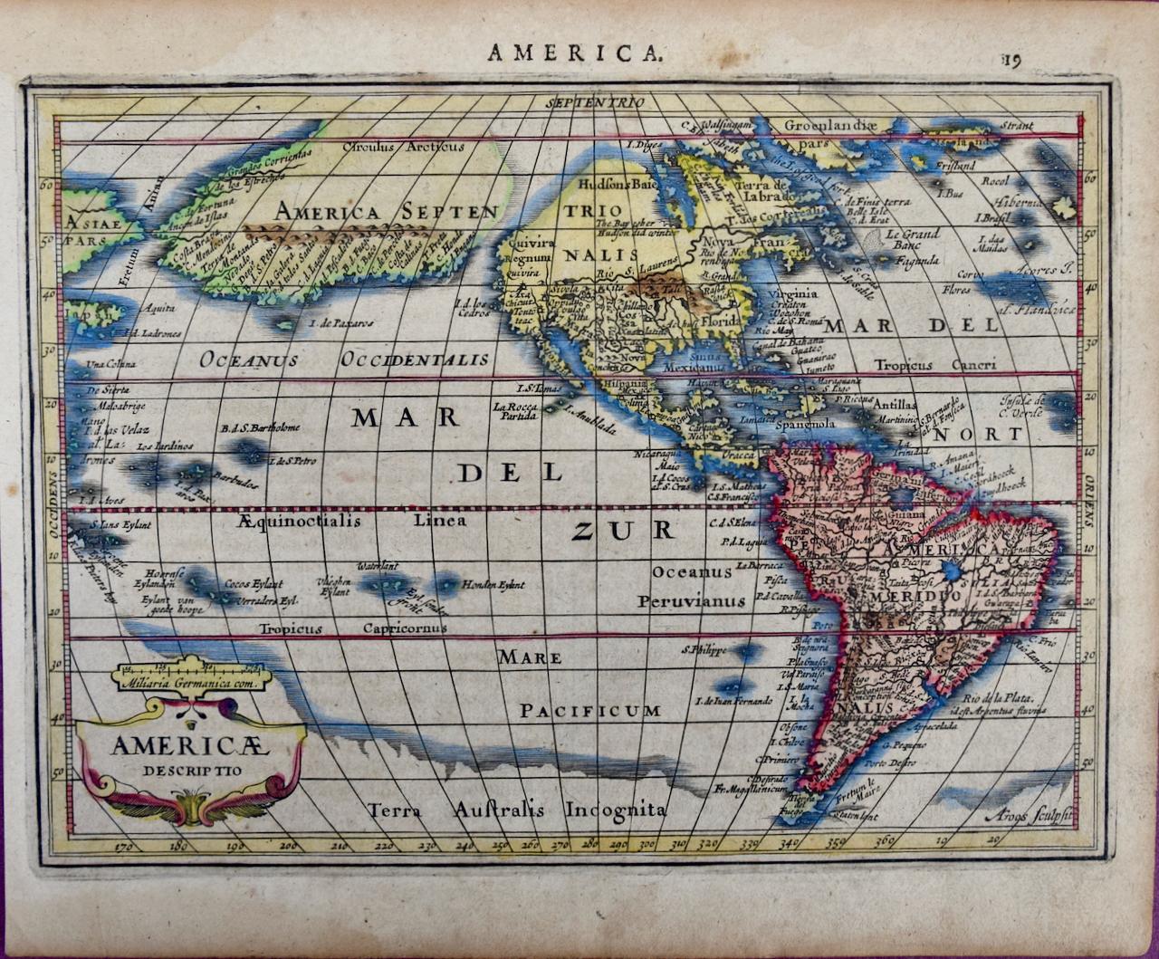
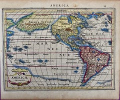
- North & South America: A 17th Century Hand-colored Map by Jansson & GoosBy Johannes JanssonLocated in Alamo, CAA 17th century hand-colored map of North & South America entitled "Americae Descriptio" by the cartographer Johannes Jansson, published in Jansson's Atlas Minor in Amsterdam in 1628....Category
1620s Landscape Prints
MaterialsEngraving
- Persia & Afghanistan: A Framed Hand-colored 17th Century Map by John CaryBy John CaryLocated in Alamo, CAThis colorful and detailed early 18th century copperplate map by John Cary entitled "A New Map of Persia from the Latest Authorities" was published in London in 1801. It depicts Persia, the region of modern day Afghanistan, the Caspian Sea, the Sea of Aral, the Persian Gulf...Category
Early 19th Century Old Masters More Prints
MaterialsEngraving
- The Normandy Region of France: A 17th C. Hand-colored Map by Sanson and JaillotBy Nicholas Sanson d'AbbevilleLocated in Alamo, CAThis large hand-colored map entitled "Le Duché et Gouvernement de Normandie divisée en Haute et Basse Normandie en divers Pays; et par evêchez, avec le Gouvernement General du Havre ...Category
1690s Landscape Prints
MaterialsEngraving


Recently Viewed
View AllMore Ways To Browse
17th Century German Engravings
Besler Engraving
Besler Basilius
Hortus Eystettensis
Basil Besler
Goff Etchings
Hiroshi Yoshida Jizuri
Hockney 220 For 2020
Hoshi Joichi
James Mcneil Whistler Etching
Jean Solombre
John Harris Curler
Joichi Hoshi Woodblock Prints
Justine Smith
Lawrence Nelson Wilbur
Mm Rogers
Park Monceau
Paul Bril