Items Similar to AMERICA

Want more images or videos?
Request additional images or videos from the seller
1 of 10
John SpeedAMERICA1626-76
1626-76
About the Item
IMPORTANT AMERICAN MAP - ONE OF THE FIRST TO SHOW CALIFORNIA as an ISLAND
JOHN SPEED (1552-1629)
AMERICA - With Those Known Parts In That Unknown Worlde (sic),
1626-(76)
(Burden 217 iv/iv) Engraving, uncolored. Engraved by Abraham Goos and
published by Thomas Basset and Richard Chiswell - 4th state of 4 in 1676
15 1/8 x 20 1/2” From “A Prospect of the Most Famous Parts of the
World”. Generally good condition. A repaired split in lower centerfold. This
is the most common version of this important map. One of the earliest
maps to show California as an Island and the first in an atlas. $8,500
Southwest, American Historical, Maps, Ships, Exploration
- Creator:John Speed (1552 - 1629)
- Creation Year:1626-76
- Dimensions:Height: 15.125 in (38.42 cm)Width: 20.5 in (52.07 cm)
- Medium:
- Movement & Style:
- Period:1620-1629
- Condition:
- Gallery Location:Santa Monica, CA
- Reference Number:1stDibs: LU41131940163
About the Seller
5.0
Recognized Seller
These prestigious sellers are industry leaders and represent the highest echelon for item quality and design.
Platinum Seller
These expertly vetted sellers are 1stDibs' most experienced sellers and are rated highest by our customers.
Established in 1977
1stDibs seller since 2016
267 sales on 1stDibs
Typical response time: <1 hour
Associations
International Fine Print Dealers Association
- ShippingRetrieving quote...Ships From: Santa Monica, CA
- Return PolicyA return for this item may be initiated within 7 days of delivery.
More From This SellerView All
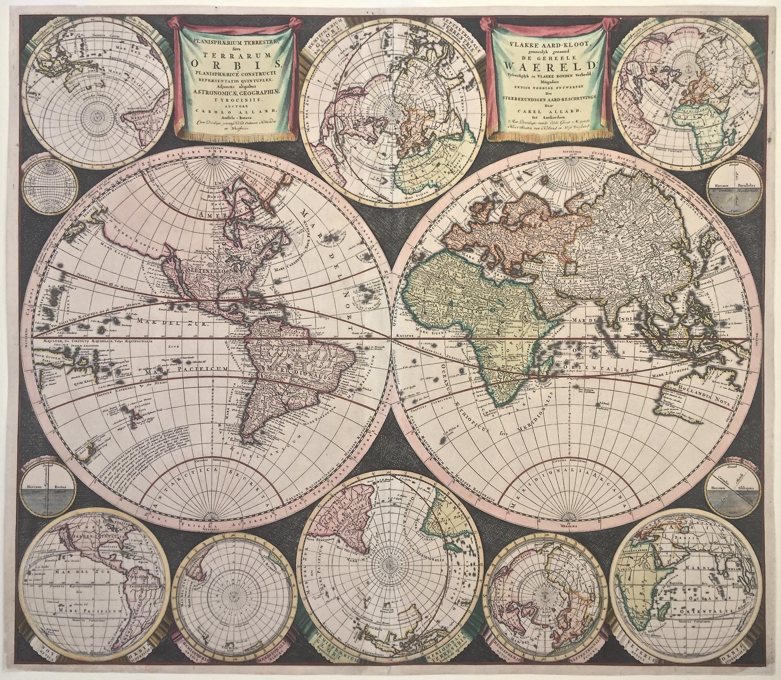
- WORLD MAP - Planisphaerium Terrestre Sive Terrarum Orbis... 1696By Carel AllardLocated in Santa Monica, CACAREL ALLARD (1648 – 1709) PLANISPHAERIUM TERRESTRE SIVE TERRARUM ORBIS… 1696 (Shirley 578) Engraving, 20 ½ x 23 ½”, sheet 21 x 24 1/8". A stunning double hemisphere World Map...Category
17th Century Old Masters Landscape Prints
MaterialsEngraving
- The Deluge - JOSEPH MALLORD WILLIAM TURNER (1775 - 1851)By Joseph Mallord William TurnerLocated in Santa Monica, CA(after) JOSEPH MALLORD WILLIAM TURNER (1775 - 1851) THE DELUGE, 1828. Mezzotint, Engraved by I. P. Quilly after a painting by J. M.W. Turner R.A.. Image ...Category
1820s Old Masters Landscape Prints
MaterialsMezzotint
- New Map of the Terraqueous Globe - WORLD MAP - CALIFORNIA AS AN ISLANDBy Edward WellsLocated in Santa Monica, CAEDWARD WELLS (British 1667- 1727) A NEW MAP of the TERRAQUEOUS GLOBE - according to the latest Discoveries and most general Divisions of it into CONTINENTS and OCEANS, 1700-01 (Shirley 609) Engraved by Michael Burghers, Oxford. Hand-colored, Platemark 14 1/4 x 20 1/8 inches. Central cartouche flanked by figures representing the continents with dedication to William, Duke of Gloucester...Category
Early 1700s Old Masters Landscape Prints
MaterialsEngraving
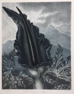
- THE DRAGON ARUMBy Dr. Robert John ThorntonLocated in Santa Monica, CADR. ROBERT JOHN THORNTON (circa 1768- 1837) THE DRAGON ARUM, 1801 (Dunthorne plate 161, pg. 250 i/iii; Nissen 1 955) Mezzotint printed in Payne's grey...Category
Early 1800s Old Masters Landscape Prints
MaterialsMezzotint
- PERUBy Johannes JanssonLocated in Santa Monica, CAJOHANNES JANSSON (1588 - 1664) PERU, engraving with early coloring. Platemark 15 1/8 x 19 3/8 inches, sheet 17 x 20 1/2 A nice example of one of the earliest maps of Peru. From the ...Category
1630s Old Masters Landscape Prints
MaterialsEngraving
- AMERICAE - Sive Novi Orbis, Nova DescriptioBy Abraham OrteliusLocated in Santa Monica, CAABRAHAM ORTELIUS (1527 - 1598) AMERICAE SIVE NOVI ORBIS, NOVA DESCRIPTIO, 1587 (1603) (Van Den Broecke 11, Burden 64; Schwartz & Ehrenberg 69) Engraving. A very good, well printed...Category
16th Century Old Masters Landscape Prints
MaterialsEngraving


You May Also Like
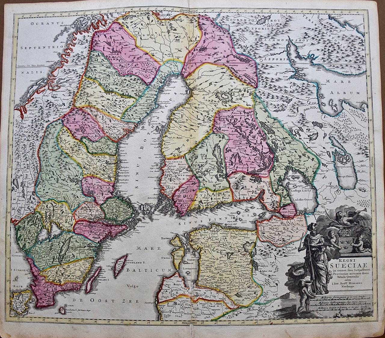
- Sweden and Adjacent Portions of Scandinavia: A Hand-colored 18th C. Homann MapBy Johann Baptist HomannLocated in Alamo, CAThis hand-colored copper-plate map of Sweden and adjacent portions of Scandinavia entitled "Regni Sueciae in Omnes suas Subjacentes Provincias accurate divisi Tabula Generalis" was c...Category
Early 18th Century Old Masters Landscape Prints
MaterialsEngraving
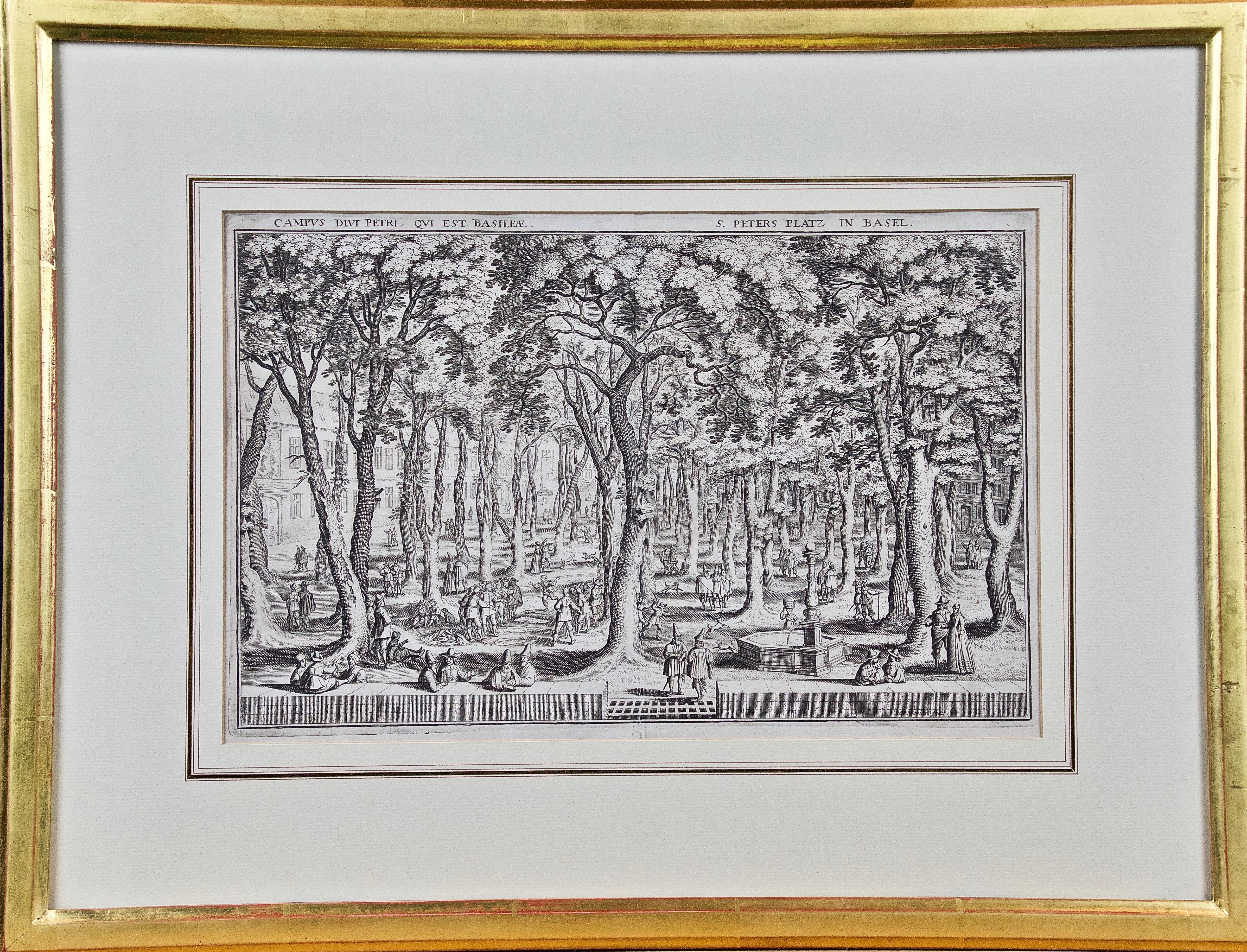
- St. Peter's Square in Basel: 17th Century Engraving by Matthäus MerianBy Matthäus Merian the ElderLocated in Alamo, CA"Campus Divi Petri qui est Basileae" (St. Peter's Platz in Basel) is a 17th century engraving by the old master engraver Matthäus Merian the Elder...Category
1650s Old Masters Landscape Prints
MaterialsEngraving
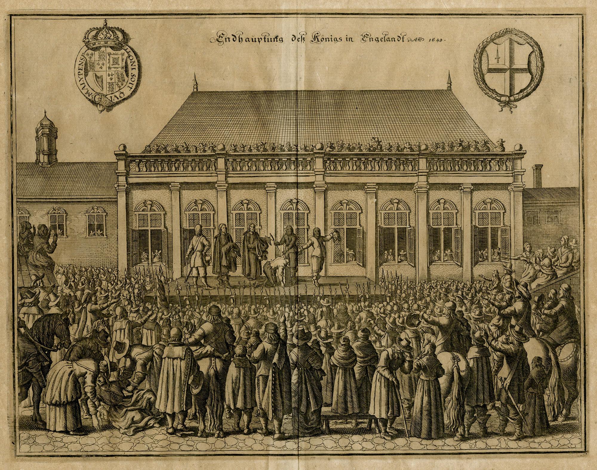
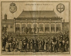
- The Beheading of the King of England; Enthauptung des Königs in EnglandBy Matthäus Merian the ElderLocated in Middletown, NYThe execution of Charles I (1600-1649) at Whitehall, January 30th 1649, in front of the Banqueting House. The executioner holding the head of Charles up to the crowd below. Engravin...Category
Mid-17th Century Old Masters Landscape Prints
MaterialsEngraving, Laid Paper
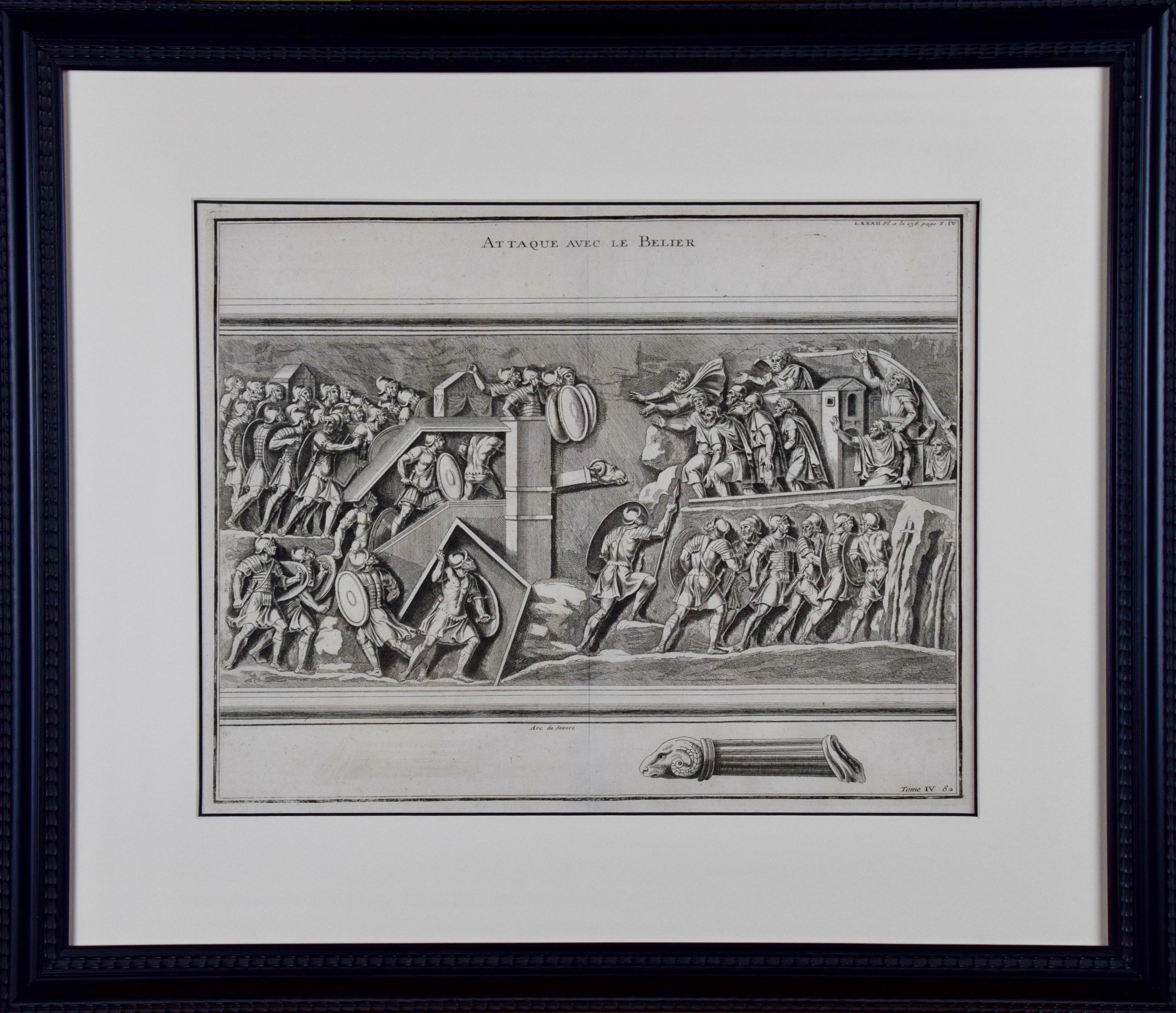
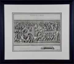
- 18th Century Engraving "Attack with a Battering Ram" by MontfauconLocated in Alamo, CAThis early original copper-plate engraving entitled "Attaque avec le Belier" from 'L'antiquité expliquée et représentée en figures' (Antiquity Explained and Represented in Diagrams), published in Paris in 1719 by Bernard de Montfaucon. It depicts an ancient...Category
Early 18th Century Old Masters Landscape Prints
MaterialsEngraving
- Frankfort, Germany: A 16th Century Hand-colored Map by Braun & HogenbergBy Franz HogenbergLocated in Alamo, CAThis is a 16th century original hand-colored copperplate engraved map of Frankfort, Germany entitled "Francenbergum, vel ut alij Francoburgum Hassiae Opp" by Georg Braun & Franz Hogenberg, from their famous city atlas "Civitates Orbis Terrarum", published in Cologne, Germany in 1595. This is an English translation of an excerpt from the original text in the atlas: "Frankenberg or, according to others, Francoburgum, a town in Hesse. Charlemagne vested the town of Frankenberg with many freedoms and privileges, which it still enjoys to this day, and on account of its valiant and victorious soldiers awarded a signet, upon which there formerly appeared a golden castle with a tower, together with the letter F and a golden crown. Frankenberg, seen here from the northeast, lies on a hill above the River Eder. The hillside is covered with fields neatly separated by bushes and fences. Soaring above the town is the massive Liebfrauenkirche, which was modelled on St Elizabeth's church in Marburg. The New Town was founded in 1335 at the foot of the hill (right) and merged with the Old Town as late as 1556. Frankenberg was founded by Conrad of Thuringia in 1233/34 to prevent the archbishops of Mainz from expanding their sphere of influence...Category
16th Century Old Masters Landscape Prints
MaterialsEngraving
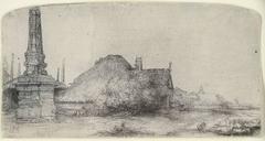
- COTTAGE AND OBELISK ON THE SPAARNDAMMERDIJKBy Rembrandt van RijnLocated in San Francisco, CAOriginal etching and drypoint printed in black ink on laid paper. A strong and dark 17th century/lifetime impression of Bartsch, Usticke and New Hollstein’s second and final stat...Category
18th Century and Earlier Old Masters Landscape Prints
MaterialsDrypoint, Etching


Recently Viewed
View AllMore Ways To Browse
Old Master Ship
Antique Ship Parts
Old American Maps
California Map
Antique Map California
Antique Map Of California
Antique Maps California
Antique Maps Of California
Speed Map
California Island Map
California As An Island Map
Speed Antique Map
John Speed Map
John Speed Maps
John Speed Antique Maps
Currier Ives View Of New York
Cyclone Coney Island
Frances Aronson