Items Similar to John Speede Map The Countye Palatine of Chester with that most ancient citie
Want more images or videos?
Request additional images or videos from the seller
1 of 5
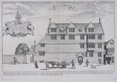
John SpeedJohn Speede Map The Countye Palatine of Chester with that most ancient citie 1676
1676
About the Item
To see our other views and maps of England - including London, Oxford and Cambridge, scroll down to "More from this Seller" and below it click on "See all from this Seller" - or send us a message if you cannot find the view you want.
John Speed/Speede (1551/2-1629)
The Countye Palatine of Chester with that most ancient citie described
Performed by John Speede assisted by William Smyth. And are to be sold by Thomas Bassett in Fleetstreet, and Richard Chiswell in St Paul's Churchyard.
Probably the most famous early English mapmaker, John Speed's early life is somewhat of an enigma. He is believed to have trained as a rolling-press printer, but he was at heart an historian granted a sinecure in the Customs House by Queen Elizabeth to indulge his passion, later becoming a Fellow of the Society of Antiquaries. His first maps were historical, of the Holy Land 'Canaan as it was Possessed both in Abraham and Israels Dayes' and of England and Ireland recording 'all their Civill Warres since the Conquest'.
In 1611 he published his 'Hostory of Great Britaine' which he regarded as his magnum opus, but it was the companion atlas 'Theatre of the Empire of Great Britaine' that - as the first printed atlas of Great Britain - sealed his reputation. William Rogers engraved the first map, 'the County Palatine of Chester' in about 1600, but following his untimely death the task of engraving was passed to Jodocus Hondius of Amsterdam.
By 1612 the atlas was complete, the maps famed for their decorative elements. Many have town plans - Brtiain's first series of such plans - and descriptive text was printed to the reverse until the 1676 edition. Later printings (up until 1770) were issued without this text. By 1627 it has become a part of a world atlas 'Prospect of the Most Famous Parts of the World'. During the 17th century the plates passed through the hands of a series of publishers, the 1676 edition (as here) of Thomas Bassett and Richard Chiswell being regarded as its high point with the inclusion for the first time of a series of important maps.
- Creator:John Speed (1552 - 1629)
- Creation Year:1676
- Dimensions:Height: 15.36 in (39 cm)Width: 20.08 in (51 cm)
- Medium:
- Movement & Style:
- Period:
- Condition:Trimmed and other small losses outside platemark. Some toning and spotting to paper as usual. Later but well undertaken hand-colouring. Old tape mark to top outside platemark. Generally good condition.
- Gallery Location:London, GB
- Reference Number:1stDibs: LU79535859742
About the Seller
4.8
Platinum Seller
These expertly vetted sellers are 1stDibs' most experienced sellers and are rated highest by our customers.
Established in 2014
1stDibs seller since 2017
286 sales on 1stDibs
Typical response time: <1 hour
- ShippingRetrieving quote...Ships From: London, United Kingdom
- Return PolicyA return for this item may be initiated within 14 days of delivery.
More From This SellerView All
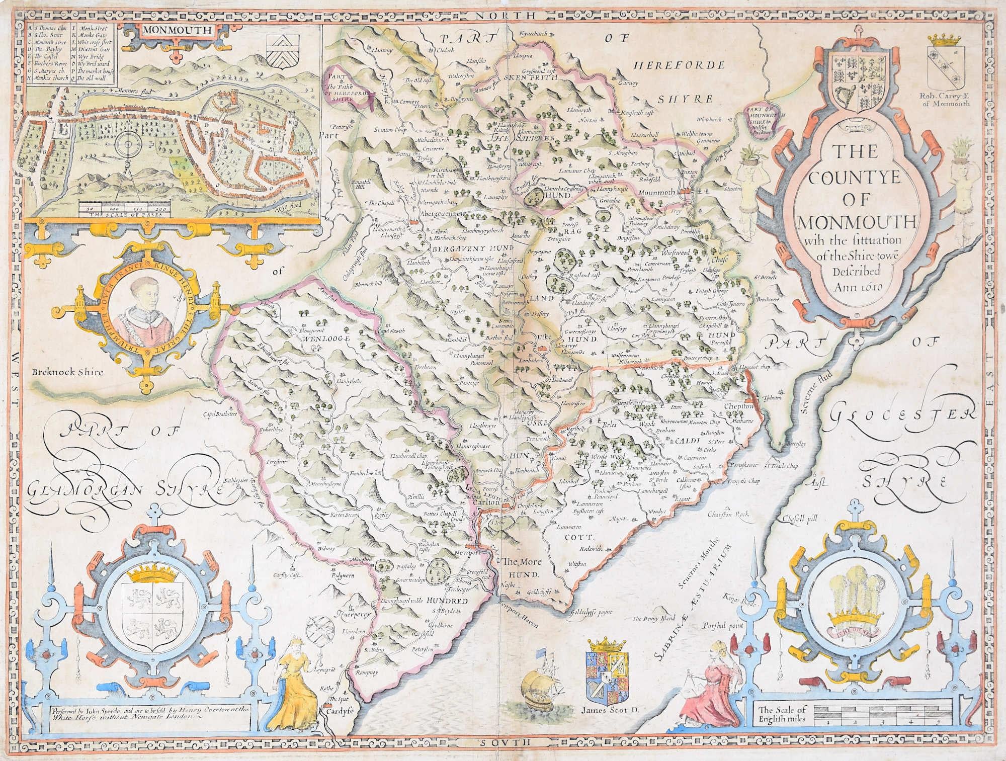
- John Speede Map The Countye of MonmouthBy John SpeedLocated in London, GBTo see our other views and maps of England - including London, Oxford and Cambridge, scroll down to "More from this Seller" and below it click on "See all from this Seller" - or send...Category
17th Century Realist Landscape Prints
MaterialsEngraving
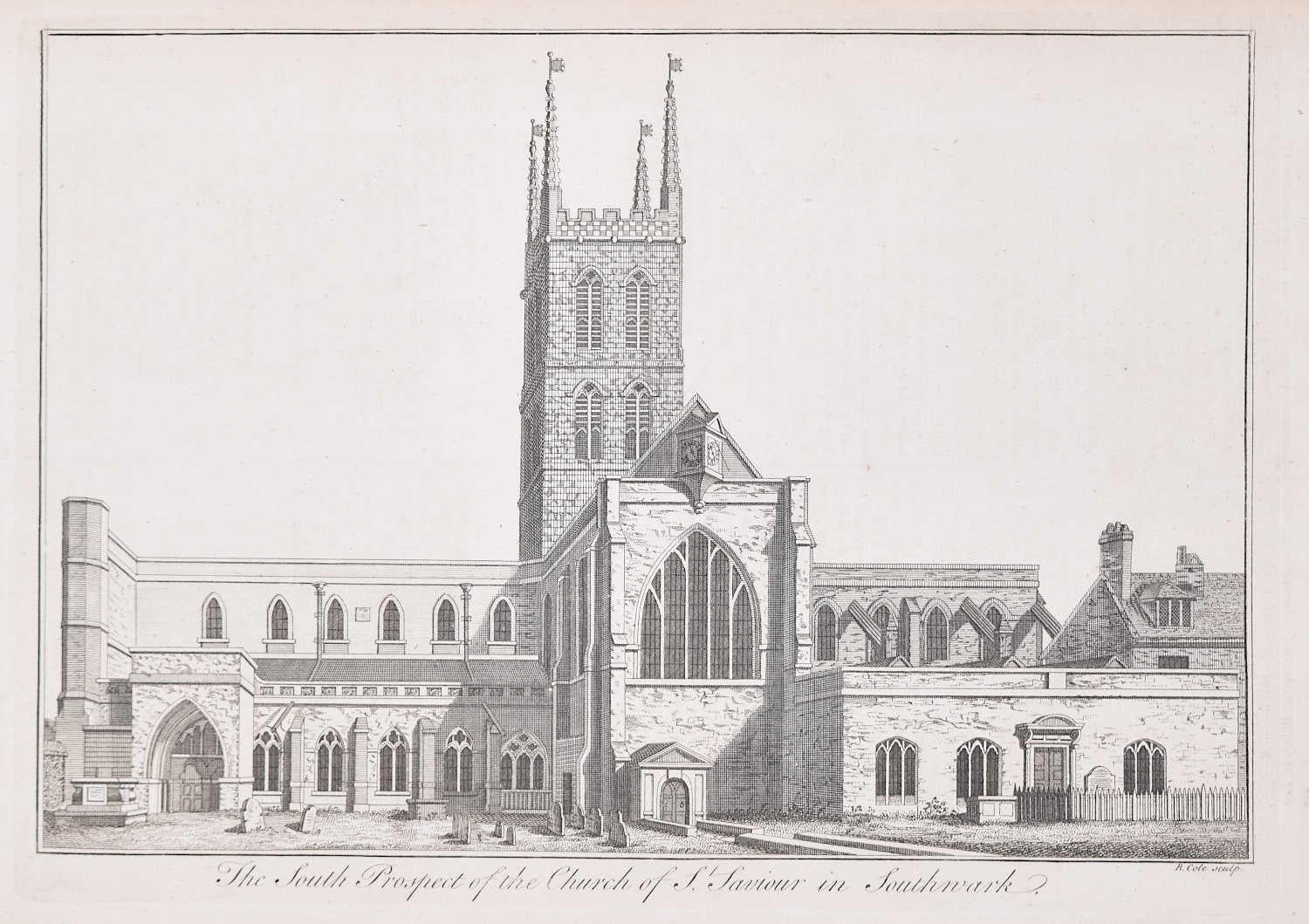
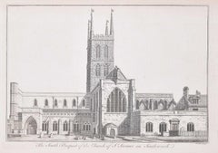
- Southwark Cathedral engraving c. 1753 for Stow's Survey of LondonLocated in London, GBTo see our other views and maps of England - including London, Oxford and Cambridge, scroll down to "More from this Seller" and below it click on "See all from this Seller" - or send...Category
1750s Realist Landscape Prints
MaterialsEngraving
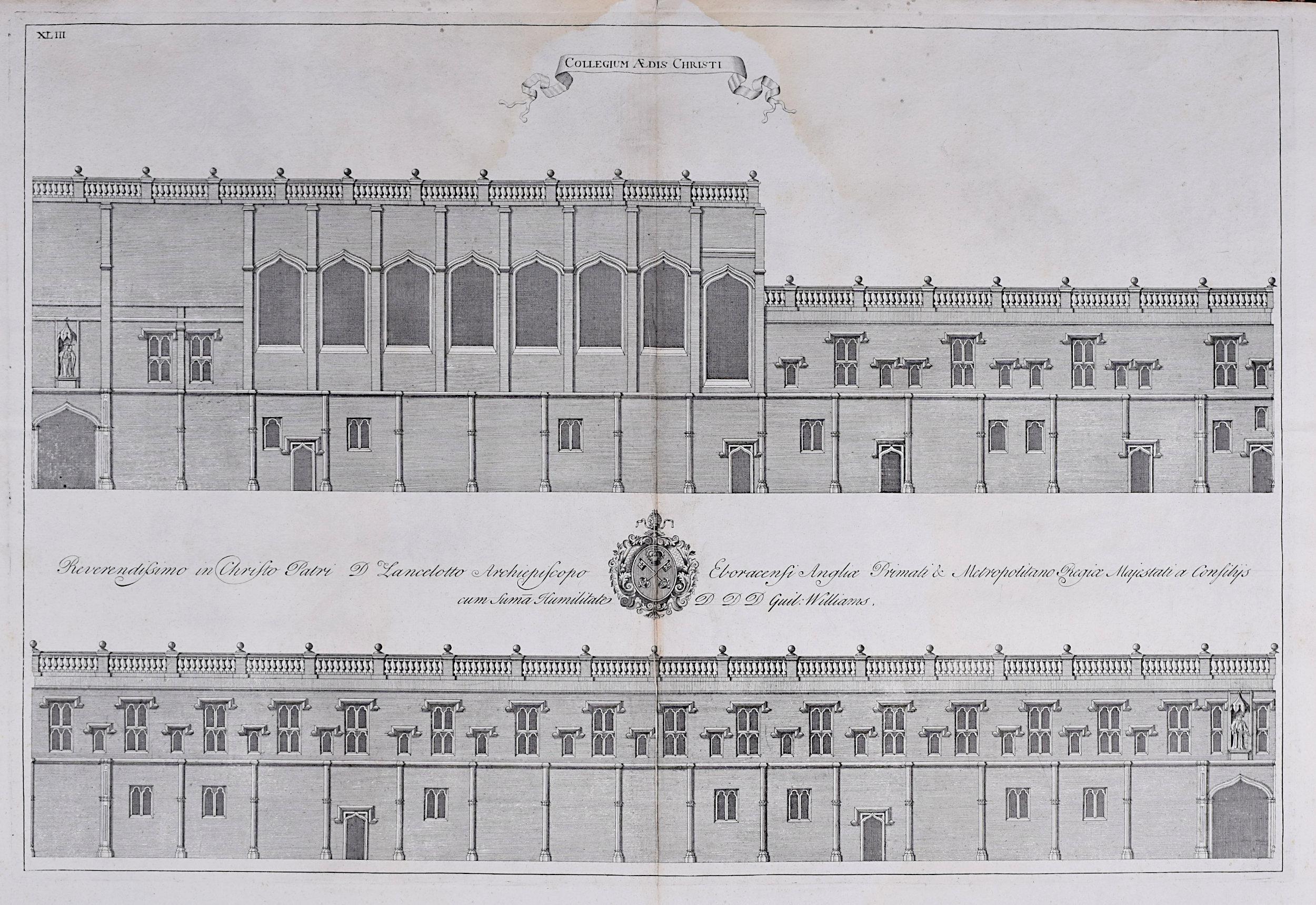
- William Williams engraving of Christ Church - College at Oxford c.1732By William Williams (painter)Located in London, GBTo see our other views of Oxford and Cambridge, scroll down to "More from this Seller" and below it click on "See all from this Seller" - or send us a message if you cannot find the view you want. William Williams...Category
Early 18th Century Realist Landscape Prints
MaterialsEngraving
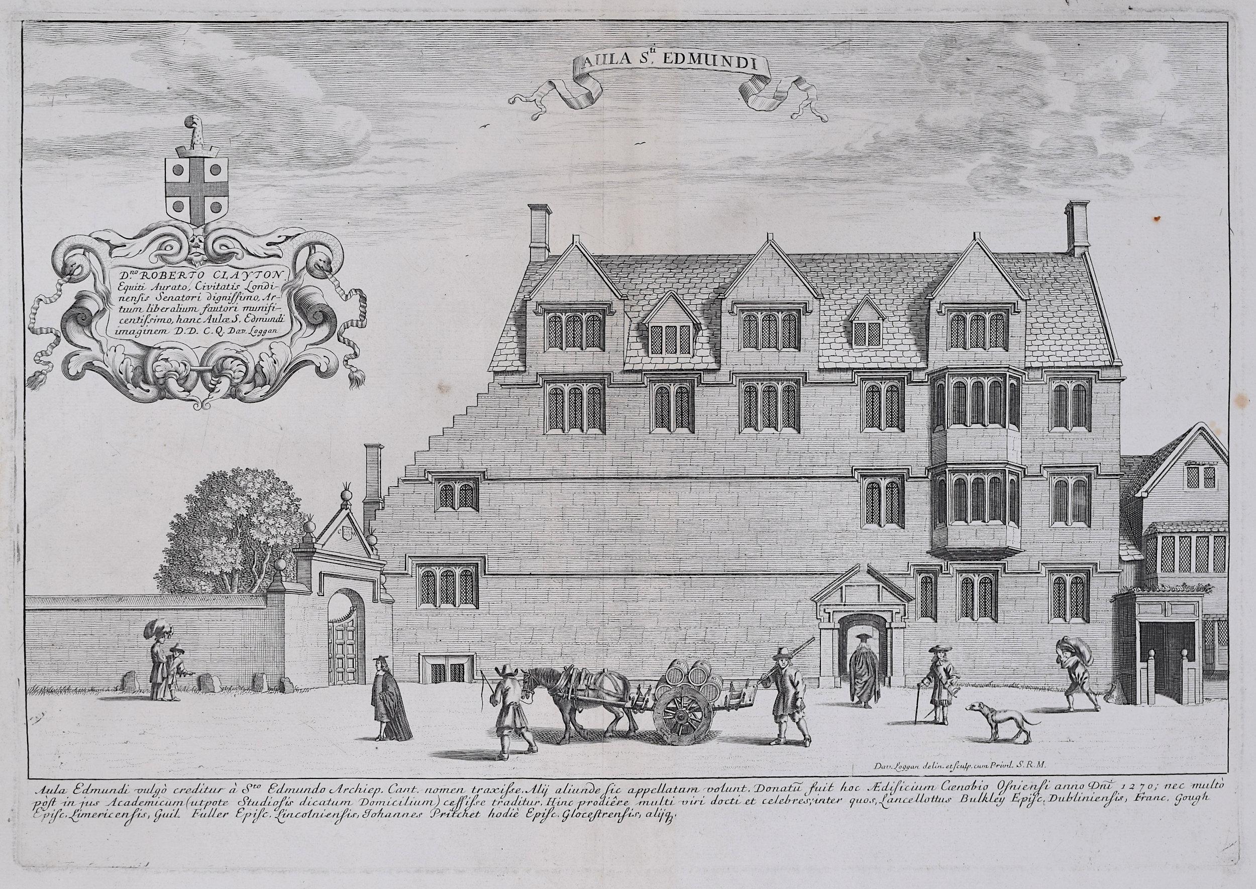
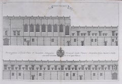
- David Loggan St Edmund Hall Oxford - Aula St Edmundi - 1675 engravingBy David LogganLocated in London, GBTo see our other views of Oxford and Cambridge, scroll down to "More from this Seller" and below it click on "See all from this Seller" - or send us a message if you cannot find the view you want. David Loggan (1634-1692) St Edmund Hall...Category
1670s Realist Prints and Multiples
MaterialsEngraving
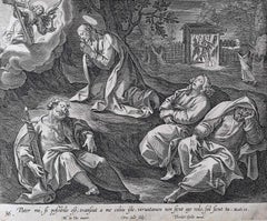
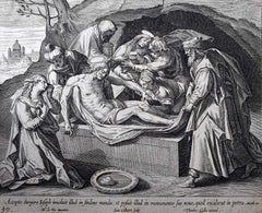
- Theodoor Galle Martin de Vos 17th Century Engraving Drinking from Jesus' CupLocated in London, GBWe have the full series of 52 prints (including title page) from Vita Passio et Resurrectio Iesu Christi listed. To find the others scroll down to "More from this Seller" and below i...Category
17th Century Realist Figurative Prints
MaterialsEngraving
- Theodoor Galle Martin de Vos 17th Century Engraving Jesus' Tomb EasterLocated in London, GBWe have the full series of 52 prints (including title page) from Vita Passio et Resurrectio Iesu Christi listed. To find the others scroll down to "More from this Seller" and below it click on "See all from this Seller" and search for 'Collaert' - or message us as they may not all have been uploaded yet. Theodoor Galle...Category
17th Century Realist Figurative Prints
MaterialsEngraving

You May Also Like
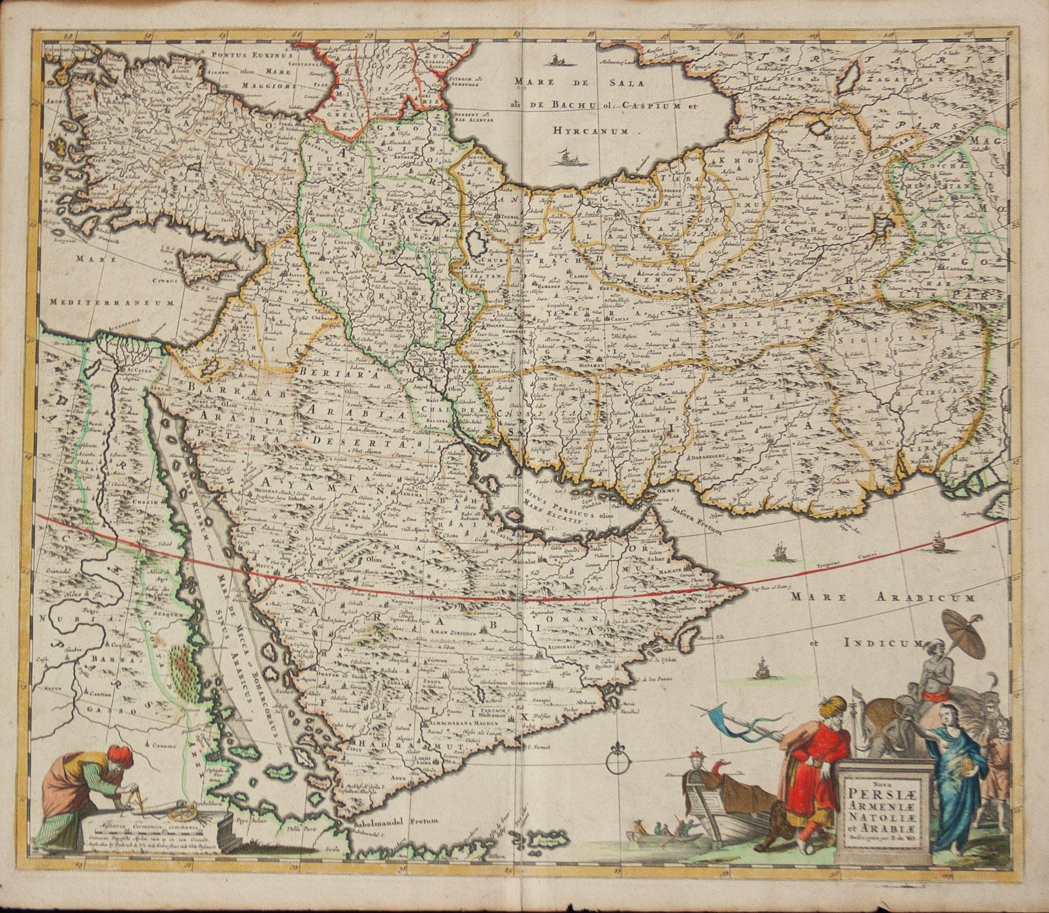
- Persiae, Armeniae, Natoliae et Arabiae Descriptio per Frederick deWit 1666 mapLocated in Paonia, COMap of Persiae, Armeniae, Natoliae et Arabiae Descriptio per F de Wit 1688 engraving from: Atlas Contractus Orbis Terrarum Praecipuas ac Novissimas Complectens Tabulas. Amsterdam, N. Visscher, 1656-77. (Koeman III, Vis5-8) This highly decorative map of the Middle East is by the Dutch engraver, publisher, and map seller...Category
1660s Realist Landscape Prints
MaterialsEngraving
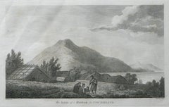
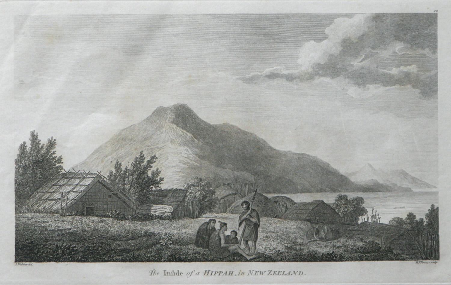
- The Inside of a Hippah in New Zealand from Captain Cooks TravelsBy John WebberLocated in Paonia, COThe Inside of a Hippah in New Zealand is from the 1784 First Edition Atlas Accompanying Capt. James Cook and King; Third and Final Voyage of Captain James Cook John...Category
1780s Realist Landscape Prints
MaterialsEngraving
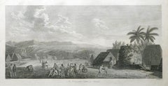
- An Inland View; in Atooi ( Hawaii ) 1784 Captain Cook engraving by John WebberBy John WebberLocated in Paonia, COAn Inland View in Atooi ( Hawaii ) is from the 1784 First Edition Atlas Accompanying Capt. James Cook and King; Third and Final Voyage of Captain James Cook. This engraving depicts ...Category
1780s Realist Landscape Prints
MaterialsEngraving
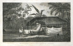
- The Body of Tee, a Chief, as preferred after Death, in Otaheite (Tahiti)By John WebberLocated in Paonia, COThe Body of Tee a chief as preferred after Death in Otaheite (Tahiti) is from the 1784 First Edition Atlas Accompanying Capt. James Cook and King; Third and Final Voyage of Capt...Category
1870s Realist Figurative Prints
MaterialsEngraving
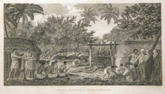
- A Human Sacrifice, in a Morai, in Otaheite (Tahiti) 1784 James Cook Final VoyageBy John WebberLocated in Paonia, COA Human Sacrifice in a Morai in Otaheite (Tahiti) 1784 by John Webber is from the First Edition Atlas Accompanying Capt. James Cook and King; Third and Final Voyage of Captain...Category
1780s Realist Figurative Prints
MaterialsEngraving
- A View at Bolcheretzko (Russia) 1784 Captains Cook Final Voyage by John WebberBy John WebberLocated in Paonia, COA View at Bolcheretzko (Russia) is from the 1784 First Edition Atlas Accompanying Capt. James Cook and King; Third and Final Voyage of Captain James Cook.John Webber (1752-1793) was ...Category
1780s Realist Landscape Prints
MaterialsEngraving