Items Similar to Map of Cambridge 18th century engraving by Sutton Nichols
Want more images or videos?
Request additional images or videos from the seller
1 of 6
Sutton NicholsMap of Cambridge 18th century engraving by Sutton Nichols
About the Item
To see more, scroll down to "More from this Seller" and below it click on "See all from this Seller."
Sutton Nichols (1668 - 1729)
Map of Cambridgeshire
Engraving
43 x 36 cm
Signed in plate lower left.
A beautifully coloured 18th century map engraving of Cambridgeshire. The map was produced by Robert Morden for publication in Edward Gibson's 1695 translation of William Camden's Britannia, a topographical and historical survey of Great Britain and Ireland produced to "restore antiquity to Britaine, and Britain to his antiquity" - a most noble aim.
William Camden (1551 - 1623) was an English antiquarian, historian, topographer, and herald, best known as the author of Britannia, the first chorographical survey of the islands of Great Britain and Ireland, and the Annales, the first detailed historical account of the Queen Elizabeth I's reign.
Sutton Nicholls was a draughtsman and engraver best known for his panoramic views of the cities of London and Westminster. Almost all of his engravings were commissioned by publishers. Nicholls specialised in topographical and architectural designs; he also produced many maps, notably illustrating John Strype’s edition of John Stowe’s ‘Survey of London’ in 1720.
- Creator:Sutton Nichols (1668 - 1729, British)
- Dimensions:Height: 16.93 in (43 cm)Width: 14.18 in (36 cm)
- Medium:
- Period:
- Framing:Framing Options Available
- Condition:Good. Mounted to board.
- Gallery Location:London, GB
- Reference Number:1stDibs: LU795311794292
About the Seller
4.8
Platinum Seller
These expertly vetted sellers are 1stDibs' most experienced sellers and are rated highest by our customers.
Established in 2014
1stDibs seller since 2017
288 sales on 1stDibs
Typical response time: <1 hour
- ShippingRetrieving quote...Ships From: London, United Kingdom
- Return PolicyA return for this item may be initiated within 14 days of delivery.
More From This SellerView All
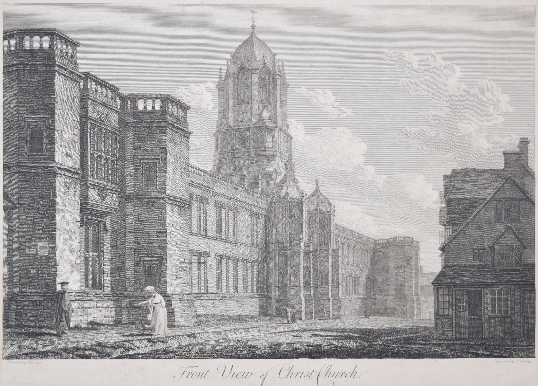
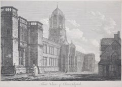
- Christ Church, Oxford 18th century engraving by John Dadley after Edward DayesLocated in London, GBTo see our other views of Oxford and Cambridge, scroll down to "More from this Seller" and below it click on "See all from this Seller" - or send us a message if you cannot find the ...Category
1790s Landscape Prints
MaterialsEngraving
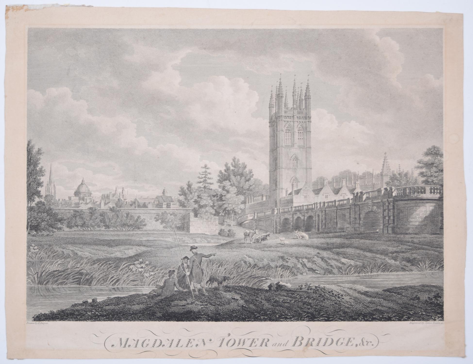
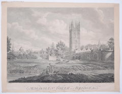
- Magdalen College, Oxford Tower and Bridge 18th century engraving by James BasireLocated in London, GBTo see our other views of Oxford and Cambridge, scroll down to "More from this Seller" and below it click on "See all from this Seller" - or send us a message if you cannot find the ...Category
1790s Landscape Prints
MaterialsEngraving
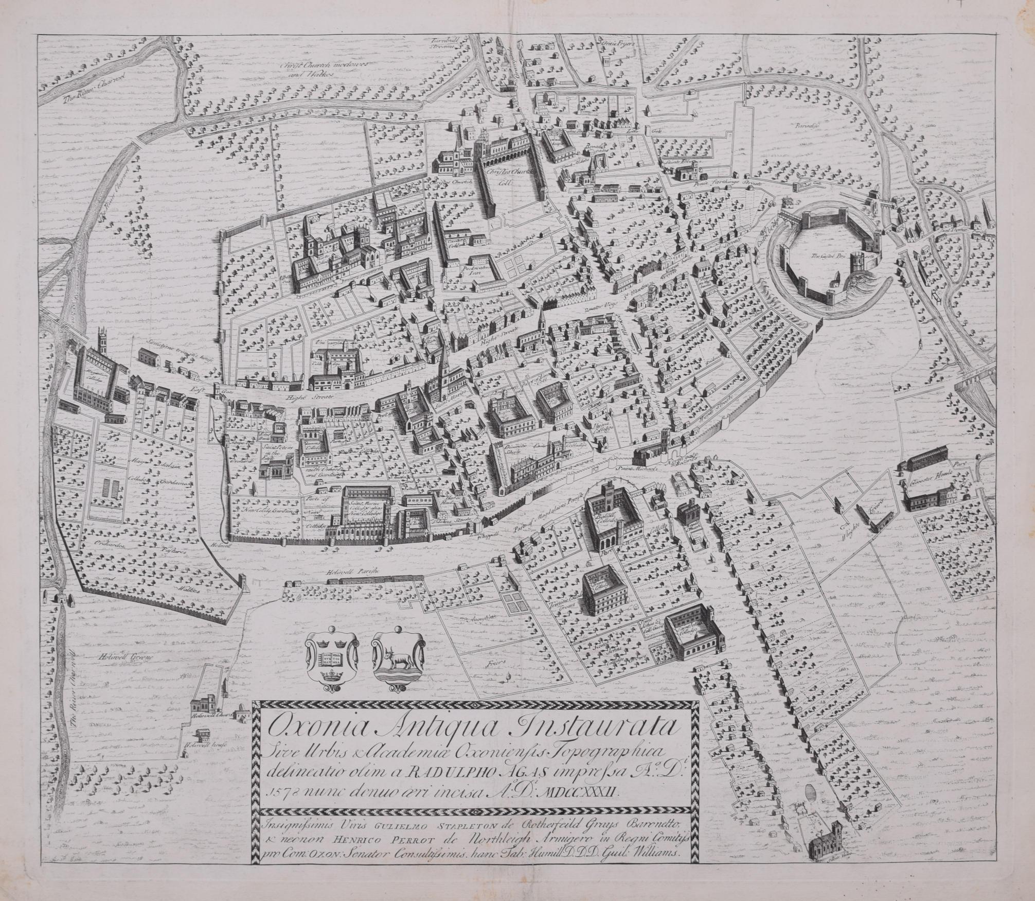
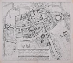
- The First Map of Oxford engraving by William Williams after Ralph AgasLocated in London, GBTo see our other views of Oxford and Cambridge, scroll down to "More from this Seller" and below it click on "See all from this Seller" - or send us a message if you cannot find the view you want. William Williams (active 1724 - 1733) after Ralph Agas (c. 1540 - 1621) The First Map of Oxford (1733) Engraving 47 x 54 cm In 1578, Ralph Agas drew the first ever map of Oxford, studded with the first colleges of the University. In 1733 it was engraved by William Williams for publication in the Oxonia Depicta, a book of illustrations depicting similar views as David Loggan's volume of engravings. Ralph Agas was an English surveyor and cartographer. He was born in Suffolk and lived there throughout his life, although he travelled regularly to London. He began to practise as a surveyor in about 1566, and has been described as "one of the leaders of the emerging body of skilled land surveyors". regular work consisted of drawing up local estate maps...Category
1730s Landscape Prints
MaterialsEngraving
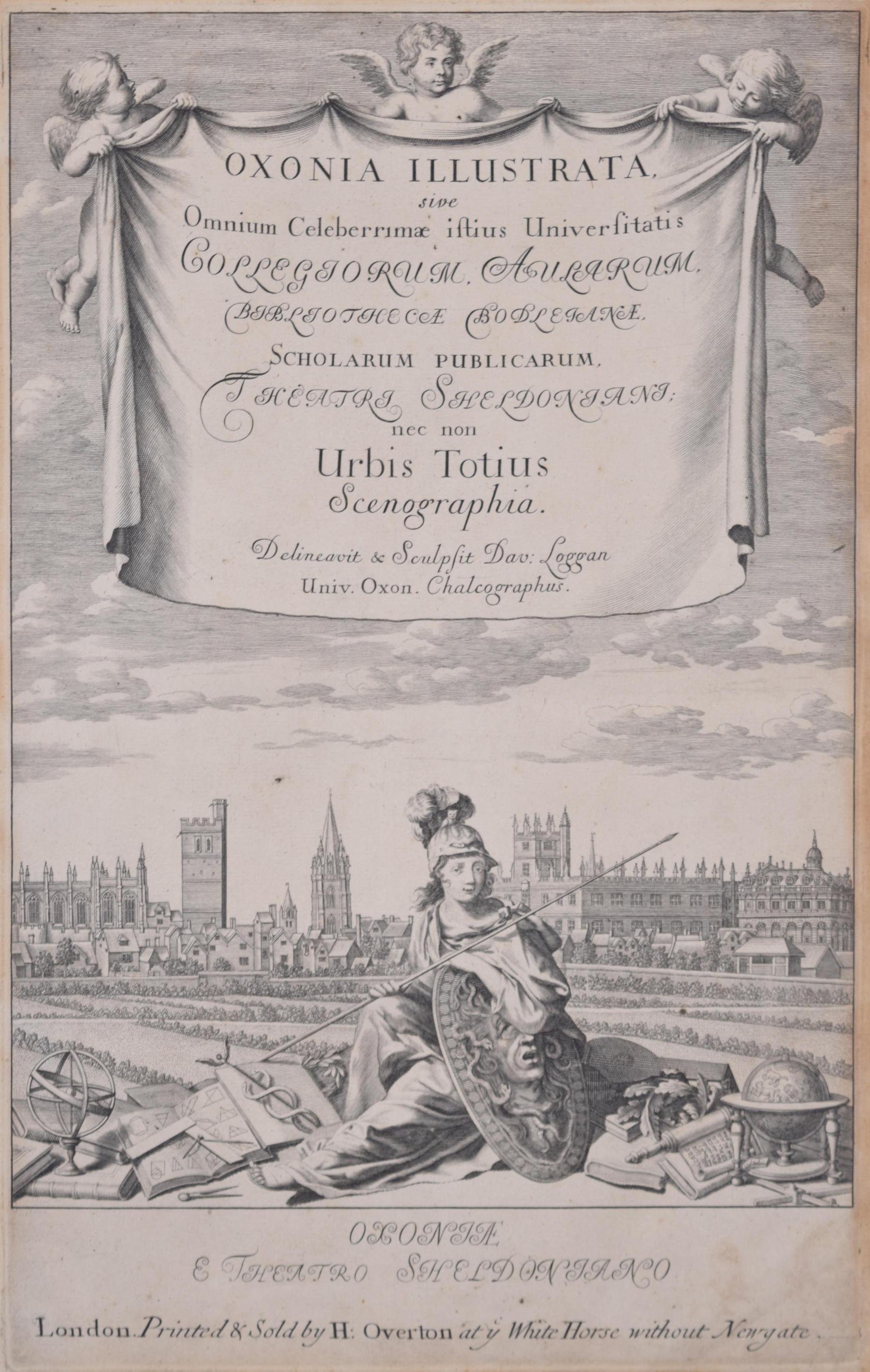
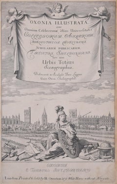
- University of Oxford Oxonia Illustrata 1675 engraving by David LogganBy David LogganLocated in London, GBTo see our other views of Oxford and Cambridge, scroll down to "More from this Seller" and below it click on "See all from this Seller" - or send us a message if you cannot find the ...Category
1670s Old Masters Prints and Multiples
MaterialsEngraving
- Cambridgeshire map 17th century engraving by John SpeedBy John SpeedLocated in London, GBTo see more, scroll down to "More from this Seller" and below it click on "See all from this Seller." John Speed (1551 or 1552 - 1629) Map of Cambridgeshire Engraving with later hand colouring 39 x 53 cm A beautifully coloured map of Cambridgeshire, with an antique description...Category
1610s Landscape Prints
MaterialsEngraving
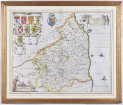
- Map of Northumberland by Joan BlaeuBy Joan (Johannes) BlaeuLocated in London, GBTo see our other original maps, scroll down to "More from this Seller" and below it click on "See all from this Seller" - or send us a message if you cannot find the poster you want....Category
1660s Landscape Prints
MaterialsEngraving

You May Also Like
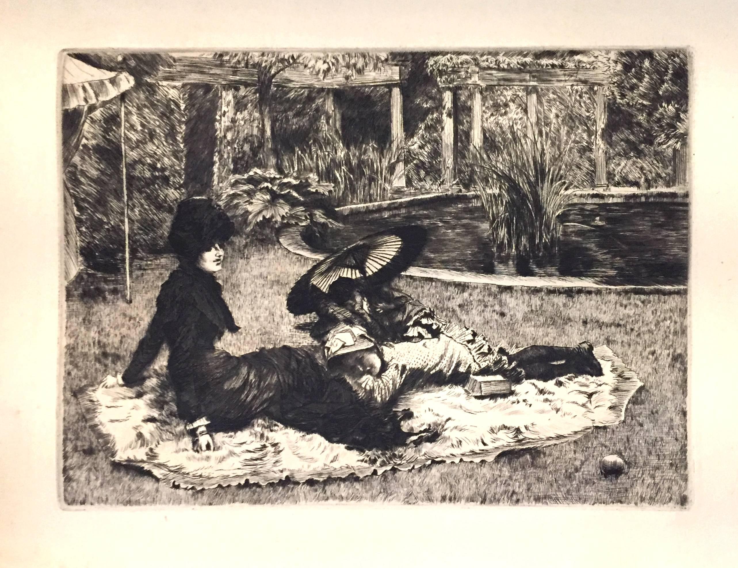
- On the Grass - Etching and Drypoint by J. Tissot - 1880By James TissotLocated in Roma, ITVery fine print on verge crème. Some small traces of oxidation, dust and some flowerings on external edges of sheet, otherwise excellent conditions. Full margins. Ref. Wentworth 50.Category
1880s Post-Impressionist Landscape Prints
MaterialsDrypoint, Etching
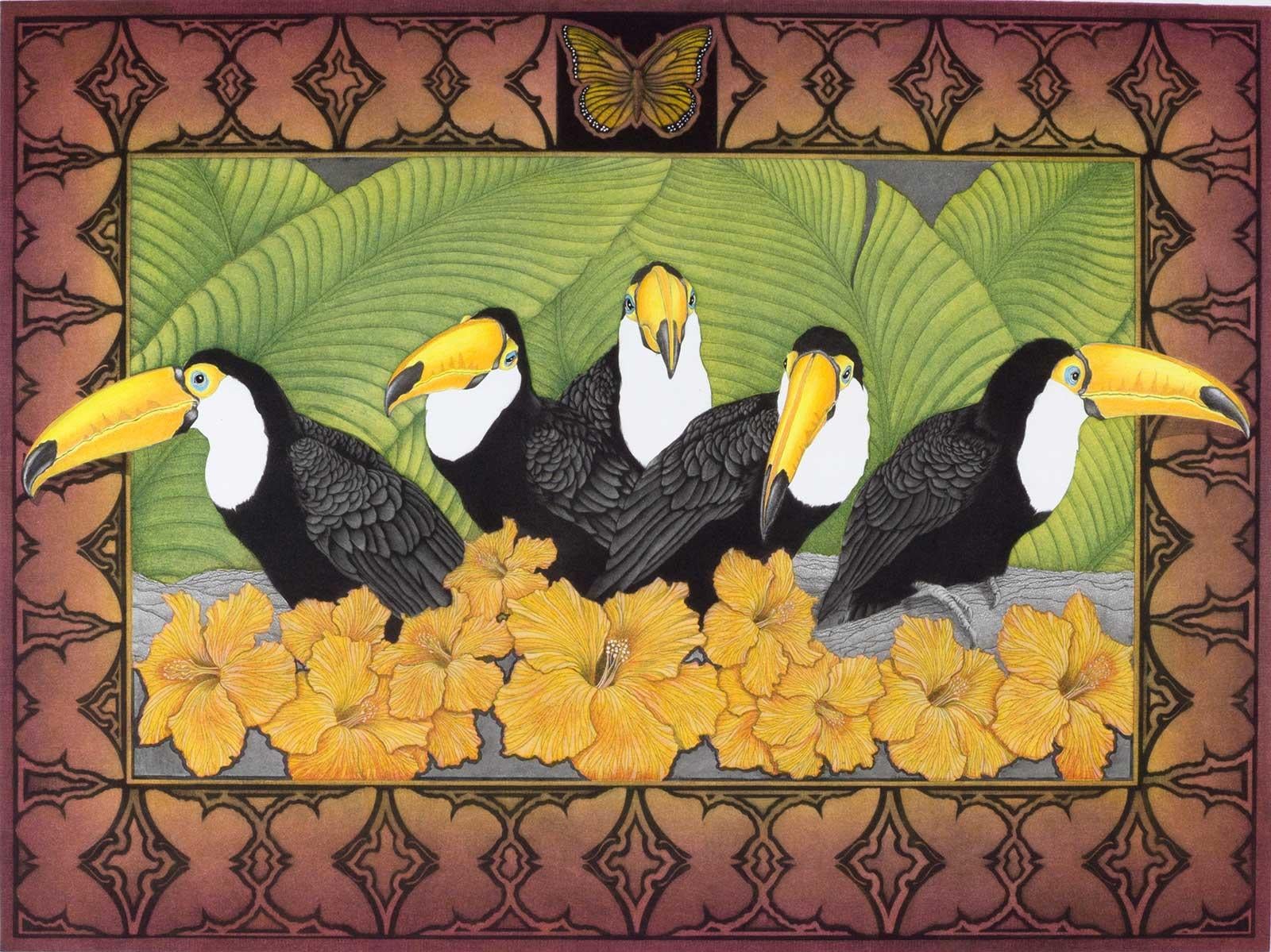
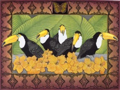
- Rainforest Tapestry(colorful image of birds, ferns and flowers found in tropics)By Sharon Augusta MitchellLocated in New Orleans, LASharon Augusta Mitchell created this vividly colored image of five toucans with bright yellow bills set against a background of green tropical ferns and bright orange flowers. The im...Category
Late 20th Century Contemporary Animal Prints
MaterialsDrypoint, Mezzotint, Aquatint
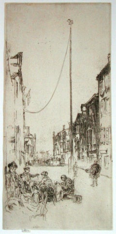
- The Venetian MastBy James Abbott McNeill WhistlerLocated in Storrs, CTThe Venetian Mast. 1879-80. Etching and drypoint. Kennedy catalog 195 state .vi; Glasgow catalog 219 state x/xii. 13 3/8 x 6 3/8. Glasgow records 53 impressions. A fine, atmospheric...Category
1870s American Impressionist Landscape Prints
MaterialsDrypoint, Etching
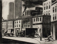
- Under the BridgeBy Lawrence WilburLocated in Storrs, CTUnder the Bridge. 1985. Etching and drypoint. 9 1/2 x 12 1/8 (sheet 20 1/16 x 22). Edition 27, #13. Printed on cream wove paper, on the full sheet with deckle edges. A rich impression in excellent condition, housed in an archival folder. The etching has never been matted. Titled and numbered in pencil. by the artist; signed and initialed in pencil by the artist's estate. Provenance: the artist's estate A dramatic view of the lower East Side in New York. Housed in an archival folder awaiting your choice of mat and frame. Painter and printmaker Lawrence Nelson Wilbur...Category
20th Century American Modern Figurative Prints
MaterialsDrypoint, Etching
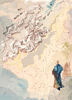
- Salvador Dalí, The Constellation of Blessed Spirits (M/L.1039-1138; F.189-200)By Salvador DalíLocated in Fairfield, CTArtist: Salvador Dali (1904-1989) Year: 1963 Medium: Wood engraving in colors on Rives BFK paper Inscription: Unsigned and unnumbered, as issued Edition: 4765 in French; 3188 in Italian, plus proofs Catalogue Raisonne Reference: Michler & Löpsinger 1039-1138; Field 189-200 Size: 13 x 10.25 inches Condition: Excellent Notes: The Salvador Dali Divine...Category
1960s Surrealist Figurative Prints
MaterialsEngraving
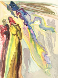
- Salvador Dalí, The Two Circles of Spirits (M/L.1039-1138; F.189-200)By Salvador DalíLocated in Fairfield, CTArtist: Salvador Dali (1904-1989) Year: 1963 Medium: Wood engraving in colors on Rives BFK paper Inscription: Unsigned and unnumbered, as issued Edition: 4765 in French; 3188 in Ital...Category
1960s Surrealist Figurative Prints
MaterialsEngraving

Recently Viewed
View AllMore Ways To Browse
Antique Map Engraving
Antique Survey
Antique Surveying
18th Century City View
Sellers Account
Queen Elizabeth Prints
Antique London Map Print
Antique Sign Ireland
Antique Signs Irish
Great Britain Maps
18th Century Map London
Britannia Designs
Ireland Map
Map Of Ireland
Cambridge Map
Antique Ireland Maps
Antique Irish Map
Antique Irish Maps