Antique Maine Maps
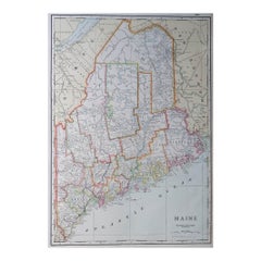
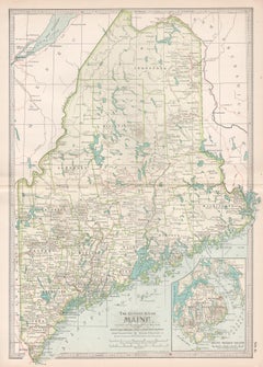
Large Original Antique Map of Maine, USA, C.1900
Located in St Annes, Lancashire
Fabulous map of Maine
Original color
Engraved and printed by the George F. Cram Company
Category
1890s American Antique Maine Maps
Materials
Paper
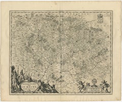
Antique Map of the Maine Region by Janssonius, 1657
By Johannes Janssonius
Located in Langweer, NL
Maine, France. This map originates from 'Atlas Novus, Sive Theatrum Orbis Orbis Terrarum: In quo Galliae
Category
17th Century Antique Maine Maps
Materials
Paper
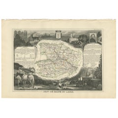
Antique Map of Maine et Loire ‘France’ by V. Levasseur, 1854
Located in Langweer, NL
Antique map titled 'Dépt. de Maine et Loire'. Map of the French department of Maine et Loire
Category
Mid-19th Century Antique Maine Maps
Materials
Paper
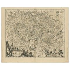
Antique Map of the Region of Maine by Janssonius, circa 1650
By Johannes Janssonius
Located in Langweer, NL
Antique map of France titled 'Diocese du Mans vulgo le Mains'. Decorative map of the region of
Category
Mid-17th Century Antique Maine Maps
Materials
Paper
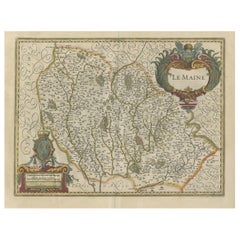
Antique Map of the French Province Maine, Showing Le Mans, Alencon Etc., Ca1640
Located in Langweer, NL
Antique map titled 'Le Maine'.
Old map of the province of Maine, France. It shows the cities of
Category
1640s Antique Maine Maps
Materials
Paper
H 19.49 in W 23.04 in D 0 in
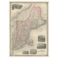
Large Antique Map of New England with decorative Vignettes
Located in Langweer, NL
Antique map titled 'Johnson's New England'. Large map of New England, comprising the states
Category
Mid-19th Century Antique Maine Maps
Materials
Paper
Antique Map of New England and Part of Canada by Vaugondy 'circa 1755'
Located in Langweer, NL
Antique map titled 'Partie de l'Amérique septent qui comprend la nouvelle France ou le Canada
Category
Mid-18th Century Antique Maine Maps
Materials
Paper
No Reserve
H 20.08 in W 25.99 in D 0.02 in
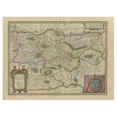
Antique Map of the Region of Le Mans 'France' by Blaeu, circa 1640
By Willem Blaeu
Located in Langweer, NL
Antique map titled 'Cenomanorum Galliae regionis typus vulgo le Mans'. This lovely map of the
Category
Mid-17th Century Antique Maine Maps
Materials
Paper
Free Shipping
H 20.08 in W 23.23 in D 0.02 in
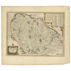
Old Original Handcoloured Map of the Former Province of Perche, France, ca.1640
Located in Langweer, NL
Antique map titled 'Perchensis Comitatus - La Perche compte'.
Old map of the former province of
Category
1640s Antique Maine Maps
Materials
Paper
H 14.77 in W 23.04 in D 0 in
Maine. USA Century Atlas state antique vintage map
Located in Melbourne, Victoria
'The Century Atlas. Maine'
Original antique map, 1903.
Central fold as issued. Map name and
Category
Early 20th Century Victorian Antique Maine Maps
Materials
Lithograph
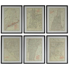
Set of 6 Original Vintage Maps of American States, circa 1900
Located in St Annes, Lancashire
Wonderful set of 6 vintage maps.
Random American states including Maine, Utah, New Hampshire
Category
Early 1900s American Edwardian Antique Maine Maps
Materials
Paper
Satyr and Pan, Life Magazine Cover
By B. Cory Kilvert
Located in Fort Washington, PA
London, devising techniques for camouflage. He also developed an interest in map making and created
Category
1920s Other Art Style Antique Maine Maps
Materials
Board, Oil
Kellogg's Corn Flakes Advertisement
By B. Cory Kilvert
Located in Fort Washington, PA
for camouflage. He also developed an interest in map making and created several mural-sized pictorial
Category
1910s Other Art Style Antique Maine Maps
Materials
Gouache, Board, Watercolor
C. 1625 After Antoine de Pluvinel, "Henry IV, Mounted", Hand Colored Engraving
Located in Morristown, NJ
.
Provenance:
Lombard Antiquarian Maps & Prints, Cape Elizabeth, Maine.
Category
Early 17th Century French Baroque Antique Maine Maps
Materials
Plexiglass, Boxwood, Paint, Paper
H 22.5 in W 25.5 in D 0.5 in
Baron Rais d'Eisenberg, Hand-Colored Equestrian Engraving c. 1747, "Le Brillant"
By Eisenberg
Located in Morristown, NJ
examined out of frame.
Provenance:
Lombard Antiquarian Maps & Prints, Cape Elizabeth, Maine
Category
1740s German Rococo Antique Maine Maps
Materials
Plexiglass, Wood, Paint, Paper
H 16.5 in W 19.25 in D 0.5 in
Map of Palestine or Judea, Illustrating the History of the New Testament
By Rev. Nathan B. Rogers
Located in New York, NY
of meticulous research by a minister working in isolation in rural Maine. The map shows New Testament
Category
19th Century Antique Maine Maps
Materials
Canvas, Paper, Ink, Pen
People Also Browsed
Rare Victorian Firescreen with Taxidermy Hummingbirds by Henry Ward
By Henry Ward
Located in Amsterdam, NL
England, third quarter of the 19th century
On two scrolling foliate feet with casters, above which a rectangular two-side glazed frame, with on top a two-sided shield with initial...
Category
Mid-19th Century English High Victorian Antique Maine Maps
Materials
Other
H 51.19 in W 55.12 in D 201.58 in
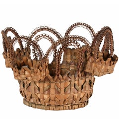
Extraordinary Passamaquoddy (Maine) Native American Sewing Basket, Dated 1891
Located in York County, PA
PASSAMAQUODDY(MAINE) NATIVE AMERICAN SEWING BASKET WITH AN EXTRAORDINARILY EXUBERANT DESIGN,DATED 1891 WITH A PENCILED INSCRIPTION:
This is perhaps the most elaborate American India...
Category
1890s American Native American Antique Maine Maps
Materials
Wood
H 10.75 in W 16 in D 16 in
Duck Decoy Table Lamp
Located in West Palm Beach, FL
This stylish and chic hand-carved wood duck decoy lamp will make a subtle statement with its form and use of materials. The piece was created by Cornwall Wood Products in Paris, Mai...
Category
Mid-20th Century American Rustic Antique Maine Maps
Materials
Brass
American Empire Chest of Drawers with Mirror in Mahogany, Maine, circa 1830
Located in Miami, FL
An American Empire chest in mahogany with four drawers with original turned knobs, and with original vanity mirror with square tapering columns. Chest rests on lion's paw feet with a...
Category
1830s American American Empire Antique Maine Maps
Materials
Mahogany
H 74 in W 44.25 in D 21.5 in
Mid-Century Modern Architecture Travel Guide East Coast USA
Located in New York, NY
A curated list of more than 250 must-see destinations organized geographically from Maine to Florida
Featuring architecture by some of the biggest midcentury names, including Mies ...
Category
21st Century and Contemporary European Antique Maine Maps
Materials
Paper
1959 France - Desnoyer Original Vintage Poster
Located in Winchester, GB
Featuring beautiful artwork from the French painter Francois Desnoyer, depicting the celebrations on the streets and river celebrating France on what is presumably Bastille Day. The ...
Category
1950s French Antique Maine Maps
Materials
Paper
19th Century Sponge Ware Serving/Mixing Bowl
Located in Los Angeles, CA
19th century salt glaze sponge ware mixing or serving bowl in pottery and in mint condition. Great size for shelf or table. This was found in Maine.
Category
19th Century American Antique Maine Maps
Materials
Pottery
New Hampshire Queen Anne Lowboy
Located in Wiscasset, ME
Fine American 18th century queen anne lowboy from New Hampshire in birch. Featuring a thumb molded top with bold cabriole legs and a nice central fan carving. Third quarter of the 18...
Category
1760s North American American Classical Antique Maine Maps
Materials
Birch
French Antique Ormolu Mantel Clock by Leroy Commemorating Napoleon Bonaparte
By LeRoy
Located in London, GB
This fine mantel clock is cast entirely in ormolu by celebrated Parisian clockmaker Leroy and commemorates the return of Napoleon's ashes to France in 1840. The clock is set on a rec...
Category
1840s French Napoleon III Antique Maine Maps
Materials
Ormolu
H 28.94 in W 21.66 in D 11.03 in
1865 "Johnson's California, Utah, Nevada, Colorado, New Mexico, Arizona" Map
Located in Colorado Springs, CO
Presented is an original 1865 "Johnson's California, with Territories of Utah, Nevada, Colorado, New Mexico, and Arizona” map. First published in 1864, this map was issued as pages 6...
Category
Mid-19th Century Antique Maine Maps
Materials
Paper
H 22.5 in W 30.5 in D 0.75 in
Original 1910 George Eldridge Chart
Located in Norwell, MA
Original framed 1910 George Eldridge chart "E" showing Gloucester to the Kennebec river. Showing the coast of Maine in great detail. Towns include Bath, Camden, Portland, the Coastal...
Category
20th Century Unknown Antique Maine Maps
Aaron Draper Shattuck Landscape
By Aaron Draper Shattuck 1
Located in Los Angeles, CA
Aaron Draper Shattuck (1832-1928) was an American painter of the White Mountain School. He was born in French Town, New Hampshire. Growing up during the civil war. He and his brother...
Category
1880s American Antique Maine Maps
Materials
Canvas, Wood, Paint
Osvaldo Borsani Dining Table
By Osvaldo Borsani
Located in Highland, IN
This elegant pedestal table by Borsani has a sexy curved base in chromed and black lacquered steel which supports a walnut top with a beveled edge.
Category
1960s Italian Mid-Century Modern Antique Maine Maps
Materials
Steel
Vintage Modern Sculptural Walnut Dining Room Set
Located in Brooklyn, NY
This stylish set of matching chairs and dining table make a striking addition to any modern dining room or kitchen. Four matching chairs feature sculptural spoke backs and upholstere...
Category
1960s American Mid-Century Modern Antique Maine Maps
Materials
Upholstery, Walnut
John Sloan Etching, 1916, "McSorley's Back Room"
By John Sloan
Located in Phoenix, AZ
John Sloan (1871-1951) etching created 1916.
Edition: 100
Titled: “McSorley’s Back Room”
Plate size: 5 1/4" H x 7 " W
Sheet size: 7 1/2" H x 10 3/8" W
In excellent condition, un...
Category
1910s Antique Maine Maps
Materials
Paper
19th Century New England Original Painted Two-Door Wall Cupboard
Located in Los Angeles, CA
This amazing mustard painted wall cupboard has the best painted surface and is in sturdy condition. This heavy cupboard is a great storage unit for collection of dishes or clothing. ...
Category
Mid-19th Century American Country Antique Maine Maps
Materials
Pine
Recent Sales
6, 19th Century hand-colored maps printed by Anthony Finley of Philadelphia 1824
Located in San Antonio, TX
nascent American cartographic world.
Maps in series: Maryland, Vermont, Maine, Massachusetts, Ohio and
Category
Early 19th Century Academic Antique Maine Maps
Materials
Lithograph, Pastel
H 13 in W 10.38 in D 0.07 in
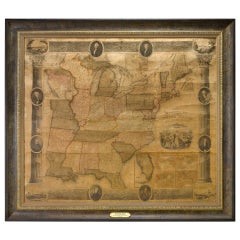
1839 Antique Ornamental Map of the United States, by William Chapin
Located in Colorado Springs, CO
This is a wonderfully "ornamental" hand-colored wall map of the United States from 1839, the first
Category
19th Century American Antique Maine Maps
Materials
Paper
American Revenue Cutter Service Ensign Belonging To Capt. W. H. Bagley
Located in York County, PA
, MAINE), A RARE AND FANTASTICALLY VISUAL EXAMPLE, MADE CA 1870-80:
United States Revenue Cutter
Category
1870s American Antique Maine Maps
H 53.75 in W 81.25 in D 2.5 in
American Revenue Cutter Service Ensign (Flag) Belonging to Cpt. William Bagley
Located in York County, PA
. 1838, Durham, Maine), a rare and fantastically visual example, made circa 1870-1880:
United States
Category
1870s American Antique Maine Maps
H 53.75 in W 81.25 in D 2.5 in
Antique Map of Maine by Johnson, 1872
Located in Langweer, NL
Antique map titled 'Johnson's Maine'. Original map of Maine. This print originates from 'Johnson's
Category
Late 19th Century Antique Maine Maps
Materials
Paper
Original Antique Map of Maine, circa 1890
Located in St Annes, Lancashire
Great map of Maine
Original color.
Published: circa 1890
Repairs to few minor edge tears
Category
1890s English Other Antique Maine Maps
Materials
Paper
1887 Maine Wall Map with Original Hanging Hardware
Located in Colorado Springs, CO
This is an 1887 Wall Map of the State of Maine by Colby & Stuart. This highly detailed Map of Maine
Category
19th Century American Antique Maine Maps
Large Original Antique Map of Maine, USA, 1894
By Rand McNally & Co.
Located in St Annes, Lancashire
Fabulous map of Maine
Original color
By Rand, McNally & Co.
Published, 1894
Unframed
Category
1890s American Antique Maine Maps
Materials
Paper
Original Antique Map of The American State of Maine, 1889
Located in St Annes, Lancashire
Great map of Maine
Drawn and Engraved by W. & A.K. Johnston
Published By A & C Black
Category
1880s Scottish Victorian Antique Maine Maps
Materials
Paper
Antique Map of Maine et Loire ‘France’ by V. Levasseur, 1854
Located in Langweer, NL
Antique map titled 'Dépt. de Maine et Loire'. Map of the French department of Maine et Loire
Category
Mid-19th Century Antique Maine Maps
Maine. USA Century Atlas state antique vintage map
Located in Melbourne, Victoria
'The Century Atlas. Maine'
Original antique map, 1903.
Central fold as issued. Map name and
Category
Early 20th Century Victorian Antique Maine Maps
Materials
Lithograph
Maine et Loire, France. Antique map of French department, 1856
By Victor Levasseur
Located in Melbourne, Victoria
'Dept. de Maine et Loire Steel', engraving with original outline hand-colouring., 1856, from
Category
19th Century Naturalistic Antique Maine Maps
Materials
Engraving
"Prouts Neck, Maine"
By Jesse Leach France
Located in Southampton, NY
. Condition: Very good. Circa 1910. View of Prouts Neck coastline in Maine. Original period frame. Overall
Category
1910s Post-Impressionist Antique Maine Maps
Materials
Oil, Board
1805 Map of the United States
Located in Missouri, MO
. This is a finely detailed and engraved map credited in the inscription to Aaron Arrowsmith and printed
Category
Early 1800s Antique Maine Maps
Materials
Etching
1889 Sea Chart Map of Delaware Bay by George Eldridge, Chart No. 11
Located in Colorado Springs, CO
block plans, among them Philadelphia, Wilmington, Delaware City, and Greenwich.
The map was published
Category
1880s Antique Maine Maps
Materials
Paper
Portrait by William Joseph Weaver, Anglo-American
Located in Litchfield, CT
" x 19 15/16"; 31 ½" x 25 ¼" framed.
Provenance: Private Collection, Maine to 2014; Jeffrey Tillou
Category
Early 19th Century American American Classical Antique Maine Maps
Get Updated with New Arrivals
Save "Antique Maine Maps", and we’ll notify you when there are new listings in this category.
Antique Maine Maps For Sale on 1stDibs
An assortment of antique maine maps is available at 1stDibs. The range of distinct antique maine maps — often made from paper — can elevate any home. Antique maine maps have long been popular, with older editions for sale from the 18th Century and newer versions made as recently as the 19th Century. Antique maine maps made by Victorian designers — are very popular at 1stDibs. Many antique maine maps are appealing in their simplicity, but Johannes Janssonius produced popular antique maine maps that are worth a look.
How Much are Antique Maine Maps?
The average selling price for at 1stDibs is $231, while they’re typically $25 on the low end and $2,000 highest priced.
More Ways To Browse
J Alden Weir
Jesse Small
Antique Maps Hampshire
Antique Maps Of Massachusetts
Antique Maps Of South Carolina
Antique Maps South Carolina
Antique Ship Captains Desk
Antique South Carolina Maps
Antique Uk Maps
Nevada Antique Map
Tariff Reform
Thai Silk Painting
Thailand Silk Painting
William F Taylor
Antique Maps Connecticut
Brass Turkish Coffee Set
Cavalier Et Cheval
Cheval Watch
