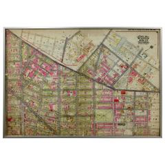
Antique Map Brooklyn
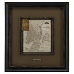
1840 "New Map of the City of New York With Part of Brooklyn & Williamsburg"
Located in Colorado Springs, CO
of Brooklyn & Williamsburg" by J. Calvin Smith. The map was issued bound in the booklet titled “A
Category
1840s American Antique Map Brooklyn
Materials
Paper
H 30 in W 27.5 in D 3 in
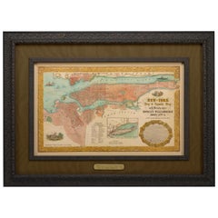
1855 "New-York City & County Map" by Charles Magnus
By Charles Magnus
Located in Colorado Springs, CO
This is a beautiful hand-colored map titled “New York City & County Map with Vicinity entire
Category
1850s American Antique Map Brooklyn
Materials
Paper
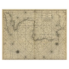
Original Antique Sea Chart of the Coastline from England to Gibraltar, ca.1700
Located in Langweer, NL
Antique map titled 'A Chart of the Sea-Coast from England to the Streights.'
Original antique map
Category
Early 1700s Antique Map Brooklyn
Materials
Paper
H 18.47 in W 23.55 in D 0 in
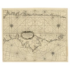
Antique Chart of The Spanish Coastline from Bilbao Eastwards, C.1720
Located in Langweer, NL
map.
Condition: Good, given age. Original middle fold, as issued. A library punch (Brooklyn Public
Category
18th Century Antique Map Brooklyn
Materials
Paper
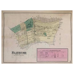
1870 Map Flatbush Brooklyn New York
By Beers Atlas Co.
Located in Sag Harbor, NY
An amazing Antique 1870 Map Flatbush Brooklyn New York, Hand Water colored, Includes Prospect Park
Category
Late 19th Century American Antique Map Brooklyn
Materials
Paper
Catskill Sawmill
By John William Hill
Located in Missouri, MO
watercolors and engravings produced in his father's studio at the Brooklyn Art Association and the National
Category
1860s Hudson River School Antique Map Brooklyn
Materials
Oil, Canvas
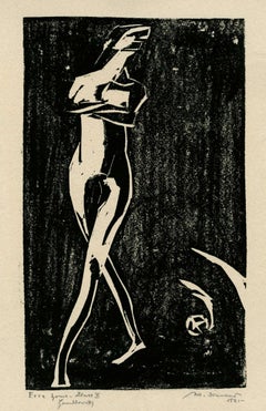
Ecce Homo Plate X
By Werner Drewes
Located in Fairlawn, OH
drawing and printmaking at the Brooklyn Museum Art School funded by the Federal Art Project of the Works
Category
1920s Bauhaus Antique Map Brooklyn
Materials
Woodcut
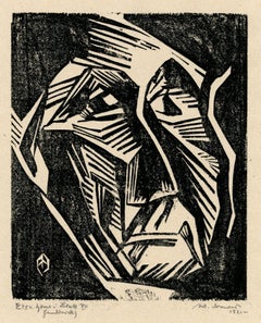
Ecce Homo VII
By Werner Drewes
Located in Fairlawn, OH
drawing and printmaking at the Brooklyn Museum Art School funded by the Federal Art Project of the Works
Category
1920s Expressionist Antique Map Brooklyn
Materials
Woodcut
Strawberries Strewn on a Forest Floor
By William Mason Brown
Located in New York, NY
. In 1858, Brown moved to Brooklyn, where he worked for the rest of his career, exhibiting annually at
Category
19th Century American Realist Antique Map Brooklyn
Materials
Canvas, Oil
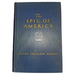
Epic of America by Jt Adams First Edition Re-Print
Located in Dallas, TX
three-volume history of New England is well regarded by scholars.
Adams was born in Brooklyn, New
Category
Early 20th Century American American Classical Antique Map Brooklyn
Materials
Paper
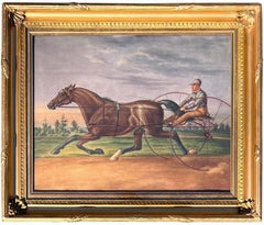
Harness Racer at Belmont Park 1884, Philadelphia
Located in Wiscasett, ME
, and Brooklyn Museum. The paper is watermarked "J Whatman" for James Whatman, who invented wove paper
Category
1880s Folk Art Antique Map Brooklyn
Materials
Oil
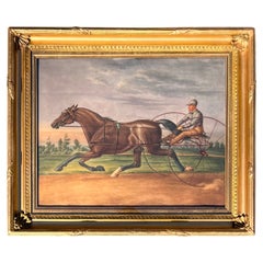
"Harness Racer at Belmont Park 1884, Philadelphia" by Agustus Kollner
Located in Wiscasset, ME
, and Brooklyn Museum. The paper is watermarked "J Whatman" for James Whatman, who invented wove paper
Category
1880s American Folk Art Antique Map Brooklyn
Materials
Paint, Paper
Spring 69
By Nancy Genn
Located in San Francisco, CA
incorporates collaged fragments of maps and undecipherable scripts. Meanwhile, she continued to make use of a
Category
Early 20th Century Abstract Expressionist Antique Map Brooklyn
Materials
Lithograph
People Also Browsed
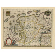
Map of East Friesland, The Netherlands & the Area Emden & Norden, Germany, 1635
Located in Langweer, NL
Antique map titled 'Typus Frisiae Orientalis.'
Map of East Friesland and the area around Emden and Norden. Large inset map of the mouth of the Amasis River. The map is decorated ...
Category
1630s Antique Map Brooklyn
Materials
Paper
H 20.48 in W 24.34 in D 0 in
Moths with Pupa on Holly
By Maria Sibylla Merian
Located in Florham Park, NJ
MARIA SIBYLLA MERIAN (1647-1717)
Metamorphosis Insectorum Surinamensium…
(Insects of Surinam)
Amsterdam, 1705
Hand-colored engravings.
Born in Frankfurt, Germany, then a free i...
Category
Early 1700s Academic Antique Map Brooklyn
Materials
Lithograph
18th century Set Hand Colored Nautical Engravings
By M. Ogier
Located in Savannah, GA
Signed M. Ogier (Fecit:by), this set of four hand colored engravings is part of a larger edition of plates. These plates are numbered PL 16, 347, 365 and 386. The subject is probably...
Category
18th Century Unknown Elizabethan Antique Map Brooklyn
Materials
Glass, Wood, Paper
President John F. & First Lady Jacqueline Kennedy’s English Victorian Tea Table
By Albert Hadley, Sister Parish
Located in St. Louis, MO
President John F. & First Lady Jacqueline Kennedy’s
English Victorian tea table
Quite possibly the most important tea table in American History
The famed, English Victorian tea ta...
Category
Late 19th Century English Victorian Antique Map Brooklyn
Materials
Lacquer
H 19 in W 33.5 in D 27.25 in
A Blue and White tile with a Dutch Merchant Ship
Located in UTRECHT, UT
Three-master sailing to the right, three men visible. Corners decorated with motif.
Category
17th Century Dutch Other Antique Map Brooklyn
Materials
Ceramic
Personal Memoirs of U. S. Grant, Two-Volume Set, 1885-86
Located in Colorado Springs, CO
Grant, Ulysses S., Personal Memoirs of U.S. Grant. New York: Charles L. Webster and Co., 1885-1886. Two volume set. Octavo, beautifully rebound in quarter green leather and cloth boa...
Category
1880s American Antique Map Brooklyn
Materials
Leather, Paper
Antique Hand Colored Framed Map of Europe
Located in West Palm Beach, FL
Antique reproduction copied from an edition dated 1595 by Ortelius.
Category
Late 19th Century Antique Map Brooklyn
Set of Monumental Bronze Egyptian Figures
By Charles Cameron
Located in New York, NY
Set of 4 Russian (19th Century) monumental bronze Egyptian figures emblematic of the Months on painted bases after those by C. Cameron & M. Alexandrov for the Egyptian Vestibule at P...
Category
19th Century Russian Neoclassical Antique Map Brooklyn
Materials
Bronze
Antique Decorative Coloured Map of North America, 1882
Located in Langweer, NL
This original antique map of North America is from the Blackie & Son Atlas published in 1882. Here are several points of interest about this map:
1. **Political Borders**: The map l...
Category
1880s Antique Map Brooklyn
Materials
Paper
"Jacob and the Angel" Bronze Sculpture by Bruno Lucchesi
By Bruno Lucchesi
Located in Wiscasset, ME
Signed bronze on marble base
Italian, b. 1926.
Born in 1926 in the village of Fibbiano Montanino, Lucca, Italy, Bruno Lucchesi has been called “the last of the Renaissance scul...
Category
1970s Italian American Craftsman Antique Map Brooklyn
Materials
Bronze
Imari ‘Black Ship’ bowl and cover, Japan, Meiji Period.
By Imari Porcelain
Located in Gargrave, North Yorkshire
A Japanese Imari porcelain ‘Black Ship’ bowl and cover, Meiji Period. The bowl hand painted to one side with a large sailing ship with Dutch flags, whilst the reverse with a group of...
Category
19th Century Japanese Meiji Antique Map Brooklyn
Materials
Porcelain
Detailed Model of Dutch Sailing Ship From the 1930s-1940s
Located in Opole, PL
Detailed Model of Dutch Sailing Ship From the 1930s-1940s
A faithfully reproduced model of a vessel dating back to the Interwar Period of the 20th century. In particularly condition.
Category
Early 20th Century Dutch Antique Map Brooklyn
Materials
Wood
The Holy Bible, Containing the Old and New Testaments, 1887
Located in Colorado Springs, CO
The Holy Bible, Containing the Old and New Testaments, Translated out of the Original Tongues: And with the Former Translations Diligently Compared and Revised, by His Majesty’s Spec...
Category
1880s English Late Victorian Antique Map Brooklyn
Materials
Leather, Paper
Memoirs of General William T. Sherman, First Edition, Two-Volume Set, 1875
Located in Colorado Springs, CO
Sherman, William T. Memoirs of General W. T. Sherman, Written By Himself. New York: D. Appleton and Company, 1875. First edition. In two volumes. Rebound in quarter blue leather and ...
Category
1870s American Antique Map Brooklyn
Materials
Leather, Paper
H 9.38 in W 6.38 in D 3.88 in
The Holy Bible, Standard Edition, Illustrated Family Bible, 1885
Located in Colorado Springs, CO
The “Standard” Edition of The Holy Bible, Containing the Old and New Testaments and Apocrypha, Translated out of the Original Tongues, Together with Cruden’s Complete Concordance… an...
Category
1880s American Late Victorian Antique Map Brooklyn
Materials
Leather, Paper
Old Framed Map of a Plan of the City of New York as Surveyed in 1767
Located in Lambertville, NJ
Old framed map of a plan of the City of New York as surveyed in 1767. Published by the Common Council and
lithographed by George Hayward circa 1800. Reproduced from the original vi...
Category
Late 19th Century American Antique Map Brooklyn
Materials
Wood, Paper
Recent Sales
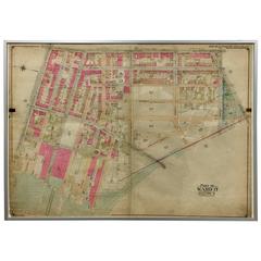
Rare 1916 Map of Fort Greene Brooklyn 'Brooklyn Map #4'
Located in Tarrytown, NY
Rare 1916 map of Fort Greene, Brooklyn. This rare map of Fort Greene is from the Atlas of the
Category
1910s American Antique Map Brooklyn
Rare 1916 of Bushwick Brooklyn, Brooklyn Map #5
Located in Tarrytown, NY
Rare 1916 map of Bushwick, Brooklyn. This rare map of Bushwick, Brooklyn is from The Atlas of the
Category
1910s American Antique Map Brooklyn
Map of Borough of Brooklyn
Located in New York, NY
Rare William's Map of the Borough of Brooklyn, Supplement to The Brooklyn Eagle Almanac, Published
Category
1910s Realist Antique Map Brooklyn
Materials
Lithograph
Rare 1916 Map of Brooklyn
Located in Tarrytown, NY
Rare map of Brooklyn, 1916. The map was originally backed on linen for preservation. The map is
Category
1910s American Antique Map Brooklyn
Rare 1916 Map of Brooklyn
Located in Tarrytown, NY
Rare map of Brooklyn neighborhood from 1916. The map was originally backed on linen for
Category
1910s American Antique Map Brooklyn
Rare 1916 Map of Prospect Park/Flatbush Avenue 'Brooklyn Map #6'
Located in Tarrytown, NY
Rare 1916 map of Prospect Park/Flatbush Avenue, Brooklyn. This rare map is from The Atlas of the
Category
1910s American Antique Map Brooklyn
New York with the City of Brooklyn in the Distance
By John William Hill
Located in New York, NY
New York with the City of Brooklyn in the distance, From the Steeple of St. Paul's Church Looking
Category
1850s Realist Antique Map Brooklyn
Materials
Engraving
Map of Hell Gate and East River, New York City
Located in New York, NY
Original, extremely rare first edition map (1887), full title "Hell Gate and East River from S. End
Category
1880s Realist Antique Map Brooklyn
Materials
Lithograph
Sketch of the Country Illustrating the late Engagement in Long Island.
Located in New York, NY
Beautiful hand-colored map fold out map from the October 1776 issue of "The Gentleman's Magazine
Category
1770s Realist Antique Map Brooklyn
Materials
Engraving
1776 Sketch of New York Harbor and Vicinity made by order of Lord Howe.
By George Hayward
Located in New York, NY
Lithograph by Geoge Hayward after the original map "A Sketch of New York Harbor and Vicinity made
Category
Mid-19th Century Realist Antique Map Brooklyn
Materials
Lithograph
Sunset with Figure Walking into Village with Stream in the foreground
By In the style of George Inness
Located in Graton, CA
a map engraver. Impatient with supervision, he started to paint alone and exhibited with the
Category
Late 19th Century Tonalist Antique Map Brooklyn
Materials
Oil
1852 Magnus Map New York City, Brooklyn & Williamsburg, Hand-Colored Engraving
By Charles Magnus
Located in Vineyard Haven, MA
Magnus, C. [New York, 1852] Complete Map of the Cities of New York, Brooklyn and Williamsburgh.
18
Category
1850s American American Colonial Antique Map Brooklyn
Materials
Paper
Free Shipping
H 18 in W 22.5 in D 0.07 in
“Johnson’s New York and Brooklyn” 1866 Map in Antique Windowpane Frame
Located in Colorado Springs, CO
“Johnson’s New York and Brooklyn” Original map
published by A.J. Johnson & Co., New York, in 1866
Category
1860s American Antique Map Brooklyn
Materials
Paper
Vintage 1927 Paris Map Created by Ilonka Karasz
Located in Dallas, TX
Stylish paper map of Paris mounted on board in colors of red/blue/yellow. The Creator/Designer of
Category
Early 20th Century French Antique Map Brooklyn
1855 "New-York City & County Map with Vicinity..." by Charles Magnus
Located in Colorado Springs, CO
color.
The map depicts the entirety of Manhattan as well as most of Brooklyn, Bedford-Stuyvesant
Category
1850s Antique Map Brooklyn
New York City and Surrounding Burroughs Map by Joesph Colton, circa 1865
Located in Colorado Springs, CO
This is a Great Republic exclusive presentation of Joseph Colton's 1865 map of NYC and the
Category
1860s Antique Map Brooklyn
1854 "Panorama of Manhattan Island, City of New York and Environs" Antique Map
Located in Colorado Springs, CO
center, and Brooklyn, Westchester County, Long Island, and Staten Island in the distance. The map is a
Category
1850s American Antique Map Brooklyn
Materials
Paper
H 45 in W 56 in D 2 in
"Twilight In Venice"
By George Inness
Located in Lambertville, NJ
worked for a map engraver. Impatient with supervision, he started to paint alone and exhibited with the
Category
19th Century Impressionist Antique Map Brooklyn
Materials
Canvas, Oil
Antique Map of New York and Brooklyn by Johnson, 1872
Located in Langweer, NL
Antique map titled 'Johnson's New York and Brooklyn'. Original map showing New York and Brooklyn
Category
Late 19th Century Antique Map Brooklyn
Materials
Paper
Map of New York City, Antique Hand-Colored Map, 1876
Located in Colorado Springs, CO
This original map of the city of New York was first surveyed by J. Hills in 1782 and was later re
Category
1870s American Antique Map Brooklyn
Materials
Paper
1844 Map of the United States, Antique Map, Featuring the Republic of Texas
Located in Colorado Springs, CO
, Brooklyn, Long Island.
This is a fascinating wall map of the United States issued in 1844 – one year
Category
19th Century American Antique Map Brooklyn
Materials
Paper
Large Original Antique City Plan of Brooklyn, New York, USA, 1894
By Rand McNally & Co.
Located in St Annes, Lancashire
Fabulous colorful map of Brooklyn & Vicinity
Original color
By Rand, McNally & Co
Category
1890s American Antique Map Brooklyn
Materials
Paper
No Reserve
H 20.5 in W 26.75 in D 0.07 in
Cape Cod Map Showing New York City
Located in Colorado Springs, CO
map was issued by George H. Walker to promote the Joy Line. The Joy Line was a regular steamship ferry
Category
Early 1900s American Antique Map Brooklyn
Hand-Colored Antique Map of Manhattan and Parts of Brooklyn, 19th Century
Located in New York, NY
A rare and original Map of New York City and environs from circa 1865 by M. Dripps showing
Category
1860s American Victorian Antique Map Brooklyn
Materials
Paper
1830 C. Burton NYC Merchant Exchange Wall Street Engraving
Located in Brooklyn, NY
on for so long.
ABOUT ITEM.
Please inquire for any questions.
More from Maps and Art on piece
Category
Early 19th Century Antique Map Brooklyn
Materials
Paper
Rare 1916 Map of Williamsburg Brooklyn
Located in Tarrytown, NY
Rare map on linen of Williamsburg Brooklyn from The Atlas of the Borough of Brooklyn City of New
Category
1910s American Antique Map Brooklyn
Materials
Linen
Rare 1916 Map of Fort Greene Brooklyn
Located in Tarrytown, NY
This rare map of Fort Greene, Brooklyn, is from The Atlas of the Borough of Brooklyn City of New
Category
1910s American Antique Map Brooklyn
Materials
Linen
1852 Magnus Map New York City, Brooklyn & Williamsburg, Hand-Colored Engraving
By Charles Magnus
Located in Vineyard Haven, MA
MAGNUS, C. [New York, 1852] Complete Map of the Cities of New York, Brooklyn and Williamsburgh.
18
Category
1850s American American Colonial Antique Map Brooklyn
Materials
Paper
Free Shipping
H 18 in W 22.5 in D 0.07 in
Map of the Country, 33 Miles Around the City of New York
By G.W. & C.B. Colton
Located in Houston, TX
City Hall, Brooklyn.
On the bottom of the map, the copyright reads: “Entered according to the Act of
Category
1860s American Other Antique Map Brooklyn
William W. Mather's Geological Map of Long Island
By William W. Mather
Located in New York, NY
including Westchester County, Brooklyn, eastern New Jersey, parts of Connecticut, and an Inset map of
Category
19th Century American Antique Map Brooklyn
Get Updated with New Arrivals
Save "Antique Map Brooklyn", and we’ll notify you when there are new listings in this category.
Antique Map Brooklyn For Sale on 1stDibs
At 1stDibs, there are many versions of the ideal antique map brooklyn for your home. An antique map brooklyn — often made from paper, fabric and linen — can elevate any home. Your living room may not be complete without an antique map brooklyn — find older editions for sale from the 19th Century and newer versions made as recently as the 20th Century. When you’re browsing for the right antique map brooklyn, those designed in Victorian styles are of considerable interest. Many designers have produced at least one well-made antique map brooklyn over the years, but those crafted by Charles Magnus and Beers Atlas Co. are often thought to be among the most beautiful.
How Much is a Antique Map Brooklyn?
An antique map brooklyn can differ in price owing to various characteristics — the average selling price 1stDibs is $850, while the lowest priced sells for $390 and the highest can go for as much as $1,600.
More Ways To Browse
Bucks County Estate
George W King Painting
John Caldwell
Menorah Bronze
Nathan Antique Furniture
Nathan Furniture Antique Furniture
Antique Spanish Coins
Unknown Pencil Drawing Still Life
Antique Mo
Mid Century Modern Menorah
Packet Ship
West German Antiques
Architectural Asian Antiques
Columbia Antiques
Church Steeple
Henry P Smith
Intaglio Jewelry Blue
J Newton
