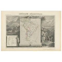
Map Of South Of France
8
to
44
263
199
182
160
118
104
82
54
49
44
43
37
33
31
30
24
22
21
21
16
13
12
11
11
10
10
9
8
8
8
8
7
6
6
6
5
4
4
4
4
3
3
3
2
2
2
2
1
1
1
1
1
1
1
1
1
1
1
42
42
39
36
10
Sort By
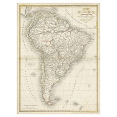
Scarce Antique Map of South America
Located in Langweer, NL
Antique map titled 'Carte de l'Amérique Méridionale'. Scarce map of South America, published in
Category
Antique Early 19th Century Maps
Materials
Paper
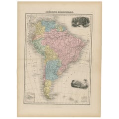
Antique Map of South America by Migeon '1880'
By J. Migeon
Located in Langweer, NL
Antique map titled 'Amérique Méridionale'. Old map of South America. With an inset map of the
Category
Antique Late 19th Century French Maps
Materials
Paper
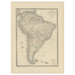
Antique Map of South America by Lapie '1842'
Located in Langweer, NL
Antique map titled 'Carte Générale de l'Amérique Meridionale'. Map of South America. This map
Category
Antique Mid-19th Century Maps
Materials
Paper
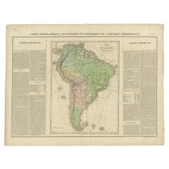
Antique Map of South America by Buchon, 1825
Located in Langweer, NL
Antique map titled 'Carte de l'Amérique méridionale'. Map of South America with attractive
Category
Antique 19th Century Maps
Materials
Paper
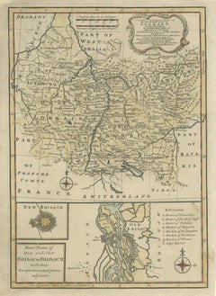
Antique Map of South West Germany with an Inset of Brisac or Brisach, France
Located in Langweer, NL
Antique map Germany titled 'A New and Accurate Map of the South West part of Germany. Comprehending
Category
Antique 18th Century Maps
Materials
Paper
H 15.36 in W 10.24 in D 0 in
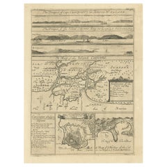
Antique Map of Cayenne and Cassepouri, French Guinea, South America, c.1730
Located in Langweer, NL
Cayenne and Cassepouri, French Guinea, South America, and Martinique in the West Indies. The map of
Category
Antique 18th Century Maps
Materials
Paper
H 16.54 in W 13.59 in D 0 in
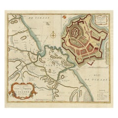
Striking Antique Map of Cayenne in French Guyana, South America, ca.1760
Located in Langweer, NL
Kust van Zuid-Amerika'.
Striking map of the island and settlement of Cayenne in French Guyana, with
Category
Antique 1760s Maps
Materials
Paper
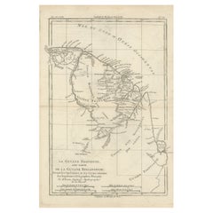
Antique Map of South America Depicting Guayana, c.1780
Located in Langweer, NL
Operations et les Cartes recentes des Ingenieurs-Geographes Francois'. Antique map of South America depicting
Category
Antique 18th Century Maps
Materials
Paper
Antique Map of South America by V. Levasseur, 1854
By Victor Levasseur
Located in Langweer, NL
Antique map titled 'Amérique Méridionale'. Map shows South America, beautiful surrounded by typical
Category
Antique Mid-19th Century Maps
Materials
Paper
Antique Map of South America by G. Anson, 1749
Located in Langweer, NL
Antique map titled 'Kaart van het Zuidelykste Gedeelte van Zuider Amerika (..) - Carte de la Partie
Category
Antique Mid-18th Century Dutch Maps
Materials
Paper
Original Antique Map of Normandy, France
Located in Langweer, NL
Antique map titled 'Carte de Normandie (..)'. Attractive map of Normandy, France. it depicts the
Category
Antique Mid-18th Century Maps
Materials
Paper
Original Copperplate Engraved Detailed Map of South Africa, ca.1680
Located in Langweer, NL
three hundred maps initiated the golden age of French Cartography.
Category
Antique 1680s Maps
Materials
Paper
Print of Maps of Islands of the South Pacific, Incl. Pitcairn & Dusky Bay, 1788
Located in Langweer, NL
Pickersgill / I de Pasques.'
Detailed set of maps of the islands of the South Pacific, with a large compass
Category
Antique 1780s Maps
Materials
Paper
No Reserve
H 12.21 in W 18.31 in D 0 in
Map of the Alsace, France Incl the Rhine from Phillipsburg to South Basle, c1650
Located in Langweer, NL
Alsace region (France) including the Rhine from Phillipsburg to south of Basle. Two decorative cartouches
Category
Antique 1650s Maps
Materials
Paper
H 19.69 in W 23.23 in D 0 in
Antique Map of South American, The West Indies & Most of Africa, Ca.1775
Located in Langweer, NL
du Commerce des Europeens dans les deux Indes'.
This map is roughly centered on South America
Category
Antique 1770s Maps
Materials
Paper
H 15.04 in W 19.77 in D 0 in
Antique Map of Tracks of Anson's Ships around South America & Cape Horn, 1749
Located in Langweer, NL
Description: Antique map titled 'Kaart van het Zuidelykste Gedeelte van Zuider Amerika (..) - Carte
Category
Antique 1740s Maps
Materials
Paper
No Reserve
H 21.66 in W 19.69 in D 0 in
Map of the Western Coast of South America from Ecuador into Chili, ca.1780
Located in Langweer, NL
Antique map titled 'Carte du Perou avec une partie des pays qui en sont a l'est.'
Map of the
Category
Antique 1780s Maps
Materials
Paper
H 15.16 in W 10.24 in D 0 in
Antique Map of the Northern Part of South America by J. Tallis, circa 1851
Located in Langweer, NL
A decorative and detailed mid-19th century map of the northern part of South America (including
Category
Antique Mid-19th Century Maps
Materials
Paper
H 10.6 in W 14.41 in D 0.02 in
Antique Map of France in Provinces, with Inset of Paris
Located in Langweer, NL
Antique map titled 'France par Provinces'. Original antique map of France in Provinces. It covers
Category
Antique Mid-19th Century Maps
Materials
Paper
Hand Colored Antique Map of the Department of Aude, France
By Victor Levasseur
Located in Langweer, NL
Antique map titled 'Dépt. de l'Aude'. Map of the French department of Aude, France. This area of
Category
Antique Mid-19th Century Maps
Materials
Paper
Old Map of The Mughal Empire and the Indian Peninsula South of the Ganges, 1787
Located in Langweer, NL
."
An original authentic map, created by Rigobert Bonne (1727-1794), an influential French cartographer
Category
Antique 1780s Maps
Materials
Paper
Free Shipping
H 16.62 in W 11.42 in D 0 in
Antique Map of Brazil Extending South to the Mouth of the Rio de la Plata
Located in Langweer, NL
Antique map titled 'Carte du Brésil'. ?Beautiful map of Brazil extending south to the mouth of the
Category
Antique Early 19th Century Maps
Materials
Paper
H 23.31 in W 17.33 in D 0.02 in
Antique Map of Saldanha Bay 'Near Cape Town, South Africa' by Bellin, 1750
By Jacques-Nicolas Bellin
Located in Langweer, NL
Navigateurs’. Detailed plan of Saldanha Bay, northwest of Cape Town, South Africa. This map originates from
Category
Antique 18th Century Maps
Materials
Paper
H 8.86 in W 11.42 in D 0.01 in
Antique Map of Aude ‘France’ by V. Levasseur, 1854
By Victor Levasseur
Located in Langweer, NL
Antique map titled 'Dépt. de 'l'Aude'. Map of the French department of Aude, France. This area of
Category
Antique Mid-19th Century Maps
Materials
Paper
Striking Large Format Antique Map of Southeastern France, 1799
Located in Langweer, NL
Antique map titled 'The South Eastern Part of France which includes Roussillon-Languedoc, with a
Category
Antique 1790s Maps
Materials
Paper
Large Scale Map of Greece with Inset Map of Macedonia, c.1786
Located in Langweer, NL
Antique map titled 'Graeciae Antiquae'. Large scale map of Greece, extends south to the island of
Category
Antique 18th Century Maps
Materials
Paper
Antique Map of the Alsace Region of France by Schenk 'circa 1700'
Located in Langweer, NL
Antique map titled 'Superioris atque Inferioris Alsatiae'. Beautiful map of the Alsace region, from
Category
Antique Early 18th Century Maps
Materials
Paper
Antique Map of the Alsace Region of France by Janssonius, c.1650
Located in Langweer, NL
region (France) including the Rhine from Phillipsburg to south of Basle. Two decorative cartouches and
Category
Antique 17th Century Maps
Materials
Paper
Original Steel Engraved Map of French Colonies in America, 1854
Located in Langweer, NL
local animals, produce and activities of the various French Colonies in America. This map originates
Category
Antique Mid-19th Century Maps
Materials
Paper
Free Shipping
H 13.12 in W 18.71 in D 0.02 in
French Antique Map of Oceania with Details of the Australian Colonies, c.1840
Located in Langweer, NL
Antique map Oceania titled 'Océanie par C.V. Monin'. Old map of Oceania with an inset of New South
Category
Antique 19th Century Maps
Materials
Paper
H 13 in W 17.52 in D 0 in
Decorative Antique Map of the Quercy Region in France, 1657
Located in Langweer, NL
Antique map of France titled 'Quercy olim Cadurcium'.
Decorative map of the Quercy region
Category
Antique 1650s Maps
Materials
Paper
Uncommon Old Map of Lapland to Russia and Denmark to Kazan in the South, 1785
Located in Langweer, NL
Description: Antique map titled 'Kaart van het Noorderdeel van Europa, Bevattende Deenmarken
Category
Antique 1780s Maps
Materials
Paper
H 10.04 in W 14.73 in D 0 in
Decorative Antique Map of Central Asia
Located in Langweer, NL
Antique map titled 'Carte de la Tartarie Indépendante (..)'. Decorative map of Central Asia
Category
Antique Late 18th Century Maps
Materials
Paper
Original Antique Regional Map of France with Orleans, Auxerre and Montargis
By Johannes Janssonius
Located in Langweer, NL
Original antique map titled 'Gastinois et Senonois'. Beautiful regional map of France. With Corbeil
Category
Antique Mid-17th Century Maps
Materials
Paper
H 16.78 in W 22.64 in D 0.02 in
Antique Map of Asia by Dussy, 1778
Located in Langweer, NL
'. Depicting South-East Asia including Hindustan, India and China. This map originates from "Nouvel Atlas
Category
Antique Late 18th Century French Maps
Materials
Paper
Old Map of North India From Kandahar East to Burma 'Pegu' and South to Goa, 1776
Located in Langweer, NL
Description: Antique map titled 'Indes Iere Feuille'.
Old map of northern India. Covers the
Category
Antique 1770s Maps
Materials
Paper
H 14.77 in W 19.1 in D 0 in
1864 Map of North America, Antique Hand-Colored Map, by Adolphe Hippolyte Dufour
Located in Colorado Springs, CO
edge of South America. The map includes an unusual view of the Transmississippi West, with a misshaped
Category
Antique 1860s French Maps
Materials
Paper
H 44.5 in W 33 in D 1.5 in
Antique Map of Artois in the North of France by Famous Mapmaker Blaeu, c.1640
Located in Langweer, NL
Antique map titled 'Artesia Comitatus Artois'. Map of Artois or Artesia, France. Artois is former
Category
Antique 17th Century Maps
Materials
Paper
No Reserve
H 19.69 in W 23.43 in D 0 in
Original Hand-Colored Antique Map of Artois or Artesia, France, ca.1650
Located in Langweer, NL
Antique map titled 'Artesia Comitatus Artois'.
Map of Artois or Artesia, France. Artois is
Category
Antique 1650s Maps
Materials
Paper
Detailed Antique Map of Western Belgium and Eastern France by Coronelli, 1690
By Vincenzo Coronelli
Located in Langweer, NL
Antique map titled 'Contado d'Hannonia (..)'. Map of western Belgium and eastern France, from south
Category
Antique 17th Century Maps
Materials
Paper
H 18.9 in W 26.58 in D 0 in
Antique Map of the Region of Rethelois by Janssonius, 1657
By Johannes Janssonius
Located in Langweer, NL
Antique map of France titled 'Dioecese de Rheims et le Païs de Rethel'. Detailed map, centered on
Category
Antique Mid-17th Century Maps
Materials
Paper
Antique Map the Windward or South Caribbean Islands and Guiana, 1859
Located in Langweer, NL
Antique map titled 'The Windward or South Caribbean Islands'. Original antique map of South
Category
Antique Mid-19th Century Maps
Materials
Paper
Antique Map of the Swabia Region of Germany by Cary, '1811'
By John Cary
Located in Langweer, NL
Antique map titled 'A New Map of the Circle of Swabia'. Antique map of Swabia in Southwestern
Category
Antique Early 19th Century Maps
Materials
Paper
Authentique Map by Pilon of The French Colonies in The West Indies, 1876
Located in Langweer, NL
This map is a significant representation of the French colonies in the West Indies during the late 19th
Category
Antique Late 19th Century Maps
Materials
Paper
H 14.38 in W 16.54 in D 0 in
Original Detailed Antique Map of the East Coast of Africa, 1747
Located in Langweer, NL
Antique map titled 'Carte de la coste Orientale d'Afrique - Kaart van de Oostkust van Afrika
Category
Antique 1740s Maps
Materials
Paper
Antique Map of the Bay of Terney by La Pérouse, 1797
Located in Langweer, NL
Antique map titled 'Plan de la Baie de Ternai'. Old map of the north eastern coast of Russia. This
Category
Antique 18th Century Maps
Materials
Paper
Antique Map of the Admiralty Islands, Bismarck Archipelago
Located in Langweer, NL
Antique map titled 'Trois Vues des Isles de l'Amirauté'. Several coastal views of the Admiralty
Category
Antique Late 18th Century Maps
Materials
Paper
Antique Map of Southeast Asia by Ortelius '1587'
By Abraham Ortelius
Located in Langweer, NL
to the north and south. The map also shows parts of the American northwest, including the cities of
Category
Antique 16th Century Maps
Materials
Paper
Antique Map of Siberia and Russia, c.1885
Located in Langweer, NL
. Migeon (fl. c. 1855 - 1899) was a late 19th century map publisher based in Paris, France. His most
Category
Antique 19th Century Maps
Materials
Paper
Antique Map of North and East Asia, 1751
Located in Langweer, NL
maps on one sheet, showing California, Alaska and Siberia, Korea and Japan. South to Korea the island
Category
Antique 18th Century Maps
Materials
Paper
Antique Map of Northern India by Bonne, 1780
Located in Langweer, NL
Antique map titled 'Carte de la partie Supérieure de l'Inde (..)'. A fine example of Rigobert Bonne
Category
Antique 18th Century Maps
Materials
Paper
Antique Map of the Region of Artois by Covens & Mortier, c.1730
By Covens & Mortier
Located in Langweer, NL
Antique map titled 'Carte d'Artois et des environs'. Large map of the region of Artois, France
Category
Antique 18th Century Maps
Materials
Paper
Detailed Decorative Antique Map of the Coast of Malabar and Coromandel, India
Located in Langweer, NL
Antique map titled 'Carte des Côtes de Malabar et de Coromandel'. Finely engraved map of the
Category
Antique Mid-18th Century Maps
Materials
Paper
H 21.07 in W 25.2 in D 0.02 in
1812 United States Map, by Pierre Tardieu, Antique French Map Depicting the U.S.
By Pierre François Tardieu
Located in Colorado Springs, CO
French and English. This extremely detailed map not only depicts the mountainous regions of the
Category
Antique 1810s French Maps
Materials
Paper
H 43.5 in W 48 in D 2.25 in
Antique Map of the Rethelois or Rethel Region in France by Janssonius, ca.1650
By Johannes Janssonius
Located in Langweer, NL
Antique map of France titled 'Dioecese de Rheims et le Païs de Rethel'.
Detailed map, centered
Category
Antique 17th Century Maps
Materials
Paper
H 19.69 in W 22.64 in D 0 in
Antique Map of Cities in the Region of Hubei in China, 1758
Located in Langweer, NL
Antique map titled 'Plans de Quelques villes de la province de Hou-Quang.' Three plans of cities in
Category
Antique 18th Century Maps
Materials
Paper
Attractive Original Hand-Colored Map of the Swabia Region of Germany, 1799
Located in Langweer, NL
example of John Cary's 1799 map of the Swabia region of Germany. Covers from the Upper Rhine region south
Category
Antique 1790s Maps
Materials
Paper
H 19.97 in W 23.23 in D 0 in
Authentic Old Map of Sumatra, Malaysia and Singapore, 1745
Located in Langweer, NL
L'Isle" translates to "Map of the Island of Sumatra and the Malayan Coast based on the work of G. de
Category
Antique 1740s Maps
Materials
Paper
Navarra in Cartographic Detail: A 1902 Map of the Crossroads of Northern Spain
Located in Langweer, NL
, demarcating it from neighboring provinces and France to the north.
- The map includes a scale of kilometers
Category
Antique Early 1900s Maps
Materials
Paper
Free Shipping
H 14.77 in W 20.08 in D 0 in
Antique Map of the Pacific Ocean by Renneville, 1702
Located in Langweer, NL
Willem Cornelisz. Schouten, who found a new passage south of Argentina. An inset map shows a detail of
Category
Antique 18th Century Maps
Materials
Paper
- 1
Get Updated with New Arrivals
Save "Map Of South Of France", and we’ll notify you when there are new listings in this category.
Map Of South Of France For Sale on 1stDibs
Choose from an assortment of styles, material and more with respect to the map of south of France you’re looking for at 1stDibs. Frequently made of paper, ceramic and wood, every map of south of France was constructed with great care. There are many kinds of the map of south of France you’re looking for, from those produced as long ago as the 18th Century to those made as recently as the 20th Century. Each map of south of France bearing Art Deco or neoclassical hallmarks is very popular. A well-made map of south of France has long been a part of the offerings for many furniture designers and manufacturers, but those produced by Victor Levasseur, Johannes Janssonius and Jacques-Nicolas Bellin are consistently popular.
How Much is a Map Of South Of France?
Prices for a map of south of France can differ depending upon size, time period and other attributes — at 1stDibs, they begin at $87 and can go as high as $238,935, while the average can fetch as much as $671.
