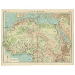
North Africa Map
3
to
23
210
88
162
117
81
51
40
39
24
23
22
22
20
19
16
15
14
13
12
11
8
6
6
6
5
5
5
4
4
4
4
3
3
3
3
2
2
2
2
2
2
1
1
1
1
1
1
1
1
1
1
1
1
42
42
4
3
3
Sort By
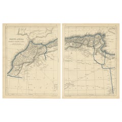
Antique Map of North Africa by Lowry '1852'
Located in Langweer, NL
Antique map titled 'North Africa Marocco Algiers & Tunis'. Two individual sheets of North Africa
Category
Antique Mid-19th Century Maps
Materials
Paper
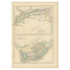
Antique Map of North Africa and South Africa by Black, 1854
Located in Langweer, NL
Antique map titled 'Africa north part - Africa south part'. Old map of Africa showing the region of
Category
Antique 19th Century Maps
Materials
Paper
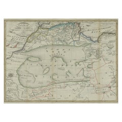
Antique Map of North Africa including the Sahara Desert
Located in Langweer, NL
Antique map titled 'Charte von Nord-Africa'. Scarce map of North Africa. Includes a fantastic
Category
Antique Early 19th Century Maps
Materials
Paper
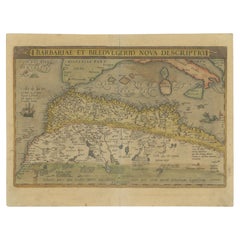
Antique Map of North Africa by Ortelius, c.1580
Located in Langweer, NL
Africa. The map covers the regions of Barbaria and Biledulgerid, essentially the territories north and
Category
Antique 16th Century Maps
Materials
Paper
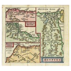
Antique Map of North Africa showing Egypt, Mauritania and Africa Minor, 1672
Located in Langweer, NL
Antique map titled 'Africa Minor, Mauritania , Aegyptus.' Charming miniature map of North Africa
Category
Antique 17th Century Maps
Materials
Paper
H 5.63 in W 5.12 in D 0 in
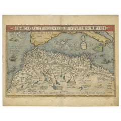
Antique Map of North Africa by Ortelius, c.1600
Located in Langweer, NL
Antique map titled 'Barbariae et Biledulgerid nova descriptio'.
Old map of coastal North Africa
Category
Antique 17th Century Maps
Materials
Paper
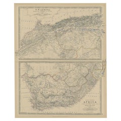
Antique Map of North and South Africa by Johnston, 1882
Located in Langweer, NL
Two antique maps on one sheet titled 'N.W. Africa, Marocco, Algeria & Tunis' and 'Southern Africa
Category
Antique 19th Century Maps
Materials
Paper
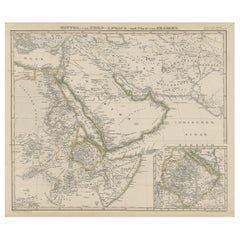
North & Central Africa & Arabia, Inset Map of Habesch 'Ethiopia & Eritrea', 1845
Located in Langweer, NL
Antique map titled 'Mittel- und Nord-Africa (östl. Theil) und Arabien'.
This map depicts North
Category
Antique 1840s Maps
Materials
Paper
H 14.18 in W 17.33 in D 0 in
Old Map of North Africa Depicting Libya, Morocco, Algeria, Tunis Etc, 1922
Located in Langweer, NL
Antique map of Africa titled 'Northern Africa'.
Old map of North Africa depicting Libya
Category
Vintage 1920s Maps
Materials
Paper
H 17.92 in W 23.23 in D 0 in
Antique Map of North and West Africa by J.B. Elwe, 1792
Located in Langweer, NL
Beautiful richly engraved map of North and West Africa, based upon the earlier maps of De L'Isle
Category
Antique Late 19th Century Maps
Materials
Paper
Copper-Engraved Map Showing the Algerian Coast of North Africa, Published 1683
Located in Langweer, NL
showing the Algerian coast of North Africa. Published 1683.
Artists and Engravers: Nicholas Sanson
Category
Antique 1680s Maps
Materials
Paper
H 8.51 in W 11.78 in D 0 in
"Nova Barbariae Descriptio", a 17th Century Hand-Colored Map of North Africa
By Johannes Janssonius
Located in Alamo, CA
This original attractive 17th century hand-colored map of North Africa entitled "Nova Barbariae
Category
Antique Mid-17th Century Dutch Maps
Materials
Paper
H 22.38 in W 29 in D 0.13 in
Rare Map of North Africa Depicting Numidia, Libia and Morocco, Published C.1740
Located in Langweer, NL
Antique map Africa titled 'Mauretania, Numidia, Gaetulia & c.'.
Rare map of North Africa
Category
Antique 1740s Maps
Materials
Paper
H 9.45 in W 14.57 in D 0 in
Antique Map of North-Western and South Africa by A.K. Johnston, 1865
Located in Langweer, NL
Two maps on one sheet titled 'North-Western Africa' and 'Southern Africa'. Depicting Morocco
Category
Antique Mid-19th Century Maps
Materials
Paper
Map of the West African coast from the North of Mauretania to Guinee, 1788
Located in Langweer, NL
Verga, and of the Course of the Rivers Senega and Gambia.'
Map of the African coast from the north
Category
Antique 1780s Maps
Materials
Paper
H 21.7 in W 14.93 in D 0 in
Very Attractive Map of North and South America and Western Part of Africa, 1744
Located in Langweer, NL
Antique map titled 'Nieuwe Kaart van America.' Very attractive map of North and South America, the
Category
Antique 18th Century Maps
Materials
Paper
H 16.34 in W 21.26 in D 0 in
Antique Map of Northern Africa by Perthes, 1848
Located in Langweer, NL
Antique map titled 'Africa Propria (..)'. Old map of North Africa and the region of Babylon
Category
Antique 19th Century Maps
Materials
Paper
Antique Map of Northwest Africa by Bartholomew, 1922
Located in Langweer, NL
Antique map of Africa titled 'North-West Africa'. Old map of north-west Africa depicting Morocco
Category
20th Century Maps
Materials
Paper
Crossroads of Continents: Spain's North African Enclaves in 1903
Located in Langweer, NL
The image for sale is a historical map of Spanish possessions in North Africa, dated 1903. The map
Category
Antique Early 1900s Maps
Materials
Paper
Free Shipping
H 14.77 in W 20.08 in D 0 in
Antique Map of Africa and Arabia with Inset Map of Ethiopia and Eritrea, 1845
Located in Langweer, NL
Antique map titled 'Mittel- und Nord-Africa (östl. Theil) und Arabien'. This map depicts North and
Category
Antique 19th Century Maps
Materials
Paper
H 14.18 in W 17.33 in D 0 in
Antique Map of Mauritania 'Africa' by G. Ruscelli, 1574
Located in Langweer, NL
A very rare mid-16th century black and white map of North and West Africa called Mauritania by the
Category
Antique 16th Century Maps
Materials
Paper
Rare Antique Map of 'Barbarie' or Northern Africa, 1655
Located in Langweer, NL
Tripoli et Pays Circomvoisins'. This map depicts North Africa with Malta and originates from 'Cartes
Category
Antique 17th Century Maps
Materials
Paper
Antique Hand-Coloured Map of North and South America, ca.1765
Located in Langweer, NL
Description: Antique map titled 'Nieuwe Kaart van Amerika.' Attractive map of North and South
Category
Antique 1760s Maps
Materials
Paper
Original Antique Coloured Map of Western Africa, Published in 1882
Located in Langweer, NL
This is a map of Western Africa from the 1882 Blackie & Son atlas. The map details the West African
Category
Antique 1880s Maps
Materials
Paper
Free Shipping
H 14.97 in W 22.45 in D 0 in
"Africa Vetus": a 17th Century Hand-Colored Map by Sanson
By Nicolas Sanson
Located in Alamo, CA
This original hand-colored copperplate engraved map of Africa entitled "Africa Vetus, Nicolai
Category
Antique Late 17th Century French Maps
Materials
Paper
Set of Three Antique Maps of Africa by Colton (circa 1855)
Located in Langweer, NL
Set of three individual maps of Africa including 'North West Africa', 'North Eastern Africa' and
Category
Antique Mid-19th Century Maps
Materials
Paper
North African Coasts: Marmarica to Mauretania in Roman Times, Published in 1880
Located in Langweer, NL
The map with the title "MARMARICA, CYRENAICA, AFRICA, NUMIDIA, MAURETANIA secundum Italiam Poetarum
Category
Antique 1880s Maps
Materials
Paper
Free Shipping
H 15.56 in W 18.51 in D 0 in
Antique Map of Western and Eastern Barbary in Africa, c.1744
Located in Langweer, NL
of the Eastern Parts of Barbary'. Decorative maps of North Africa and the Southern Mediterranean
Category
Antique 18th Century Maps
Materials
Paper
Antique Map of the Coast of Northwest Africa by Dien, 1820
Located in Langweer, NL
Riviere de Sierra Leona'. Detailed map of Coastal North and West Africa, from Biafra and Sierra Leone
Category
Antique 19th Century Maps
Materials
Paper
Vintage Red Boujad Moroccan Rug by Berber Tribes of Morocco
By Berber Tribes of Morocco
Located in Dallas, TX
abrashed red, the allover geometric pattern unfolds like a mystical map, adorned with enigmatic motifs and
Category
Late 20th Century Moroccan Bohemian Moroccan and North African Rugs
Materials
Wool
Africa: A Large 17th Century Hand-Colored Map by Sanson and Jaillot
By Nicolas Sanson
Located in Alamo, CA
This large original hand-colored copperplate engraved map of Africa entitled "L'Afrique divisee
Category
Antique 1690s French Maps
Materials
Paper
Antique Map of South American, The West Indies & Most of Africa, Ca.1775
Located in Langweer, NL
, but includes most of Africa, the southern part of North America and the West Indies. Arrows in the
Category
Antique 1770s Maps
Materials
Paper
H 15.04 in W 19.77 in D 0 in
Antique Map of the City of Algiers and Surroundings in Northern Africa, 1773
Located in Langweer, NL
Antique print titled 'Plan van de Stad Algiers'. Old map of Algiers, also depicting surrounding
Category
Antique 18th Century Maps
Materials
Paper
H 10.44 in W 8.08 in D 0 in
Authentic Map of the Coast from Cape Formosa to the Dony River, Africa, 1732
Located in Langweer, NL
Antique map titled 'The New Correct Mapp of Calbar River vulgarly call'd Calabar (..)'.
An
Category
Antique 1730s Maps
Materials
Paper
H 12.76 in W 17.25 in D 0 in
Antique Map Made After a Roman Papyrus Travel Map, Known as Peutinger Map, 1773
Located in Langweer, NL
Iberian Peninsula and the British Isles), North Africa, and parts of Asia, including the Middle East
Category
Antique 18th Century Maps
Materials
Paper
H 15.56 in W 18.51 in D 0 in
Large Decorative Map of the Iberian Peninsula
Located in Langweer, NL
Islands and part of the north coast of Africa. The map is based on the cartography of Rodrigo Mendez Sylva
Category
Antique Mid-18th Century Maps
Materials
Paper
Bay of Arguin, West Coast of Africa from Cape Blanco to Tanit, Africa, 1747
Located in Langweer, NL
Arguin on the West Coast of Africa from Cape Blanco in the north to Tanit in the south. This map
Category
Antique 1740s Maps
Materials
Paper
H 10.75 in W 8.19 in D 0 in
Antique Map of the Sinai Peninsula, '1895'
Located in Langweer, NL
the north and the Red Sea to the south, and is a land bridge between Asia and Africa. Published by D
Category
Antique Late 19th Century Maps
Materials
Paper
Antique Map of Anjouan Island by Valentijn, 1726
By F. Valentijn
Located in Langweer, NL
situated between Madagascar and Africa. The map is oriented with north to the left with the King's Palace
Category
Antique Early 18th Century Dutch Maps
Antique Decorative Coloured Map Marocco, Algeria and Tunis, 1882
Located in Langweer, NL
The maps is from the 1882 atlas by Blackie & Son and offers a detailed view of the North African
Category
Antique 1880s Maps
Materials
Paper
Free Shipping
H 14.97 in W 22.45 in D 0 in
Orginal Antique Handcolored Map of the Turkish Empire, 1748
Located in Langweer, NL
Antique map titled 'L'Empire des Turcs'. Old map of the Turkish Empire with an inset of the North
Category
Antique 18th Century Maps
Materials
Paper
Antique Map of Barbary and Biledulgerid by Sanson, 1705
Located in Langweer, NL
Barbary (Algeria) and Biledulgerid (Tegoryn, Zeb etc.), North Africa. Source unknown, to be determined
Category
Antique 18th Century Maps
Materials
Paper
Original Steel Engraved Map of French Colonies in America, 1854
Located in Langweer, NL
Antique map titled 'Colonies Francaises (en Amerique)'. Detailed map bordered by vignettes showing
Category
Antique Mid-19th Century Maps
Materials
Paper
Free Shipping
H 13.12 in W 18.71 in D 0.02 in
Antique Map of the Island of Psara by Dapper, 1688
Located in Langweer, NL
Antique map titled 'Sara.' Map of Psara ( Psyra or Ipsera) Island (North East Aegean Islands
Category
Antique 17th Century Maps
Materials
Paper
Large Wall Map of Europe by George Philip & Son, circa 1920
Located in Langweer, NL
the North African coast and Turkey. Decorative borders. Dissected into 48 segments and mounted on
Category
Early 20th Century Maps
Materials
Linen, Paper
No Reserve
H 72.05 in W 66.15 in D 0.02 in
Antique Map of Europe with Elaborate Title Cartouche, c.1750
Located in Langweer, NL
depicts all of Europe including Iceland and parts of North Africa and Asia. Color coded according to
Category
Antique 18th Century Maps
Materials
Paper
Antique Sea Chart of the Western Coast of Africa
Located in Langweer, NL
Antique map titled 'Nieuwe Paskaert van de Kust van Genehoa (..)'. This attractive sea chart covers
Category
Antique Late 17th Century Maps
Materials
Paper
Mediterranean Tapestry: A 19th Century Map of the Mediterranean Shores, 1882
Located in Langweer, NL
Europe down to the northern coastlines of Africa.
The map is a vivid document of the time, with each
Category
Antique 1880s Maps
Materials
Paper
H 11.03 in W 14.97 in D 0 in
Original Hand-Coloured Nautical Chart of West-Africa, c.1680
Located in Langweer, NL
impressive and decorative map of this part of Africa.
Category
Antique 17th Century Maps
Materials
Paper
18th Century Hand Colored Map of Spain and Portugal by Visscher
By Nicolaes Visscher II
Located in Alamo, CA
. The map includes portions of North Africa and the Strait of Gibralter.
This copperplate engraved map
Category
Antique Early 18th Century Dutch Maps
Materials
Paper
Map Silk Embroidered Western Eastern Hemisphere New Old World Asia America Afri
Located in BUNGAY, SUFFOLK
indicated within the southern polar region, the interior portions of western North America, Africa, and
Category
Antique 18th Century British Georgian Maps
Materials
Silk
H 0.4 in W 0.4 in D 0.4 in
St. Christophe 'St. Kitts' Island: An 18th Century Hand-colored Map by Bellin
By Jacques-Nicolas Bellin
Located in Alamo, CA
Jacques Bellin's copper-plate map of the Caribbean island of Saint Kitts entitled "Carte De De
Category
Antique Mid-18th Century French Maps
Materials
Paper
H 10 in W 14.25 in D 0.07 in
Original Old Composite of Several Maps of the Ancient World on One Sheet, 1880
Located in Langweer, NL
Europe, North Africa, and parts of Asia, reflecting the Roman Empire at its extent.
The map includes
Category
Antique 1880s Maps
Materials
Paper
Free Shipping
H 15.56 in W 18.51 in D 0 in
Antique Map of the Harbour of Praia, Santiago Island, Cape Verde, c.1750
Located in Langweer, NL
Antique map titled 'A Draught of ye Harbour of Praya in the Island St. Jago (..)'. Uncommon map
Category
Antique 18th Century Maps
Materials
Paper
Old Map of the Sinai Peninsula Showing the Mediterranean and the Red Sea, 1773
Located in Langweer, NL
Antique map of the Sinai Peninsula showing the Mediterranean Sea to the north and the Red Sea to
Category
Antique 1770s Maps
Materials
Paper
H 17.05 in W 21.19 in D 0 in
Antique Map of Southern Asia with India, the Maldives, Ceylon and Arabia, c.1700
Located in Langweer, NL
Siam, Mataban, Pegu, and, to the north, Grant Thibet. Beautiful antique map of the Indian Ocean
Category
Antique Early 18th Century Maps
Materials
Paper
H 24.81 in W 37.01 in D 0 in
Antique Map of Mozambique and Cape of Good Hope with Kingdom Monomotapa, 1780
Located in Langweer, NL
, details the Dutch claims in the western of South Africa from the Cape of Good Hope north as far as St
Category
Antique 18th Century Maps
Materials
Paper
H 14.69 in W 10.44 in D 0 in
Grand Map of Europe by Frederick de Wit, Circa 1690: A Baroque Era Masterpiece.
Located in Langweer, NL
Ocean in the west to the Ural Mountains in the east. It includes parts of North Africa and the Middle
Category
Antique Late 17th Century Maps
Materials
Paper
H 20.67 in W 25.2 in D 0.02 in
Old Print of Fort James on Kunta Kinteh Island on the Gambia River, Africa, 1746
Located in Langweer, NL
River in 1732, view of Fort James from the north east and a view of Fort James from the NNW. Made by
Category
Antique 1740s Maps
Materials
Paper
H 10.08 in W 7.88 in D 0 in
The Roman Empire from the Time of Constantine the Great, Published in 1880
Located in Langweer, NL
East and North Africa.
This map serves as a historical document, capturing the grandeur of the Roman
Category
Antique 1880s Maps
Materials
Paper
No Reserve
H 15.56 in W 18.51 in D 0 in
- 1
Get Updated with New Arrivals
Save "North Africa Map", and we’ll notify you when there are new listings in this category.
North Africa Map For Sale on 1stDibs
Choose from an assortment of styles, material and more with respect to the north africa map you’re looking for at 1stDibs. Each north africa map for sale was constructed with extraordinary care, often using paper, canvas and fabric. Your living room may not be complete without a north africa map — find older editions for sale from the 18th Century and newer versions made as recently as the 20th Century. A north africa map, designed in the Art Deco style, is generally a popular piece of furniture. A well-made north africa map has long been a part of the offerings for many furniture designers and manufacturers, but those produced by Robert Falcucci and Johannes Janssonius are consistently popular.
How Much is a North Africa Map?
A north africa map can differ in price owing to various characteristics — the average selling price 1stDibs is $473, while the lowest priced sells for $129 and the highest can go for as much as $6,182.
More Ways To Browse
African Tripod
Antique Map New Orleans
Cairo Poster
Florida Map Vintage
Florida Vintage Map
Poster Maroc
Shark Skin Box
Vintage Track Cycling
Bear Hill Interior
Dutch Monkey
Lane Delineator
Magnetic Compass Used
New Orleans Maps
Nile Crocodile
Old Map Florida
Ottoman Clock
Painted Round Trinket Box
Paper Mache Plate
