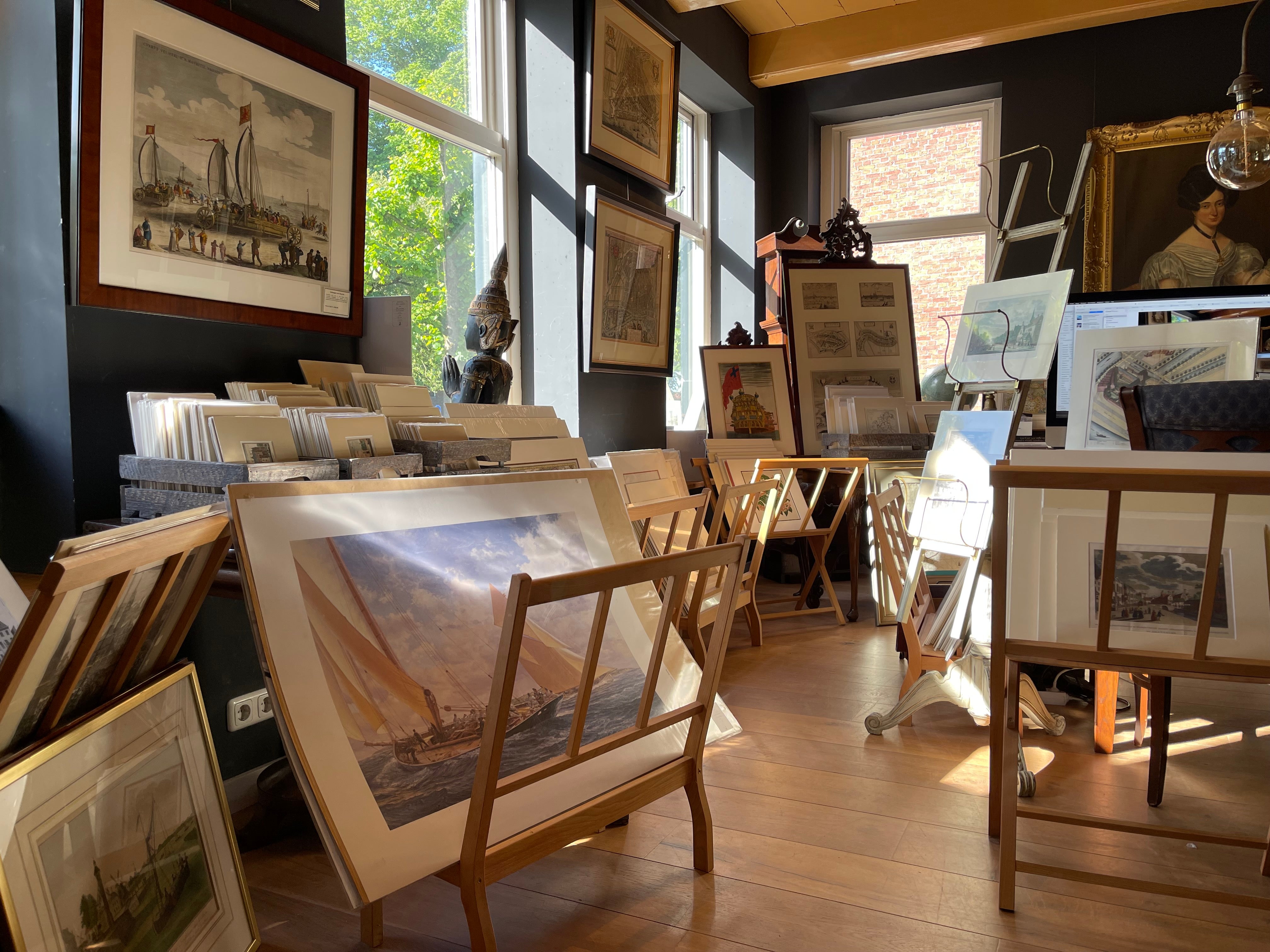
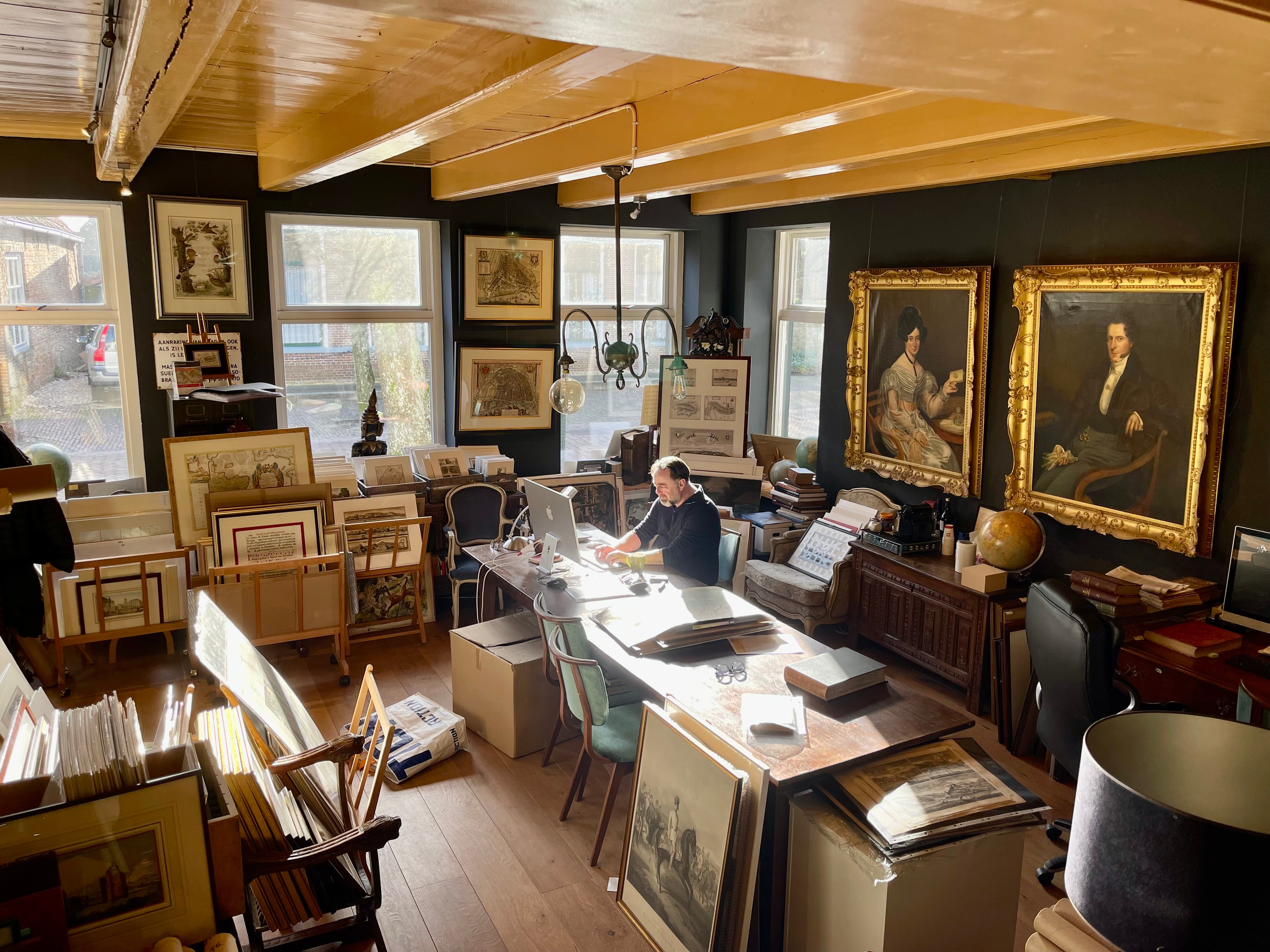
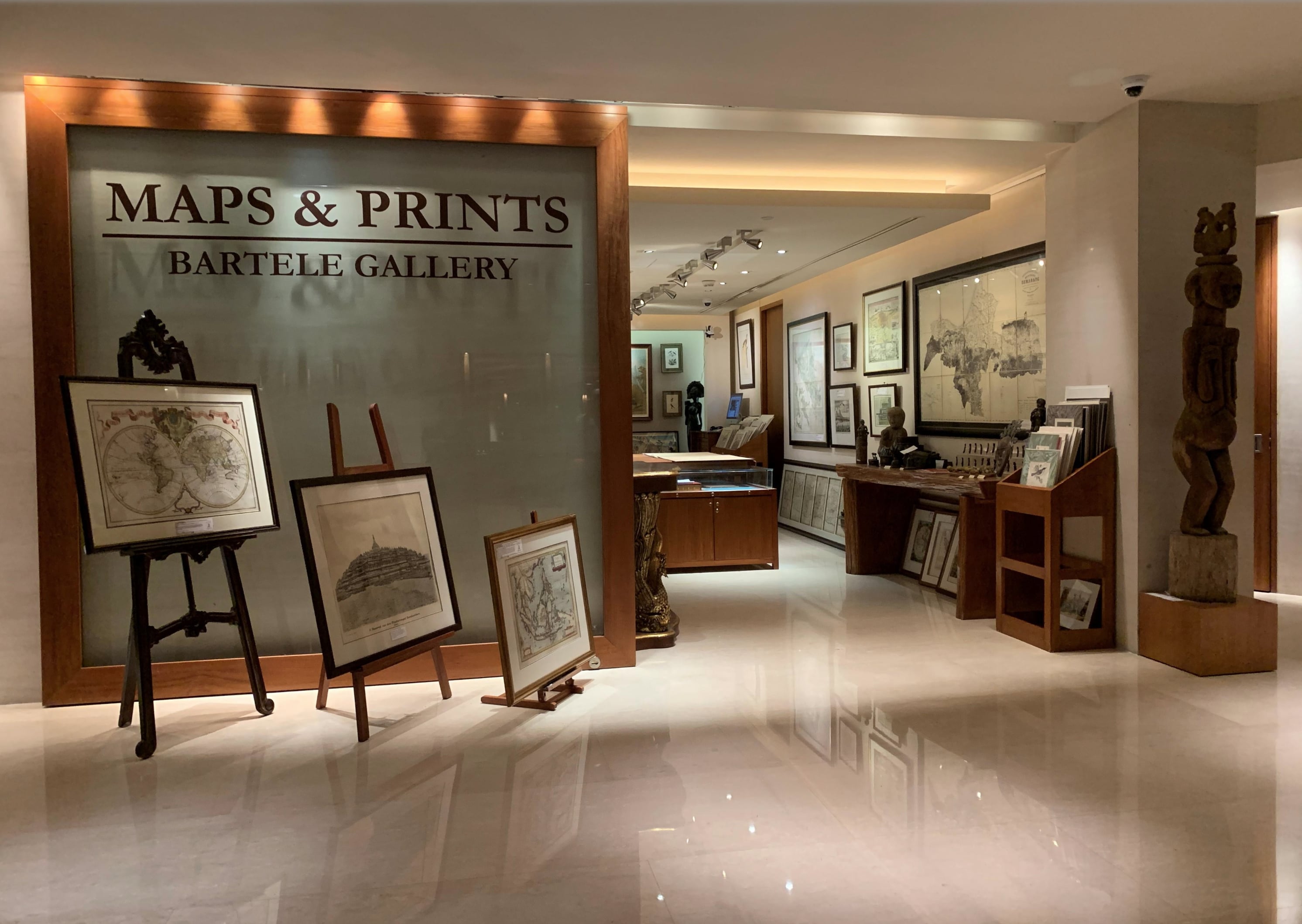
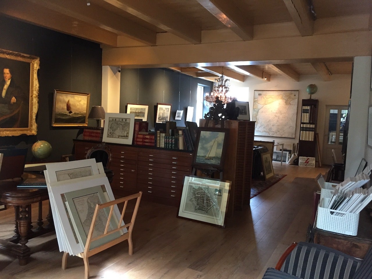
About Bartele Gallery
Bartele Gallery offers a wide range of antique maps, prints and rare books. Our extensive collection of antique maps covers every part of the world. Whilst cartography holds a special place in our collection, we also offer thousands of antique prints covering fields of interest as diverse as architecture, natural history, religion, ethnology and many more. Bartele Gallery is managed by Bartele Santema, in 2009 he founded the first gallery in Indonesia. This gallery is located in the Mandarin Oriental Hotel Jakarta and supported by curator Dr. David Parry, who wrote 'The ...Read More
Featured Pieces
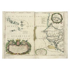
Antique Map of the Cape Verde Islands and Part of Senegal, West Africa, 1690
Located in Langweer, NL
Antique map titled 'Bocche del Fivme Negro et Isole di Capo Verde'. Beautiful double-page map of the Cape Verde Islands and part of the coast of Senegal, with large decorative cartou...
Category
Antique 17th Century Maps
Materials
Paper
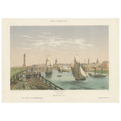
Original Antique Print of the Port of Calais, France, ca.1860
Located in Langweer, NL
Antique print titled 'Calais Entrée du Port'.
Original antique print of the port of Calais, France. This print originates from 'France en miniature'. Published circa 1860.
Art...
Category
Antique 1860s Prints
Materials
Paper
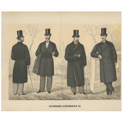
Original Antique Print of Men's Fashion, circa 1900
Located in Langweer, NL
Antique print titled 'Der Moderne Kleidermacher XII'. German fashion print, published circa 1900. Four men showing various outfits (incl. long jackets/coats), all wearing hats.
Category
Early 20th Century Prints
Materials
Paper
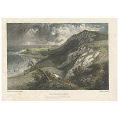
Hand-Colored Print of Folkestone 'United Kingdom' as Seen from the East, 1822
Located in Langweer, NL
Antique print titled 'Folkestone'.
This print depicts the town of Folkestone (United Kingdom) as seen from the East, the viewpoint high on the cliffs above the Warren, with cattl...
Category
Antique 1820s Prints
Materials
Paper
Antique Map of England and London with Two Large Allegorical Views, c.1720
Located in Langweer, NL
Antique map titled 'Nouvelle Carte du gouvernement civil d'Angleterre (..)'. Old plan of London, with map of England and two large allegorical views. This map originates from Chatela...
Category
Antique 18th Century Maps
Materials
Paper

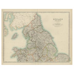
Original Antique Map of England and Wales from the 1909 Royal Atlas
Located in Langweer, NL
The antique map titled 'England and Wales' is a historical cartographic representation of these two nations. This original antique map of England...
Category
Early 20th Century Maps
Materials
Paper
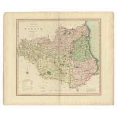
Original Hand-Colored Antique County Map of Durham, England, 1804
Located in Langweer, NL
Antique county map of Durham first published c.1800. Villages, towns, and cities illustrated include Gateshead, South Shields, and Darlington.
C...
Category
Antique Early 1800s Maps
Materials
Paper
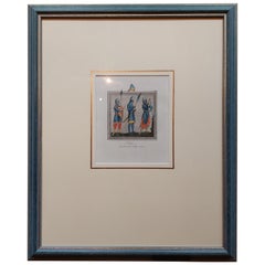
Antique Print of Soldiers of the 11th and 12th Century by Strutt '1842'
Located in Langweer, NL
Antique print titled 'Soldiers of the Eleventh & Twelfth Centuries'. Original antique print of Soldiers of the 11th and 12th Century. This print originates from 'Illustration for Dre...
Category
Antique Mid-19th Century Prints
Materials
Paper
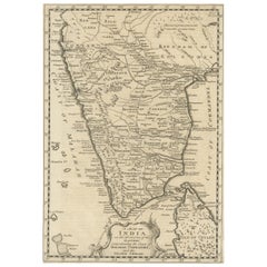
Original Detailed Antique Map of Southern India and Most of Ceylon, 1744
Located in Langweer, NL
Antique map titled 'A Map of India on the west Side of the Ganges, comprehending the coasts of Malabar, Coromandel and the Island Ceylon'.
Map of Southern India and most of Ceylo...
Category
Antique 1740s Maps
Materials
Paper
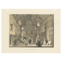
Antique Print of the Great Hall of Athelhampton House by Nash, circa 1870
Located in Langweer, NL
Antique print titled 'Hall. Athelhampton. Dorsetshire'. Lithograph of the Great Hall of Athelhampton House. Athelhampton House is a Tudor Manor in Dorset, E...
Category
Antique Mid-19th Century Prints
Materials
Paper
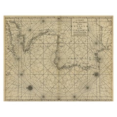
Original Antique Sea Chart of the Coastline from England to Gibraltar, ca.1700
Located in Langweer, NL
Antique map titled 'A Chart of the Sea-Coast from England to the Streights.'
Original antique map showing the European coastline from the South of England (and North of France) to ...
Category
Antique Early 1700s Maps
Materials
Paper
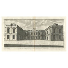
Antique Print of Althorp, Previous Home of Lady Diana Spencer in England, 1725
Located in Langweer, NL
Antique print titled 'Althrop in Northamptonshire (..)'.
Old engraving of Althorp, Northamptonshire.
Althorp is a Grade I listed stately home and estate in the civil parish of Althorp, in West Northamptonshire, England of about 13,000 acres (5,300 ha). By road it is about 6 miles (9.7 km) northwest of the county town of Northampton and about 75 miles (121 km) northwest of central London, situated between the villages of Great Brington and Harlestone. It has been held by the prominent aristocratic Spencer family for more than 500 years, and has been owned by Charles Spencer, 9th Earl Spencer since 1992. It was also the home of Lady Diana Spencer...
Category
Antique 18th Century Architectural Models
Materials
Paper
More About Bartele Gallery

Featured Creators