Items Similar to 1900s Stielers Hand Atlas 100 Maps
Want more images or videos?
Request additional images or videos from the seller
1 of 21
1900s Stielers Hand Atlas 100 Maps
About the Item
Stielers Hand Atlas, Gotha: Justus Perthes, Germany, circa 1905. Linen covered wood box containing 100 folded individual loose leaf maps of the world, text in german. Box made to look like a book, and has tears, spots and fading, maps are in very good condition.
- Dimensions:Height: 17.5 in (44.45 cm)Width: 12 in (30.48 cm)Depth: 3 in (7.62 cm)
- Style:Victorian (Of the Period)
- Materials and Techniques:
- Place of Origin:
- Period:
- Date of Manufacture:circa 1900
- Condition:Wear consistent with age and use. Box made to look like a book, and has tears, spots and fading, maps are in very good condition.
- Seller Location:Seguin, TX
- Reference Number:1stDibs: LU7228234753982
About the Seller
5.0
Platinum Seller
These expertly vetted sellers are 1stDibs' most experienced sellers and are rated highest by our customers.
Established in 1990
1stDibs seller since 2022
123 sales on 1stDibs
Typical response time: <1 hour
- ShippingRetrieving quote...Ships From: Seguin, TX
- Return PolicyA return for this item may be initiated within 7 days of delivery.
More From This SellerView All
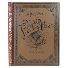
- Antique German Hartleben's Volks Atlas Book World MapsLocated in Seguin, TXAntique circa 1900 A. Hartleben's Volks-Atlas. Published by A. Hartleben's, Germany. Folio hardcover with decorated olive cloth binding and brown leather spine. Gilt title to spine...Category
Early 20th Century German Aesthetic Movement Maps
MaterialsPaper
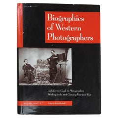
- 1997 Biographies of Western Photographers 1840-1900 BookLocated in Seguin, TXBiographies of Western Photographers 1840-1900 by Carl Mautz. Published by Carl Mautz Nevada City California, 1997. Red cloth hardcover binding, illustrated dust jacket, edge wear ...Category
1990s American Victorian Books
MaterialsPaper
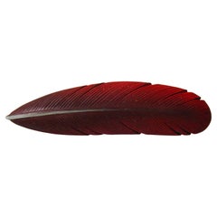
- Artist Hand Carved Wood Feather BroochLocated in Seguin, TXArtist signed hand carved wood brooch. Looks like a real feather, painted deep ombre red, signed on reverse Bordelon, circa 1990s.Category
Late 20th Century American Collectible Jewelry
MaterialsWood
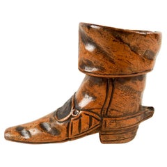
- Antique Hand Carved Wood Boot Match Holder StrikerLocated in Seguin, TXCirca 1890's hand carved wood match striker and holder. In the shape of 17th Century syle boot, think 3 Muskateers. Buckle area is rough for striking, s...Category
Antique Late 19th Century Unknown Louis XIV Tobacco Accessories
MaterialsWood
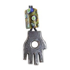
- Vintage 1990s Sterling Silver Hand Symbol Pendant Artist StudioLocated in Seguin, TXVintage 1990's sterling silver sculptural hand symbol pendant. Lost wax cast sterling silver hand pendant by Linda Thompson (20th/21st century) Texas, unsigned. With glass trade bead...Category
1990s American Rustic Collectible Jewelry
MaterialsSterling Silver
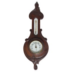
- Antique English Aneroid Barometer & ThermometerLocated in Seguin, TXAntique circa 1900 aneroid barometer and thermometer. Made in England, carved oak case, banjo shaped with white porcelain dials, beveled glass cover, on barometer. Thermometer works...Category
Early 20th Century English Late Victorian Scientific Instruments
MaterialsGlass, Walnut
You May Also Like
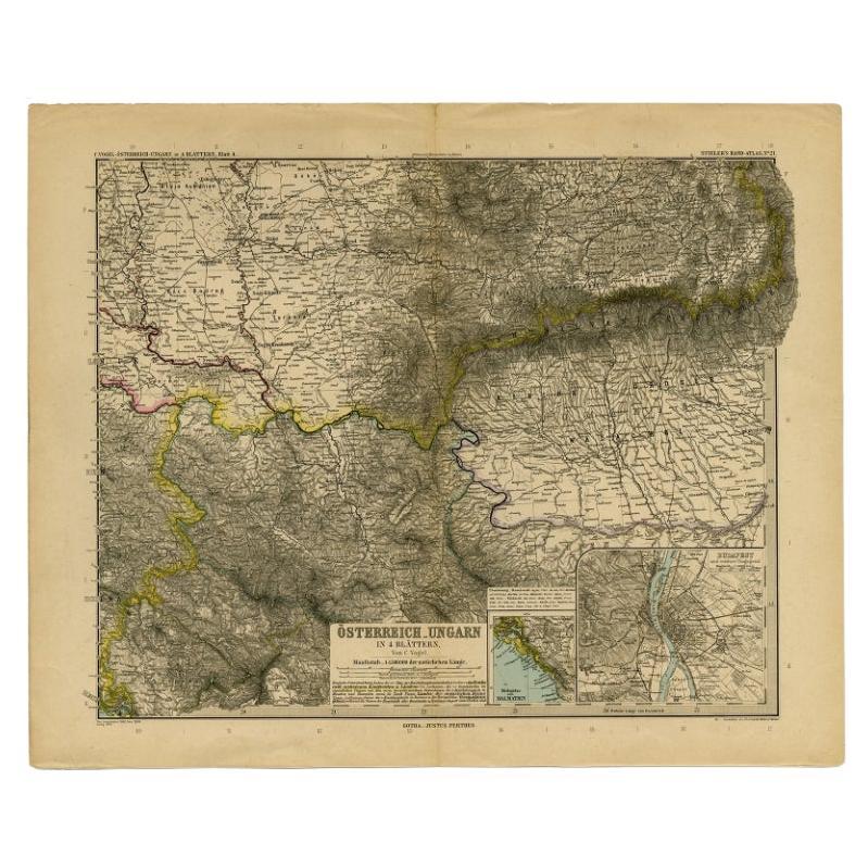
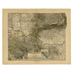
- Antique Map of Eastern Europe by Stieler, 1890Located in Langweer, NLAntique map titled 'Osterreich-Ungarn in 4 Blattern, Blatt 4.' Map of Eastern Europe, with Montenegro in the lower left corner, the southern edge...Category
Antique 19th Century Maps
MaterialsPaper
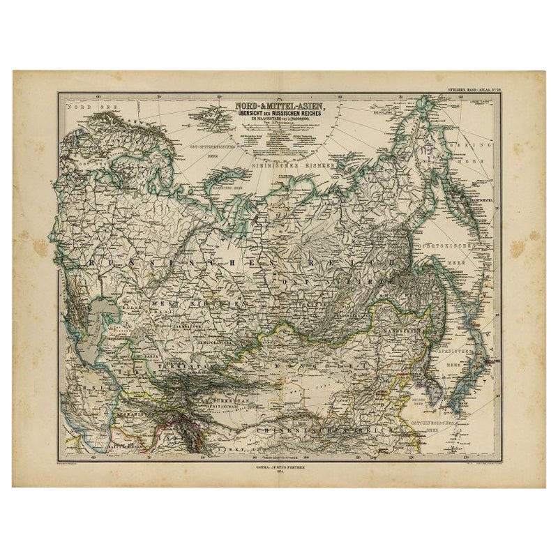
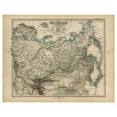
- Antique Map of Russia and Surroundings by Stieler, 1874Located in Langweer, NLAntique map titled 'Nord- & Mittal-Asien, Ubersicht des Russischen Reiches.' A map of Russia in scale 1:20.000.000. The depicted area spans from Iran and Sweden in the left edge of t...Category
Antique 19th Century Maps
MaterialsPaper
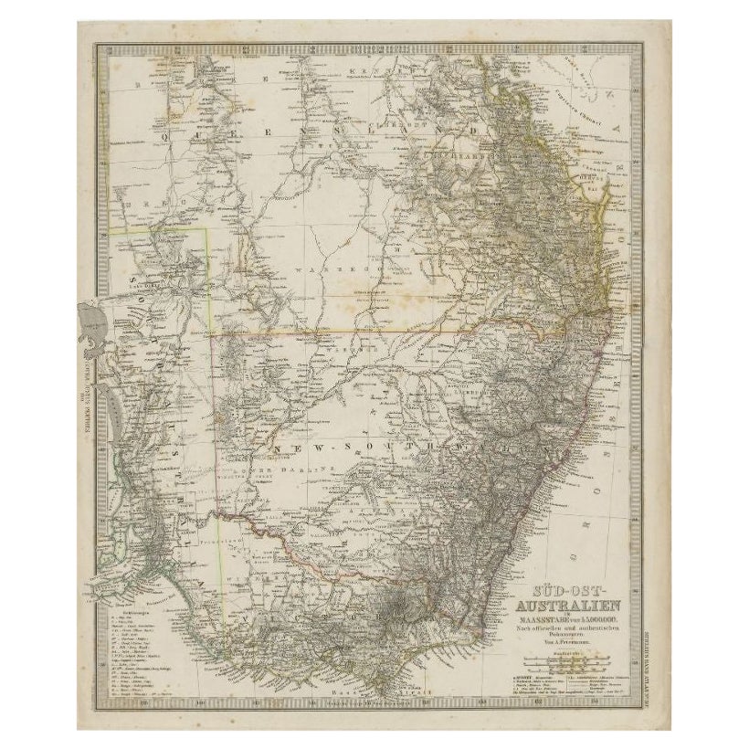
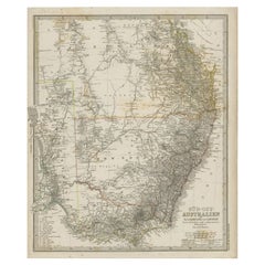
- Antique Map of South East Australia by Stieler, c.1848By Thomas KitchinLocated in Langweer, NLAntique map Australia titled 'Süd-Ost Australien'. Detailed map of South East Australia. Orginates from 'Stieler's Hand Atlas', published in Germ...Category
Antique 19th Century Maps
MaterialsPaper
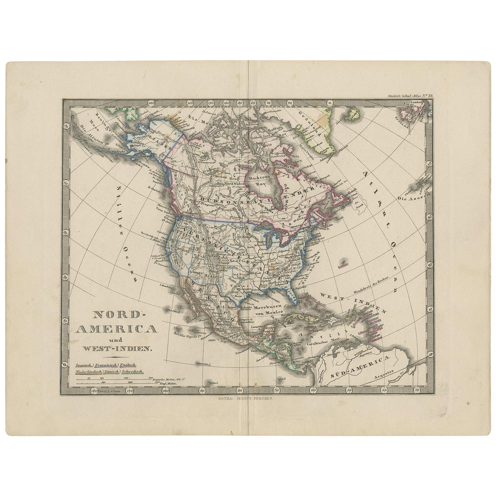
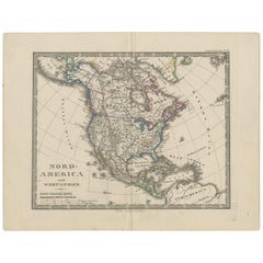
- Antique Map of North America and the West Indies by Stieler, circa 1865Located in Langweer, NLAntique map titled 'Nord-America und West-Indien'. Old map of North America and the West Indies. This map originates from Stieler's 'Schul-Atlas'.Category
Antique Mid-19th Century Maps
MaterialsPaper
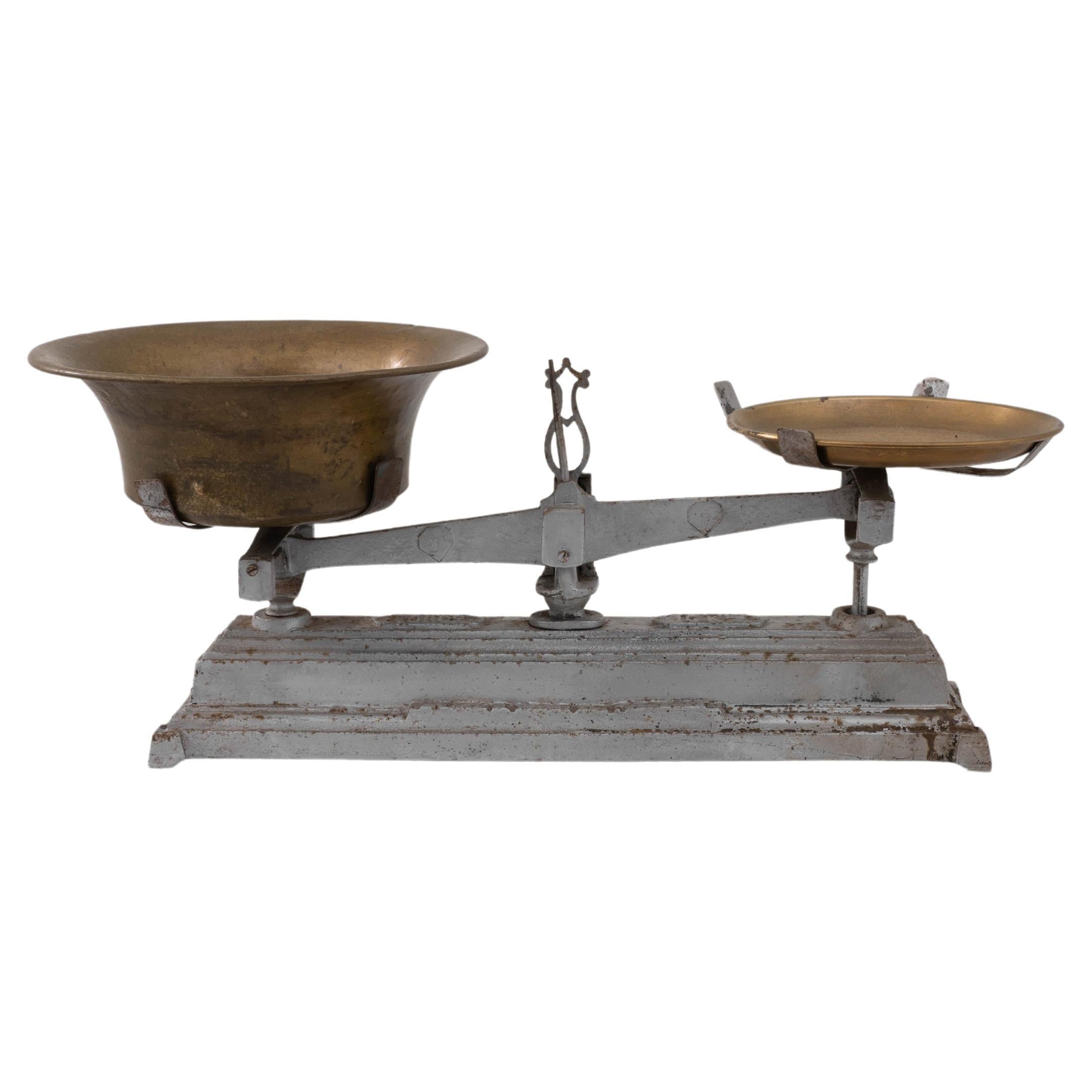
- 1900s French Metal ScaleLocated in High Point, NCThis early 1900s French Metal Scale is an evocative piece of history that marries function with rustic charm. Featuring a robust metal frame with an aged, weathered patina, the scale...Category
Early 20th Century French Scientific Instruments
MaterialsMetal
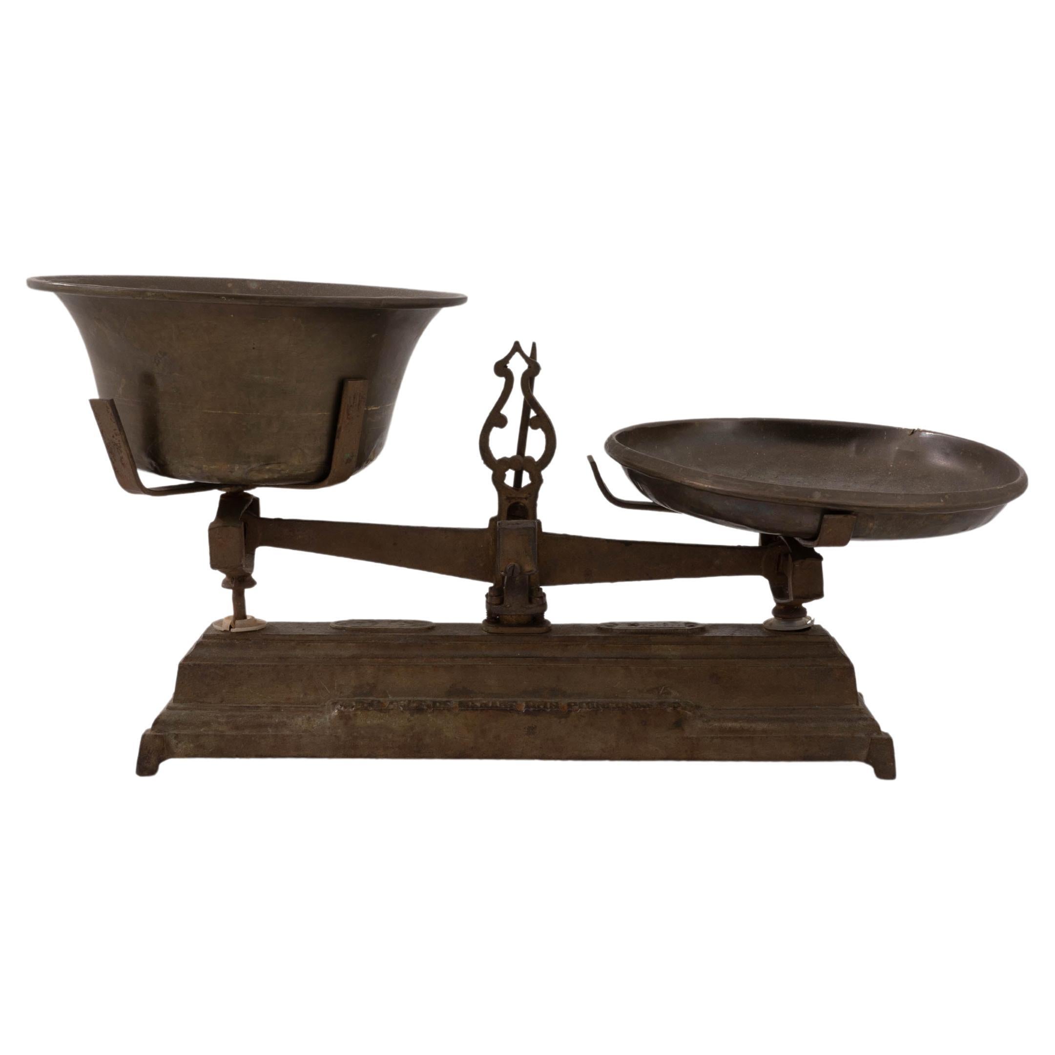

Recently Viewed
View AllMore Ways To Browse
Antique German Linens
Wood Box 1900s
Antique Linen Box
Antique Saudi
Arabian Peninsula
Colombia Map
Framed Map Asia
Map Of Bengal
Map Of Syria
United States Civil War Map
Afghanistan Antique Map
Antique Furniture Santa Cruz
Antique Mississippi Map
Hindeloopen Furniture
Madagascar Antique Map
Map Of Prussia
Normandy Map
Prussia Map