Items Similar to Antique Decorative Coloured Map of South Africa and Madagascar, 1882

Want more images or videos?
Request additional images or videos from the seller
1 of 7
Antique Decorative Coloured Map of South Africa and Madagascar, 1882
About the Item
The map of South Africa is from the Blackie & Son Atlas, published in 1882. This historical map is quite interesting for several reasons:
1. **Historical Period**: This map was created during a significant period in South African history, just before the discovery of gold and diamonds led to the rapid economic development of the region and, subsequently, to the conflicts of the Anglo-Boer Wars at the end of the 19th century.
2. **Geographical Detail**: It displays the topographical features of South Africa, including mountain ranges such as the Drakensberg, and major rivers. It would also possibly show the distribution of the colonial possessions and the independent African states at the time, like the Zulu Kingdom, which had significant historical implications.
3. **Colonial Impact**: The map reflects the territorial knowledge and the extent of colonial impact before the major changes that would come with the mineral revolution and the subsequent scramble for Africa.
4. **Portrayal of the Terrain**: South Africa’s diverse terrain, from the coastal regions to the interior highveld and the arid regions of the northwest, would be depicted, offering insight into the challenges of settlement and development in the region.
5. **Transportation**: Any rail lines, roads, ports, and other infrastructure depicted on the map would show the development of transportation networks critical for colonial expansion and exploitation of natural resources.
6. **Cultural and Political Boundaries**: The map may show the boundaries of different cultural and political entities as they were understood by Europeans at the time, which could differ significantly from today's boundaries.
7. **Cartographic Techniques**: The map showcases the cartographic techniques and styles of the era, including the use of color, shading, and symbols to represent geographical features and political boundaries.
8. **Maritime Details**: Given South Africa’s position on the trade route to Asia, maritime details such as currents and harbors along the coastline would be important for navigation and trade.
Maps from this era are valuable for the historical insights they provide and for understanding the world view and knowledge at the time of their creation.
- Dimensions:Height: 14.97 in (38 cm)Width: 22.45 in (57 cm)Depth: 0 in (0.02 mm)
- Materials and Techniques:
- Period:
- Date of Manufacture:1882
- Condition:Good condition, folding line in the middle. The outer borders are slightly discolored due to age, but not the image. One small tear in the lower margin, not affecting the image. Study the image carefully.
- Seller Location:Langweer, NL
- Reference Number:
About the Seller
5.0
Platinum Seller
These expertly vetted sellers are 1stDibs' most experienced sellers and are rated highest by our customers.
Established in 2009
1stDibs seller since 2017
1,969 sales on 1stDibs
Typical response time: <1 hour
- ShippingRetrieving quote...Ships From: Langweer, Netherlands
- Return PolicyA return for this item may be initiated within 14 days of delivery.
More From This SellerView All
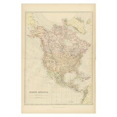
- Antique Decorative Coloured Map of North America, 1882Located in Langweer, NLThis original antique map of North America is from the Blackie & Son Atlas published in 1882. Here are several points of interest about this map: 1. **Political Borders**: The map l...Category
Antique 1880s Maps
MaterialsPaper
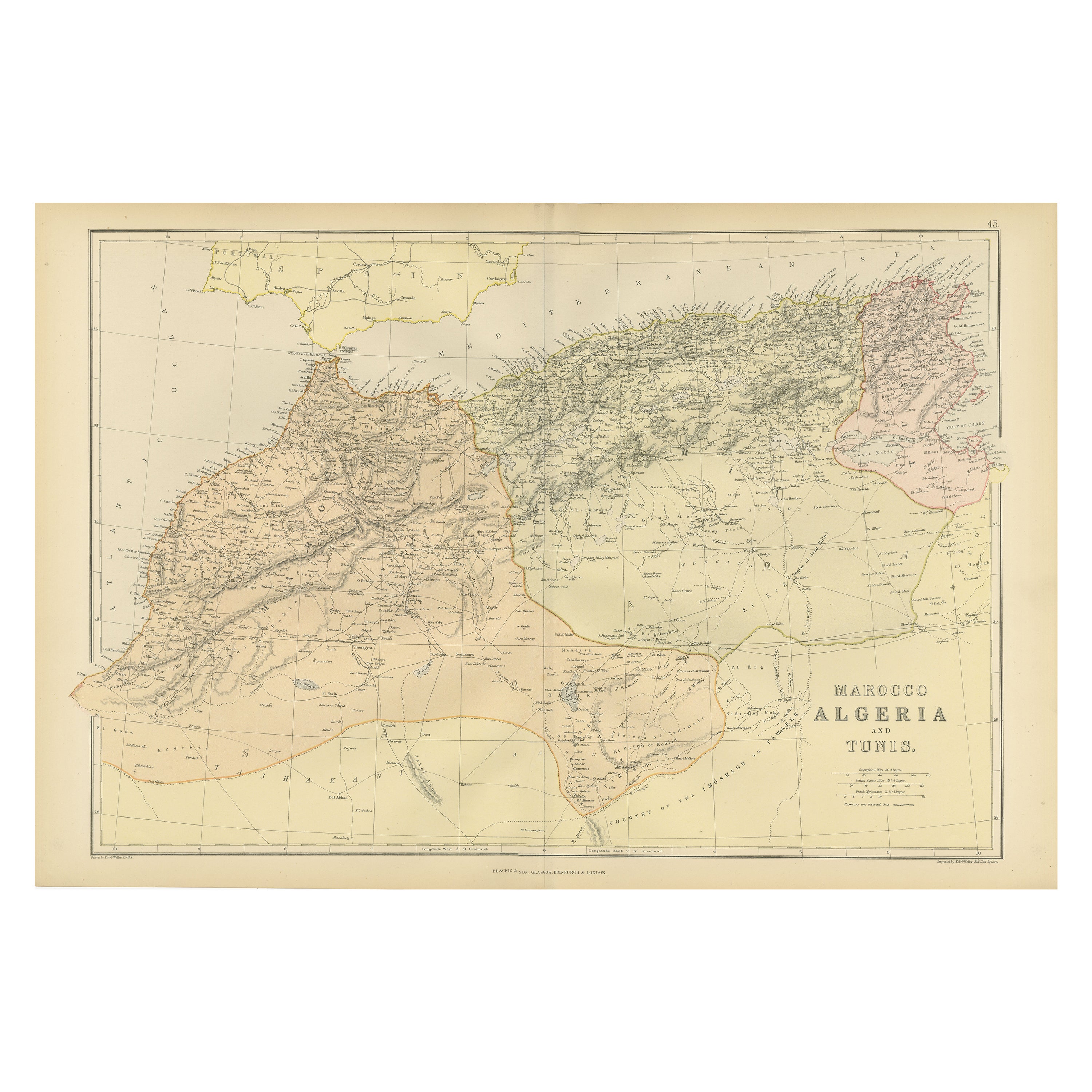
- Antique Decorative Coloured Map Marocco, Algeria and Tunis, 1882Located in Langweer, NLThe maps is from the 1882 atlas by Blackie & Son and offers a detailed view of the North African regions as understood in the late 19th century. **Map of Morocco, Algeria, and Tun...Category
Antique 1880s Maps
MaterialsPaper
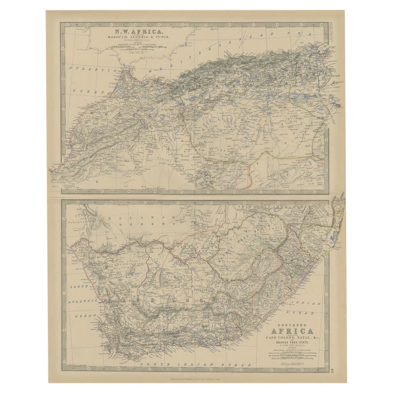
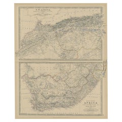
- Antique Map of North and South Africa by Johnston, 1882Located in Langweer, NLTwo antique maps on one sheet titled 'N.W. Africa, Marocco, Algeria & Tunis' and 'Southern Africa, comprising Cape Colony, Natal & c'. This map originates from 'The Royal Atlas of ...Category
Antique 19th Century Maps
MaterialsPaper
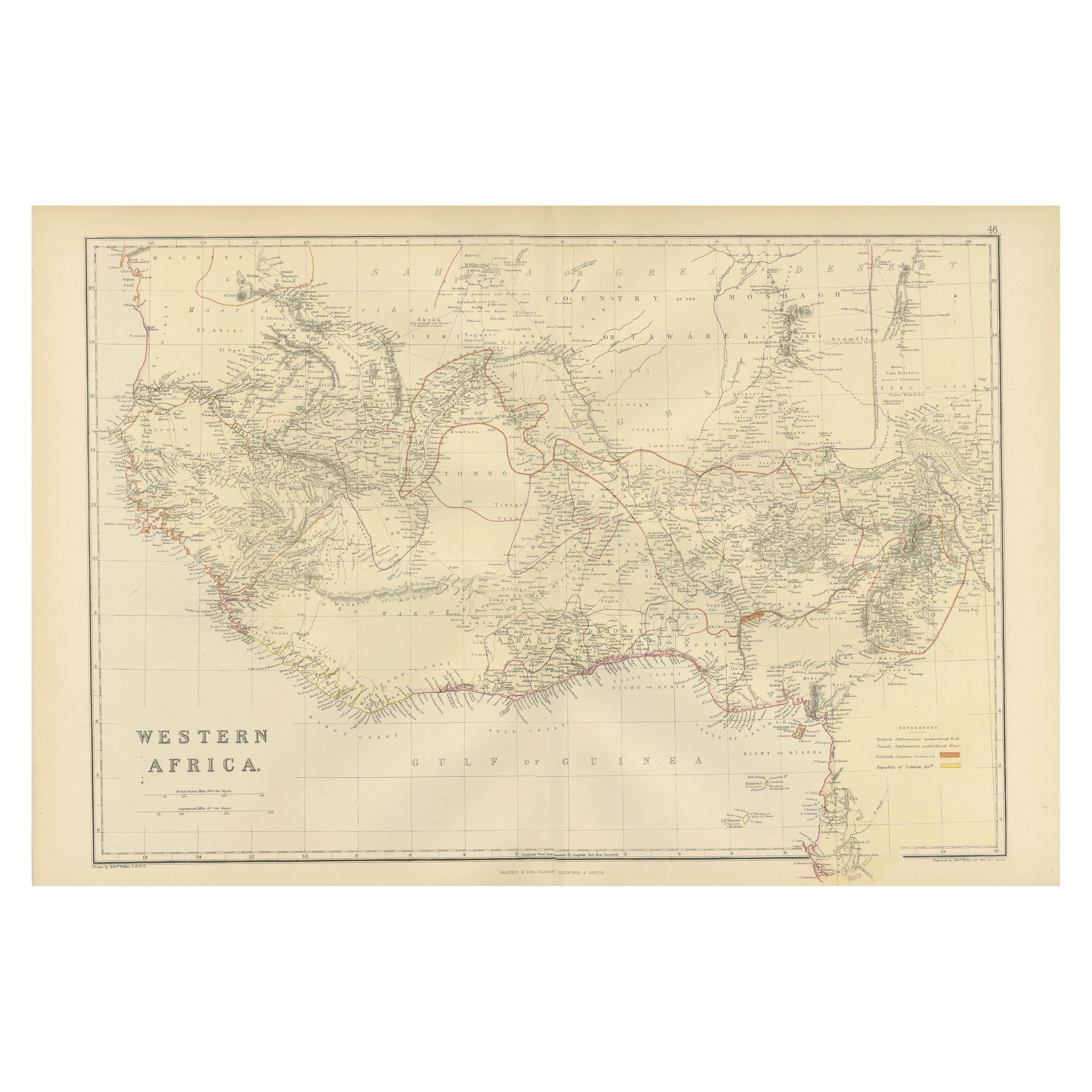
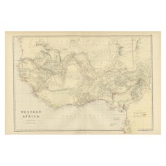
- Original Antique Coloured Map of Western Africa, Published in 1882Located in Langweer, NLThis is a map of Western Africa from the 1882 Blackie & Son atlas. The map details the West African coast from the Sahara Desert in the north down to the Gulf of Guinea, including a ...Category
Antique 1880s Maps
MaterialsPaper
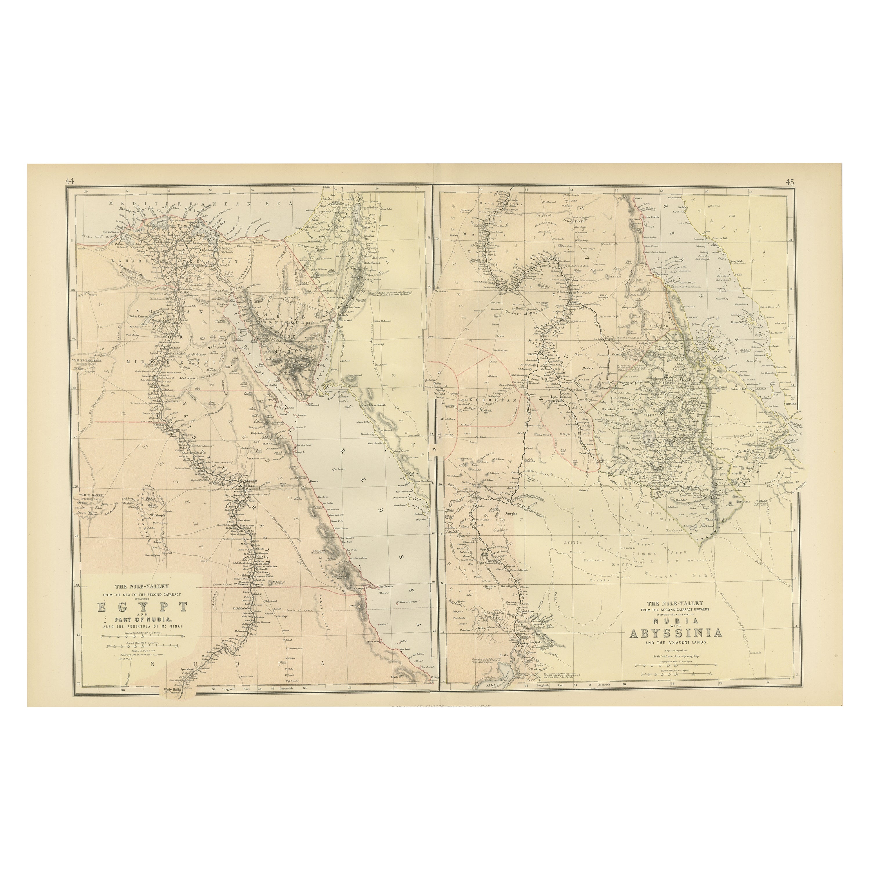
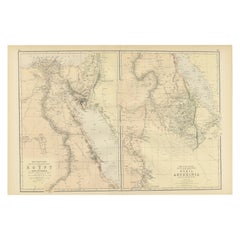
- Antique Decorative Coloured Map Egypt, Nubia, Abyssinia and more, 1882Located in Langweer, NLThis image contains two maps, with the left one being labeled "Egypt" and the right one "Nubia, Abyssinia and the Adjacent Lands." These maps highlight the Nile Valley and surroundin...Category
Antique 1880s Maps
MaterialsPaper
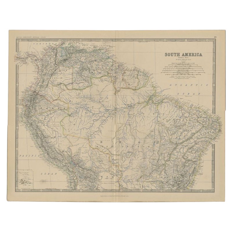
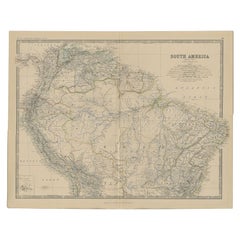
- Antique Map of South America by Johnston, 1882Located in Langweer, NLAntique map titled 'South America'. Old map of South America, with an inset map of the Galapagos Isles. This map originates from 'The Royal Atlas of Modern Geography, Exhibiting, in ...Category
Antique 19th Century Maps
MaterialsPaper

You May Also Like
- Original Antique Map of South Africa, Arrowsmith, 1820Located in St Annes, LancashireGreat map of South Africa. Drawn under the direction of Arrowsmith. Copper-plate engraving. Published by Longman, Hurst, Rees, Orme and Br...Category
Antique 1820s English Maps
MaterialsPaper
- Original Antique Decorative Map of South America-West Coast, Fullarton, C.1870Located in St Annes, LancashireGreat map of Chili, Peru and part of Bolivia Wonderful figural border From the celebrated Royal Illustrated Atlas Lithograph. Original color. Published by Fullarton, Edi...Category
Antique 1870s Scottish Maps
MaterialsPaper
- Large Original Vintage Map of South Africa, circa 1920Located in St Annes, LancashireGreat map of South Africa Original color. Good condition / repair to a minor edge tear middle bottom Published by Alexander Gross Unframed. ...Category
Vintage 1920s English Edwardian Maps
MaterialsPaper
- Original Antique Map of South America. C.1780Located in St Annes, LancashireGreat map of South America Copper-plate engraving Published C.1780 Two small worm holes to left side of map Unframed.Category
Antique Early 1800s English Georgian Maps
MaterialsPaper
- Original Antique Map of South America, circa 1830Located in St Annes, LancashireGreat map of South America Copper plate engraving Published by Butterworth, Livesey & Co., circa 1830 Unframed.Category
Antique Early 1800s English Other Maps
MaterialsPaper
- Original Antique Decorative Map of Japan, Fullarton, C.1870Located in St Annes, LancashireGreat map of Japan Wonderful figural border From the celebrated Royal Illustrated Atlas Lithograph. Original color. Published by Fullarton, Edinburgh, C.1870 Unframed...Category
Antique 1870s Scottish Maps
MaterialsPaper


Recently Viewed
View AllMore Ways To Browse
Antique Knowledge
South African Gold
South African Antique
Antique Furniture In South Africa
South African Diamonds
Gold World Map
Map Of South Africa
Cultural Revolution
Colonial Creations
Rail Road
Boer War
Maritime Navigation Antiques
Map Colonial Africa
Rail Road Collectables
Antique Zulu
Zulu War
Constantinople Map
Map Colonial Africa