Items Similar to Antique Map of Asia Minor, Region of the Nile and Region of the City of Carthage


Want more images or videos?
Request additional images or videos from the seller
1 of 5
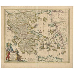
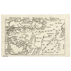
Antique Map of Asia Minor, Region of the Nile and Region of the City of Carthage
About the Item
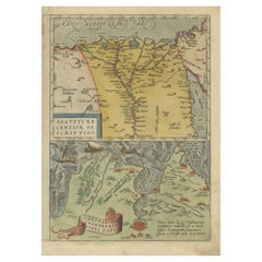
Three antique maps on one sheet titled 'Natoliae quae olim Asia Minor [with] Aegypti recentior descriptio [with] Carthaginis Celeberrimisinus Typus'. The first map covers Asia Minor, Cyprus, and the Eastern Mediterranean. The second map shows the region around the Nile, as far as Aswan. The third map shows the environs of the City of Carthage. Published by A. Ortelius, circa 1571.
- Dimensions:Height: 16.93 in (43 cm)Width: 22.05 in (56 cm)Depth: 0.02 in (0.5 mm)
- Materials and Techniques:
- Period:
- Date of Manufacture:circa 1571
- Condition:Repaired: Please read description below. General age-related toning, minor wear. Latin text verso, central vertical fold with several repairs to small loss. Please study images carefully.
- Seller Location:Langweer, NL
- Reference Number:
About the Seller
5.0
Platinum Seller
These expertly vetted sellers are 1stDibs' most experienced sellers and are rated highest by our customers.
Established in 2009
1stDibs seller since 2017
1,965 sales on 1stDibs
Typical response time: <1 hour
- ShippingRetrieving quote...Ships From: Langweer, Netherlands
- Return PolicyA return for this item may be initiated within 14 days of delivery.
More From This SellerView All
- Antique Map of the Region Around the Nile and the City of CarthageLocated in Langweer, NLAntique map titled 'Aegypti recentior descriptio - Carthaginis Celeberrimi sinus typus'. Two detailed regional maps by Ortelius. One map shows the region around the Nile, as far as A...Category
Antique 16th Century Maps
MaterialsPaper
- Antique Map of Asia Minor, Cyprus, and the Eastern MediterraneanLocated in Langweer, NLAntique map titled 'Natoliae quae olim Asia Minor nova descriptio'. Original antique map of Asia Minor, Cyprus, and the eastern Mediterranean. Originally published on one sheet toget...Category
Antique Early 17th Century Maps
MaterialsPaper
- Original Antique Map of Turkey, Asia Minor and CyprusBy Gerard MercatorLocated in Langweer, NLAntique map titled 'Natoliae sive Asia Minor'. Original old map of Turkey, Asia Minor and Cyprus. Includes a decorative cartouches, sailing ship, sea mon...Category
Antique Early 17th Century Maps
MaterialsPaper
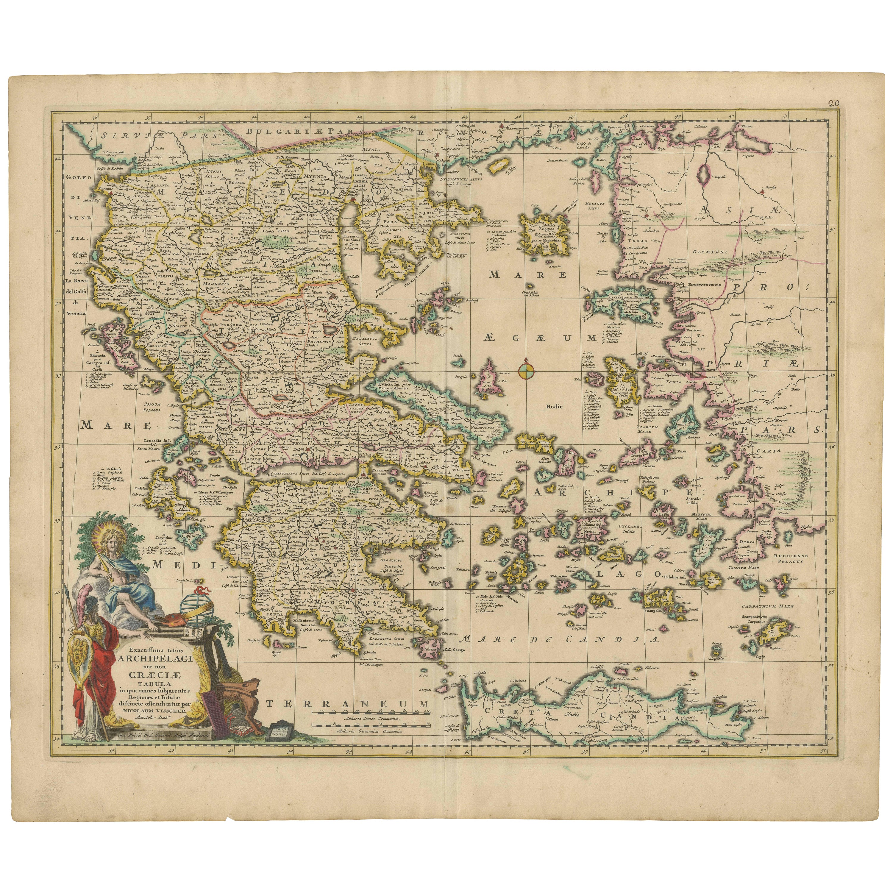
- Scarce Antique Map of Greece, the Aegean, Crete and part of Asia MinorLocated in Langweer, NLOriginal antique map titled 'Exactissima totius Archipelagi nec non Graeciae Tabula'. Visscher's scarce map of the Greek Islands, the Aegean, Crete and part of Asia Minor. Published circa 1680. Among the many great Dutch map publishers active in the seventeenth century were the Visscher family; the firm was begun by Claes Jansz Visscher...Category
Antique Late 17th Century Maps
MaterialsPaper
- Antique Map of the United States with inset map of the region of Mexico CityLocated in Langweer, NLAntique map titled 'Verein-Staaten von Nord-America, Mexico, Yucatan u.a.'. Very detailed map of the United States of America showing the Caribbean. With an inset map of the surround...Category
Antique Mid-19th Century Maps
MaterialsPaper
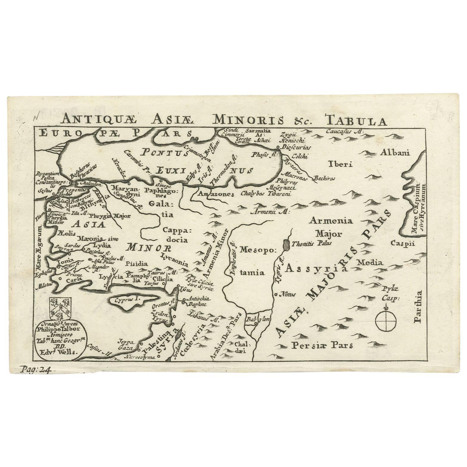
- Nice Antique Map of Asia Minor, Turkey, circa 1718Located in Langweer, NLAntique map titled 'Antiquae Asiae Minoris & C. Tabula' by Philippo Talbor. This rare antique map is published by Edward Wells, circa 1718.Category
Antique Early 18th Century Maps
MaterialsPaper


You May Also Like
- Hand-Colored 18th Century Homann Map of the Black Sea, Turkey and Asia MinorBy Johann Baptist HomannLocated in Alamo, CAAn attractive original early 18th century hand-colored map of the Black Sea and Turkey entitled "Carte de L'Asie Minevre ou de la Natolie et du Pont Evxin Tiree des Voyages et des Ob...Category
Antique Early 18th Century German Maps
MaterialsPaper
- Original Antique Map of Asia. C.1780Located in St Annes, LancashireGreat map of Asia Copper-plate engraving Published C.1780 Two small worm holes to right side of map Unframed.Category
Antique Early 1800s English Georgian Maps
MaterialsPaper

- Original Antique Map of South East Asia, Arrowsmith, 1820Located in St Annes, LancashireGreat map of South East Asia Drawn under the direction of Arrowsmith Copper-plate engraving Published by Longman, Hurst, Rees, Orme and Brown, 1820 Unframed.Category
Antique 1820s English Maps
MaterialsPaper
- The Normandy Region of France: A 17th C. Hand-colored Map by Sanson and JaillotBy Nicolas SansonLocated in Alamo, CAThis large hand-colored map entitled "Le Duché et Gouvernement de Normandie divisée en Haute et Basse Normandie en divers Pays; et par evêchez, avec le Gouvernement General du Havre ...Category
Antique 1690s French Maps
MaterialsPaper
- Original Antique Map of South East Asia by Becker, circa 1840Located in St Annes, LancashireGreat map of South East Asia Steel engraving with original color outline Engraved by Becker Published by Virtue, circa 1840. Unframed.Category
Antique 1840s English Other Maps
MaterialsPaper
- Original Antique Map of South East Asia by Thomas Clerk, 1817Located in St Annes, LancashireGreat map of South East Asia Copper-plate engraving Drawn and engraved by Thomas Clerk, Edinburgh. Published by Mackenzie And Dent, 1817 Unframed.Category
Antique 1810s English Maps
MaterialsPaper


Recently Viewed
View AllMore Ways To Browse
Antique Maps Of Asia
Maps Of Mediterranean
Map Mediterranean
Eastern Mediterranean
Antique Mediterranean Map
Antique Map Ortelius
Antique Maps Ortelius
Antique Furniture Cyprus
Carthage Antique
Antique Map Of Cyprus
Cyprus Antique Maps
Map Cyprus
Dutch 16th Century Furniture
Map Of Britain
Ancient Maps
Antique Maps Of Amsterdam
Netherlands 16th Century
Africa Map