Items Similar to Antique Map of the Coast of New Ireland, Earlier Part of German New Guinea, 1833


Want more images or videos?
Request additional images or videos from the seller
1 of 5
Antique Map of the Coast of New Ireland, Earlier Part of German New Guinea, 1833
About the Item
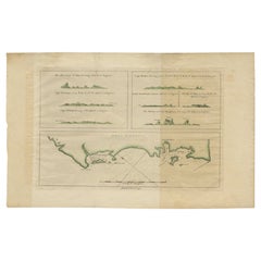
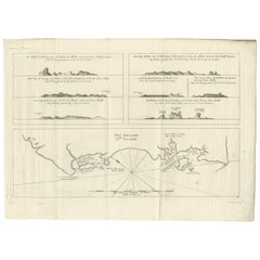
Antique map titled 'Plan du Havre Carteret sur la Cote occidentale de la Nelle Irlande.
Expedition de la Corvette de S.M. l'Astrolabe, Commandee par le CAP ne de Fregate Dumont D'Urville. Juillet 1827.' A chart of the coast of Latangai Island (then known as New Ireland), with Lamassa Island (identified as Ile Cocos), and a second island identified as Ile Leigh. Shows soundings and height profile. New Ireland, also New Mecklenburg, is the Northeastern Province of Papua New Guinea. Map no. 26 from Dumont D'Urville's "Voyage de la Corvette l'Astrolabe - Atlas"", published in Paris: J. Tastu, 1833.
New Ireland or Latangai, is a large island in Papua New Guinea, approximately 7,404 km2 (2,859 sq mi) in area with c. 120,000 people. It is named after the island of Ireland. It is the largest island of New Ireland Province, lying northeast of the island of New Britain. Both islands are part of the Bismarck Archipelago, named after Otto von Bismarck, and they are separated by Saint George's Channel. The administrative centre of the island and of New Ireland province is the town of Kavieng located at the northern end of the island. While the island was part of German New Guinea, it was named Neumecklenburg ("New Mecklenburg").
Artists and Engravers: Made by 'Chassant' after 'Mr. Paris'.
Condition: Very good, given age. A small stain in the center of the image. A few faint small stains in the far right of the image. Margins a little stained. A few small tears in the right margin (not affecting image). General age-related toning and/or occasional minor defects from handling. Please study image carefully.
Date: 1833
Overall size: 64.6 x 47.9 cm.
Image size: 59.3 x 43.1 cm.
We sell original antique maps to collectors, historians, educators and interior decorators all over the world. Our collection includes a wide range of authentic antique maps from the 16th to the 20th centuries. Buying and collecting antique maps is a tradition that goes back hundreds of years. Antique maps have proved a richly rewarding investment over the past decade, thanks to a growing appreciation of their unique historical appeal. Today the decorative qualities of antique maps are widely recognized by interior designers who appreciate their beauty and design flexibility. Depending on the individual map, presentation, and context, a rare or antique map can be modern, traditional, abstract, figurative, serious or whimsical. We offer a wide range of authentic antique maps for any budget.
- Dimensions:Height: 18.86 in (47.9 cm)Width: 25.44 in (64.6 cm)Depth: 0 in (0.01 mm)
- Materials and Techniques:
- Period:
- Date of Manufacture:1833
- Condition:Condition: Very good, given age. A small stain in the center of the image. A few faint small stains in the far right of the image. Margins a little stained. A few small tears in the right margin (not affecting image). General age-related toning.
- Seller Location:Langweer, NL
- Reference Number:
About the Seller
5.0
Platinum Seller
These expertly vetted sellers are 1stDibs' most experienced sellers and are rated highest by our customers.
Established in 2009
1stDibs seller since 2017
1,959 sales on 1stDibs
Typical response time: <1 hour
- ShippingRetrieving quote...Ships From: Langweer, Netherlands
- Return PolicyA return for this item may be initiated within 14 days of delivery.
More From This SellerView All
- Antique Map of New Ireland Island in the Bismarck Archipelago, New Guinea, 1772Located in Langweer, NLAntique map titled 'Nova Hibernia'. Antique map of New Ireland, an island in the Bismarck Archipelago, New Guinea. Lying just north of New Britain, from which it is separated by St. ...Category
Antique 18th Century Maps
MaterialsPaper
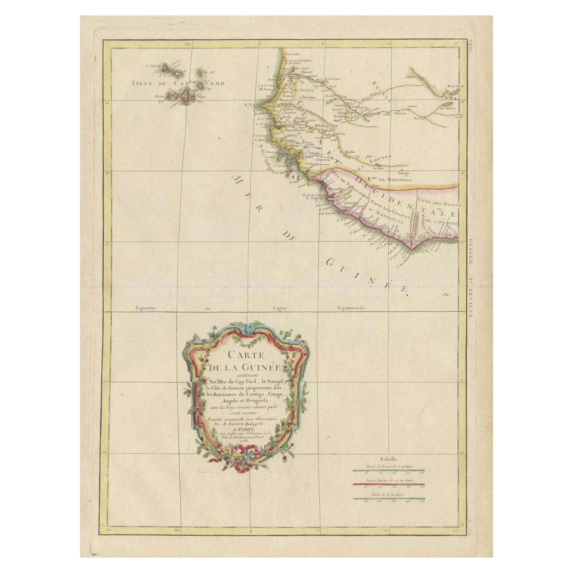
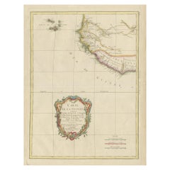
- Antique Map of the Coast of Guinea and the Cape Verde IslandsLocated in Langweer, NLAntique map titled 'Carte de la Guinée (..)'. This map was originally part of a 2 sheet larger map of Eastern Africa, showing the Cape Verde Islands and Senegal. This map originates ...Category
Antique Late 18th Century Maps
MaterialsPaper
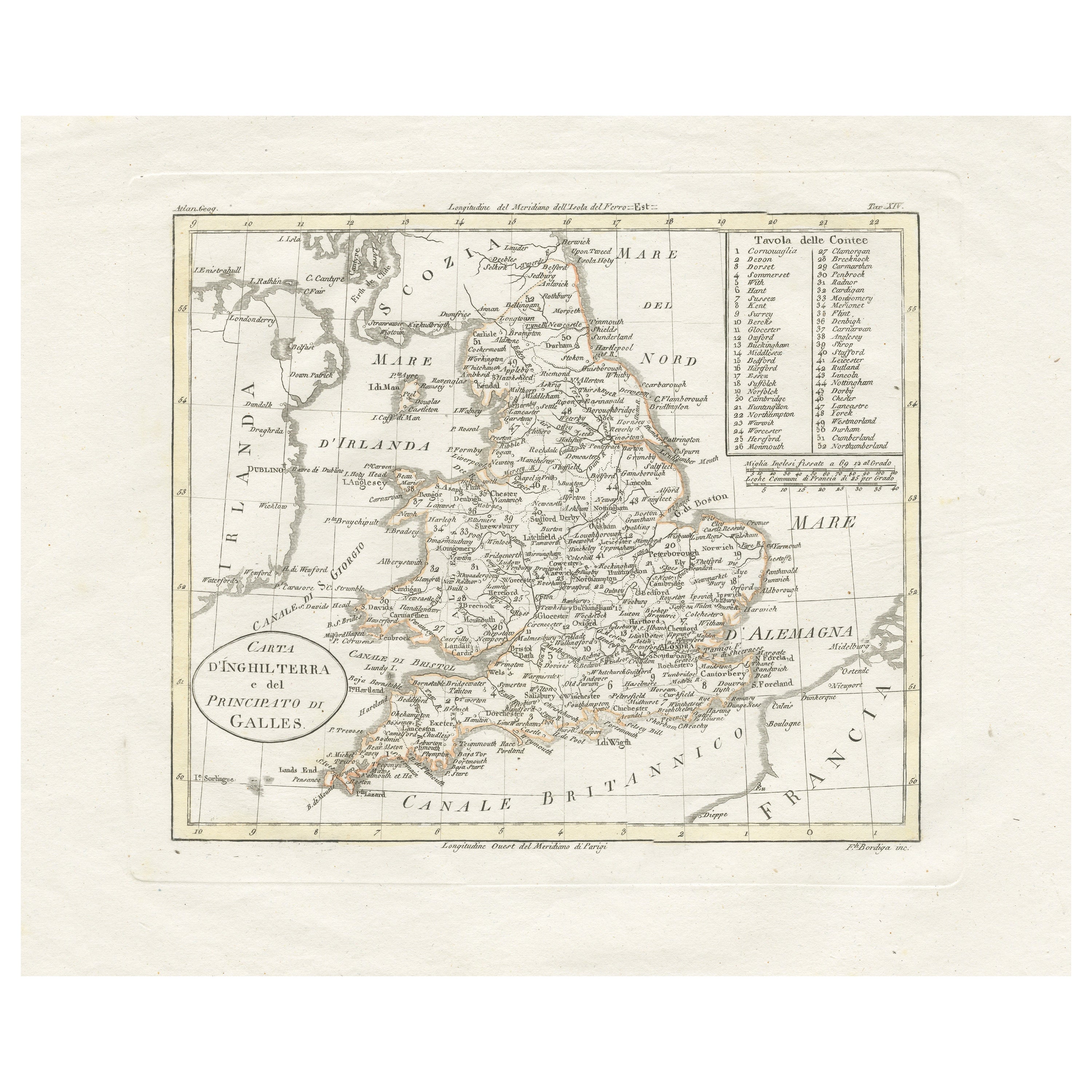
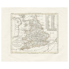
- Detailed Antique Map of Britain, Wales and the Coast of IrelandLocated in Langweer, NLAntique map titled 'Carta d'Inghilterra e del Principato di Galles'. Detailed map of Britain, Wales and the coast of Ireland with a list of counties. This map originates from 'Nuovo ...Category
Antique Mid-19th Century Maps
MaterialsPaper
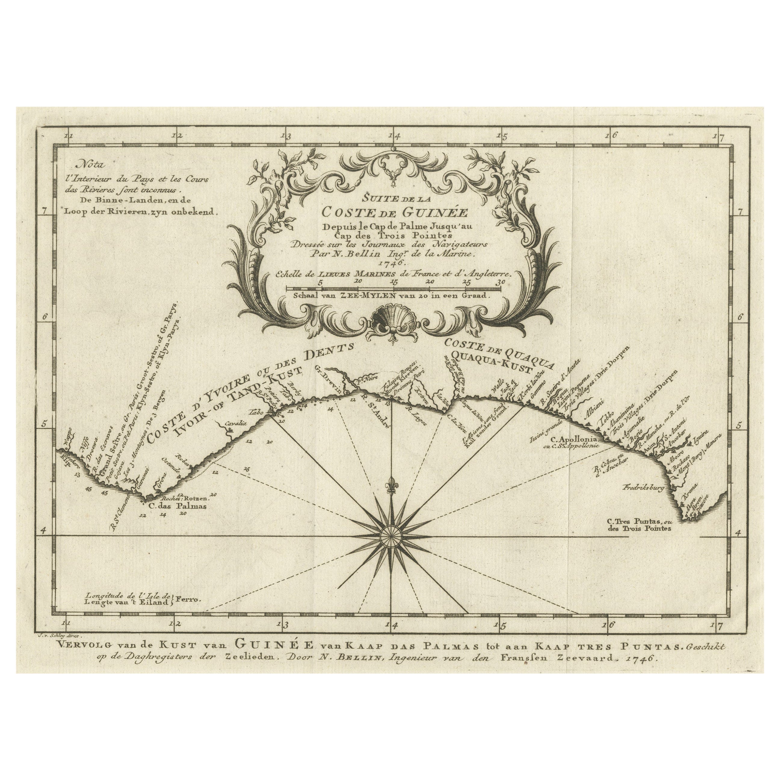
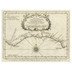
- Antique Map of the Coast of Guinea from, Cape Apollonia to the Volta RiverLocated in Langweer, NLAntique map titled 'Suite de la Coste de Guinée (..) - Vervolg van de Kust van Guinée (..)'. Decorative map of the coast of Guinea from, Cape Apollonia to the Volta River. Engraved b...Category
Antique Mid-18th Century Maps
MaterialsPaper
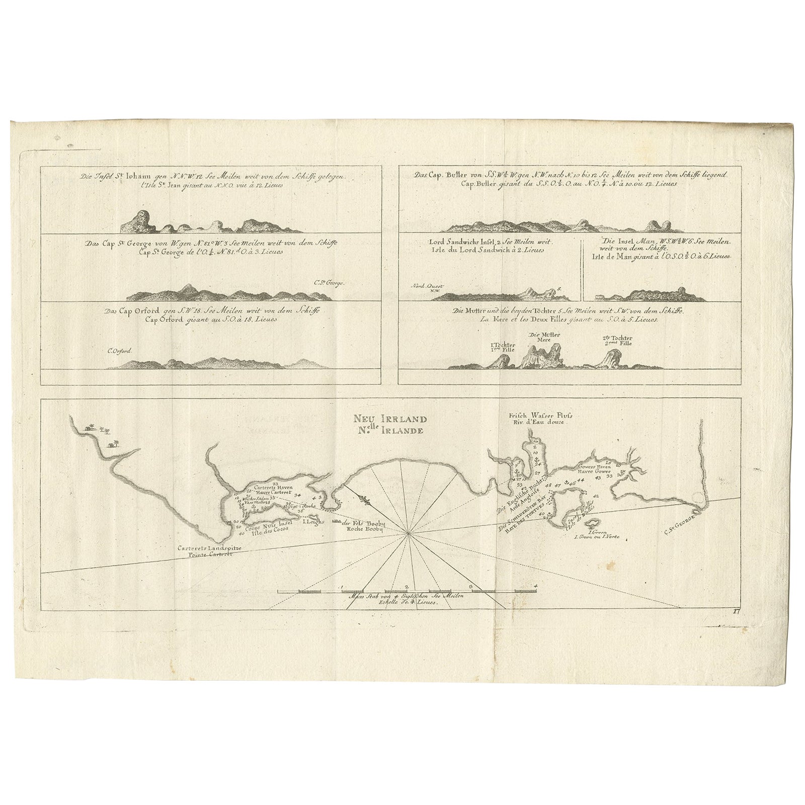
- Antique Map of New Ireland, 1774Located in Langweer, NLAntique print titled 'Neu Irrland (..)'. Antique map of New Ireland with 7 coastal profiles, Papua New Guinea. Originates from 'Geschichte der See-Reisen u...Category
Antique 18th Century Maps
MaterialsPaper
- Antique Miniature Map of New Guinea by Bertius, '1618'Located in Langweer, NLAntique miniature map titled 'Nova Guinea et Ins. Salomonis'. Rare miniature map of New Guinea (Solomon Islands). This map originates from 'Tabularum Geo...Category
Antique Early 17th Century Maps
MaterialsPaper
You May Also Like
- West Coast of Africa, Guinea & Sierra Leone: An 18th Century Map by BellinBy Jacques-Nicolas BellinLocated in Alamo, CAJacques Bellin's copper-plate map entitled "Partie de la Coste de Guinee Dupuis la Riviere de Sierra Leona Jusquau Cap das Palmas", depicting the coast of Guinea and Sierra Leone in ...Category
Antique Mid-18th Century French Maps
MaterialsPaper
- Original Antique Map of Ireland- Kerry. C.1840Located in St Annes, LancashireGreat map of Kerry Steel engraving Drawn under the direction of A.Adlard Published by How and Parsons, C.1840 Unframed.Category
Antique 1840s English Maps
MaterialsPaper
- Original Antique Map of Ireland- Tipperary and Waterford. C.1840Located in St Annes, LancashireGreat map of Tipperary and Waterford Steel engraving Drawn under the direction of A.Adlard Published by How and Parsons, C.1840 Unframed.Category
Antique 1840s English Maps
MaterialsPaper
- New Map of North America from the Latest Discoveries, 1763Located in Philadelphia, PAA fine antique 18th century map of the North American seaboard. Entitled "A New Map of North America from the Latest Discoveries 1763". By the Cartographer/Engraver - John Spil...Category
Antique Mid-18th Century English Georgian Maps
MaterialsPaper
- Map of the Republic of GenoaLocated in New York, NYFramed antique hand-coloured map of the Republic of Genoa including the duchies of Mantua, Modena, and Parma. Europe, late 18th century. Dimension: 25...Category
Antique Late 18th Century European Maps
- Antique 1901 National Publishing Company's Road Map of New Jersey GeologicalLocated in Dayton, OHThe National Publishing Company's road map of New Jersey, showing all county and township divisions, cities villages and post-offices, railroads, ste...Category
Antique Early 1900s Victorian Prints
MaterialsPaper


Recently Viewed
View AllMore Ways To Browse
Antique Center Islands
Used Furniture Northern Ireland
Little Paris Antiques
Irish Antiques 16th Century
Antique Northern Ireland
Antique Furniture Northern Ireland
Antique Corvette
Large Antique Map Of Paris
Antique Astrolabes
Antique Astrolabe
Maps Of Ireland Large
Papua New Guinea Antique Map
Otto Von Bismarck
Antique Nautical Map
Antique Nautical Maps
Map Of Arabia
Antique Stand Up Scale
Civil War Map