Items Similar to Antique Map of the of the Course of the Albis River 'or Elbe River'

Want more images or videos?
Request additional images or videos from the seller
1 of 6
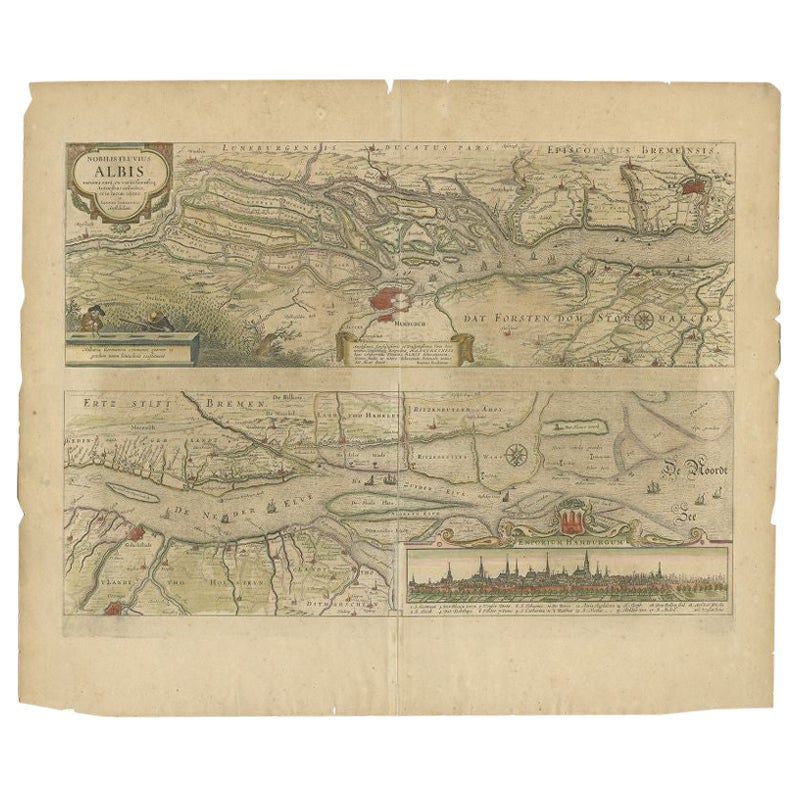
Antique Map of the of the Course of the Albis River 'or Elbe River'
About the Item
Antique map titled 'Albis Fluvius Germaniae celebris A Fontiubus Ad Ostia, Cum Fluminibus ab utroque latere in illum fluenibus descriptus'. Detailed map of the course of the Albis River (or Elbe river), from its source east of Prag to the North Sea. Includes two cartouches and compass rose. Published by J. Janssonius, circa 1640.
- Creator:Johannes Janssonius (Artist)
- Dimensions:Height: 17.41 in (44.2 cm)Width: 22.25 in (56.5 cm)Depth: 0.02 in (0.5 mm)
- Materials and Techniques:
- Period:Mid-17th Century
- Date of Manufacture:circa 1640
- Condition:Repaired. Wear consistent with age and use. Repair on folding line. General age-related toning. Shows some wear and soiling. Small weak spot near 'Schunburg'. French text on verso, please study image carefully.
- Seller Location:Langweer, NL
- Reference Number:
About the Seller
5.0
Platinum Seller
These expertly vetted sellers are 1stDibs' most experienced sellers and are rated highest by our customers.
Established in 2009
1stDibs seller since 2017
1,973 sales on 1stDibs
Typical response time: <1 hour
- ShippingRetrieving quote...Ships From: Langweer, Netherlands
- Return PolicyA return for this item may be initiated within 14 days of delivery.
More From This SellerView All
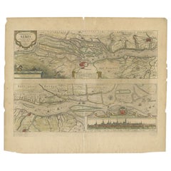
- Antique Map of the Course of the Elbe River by Janssonius, c.1650By Johannes JanssoniusLocated in Langweer, NLAntique map titled 'Nobilis Flubius Albis (..)'. Old map of the course of the Elbe river, large inset view of the city of Hamburg. Source unknown, to be determined. Artists and En...Category
Antique 17th Century Maps
MaterialsPaper
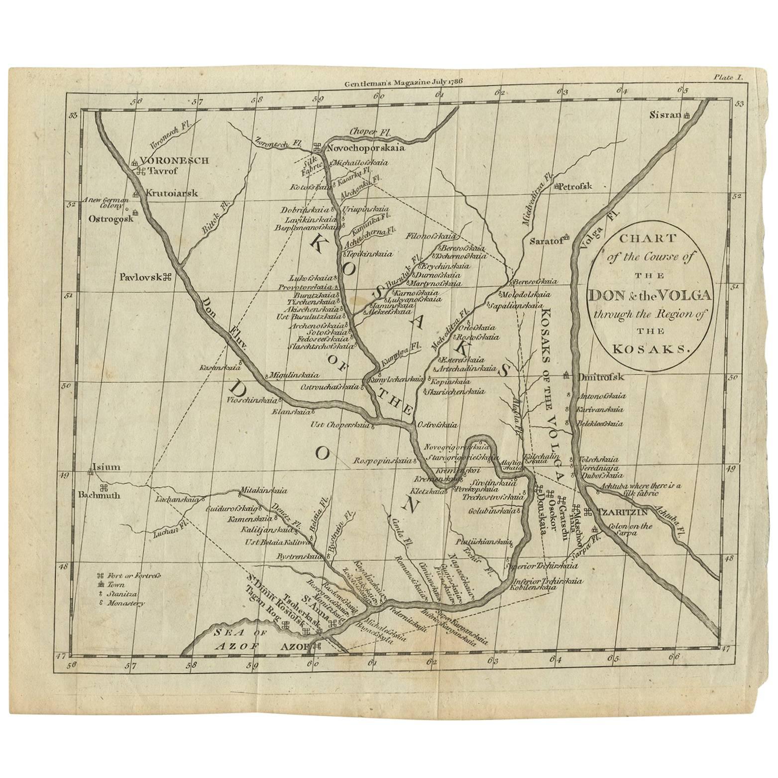
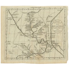
- Antique Map of the course of the Don & Voga riversLocated in Langweer, NLAntique map titled 'Chart of the Course of The Don & the Volga through the Region of The Kosaks'. SW Russia & Ukraine: interesting map showing the course of the Don & Voga rivers thr...Category
Antique Late 18th Century Maps
MaterialsPaper
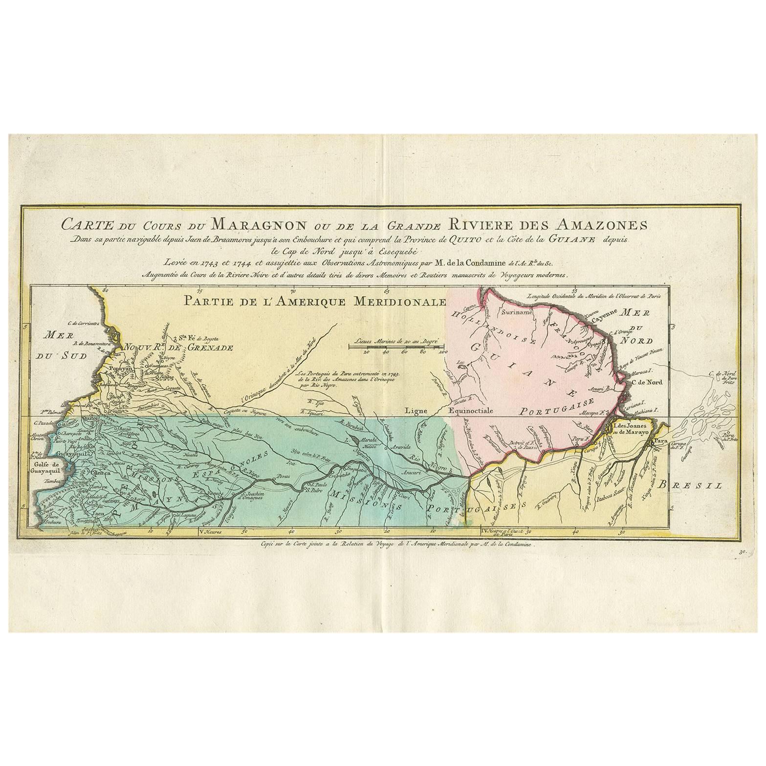
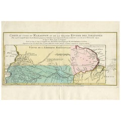
- Antique Map of the Course of the Amazon River by E. Van Harrevelt, 1773Located in Langweer, NLDetailed regional map, showing the course of the Amazon River from the Andes to the Atlantic. This map originates from 'Atlas portatif pour servir à l'intelligence de l'histoire phil...Category
Antique Late 18th Century Maps
MaterialsPaper
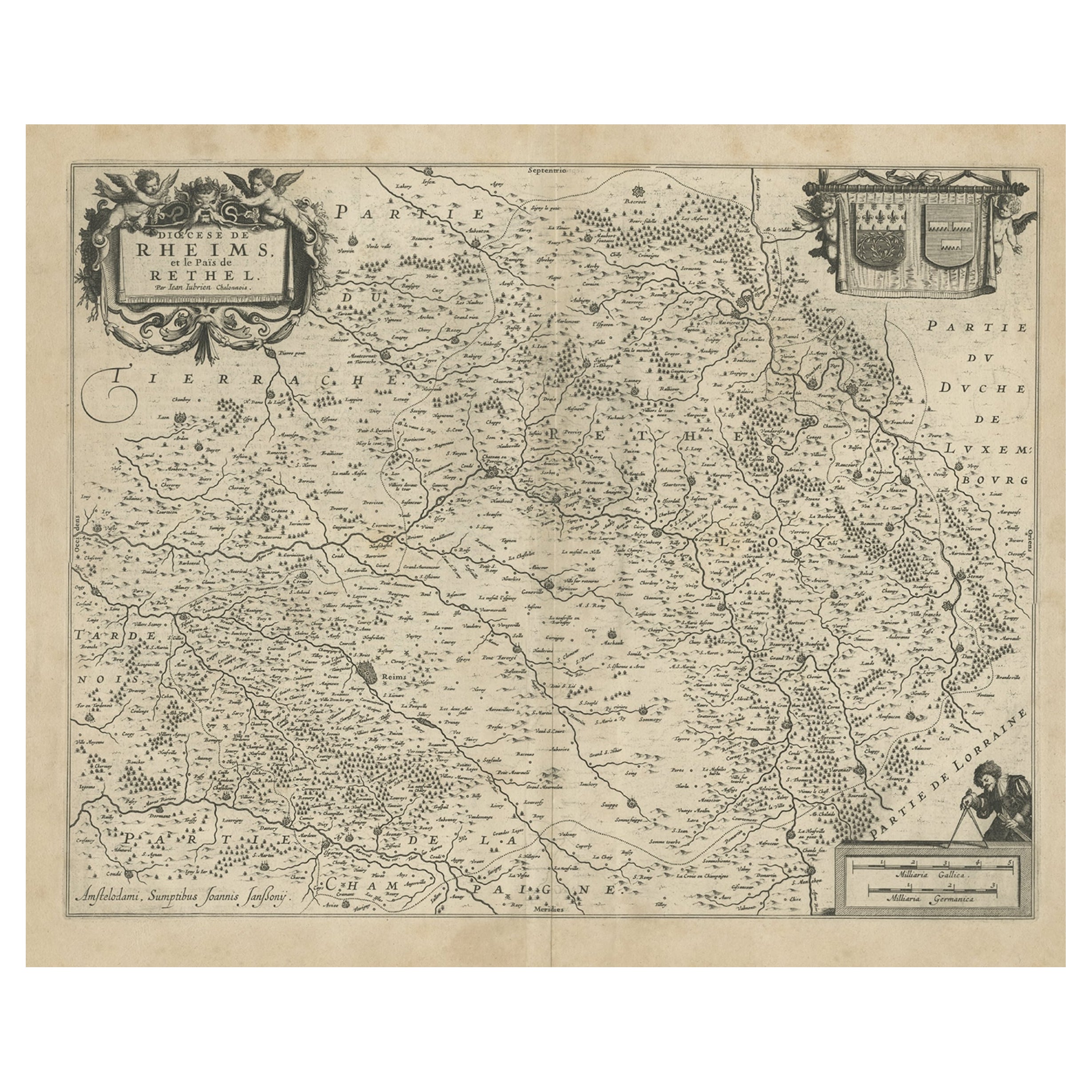
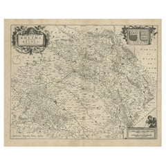
- Antique Map of the Rethelois or Rethel Region in France by Janssonius, ca.1650By Johannes JanssoniusLocated in Langweer, NLAntique map of France titled 'Dioecese de Rheims et le Païs de Rethel'. Detailed map, centered on the River Ayne and the River Velle and sowing Reims, Chalons, Rethel, Sedan, Cha...Category
Antique 17th Century Maps
MaterialsPaper
- Antique Map of the Region of Picardy by Janssonius, 1657By Johannes JanssoniusLocated in Langweer, NLAntique map of France titled 'Picardia vera et inferior'. Detailed map of the Picardy region of France. This map originates from 'Atlas Novus, Sive Theatrum Orbis Orbis Terrarum: In ...Category
Antique Mid-17th Century Maps
MaterialsPaper
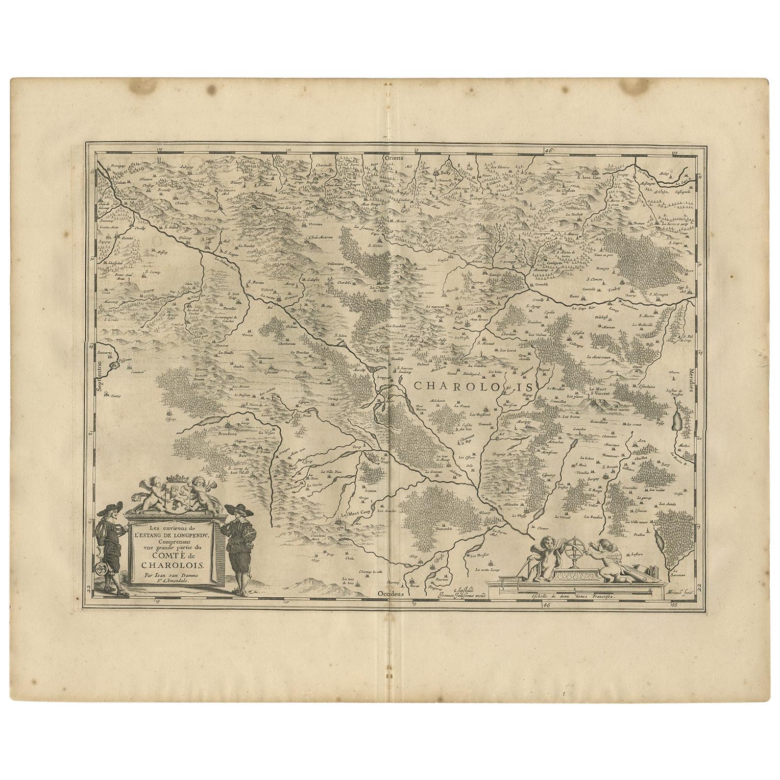
- Antique Map of the Region of Charolais by Janssonius, 1657By Johannes JanssoniusLocated in Langweer, NLAntique map 'Les environs de L'Estang de Longpendu, comprenant une grande partie du Comté de Charolois'. Decorative map of the Charolais region. This map originates from 'Atlas Novus...Category
Antique Mid-17th Century Maps
MaterialsPaper

You May Also Like
- "Nova Barbariae Descriptio", a 17th Century Hand-Colored Map of North AfricaBy Johannes JanssoniusLocated in Alamo, CAThis original attractive 17th century hand-colored map of North Africa entitled "Nova Barbariae Descriptio" by Johannes Janssonius was published in Paris in 1635. It includes the Med...Category
Antique Mid-17th Century Dutch Maps
MaterialsPaper
- Map of the Republic of GenoaLocated in New York, NYFramed antique hand-coloured map of the Republic of Genoa including the duchies of Mantua, Modena, and Parma. Europe, late 18th century. Dimension: 25...Category
Antique Late 18th Century European Maps
- 17th Century Hand-Colored Map of a Region in West Germany by JanssoniusBy Johannes JanssoniusLocated in Alamo, CAThis attractive highly detailed 17th century original hand-colored map is entitled "Archiepiscopatus Maghdeburgensis et Anhaltinus Ducatus cum terris adjacentibus". It was published ...Category
Antique Mid-17th Century Dutch Maps
MaterialsPaper
- Antique Map of Principality of MonacoBy Antonio Vallardi EditoreLocated in Alessandria, PiemonteST/619 - "Old Geographical Atlas of Italy - Topographic map of ex-Principality of Monaco" - ediz Vallardi - Milano - A somewhat special edition ---Category
Antique Late 19th Century Italian Other Prints
MaterialsPaper
- Original Antique Map of The World by Thomas Clerk, 1817Located in St Annes, LancashireGreat map of The Eastern and Western Hemispheres On 2 sheets Copper-plate engraving Drawn and engraved by Thomas Clerk, Edinburgh. Published by Mackenzie And Dent, 1817 ...Category
Antique 1810s English Maps
MaterialsPaper
- Antique 18th Century Map of the Province of Pensilvania 'Pennsylvania State'Located in Philadelphia, PAA fine antique of the colony of Pennsylvania. Noted at the top of the sheet as a 'Map of the province of Pensilvania'. This undated and anonymous map is thought to be from the Gentleman's Magazine, London, circa 1775, although the general appearance could date it to the 1760's. The southern boundary reflects the Mason-Dixon survey (1768), the western boundary is placed just west of Pittsburgh, and the northern boundary is not marked. The map has a number of reference points that likely refer to companion text and appear to be connected to boundaries. The western and southern boundaries are marked Q, R, S, for example. A diagonal line runs from the Susquehanna R to the Lake Erie P. A broken line marked by many letters A, B, N, O, etc., appears in the east. There are no latitude or longitude markings, blank verso. Framed in a shaped contemporary gilt wooden frame and matted under a cream colored matte. Bearing an old Graham Arader Gallery...Category
Antique 18th Century British American Colonial Maps
MaterialsPaper


Recently Viewed
View AllMore Ways To Browse
Antique Maps Of Virginia
Framed Africa Maps
G Plan Antique Furniture
G Plan Furniture Antique Furniture
Map Hawaii
Napoleon Map
Rand Mcnally Antique Maps
Victorian Staircase
Alsace Map
Antique Great Lakes Map
Antique Map Chile
Antique Map Of Jerusalem
Antique Ohio Maps
Burgundy Map
Macedonia Map
Map Of Hungary
Maps Of Ireland 18th Century
Oceanic Wood Carving