Items Similar to Antique Map of the Island of Java, Indonesia by P. Van Der Aa, 1713


Want more images or videos?
Request additional images or videos from the seller
1 of 9
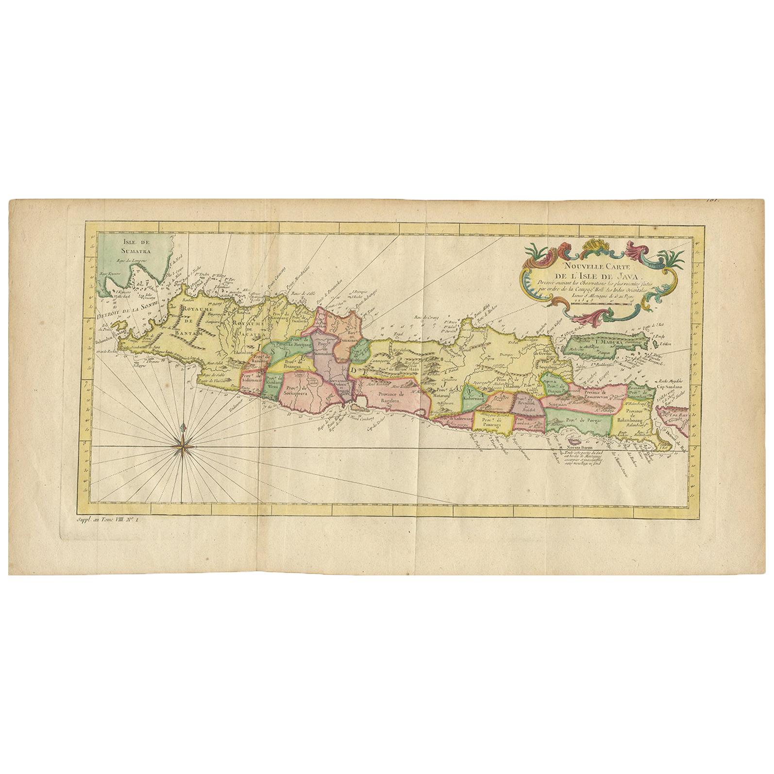
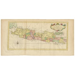
Antique Map of the Island of Java, Indonesia by P. Van Der Aa, 1713
About the Item
This rare map shows the Indonesian island of Java. With compass rose and scale. From: Nouvel Atlas, très exact et fort commode pour toutes sortes de personnes, Contenant Les Principales cartes géographiques. Leiden, P. Van der Aa, n.d. (1713).
- Dimensions:Height: 12.92 in (32.8 cm)Width: 8.39 in (21.3 cm)Depth: 0.02 in (0.5 mm)
- Materials and Techniques:
- Period:
- Date of Manufacture:1713
- Condition:Please study image carefully.
- Seller Location:Langweer, NL
- Reference Number:
About the Seller
5.0
Platinum Seller
These expertly vetted sellers are 1stDibs' most experienced sellers and are rated highest by our customers.
Established in 2009
1stDibs seller since 2017
1,976 sales on 1stDibs
Typical response time: <1 hour
- ShippingRetrieving quote...Ships From: Langweer, Netherlands
- Return PolicyA return for this item may be initiated within 14 days of delivery.
More From This SellerView All
- Antique Map of the Island Java, Indonesia, c.1650Located in Langweer, NLAntique map titled 'Insulae Iavae cum parte insularum Boreno Sumatrae (..)'. Beautiful map of the island of Java and part of Borneo, Bali, Madura and Sumatra. With decorative carto...Category
Antique 17th Century Maps
MaterialsPaper
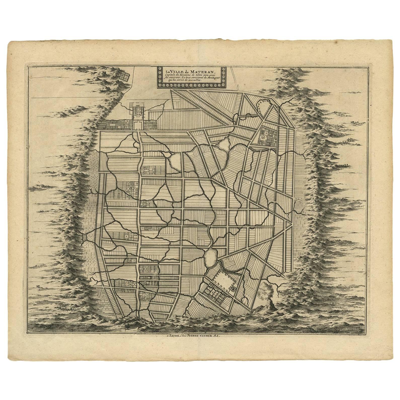
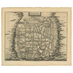
- Antique Map of the City of Materan 'Indonesia' by P. van der Aa, circa 1725By Pieter Van Der AaLocated in Langweer, NLAntique map titled 'La Ville de Materan, capitale de Roiaume de meme nom, avec ses environs. Le tout environne de Montagnes qui lui serve de murailles.' The city of Materan, capital ...Category
Antique Early 18th Century Maps
MaterialsPaper
- Scarce Antique Map of the Island of Java, IndonesiaLocated in Langweer, NLTitle: "Kaart van 't Eyland Groot Java: Antique Map of Java, Indonesia" Description: This antique map, titled "Kaart van 't Eyland Groot Java," offers a rare and valuable depiction ...Category
Antique Late 18th Century Maps
MaterialsPaper
- Antique Map of the Island of Java by Van Der Aa, 1725By Pieter Van Der AaLocated in Langweer, NLAntique map titled 'Map: 'L'Ile de Java'. (The island of Java.) This map shows the Indonesian island of Java. With compass rose and scale. This plate originates from the very scarse:...Category
Antique 18th Century Maps
MaterialsPaper
- Antique Map of the Island of Java in Indonesia, circa 1760By Jacques-Nicolas BellinLocated in Langweer, NLAntique map Indonesia titled 'Nouvelle Carte de l'Isle de Java'. Chart of the island of Java, depicting soundings around the coast, all principa...Category
Antique Mid-18th Century Maps
MaterialsPaper
- Antique Map of the City of Batavia by Van der Aa 'c.1730'Located in Langweer, NLAntique map titled 'Plan de la Ville et du Chateau de Batavia en l'Isle de Iava - Ware affbeeldinge wegens het Casteel ende Stadt Batavia gelegen op groot Eylant Java'. Detailed plan...Category
Antique Mid-18th Century Maps
MaterialsPaper


You May Also Like
- Original Antique Map of The World by Thomas Clerk, 1817Located in St Annes, LancashireGreat map of The Eastern and Western Hemispheres On 2 sheets Copper-plate engraving Drawn and engraved by Thomas Clerk, Edinburgh. Published by Mackenzie And Dent, 1817 ...Category
Antique 1810s English Maps
MaterialsPaper
- Original Antique Map of The Netherlands, Engraved by Barlow, Dated 1807Located in St Annes, LancashireGreat map of Netherlands Copper-plate engraving by Barlow Published by Brightly & Kinnersly, Bungay, Suffolk. Dated 1807 Unframed.Category
Antique Early 1800s English Maps
MaterialsPaper
- Hand-Colored 18th Century Homann Map of Denmark and Islands in the Baltic SeaBy Johann Baptist HomannLocated in Alamo, CAAn 18th century copper plate hand-colored map entitled "Insulae Danicae in Mari Balthico Sitae utpote Zeelandia, Fionia, Langelandia, Lalandia, Falstria, Fembria Mona" created by Joh...Category
Antique Early 18th Century German Maps
MaterialsPaper
- Map of the Republic of GenoaLocated in New York, NYFramed antique hand-coloured map of the Republic of Genoa including the duchies of Mantua, Modena, and Parma. Europe, late 18th century. Dimension: 25...Category
Antique Late 18th Century European Maps
- Antique Map of Italy by Andriveau-Goujon, 1843By Andriveau-GoujonLocated in New York, NYAntique Map of Italy by Andriveau-Goujon, 1843. Map of Italy in two parts by Andriveau-Goujon for the Library of Prince Carini at Palazzo Carini i...Category
Antique 1840s French Maps
MaterialsLinen, Paper
- Antique Map of Principality of MonacoBy Antonio Vallardi EditoreLocated in Alessandria, PiemonteST/619 - "Old Geographical Atlas of Italy - Topographic map of ex-Principality of Monaco" - ediz Vallardi - Milano - A somewhat special edition ---Category
Antique Late 19th Century Italian Other Prints
MaterialsPaper


Recently Viewed
View AllMore Ways To Browse
Le Nouvel
Ottoman Map
Antique Bassett Furniture
Antique Furniture Furniture Nova Scotia
Antique Furniture Nova Scotia Furniture
Antique Furniture Nova Scotia
Antique Mace
Antique Map By Coronelli
Antique Map Of Chicago
Antique Map Of The Moon
Antique Moon Map
Antique Norfolk County
Antique Railroad Scale
Arkansas Map
Bassett Furniture Antique
Croatia Map
John Ogilby
Map Antarctica