Items Similar to Antique Map of Israel Filled with Biblical Scenes, Published in 1748

Want more images or videos?
Request additional images or videos from the seller
1 of 5
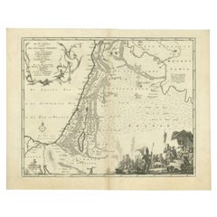
Antique Map of Israel Filled with Biblical Scenes, Published in 1748
About the Item
Antique map Holy Land titled 'Het beloofde landt Canaan doorwandelt van onsen Saligmaker Jesu Christo neffens zyne Apostelen'.
Antique map of Israel filled with biblical scenes. A compass rose orients the map with north in the top right corner. The large decorative title cartouche at bottom is flanked with the four evangelists and vignettes depicting the life of Christ, including his birth, crucifixion and a triumphant Resurrection, showing Christ bursting from the tomb and scattering Roman solders.
Artists and engravers: Engraved by J. van Jagen.
- Dimensions:Height: 14.18 in (36 cm)Width: 19.3 in (49 cm)Depth: 0 in (0.02 mm)
- Materials and Techniques:
- Period:1740-1749
- Date of Manufacture:1748
- Condition:Wear consistent with age and use. Condition: Very good, age-related toning. Dutch text on verso, please study image carefully.
- Seller Location:Langweer, NL
- Reference Number:
About the Seller
5.0
Platinum Seller
These expertly vetted sellers are 1stDibs' most experienced sellers and are rated highest by our customers.
Established in 2009
1stDibs seller since 2017
1,976 sales on 1stDibs
Typical response time: <1 hour
- ShippingRetrieving quote...Ships From: Langweer, Netherlands
- Return PolicyA return for this item may be initiated within 14 days of delivery.
More From This SellerView All
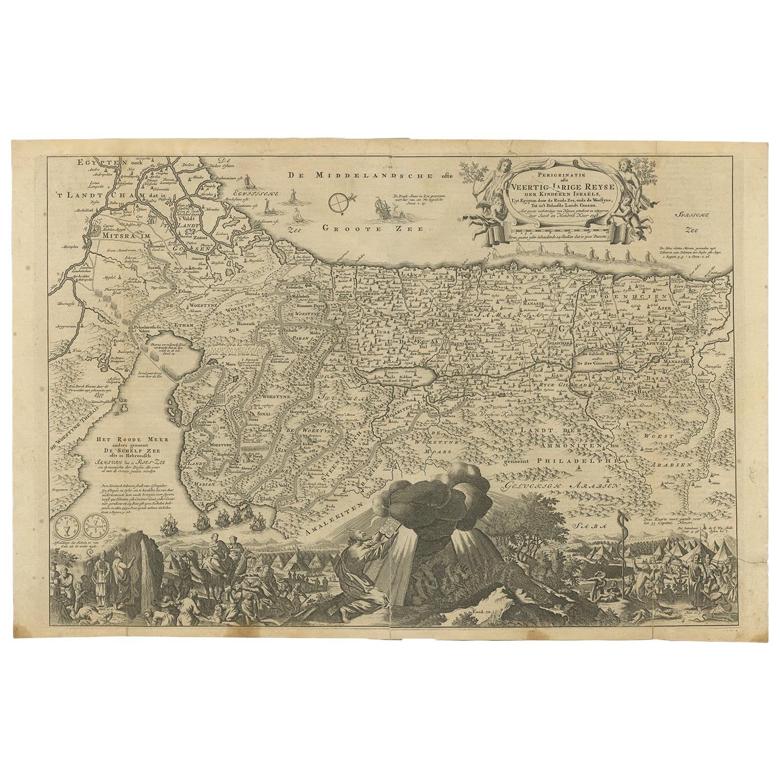
- Antique Map Travel Children of Israel by Keur, 1748Located in Langweer, NLAntique biblical map titled 'Perigrinatie ofte veertigh-Iarige Reyse der Kinderen Israels uyt Egypten door de Roode Zee ende de Woestyne tot in 't Beloof...Category
Antique Mid-18th Century Dutch Maps
MaterialsPaper
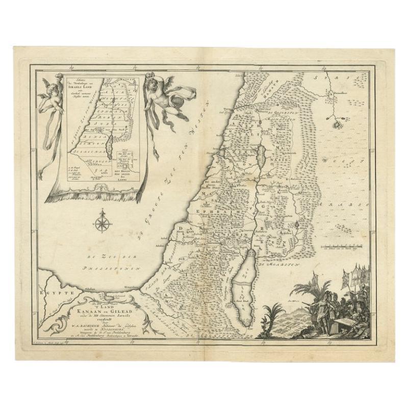
- Antique Map of Biblical Palestine with Inset of Israel's 12 Tribes, 1758Located in Langweer, NLAntique map titled 'De IIIde Landkaart 't land Kanaan en Gilead onder de XII stammen Israëls verdeelt.' Map of biblical Palestine. Inset map of the land of Israel divided in 12 tribes...Category
Antique 18th Century Maps
MaterialsPaper
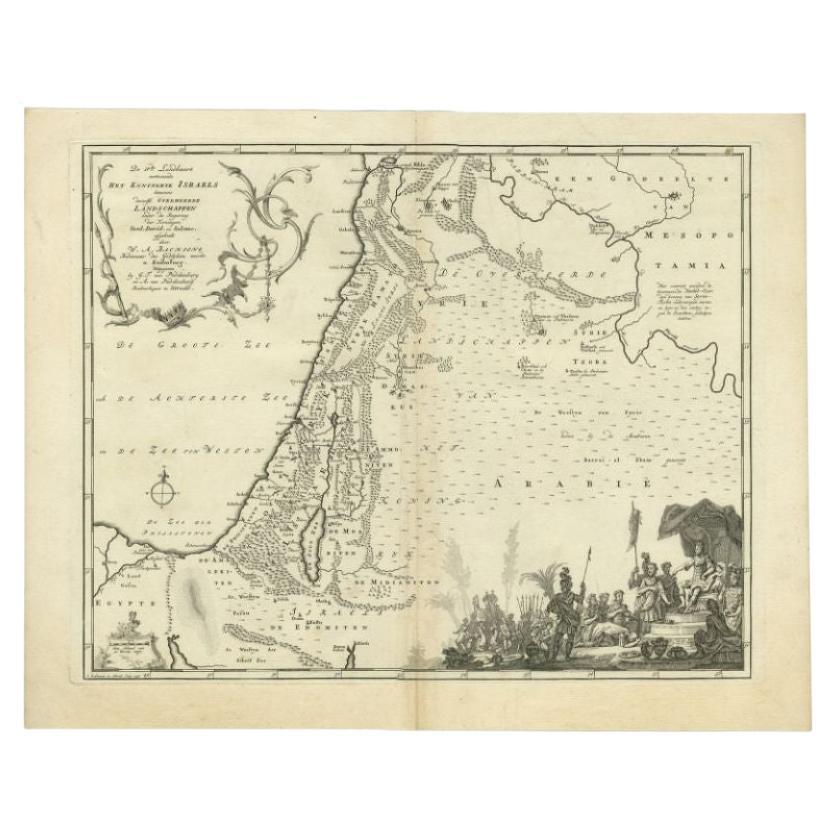
- Antique Map of the Biblical Kingdom of Israel by Lindeman, c.1758Located in Langweer, NLAntique map titled 'De IVde Landkaart vertoonende het Koningryk Israels benevens deszelfs overheerde Landschappen (..).' Map of the biblical Kingdom of Israel under the Kings Saul, D...Category
Antique 18th Century Maps
MaterialsPaper
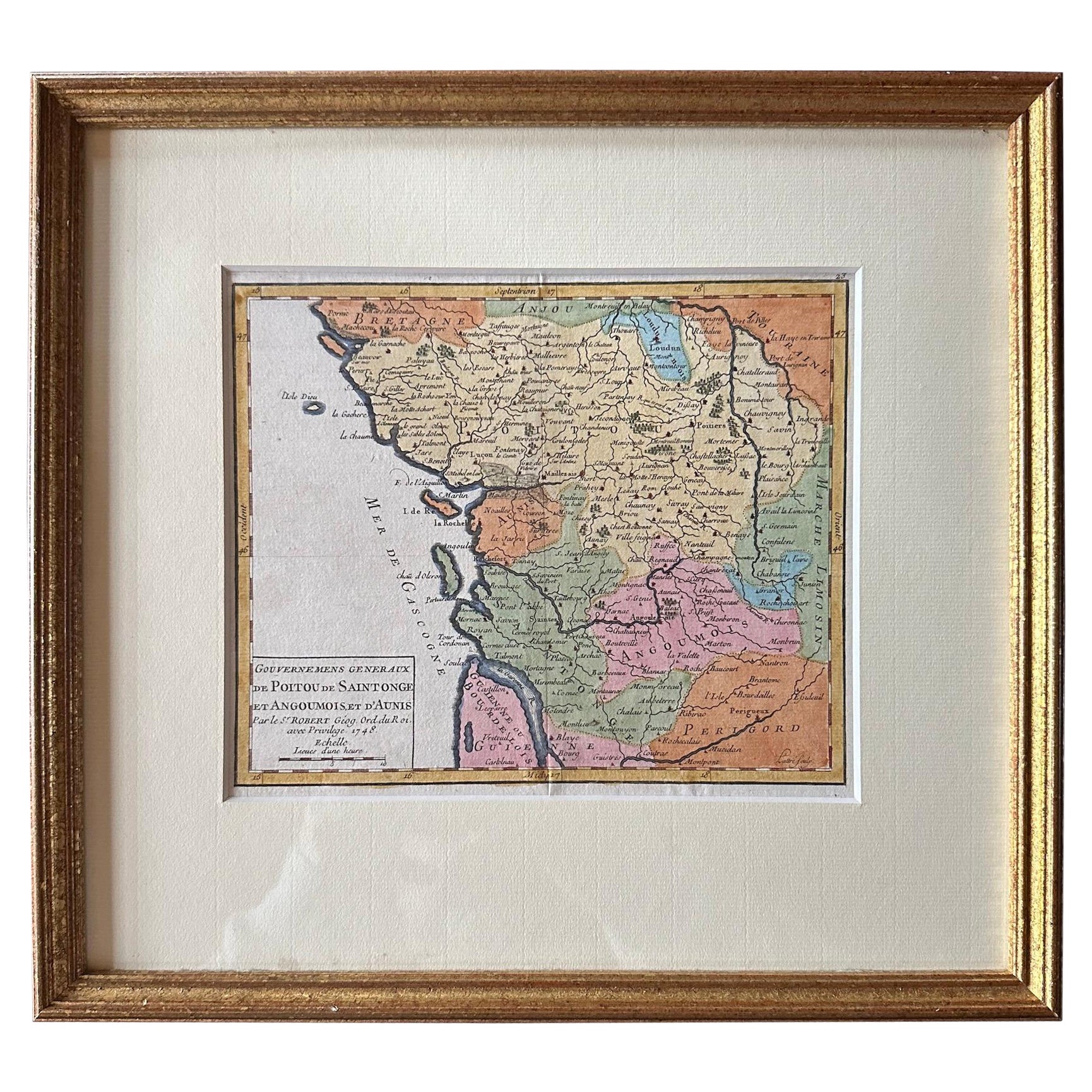
- Original Antique Map of West Central France in Frame, 1748Located in Langweer, NLA nicely framed and hand-coloured decorative map titled "Gouvernemens Generaux De Poitou et De Saintonge" and engraved by M. Robert. This historical international map includes severa...Category
Antique 1740s Maps
MaterialsPaper
- Original Antique Map of Southern Asia, Published in 1833Located in Langweer, NLAntique map titled 'Carte de l'Inde'. Detailed map extending from India in the west to Vietnam and the Malay Peninsula in the east. This map originates from 'Atlas universel de geogr...Category
Antique Mid-19th Century Maps
MaterialsPaper
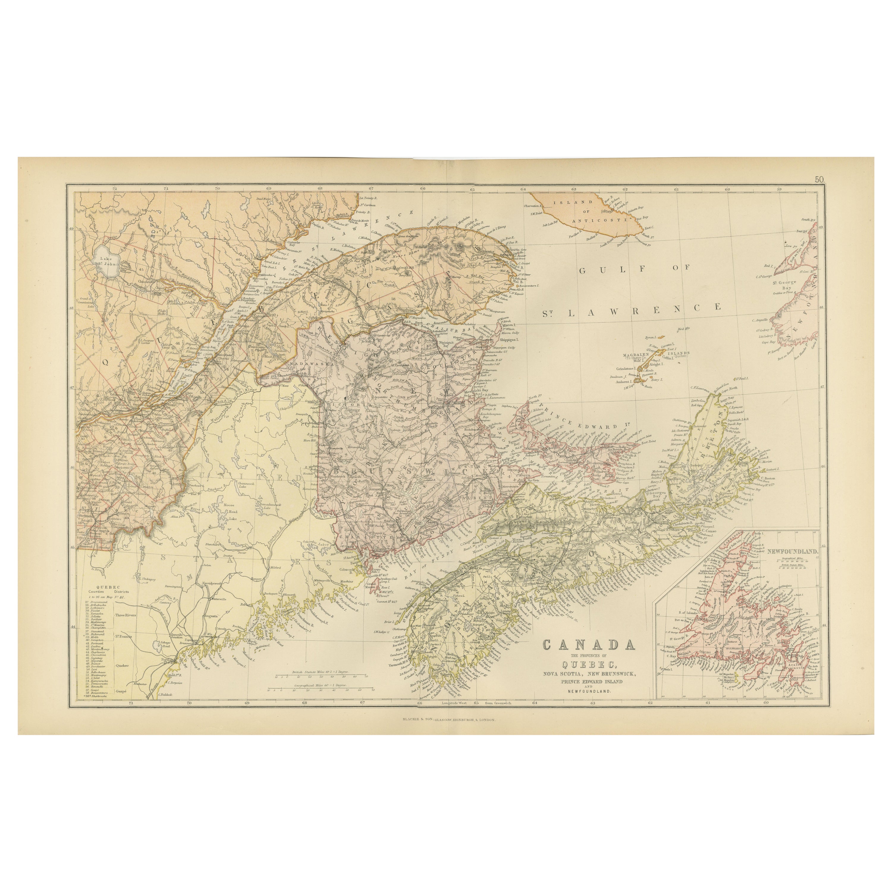
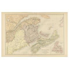
- Decorative Antique Map of Eastern Canada, Published in 1882Located in Langweer, NLThis is a historical map from the 1882 Blackie Atlas, focused on eastern Canada and the maritime provinces. The map is titled "Canada. No. 2. Provinces of Nova Scotia, New Brunswick,...Category
Antique 1880s Maps
MaterialsPaper


You May Also Like
- Antique Oarsman's Map of the River Thames, English, Cartography, Published 1912Located in Hele, Devon, GBThis is an antique copy of The Oarsman's and Angler's Map of the River Thames - New Edition. An English, bound map book, published in English by Edward Stanford, London, this new edi...Category
Early 20th Century British Other Books
MaterialsPaper
- London 1744 Published Watercolour Antique Map of East Africa by Eman BowenLocated in GBWe are delighted to offer for sale this New and Accurate Map of Nubia & Abissinia, together with all the Kingdoms Tributary Thereto, and bordering upon them published in 1744 by Emanuel Bowen This is a decorative antique engraved map of East Africa...Category
Antique 1740s English George III Maps
MaterialsPaper
- Large Original Vintage Map of Israel, circa 1920Located in St Annes, LancashireGreat map of Israel Original color. Good condition Published by Alexander Gross Unframed.Category
Vintage 1920s English Edwardian Maps
MaterialsPaper
- Antique Paterson's Guide to Britain, English, Maps, Georgian, Published 1811Located in Hele, Devon, GBThis is an antique copy of Paterson's New and Accurate guide to Direct & Principal Crossroads. An English, bound book of maps and descriptive tables, published in English by Longman,...Category
Antique Early 19th Century British Georgian Books
MaterialsPaper
- 1840 Map of the City of Washington Published by William M. MorrisonLocated in Colorado Springs, COThis map, printed in 1840, is a detailed representation of Washington, D.C. in the mid-19th century. The map shows block numbers, wards, and government buildings as well as details o...Category
Antique 1840s American Federal Maps
MaterialsPaper
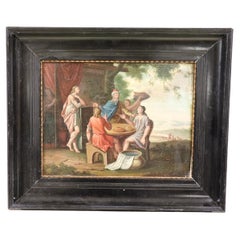
- Early 19th Century Oil Painting on Board Biblical SceneLocated in Casale Monferrato, ITBeautiful early 19th century Italian oil painting on board, not signed. Biblical scene probably "the Emmaus supper". High pictorial quality. Sold with frame.Category
Antique 1820s Italian Paintings
MaterialsWood


Recently Viewed
View AllMore Ways To Browse
Israeli Artist Furniture
Antique Israel
Israel Antique
Israeli Antique
Antique Furniture Israel
Orient Map
Crucifixion Of Christ
Large Antique Compass
Birth Of Christ
Christ Resurrection
Biblical Maps
Holy Land Map
Antique Map Israel
Antique Map Of Israel
Antique Maps Of Israel
Israel Map
Map Of Israel
Resurrection Of Christ