Items Similar to Antique Map of New Jersey, Delaware and Maryland by Johnson, 1872


Want more images or videos?
Request additional images or videos from the seller
1 of 5
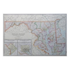
Antique Map of New Jersey, Delaware and Maryland by Johnson, 1872
About the Item
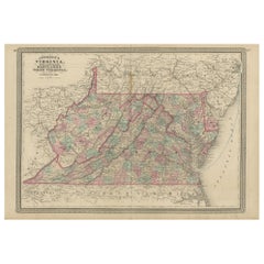
Antique map titled 'Johnson's New Jersey (..). Two maps on one sheet showing New Jersey, Delaware and Maryland. With inset map of the district of Columbia. This map originates from 'Johnson's New Illustrated Family Atlas of the World' by A.J. Johnson. Published 1872.
- Dimensions:Height: 18.12 in (46 cm)Width: 26.38 in (67 cm)Depth: 0.02 in (0.5 mm)
- Materials and Techniques:
- Period:
- Date of Manufacture:1872
- Condition:General age-related toning, shows minor wear and creasing. Some soiling. Original folding line. English text on verso. Please study images carefully.
- Seller Location:Langweer, NL
- Reference Number:
About the Seller
5.0
Platinum Seller
These expertly vetted sellers are 1stDibs' most experienced sellers and are rated highest by our customers.
Established in 2009
1stDibs seller since 2017
1,959 sales on 1stDibs
Typical response time: <1 hour
- ShippingRetrieving quote...Ships From: Langweer, Netherlands
- Return PolicyA return for this item may be initiated within 14 days of delivery.
More From This SellerView All
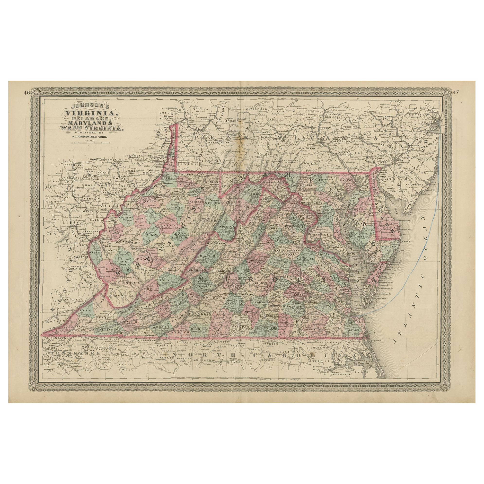
- Antique Map of Virginia, Delaware, Maryland & West Virginia by Johnson, 1872Located in Langweer, NLAntique map titled 'Johnson's Viriginia (..). Original map of Virginia, Delaware, Maryland and West Virginia. This map originates from 'Johnson's New I...Category
Antique Late 19th Century Maps
MaterialsPaper
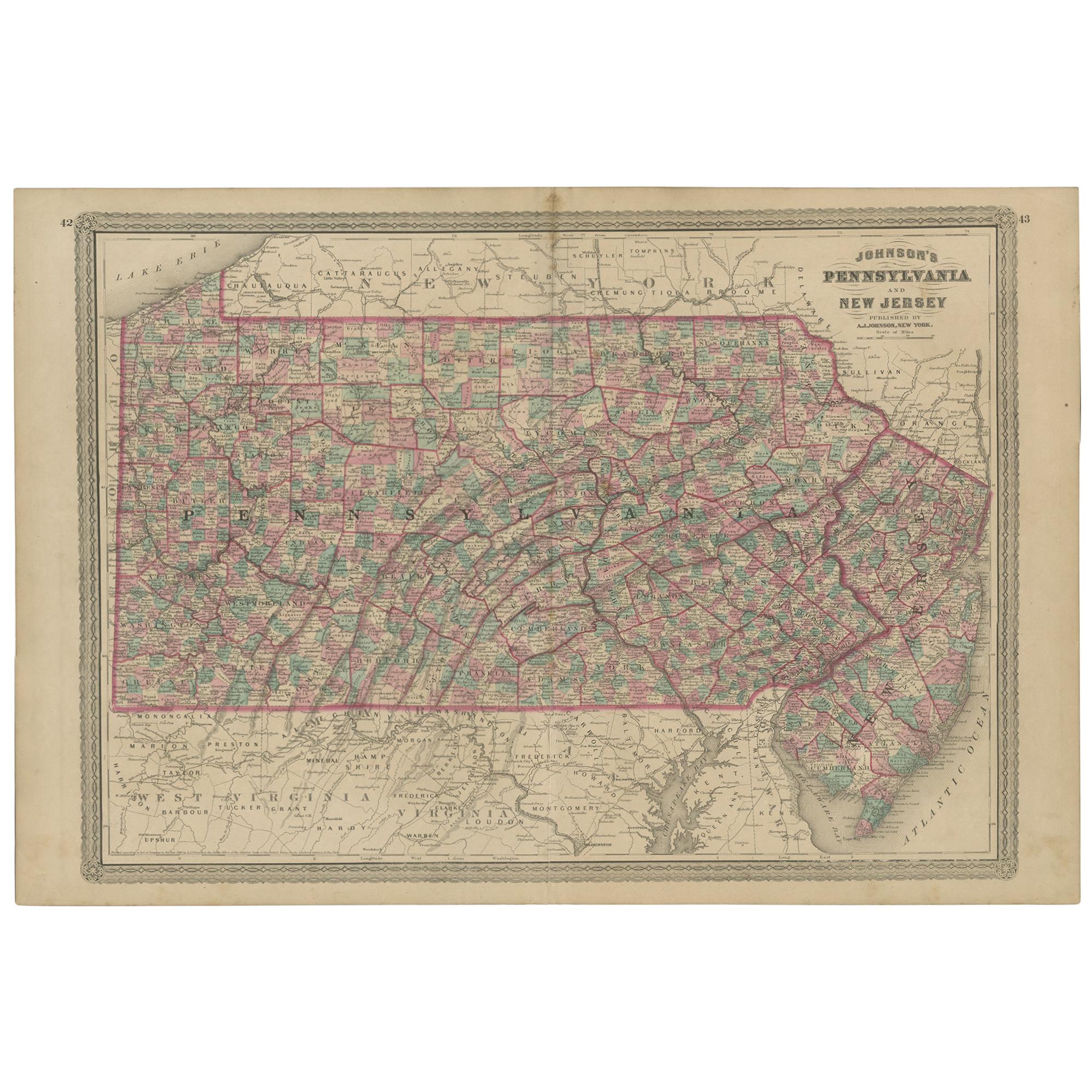
- Antique Map of Pennsylvania and New Jersey by Johnson, 1872Located in Langweer, NLAntique map titled 'Johnson's Pennsylvania and New Jersey'. Original map showing Pennsylvania and New Jersey. This map originates from 'Johnson's New Illustrated Family Atlas of the ...Category
Antique Late 19th Century Maps
MaterialsPaper
- Antique Map of New York by Johnson '1872'Located in Langweer, NLAntique map titled 'Johnson's New York'. Original map showing New York, with an inset map of Long Island. This map originates from 'Johnson's New Il...Category
Antique Late 19th Century Maps
MaterialsPaper
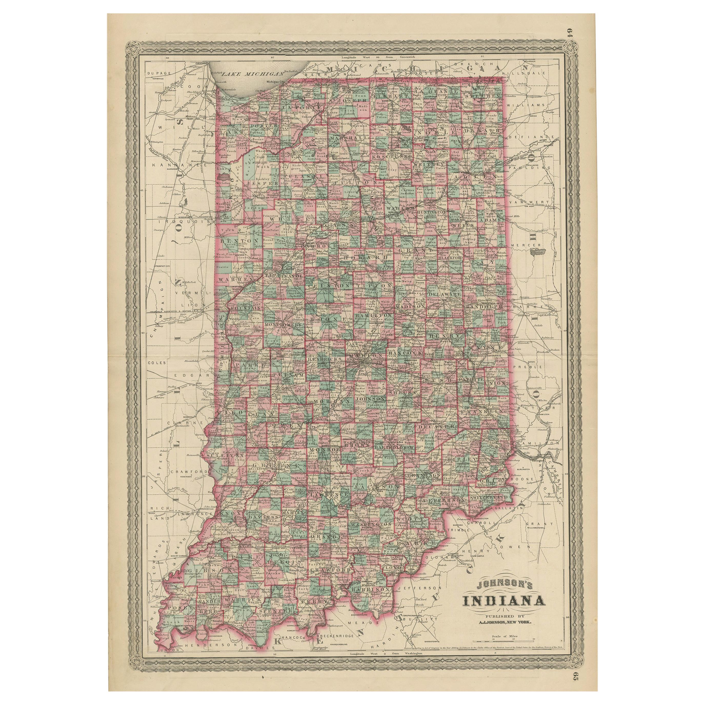
- Antique Map of Indiana by Johnson, 1872Located in Langweer, NLAntique map titled 'Johnson's Indiana'. Original map of Indiana. This map originates from 'Johnson's New Illustrated Family Atlas of the World' by A.J. ...Category
Antique Late 19th Century Maps
MaterialsPaper
- Antique Map of Europe by Johnson, '1872'Located in Langweer, NLAntique map titled 'Johnson's Europe'. Original map of Europe. This map originates from 'Johnson's New Illustrated Family Atlas of the World' by A.J. Johnson. Published 1872.Category
Antique Late 19th Century Maps
MaterialsPaper
- Antique Map of Asia by Johnson, 1872Located in Langweer, NLAntique map titled 'Johnson's Asia'. Original map of Asia. This map originates from 'Johnson's New Illustrated Family Atlas of the World' by A.J. Johnson. Published, 1872.Category
Antique Late 19th Century Maps
MaterialsPaper


You May Also Like
- Antique 1901 National Publishing Company's Road Map of New Jersey GeologicalLocated in Dayton, OHThe National Publishing Company's road map of New Jersey, showing all county and township divisions, cities villages and post-offices, railroads, ste...Category
Antique Early 1900s Victorian Prints
MaterialsPaper
- Large Original Antique Map of Maryland, Delaware & DC, USA, C.1900Located in St Annes, LancashireFabulous map of Maryland, Delaware And District of Columbia Original color Engraved and printed by the George F. Cram Company, Indianapolis. Pu...Category
Antique 1890s American Maps
MaterialsPaper
- Original Antique Map of Spain and Portugal by Thomas Clerk, 1817Located in St Annes, LancashireGreat map of Spain and Portugal Copper-plate engraving Drawn and engraved by Thomas Clerk, Edinburgh. Published by Mackenzie And Dent, 1817 Unframed.Category
Antique 1810s English Maps
MaterialsPaper
- Original Antique Map of Spain and Portugal, Engraved By Barlow, 1806Located in St Annes, LancashireGreat map of Spain And Portugal Copper-plate engraving by Barlow Published by Brightly & Kinnersly, Bungay, Suffolk. 1806 Unframed.Category
Antique Early 1800s English Maps
MaterialsPaper
- Antique Map of Italy by Andriveau-Goujon, 1843By Andriveau-GoujonLocated in New York, NYAntique Map of Italy by Andriveau-Goujon, 1843. Map of Italy in two parts by Andriveau-Goujon for the Library of Prince Carini at Palazzo Carini i...Category
Antique 1840s French Maps
MaterialsLinen, Paper
- Original Antique Map of Russia By Arrowsmith. 1820Located in St Annes, LancashireGreat map of Russia Drawn under the direction of Arrowsmith Copper-plate engraving Published by Longman, Hurst, Rees, Orme and Brown, 1820 Unframed.Category
Antique 1820s English Maps
MaterialsPaper


Recently Viewed
View AllMore Ways To Browse
New Jersey Furniture
Maryland Furniture
Used Furniture Maryland
Antique Map New
A J Johnson
New Jersey 19th Century
Antique Delaware
Delaware Furniture
Antique Furniture Maryland
Antique Furniture Columbia
Map Of Delaware
Antique Furniture Delaware
Antique Map Of Jersey
Antique Map New Jersey
Antique Map Of New Jersey
Antique Maps Of New Jersey
Antique Map Maryland
Antique Maps Of Maryland