Items Similar to Antique Map of South Africa showing the Travels of Truter and Somerville


Want more images or videos?
Request additional images or videos from the seller
1 of 6
Antique Map of South Africa showing the Travels of Truter and Somerville
About the Item
Antique map titled 'Charte von Süd-Afrika'. Original antique map of South Africa showing the travels of Truter and Somerville. Published circa 1807.
- Dimensions:Height: 12.6 in (32 cm)Width: 16.93 in (43 cm)Depth: 0.02 in (0.5 mm)
- Materials and Techniques:
- Period:
- Date of Manufacture:c.1807
- Condition:General age-related toning. Shows some wear and foxing. Original folding lines. Blank verso. Please study image carefully.
- Seller Location:Langweer, NL
- Reference Number:
About the Seller
5.0
Platinum Seller
These expertly vetted sellers are 1stDibs' most experienced sellers and are rated highest by our customers.
Established in 2009
1stDibs seller since 2017
1,969 sales on 1stDibs
Typical response time: <1 hour
- ShippingRetrieving quote...Ships From: Langweer, Netherlands
- Return PolicyA return for this item may be initiated within 14 days of delivery.
More From This SellerView All
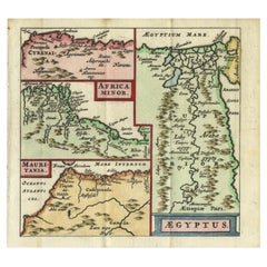
- Antique Map of North Africa showing Egypt, Mauritania and Africa Minor, 1672Located in Langweer, NLAntique map titled 'Africa Minor, Mauritania , Aegyptus.' Charming miniature map of North Africa, showing Egypt, Mauritania and Africa Minor. This map originates from the pocket atla...Category
Antique 17th Century Maps
MaterialsPaper
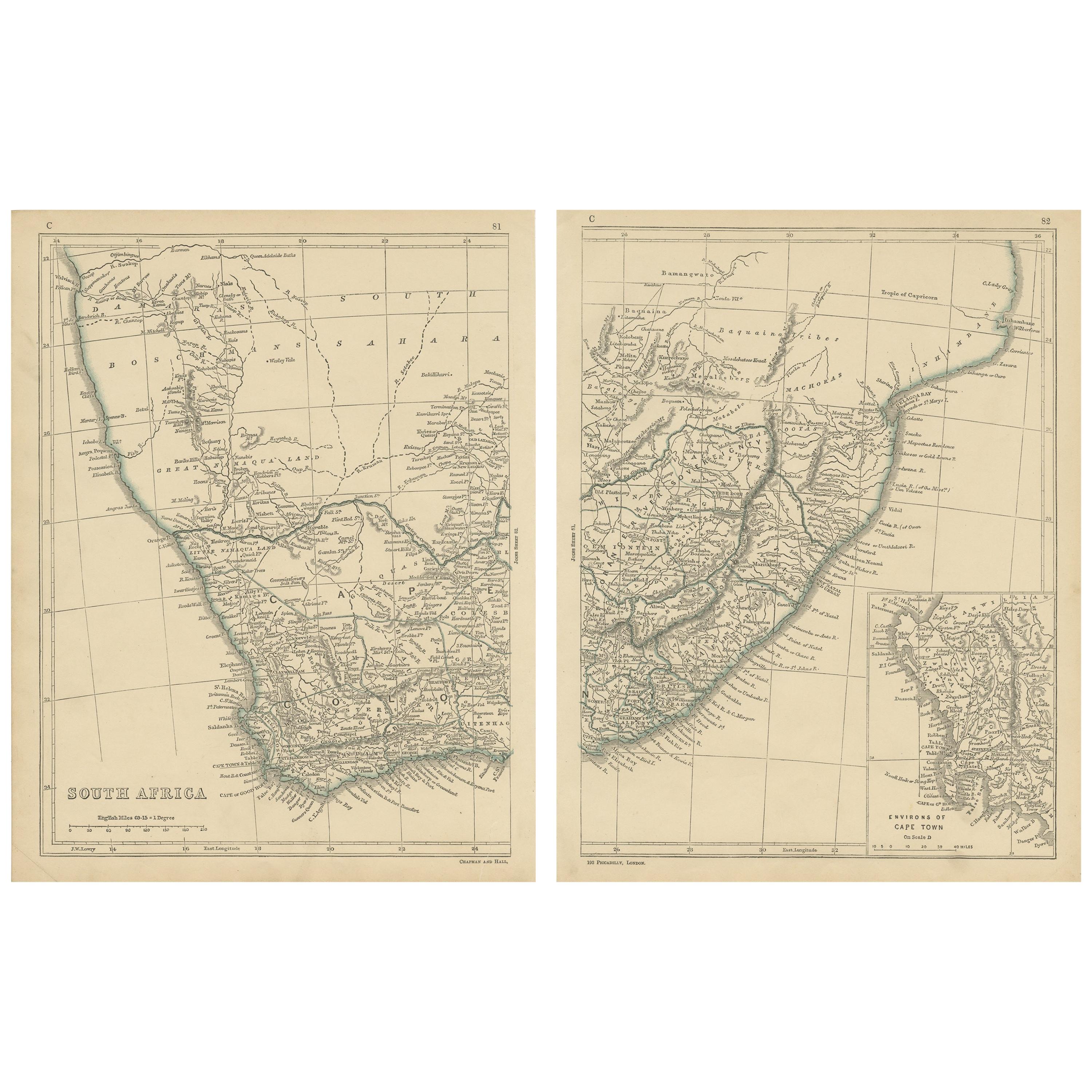
- Antique Map of South Africa by Lowry, 1852Located in Langweer, NLAntique map titled 'South Africa'. Two individual sheets of South Africa. This map originates from 'Lowry's table Atlas constructed and engraved from the most recent authorities' by ...Category
Antique Mid-19th Century Maps
MaterialsPaper
- Antique Map of South Africa by Wyld '1845'Located in Langweer, NLAntique map titled 'South Africa'. Original antique map of South Africa. This decorative original old map originates from 'An Atlas of th...Category
Antique Mid-19th Century Maps
MaterialsPaper
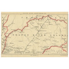
- Antique Map of the Orange River Colony in South Africa, 1901Located in Langweer, NLAntique map titled 'Orange River Colony, northern part'. Lithograph of the northern part of the Orange River Colony, Africa. The Orange River Colony was the British colony created af...Category
Early 20th Century Maps
MaterialsPaper
- Antique Map of the World Showing the Distribution of Plants and Minerals, 1872Located in Langweer, NLAntique map titled 'Johnson's World showing the distribution of the Characteristic Forest Trees (..)'. Original world map showing the distribution o...Category
Antique Late 19th Century Maps
MaterialsPaper
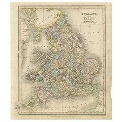
- Antique Map of England and Wales, Also Showing the English ChannelLocated in Langweer, NLAntique map titled 'England and Wales'. Original antique map of England and Wales. Drawn and engraved by J. Dower. Originates from 'A General Descriptive Atlas Of The Earth, Containi...Category
Antique Mid-19th Century Maps
MaterialsPaper


You May Also Like
- Original Antique Map of South Africa, Arrowsmith, 1820Located in St Annes, LancashireGreat map of South Africa. Drawn under the direction of Arrowsmith. Copper-plate engraving. Published by Longman, Hurst, Rees, Orme and Br...Category
Antique 1820s English Maps
MaterialsPaper
- Original Antique Map of South America. C.1780Located in St Annes, LancashireGreat map of South America Copper-plate engraving Published C.1780 Two small worm holes to left side of map Unframed.Category
Antique Early 1800s English Georgian Maps
MaterialsPaper
- Original Antique Map of South America, circa 1830Located in St Annes, LancashireGreat map of South America Copper plate engraving Published by Butterworth, Livesey & Co., circa 1830 Unframed.Category
Antique Early 1800s English Other Maps
MaterialsPaper
- Original Antique Map of South East Asia, Arrowsmith, 1820Located in St Annes, LancashireGreat map of South East Asia Drawn under the direction of Arrowsmith Copper-plate engraving Published by Longman, Hurst, Rees, Orme and Brown, 1820 Unframed.Category
Antique 1820s English Maps
MaterialsPaper
- Original Antique Map of South America by Thomas Clerk, 1817Located in St Annes, LancashireGreat map of South America Copper-plate engraving Drawn and engraved by Thomas Clerk, Edinburgh. Published by Mackenzie And Dent, 1817 Unframed.Category
Antique 1810s English Maps
MaterialsPaper
- Original Antique Map of South East Asia by Becker, circa 1840Located in St Annes, LancashireGreat map of South East Asia Steel engraving with original color outline Engraved by Becker Published by Virtue, circa 1840. Unframed.Category
Antique 1840s English Other Maps
MaterialsPaper


Recently Viewed
View AllMore Ways To Browse
South African Antique
Map Of South Africa
Ipswich Antique Furniture
Antique Compass Made In France
Antique Maps Of Texas
Antique Maps Of Venice Italy
Mississippi Map
Used Office Furniture Cornwall
Yorkshire Map
Antique Alaska Maps
Antique Copper Australia
Antique Iranian Map
Antique Map New South Wales
Antique Newfoundland Canada
Bush Antiques
Canadian Atlas Furniture
Harley Antique
Iran Antique Map