Items Similar to Antique Plan of the Battle of Abensberg in Germany

Want more images or videos?
Request additional images or videos from the seller
1 of 6
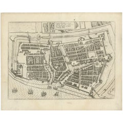
Antique Plan of the Battle of Abensberg in Germany
About the Item
Antique battle map titled 'Battle of Abensberg 20 April 1809'. Plan of the Battle of Abensberg, fought on 20 April 1809 between a Franco-German force under the command of Emperor Napoleon I of France and a reinforced Austrian corps led by Feldmarschall-Leutnant Archduke Louis of Austria. This print originates from 'Atlas to Alison's history of Europe: constructed and arranged under the direction of Sir Archibald Alison (..)' by W. & A.K. Johnston. Published 1852.
- Dimensions:Height: 7.09 in (18 cm)Width: 8.98 in (22.8 cm)Depth: 0.02 in (0.5 mm)
- Materials and Techniques:
- Period:
- Date of Manufacture:1852
- Condition:General age-related toning. Defects in left margin. Shows some wear and foxing, blank verso. Please study image carefully.
- Seller Location:Langweer, NL
- Reference Number:
About the Seller
5.0
Platinum Seller
These expertly vetted sellers are 1stDibs' most experienced sellers and are rated highest by our customers.
Established in 2009
1stDibs seller since 2017
1,965 sales on 1stDibs
Typical response time: <1 hour
- ShippingRetrieving quote...Ships From: Langweer, Netherlands
- Return PolicyA return for this item may be initiated within 14 days of delivery.
More From This SellerView All
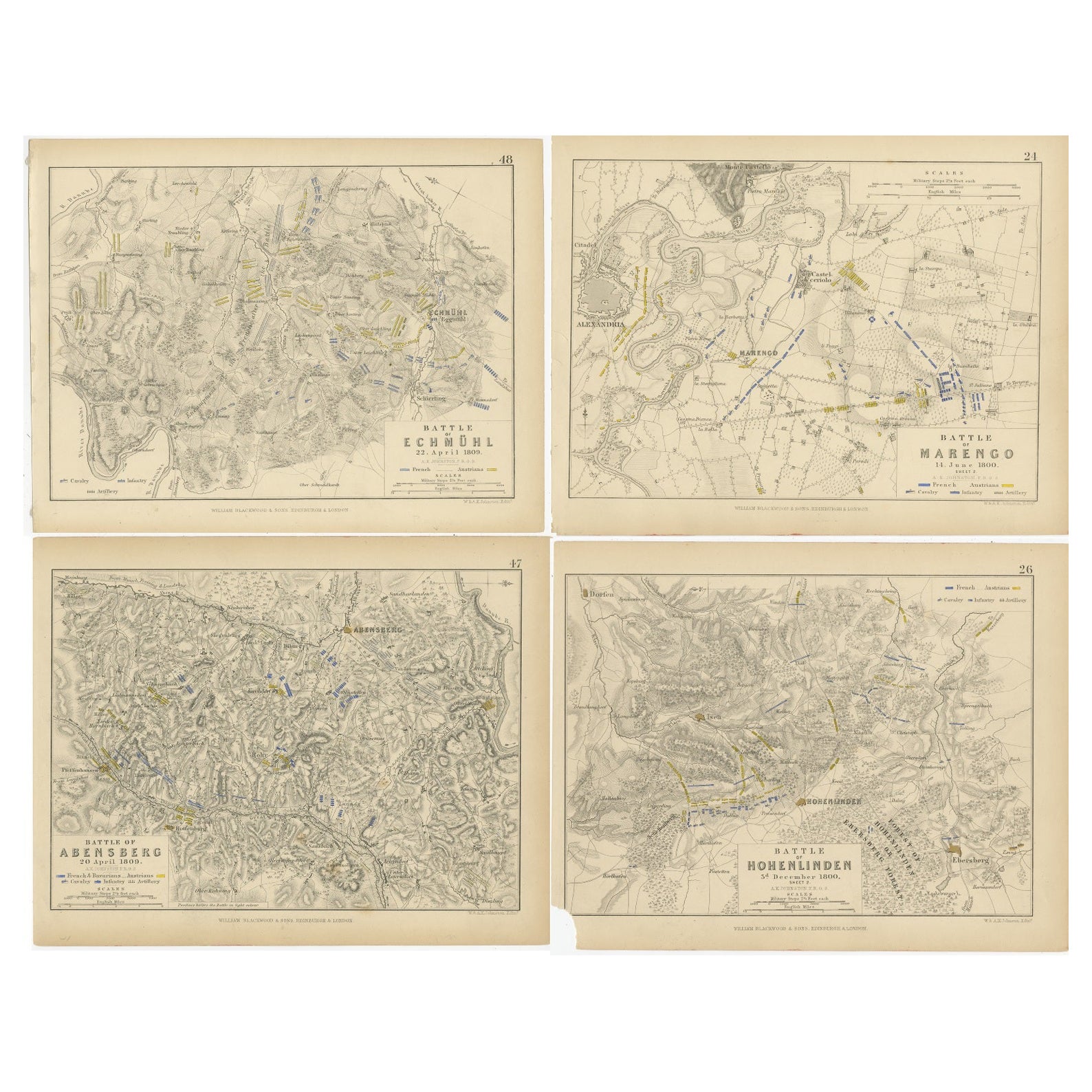
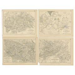
- Four Antique Battle Plans of Echmühl, Hohenlinden, Abensberg and Marengo, 1852Located in Langweer, NLSet of 4 antique battle plans. Included are: 1) Battle of Hohenlinden 3d. December 1800 2) Battle of Echmühl 22. April 1809 3) Battle of Arensberg 20. Ap...Category
Antique Mid-19th Century Maps
MaterialsPaper
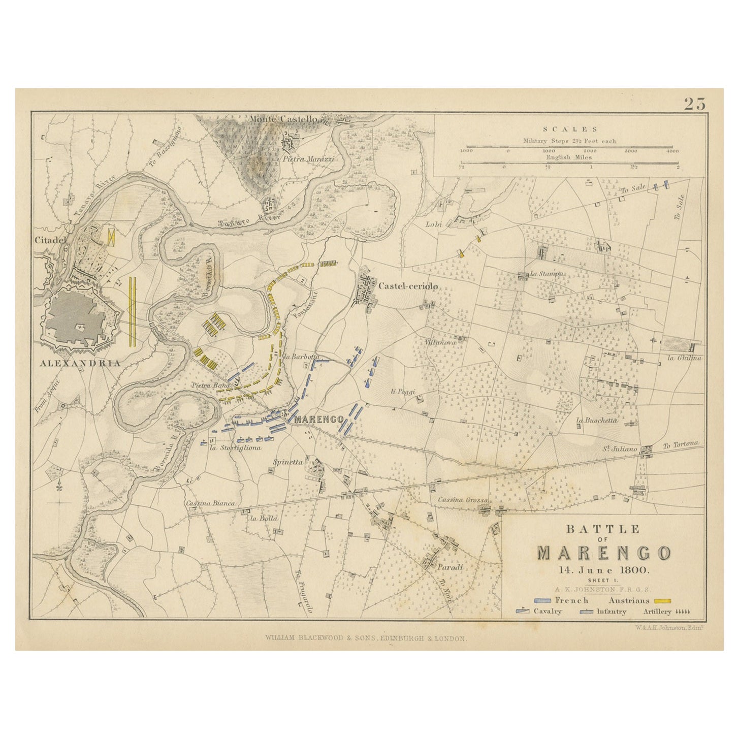
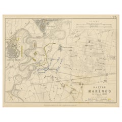
- Antique Plan of the Battle of Marengo, Near Alexandria, Italy, 1852Located in Langweer, NLThis antique battle map, titled "Battle of Marengo 14. June 1800 Sheet I," depicts the plan of the Battle of Marengo. This historic battle took place on Jun...Category
Antique Mid-19th Century Maps
MaterialsPaper
- Antique Roman Battle Plan of a Camp by Duncan, c.1753Located in Langweer, NLAntique battle map showing a plan of a camp. With detailed legend explaining the various elements of the print. This print most likely originates f...Category
Antique 18th Century Prints
MaterialsPaper
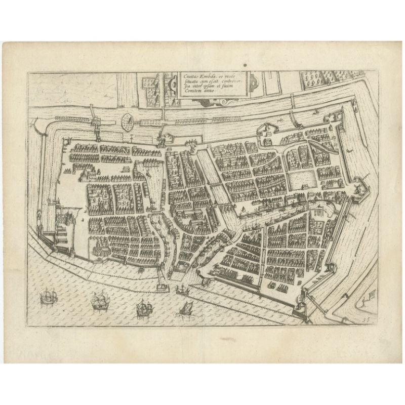
- Antique Plan of Emden in Germany by Guicciardini, 1612Located in Langweer, NLAntique map Emden titled 'Civitas Embda, eo modo situata cum essit controversia inter ipsam et suum Comitem anno'. Small plan of the city of Emden, Germany, Also depicted is part of ...Category
Antique 17th Century Maps
MaterialsPaper
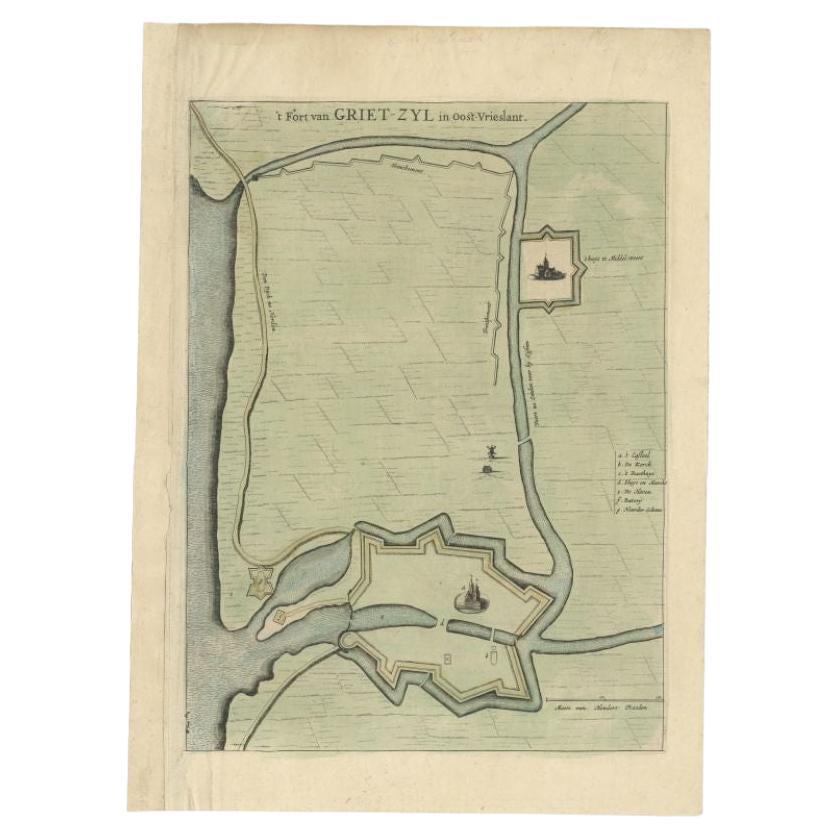
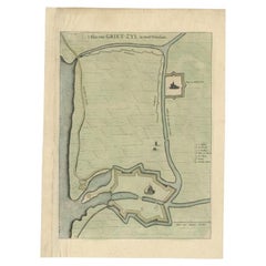
- Antique Plan of the Fortress of Greetsiel, Germany, by Blaeu, c.1650Located in Langweer, NLAntique plan titled 't Fort van Griet-Zyl in Oost-Vrieslant'. Plan of the fortress of Greetsiel, Germany. This print originates from 'Novum ac magnum theatrum urbium Belgicae' by J. ...Category
Antique 17th Century Maps
MaterialsPaper
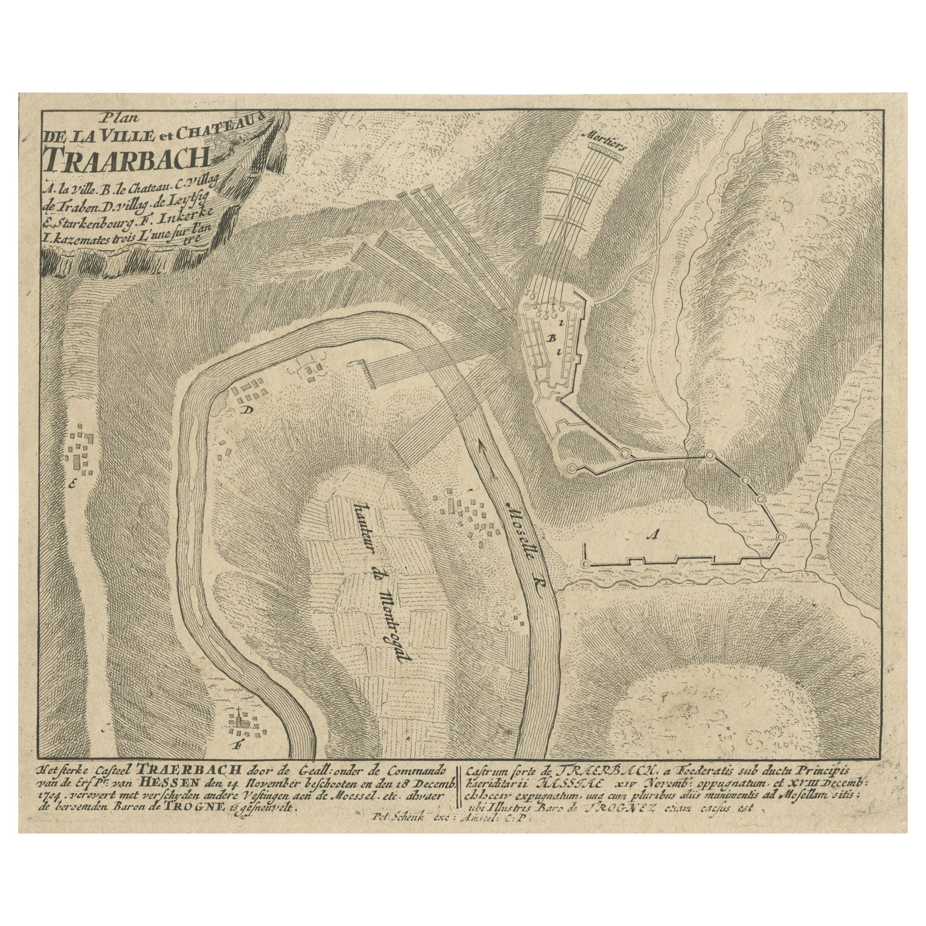
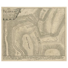
- Old Engraving of the Trarbach Battle in Rhineland-Palatinate, Germany, c.1710Located in Langweer, NLRare antique print titled 'Plan de la Ville et Chateau Traarbach (..)'. Battle plan of Trarbach, Rhineland-Palatinate, Germany. Published circa 1710 b...Category
Antique 1710s Maps
MaterialsPaper
You May Also Like
- Antique Lithographic Print of the Diamond Rock Battle Early 1900s, Oakwood FrameLocated in Milan, ITLithographic print of the diamond rock battle, the main port of the island of Martinique, taken from the book Historical Gallery of Versailles 112. Chacoane is the engraver. Original...Category
Early 20th Century French Nautical Objects
MaterialsPaper
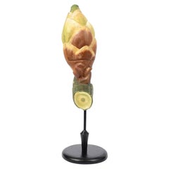
- Antique Scientific Didactic Model of the Yew Seed, Germany made in the TwentiesLocated in Milan, ITTaxus baccata, enlarged and removable didactic model of the yew seed, tree very used as hedge, belonging to the order of the conifers. German manufacture of the twenties made of papi...Category
Vintage 1920s German Scientific Instruments
MaterialsWood
- Antique German Silver Music Box in the Form of a Grand PianoLocated in London, GBThis charming antique silver musical box features a singing bird, which appears from an opening oval. The musical box is exquisitely crafted in the shape of a miniature grand piano, ...Category
Antique 19th Century German Models and Miniatures
MaterialsSilver
- Gold Leaf Foil Pictorial Plan Map of the West Country of England Antique StyleLocated in GBWe are delighted to offer for sale this lovely Antique style pictorial plan map of the West Country of England etched in gold leaf foil This is a very interesting and decorative p...Category
20th Century English Adam Style Maps
MaterialsGold Leaf
- Original Antique City Plan of Milwaukee, USA, 1894By Rand McNally & Co.Located in St Annes, LancashireFabulous colorful map of Milwaukee Original color By Rand, McNally & Co. Published, 1894 Unframed Free shipping.Category
Antique 1890s American Maps
MaterialsPaper
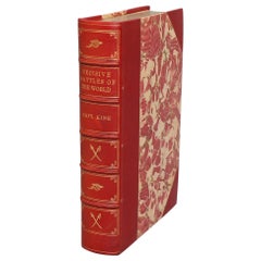
- Books, Captain Charles King's "Famous Decisive Battles of the World"Located in New York, NYBooks, Captain Charles King's "Famous Decisive Battles of the World. Or, History From the Battlefield." Leatherbound. One volume. Octavo. Bound in three quarter red morocco with marbled boards, top edges gilt, raised bands, & gilt panels on spine. Very good. Published in Philadelphia by J.C. McCurdy & Co., N.D., Circa 1890s. History, Military History...Category
Antique Late 19th Century American Books
MaterialsLeather, Paper


Recently Viewed
View AllMore Ways To Browse
Emperor Napoleon I
Napoleon Battle Map
Antique Saudi
Arabian Peninsula
Colombia Map
Framed Map Asia
Map Of Bengal
Map Of Syria
United States Civil War Map
Afghanistan Antique Map
Antique Furniture Santa Cruz
Antique Mississippi Map
Hindeloopen Furniture
Madagascar Antique Map
Map Of Prussia
Normandy Map
Prussia Map
Antique Map Of Florida