Items Similar to Antique Plan of the Harbour of Taloo by Cook, 1784

Want more images or videos?
Request additional images or videos from the seller
1 of 6
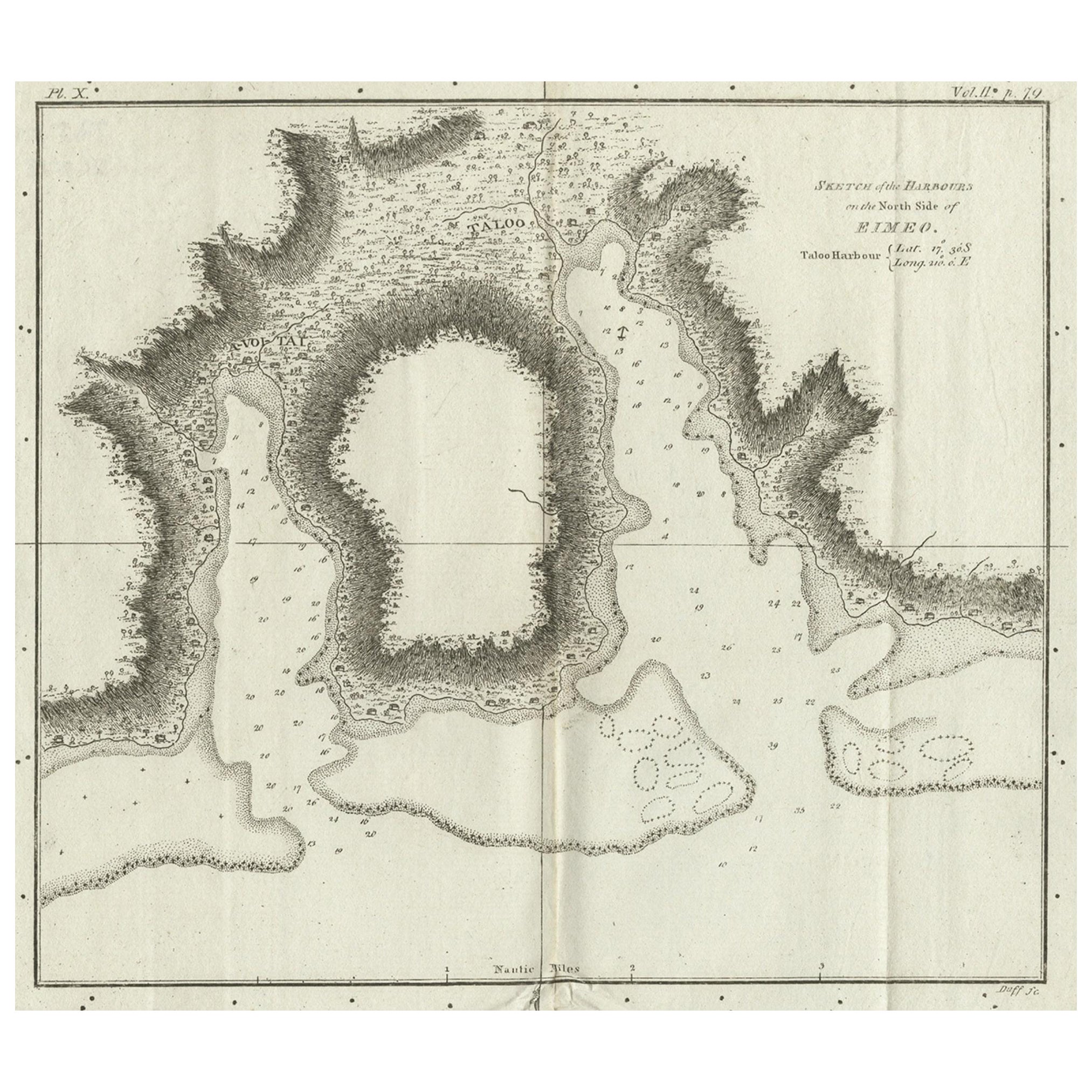
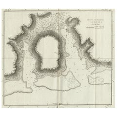
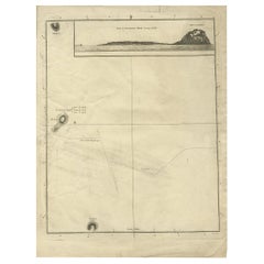
Antique Plan of the Harbour of Taloo by Cook, 1784
About the Item
Antique map titled 'Sketch of the Harbours on the North Side of Eimeo (..)'. Plan of the harbour of Taloo in the Island of Moorea, one of the Society Islands, French Polynesia. Originates from an edition of Cook's Voyages.
Artists and Engravers: Published by Nicol, G. and Cadell, London.
Condition: Good, some wear and age-related toning. Please study image carefully.
Date: 1784
Overall size: 30 x 23 cm.
Image size: 21 x 18.5 cm.
We sell original antique maps to collectors, historians, educators and interior decorators all over the world. Our collection includes a wide range of authentic antique maps from the 16th to the 20th centuries. Buying and collecting antique maps is a tradition that goes back hundreds of years. Antique maps have proved a richly rewarding investment over the past decade, thanks to a growing appreciation of their unique historical appeal. Today the decorative qualities of antique maps are widely recognized by interior designers who appreciate their beauty and design flexibility. Depending on the individual map, presentation, and context, a rare or antique map can be modern, traditional, abstract, figurative, serious or whimsical. We offer a wide range of authentic antique maps for any budget.
- Dimensions:Height: 9.06 in (23 cm)Width: 11.82 in (30 cm)Depth: 0 in (0.01 mm)
- Materials and Techniques:
- Period:
- Date of Manufacture:1784
- Condition:Condition: Good, some wear and age-related toning. Please study image carefully.
- Seller Location:Langweer, NL
- Reference Number:
About the Seller
5.0
Platinum Seller
These expertly vetted sellers are 1stDibs' most experienced sellers and are rated highest by our customers.
Established in 2009
1stDibs seller since 2017
1,965 sales on 1stDibs
Typical response time: <1 hour
- ShippingRetrieving quote...Ships From: Langweer, Netherlands
- Return PolicyA return for this item may be initiated within 14 days of delivery.
More From This SellerView All
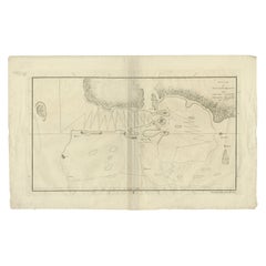
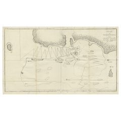
- Antique Plan of the Harbour of Taloo by Cook, c.1781Located in Langweer, NLAntique map titled 'Sketch of the Harbours on the North Side of Eimeo (..)'. Plan of the harbour of Taloo in the Island of Moorea, one of the Society Islands, French Polynesia. Origi...Category
Antique 18th Century Maps
MaterialsPaper
- Antique Map of the Harbour of Taloo by J. Cook, 1803By James CookLocated in Langweer, NLAntique map French Polynesia titled 'Schets van de Havenen aan de Noord Zijde van Eimeo'. Plan of the harbour of Taloo in the Island of Moorea, one of the Society Islands, French Polynesia. Originates from 'Reize rondom de Waereld door James Cook...Category
Antique Early 19th Century Dutch Maps
MaterialsPaper
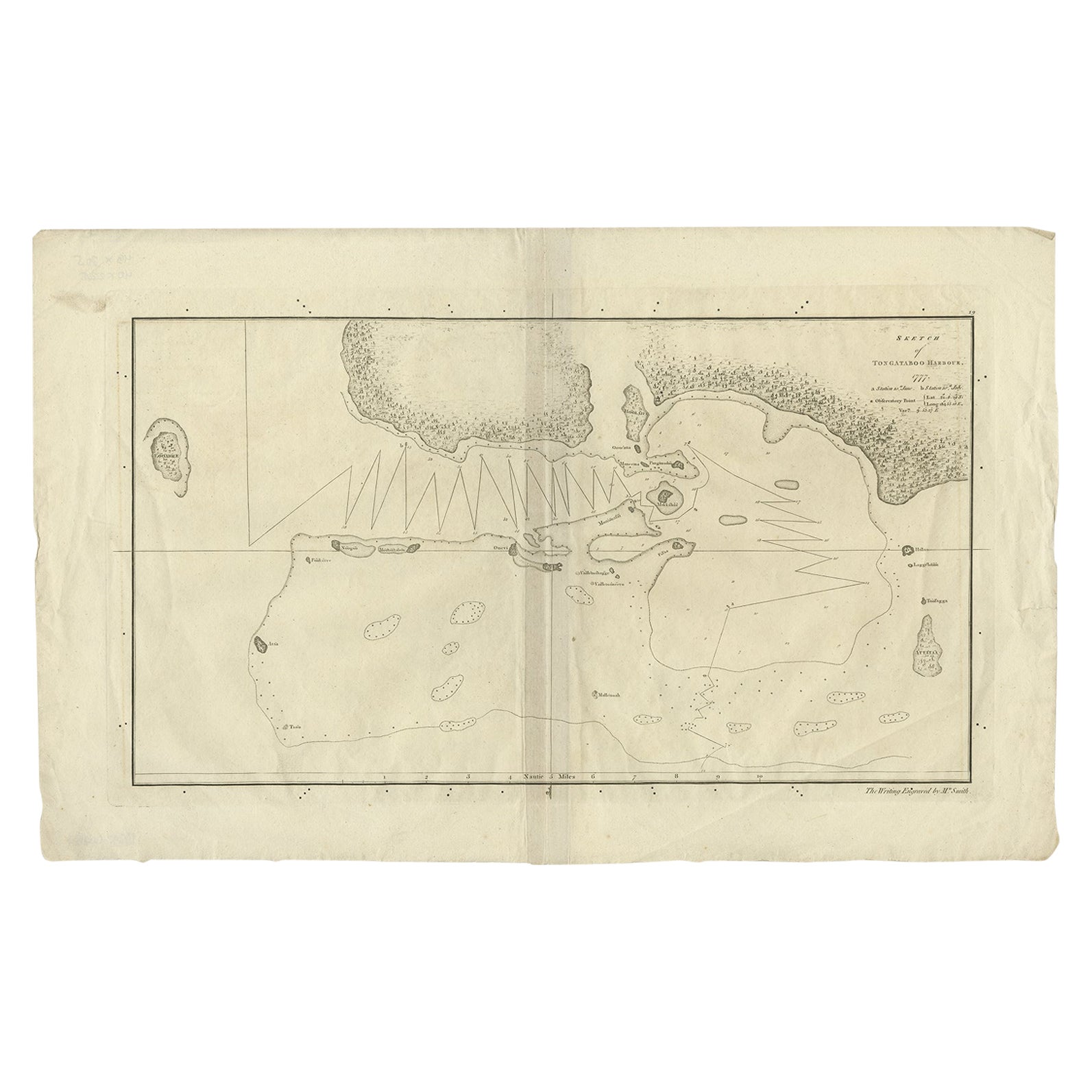
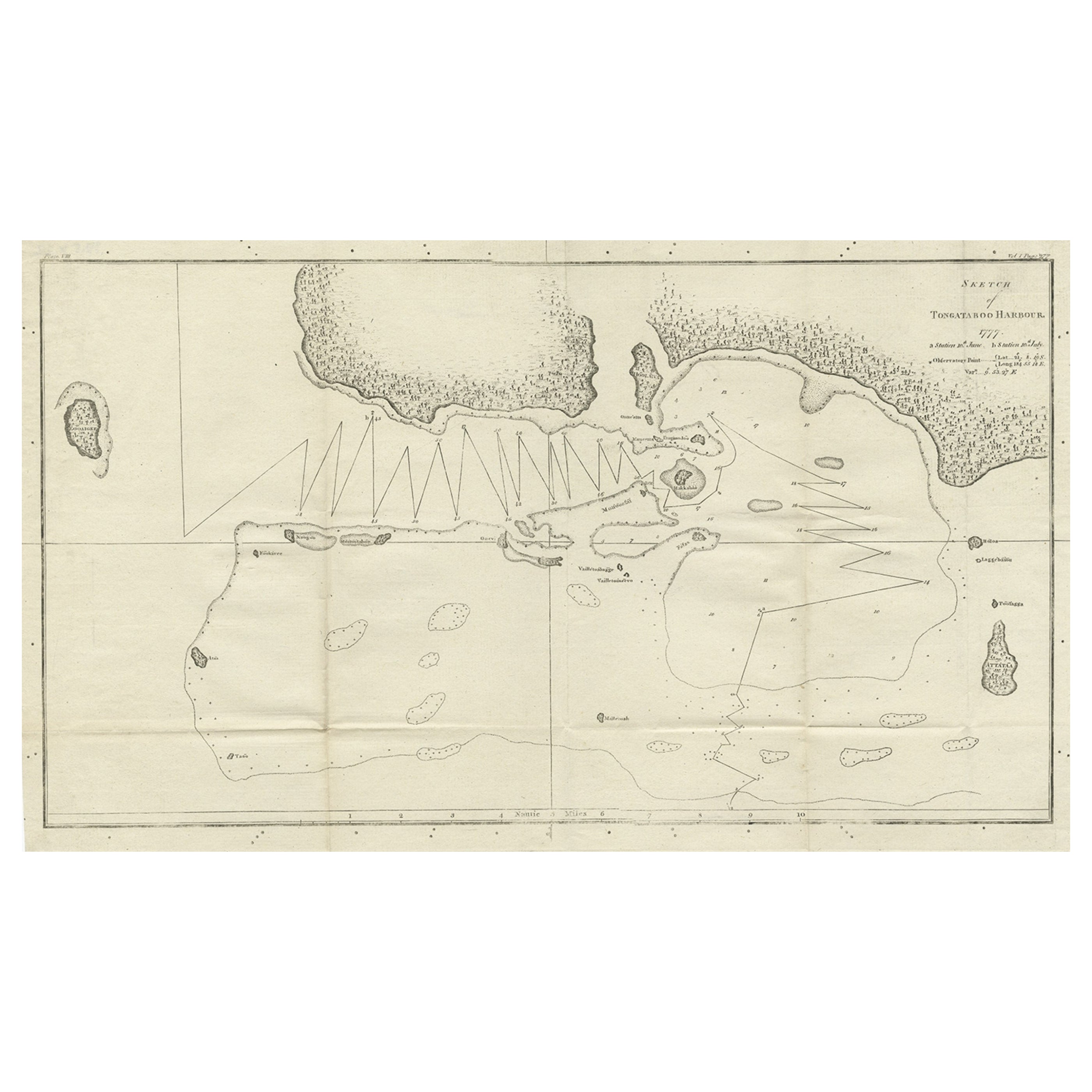
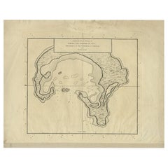
- Original Antique Map of the Harbour of Tongatabu by Cook, 1784Located in Langweer, NLAntique map titled 'Sketch of Tongataboo Harbour (..)'. Antique map of the harbour of Tongatabu, one of the Tonga Islands. Originates from an edition of Cook's Voyages. Artists an...Category
Antique 18th Century Maps
MaterialsPaper
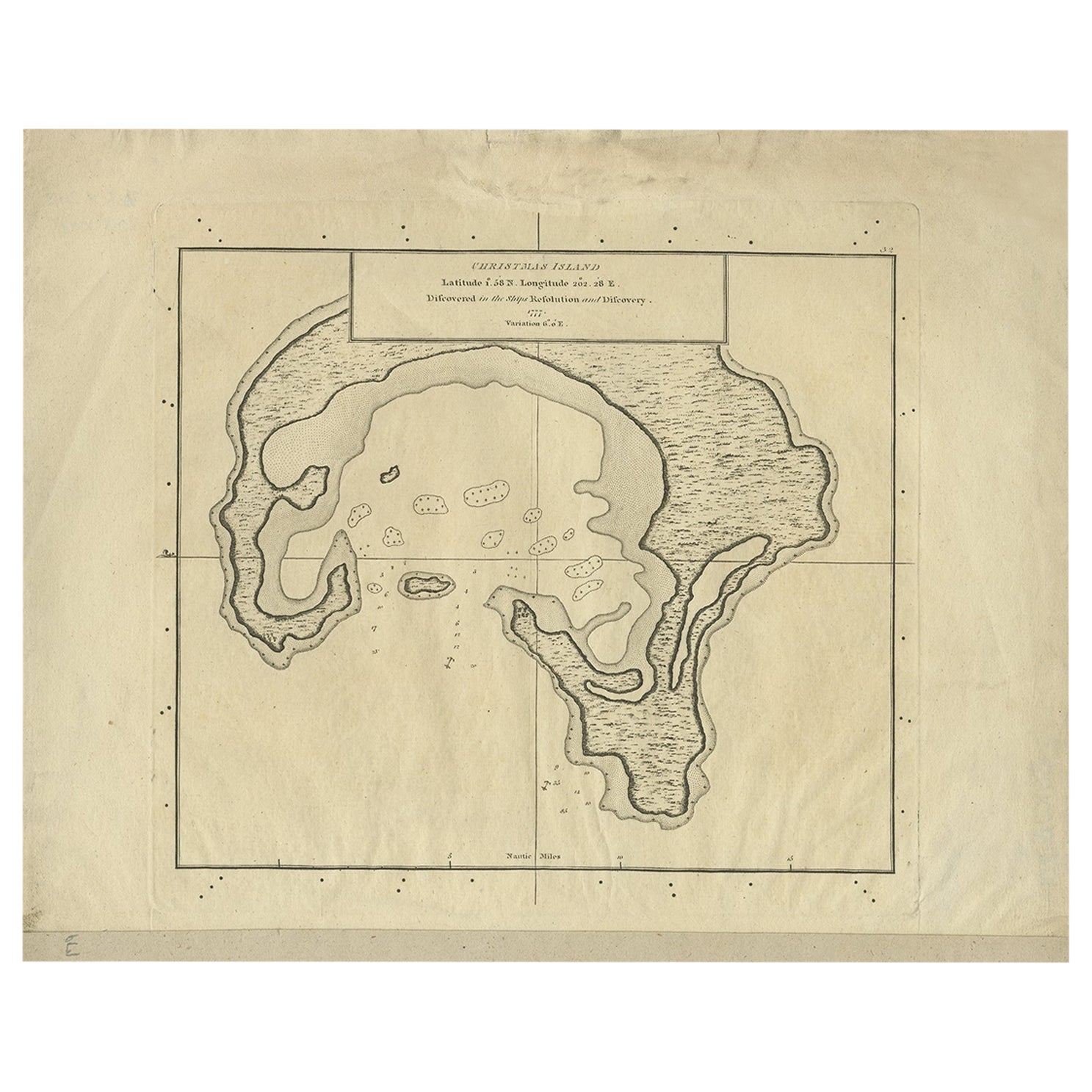
- Antique Map of Christmas Island by Cook, 1784Located in Langweer, NLAntique map Kiribati titled 'Christmas Island (..)'. Antique map of Christmas Island, also known as Kiritimati. Originates from an edition of Cook's Voyages. Artists and Engravers...Category
Antique 18th Century Maps
MaterialsPaper
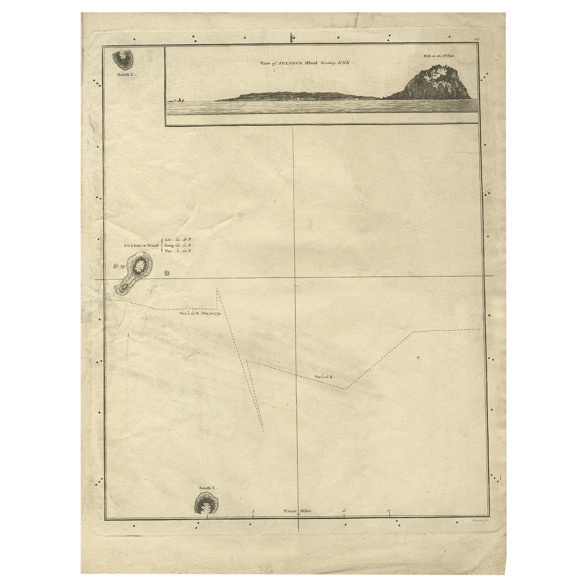
- Antique Map of Suffren Island by Cook, 1784Located in Langweer, NLAntique map titled 'View of Sulphur Island (..)'. Antique map and view of Suffren Island. Originates from an edition of Cook's Voyages. Artists and Engravers: Published by Nicol, ...Category
Antique 18th Century Maps
MaterialsPaper
- Antique Map of the Harbour of Tongatabu by Cook, C.1783Located in Langweer, NLAntique map titled 'Sketch of Tongataboo Harbour (..)'. Antique map of the harbour of Tongatabu, one of the Tonga Islands. Originates from an edition of Cook's Voyages. Artists an...Category
Antique 18th Century Maps
MaterialsPaper

You May Also Like
- Chart of the Harbour of LiverpoolLocated in Cheshire, GBPL Burdett A Chart of the Harbour of Liverpool hand coloured. Encased in an ebonised frame. Dimensions Height 23.5 Inches Width 28 Inches Depth 1 InchesCategory
Early 20th Century British Maps
MaterialsPaper
- Plan of Paris, France, by A. Vuillemin, Antique Map, 1845Located in Colorado Springs, COThis large and detailed plan of Paris was published by Alexandre Vuillemin in 1845. The map conveys a wonderful amount of information and is decorated throughout with pictorial vigne...Category
Antique 1840s American Maps
MaterialsPaper
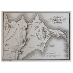
- Original Antique Plan of The Battle of Abukir, Napoleon Bonaparte. Circa 1850Located in St Annes, LancashireGreat battle plan of The Battle of Abukir Drawn by A.M Perrot Steel engraving by Tardieu with original hand colour Unframed. The size given is the pape...Category
Antique 1850s French Maps
MaterialsPaper
- Antique "New Plan of London" Map by John Bartholomew, 1900Located in Bridgeport, CTProduced for the W.H. Smith guide, folded in the original. The map here is unfolded and framed flat, with transportation routes shown and color details. sight 22 x 32" (original ful...Category
Antique Early 1900s English Victorian Maps
MaterialsPaper
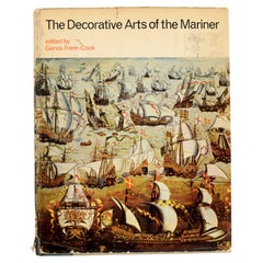
- The Decorative Arts of The Mariner by Gervis Frere-Cook, Stated 1st American EdLocated in valatie, NYThe Decorative Arts Of The Mariner by Gervis Frere-Cook. Boston: Little, Brown and Company, (1966). Profusely illustrated. Seventeen authorities have...Category
Vintage 1960s American Books
MaterialsPaper
- Gold Leaf Foil Pictorial Plan Map of the West Country of England Antique StyleLocated in GBWe are delighted to offer for sale this lovely Antique style pictorial plan map of the West Country of England etched in gold leaf foil This is a very interesting and decorative p...Category
20th Century English Adam Style Maps
MaterialsGold Leaf


Recently Viewed
View AllMore Ways To Browse
Antique Cook
1784 Furniture
Cook Islands
G Plan Antique Furniture
G Plan Furniture Antique Furniture
Large Map Of Italy
Map Of Antique Philippines
Map Of Mexican California
Persian Maps
Singapore Antique Furniture
Antique Sri Lanka Map
Korean Map
Maps Of Ireland Large
Washington Antique Map
Antique Classroom
Peru Map
Antique Blackwood
Antique Civil War Maps