Items Similar to Decorative Original HandColoredAntique Map of South America by J.B. Elwe, 1792


Want more images or videos?
Request additional images or videos from the seller
1 of 7
Decorative Original HandColoredAntique Map of South America by J.B. Elwe, 1792
About the Item
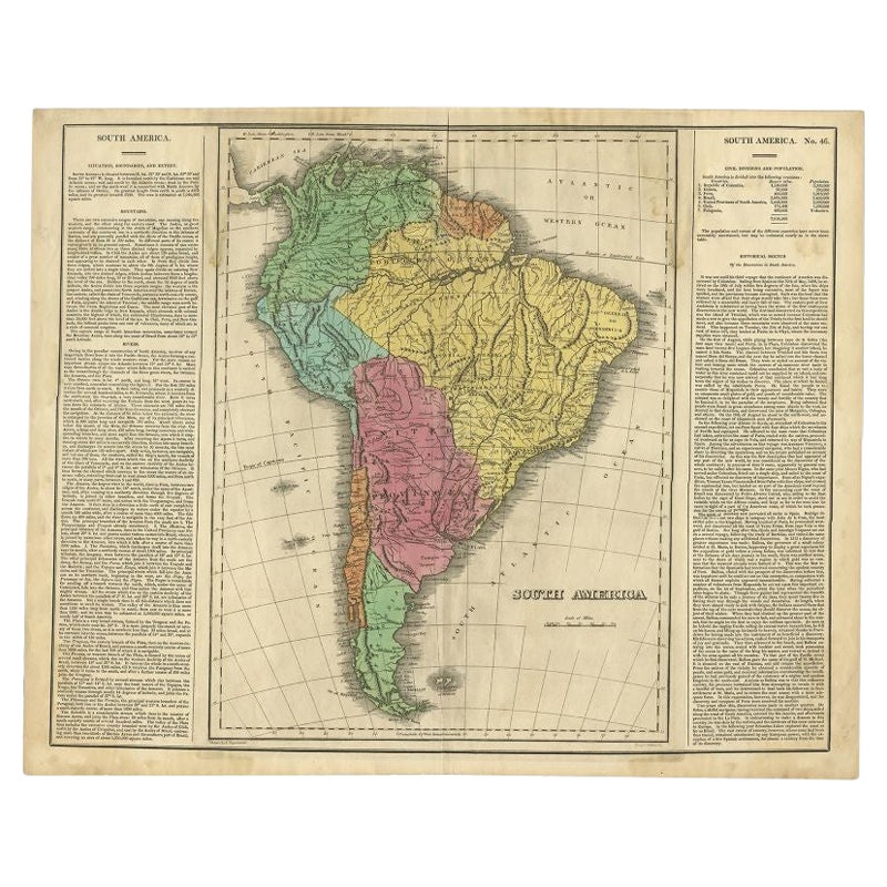
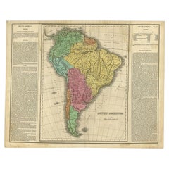
This image depicts 'L'Amerique Meridionale', an antique map of South America. The map is carefully hand-colored, showcasing the diverse countries within the continent, including Brazil, Chile, Argentina, Mexico, Ecuador, Peru, Uruguay, Paraguay, Colombia, Venezuela, Guiana, Guyana, and Surinam. The craftsmanship suggests it was created in a time when maps were not just tools for navigation but also works of art. It appears to be an authentic piece from 1792, originating from an atlas published by J.B. Elwe. The artistry in the coloration and the detail in the geographical features capture the essence of cartography from the late 18th century.
- Creator:J.B. Elwe (Artist)
- Dimensions:Height: 21.46 in (54.5 cm)Width: 25.6 in (65 cm)Depth: 0.02 in (0.5 mm)
- Materials and Techniques:Paper,Engraved
- Period:
- Date of Manufacture:1792
- Condition:Wear consistent with age and use. Small tear at bottom of the middle-fold. Overall in very good condition.
- Seller Location:Langweer, NL
- Reference Number:Seller: BG-021191stDibs: LU305438833113
About the Seller
5.0
Platinum Seller
These expertly vetted sellers are 1stDibs' most experienced sellers and are rated highest by our customers.
Established in 2009
1stDibs seller since 2017
1,965 sales on 1stDibs
Typical response time: <1 hour
- ShippingRetrieving quote...Ships From: Langweer, Netherlands
- Return PolicyA return for this item may be initiated within 14 days of delivery.
Auctions on 1stDibs
Our timed auctions are an opportunity to bid on extraordinary design. We do not charge a Buyer's Premium and shipping is facilitated by 1stDibs and/or the seller. Plus, all auction purchases are covered by our comprehensive Buyer Protection. Learn More
More From This SellerView All
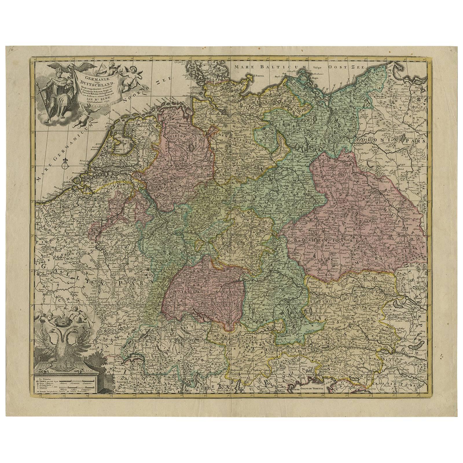
- Antique Map of Germany by J.B. Elwe, 1792Located in Langweer, NLAntique map titled 'Germanie vulgo Duitschland (..)'. Decorative map of Germany with Silesia, Bohemia , Netherlands, Belgium, Elzas, Switzerland, Tyrol and Austria. With two cartouch...Category
Antique Late 18th Century Maps
MaterialsPaper
- Original Hand-Colored Antique Map of Africa by Elwe '1792'Located in Langweer, NLAntique map titled 'l'Afrique Divisée en ses Empires, Royaumes, et Etats'. Decorative large map of Africa. The cartography is typical for the 17th century with the Nile originating i...Category
Antique Late 18th Century Maps
MaterialsPaper
- Antique Hand-Colored Map of France by J.B. Elwe, 1792Located in Langweer, NLAntique map titled 'Carte Nouvelle du Royaume de France'. Beautiful antique map of France, including the Southern part of England. Decorated with cartouche and 12 coats of arms.Category
Antique Late 18th Century Maps
MaterialsPaper
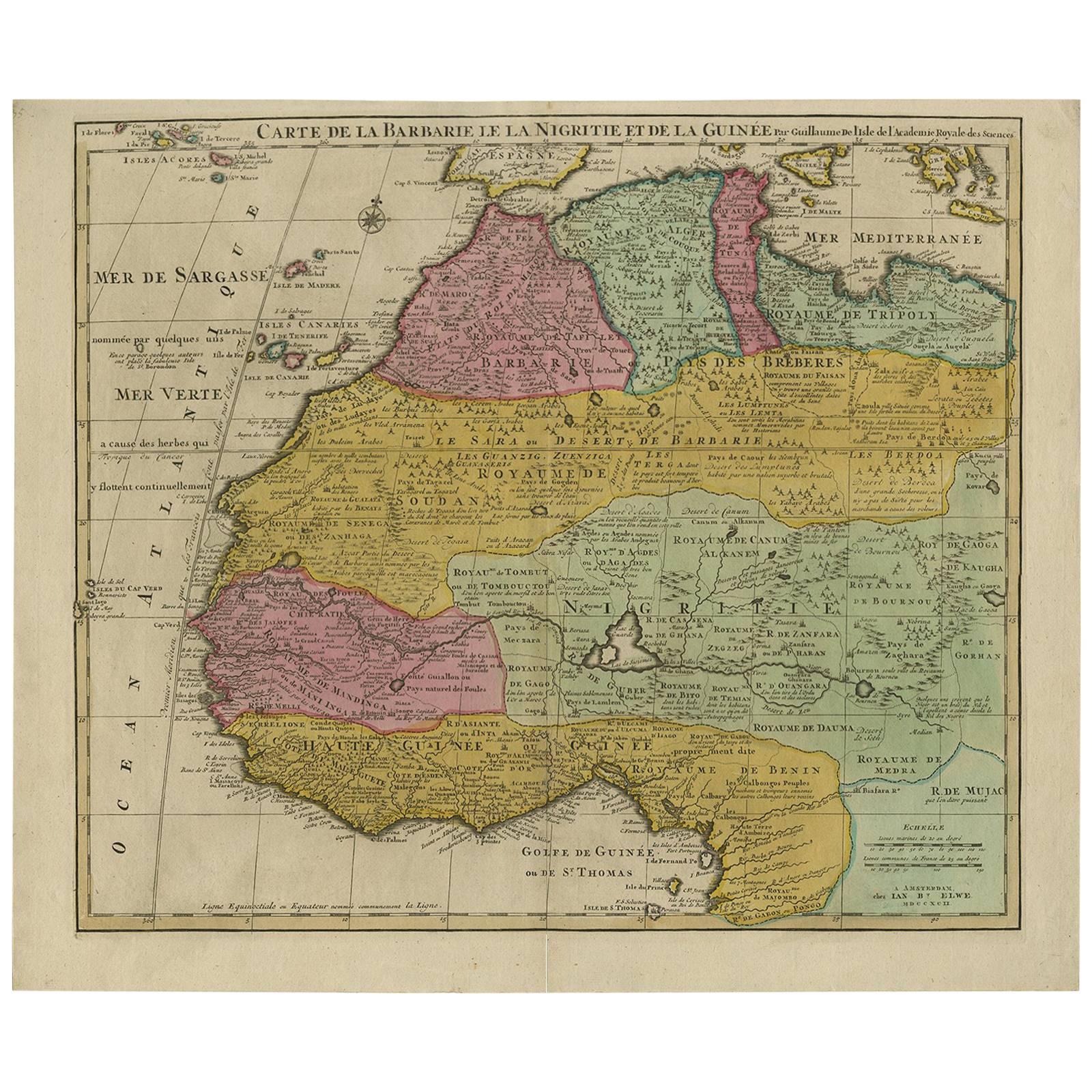
- Antique Map of North and West Africa by J.B. Elwe, 1792Located in Langweer, NLBeautiful richly engraved map of North and West Africa, based upon the earlier maps of De L'Isle. Richly annotated throughout and with excellent regional detail. Too much detail to d...Category
Antique Late 19th Century Maps
MaterialsPaper
- Interesting Original Antique Map of South America, 1822Located in Langweer, NLAntique map titled 'South America'. Map of South America with attractive topography, surrounded on three sides by text on the history, geography, and economy of the continent. Sh...Category
Antique 19th Century Maps
MaterialsPaper
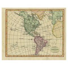
- Decorative Dutch Antique Map of North and South America, 1841Located in Langweer, NLDescription: Antique map titled 'Amerika'. Small map of North and South America. This map originates from the Dutch publication 'De Aarde, beschouwd in haren Natuurlijken Toestan...Category
Antique 1840s Maps
MaterialsPaper


You May Also Like
- South America: Hand-colored 18th Century Framed Map by Thomas JefferysBy Thomas JefferysLocated in Alamo, CAThis detailed hand-colored map of South America by Thomas Jefferys was published in London in 1750. The map shows countries, early colonial possessions, towns, rivers, mountains, and...Category
Antique Mid-18th Century English Maps
MaterialsPaper
- North & South America: A 17th Century Hand-colored Map by Jansson & GoosBy Johannes JanssoniusLocated in Alamo, CAA 17th century hand-colored map of North & South America entitled "Americae Descriptio" by the cartographer Johannes Jansson, published in Jansson's Atlas Minor in Amsterdam in 1628....Category
Antique 1620s Dutch Maps
MaterialsPaper
- Large Antique 1859 Map of North AmericaLocated in Sag Harbor, NYThis Map was made by Augustus Mitchell in 1859 It is in amazing condition for being 163 years old. This price is for the rolled up easy to ship version of this piece. I will be Frami...Category
Antique Mid-19th Century American Maps
MaterialsCanvas, Paper

- New Map of North America from the Latest Discoveries, 1763Located in Philadelphia, PAA fine antique 18th century map of the North American seaboard. Entitled "A New Map of North America from the Latest Discoveries 1763". By the Cartographer/Engraver - John Spil...Category
Antique Mid-18th Century English Georgian Maps
MaterialsPaper
- America "Amérique Septentrionale": A 19th Century French Map by DelamarcheBy Maison Delamarche 1Located in Alamo, CAThis framed mid 19th century map of North America entitled "Amérique Septentrionale" by Felix Delamarche was published in Paris in 1854 by Quay de l'Horloge du Palais, avec les Carte...Category
Antique Mid-19th Century American Other Maps
MaterialsPaper
- Antique Map of Italy by Andriveau-Goujon, 1843By Andriveau-GoujonLocated in New York, NYAntique Map of Italy by Andriveau-Goujon, 1843. Map of Italy in two parts by Andriveau-Goujon for the Library of Prince Carini at Palazzo Carini i...Category
Antique 1840s French Maps
MaterialsLinen, Paper


Recently Viewed
View AllMore Ways To Browse
J Engraved
Mexican Engraved
Mexican 18th Century Furniture
Antique Furniture Peru
Peruvian Antiques
18th Century Art Tools
Brazil Map
Paraguay Antique Map
Antique Map Of Colombia
Ecuador Antique Map
Guyana Antique Map
Antique Map Of Argentina
Uruguay Antique Map
Antique Furniture Dundee
Antique Map Chicago
Antique Map Copenhagen
Antique Map Malta
Antique Map Of Malta