Items Similar to Map of East Frisian Islands & Northwestern Tip of Germany, Ostfriesland, c.1595


Want more images or videos?
Request additional images or videos from the seller
1 of 5
Map of East Frisian Islands & Northwestern Tip of Germany, Ostfriesland, c.1595
About the Item
Antique map titled 'Frisia Orientalis'. Beautiful map of east Frisian islands and the northwestern tip of Germany, Ostfriesland. With people in local costumes. Ornamented inset of the Eems estuary. Based on a manuscript map of Jan Bloemaert or Johannes Florianus.
Artists and Engravers: Abraham Ortelius was born 1528 in Antwerp. He studied mathematics, Greek and Latin and travelled a lot across Europe. He established a business in dealing with books and drawing maps. His first remarkable map was a 8 sheet world map in the year 1564, but only three copies have survived. In 1570 he issued the "Theatrum Orbis Terrarum", the first modern "Atlas" with uniformly sized maps in a systematic collection. The term "Atlas" was not used until Mercator introduced it 20 years later. Most of the maps in Theatrum have been engraved by Frans Hogenberg. At the time of publication, the atlas was the most expensive book ever printed. Nevertheless it was a big success and around 7000 copies have been printed until 1612 in many editions and six different languages. Beside the Theatrum, Ortelius compiled a series of historical maps and published it in the "Parergon Theatri" which was bound with the Theatrum from 1579 onwards or published separately.
Condition: Good, original/contemporary hand coloring. General age-related toning, minor wear. Original folding line, Spanish text on verso.
- Dimensions:Height: 15.75 in (40 cm)Width: 20.67 in (52.5 cm)Depth: 0 in (0.02 mm)
- Materials and Techniques:
- Period:
- Date of Manufacture:circa 1595
- Condition:Wear consistent with age and use. Condition: Good, original/contemporary hand coloring. General age-related toning, minor wear. Original folding line, Spanish text on verso.
- Seller Location:Langweer, NL
- Reference Number:
About the Seller
5.0
Platinum Seller
These expertly vetted sellers are 1stDibs' most experienced sellers and are rated highest by our customers.
Established in 2009
1stDibs seller since 2017
1,974 sales on 1stDibs
Typical response time: <1 hour
- ShippingRetrieving quote...Ships From: Langweer, Netherlands
- Return PolicyA return for this item may be initiated within 14 days of delivery.
More From This SellerView All
- Antique Map of East Frisia by Ortelius, c.1595Located in Langweer, NLAntique print, titled: 'Frisia Orientalis.' Map of East Frisia originating from 'Theatrum Orbis Terrarum'. It is based on the manuscript map by Jon Bloe...Category
Antique 16th Century Maps
MaterialsPaper
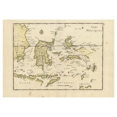
- Old Original Antique Map of the Islands of East Indonesia, 1756Located in Langweer, NLTitle: Isles Moluques. Old and rare, this decorative map of the Maluku Islands in the period it was still controlled by the Dutch colonial power. It also shows the island of Bali, Lombok, part of Borneo (Kalimantan), Celebes (Sulawesi), Timor, The Lesser Sunda Islands, West Papua...Category
Antique 1750s Maps
MaterialsPaper
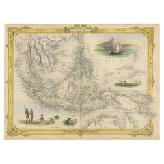
- Decorative Antique Map of the Malay Archipelago or East Indies Island, 1851Located in Langweer, NLAntique map Indonesia titled 'Malay Archipelago, or East India Islands'. With vignettes of Victoria Mount, New Guinea, Nativaes of New Guinea an...Category
Antique 1850s Maps
MaterialsPaper
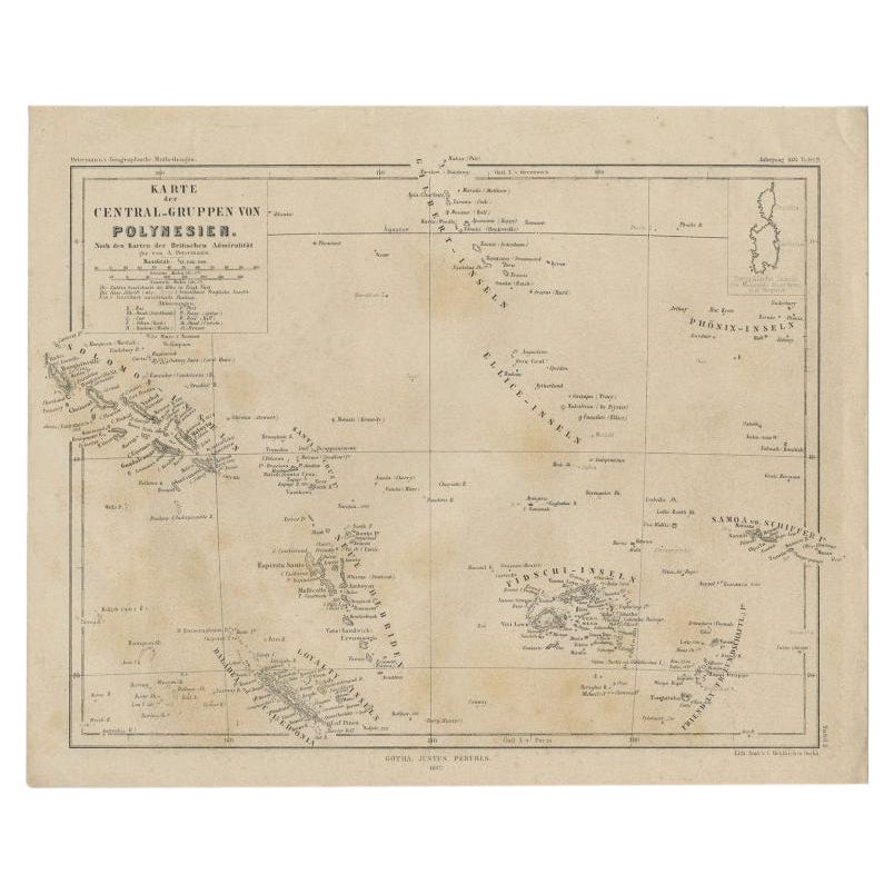
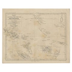
- Old German Map Depicting the Central Islands of Polynesia, 1857Located in Langweer, NLAntique map Polynesia titled 'Karte der Central-Gruppen von Polynesien'. Old map depicting the central islands of Polynesia. This map originates from 'Petermanns Geographische Mittei...Category
Antique 19th Century Maps
MaterialsPaper
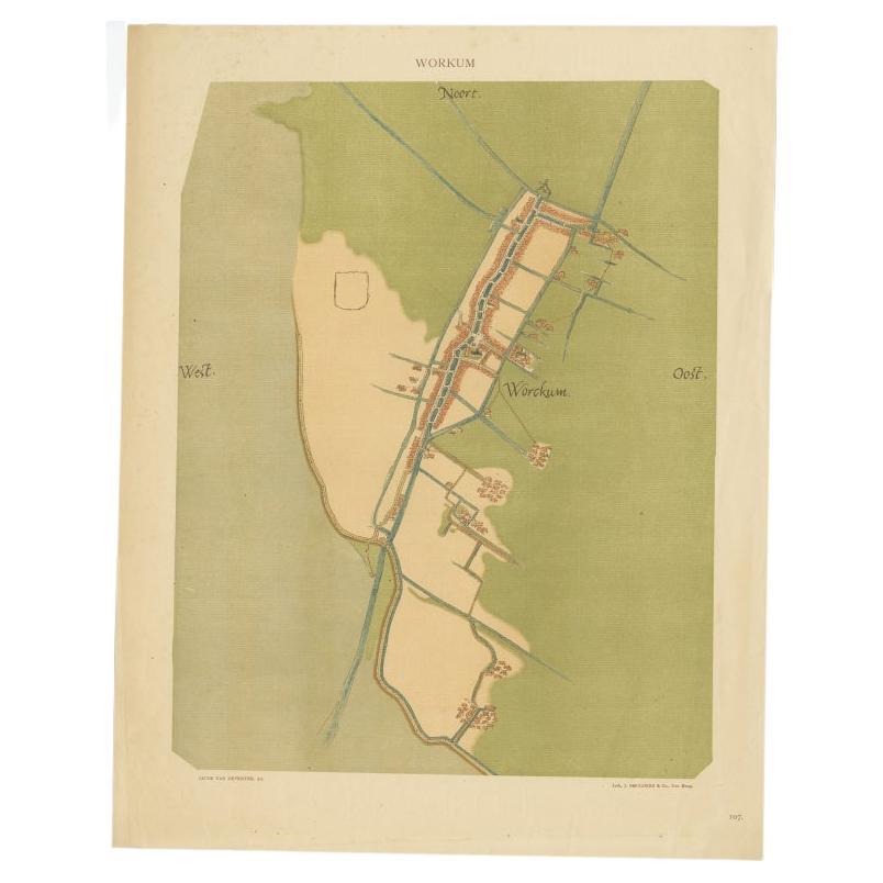
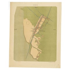
- Old Map of The Frisian City of Workum in Holland, 1916Located in Langweer, NLAntique map Workum titled 'Workum'. Antique map depicting the Frisian city of Workum, the Netherlands. Artists and Engravers: Lithograph by J. Smulders & Co, Den Haag. Condi...Category
20th Century Maps
MaterialsPaper
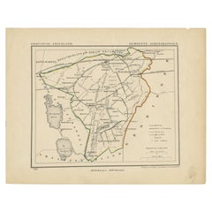
- Antique Map of Frisian Municipality of Achtkarspelen in the Netherlands, 1868Located in Langweer, NLAntique map titled 'Provincie Friesland - Gemeente Achtkarspelen'. Map of the township of Achtkarspelen including Buitenpost, Surhuisterveen and many other villages. This map origina...Category
Antique 19th Century Maps
MaterialsPaper

You May Also Like
- Original Antique Map of South East Asia, Arrowsmith, 1820Located in St Annes, LancashireGreat map of South East Asia Drawn under the direction of Arrowsmith Copper-plate engraving Published by Longman, Hurst, Rees, Orme and Brown, 1820 Unframed.Category
Antique 1820s English Maps
MaterialsPaper
- East German MapBy VEB Hermann HaackLocated in Baltimore, MDA brilliantly colourful map of the Leipzig, Karl Marx Stadt and Dresden area in the former German Democratic Republic by VEB Hermann Haack of Gotha.Category
Vintage 1970s German Maps
- Original Antique Map of South East Asia by Becker, circa 1840Located in St Annes, LancashireGreat map of South East Asia Steel engraving with original color outline Engraved by Becker Published by Virtue, circa 1840. Unframed.Category
Antique 1840s English Other Maps
MaterialsPaper
- Original Antique English County Map, East Yorkshire, J & C Walker, 1851Located in St Annes, LancashireGreat map of The East Riding of Yorkshire Original colour By J & C Walker Published by Longman, Rees, Orme, Brown & Co. 1851 Unframed.Category
Antique 1850s English Other Maps
MaterialsPaper
- Hand-Colored 18th Century Homann Map of Denmark and Islands in the Baltic SeaBy Johann Baptist HomannLocated in Alamo, CAAn 18th century copper plate hand-colored map entitled "Insulae Danicae in Mari Balthico Sitae utpote Zeelandia, Fionia, Langelandia, Lalandia, Falstria, Fembria Mona" created by Joh...Category
Antique Early 18th Century German Maps
MaterialsPaper
- 18th Century Hand-Colored Homann Map of Germany, Including Frankfurt and BerlinBy Johann Baptist HomannLocated in Alamo, CAAn 18th century hand-colored map entitled "Tabula Marchionatus Brandenburgici et Ducatus Pomeraniae quae sunt Pars Septentrionalis Circuli Saxoniae Superioris" by Johann Baptist Homa...Category
Antique Early 18th Century German Maps
MaterialsPaper


Recently Viewed
View AllMore Ways To Browse
Antique Tips
Northwestern Furniture
German Uniform
German Antique Ornaments
Antique German Ornaments Ornaments
Antique German Ornaments
Antique Lot Collectables
Antique Map Greece
Antique Maps Of Greece
Lot Of Antique Books
Johanne 8
Antique Map Ortelius
Antique Maps Ortelius
Greece Map Print
Antique Greek Costume
Abraham Bloemaert
Antique Map Of New England
Antique Maps New England