Items Similar to Old French Lithograph of Oceania with an Inset of Victoria, Australia 1897
Want more images or videos?
Request additional images or videos from the seller
1 of 5
Old French Lithograph of Oceania with an Inset of Victoria, Australia 1897
About the Item
Sheet: Front: 'Oceanie.' (Map of Oceania). Rear: 'Oceanie.' (Oceania; native people, costume, plants, animals; crocodile, cassowary, tiger, kangeroo, platypus, lyre bird etc.).'
This lithographic print originates from: 'Nouveau Larousse Illustre en sept volumes.', Directeur Claude Auge, Paris, published 1897-1904, with a supplement addedin 1907. The Nouveau Larousse illustre (New Larousse Illustrated) was an illustrated French language encyclopedia published by Larousse between 1897-1904, in 7 volumes and a supplement. It was essentially a scaled-down version of the 'Grand dictionnaire universel du XIXesiècle.' (Great universal dictionary of the 19th century) of Pierre Larousse, but updated and written in a more neutral, scientific style under the editorship of Claude Auge.
Artists and Engravers: Pierre Larousse (1817-1875). Claude Auge (1854-1924). Plate by Vignerot Demoulin after H. Chartier.
Technic: Colour lithograph using rastering techniques.
Condition: Excellent. General age related toning and occasional light staining from handling. Irregular left paper edge from binding.
Date: 1897
Overall size: 12.2 x 9.1 inch
Image size: 0.001 x 11 x 8.3 inch
We sell original antique maps to collectors, historians, educators and interior decorators all over the world. Our collection includes a wide range of authentic antique maps from the 16th to the 20th centuries. Buying and collecting antique maps is a tradition that goes back hundreds of years. Antique maps have proved a richly rewarding investment over the past decade, thanks to a growing appreciation of their unique historical appeal. Today the decorative qualities of antique maps are widely recognized by interior designers who appreciate their beauty and design flexibility. Depending on the individual map, presentation, and context, a rare or antique map can be modern, traditional, abstract, figurative, serious or whimsical. We offer a wide range of authentic antique maps for any budget.
- Creator:Pierre Larousse (Artist)
- Dimensions:Height: 9.1 in (23.12 cm)Width: 12.2 in (30.99 cm)Depth: 0.001 in (0.03 mm)
- Materials and Techniques:
- Period:
- Date of Manufacture:1897
- Condition:
- Seller Location:Langweer, NL
- Reference Number:
About the Seller
5.0
Platinum Seller
These expertly vetted sellers are 1stDibs' most experienced sellers and are rated highest by our customers.
Established in 2009
1stDibs seller since 2017
1,974 sales on 1stDibs
Typical response time: <1 hour
- ShippingRetrieving quote...Ships From: Langweer, Netherlands
- Return PolicyA return for this item may be initiated within 14 days of delivery.
More From This SellerView All
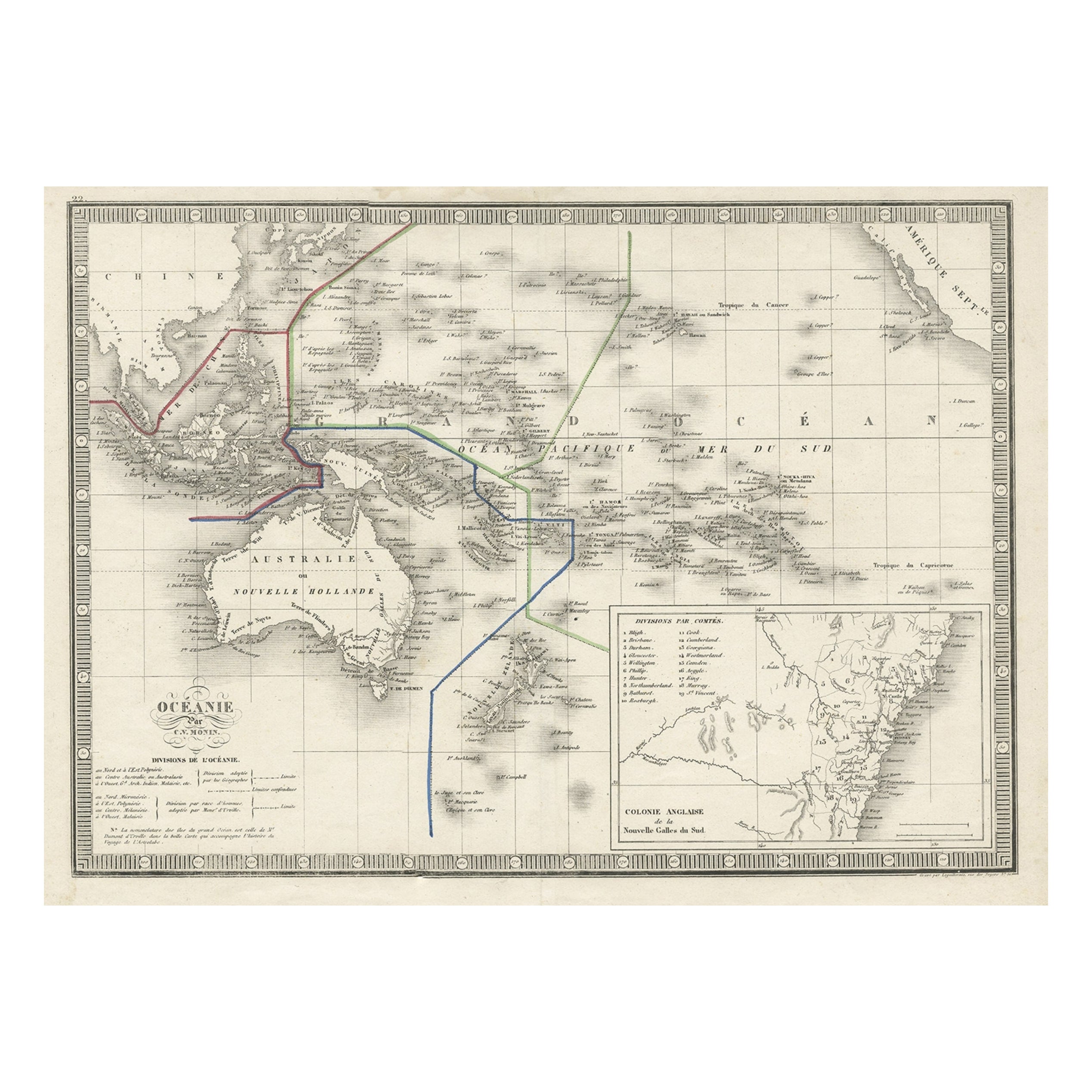
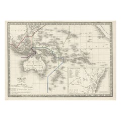
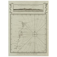
- French Antique Map of Oceania with Details of the Australian Colonies, c.1840Located in Langweer, NLAntique map Oceania titled 'Océanie par C.V. Monin'. Old map of Oceania with an inset of New South Wales. Originates from 'Atlas Classique de la Géographie Ancienne (..)'. Artists ...Category
Antique 19th Century Maps
MaterialsPaper
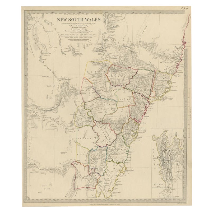
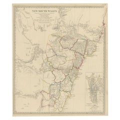
- Antique Map of New South Wales with an Inset of Sydney, Australia, 1833Located in Langweer, NLAntique map of Australia titled 'New South Wales'. Old map of New South Wales, Australia. With an inset map of Sydney. Arists and Engravers: Engraved by J. & C. Walker. Published by ...Category
Antique 19th Century Maps
MaterialsPaper
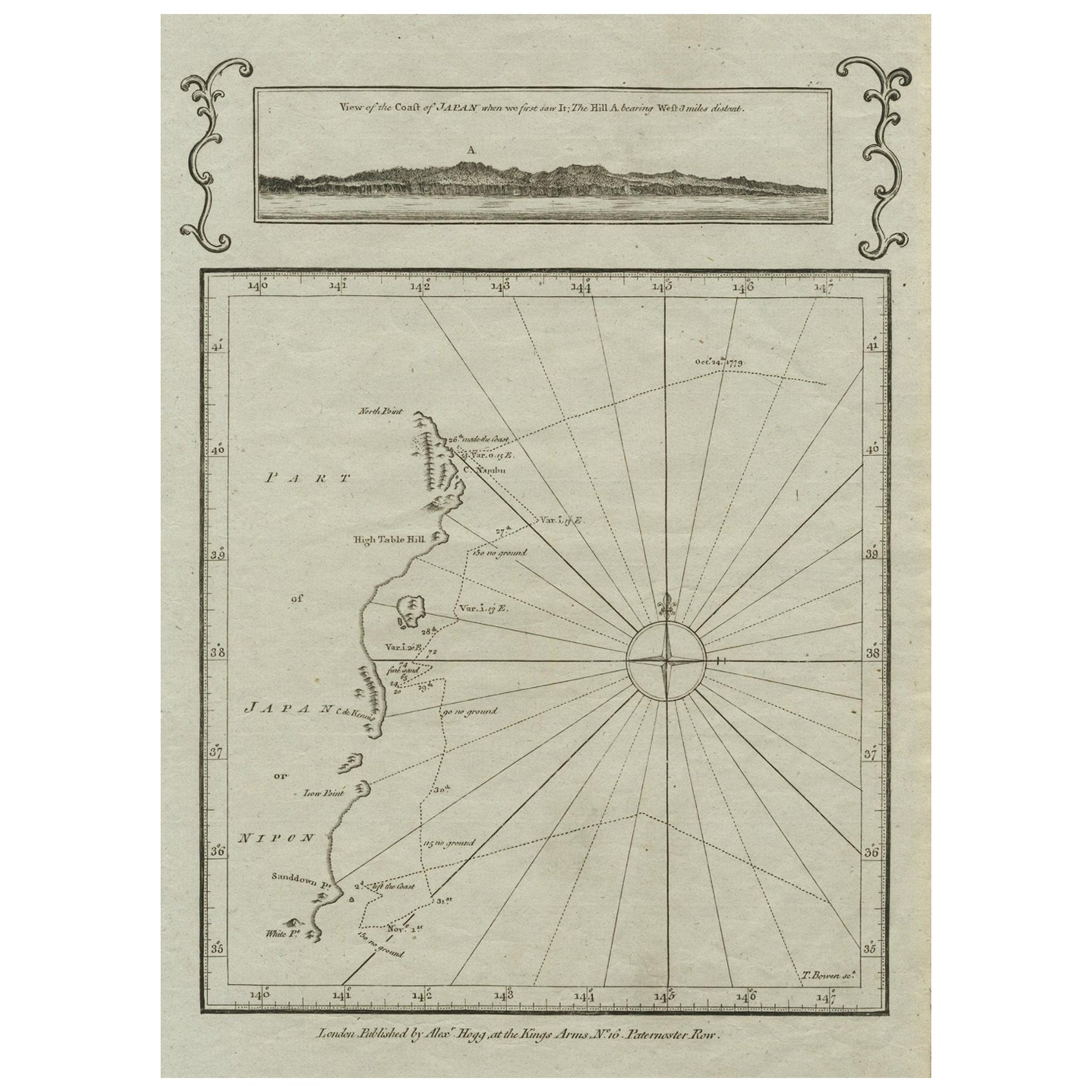
- Old Map of the East Coast of Honshu with an Inset, Japan, c.1785Located in Langweer, NLAntique map titled ‘Part of Japan or Nippon'. View of the Coast of Japan when we first saw it: The Hill a bearing West 3 miles distant. London Published by Allexer Hogg at the Kings Arms...Category
Antique 1780s Maps
MaterialsPaper
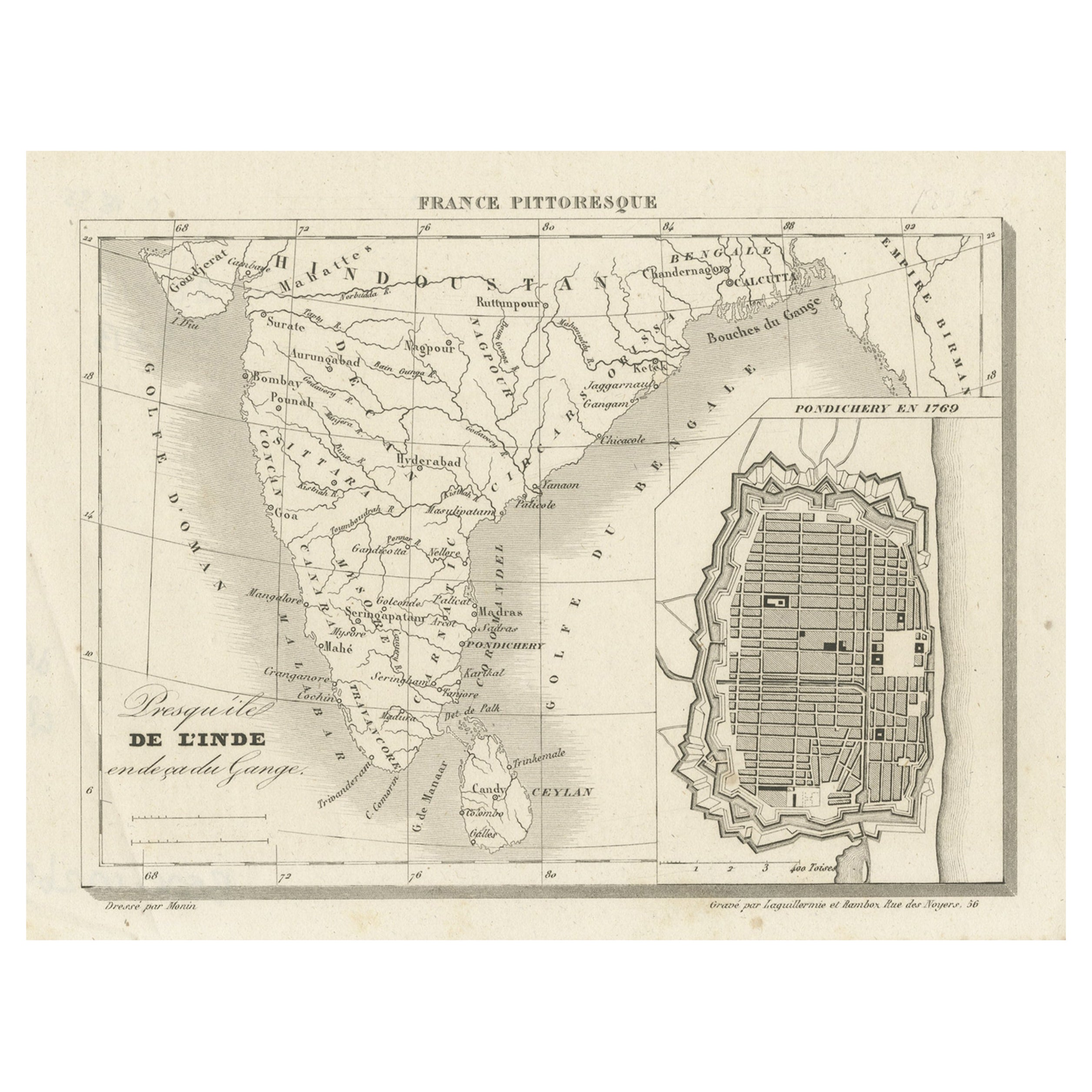
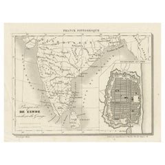
- French Antique Map of India with an Inset of Pondicherry, 1835Located in Langweer, NLAntique map India titled 'Presqu'ile de l'Inde en de ca du Gange'. Miniature map depicting India with an inset map of Pondicherry (Puducherry). This ...Category
Antique 19th Century Maps
MaterialsPaper
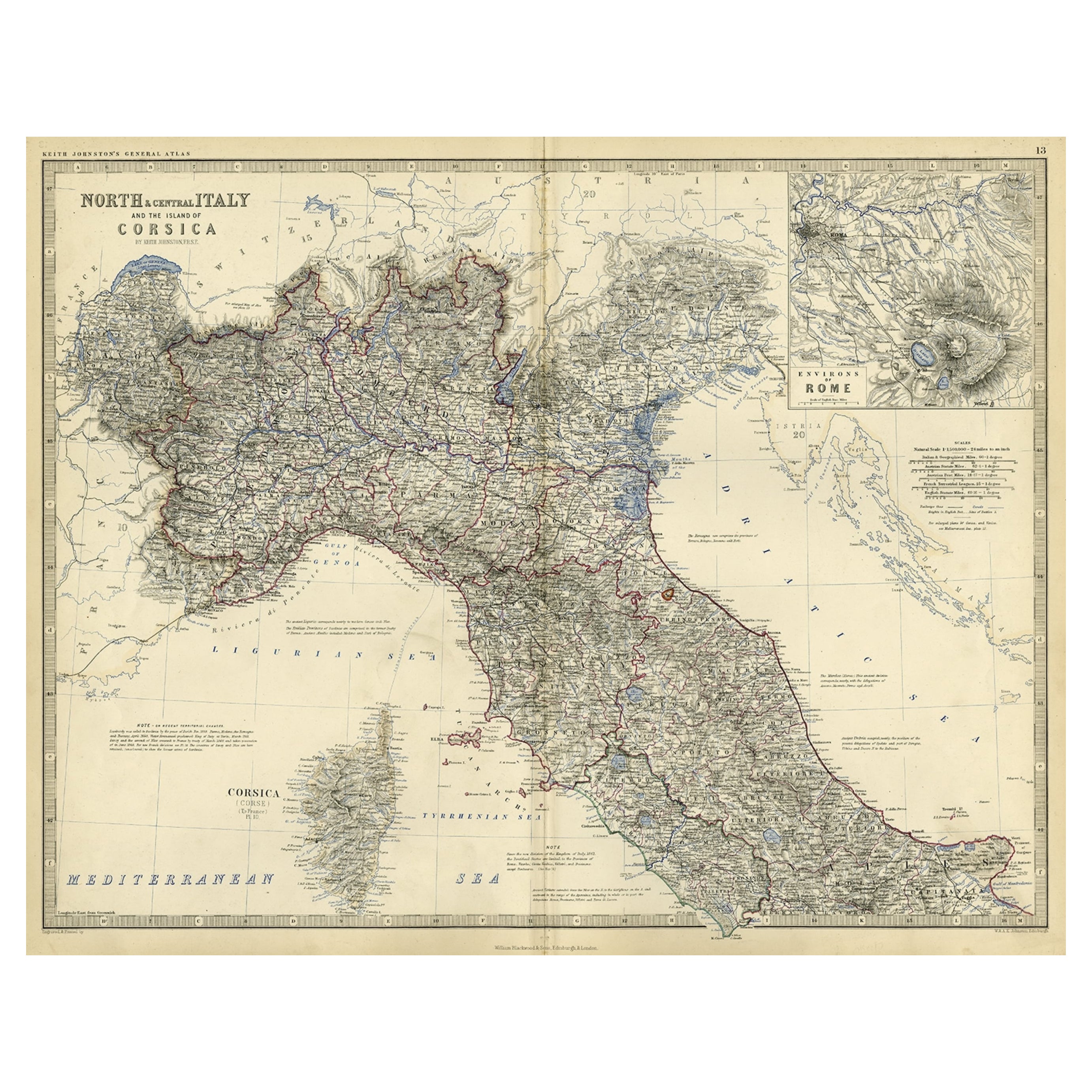
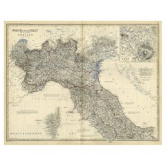
- Old Coloure Map of North & Central Italy & Corsica with an Inset of Rome, c.1860Located in Langweer, NLAntique map titled 'North & Central Italy and the Island of Corsica'. Old map of North and Central Italy, and the island of Corsica. With an inset map of the region of Rome. Orig...Category
Antique 1860s Maps
MaterialsPaper
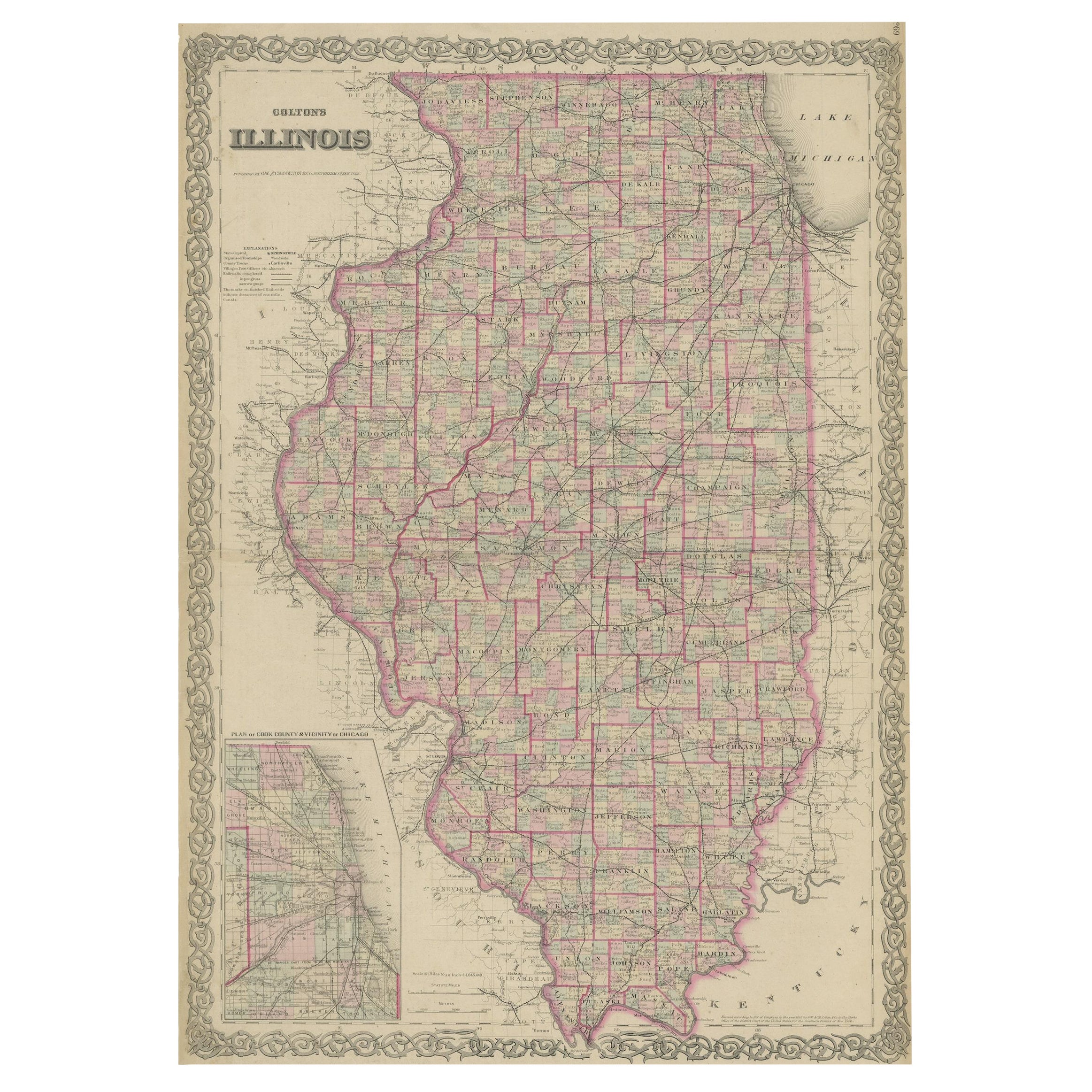
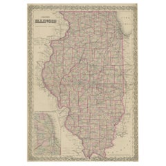
- Colton's Map of Illinois, with an Inset of ChicagoLocated in Langweer, NLAntique map titled 'Colton's Illinois'. Antique map of Illinois, a state in the Midwestern United States. With an inset map of of Cook County &...Category
Antique Mid-19th Century Maps
MaterialsPaper
You May Also Like
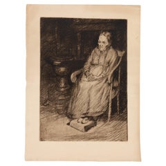
- Jean Donnay (1897-1993) Belgian Engraving of an Old Seated WomanLocated in Nottingham, GBIn good condition From a private collection Free international shipping Jean Donnay (1897-1993) Belgian Engraving of an Old Seated WomanCategory
20th Century Prints
MaterialsPaper
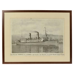
- 1930s Antique Nautical Print Depicting Oceania ship by Adolfo Barabino GenovaLocated in Milan, ITLithograph on paper published by S.A.I.G, Adolfo Barabino Genova depicting the Oceania steamer. Title of the lithograph “America and Oceania Steamboats of the La Veloce Company, Auxi...Category
Vintage 1930s Italian Nautical Objects
MaterialsWood, Paper
- Old Nautical Map of CorsicaLocated in Alessandria, PiemonteST/556/1 - Old map of Corsica isle, surveyed by Captain Hell, of the French Royal Navy in 1824, engraved and published on 1874, with additions and corre...Category
Antique Early 19th Century English Other Prints
MaterialsPaper
- Old Horizontal Map of EnglandBy TassoLocated in Alessandria, PiemonteST/520 - Old rare Italian map of England, dated 1826-1827 - by Girolamo Tasso, editor in Venise, for the atlas of M.r Le-Sage.Category
Antique Early 19th Century Italian Other Prints
MaterialsPaper
- Old Nautical Print Depicting the Bombardment of Cadiz by the French Navy 1823Located in Milan, ITPrint by engraving on copper plate of the first half of the 19th century, depicting the bombardment of Cadiz by the French Navy, 23 September 1823. The print is signed peint par Crep...Category
Antique 1830s French Nautical Objects
MaterialsPaper
- 19th Century French Émile Deyrolle Anatomical Lithograph PosterLocated in London, GBÉmile Deyrolle Anatomical poster A wonderfully rare and decorative curio medical French (Paris) original lithograph on board anatomical poster in ...Category
Antique 1880s French Early Victorian Scientific Instruments
MaterialsPaper


Recently Viewed
View AllMore Ways To Browse
Antique Victoria
Old French Plates
Victoria Antique Furniture
Australian Designer Furniture
Used Victoria Antiques
Old Antique Scale
Old Antique Scales
French Old Paris Plates
Antique Furniture In Australia
Used Victoria Antique Furniture
19th Century Australian Furniture
Victoria Plates
Antique Paris Map Print
Antique Australia Map
Antique Australian Map
Antique Australian Maps
Antique Maps Australia
Antique Maps Of Australia