Items Similar to Old Map of Prussia, Embellished with a Large Cartouche and Compass Rose, ca.1680

Want more images or videos?
Request additional images or videos from the seller
1 of 5
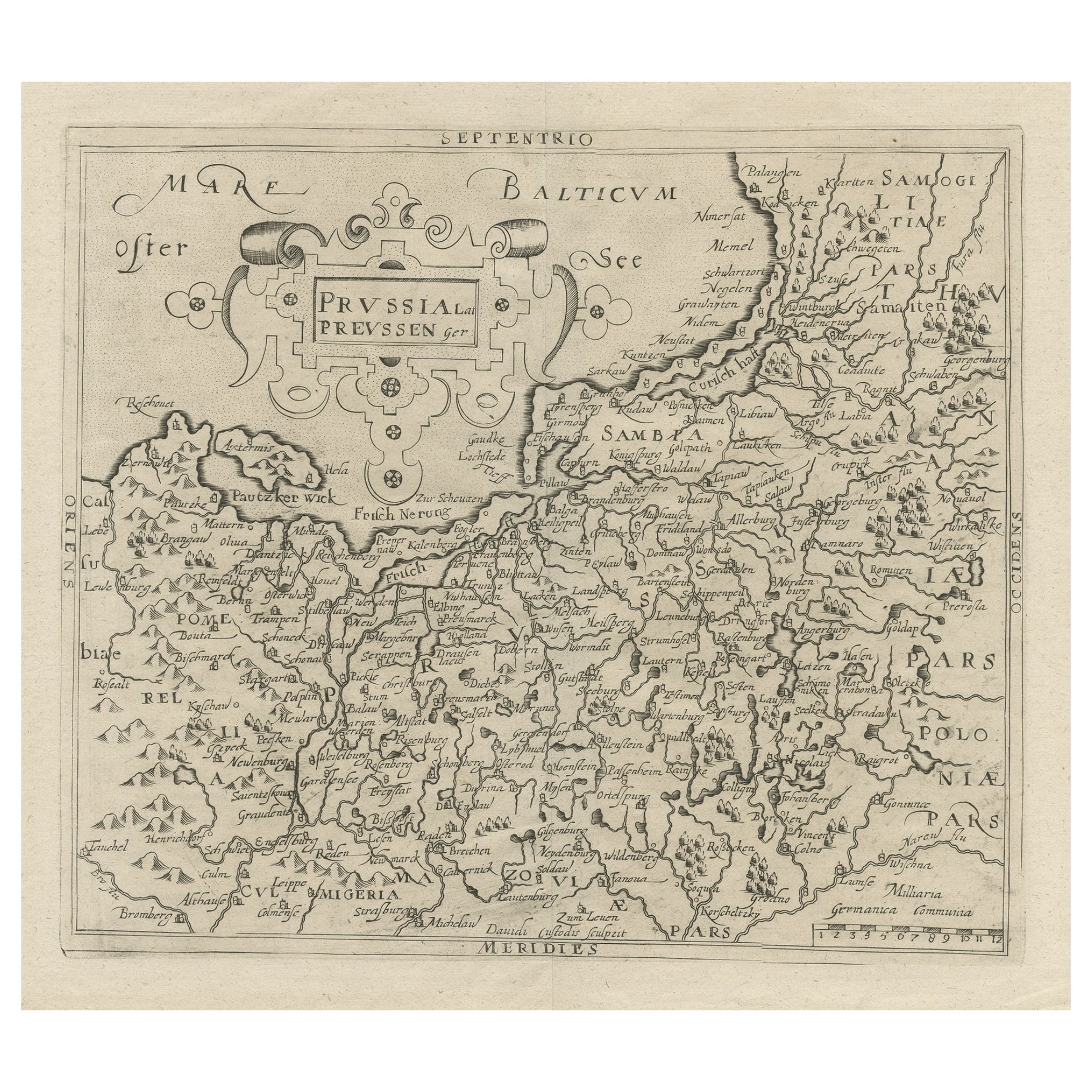
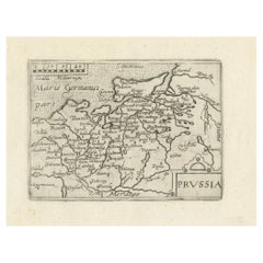
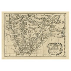
Old Map of Prussia, Embellished with a Large Cartouche and Compass Rose, ca.1680
About the Item
Antique map titled 'Prussiae nova Tabula'.
Later edition of Blaeu's map of Prussia, embellished with a large cartouche and compass rose. Prussia was a historically prominent German state that originated in 1525 with a duchy centered on the region of Prussia on the southeast coast of the Baltic Sea.
Artists and Engravers: Joan Blaeu (23 September 1596 - 28 May 1673) was a Dutch cartographer. He was born in Alkmaar, the son of cartographer Willem Blaeu. In 1620 he became a doctor of law but he joined the work of his father. In 1635 they published the Atlas Novus (full title: Theatrum orbis terrarum, sive, Atlas novus) in two volumes. Joan and his brother Cornelius took over the studio after their father died in 1638. Joan became the official cartographer of the Dutch East India Company. Around 1649 Joan Blaeu published a collection of Dutch city maps named Tooneel der Steeden (Views of Cities). In 1651 he was voted into the Amsterdam council. In 1654 Joan published the first atlas of Scotland, devised by Timothy Pont. In 1662 he reissued the atlas with 11 volumes, and one for oceans. It was also known as Atlas Maior. A cosmology was planned as their next project, but a fire destroyed the studio completely in 1672. Joan Blaeu died in Amsterdam the following year.
- Dimensions:Height: 17.13 in (43.5 cm)Width: 21.86 in (55.5 cm)Depth: 0 in (0.02 mm)
- Materials and Techniques:
- Period:1680-1689
- Date of Manufacture:circa 1680
- Condition:Repaired: Some marginal closed tears and repairs to verso, margins professionally repaired but not affecting printed image, backed with archival tissue. Condition: Fair, age-related toning. Some marginal closed tears and repairs to verso, margins professionally repaired but not affecting printed image, backed with archival tissue. Blank verso, please study image carefully.
- Seller Location:Langweer, NL
- Reference Number:
About the Seller
5.0
Platinum Seller
These expertly vetted sellers are 1stDibs' most experienced sellers and are rated highest by our customers.
Established in 2009
1stDibs seller since 2017
1,976 sales on 1stDibs
Typical response time: <1 hour
- ShippingRetrieving quote...Ships From: Langweer, Netherlands
- Return PolicyA return for this item may be initiated within 14 days of delivery.
More From This SellerView All
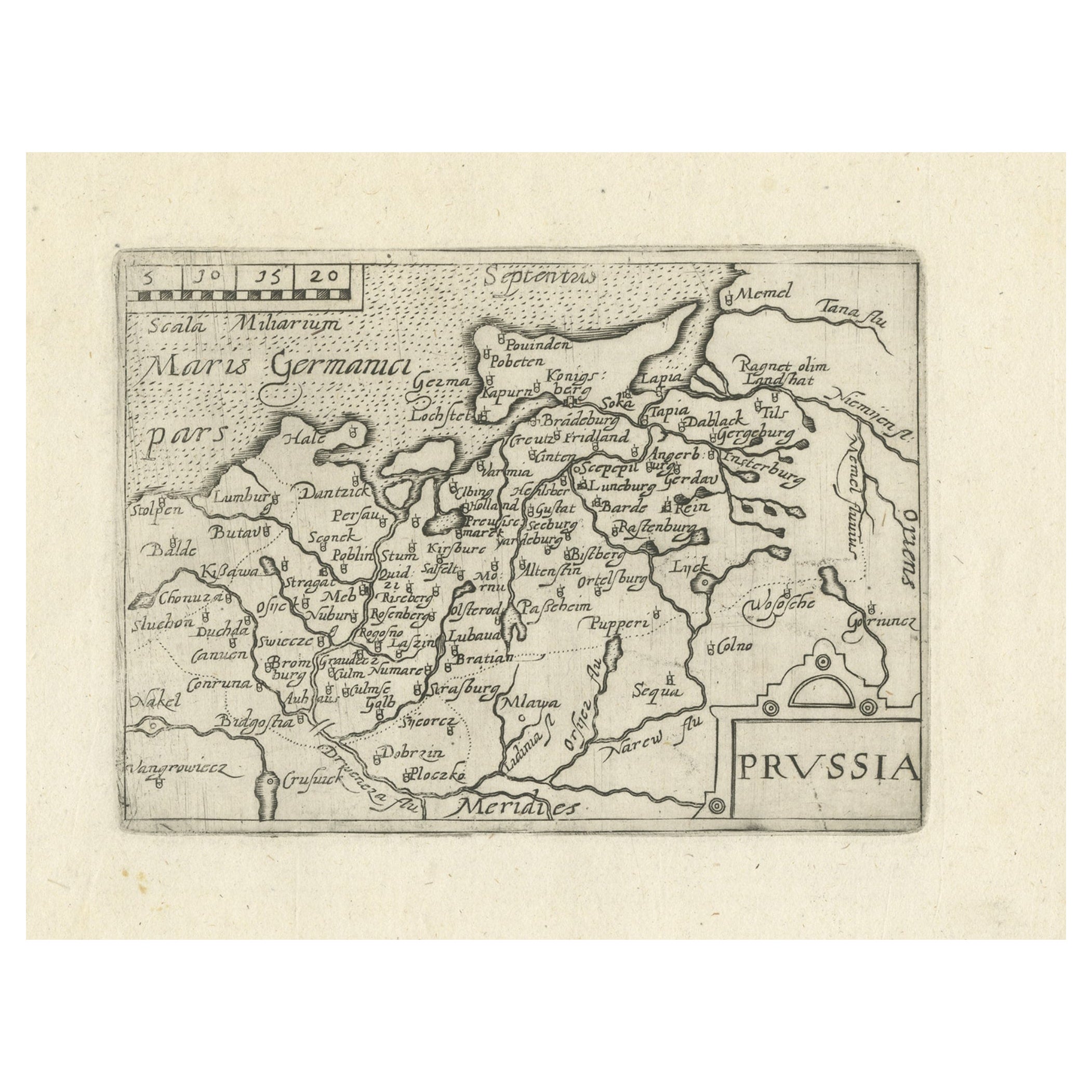
- Original Antique Map of Prussia, ca.1630Located in Langweer, NLAntique map titled 'Prussia - Preussen'. Original map of Prussia, a historically prominent German state that originated in 1525 with a duchy centered on...Category
Antique 1630s Maps
MaterialsPaper
- Extremele Rare, Original Miniature Map of Prussia, ca.1640Located in Langweer, NLAntique map titled 'Prussia'. Extremele rare, original miniature map of Prussia, a historically prominent German state that originated in 1525 with a du...Category
Antique 1640s Maps
MaterialsPaper
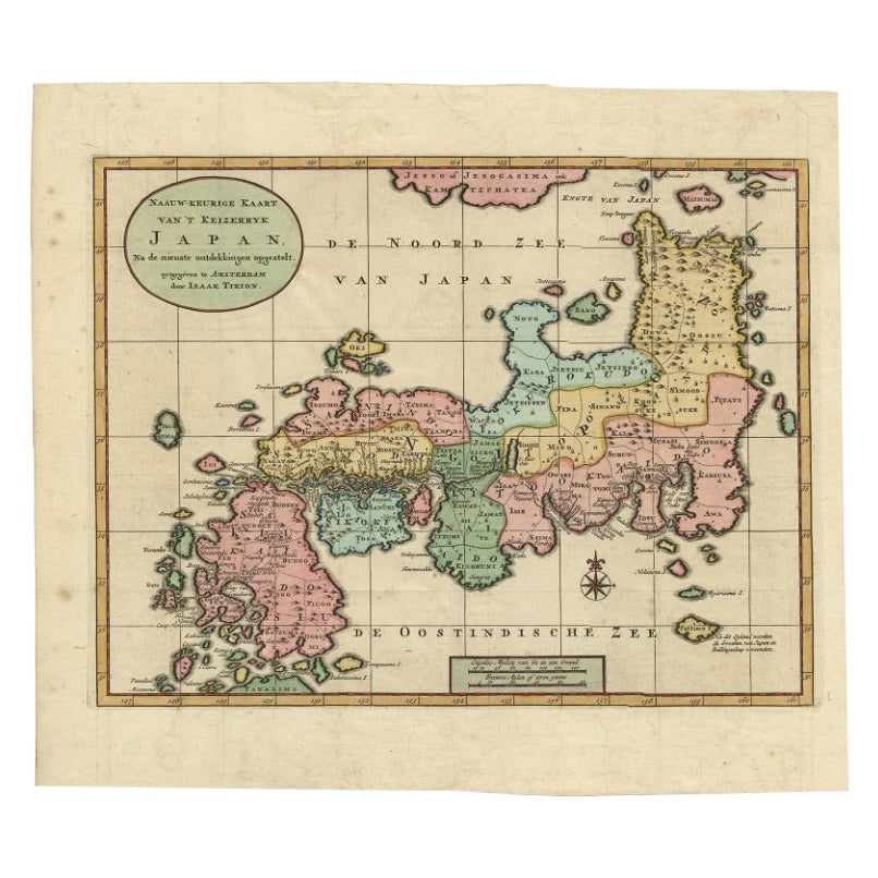
- Antique Map of Japan with Scale and Compass Rose, c.1730Located in Langweer, NLAntique map titled 'Naauwkeurige Kaart van 'T Keizerryk Japan (..).' Attractive detailed map of Japan. With scale and compass rose. This map originates from 'Hedendaegsche historie...Category
Antique 18th Century Maps
MaterialsPaper
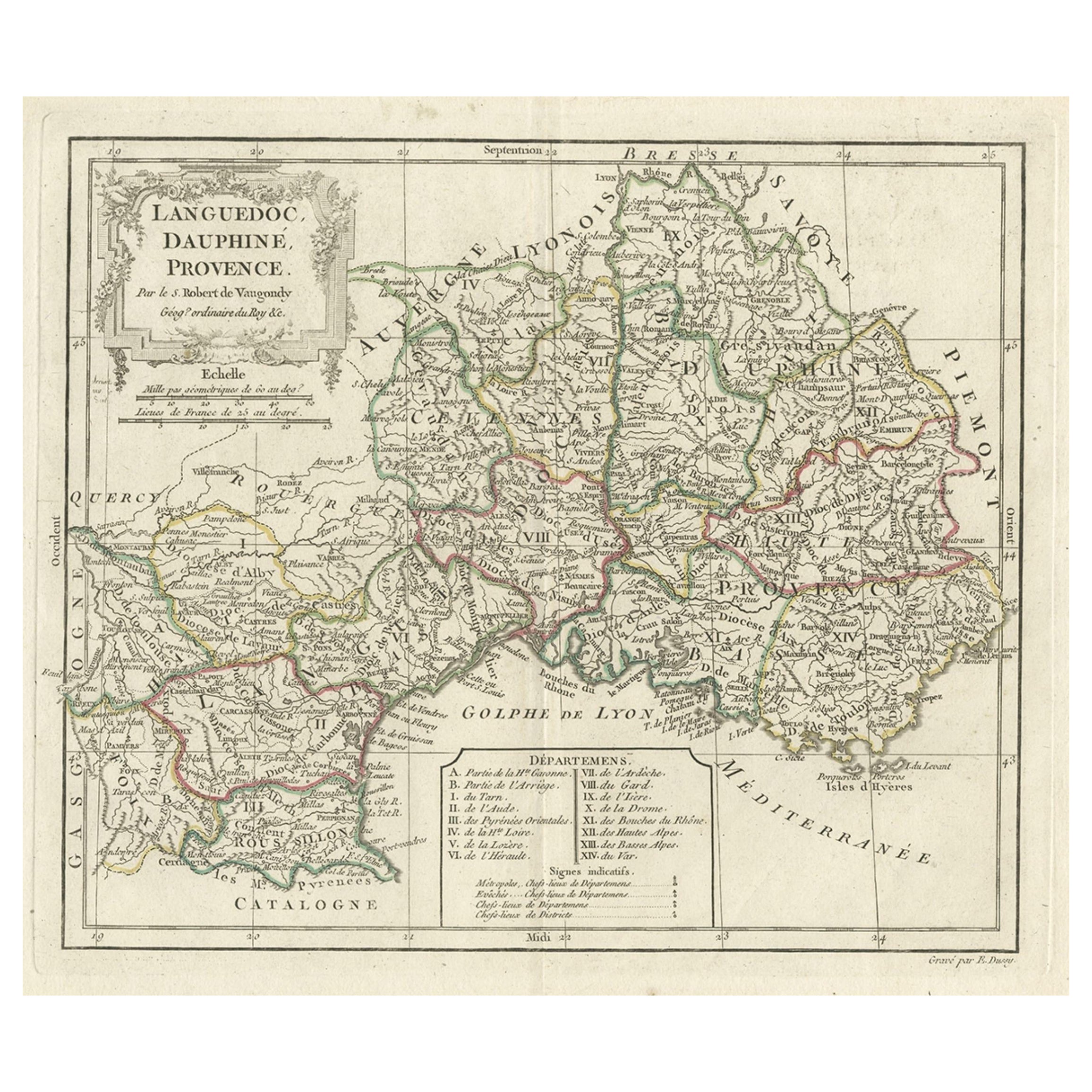
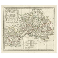
- Beautiful Antique Map of Southeastern France with Decorative Cartouche, ca.1790Located in Langweer, NLAntique map titled 'Languedoc, Dauphiné, Province'. Beautiful antique map of Southeastern France with decorative cartouche. Map includes topographical detail as well as a referen...Category
Antique 1790s Maps
MaterialsPaper
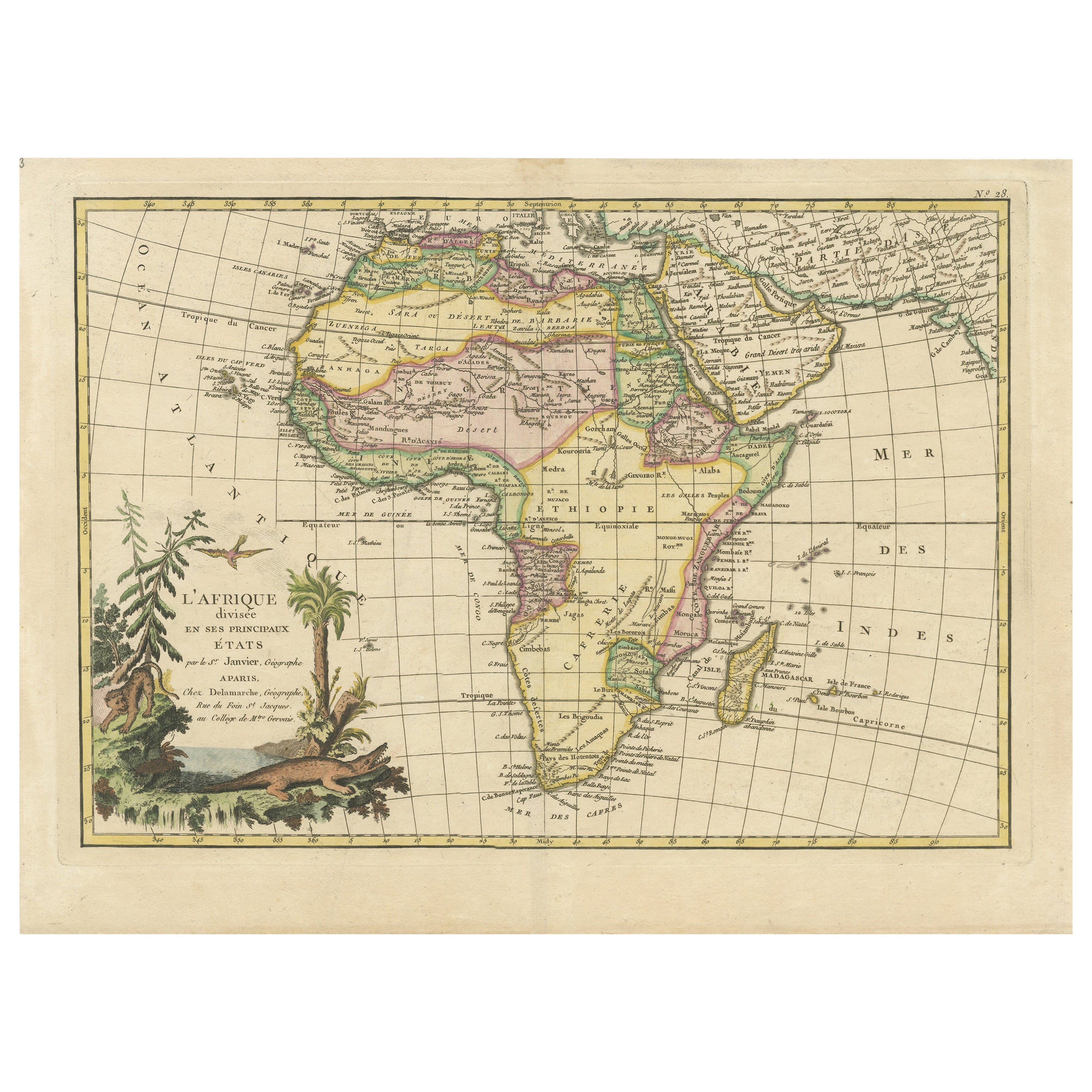
- Original Antique Map of Africa with large decorative cartoucheLocated in Langweer, NLOriginal antique map titled 'L'Afrique divisée en ses principaux États'. Attractive and precise map of Africa, with large decorative cartouche. Engraved by Janvier. Published by Dela...Category
Antique Late 18th Century Maps
MaterialsPaper
- Original Copperplate Engraved Detailed Map of South Africa, ca.1680Located in Langweer, NLAntique map titled 'Pays et Coste des Caffres Empires de Monomotapa (..)'. Detailed map of South Africa. Engraved by Antoine d'Winter for a Dutch edition of Sanson's pocket atlas...Category
Antique 1680s Maps
MaterialsPaper


You May Also Like
- Old Nautical Map of CorsicaLocated in Alessandria, PiemonteST/556/1 - Old map of Corsica isle, surveyed by Captain Hell, of the French Royal Navy in 1824, engraved and published on 1874, with additions and corre...Category
Antique Early 19th Century English Other Prints
MaterialsPaper
- Old Horizontal Map of EnglandBy TassoLocated in Alessandria, PiemonteST/520 - Old rare Italian map of England, dated 1826-1827 - by Girolamo Tasso, editor in Venise, for the atlas of M.r Le-Sage.Category
Antique Early 19th Century Italian Other Prints
MaterialsPaper
- Prussia, Poland, N. Germany, Etc: A Hand-colored 17th Century Map by JanssoniusBy Johannes JanssoniusLocated in Alamo, CAThis is an attractive hand-colored copperplate engraved 17th century map of Prussia entitled "Prussia Accurate Descripta a Gasparo Henneberg Erlichensi", published in Amsterdam by Joannes Janssonius in 1664. This very detailed map from the golden age of Dutch cartography includes present-day Poland, Latvia, Lithuania, Estonia and portions of Germany. This highly detailed map is embellished by three ornate pink, red, mint green and gold...Category
Antique Mid-17th Century Dutch Maps
MaterialsPaper
- Large Antique 1859 Map of North AmericaLocated in Sag Harbor, NYThis Map was made by Augustus Mitchell in 1859 It is in amazing condition for being 163 years old. This price is for the rolled up easy to ship version of this piece. I will be Frami...Category
Antique Mid-19th Century American Maps
MaterialsCanvas, Paper

- Antique Map of Principality of MonacoBy Antonio Vallardi EditoreLocated in Alessandria, PiemonteST/619 - "Old Geographical Atlas of Italy - Topographic map of ex-Principality of Monaco" - ediz Vallardi - Milano - A somewhat special edition ---Category
Antique Late 19th Century Italian Other Prints
MaterialsPaper
- Map of the Republic of GenoaLocated in New York, NYFramed antique hand-coloured map of the Republic of Genoa including the duchies of Mantua, Modena, and Parma. Europe, late 18th century. Dimension: 25...Category
Antique Late 18th Century European Maps


