Items Similar to Original Antique Map of Leicestershire, England

Want more images or videos?
Request additional images or videos from the seller
1 of 6
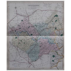
Original Antique Map of Leicestershire, England
About the Item
Antique map titled 'A Mapp of the Country of Leicester'. Original old map of Leicestershire, England. This map originates from 'Britannia: or, a Geographical Description of the Kingdoms of England, Scotland, and Ireland with the Isles and Territories thereto belonging' by Richard Blome. Published 1673.
- Dimensions:Height: 10.79 in (27.4 cm)Width: 13.39 in (34 cm)Depth: 0.02 in (0.5 mm)
- Materials and Techniques:
- Period:Late 17th Century
- Date of Manufacture:1673
- Condition:General age-related toning. Original folding line. Minor wear and soiling, blank verso. Two pieces of tape on verso. Please study image carefully.
- Seller Location:Langweer, NL
- Reference Number:
About the Seller
5.0
Platinum Seller
These expertly vetted sellers are 1stDibs' most experienced sellers and are rated highest by our customers.
Established in 2009
1stDibs seller since 2017
1,960 sales on 1stDibs
Typical response time: <1 hour
- ShippingRetrieving quote...Ships From: Langweer, Netherlands
- Return PolicyA return for this item may be initiated within 14 days of delivery.
More From This SellerView All
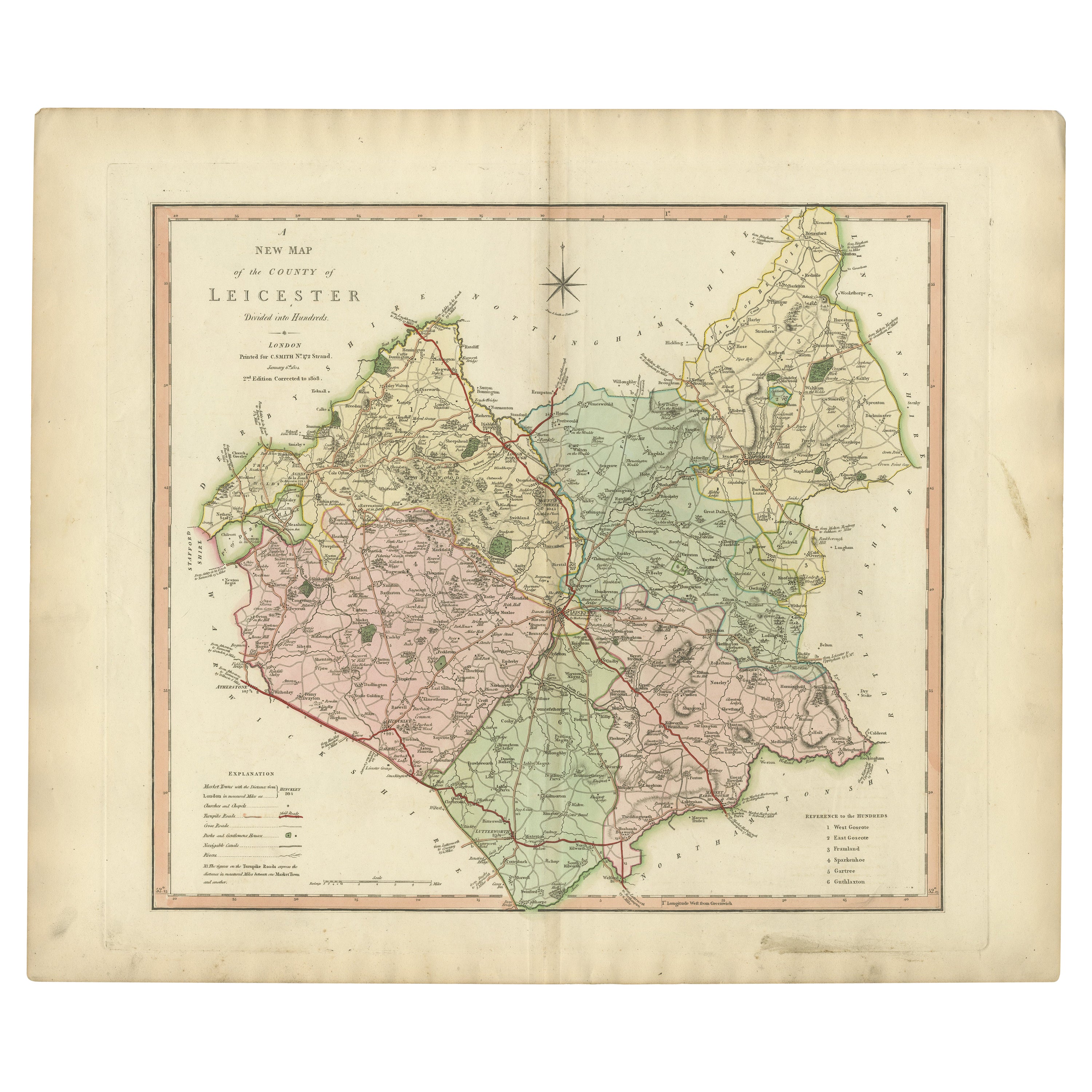
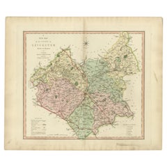
- Antique County Map of Leicestershire, England, 1804Located in Langweer, NLAntique county map of Leicestershire first published c.1800. Villages, towns, and cities illustrated include Lutterworth, Ashby, Hinkley, and Marke...Category
Antique Early 1800s Maps
MaterialsPaper
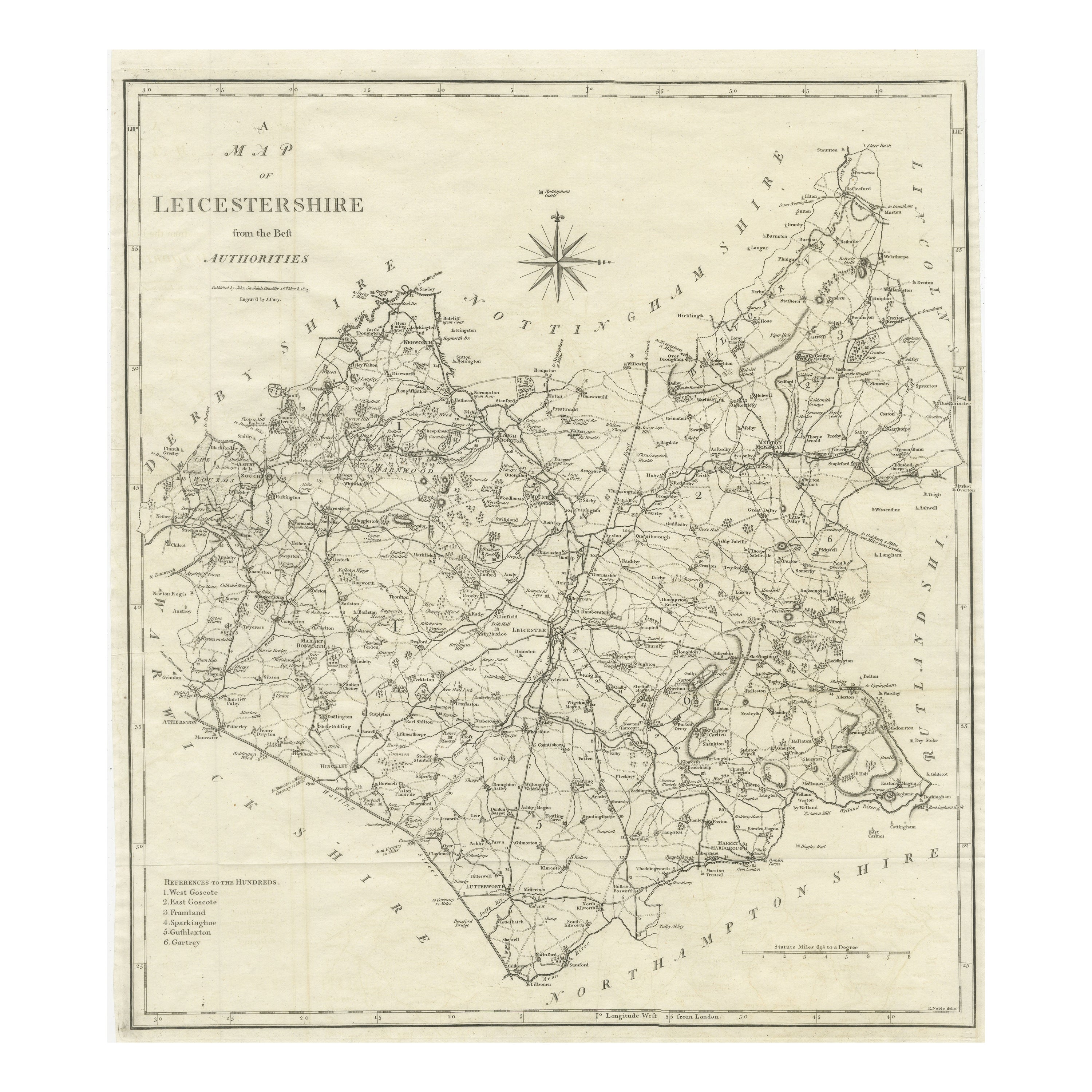
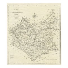
- Large Antique County Map of Leicestershire, England, 1805Located in Langweer, NLExplore Leicestershire's Past: Antique Map by John Cary Step into the history of Leicestershire, England, with this original old county map engraved by the renowned cartographer Joh...Category
Antique Early 19th Century Maps
MaterialsPaper
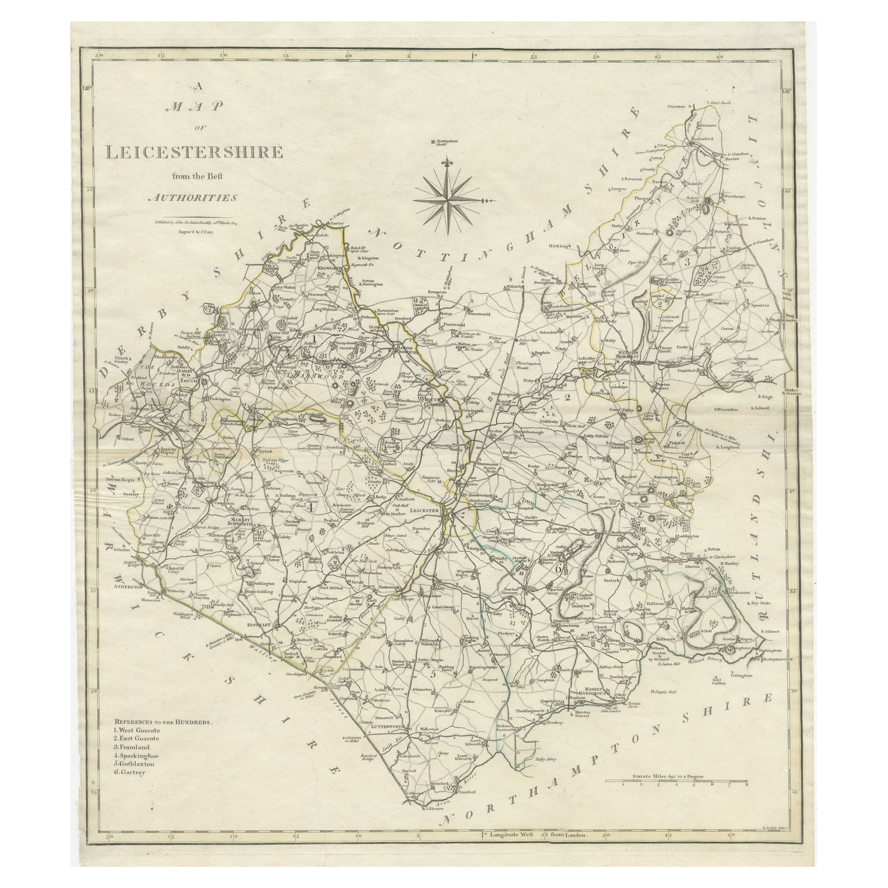
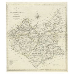
- Large Antique County Map of Leicestershire, England, with Outline ColoringLocated in Langweer, NLAntique map titled 'A Map of Leicestershire from the best Authorities'. Original old county map of Leicestershire, England. Engraved by John Cary. Originates from 'New British Atlas'...Category
Antique Early 19th Century Maps
MaterialsPaper
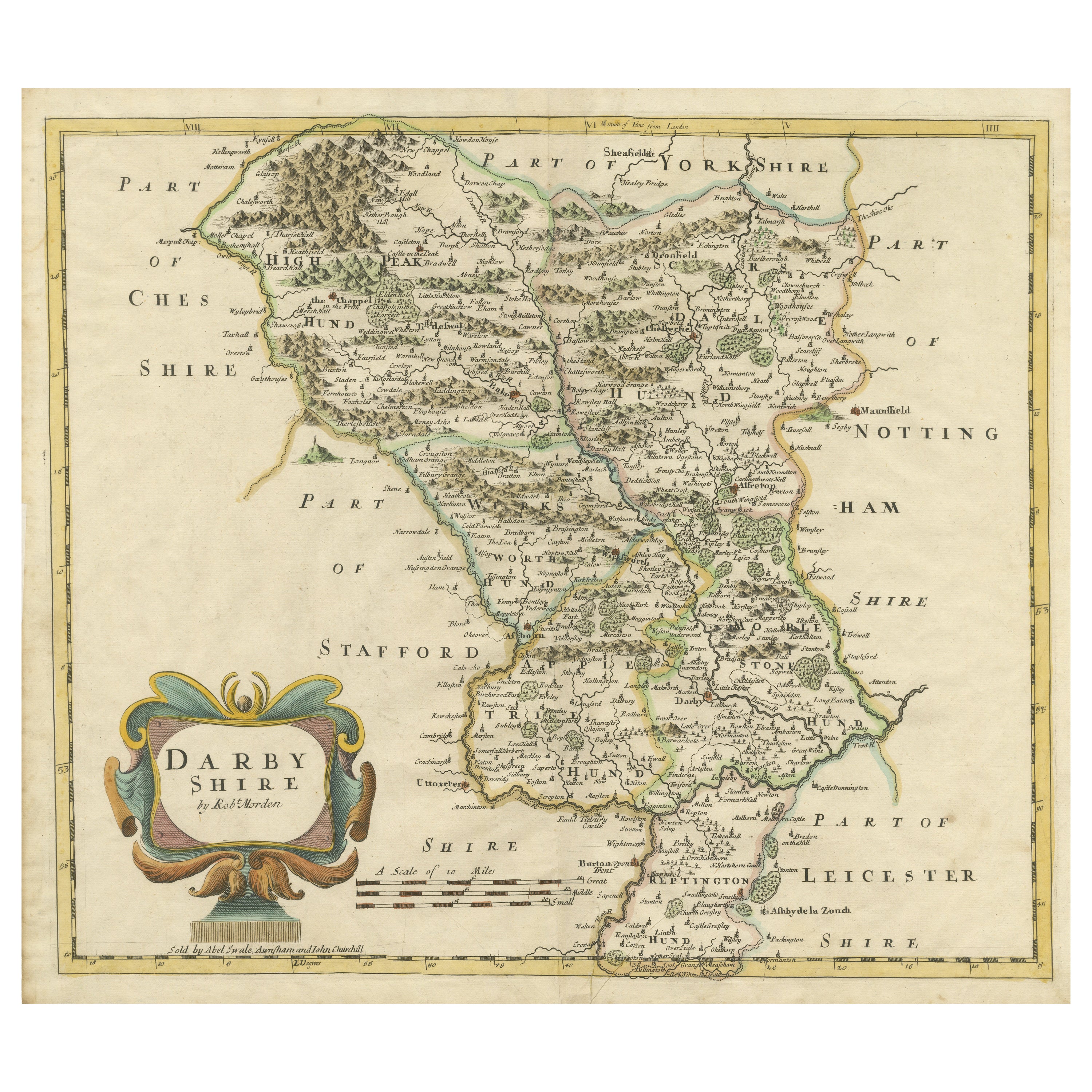
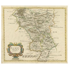
- Original Antique County Map of Derbyshire, EnglandLocated in Langweer, NLAntique map titled 'Darbyshire'. Original antique map of the country of Derbyshire, England. Engraved by Robert Morden. Sold by Abel Swale, Awnsham and John Churchill...Category
Antique Late 17th Century Maps
MaterialsPaper
- Original Antique Map of England and WalesLocated in Langweer, NLAntique map titled 'A New and Correct Map of England and Wales from the Latest and Best Improvements'. Original antique map of England and Wales. Printed by Alex Hogg, London for George Henry Millar's 'New, Complete and Universal System...Category
Antique Late 18th Century Maps
MaterialsPaper
- Original Antique Map of England with Hand ColoringLocated in Langweer, NLAntique map titled 'Engand'. Original old map of England. Engraved by W. Milton. Published by John Mc. Gowan, circa 1829.Category
Antique Mid-19th Century Maps
MaterialsPaper


You May Also Like
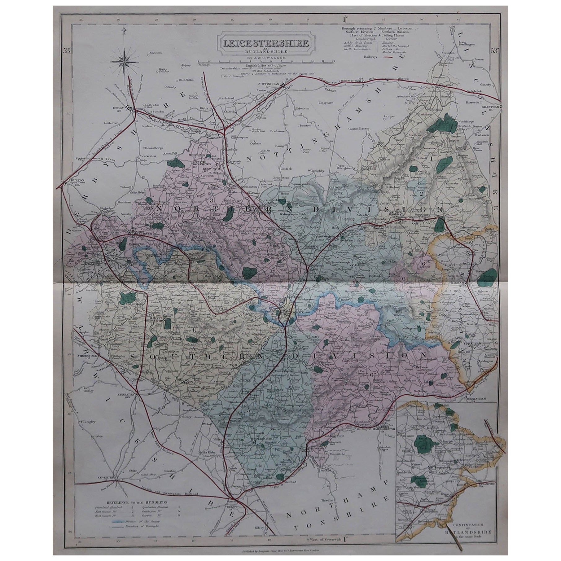
- Original Antique English County Map, Leicestershire, J & C Walker, 1851Located in St Annes, LancashireGreat map of Leicestershire Original colour By J & C Walker Published by Longman, Rees, Orme, Brown & Co. 1851 Unframed.Category
Antique 1850s English Other Maps
MaterialsPaper
- Old Horizontal Map of EnglandBy TassoLocated in Alessandria, PiemonteST/520 - Old rare Italian map of England, dated 1826-1827 - by Girolamo Tasso, editor in Venise, for the atlas of M.r Le-Sage.Category
Antique Early 19th Century Italian Other Prints
MaterialsPaper
- Original Antique Map of Asia. C.1780Located in St Annes, LancashireGreat map of Asia Copper-plate engraving Published C.1780 Two small worm holes to right side of map Unframed.Category
Antique Early 1800s English Georgian Maps
MaterialsPaper

- Original Antique Map of Italy. C.1780Located in St Annes, LancashireGreat map of Italy Copper-plate engraving Published C.1780 Unframed.Category
Antique Early 1800s English Georgian Maps
MaterialsPaper

- Original Antique Map of India. C.1780Located in St Annes, LancashireGreat map of India Copper-plate engraving Published C.1780 Three small worm holes to right side of map and one bottom left corner Unframed.Category
Antique Early 1800s English Georgian Maps
MaterialsPaper

- Original Antique Map of Canada, Arrowsmith, 1820Located in St Annes, LancashireGreat map of Canada. Drawn under the direction of Arrowsmith. Copper-plate engraving. Published by Longman, Hurst, Rees, Orme and Brown, 1820 ...Category
Antique 1820s English Maps
MaterialsPaper


Recently Viewed
View AllMore Ways To Browse
Old England
Antique Irish Country Furniture
Used Furniture Leicester
Irish 17th Century
Antique Furniture Leicester
Oceanic Wood Carving
Wood Carving Ocean
Afghanistan Map
Antique Map Of Boston
Antique Map Of Turkish Empire
Antique Maps Of Ancient Greece
Antique Maps Of Boston
Antique Texas Map
Antique Texas Maps
Ipswich Antique Furniture
Sardinia Map
Antique Compass Made In France
Antique Map Of Ohio