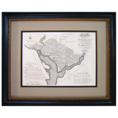
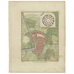
Plan for the City of Washington by Andrew Ellicott, Antique Print, 19th Century
View Similar Items


Want more images or videos?
Request additional images or videos from the seller
1 of 6
Plan for the City of Washington by Andrew Ellicott, Antique Print, 19th Century
About the Item
- Dimensions:Height: 36 in (91.44 cm)Width: 43.75 in (111.13 cm)Depth: 3 in (7.62 cm)
- Materials and Techniques:
- Place of Origin:
- Period:
- Date of Manufacture:1850-1890
- Condition:Wear consistent with age and use.
- Seller Location:Colorado Springs, CO
- Reference Number:Seller: M0571stDibs: LU90973150932
About the Seller
4.9
Platinum Seller
These expertly vetted sellers are 1stDibs' most experienced sellers and are rated highest by our customers.
Established in 2010
1stDibs seller since 2011
408 sales on 1stDibs
More From This SellerView All
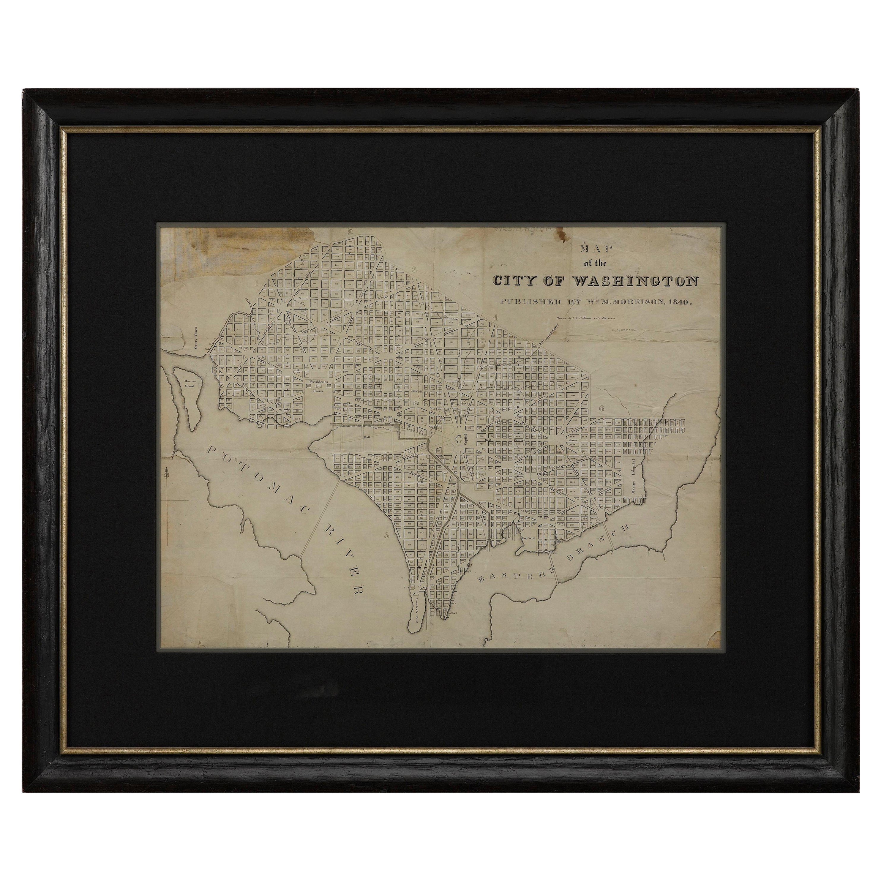
- 1840 Map of the City of Washington Published by William M. MorrisonLocated in Colorado Springs, COThis map, printed in 1840, is a detailed representation of Washington, D.C. in the mid-19th century. The map shows block numbers, wards, and government buildings as well as details o...Category
Antique 1840s American Federal Maps
MaterialsPaper
- "Lady Washington's Reception, " Engraved by A. H. Ritchie, Antique Print, 1865Located in Colorado Springs, COThis 1865, hand-colored engraving by A. H. Ritchie is entitled Lady Washington's Reception and is based on Daniel F. Huntington's original painting "Th...Category
Antique 1860s American Prints
MaterialsPaper
- N.E. View of the United States Capitol, Washington, DC Antique Proof Print 1858Located in Colorado Springs, COThis engraved print shows a view of the United States Capitol Building, in Washington, D.C. The print depicts the neoclassical building from the northeast orientation, with a bustling street scene in front. The steel engraving is a proof printing, drawn and engraved by Henry Sartain and published in 1858. Plans began in May 1854 to build a new cast-iron dome for the United States Capitol. The then-architect of the Capitol Thomas Walter and his team were sold on the aesthetics of a new dome, as well as the utility of a fire-proof one. A year later, on March 3, 1855, President Franklin Pierce...Category
Antique 1850s American Prints
MaterialsPaper
- Antique Brass Three-Draw Telescope, 19th CenturyLocated in Colorado Springs, COThis antique three-draw telescope dates to the 19th century. Solidly crafted with brass draws and a brass barrel wrapped in leather, this antique telescope is a beautiful example of ...Category
Antique 19th Century French Scientific Instruments
MaterialsBrass
- Plan of Paris, France, by A. Vuillemin, Antique Map, 1845Located in Colorado Springs, COThis large and detailed plan of Paris was published by Alexandre Vuillemin in 1845. The map conveys a wonderful amount of information and is decorated throughout with pictorial vigne...Category
Antique 1840s American Maps
MaterialsPaper
- Antique 13-Star Patriotic Sash by Louis E. Stilz & Bros., Late 19th CenturyLocated in Colorado Springs, COPresented is an original patriotic sash from the late 19th century, featuring 13 stars against a bright blue field. This sash features appliqued silver stars on a blue canton, red an...Category
Antique Late 19th Century American Historical Memorabilia
MaterialsCotton


You May Also LikeView All
- Antique Plan of the City of Bayonne, FranceLocated in Langweer, NLAntique map titled 'Plan de Bayonne'. Original old plan of the city of Bayonne, France. This map originates from 'Le Petit Atlas Maritime (..)' by J.N. Bellin. Published 1764. Be...Category
Antique Mid-18th Century Maps
MaterialsPaper
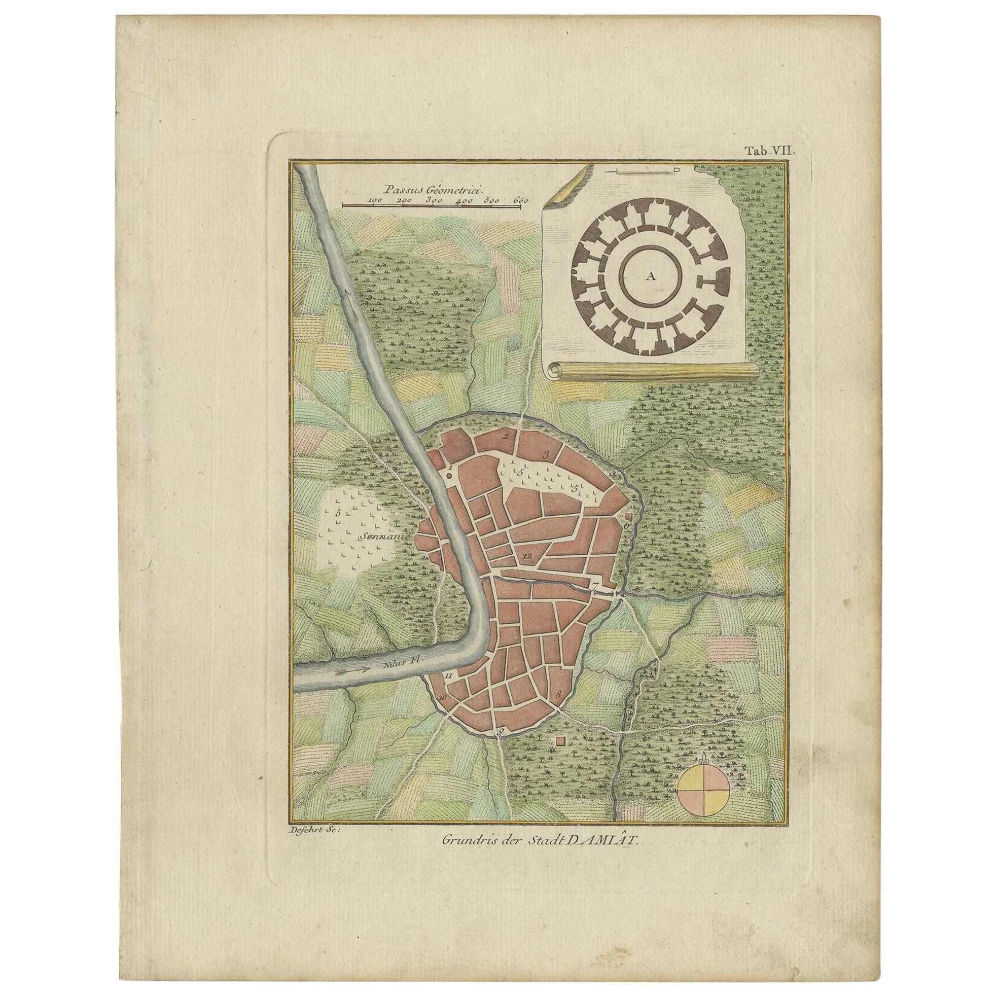
- Antique Plan of the City of Damietta Egypt by C. Niebuhr, 1774Located in Langweer, NLAntique print titled 'Grundris der Stadt Damiât'. This print originates from 'Reisebeschreibung nach Arabien und andern umliegenden Ländern' by C. Niebuhr, 1774.Category
Antique Late 18th Century Prints
MaterialsPaper
 $110 Sale Price44% Off
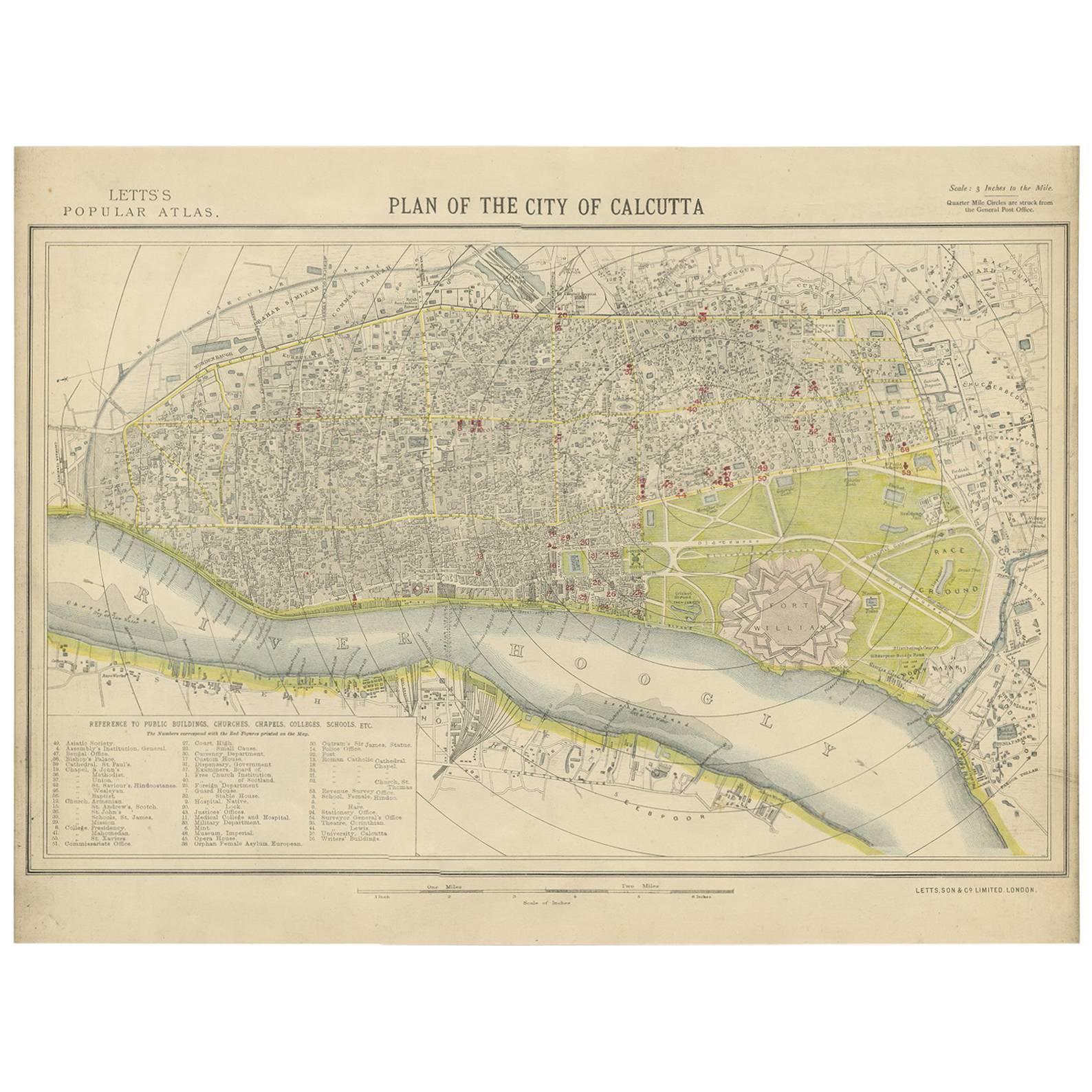
 - Antique Plan of the City of Calcutta 'India' by Letts, 1883Located in Langweer, NLBeautiful colored plan showing buildings (with key), Fort William, race ground, canals, railroads, etc. This plan originates from Letts's Popular Atlas.Category
Antique Late 19th Century Maps
MaterialsPaper
 $275 Sale Price33% Off
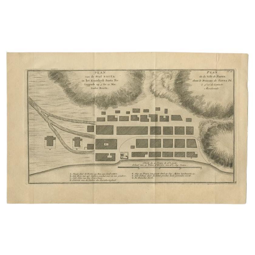
 - Antique Plan of the City of Paita in Peru, by Anson, 1749Located in Langweer, NLAntique map titled 'Plan van de Stad Paita in het Koninkryk Santa Fee (..) - Plan de la Ville de Paita (..)'. Original antique plan of the city of Paita, Peru. This map originates fr...Category
Antique 18th Century Maps
MaterialsPaper
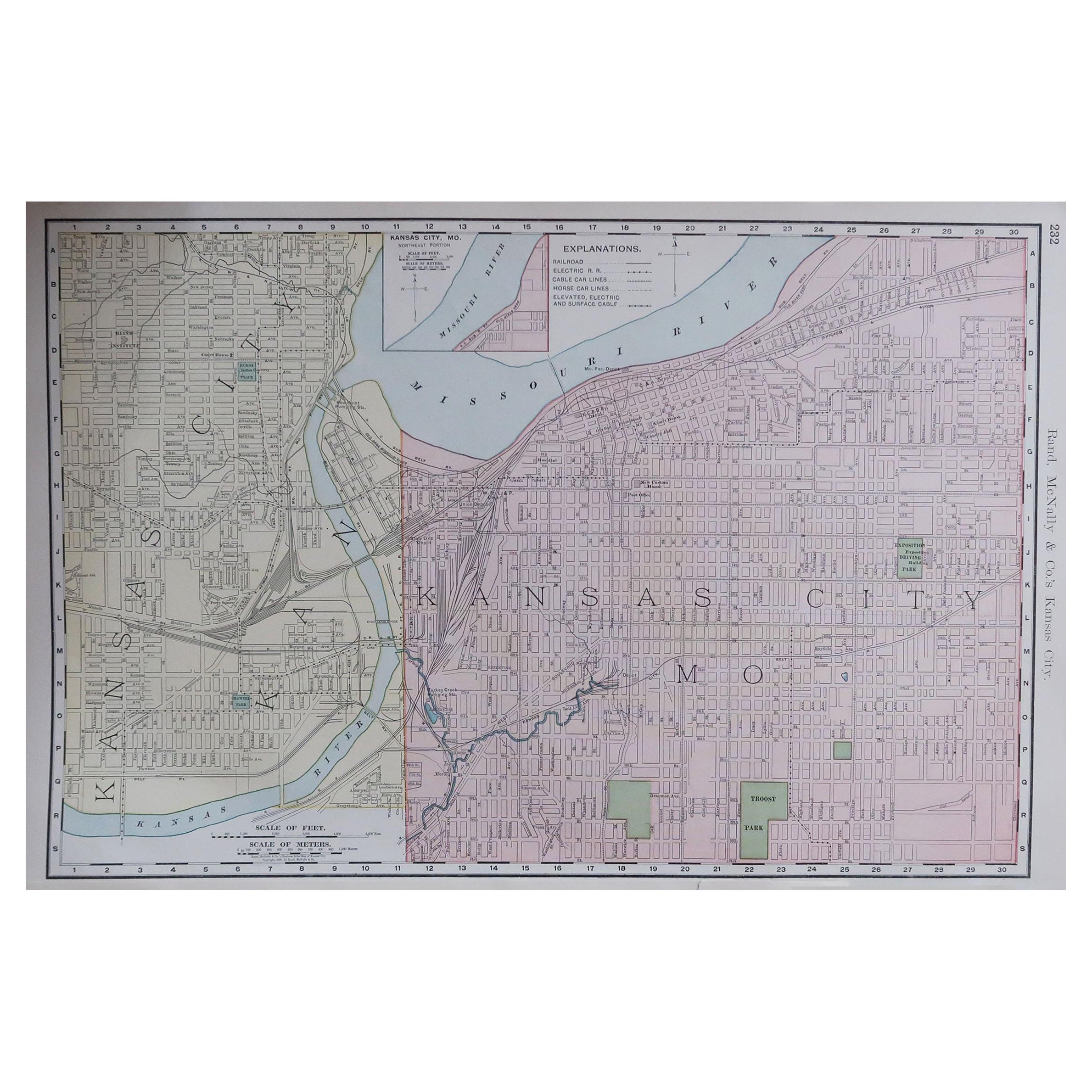
- Original Antique City Plan of Kansas City, USA. 1894By Rand McNally & Co.Located in St Annes, LancashireFabulous colorful map of Kansas City Original color By Rand, McNally & Co. Published, 1894 Unframed Slightly reduced bottom margin. Free shipping.Category
Antique 1890s American Maps
MaterialsPaper

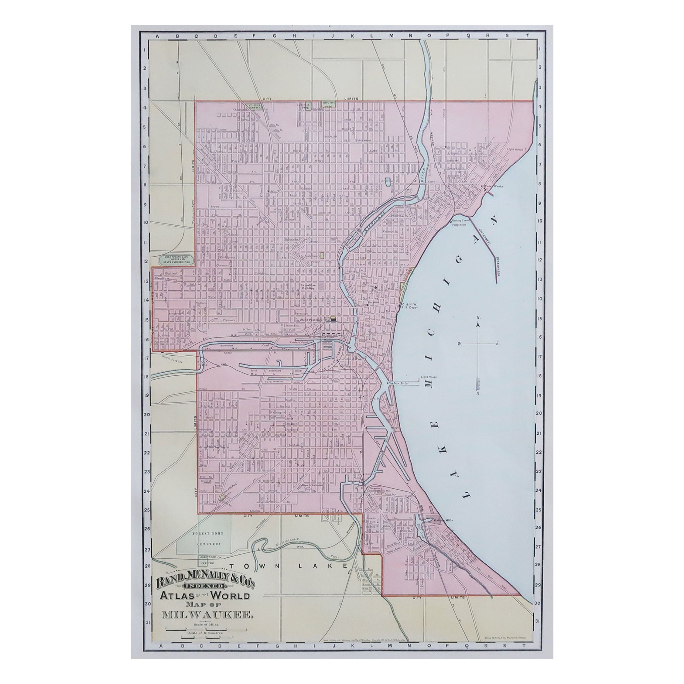
- Original Antique City Plan of Milwaukee, USA, 1894By Rand McNally & Co.Located in St Annes, LancashireFabulous colorful map of Milwaukee Original color By Rand, McNally & Co. Published, 1894 Unframed Free shipping.Category
Antique 1890s American Maps
MaterialsPaper


Recently Viewed
View AllMore Ways To Browse
Used Furniture Washington
Architect Plan
Antique Furniture Washington
United States Government
Massachusetts Antiques
Virginia 19th Century
Washington Map
Paris City Maps
James Madison
Revolutionary War Antique
Antique Federal Glass
George Washington Glass
Collectible Banks Antique
Antique Surveyor
Antique Surveyors
James River Furniture
Hamilton Engravings
Alexander Hamilton