Items Similar to Very Large Vintage Map of Canada, German, Education, Institution, Cartography
Want more images or videos?
Request additional images or videos from the seller
1 of 13
Very Large Vintage Map of Canada, German, Education, Institution, Cartography
About the Item
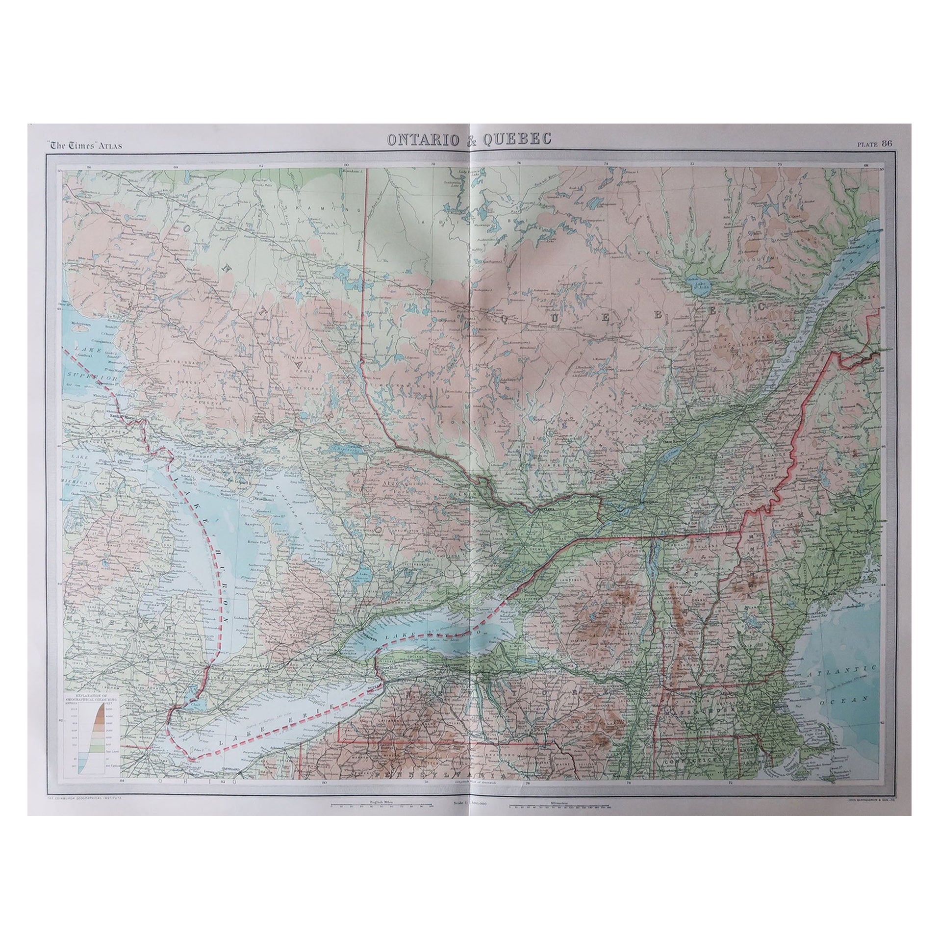
This is a very large vintage map of Canada. A German, quality printed educational or institution map, dating to the mid 20th century, circa 1965.
Striking proportion with superb attention to detail
Displays a desirable aged patina and in good order
Wonderfully printed upon a large roll of canvas-backed paper
Full colour with topographical shading for altitude
Depicts the land mass of Canada, United States of America, Greenland and Iceland
Annotated with an extensive key, detailing cities, borders and height et al
Printed in Germany by Georg Westermann, dated to March 1965
Set between a pair of ebonized spars for ease of wall mounting
This is a captivating vintage map of Canada, with impressive proportion and replete with fascinating attention to detail. Of educational or institutional quality, it could grace any large wall. Delivered ready to display.
Dimensions:
Max width: 216cm (85'')
Max depth: 3cm (1.25'')
Max height: 197cm (77.5'')
Map width: 205cm (80.75'')
Map height: 191cm (75.25'').
- Dimensions:Height: 77.56 in (197 cm)Width: 85.04 in (216 cm)Depth: 1.19 in (3 cm)
- Materials and Techniques:
- Place of Origin:
- Period:
- Date of Manufacture:circa 1965
- Condition:Wear consistent with age and use. Presented in very good vintage condition.
- Seller Location:Hele, Devon, GB
- Reference Number:
About the Seller
5.0
Platinum Seller
These expertly vetted sellers are 1stDibs' most experienced sellers and are rated highest by our customers.
Established in 2005
1stDibs seller since 2017
856 sales on 1stDibs
Typical response time: 2 hours
- ShippingRetrieving quote...Ships From: Hele, Devon, United Kingdom
- Return PolicyA return for this item may be initiated within 14 days of delivery.
More From This SellerView All
- Vintage Reproduction 17th Century Map of Europe, American, Cartography, BlaeuwLocated in Hele, Devon, GBThis is a vintage reproduction map of Europe. An American, paper stock cartography print in frame after the work by Blaeuw, dating to the late 20t...Category
Late 20th Century Central American Mid-Century Modern Maps
MaterialsGlass, Wood, Paper
- Antique Lithography Map, Isle of Wight, English, Framed, Engraving, CartographyLocated in Hele, Devon, GBThis is an antique lithography map of the Isle of Wight. An English, framed atlas engraving of cartographic interest, dating to the early 19th century and later. Superb lithography ...Category
Antique Early 19th Century British Regency Maps
MaterialsWood
- Antique Lithography Map, Isle of Thanet, Kent, English, Cartography, VictorianLocated in Hele, Devon, GBThis is an antique lithography map of The Isle of Thanet in Kent. An English, framed atlas engraving of cartographic interest, dating to the mid 19th century and later. Superb litho...Category
Antique Mid-19th Century British Victorian Maps
MaterialsWood
- Antique Lithography Map, Northumberland, English, Framed, Engraving, CartographyLocated in Hele, Devon, GBThis is an antique lithography map of Northumberland. An English, framed atlas engraving of cartographic interest, dating to the mid 19th century a...Category
Antique Mid-19th Century British Victorian Maps
MaterialsWood
- Antique Lithography Map, Gloucestershire, English, Framed Engraving, CartographyLocated in Hele, Devon, GBThis is an antique lithography map of Gloucestershire. An English, framed atlas engraving of cartographic interest, dating to the mid 19th century ...Category
Antique Mid-19th Century British Victorian Maps
MaterialsWood
- Antique Lithography Map, Lincolnshire, English, Framed, Engraving, CartographyLocated in Hele, Devon, GBThis is an antique lithography map of Lincolnshire. An English, framed atlas engraving of cartographic interest, dating to the mid 19th century and...Category
Antique Mid-19th Century British Victorian Maps
MaterialsWood


You May Also Like
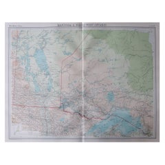
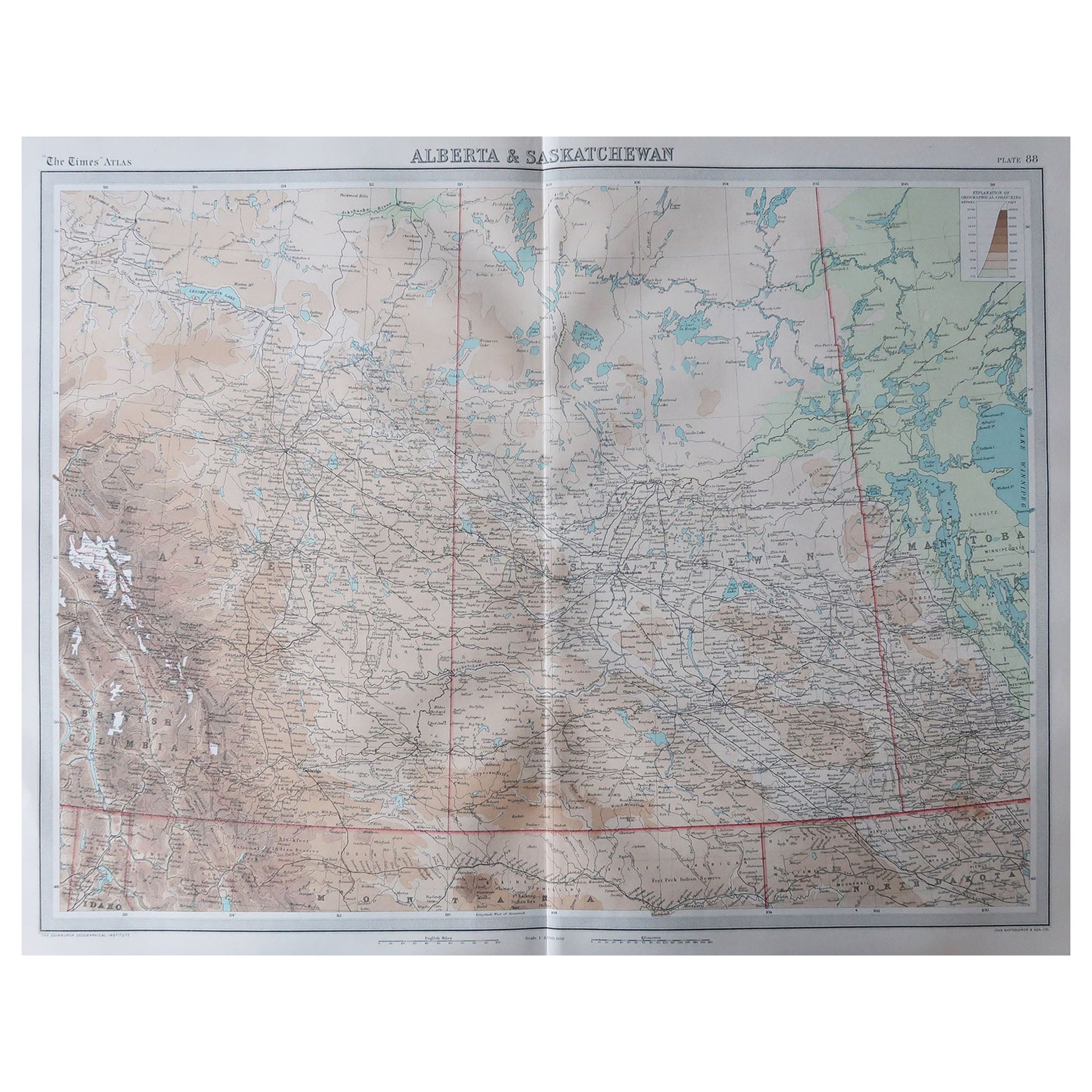
- Large Original Vintage Map of Alberta & Saskatchewan, Canada, C.1920Located in St Annes, LancashireGreat maps of Alberta and Saskatchewan Unframed Original color By John Bartholomew and Co. Edinburgh Geographical Institute Published, circa 1920 Free shipping.Category
Vintage 1920s British Maps
MaterialsPaper
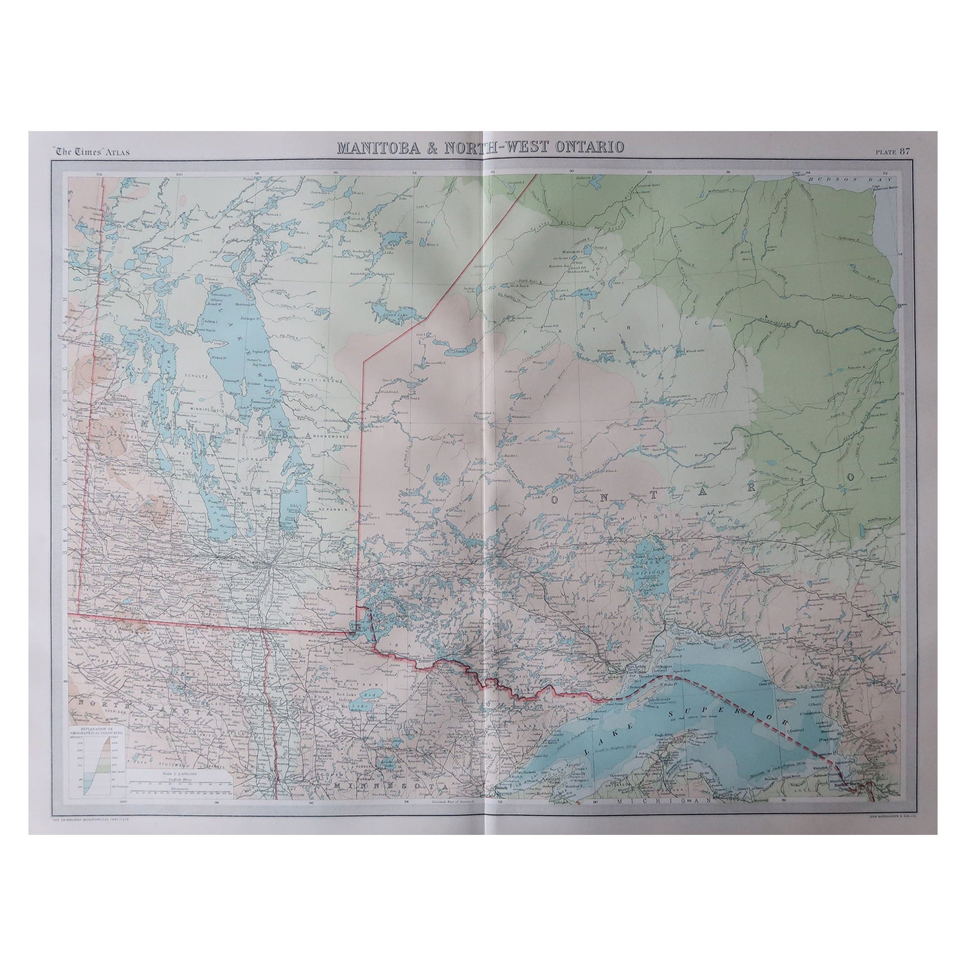
- Large Original Vintage Map of Manitoba, Canada, circa 1920Located in St Annes, LancashireGreat map of Manitoba and part of Ontario Unframed Original color By John Bartholomew and Co. Edinburgh Geographical Institute Published, circa 1920 Free shipping.Category
Vintage 1920s British Maps
MaterialsPaper
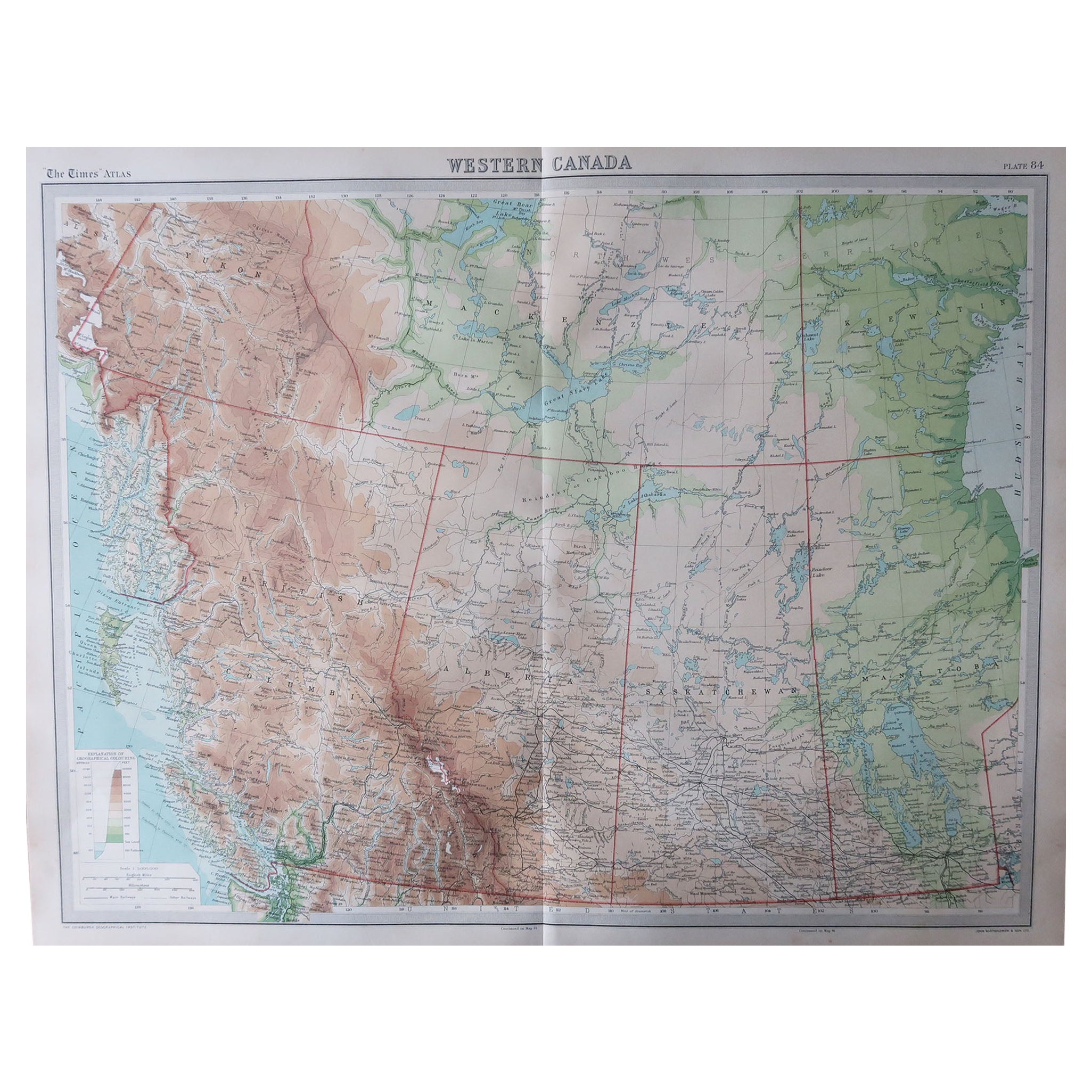
- Large Original Vintage Map of Western Canada, circa 1920Located in St Annes, LancashireGreat map of Western Canada Unframed Original color By John Bartholomew and Co. Edinburgh Geographical Institute Published, circa 1920 Fr...Category
Vintage 1920s British Maps
MaterialsPaper
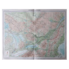
- Large Original Vintage Map of Quebec & Ontario, Canada, circa 1920Located in St Annes, LancashireGreat map of Quebec and Ontario. Unframed Original color By John Bartholomew and Co. Edinburgh Geographical Institute Published, circa 1920 ...Category
Vintage 1920s British Maps
MaterialsPaper
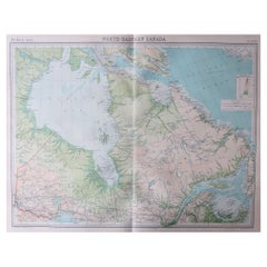
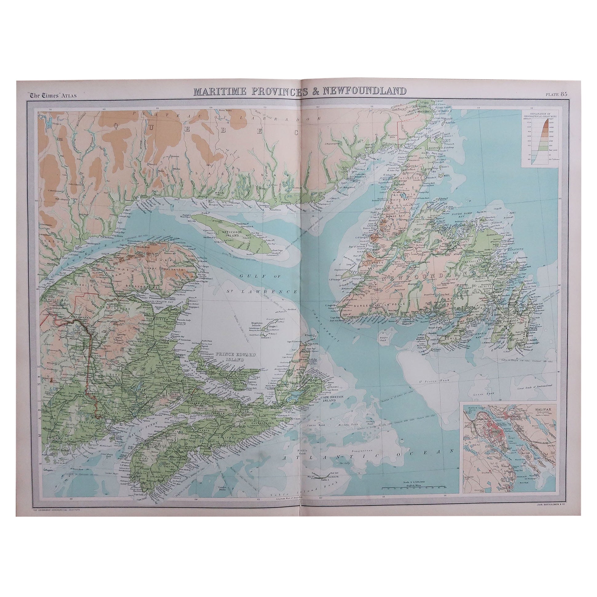
- Large Original Vintage Map of the Maritimes, Canada, circa 1920Located in St Annes, LancashireGreat map of The Maritime provinces Unframed Original color By John Bartholomew and Co. Edinburgh Geographical Institute Published, circa 1920 Free shipping.Category
Vintage 1920s British Maps
MaterialsPaper
- Large Original Vintage Map of the Great Lakes, Canada, circa 1920Located in St Annes, LancashireGreat map of The Great Lakes. Unframed. Original color. By John Bartholomew and Co. Edinburgh Geographical Institute Published, circa 1920 ...Category
Vintage 1920s British Maps
MaterialsPaper