Items Similar to Great Britain Scandinavia Northern France Netherland Germany Mural Map
Want more images or videos?
Request additional images or videos from the seller
1 of 6
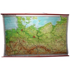
Great Britain Scandinavia Northern France Netherland Germany Mural Map
About the Item
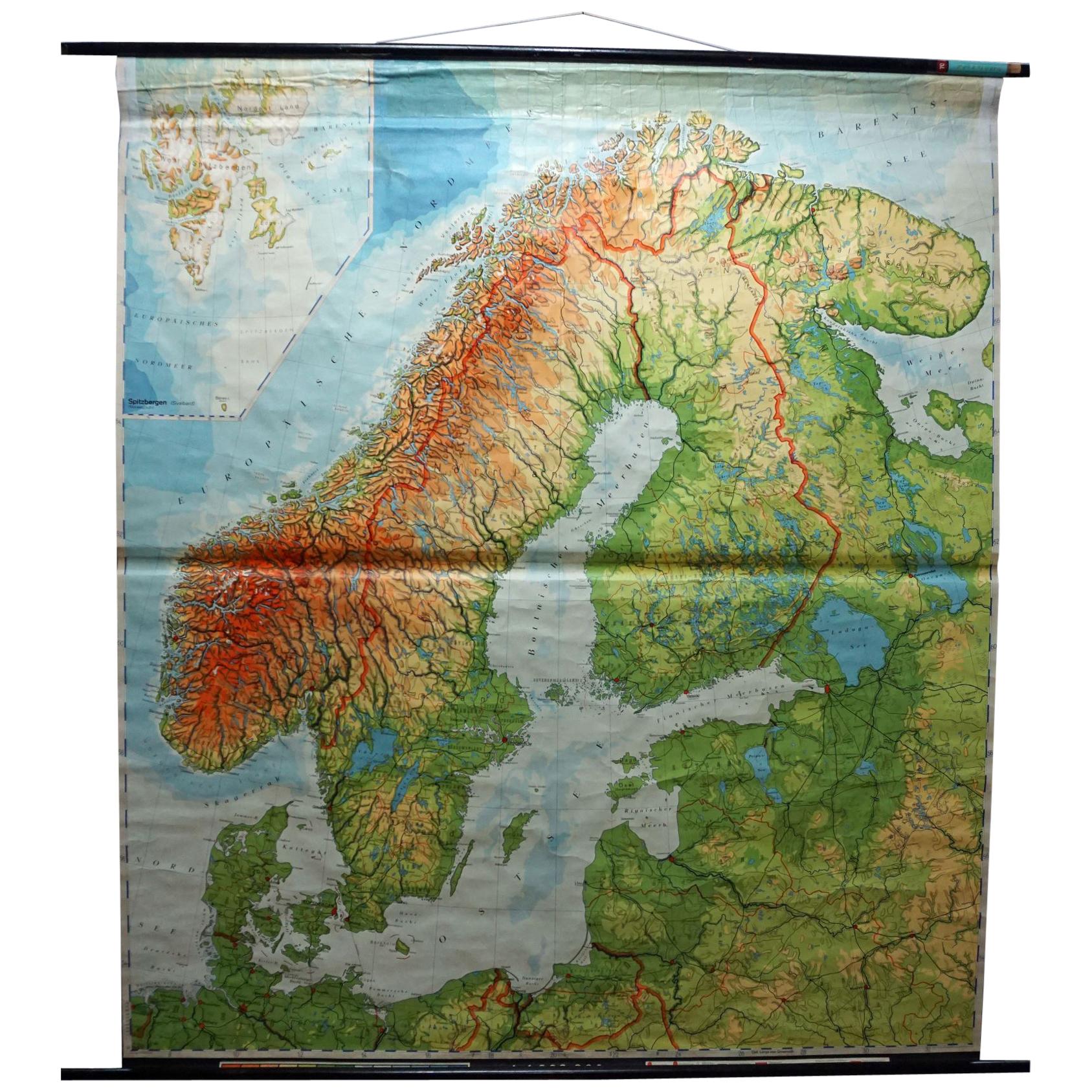
The vintage pull-down cottagecore mural map illustrates the North Sea countries with Great Britain and Ireland, Scandinavia (Norway, Sweden, Denmark), Northern France, the Netherlands, Northern Germany. A great scroll picture in vintage look for all friends of the country house style and sailors. Published by Westermann. Colorful print on paper reinforced with canvas.
Measurements:
Width 224 cm (88.19 inch)
Height 208 cm (81.89 inch)
The measurements shown refer just to the canvas and do not include the poles.
Background information on the history of school wall charts:
The idea to upgrade every day school life by using pictures was supported in the late 18th century by Johann Bernhard Basedow. In 1774 he published a four-volume book "Elementarwerk" which combined pictures, text and information with merely hundred copperplates. Modern printing methods enabled the spread from rich private schools to rural grade schools. From 1820-1836 the oldest mentioned series of wall charts were published with the range of six booklets including 63 large sized charts. The rising 20th century was the golden age for publishers printing wall charts. Artists Masterly performed pictures which combined the subject-specific standards of a scientist with the standards given by an educator and finally created a magnificent art work.
artfour is an owner-managed trading company dealing in Black Forest woodcarvings, antler furniture and an impressive variety of unique decorative items. Our antiques are displayed in a 100 years old barn in southern Germany which we have remodeled ourselves. Antique pieces have been our passion since the 1980s. We ship worldwide, perfectly packed and with money back guarantee. This qualifies us as your preferred partner for Black Forest and antique art.
- Dimensions:Height: 81.89 in (208 cm)Width: 88.19 in (224 cm)Depth: 0.79 in (2 cm)
- Style:Country (In the Style Of)
- Materials and Techniques:
- Place of Origin:
- Period:
- Date of Manufacture:1970
- Condition:Wear consistent with age and use. The wall chart / map has been utilised and therefore shows age-related traces of usage. During storage the chart might partly be fissured, stained, sometimes smells and may have some old repairs. Please contact us for a detailed report .
- Seller Location:Berghuelen, DE
- Reference Number:
About the Seller
5.0
Platinum Seller
These expertly vetted sellers are 1stDibs' most experienced sellers and are rated highest by our customers.
Established in 1989
1stDibs seller since 2013
502 sales on 1stDibs
Typical response time: 1 hour
- ShippingRetrieving quote...Ships From: Berghuelen, Germany
- Return PolicyA return for this item may be initiated within 30 days of delivery.
More From This SellerView All
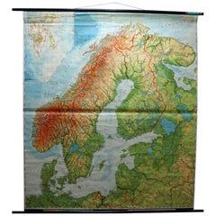
- Vintage Rollable Mural Map Wall Chart Print Scandinavia Norway Sweden FinlandLocated in Berghuelen, DEA great impressive cottagecore map illustrating Scandinavia (Norway, Sweden, Finland, Denmark and bordering Baltic Sea countries). Colorful print on paper reinforced with canvas. Mea...Category
Mid-20th Century German Country Prints
MaterialsCanvas, Wood, Paper
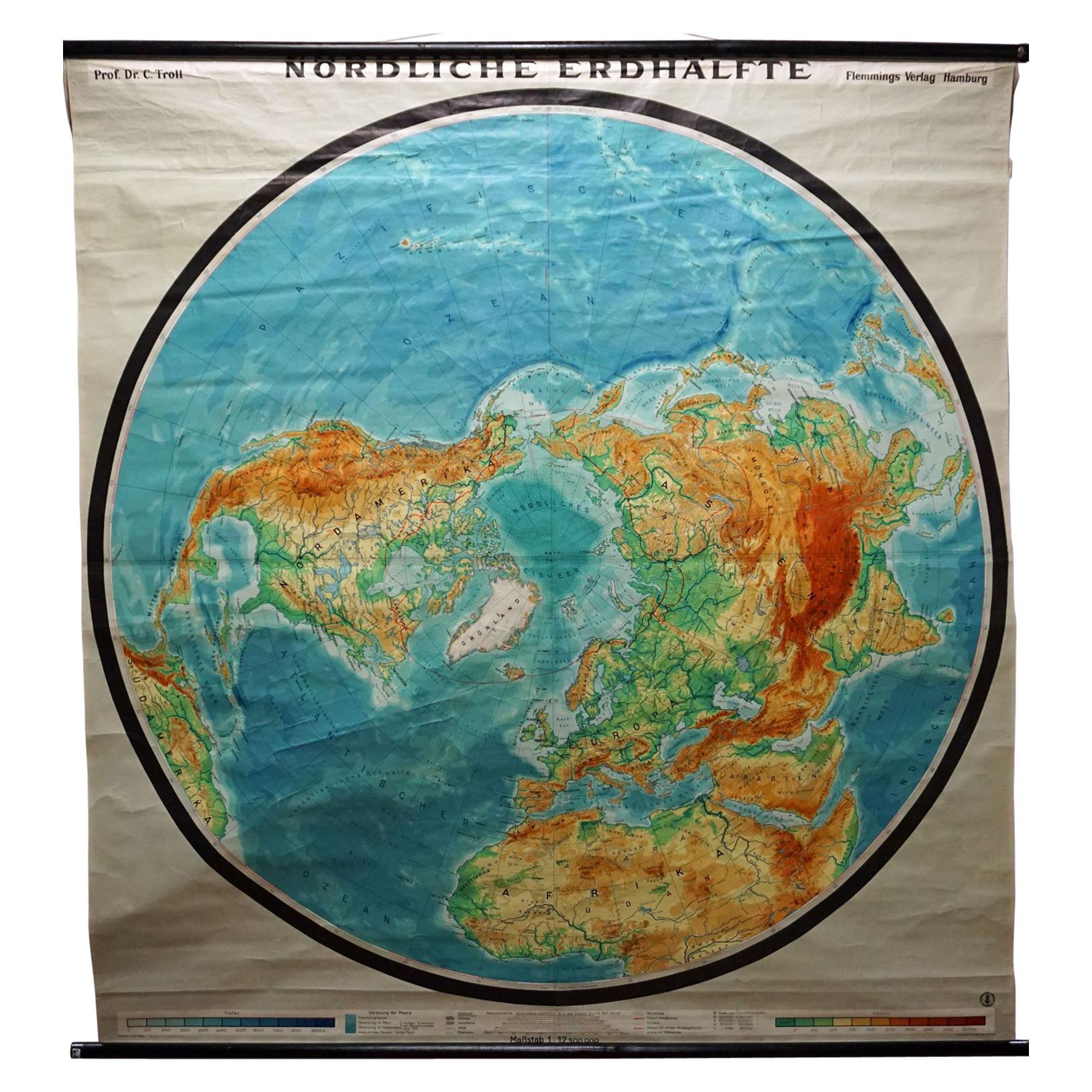
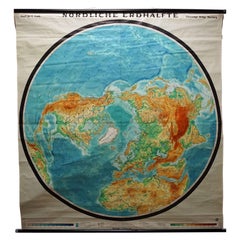
- Northern Hemisphere of the Earth Rollable Map Vintage Wall Chart World MuralLocated in Berghuelen, DEA great pull-down map or vintage wall chart illustrating the northern hemisphere of the earth. Published by Prof. Dr. C. Troll, Flemmings Verlag Ha...Category
Mid-20th Century German Country Prints
MaterialsCanvas, Wood, Paper
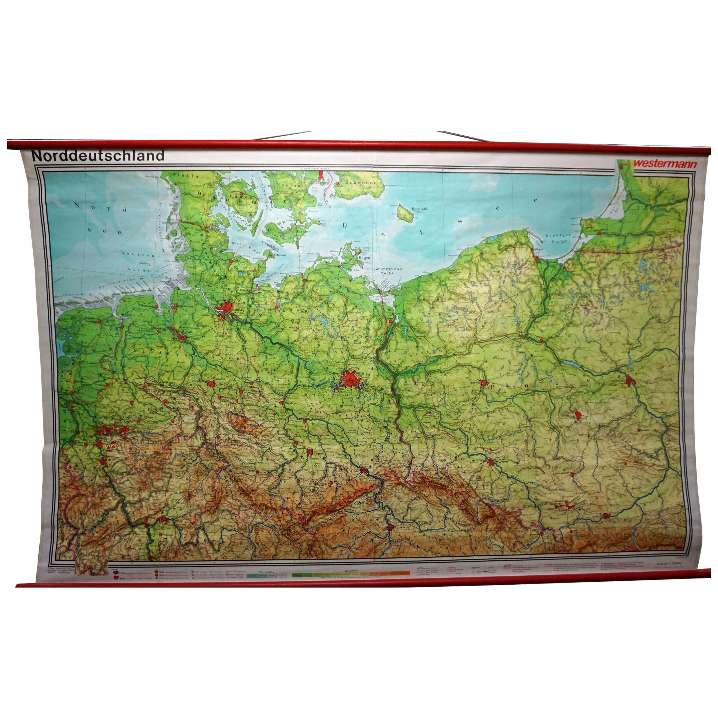
- Vintage Rollable Map Northern Germany Poland Seaside Wallchart Baltic SeaLocated in Berghuelen, DEThe large impressive cottagecore pull-down map illustrates Northern Germany, Poland and parts of the Baltic Sea. It was published by Westermann-Schulwandkar...Category
Late 20th Century German Country Prints
MaterialsCanvas, Wood, Paper
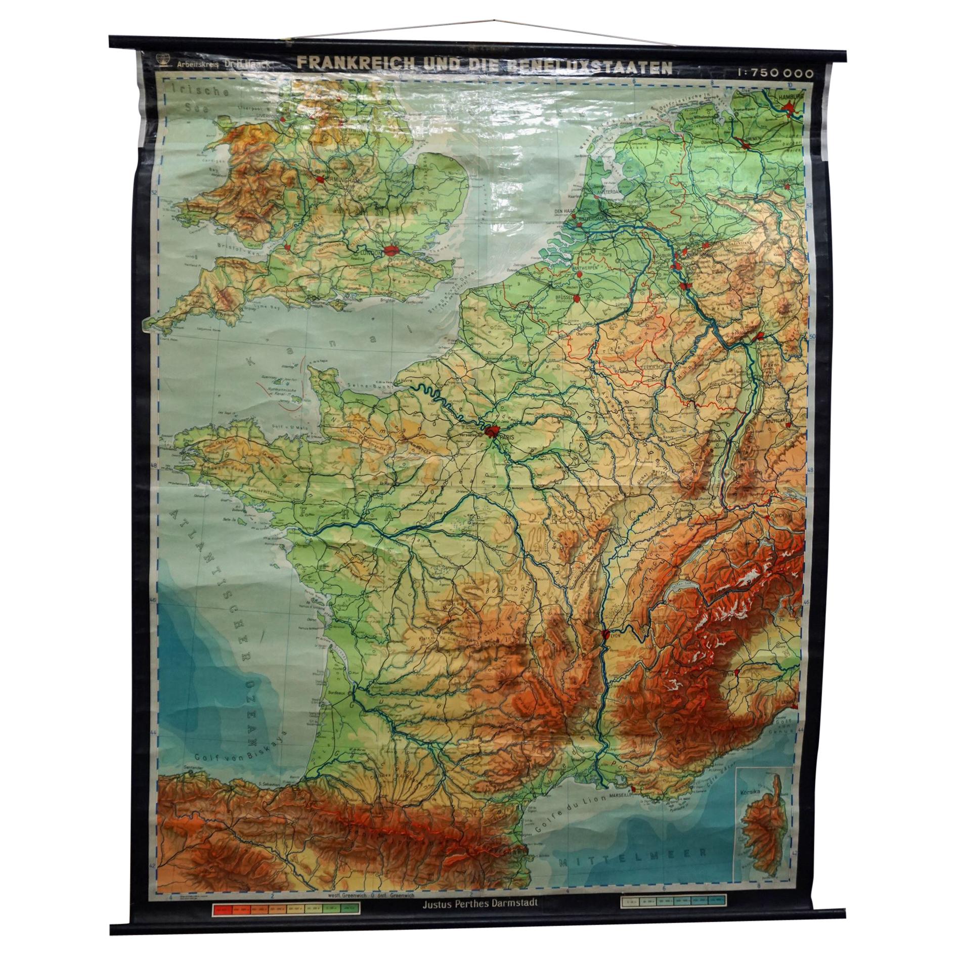
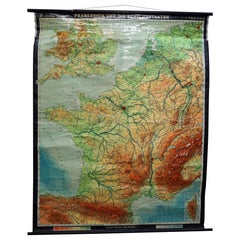
- Vintage Mural Rollable Map Wall Chart France Benelux Countries South EnglandLocated in Berghuelen, DEA cottagecore pull-down wall chart map illustrating France and the Benelux countries (the Netherlands, Belgium and Luxemburg) and main parts of Western Europe. Published by Justus Pe...Category
Mid-20th Century German Country Prints
MaterialsCanvas, Wood, Paper
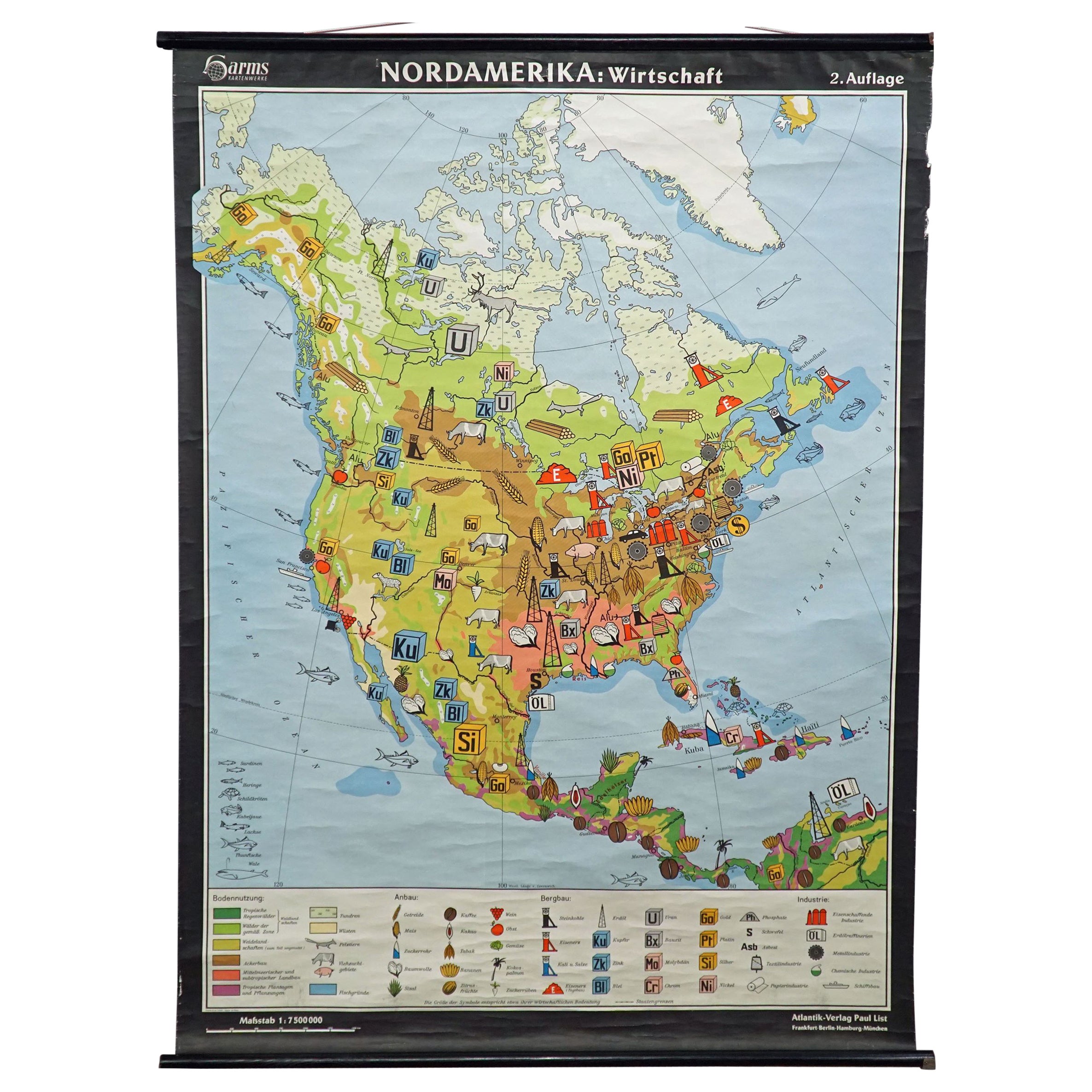
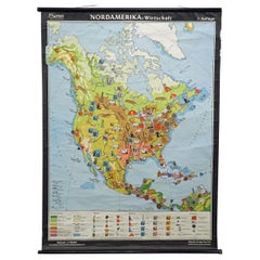
- North America Map Economy Wall Chart Rollable Poster Vintage MuralLocated in Berghuelen, DEA vintage pull-down map showing the economy of North America, published by Harms. Colorful print on paper reinforced with canvas. Measurements: Width 101 cm (39.76 inch) Height 169 c...Category
Late 20th Century German Country Prints
MaterialsCanvas, Wood, Paper
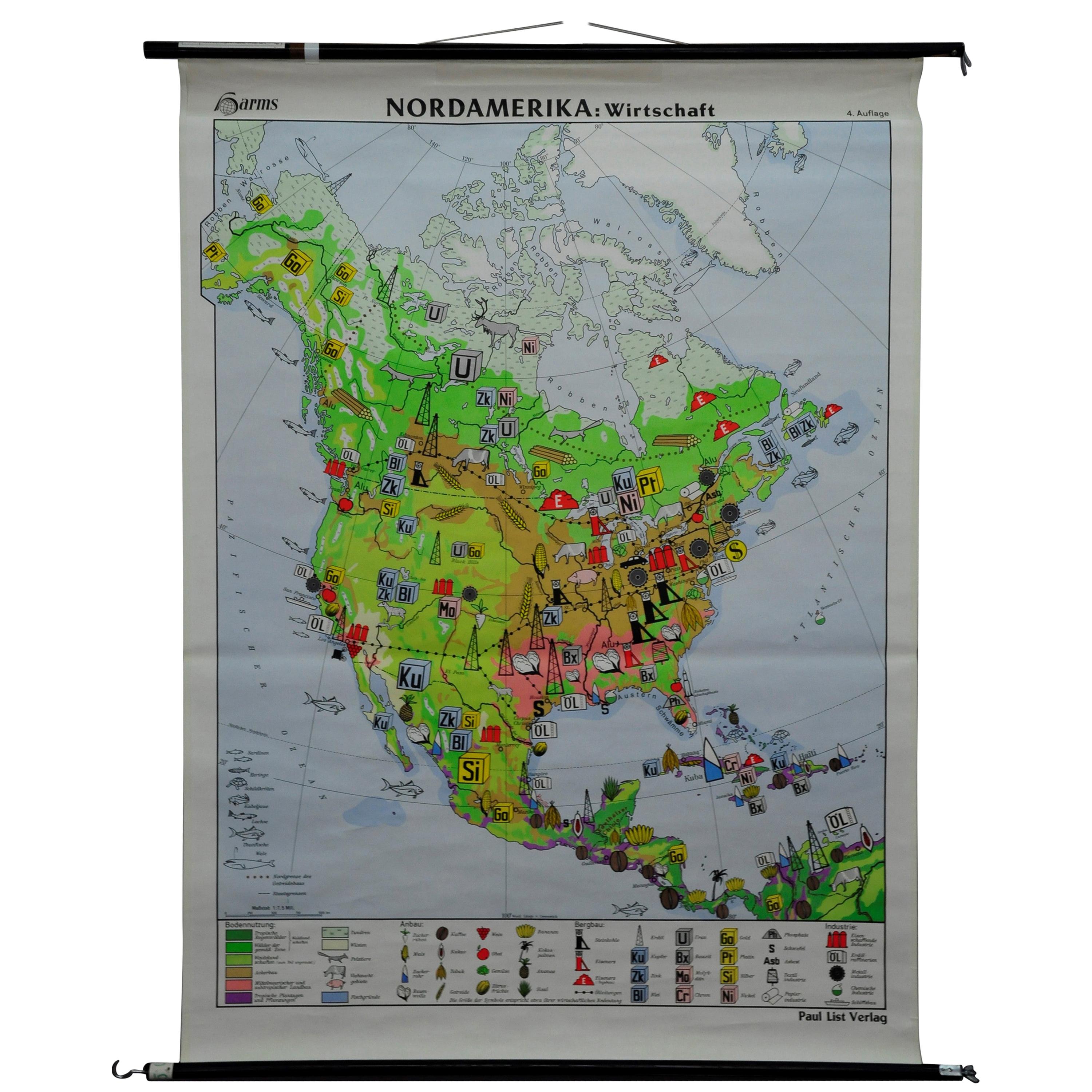
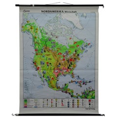
- Vintage Mural Map Pull Down Wall Chart North America Economy FinancesLocated in Berghuelen, DEA classical rollable wall chart showing the economy of North America. Publishd by the Paul List Verlag. Used as teaching material in German schools. Colorful print on paper reinforce...Category
Mid-20th Century German Country Prints
MaterialsCanvas, Wood, Paper
You May Also Like
- East German MapBy VEB Hermann HaackLocated in Baltimore, MDA brilliantly colourful map of the Leipzig, Karl Marx Stadt and Dresden area in the former German Democratic Republic by VEB Hermann Haack of Gotha.Category
Vintage 1970s German Maps
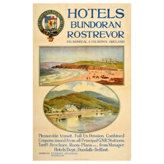
- Original Antique Travel Poster Great Northern Railway Ireland Hotels BundoranLocated in London, GBOriginal antique northern Ireland travel poster - Hotels Bundoran Rostrevor County Donegal & County Down Ireland - features two picturesque views depicting holiday makers enjoying the sandy beach at the seaside with beach huts and walks along the cliffs in front the grand hotels and hills in the background, the title with the Great Northern Railway Ireland...Category
Antique Early 1900s British Posters
MaterialsPaper
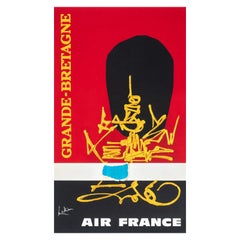
- Georges Mathieu, Original Vintage Airline Poster, Air France Great Britain, 1967By Georges MathieuLocated in SAINT-OUEN-SUR-SEINE, FROriginal Vintage Poster-Mathieu Georges-Air France Great Britain London, 1967 This poster promotes Air France travel to Great Britain (England-Wales-Scotland). A bearskin hat of Que...Category
20th Century French Modern Posters
MaterialsPaper
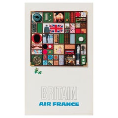
- Raymond Pages, Original Vintage Airline Poster, Air France, Great Britain, 1971By Raymond PagesLocated in SAINT-OUEN-SUR-SEINE, FROriginal Vintage Poster-Raymond Pages-Air France-Bretagne-Avion, 1971 Pop Art style advertising poster for Air France, for Great Britain, we can see a bo...Category
20th Century French Mid-Century Modern Posters
MaterialsPaper
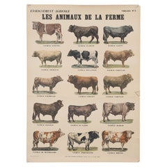
- Old French Poster of Farm Animals Great for Country French Kitchen from ParisLocated in Chicago, ILOld French Poster of Farm Animals which could look great in a Country French Kitchen. These used to be sold in Paris and unfortunately the store suf...Category
Vintage 1950s French Country Posters
MaterialsPaper
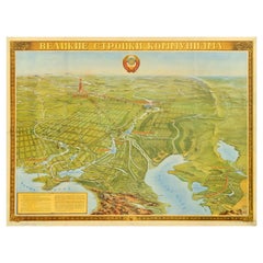
- Original Vintage Soviet Propaganda Poster Great Buildings Of Communism Map USSRLocated in London, GBOriginal vintage Soviet propaganda poster - Great Buildings of Communism - featuring a pictorial map design with an illustration of the Moscow Kremlin and skyscrapers in the capital ...Category
Vintage 1950s Russian Posters
MaterialsPaper

Recently Viewed
View AllMore Ways To Browse
Wall Map Of France
French Sailor
Vintage Forest Poster
Vintage Map Of Germany
Norwegian Wall Art
Vintage Map Book
Vintage Sailor
Swedish School Poster
Vintage Canvas Map
18th Century Mural
French Poster 1980s
Vintage Pull Down Chart
Pull Down School Chart
Vintage Pull Down Wall Charts
Vintage Sailor Poster
Guaranteed Irish
Vintage Sailor Ship
Pull Down Maps