Items Similar to Antique Frontispiece of a Book Describing England, Scotland and Ireland, 1755

Want more images or videos?
Request additional images or videos from the seller
1 of 6
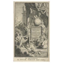
Antique Frontispiece of a Book Describing England, Scotland and Ireland, 1755
About the Item
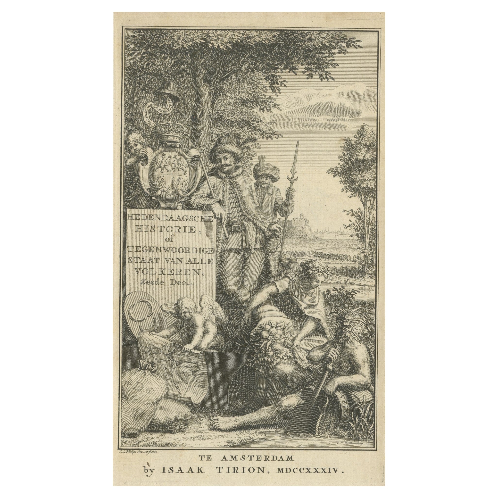
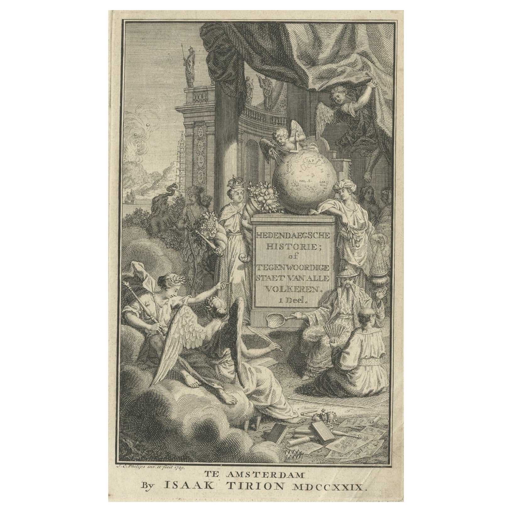
Antique frontispiece of the 2nd volume of 'Hedendaagsche Historie of Tegenwoordige staat van Groot Brittannie behelsende de beschrijving van Engeland ,Schotland en Ierland'. This volume describes England, Scotland and Ireland.
Artists and Engravers: Published by I. Tirion, Amsterdam.
Condition: Very good, general age-related toning. Please study image carefully.
Date: 1755
Overall size: 12 x 19.5 cm.
Image size: 10 x 16 cm.
- Dimensions:Height: 7.68 in (19.5 cm)Width: 4.73 in (12 cm)Depth: 0 in (0.01 mm)
- Materials and Techniques:
- Period:
- Date of Manufacture:1755
- Condition:
- Seller Location:Langweer, NL
- Reference Number:
About the Seller
5.0
Platinum Seller
These expertly vetted sellers are 1stDibs' most experienced sellers and are rated highest by our customers.
Established in 2009
1stDibs seller since 2017
1,969 sales on 1stDibs
Typical response time: <1 hour
- ShippingRetrieving quote...Ships From: Langweer, Netherlands
- Return PolicyA return for this item may be initiated within 14 days of delivery.
More From This SellerView All
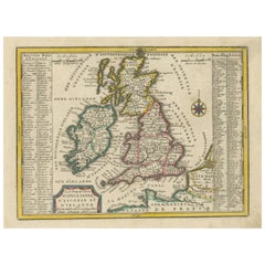
- Original Antique Map of England, Ireland, Scotland and WalesLocated in Langweer, NLAntique map titled 'Les Isles Britanniques, ou sont les Royaumes d Angleterre (..)'. Detailed map of England, Ireland, Scotland and Wales, with French coast and part of the Netherlan...Category
Antique Early 18th Century Maps
MaterialsPaper
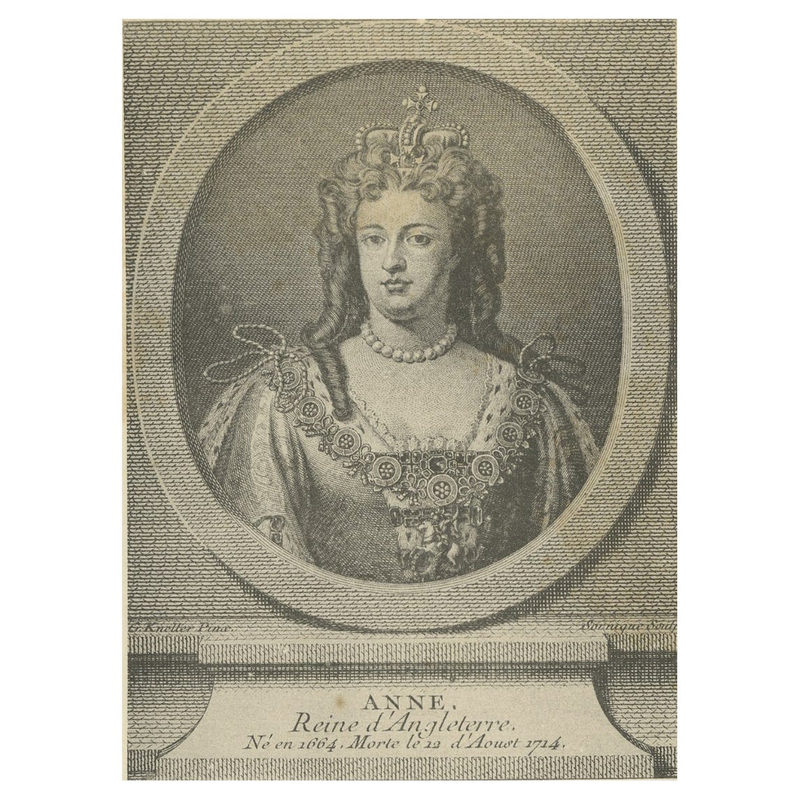
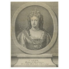
- Antique Portrait of Queen Anne of England, Scotland and Ireland, 1890Located in Langweer, NLAntique portrait titled 'Anne, Reine d'Angleterre'. Anne was the Queen of England, Scotland and Ireland between 8 March 1702 and 1 May 1707. On 1 May 1707, under the Acts of Union, t...Category
Antique 19th Century Prints
MaterialsPaper
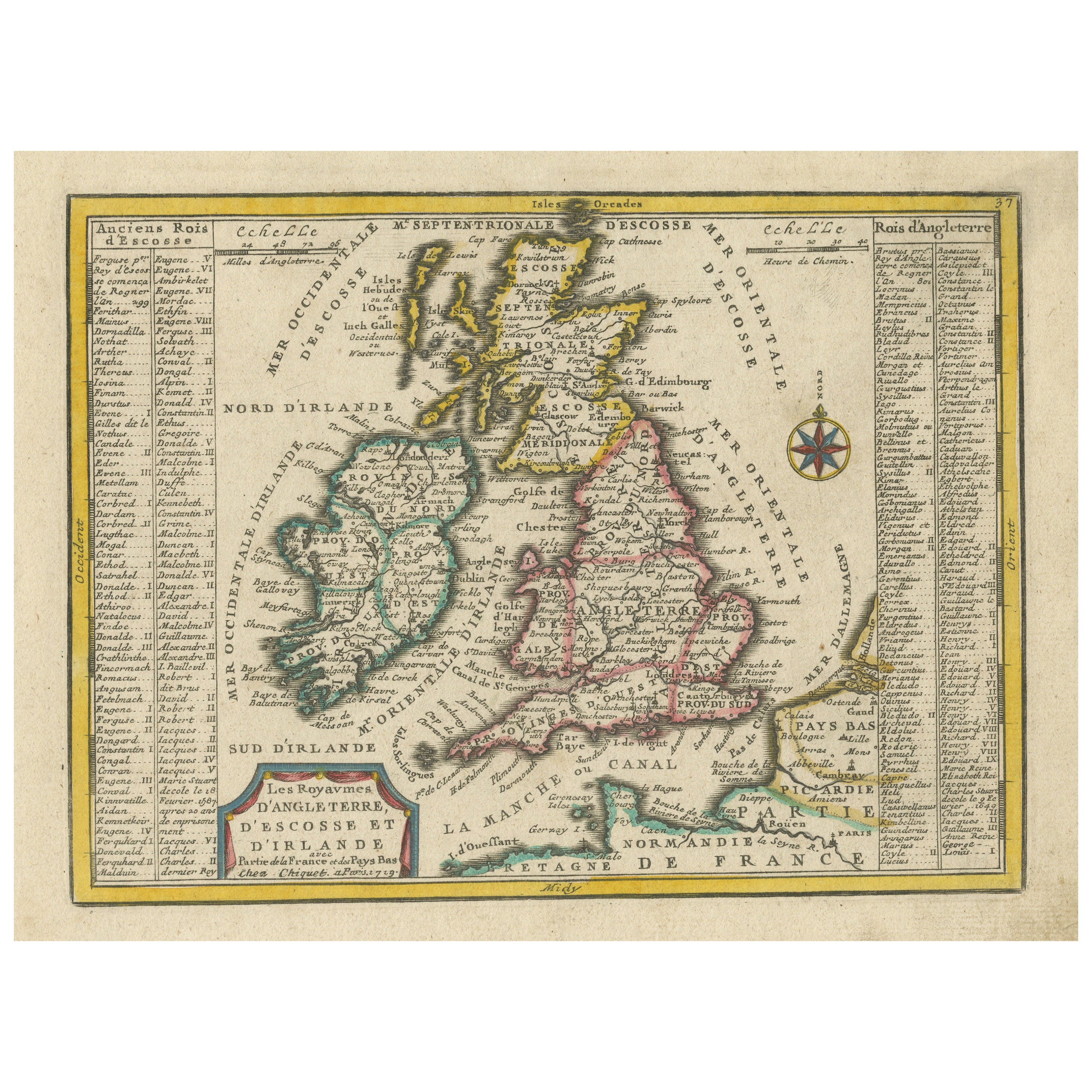
- Small Antique Map of England, Wales, Scotland and Ireland with Original ColoringLocated in Langweer, NLAntique map titled 'Les Royaumes d'Angleterre d'Escosse et d'Irlande (..)'. A lovely, small map of England, Wales, Scotland and Ireland with a portion of the coastline of France and ...Category
Antique Early 18th Century Maps
MaterialsPaper
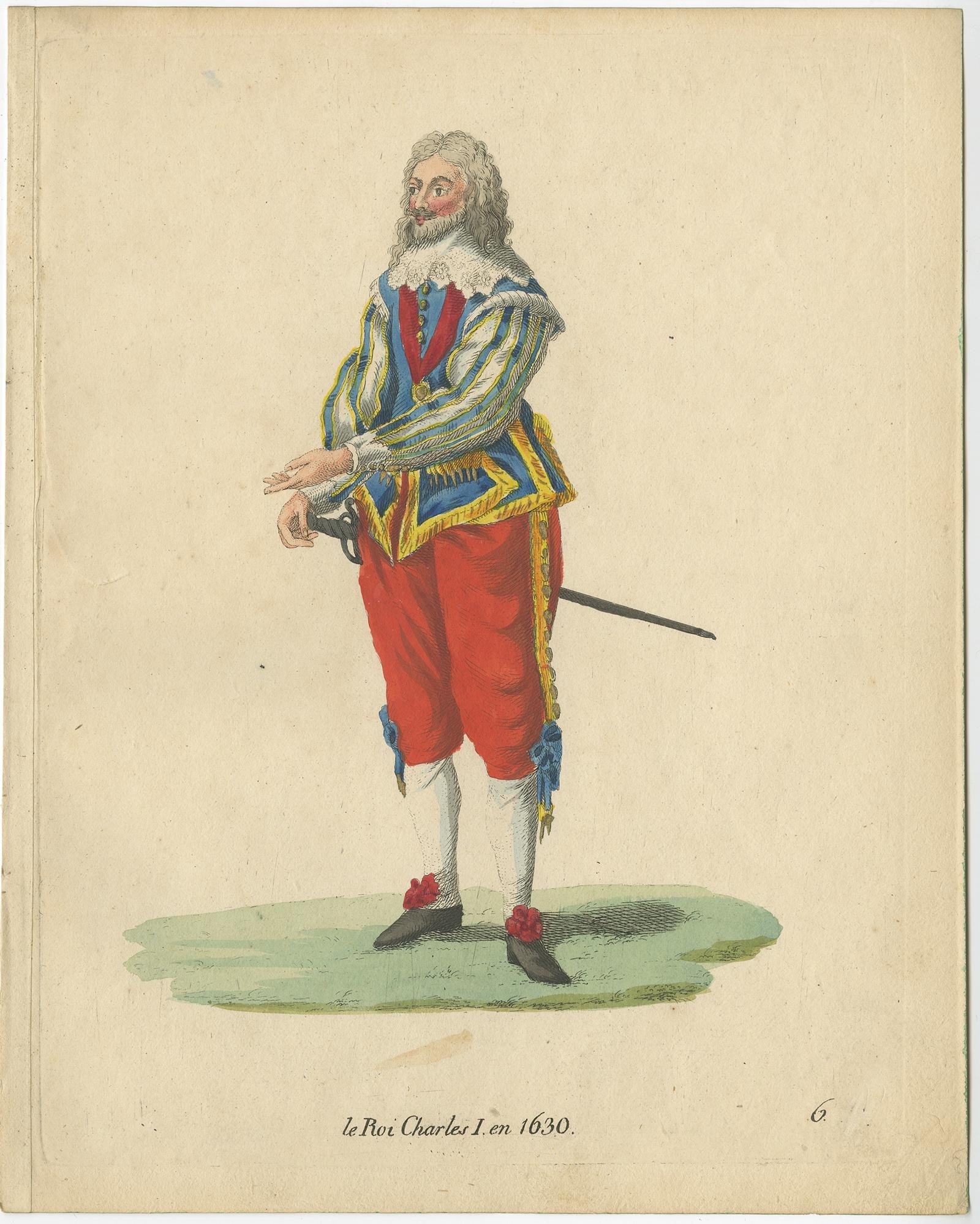
- Old Antique Print of King Charles I, King of England, Scotland and Ireland, 1805Located in Langweer, NLAntique costume print titled 'le Roi Charles I en 1630'. This print depicts King Charles I. Originates from a rare costume book titled 'Sammlung von Trachten bey verschiedenen ältern...Category
Antique 19th Century Prints
MaterialsPaper
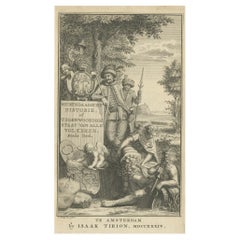
- Antique Frontispiece of a Book about Europe by Tirion, 1734Located in Langweer, NLAntique frontispiece of the 6th volume of 'Hedendaagsche historie of tegenwoordige staat van allen volkeren (..)' by Thomas Salmon. This volume describes par...Category
Antique 18th Century Prints
MaterialsPaper
- Antique Frontispiece of a Book About Japan, China and the Philippines, 1736Located in Langweer, NLAntique frontispiece of the 1st volume of 'Hedendaegsche historie of tegenwoordige staat van allen volkeren (..)' by Thomas Salmon. This volume describes Jap...Category
Antique 18th Century Prints
MaterialsPaper


You May Also Like
- England, Scotland & Ireland: A Hand Colored Map of Great Britain by TirionBy Isaak TirionLocated in Alamo, CAThis is a hand-colored double page copperplate map of Great Britain entitled "Nieuwe Kaart van de Eilanden van Groot Brittannien Behelzende de Kon...Category
Antique Mid-18th Century Dutch Maps
MaterialsPaper
- “A Football Match, Scotland v. England” Antique Engraving, Proof Edition of 100By Overend and SmytheLocated in Colorado Springs, COThis is the 1889 William H. Overend (1851-1898) and Lionel Smythe (1839-1918) first edition, photogravure of the Calcutta Cup – a Rugby match between Scotland and England, that has been played over 100 times, the first match...Category
Antique 19th Century English Prints
MaterialsPaper
- Original Antique Map of Ireland- Tipperary and Waterford. C.1840Located in St Annes, LancashireGreat map of Tipperary and Waterford Steel engraving Drawn under the direction of A.Adlard Published by How and Parsons, C.1840 Unframed.Category
Antique 1840s English Maps
MaterialsPaper
- Antique 1755 Copperplate Engraving Westminster Bridge Lambeth Survey of LondonLocated in Dayton, OHAntique hand colored riverscape / landscape copperplate engraving based on a painting by Jacob Maurer and engraved by Paul Fourdrinier - A View of Westminster Bridge from Lambeth, published according to Act of Parliament 1754 for Stowe’s Survey of London. BIO: Paul Fourdrinier sometimes referred to as Peter or Pierre Fourdrinier, was an 18th Century engraver in England. Paul Fourdrinier, engraver and printseller, was born on 20 December 1698 in Groningen in the Netherlands, the son of Jacques Fourdrinier and his wife, Jeanne Theroude, Huguenot refugees from Dieppe, Normandy. He was a pupil of Bernard Picart at Amsterdam for six years, and came to England in 1720. He was employed in engraving portraits and book illustrations. He also engraved two works by Peter Monamy, marine paintings displayed in Vauxhall Gardens. The engravings were published in 1743, but may have been executed earlier. Starting in 1742 Fourdrinier produced a series of books consisting of numerous folding charts showing "The Succession of Colonels to all his Majesties Land Forces from their Rise to 1742", as well as many other details of British military and naval personnel. The 2004 edition of the Oxford Dictionary of National Biography makes it clear that in the 19th century edition of the Dictionary of National Biography this engraver's works and career were assigned to two individuals, Peter (or Pierre) and Paul Fourdrinier. Peter/Pierre is now seen to be a fictitious individual resulting from an accidental misnaming of Paul. Paul Fourdrinier is mentioned as the engraver of some of the works listed above, and he has been identified with the Paul Fourdrinier who was of the parish of St. Martin's-in-the-Fields, married to Susanna Grolleau, and who died in January or February 1758. The couple had at least five children, including a son Henry Fourdrinier, whose daughter, or granddaughter, Jemima Fourdrinier was the mother of Cardinal John Henry Newman...Category
Antique Mid-18th Century British Colonial Prints
MaterialsPaper
- Original Antique Map of Ireland- Kerry. C.1840Located in St Annes, LancashireGreat map of Kerry Steel engraving Drawn under the direction of A.Adlard Published by How and Parsons, C.1840 Unframed.Category
Antique 1840s English Maps
MaterialsPaper
- Set of 15 Original Antique Prints of Ireland, C.1840Located in St Annes, LancashireGlorious set of 15 prints of Ireland Steel engravings after T.Creswick Published C.1840 Unframed. The measurement given is the paper size of one print.Category
Antique 1840s English Prints
MaterialsPaper


Recently Viewed
View AllMore Ways To Browse
18th Century Scottish Furniture
Philip Tarlow
Picasso Book Ceramiques
Raden Saleh
Rene Grau
Renee Farca
Richard Kemble
Ron Lewis The Moonwalkers
Ruffed Grouse
Salvador Dali Divine Comedy E
Scientific Chart Of Snake
Shirley Pettibone
Sir John Vanbrugh
Snaffles Jock
Spy Magazine Gentlemen Prints
The Burial Of Atala
The Dinky Bird Maxfield Parrish
Toni Hermansson