Items Similar to Bonne, Map of Middle East, Persia, Red Sea, Egypt, Nubia Hand Coloured


Want more images or videos?
Request additional images or videos from the seller
1 of 6
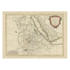
Bonne, Map of Middle East, Persia, Red Sea, Egypt, Nubia Hand Coloured
About the Item
Rigobert Bonne.
Carte de L'Arabia du Golfe Persique et de la Mer Rouge, avec l’Egypte, la Nubia et l’Abissinie
From Bonne's Atlas de toutes les parties connues du Globe Terrestre. Paris, 1780.
Measures approx. 210 x 320 mm.
Engraving.
Rigobert Bonne was the Royal Hydrographer of France, so his primary interest was in marine charts. However, with his Royal connections and access to the cartographic documents in Paris, Bonne was able to compile maps containing some of the most up-to-date information of his time. This map was issued just at the end of the American Revolution. Bonne had good information to show towns, rivers, forts and other features. Detail is clearly presented, and fascinating to study. This is a fine map of North America from the very beginning of our country's history.
Very good condition. Light age toning and minor stain to outer margin.
- Dimensions:Height: 8.27 in (21 cm)Width: 12.6 in (32 cm)Depth: 0.04 in (1 mm)
- Materials and Techniques:Paper,Etched
- Place of Origin:
- Period:1780-1789
- Date of Manufacture:1780
- Condition:Wear consistent with age and use.
- Seller Location:Norwich, GB
- Reference Number:1stDibs: LU7031230765452
About the Seller
No Reviews Yet
Vetted Seller
These experienced sellers undergo a comprehensive evaluation by our team of in-house experts.
Established in 1992
1stDibs seller since 2022
9 sales on 1stDibs
- ShippingRetrieving quote...Ships From: Norwich, United Kingdom
- Return PolicyA return for this item may be initiated within 14 days of delivery.
More From This SellerView All
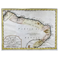
- Krevelt, Map, Coast of Brazil, South America, Amazon, Hand ColouredLocated in Norwich, GBCarte Du Bresil Prem. Partie Depuis la Riviere des Amazones jusqu' à la Baie de Tous les Saints Pour servir à l'Histoire des Etablissemens Europeens. A. v. Krevelt, sculpsit, ...Category
Antique Late 18th Century French Prints
MaterialsPaper
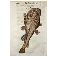
- 1558 Sea Serpent, Conrad Gesner, Folio Woodcut, Hand Coloured, First StateBy Albrecht DürerLocated in Norwich, GBFirst State. Unidentified woodcut artist for Konrad Gesner (aka Conrad Gesner; Philiatrus Euonymus) (1516–1565) Fine folio woodcut leaf. With uncoloured second woodcut to verso...Category
Antique 16th Century Swiss Renaissance Prints
MaterialsPaper
- 1558 Monster Sea Ray, Conrad Gesner, Folio Woodcut, Hand Coloured, First StateBy Albrecht DürerLocated in Norwich, GBOutstanding woodcut of a Sea Creature, clearly based on a second hand description of a Frogfish Unidentified woodcut artist for Konrad Gesner (aka Conrad Gesner; Philiatrus Euonym...Category
Antique 16th Century Swiss Renaissance Prints
MaterialsPaper
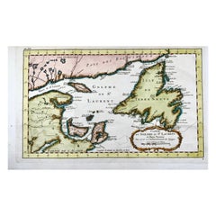
- Bellin, Canada, Gulf of Saint Lawrence, Hand Coloured EngravingBy Jacques-Nicolas BellinLocated in Norwich, GBJ.V. Schley after Bellin ‘Carte du Golphe de St. Laurent et Pays Voisins’ Size: 14.2 x 8.6 inches 36.1 x 21.8 cm First state of this nice copper engraved map of St. Lawrence Bay with Anticosti Island, Prince Edward Island, Cape Breton...Category
Antique 1780s French Prints
MaterialsPaper
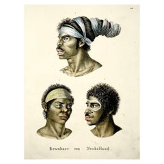
- Brodtmann, Aborigines of Australia, Folio, Stone Lithograph, Hand ColouredBy Brodtmann, K.J.A.Located in Norwich, GBPortraits of Australian aborigines based on Nicholas Petit’s engravings issued in the Baudin voyage account. 1. Top: Aboriginal man with his hair wrapped in paperbark strips told ...Category
Antique 1840s American Early Victorian Prints
MaterialsPaper
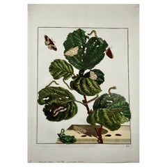
- Butterlies, Metamorphosis of Insects, Large Folio, L'Admiral, Hand ColouredLocated in Norwich, GBAntique print, untitled. From: 'Naauwkeurige waarnemingen omtrent de veranderingen van veele insekten …' Published 1740. Overall size: 36.5 x 26.2 cm Original hand colour. ...Category
Antique 1740s Dutch Prints
MaterialsPaper

You May Also Like
- Antique Map of the East Indies by Bonne '1776'Located in Langweer, NLAntique map titled 'Indes IVe Feuille'. Very decorative original antique map of the East Indies. Covbers from the Gulf of Siam (Gulf of Thailand) and Malacca (Malaysia) eastward to i...Category
Antique Late 18th Century Maps
MaterialsPaper
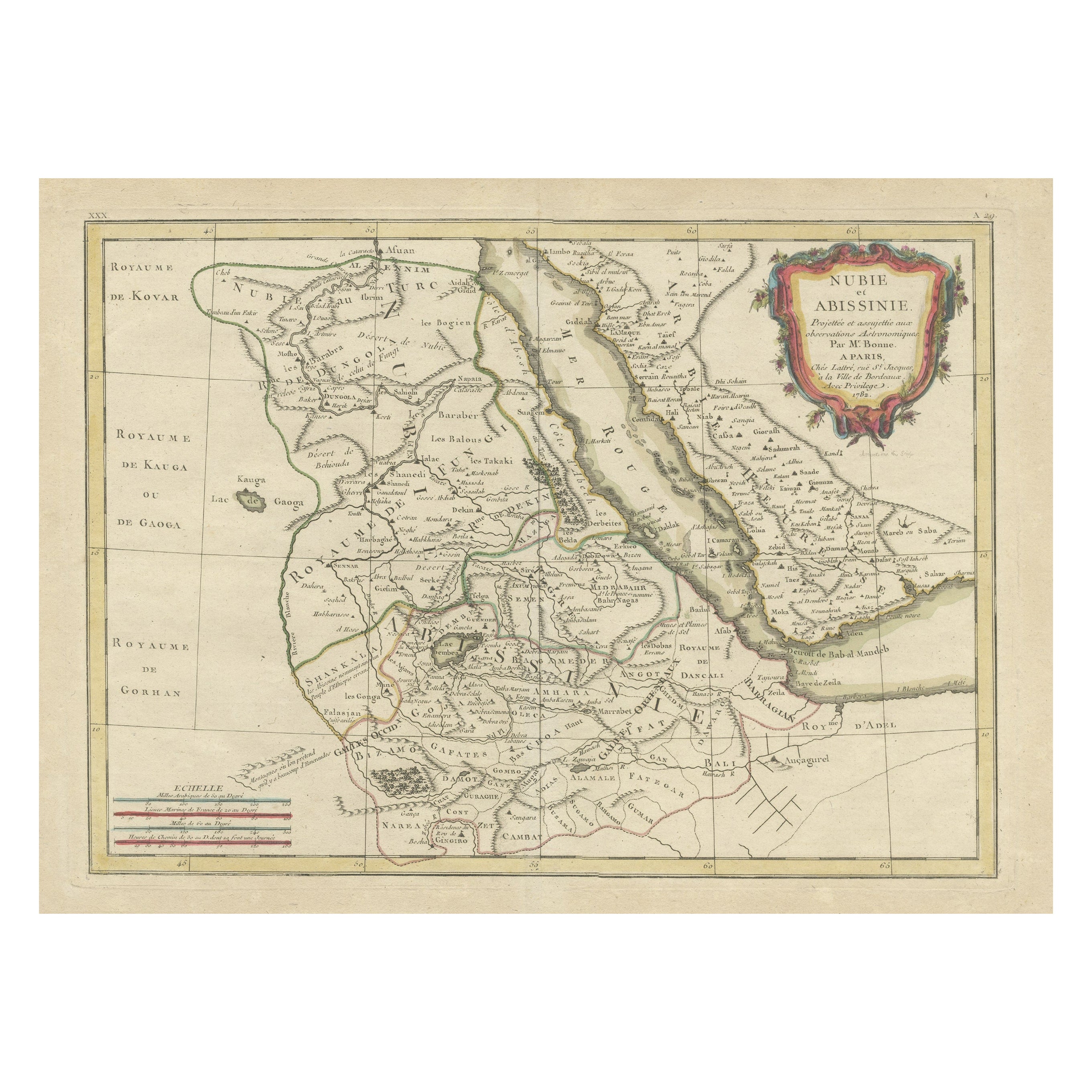
- Antique Map of Arabia including Nubia and Abyssinia, also shows the Red SeaLocated in Langweer, NLAntique map titled 'Nubie et Abissinie'. Original antique map of Nubia, a region along the Nile river, and Abyssinia or the Ethiopian Empire. This map o...Category
Antique Late 18th Century Maps
MaterialsPaper
- Antique Map of Egypt, Arabia Petraea and Lower Nubia by Johnston '1909'Located in Langweer, NLAntique map titled 'Egypt, Arabia Petraea and Lower Nubia'. Original antique map of Egypt, Arabia Petraea and Lower Nubia. With inset maps of Alexandriam Cairo and the Suez Canal...Category
Early 20th Century Maps
MaterialsPaper
- Rare Antique Map of the Middle East, ca.1690Located in Langweer, NLDescription: Antique print, untitled. Two decorative maps on one sheet of the middle east in biblical times. Source unknown, to be determined. Artists and Engravers: Anonymous...Category
Antique 1690s Prints
MaterialsPaper
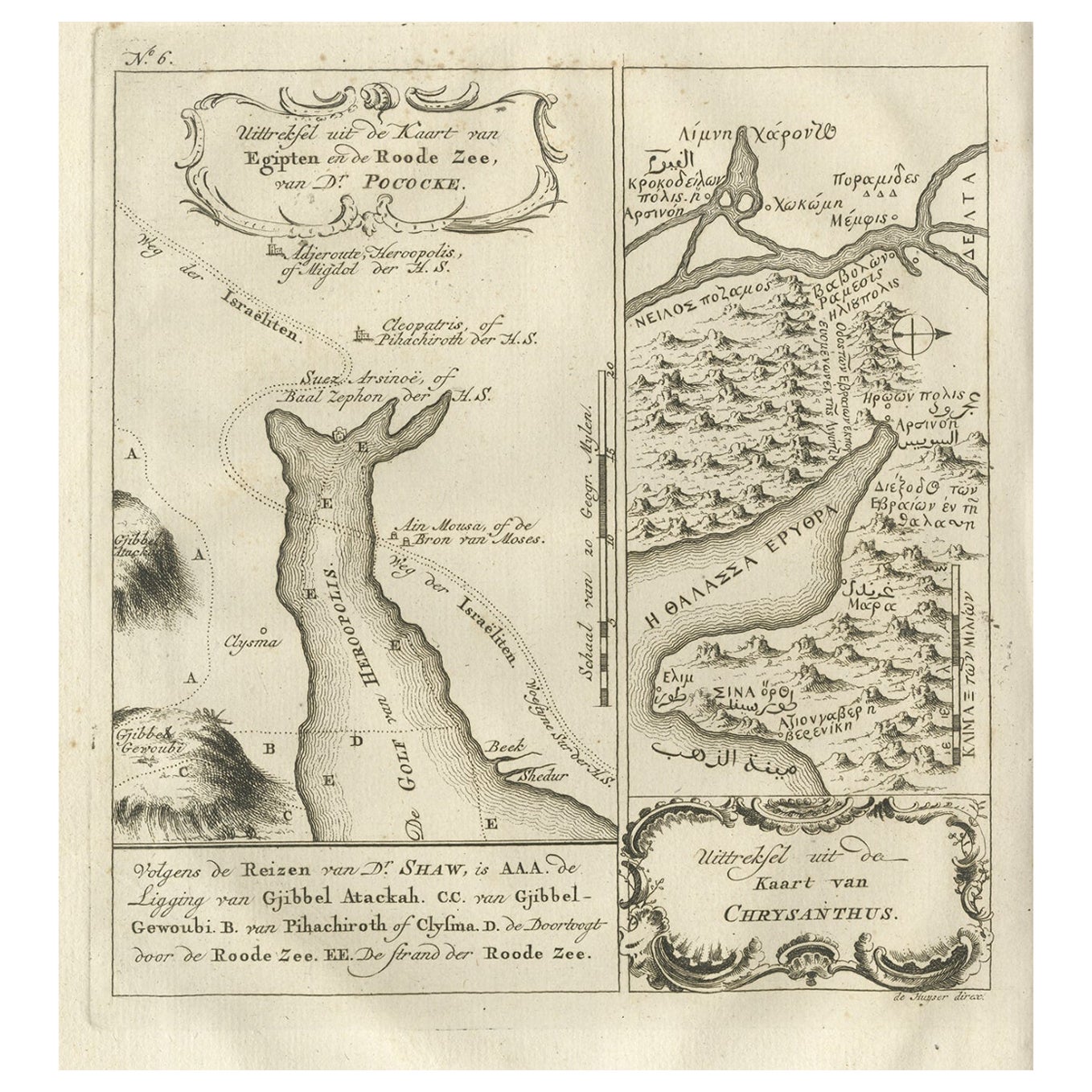
- Rare Antique Map of Yam Suph, Egypt and Red Sea, 1773Located in Langweer, NLAntique print with two maps titled 'Uittreksel van de Kaart van Egipten en de Roode Zee' and 'Uittreksel uit de Kaart van Chrysanthus'. The left image shows Yam Suph, the body of wat...Category
Antique 18th Century Maps
MaterialsPaper
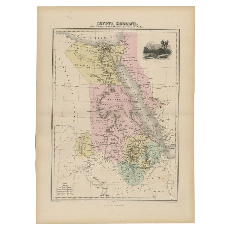
- Antique Map of The Nile, Egypt, Nubia and Abyssinia and Inset of Jerusalem, 1880Located in Langweer, NLAntique map titled 'Égypte Moderne'. Old map of Egypt, Nubia and Abyssinia (Ethiopia), Kordofan and Darfour (parts of Sudan), as well as part of Arabia. With decorative vignette of J...Category
Antique 19th Century Maps
MaterialsPaper


Recently Viewed
View AllMore Ways To Browse
Paris Globe Light
Marine Rouge
Carte Egypte Antique
River Rouge
Carved Gothic Cabinet
Jewlery Storage Chest
Louis Xvi Chest Brass
Olive Leaf
Oriental Cushions
Oval Chest
Pair Of Antique Beds
Pierced Wood Cabinets
Polychrome Cabinet
Victorian Small Cabinet
Vintage Brass Door Hardware
Vintage Document Box
Vintage Salterini Wrought Iron Furniture
Wooden Painted Antique Cabinet