Items Similar to Framed Hand Colored Map of Persia by John Speed


Want more images or videos?
Request additional images or videos from the seller
1 of 10
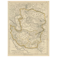
Framed Hand Colored Map of Persia by John Speed
About the Item
Framed hand colored map of Persia by John Speed. Nicely matted.
About the Seller
4.9
Gold Seller
These expertly vetted sellers are highly rated and consistently exceed customer expectations.
Established in 1985
1stDibs seller since 2007
822 sales on 1stDibs
Typical response time: 1 hour
Associations
The Art and Antique Dealers League of America
- ShippingRetrieving quote...Ships From: Essex, MA
- Return PolicyA return for this item may be initiated within 14 days of delivery.
More From This SellerView All
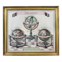
- Framed Engraving By Matthaus Seutter Of Sphaerae ArtificialesLocated in Essex, MACartographer from Germany 1678-1757. Hand colored. Gilt wood frame. Estate of William Hodgins.Category
Antique Early 1700s German Prints
MaterialsPaper
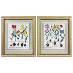
- Pair of Framed Hand Colored Engravings of Tulips by Basilius BeslerBy Basilius BeslerLocated in Essex, MAEach with crisp vivid colors of the most desirable tulip series.Category
Antique Mid-17th Century European Prints
MaterialsPaper
- Pair of Road Maps of England by John OgilbyLocated in Essex, MAThe first road maps of England. London to Holyhead and London to Carlisle. Nicely framed and matted. These are plates removed from a book. These are fir...Category
Antique 1690s English Prints
MaterialsPaper
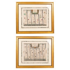
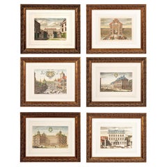
- Set of Six Framed Hand Colored Engravings of Swedish Royal ResidencesLocated in Essex, MABy Johannes Van den Aveelen and engraved by Holmice. Six views of Swedish royal residences. Hand colored engravings. Framed and matted.Category
Antique Early 1700s Dutch Baroque Prints
MaterialsPaper
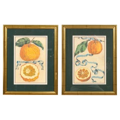
- Pair Of Hand Colored Engravings Of Citrus By Giovanni Baptista FerrariLocated in Essex, MAFrom "Hesperides sive de Malorum Aureorum Cultura et Usu Libri Quatuor", published in 1646. Cassiano dal Pozzo, a friend and scholar on citrus led to the publication. Ferrari was the...Category
Antique 17th Century Italian Prints
MaterialsGlass, Giltwood, Paper
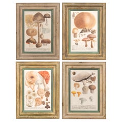
- Set Of Four Hand Colored Engravings Of MushroomsLocated in Essex, MAEach in a painted frame and all hand colored plate engravings with inscriptions in Latin and German.Category
Antique Mid-19th Century European Prints
MaterialsGlass, Paper
You May Also Like
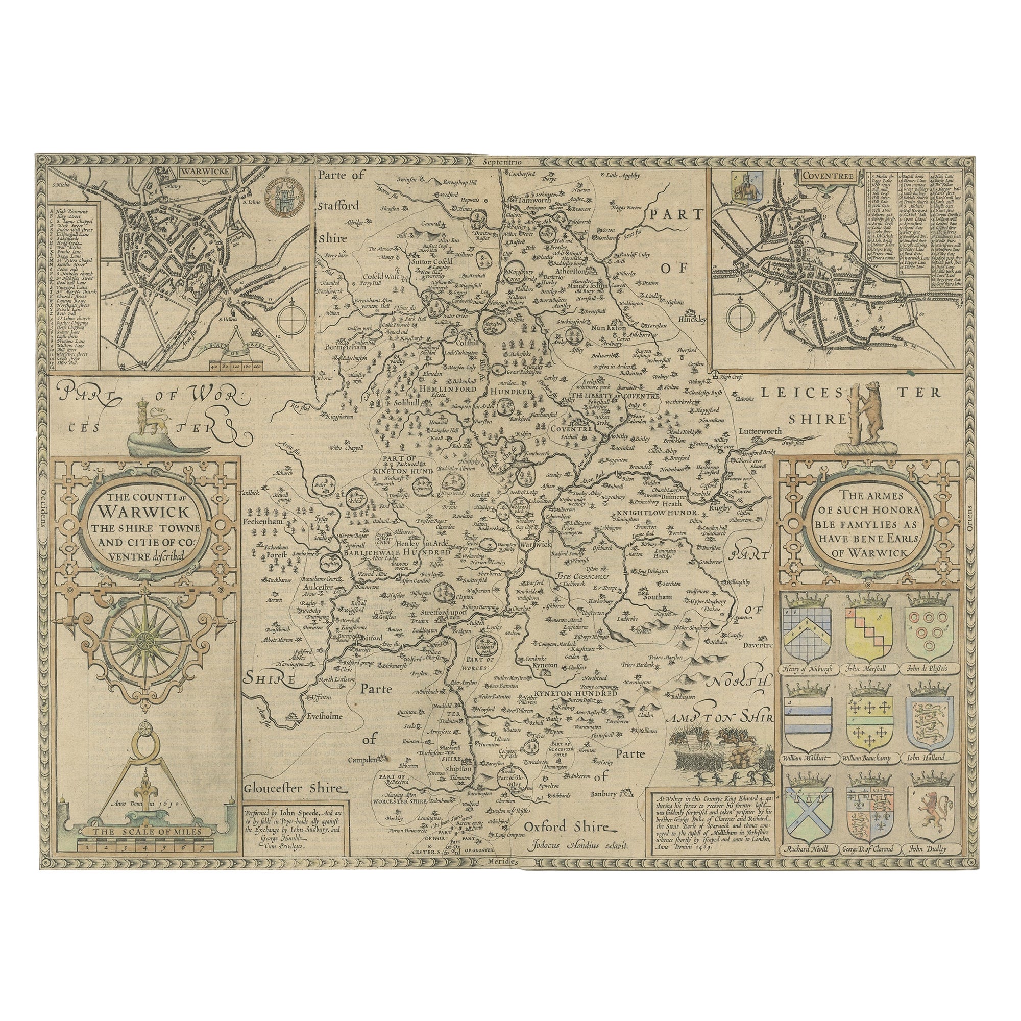
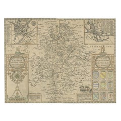
- Antique Map of Warwickshire by Speed, c.1614Located in Langweer, NLAntique map titled 'The Counti of Warwick (..)'. Map of Warwickshire, England. Includes inset town plans of Warwick and Coventry. This map originates from 'Theatre of Great Britaine'...Category
Antique 17th Century Maps
MaterialsPaper
- Antique Map of Persia by A. Zatta, circa 1785Located in Langweer, NLAntique map titled 'L'Impero della Persia diviso ne suoi Stati'. The Empire of Persia divided into its states. Originates from 'Atlante Novissimo, illustrato ed accresciuto sulle oss...Category
Antique Late 18th Century Maps
MaterialsPaper
- Antique Map of Eastern Persia, 1852Located in Langweer, NLAntique map titled 'Eastern Persia'. Original map of Eastern Persia. This map originates from 'Lowry's Table Atlas constructed and engraved from the most recent Authorities' by J.W. ...Category
Antique Mid-19th Century Maps
MaterialsPaper
- South America: Hand-colored 18th Century Framed Map by Thomas JefferysBy Thomas JefferysLocated in Alamo, CAThis detailed hand-colored map of South America by Thomas Jefferys was published in London in 1750. The map shows countries, early colonial possessions, towns, rivers, mountains, and...Category
Antique Mid-18th Century English Maps
MaterialsPaper
- Antique Map of Persia and Tartary by Lowry, '1852'Located in Langweer, NLAntique map titled 'Persia and Tartary'. Original map of Persia and Tartary. This map originates from 'Lowry's Table Atlas constructed and engraved from the most recent Authorities' ...Category
Antique Mid-19th Century Maps
MaterialsPaper
- Antique Map of Persia and Afghanistan by Johnston '1909'Located in Langweer, NLAntique map titled 'Persia and Afghanistan'. Original antique map of Persia and Afghanistan. This map originates from the ‘Royal Atlas o...Category
Early 20th Century Maps
MaterialsPaper


Recently Viewed
View AllMore Ways To Browse
Antique Print Collection
19th Century Bird Prints
Set Of Wall Color Prints
Wall Color Prints Set
Antique Chinese Wall Paper
Antique Bird House
Antique Bird Houses
Framed Antique Prints Sets
Set Of Antique Prints Framed
20th Century Etchings
Circa Bird Print
Antique Art Print Sets
Pair Of French Prints
Metal Bird Wall
Antique Cook
Amsterdam Wall Plate
Antique Ornithology Prints
Antique Picture Prints