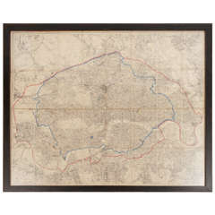
19th Century London Postal Map of Large Scale - Framed
View Similar Items

Want more images or videos?
Request additional images or videos from the seller
1 of 7
19th Century London Postal Map of Large Scale - Framed
About the Item
- Dimensions:Height: 42.25 in (107.32 cm)Width: 49.25 in (125.1 cm)Depth: 1.5 in (3.81 cm)
- Materials and Techniques:
- Place of Origin:
- Period:
- Date of Manufacture:c. 1885
- Condition:
- Seller Location:Kinderhook, NY
- Reference Number:1stDibs: 1402211002158
About the Seller
5.0
Vetted Seller
These experienced sellers undergo a comprehensive evaluation by our team of in-house experts.
Established in 2012
1stDibs seller since 2013
141 sales on 1stDibs
More From This SellerView All
- Pair of 19th Century Italian Neoclassical Tazze in Polychrome MarblesLocated in Kinderhook, NYPair of 19th century Italian 'grand tour' tazze or shallow urns of neoclassical form composed of ancient Roman marbles; the tazze having round giallo antico bowls and socles on squar...Category
Antique 19th Century Italian Grand Tour Garniture
MaterialsMarble
- Italian Louis XVI Painted and Parcel Gilt Fauteuil of Large Scale, circa 1780Located in Kinderhook, NYAn unusual circa 1780 Italian Neapolitan Louis XVI style fauteuil or open-armchair of large "Palazzo" scale having acanthus and lambs-tongue carved fruitwood frame in original 'creme...Category
Antique Late 18th Century Italian Louis XVI Armchairs
MaterialsFruitwood, Giltwood
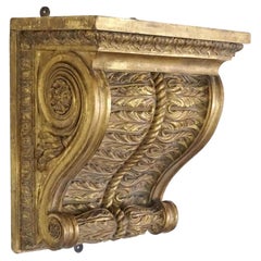
- English Regency Large Scale Neoclassical Giltwood Wall Bracket, circa 1825Located in Kinderhook, NYA rare, exceptional, and monumentally scaled circa 1825 English Regency George IV period giltwood wall bracket or shelf of corbel form having rectangular plinth shelf above double sp...Category
Antique Early 19th Century English Neoclassical Wall Brackets
MaterialsGiltwood, Paint
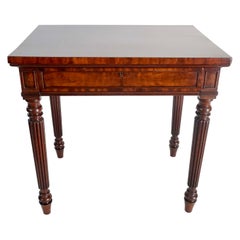
- Crocodile Mahogany Side Table by Gillows of Lancaster & London, circa 1820By Gillows of Lancaster & LondonLocated in Kinderhook, NYAn extremely fine circa 1820 side or writing table by legendary English cabinetmaking firm of Gillows of Lancaster and London of rectangular form having an exquisitely grained solid ...Category
Antique Early 19th Century English Regency Side Tables
MaterialsMahogany
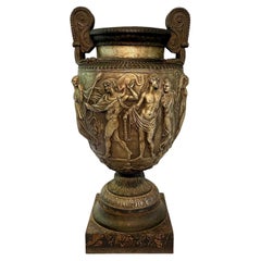
- Cast Iron Scale Model of the Townley Vase, Val d'Osne Foundry, circa 1870By Val D'Osne FoundryLocated in Kinderhook, NYRare and spectacular circa 1870 cast iron actual scale model of the Townley Vase by French foundry Val d'Osne, having original black and silver paint scheme on faux-marbre painted plinth, the volute-krater form vase decorated in high-relief with a Bacchic scene, featuring Pan and followers of the wine-god Bacchus dancing in revelry. The Townley Vase is a large Roman marble vase of the 2nd century CE, discovered in 1773 by Scottish antiquarian and antiquities dealer Gavin Hamilton while excavating a Roman villa at Monte Cagnolo, Lazio, Italy. Its name comes from the English collector Charles Townley, who purchased it from Hamilton in 1774 for £250. Townley's collection, displayed in his Park Street, London house, and immortalized by Johan Zoffany...Category
Antique Late 19th Century French Neoclassical Revival Urns
MaterialsIron
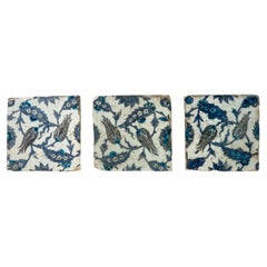
- Iznik Pottery Tiles, 17th Century Ottoman Turkey, Set of ThreeBy Iznik PotteryLocated in Kinderhook, NYA collection of three 17th century Turkish Ottoman Iznik pottery wall tiles having underglaze-polychrome decoration of stylized tulips and 'saz leaf' des...Category
Antique 17th Century Turkish Architectural Elements
MaterialsPottery
You May Also Like
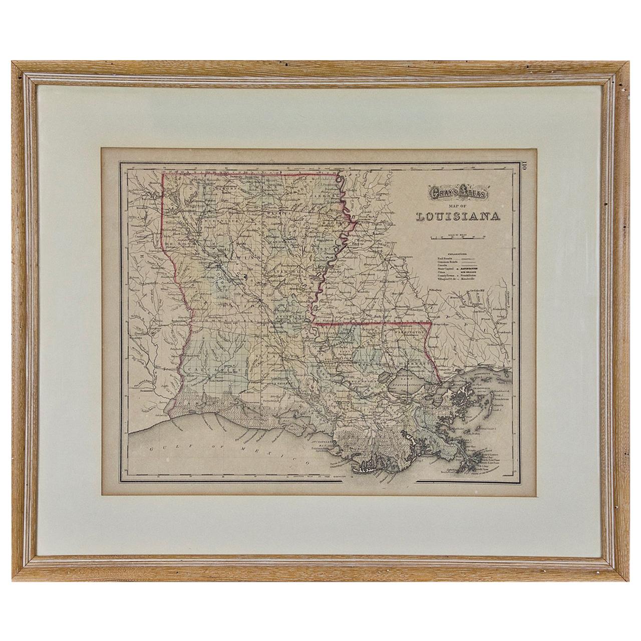
- Louisiana: A Framed 19th Century Map by O. W. GrayBy Gray and CoLocated in Alamo, CAThis framed 19th century map of the Louisiana territory was published in "Gray's Atlas of the United States with General Maps of the World, accompanied by Descriptions Geographical, Historical, Scientific and Statistica" published in 1873 in Philadelphia by O.W. Gray and Son and Stedman, Brown and Lyon. It is a highly detailed map of Louisiana...Category
Antique Mid-19th Century American Other Maps
MaterialsPaper
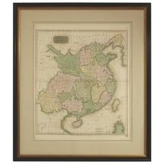
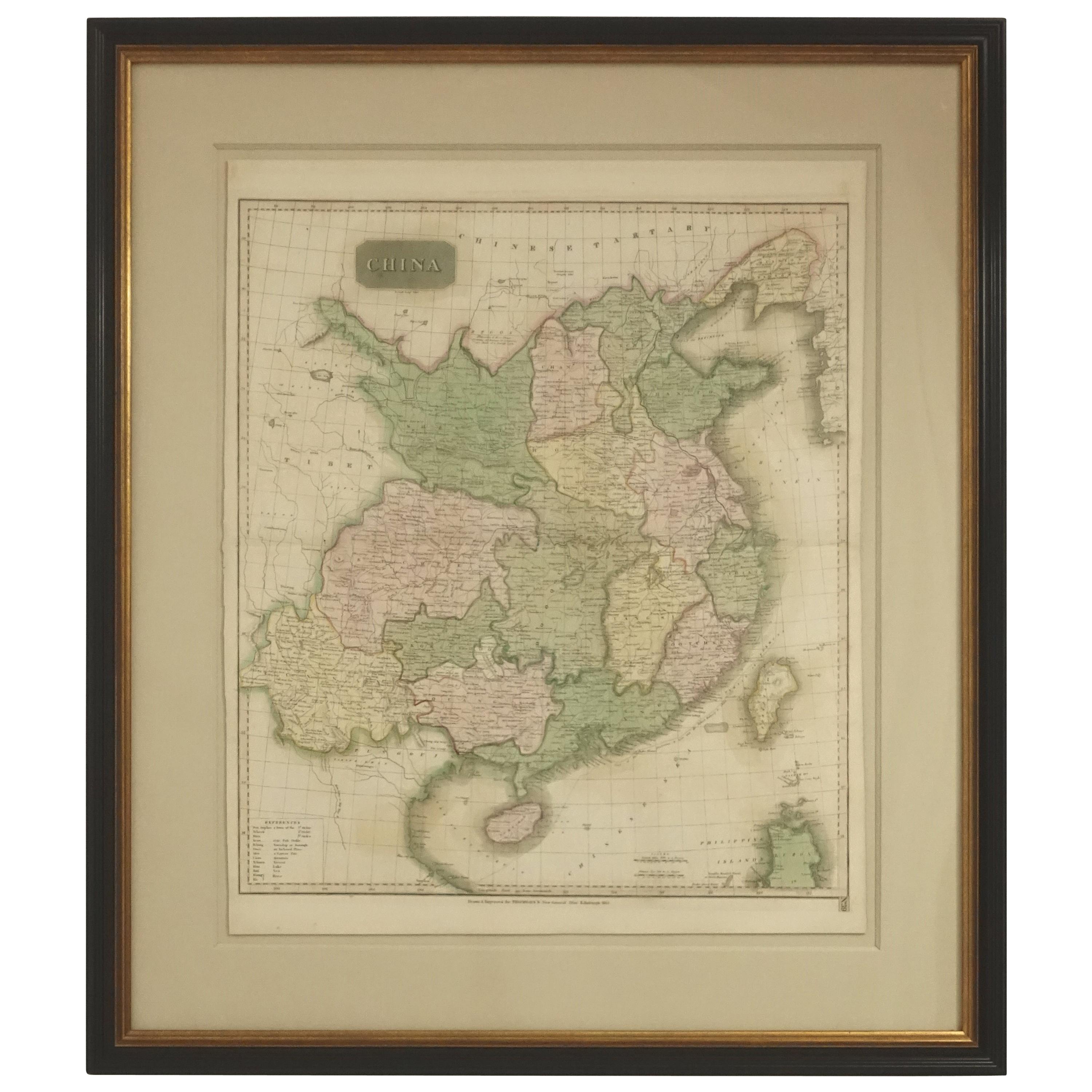
- Framed Early 19th Century Drawn and Engraved Map of ChinaBy John Knighton ThomsonLocated in San Francisco, CAHand drawn and tinted engraved map of China dated 1815 Created for Thomson's New General Atlas Edinburgh Beautifully framed with a linen covered mat.Category
Antique Early 19th Century European Prints
MaterialsPaper
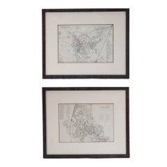
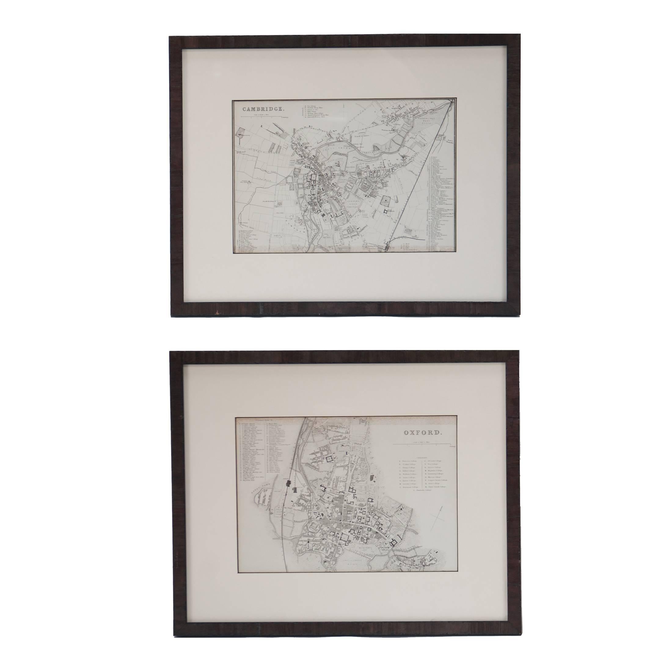
- Mid 19th Century Pair of Framed English Maps of Oxford and CambridgeLocated in Los Angeles, CAPair of maps of Oxford and Cambridge in custom black wood frames. With beautiful hand-drawn lettering and a breathtaking commitment to detail, these mid ...Category
Antique 19th Century English Victorian Prints
MaterialsPaper, Wood
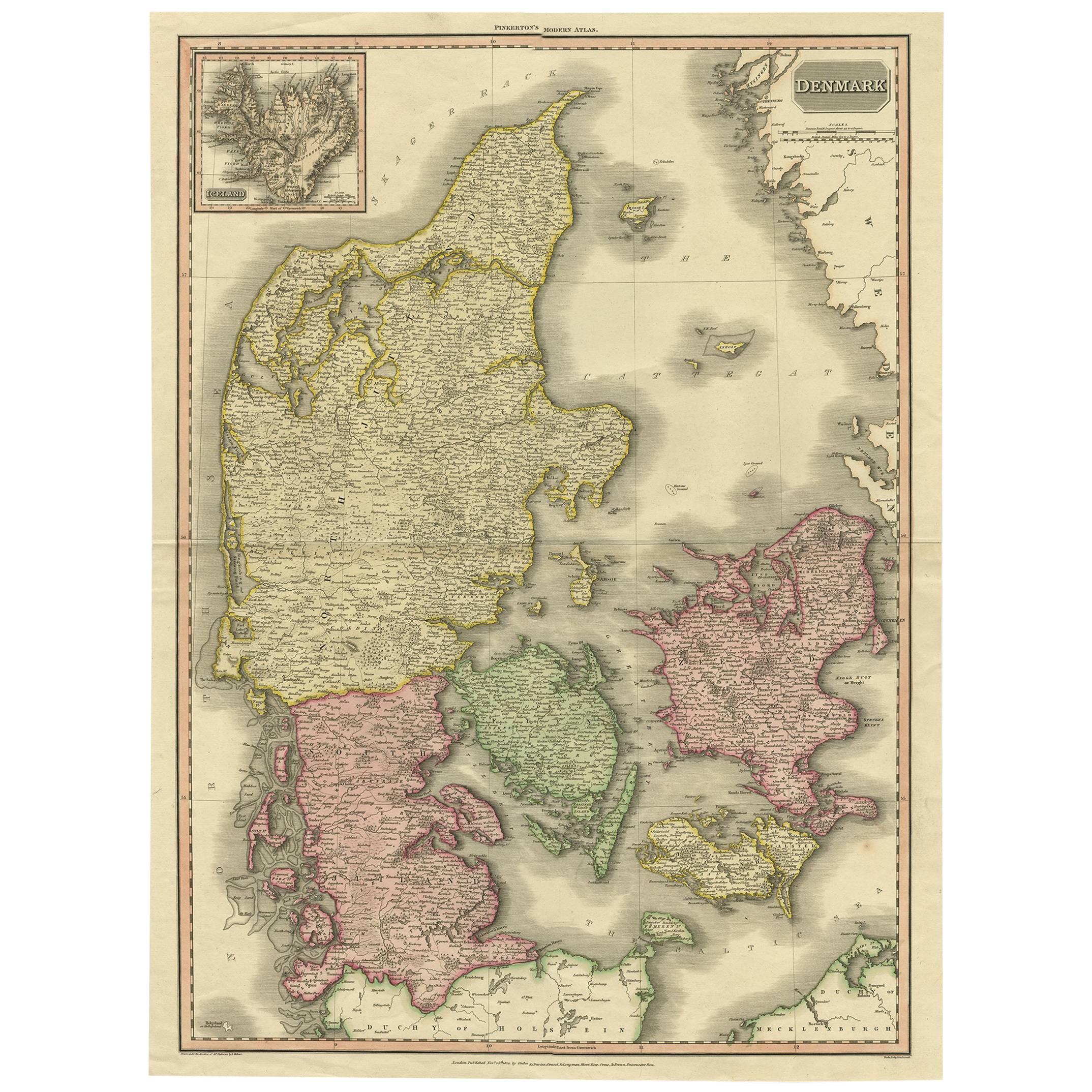
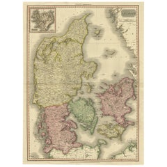
- 19th Century Large Original Antique Map of Denmark by J. Pinkerton, 1812By PinkertonLocated in Langweer, NLHighly detailed map of Denmark. One of the best large format English atlas maps of the period. Pinkerton's maps reflect the fine copperplate engraving work being done in the Britain...Category
Antique Early 19th Century Maps
MaterialsPaper
 $322 Sale Price40% OffFree Shipping
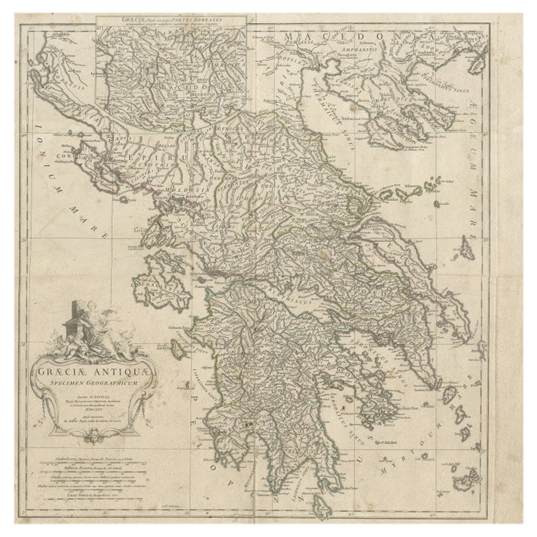
 - Large Scale Map of Greece with Inset Map of Macedonia, c.1786Located in Langweer, NLAntique map titled 'Graeciae Antiquae'. Large scale map of Greece, extends south to the island of Cythera. Inset map shows details of Macedonia. Publis...Category
Antique 18th Century Maps
MaterialsPaper
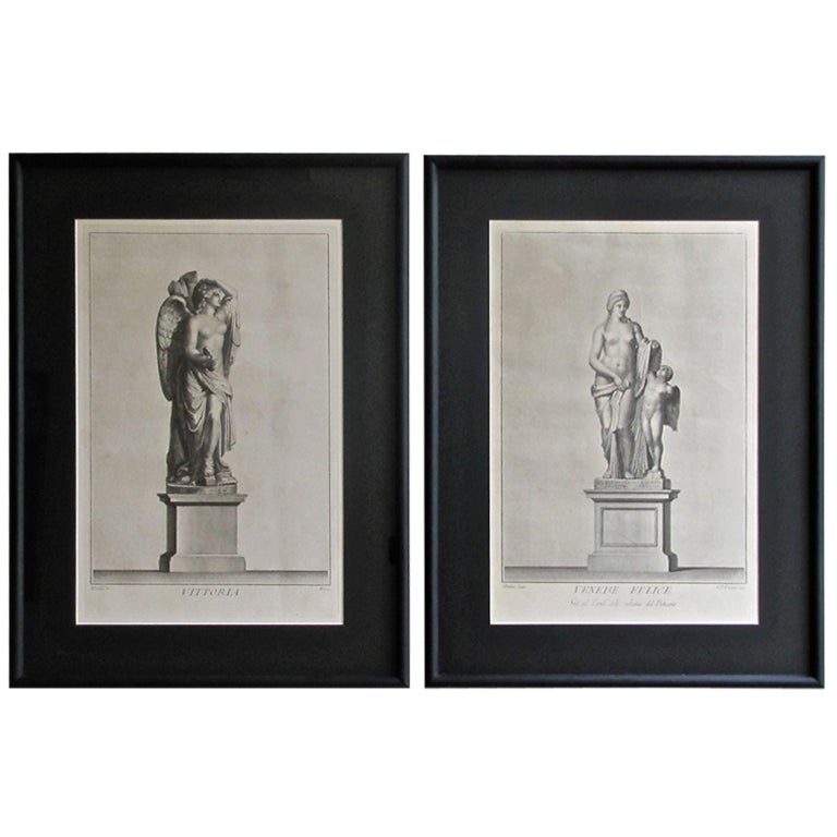
- Series of Framed 19th Century Italian EngravingsLocated in Houston, TXAn exceptional collection of Italian engravings depicting various figures, faces and scenes of Rome. These pieces are custom framed in Classic black and...Category
Antique 19th Century Italian Prints
MaterialsPaper
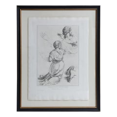 $1,150 / item