Items Similar to Antique Map of Italy by Andriveau-Goujon, 1843


Want more images or videos?
Request additional images or videos from the seller
1 of 12
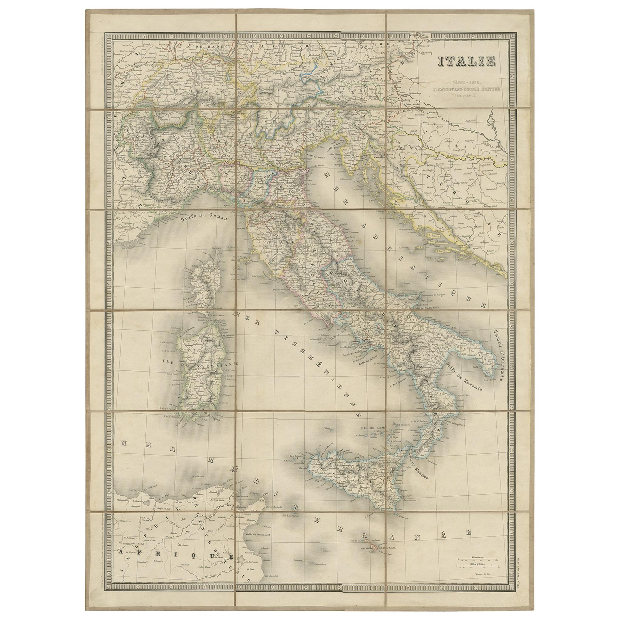
Antique Map of Italy by Andriveau-Goujon, 1843
About the Item
Antique Map of Italy by Andriveau-Goujon, 1843. Map of Italy in two parts by Andriveau-Goujon for the Library of Prince Carini at Palazzo Carini in Palermo, circa 1843. In excellent condition on two panels, dissected and mounted on original linen in 32 sections. Comes with original marbleized cardboard slipcase in rich purple and orange and paper label of the Prince of Carini.
Map dimensions in two parts; each of the two sections measures 38.5" W x 26.25" L for a total overall dimension of 38.5 W x 52.5 L. Box dimensions: 5.5" W x 1.5" D x 7" H.
- Creator:Andriveau-Goujon (Maker)
- Dimensions:Height: 0.38 in (9.66 mm)Width: 38.5 in (97.79 cm)Depth: 52.5 in (133.35 cm)
- Sold As:Set of 2
- Materials and Techniques:
- Place of Origin:
- Period:
- Date of Manufacture:1843
- Condition:Wear consistent with age and use. Excellent antique condition.
- Seller Location:New York, NY
- Reference Number:1stDibs: LU108421930732
About the Seller
4.9
Platinum Seller
These expertly vetted sellers are 1stDibs' most experienced sellers and are rated highest by our customers.
1stDibs seller since 2014
520 sales on 1stDibs
Typical response time: 2 hours
- ShippingRetrieving quote...Ships From: New York, NY
- Return PolicyA return for this item may be initiated within 3 days of delivery.
More From This SellerView All
- Map of the Republic of GenoaLocated in New York, NYFramed antique hand-coloured map of the Republic of Genoa including the duchies of Mantua, Modena, and Parma. Europe, late 18th century. Dimension: 25...Category
Antique Late 18th Century European Maps
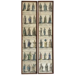
- Set of Six Engravings of Italian Regional DressBy Alessandro d'AnnaLocated in New York, NYSet of six engravings of Italian regional dress. Set of six framed antique engravings from a series of Italian regional dress after Alessandro d'...Category
Antique Late 18th Century Italian Prints
MaterialsPaper
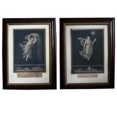
- Pair of Italian Neoclassical Allegorical EngravingsBy Raphael (Raffaello Sanzio da Urbino)Located in New York, NYPair of Italian Neoclassical allegorical engravings. Pair of Italian neoclassical allegorical engravings after Raphael from "The Hours of the Nig...Category
Antique Early 19th Century Italian Prints
MaterialsPaper
- Pair Framed Antique Engravings of Ottoman PersonagesLocated in New York, NYSet of 12 hand coloured antique engravings of 36 diverse personages of Ottoman and Oriental background spectacularly attired in characteristic attire and headgear. A truly fantastic artistic and historic assemblage of richly attired individuals of rank and station with descriptions in Latin, French and German; twelve pages in all divided into two later wood framed panels...Category
Antique Early 18th Century European Prints
MaterialsPaper
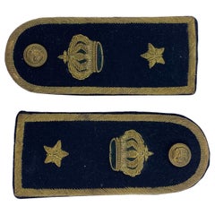
- Pair of Italian Military EpaulettesLocated in New York, NYPair of Italian Military epaulettes. Handsome pair of black and gold thread stitched functioning naval epaulettes with the crown of Savoy, stars and b...Category
Vintage 1930s Italian Historical Memorabilia
MaterialsMetallic Thread
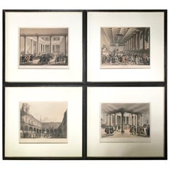
- Set of Four Regency Era Coloured Engravings by RowlandsonBy Rowlandson and PuginLocated in New York, NYSet of four Regency era coloured engravings by Rowlandson. Four framed coloured engravings of Regency London landmarks including the Corn Exchange,...Category
Antique Early 19th Century English Prints
MaterialsPaper


You May Also Like
- Antique Map of Italy by Andriveau-Goujon, 1855Located in Langweer, NLAntique folding map of Italy titled 'Italie'. Detailed map of Italy. The map originates from 'Atlas Universel' and is mounted on linen.Category
Antique Mid-19th Century Maps
MaterialsPaper
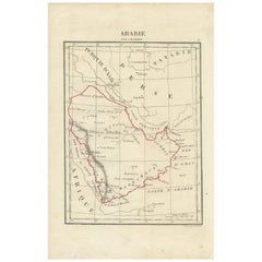
- Antique Map of Arabia by Tardieu '1843'Located in Langweer, NLAntique map titled 'Arabie'. Attractive small map of Arabia. This map originates from 'Dictionnaire Universel de Geographie Moderne' 4th Edition, by A.Pe...Category
Antique Mid-19th Century Maps
MaterialsPaper
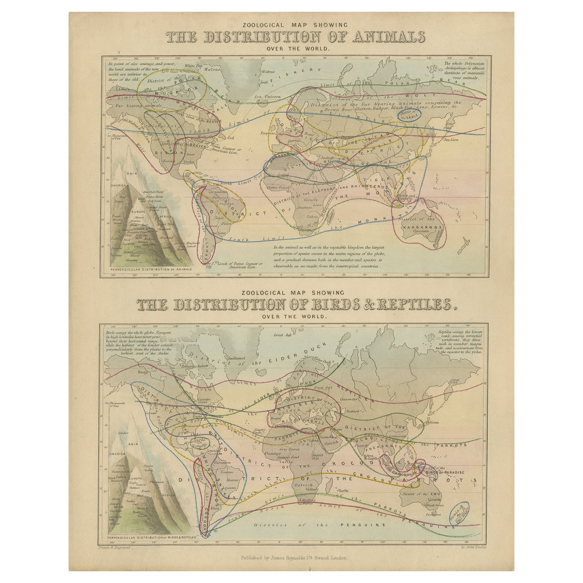
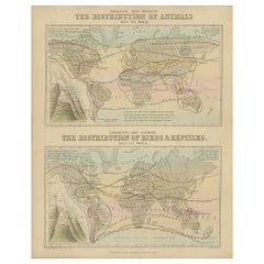
- Antique Zoological Map, 1843Located in Langweer, NLTwo antique world maps on one sheet. The upper map shows the distribution of animals over the world. The lower map shows the distribution of birds & reptiles over the world. Originat...Category
Antique 19th Century Maps
MaterialsPaper
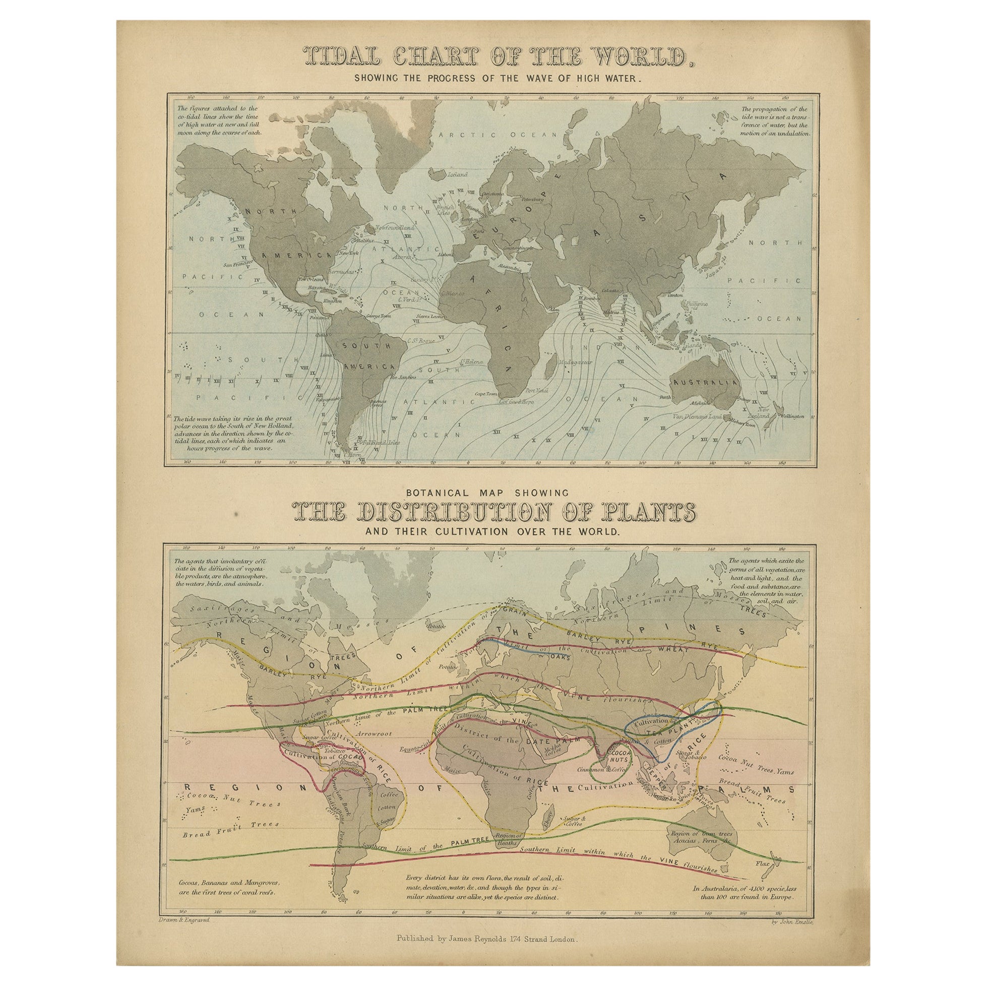
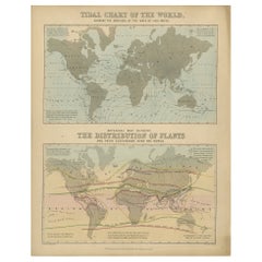
- Antique Tidal Chart and Botanical Map, 1843Located in Langweer, NLTwo antique world maps on one sheet. The upper map is a tidal chart of the world and shows the progress of the wave of high water. The lower botanical map shows the distribution of p...Category
Antique 19th Century Maps
MaterialsPaper
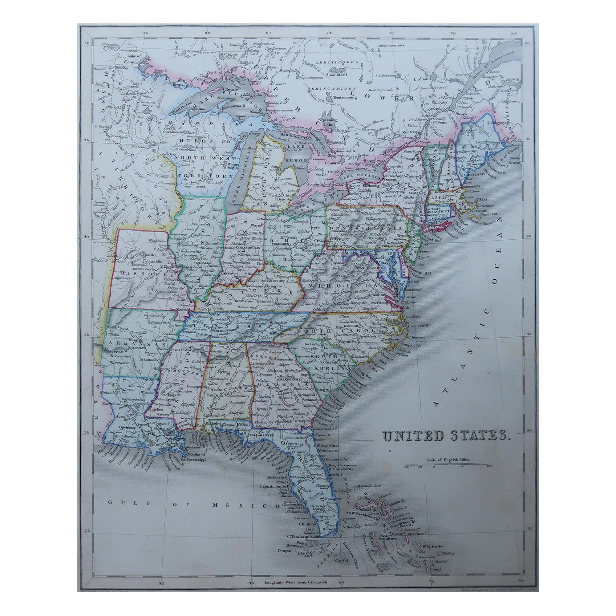
- Original Antique Map of United States, Grattan and Gilbert, 1843Located in St Annes, LancashireGreat map of United States Drawn and engraved by Archer Published by Grattan and Gilbert. 1843 Original colour Unframed.Category
Antique 1840s English Maps
MaterialsPaper
- Antique Map of Italy by Lapie, 1842Located in Langweer, NLAntique map titled 'Carte de l'Italie Ancienne'. Map of Italy. This map originates from 'Atlas universel de géographie ancienne et moderne (..)' by Pierre...Category
Antique Mid-19th Century Maps
MaterialsPaper


Recently Viewed
View AllMore Ways To Browse
Antique Italian Maps
Antique Maps Italy
Antique Map Of Italy
Antique Maps Of Italy
Antique Curiosity Box
French Italian Panel
Prince Orange
Antique Italian Linens
Antique Library Panels
Antique French Paper Panels
Antique Linen Box
Antique Marble Boxes
Antique Linen Map
Antique Map Box
Linen Map Italy
Antique Geography
Antique World Atlas
Folding Maps