Items Similar to Large Original Antique Folding Map of Manchester, England, Dated 1793


Want more images or videos?
Request additional images or videos from the seller
1 of 8
Large Original Antique Folding Map of Manchester, England, Dated 1793
About the Item
Superb map of Manchester and Salford
Folding map. Printed on paper laid on to the original canvas
Unframed.
Published by C. Laurent, 1793.
- Dimensions:Height: 42 in (106.68 cm)Width: 36 in (91.44 cm)Depth: 0.07 in (1.78 mm)
- Style:Georgian (Of the Period)
- Materials and Techniques:
- Place of Origin:
- Period:1790-1799
- Date of Manufacture:1793
- Condition:Wear consistent with age and use.
- Seller Location:St Annes, GB
- Reference Number:1stDibs: LU1836324414672
About the Seller
4.9
Platinum Seller
These expertly vetted sellers are 1stDibs' most experienced sellers and are rated highest by our customers.
1stDibs seller since 2016
2,664 sales on 1stDibs
Typical response time: <1 hour
Associations
International Confederation of Art and Antique Dealers' Associations
- ShippingRetrieving quote...Ships From: St Annes, United Kingdom
- Return PolicyA return for this item may be initiated within 3 days of delivery.
More From This SellerView All
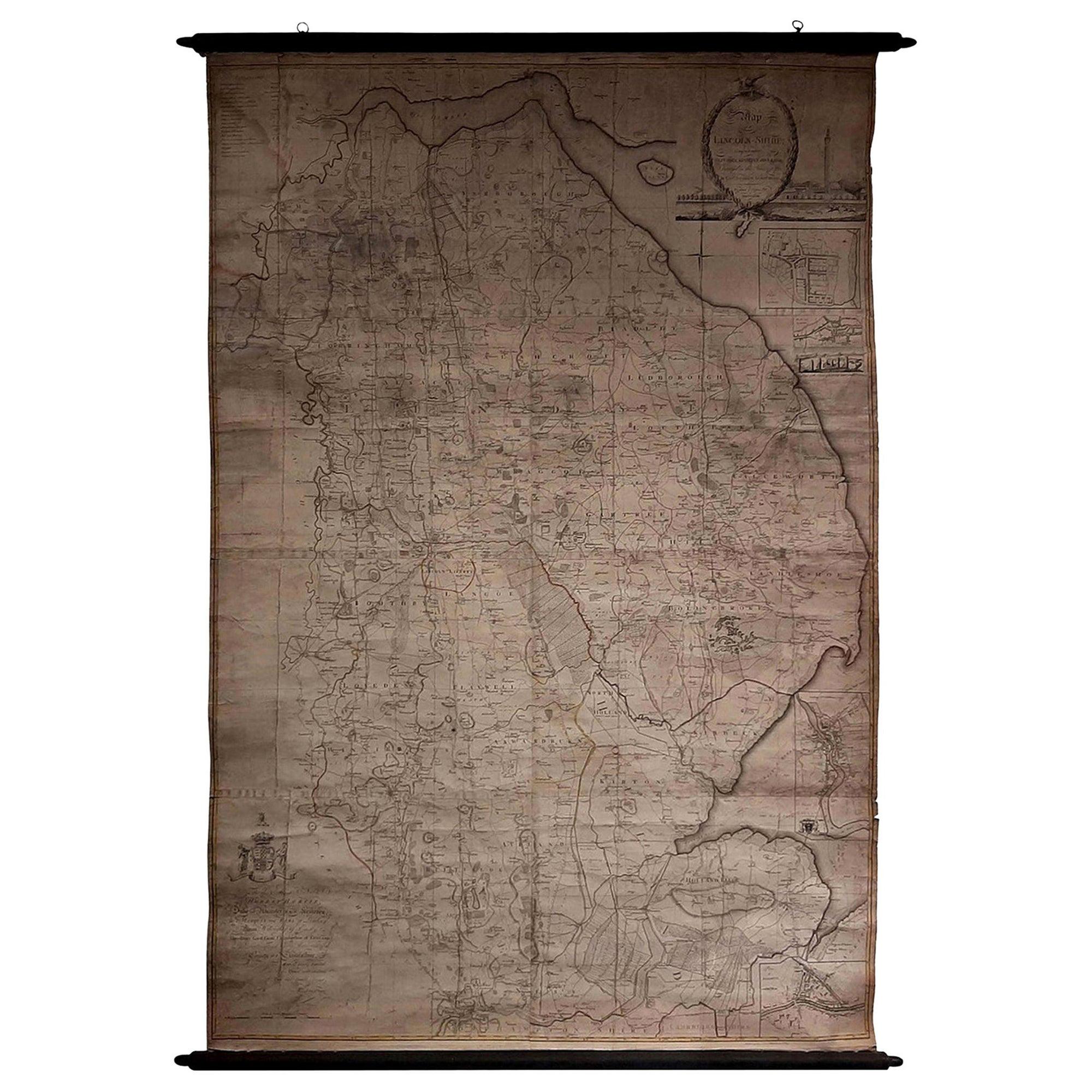
- Large Scale Antique Scroll Map of Lincolnshire, England, Dated 1778Located in St Annes, LancashireWonderful scroll map of Lincolnshire By Captain Armstrong, 1778 Copper plate engraving on paper laid on canvas Original ebonized wood frame with lo...Category
Antique 1770s English Georgian Maps
MaterialsWood, Paper
- Large Original Antique Map of China, Fullarton, C.1870Located in St Annes, LancashireGreat map of China From the celebrated Royal Illustrated Atlas Lithograph by Swanston. Original color. Published by Fullarton, Edinburgh. C.1870 Repairs to minor edge te...Category
Antique 1870s Scottish Maps
MaterialsPaper
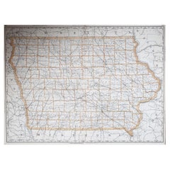
- Large Original Antique Map of Iowa, USA, 1894By Rand McNally & Co.Located in St Annes, LancashireFabulous map of Iowa. Original color. By Rand, McNally & Co. Published, 1894. Unframed. Free shipping.Category
Antique 1890s American Maps
MaterialsPaper
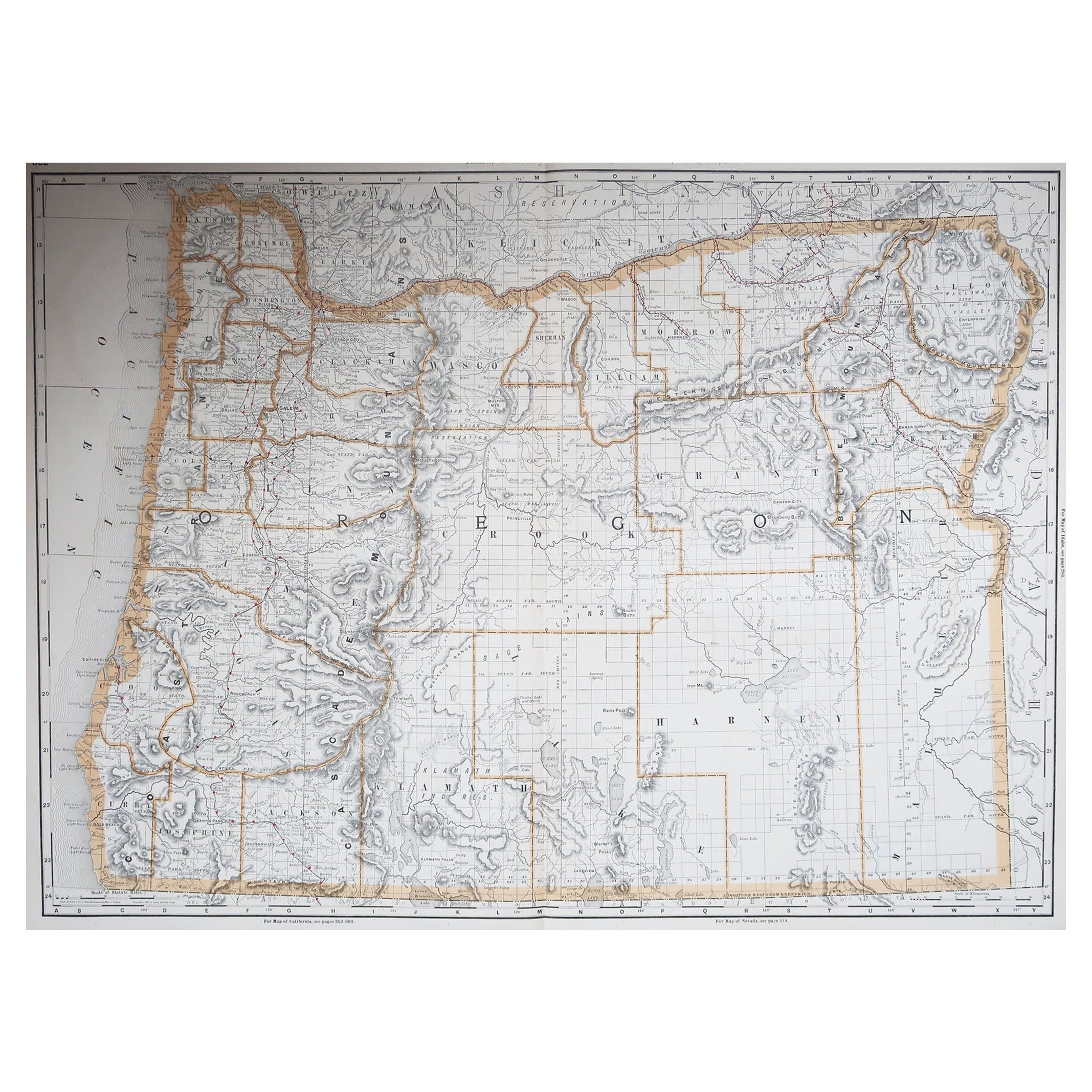
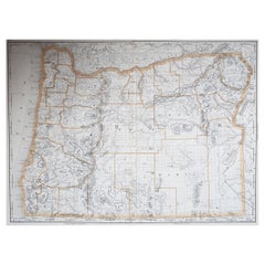
- Large Original Antique Map of Oregon, USA, 1894By Rand McNally & Co.Located in St Annes, LancashireFabulous map of Oregon. Original color. By Rand, McNally & Co. Published, 1894. Unframed. Free shipping.Category
Antique 1890s American Maps
MaterialsPaper
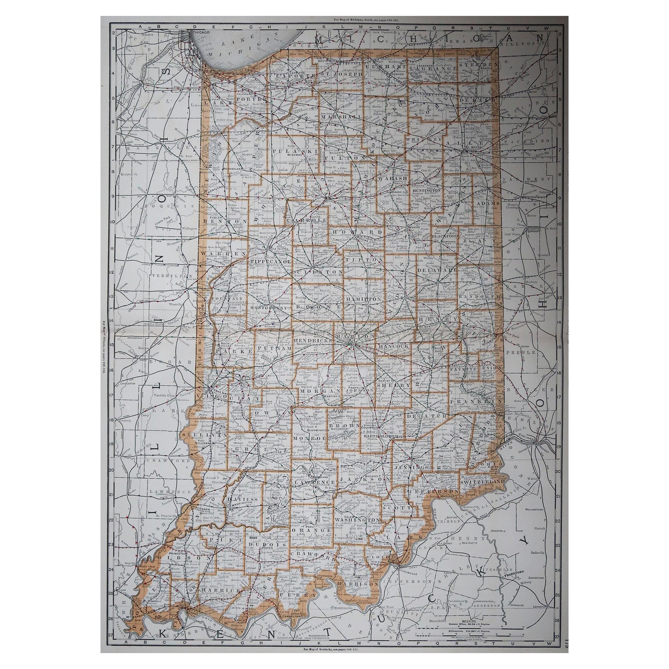
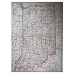
- Large Original Antique Map of Indiana, USA, 1894By Rand McNally & Co.Located in St Annes, LancashireFabulous map of Indiana. Original color. By Rand, McNally & Co. Published, 1894. Unframed. Free shipping.Category
Antique 1890s American Maps
MaterialsPaper
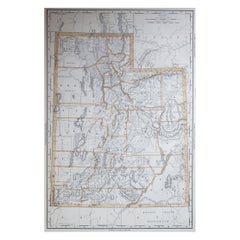
- Large Original Antique Map of Utah, USA, 1894By Rand McNally & Co.Located in St Annes, LancashireFabulous map of Utah Original color By Rand, McNally & Co. Published, 1894 Unframed Free shipping.Category
Antique 1890s American Maps
MaterialsPaper


You May Also Like
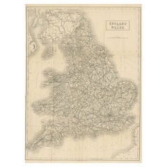
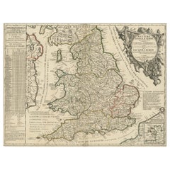
- Antique Folding Map of England and WalesLocated in Langweer, NLAntique map titled 'England and Wales'. Original folding map of England and Wales. Publishes by A. & C. Black, circa 1890.Category
Antique Late 19th Century Maps
MaterialsPaper
- Gold Leaf Foil Pictorial Plan Map of the West Country of England Antique StyleLocated in GBWe are delighted to offer for sale this lovely Antique style pictorial plan map of the West Country of England etched in gold leaf foil This is a very interesting and decorative p...Category
20th Century English Adam Style Maps
MaterialsGold Leaf
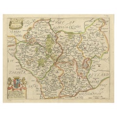
- Original Antique Map of Leicestershire, EnglandLocated in Langweer, NLAntique map titled 'A Mapp of the Country of Leicester'. Original old map of Leicestershire, England. This map originates from 'Britannia: or, a Geographical Description of the Kingd...Category
Antique Late 17th Century Maps
MaterialsPaper
- Original Engraved Antique Map of the World, Colorful and Decorative, C.1780By Pierre François TardieuLocated in Langweer, NLAntique map titled 'Mappemonde en Deux Hemispheres ou l'on a Indique les Nouvelles Decouvertes' - This handsome double hemisphere map presents a ...Category
Antique 18th Century Maps
MaterialsPaper
- Large Antique Wall Map of Friesland by Vegelin van Claerbergen, 1739Located in Langweer, NLAntique map titled 'Nieuwe Caert van Frieslant, Vermeerdert en verbetert op order der Ed. Mo. Heeren Gedeputeerde Staeten'. Rare and large attractive wall map of Friesland, the so-called 'Vegelin-map'. It shows the region of Oostergo, Westergo and Zevenwolden in Friesland, the Netherlands. Decorated with coats of arms of Friesland, Oostergo, Zevenwolden and other regions and cities/villages of Friesland. Artists and Engravers: For this particular map, Bernhardus Schotanus à Sterringa prepared the plates. However, these plates were never published in his 'Schotanus Atlas'. He wanted the plates to be published as a large wall map...Category
Antique 18th Century Maps
MaterialsPaper
- Original Antique Map of England and Wales with Large CartoucheLocated in Langweer, NLAntique map titled 'Le Royaume d'Angleterre divisé en plusieurs Parties (..)'. Large and rare map of England and Wales by J.B. Nolin after Coronelli. With decorative cartouche, table...Category
Antique Late 17th Century Maps
MaterialsPaper


Recently Viewed
View AllMore Ways To Browse
Antique Map Prints
Antique Maps Prints
Antique Furniture Manchester
Used Office Furniture Manchester
Georgia Map
Maps Of Georgia
Antique Georgia Map
Antique Georgia Maps
Antique Map Of Georgia
Framed Map
Set Of Maps
Latin Texts
Atlas Metal
Antique Maps Book
Antique Law Office Furniture
Antique Map Framing
Antique Maps Framed
Framing Antique Maps