Items Similar to Southeastern Ireland: A 17th Century Hand Colored Map by Mercator and Hondius
Want more images or videos?
Request additional images or videos from the seller
1 of 11
Gerard MercatorSoutheastern Ireland: A 17th Century Hand Colored Map by Mercator and Hondius1635
1635
About the Item
A 17th century copperplate hand-colored map entitled "The Second Table of Ireland, Udrone" by Gerard Mercator and Jodocus Hondius, published in Amsterdam in 1635 in 'Cosmographicall Description of the Fabricke & Figure of the World with new Mappes and Tables; By the studious industry of Jodocus Hondy', the first English edition of their 'Atlas Minor'. It is focused on a region of Ireland depicting present day County Carlow in Leinster Province and the city of Catherlaugh, which is now the city of Carlow. This region has an interesting history which led to Mercator producing a map focused on it. When Queen Elizabeth I forced Earl of Desmond, Gerald Fitzgerald, to renounce all his rights to family lands in Munster, Peter Carew claimed much of these land holdings in Ireland. Carew made his case to the English at Dublin Castle and was awarded title to the Barony of Udrone. He subsequently claimed title to one half the Kingdom of Cork, as well as other Irish lands.
The map is embellished with a strap work cartouche containing the name of the region. The map is beautifully hand colored with wide margins. It is presented in an archival cream colored mat measuring 14' wide x 12" high and the map sheet measures 11.25" wide x 7" high. There is English text on the verso. The map is in excellent condition.
Gerard Mercator (1512-1594) is one of the most famous cartographers of all time. He was born in Flanders and moved to Duisburg from Leuven in the Netherlands, where he lived and worked for the rest of his life. In addition to producing important maps and globes, he invented a projection on maps that presented all parallels and meridians at right angles to each other, with the distance between the parallels extending towards the poles, allowing accurate latitude and longitude calculation and navigational routes to be drawn using straight lines. This was an important technological advance for navigation at sea, as this allowed seafarers to plot their course without having to adjust their course based on frequent compass readings. This has become known as Mercator projection on maps produced by subsequent cartographers to this day. He is also the first to use the term “atlas”, which was first used to describe his collection of maps gathered in one volume. The Mercator atlas was published in 1595, a year after Mercator’s death by his heirs.
Jodocus Hondius (1563-1612) was a prominent globe maker and map engraver from Ghent (Flanders). After spending some time in London, he established his business in Amsterdam in 1593. Hondius bought the plates of Gerard Mercator in 1604 and added around 40 of his own maps in an atlas that he first published in 1606, preserving Mercator's name. After his death in 1612 in Amsterdam, the business was continued by his sons Jodocus II and Henricus, who published the English edition of the Mercator and Hondius Atlas Minor in 1635 that contained this map.
- Creator:Gerard Mercator (1512 - 1594, Flemish, German)
- Creation Year:1635
- Dimensions:Height: 12 in (30.48 cm)Width: 14 in (35.56 cm)
- Medium:
- Period:1630-1639
- Framing:Framing Options Available
- Condition:
- Gallery Location:Alamo, CA
- Reference Number:
Gerard Mercator
Gerard Mercator (1512-1594) was one of the most famous cartographers of the 16th century and, in fact, of all time. Mercator was known for his strict adherence to scientific methods of the day. He was responsible for advancing the technology of map making. For example his method of representing land masses in a cylindrical projection with north up and south down, first described in 1569, became the standard map projection for navigation. It is still referred to as The Mercator projection.
About the Seller
5.0
Vetted Seller
These experienced sellers undergo a comprehensive evaluation by our team of in-house experts.
Established in 2011
1stDibs seller since 2019
242 sales on 1stDibs
Typical response time: 1 hour
- ShippingRetrieving quote...Ships From: Alamo, CA
- Return PolicyA return for this item may be initiated within 7 days of delivery.
More From This SellerView All
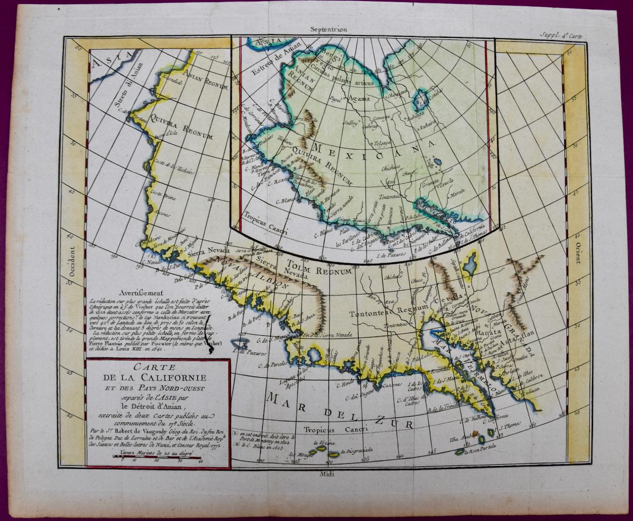
- California: 18th Century Hand-colored Map by de VaugondyBy Didier Robert de VaugondyLocated in Alamo, CAThis is an 18th century hand-colored map of the western portions of North America entitled "Carte de la Californie et des Pays Nord-Ouest separés de l'Asie par le détroit d'Anian, ex...Category
1770s Landscape Prints
MaterialsEngraving
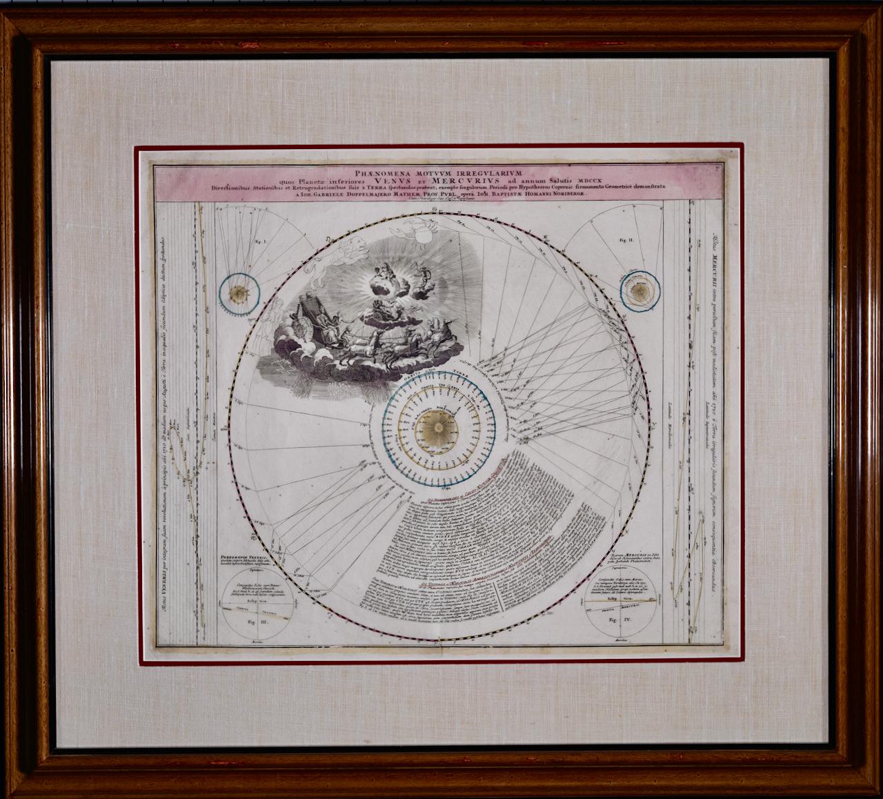
- The Orbits of Venus and Mercury: An 18th C. Framed Celestial Map by DoppelmayrBy Johann Gabriel Doppelmayr 1Located in Alamo, CAThis 18th century hand-colored copperplate celestial map by Johann Doppelmayr entitled "Phænomena Motuum Irregularium quos Planetar inferiores Venus et M...Category
Early 18th Century Landscape Prints
MaterialsEngraving
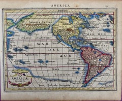
- North & South America: A 17th Century Hand-colored Map by Jansson & GoosBy Johannes JanssonLocated in Alamo, CAA 17th century hand-colored map of North & South America entitled "Americae Descriptio" by the cartographer Johannes Jansson, published in Jansson's Atlas Minor in Amsterdam in 1628....Category
1620s Landscape Prints
MaterialsEngraving
- Persia & Afghanistan: A Framed Hand-colored 17th Century Map by John CaryBy John CaryLocated in Alamo, CAThis colorful and detailed early 18th century copperplate map by John Cary entitled "A New Map of Persia from the Latest Authorities" was published in London in 1801. It depicts Persia, the region of modern day Afghanistan, the Caspian Sea, the Sea of Aral, the Persian Gulf...Category
Early 19th Century Old Masters More Prints
MaterialsEngraving
- The Normandy Region of France: A 17th C. Hand-colored Map by Sanson and JaillotBy Nicholas Sanson d'AbbevilleLocated in Alamo, CAThis large hand-colored map entitled "Le Duché et Gouvernement de Normandie divisée en Haute et Basse Normandie en divers Pays; et par evêchez, avec le Gouvernement General du Havre ...Category
1690s Landscape Prints
MaterialsEngraving
- View of Pisaro, Italy: A 16th Century Hand-colored Map by Braun & HogenbergBy Franz HogenbergLocated in Alamo, CAThis is a 16th century original hand-colored copperplate engraved map of View of Pezaro (Pisaro), Italy entitled "Pisaurum vulgo Pezaro" by Georg Braun & Franz Hogenberg, from their famous city atlas "Civitates Orbis Terrarum", published in Augsberg, Germany in 1575. The map depicts a view of Pesaro, Italy from the west looking over the town to the Adriatic Sea. The River Foglia flows into the Adriatic in the foreground. The only identifiable building is the cathedral of San Domenico, which rises above the other roofs with its tall spire. Two women, dressed in styles of the 16th century are in conversation on a hill in the foreground on the left. Pesaro is in the province of Pesaro and Urbino and lies on the Adriatic and east of Florence. The city, which was founded by the Etruscans and named Pisaurum by the Romans, belonged from AD 754 onwards to the Papal States, and after 1285 was controlled by the princely families of Malatesta, Sforza and della Rovere. Today it is the capital of the province of Pesaro and Urbino and has a population of about 92,000. Pesaro's most famous resident, composer Gioacchino Rossini, was born here in 1792. The following is an English translation of an excerpt from Braun's description of the city: "We believe that the astonishingly short life of the inhabitants of Pesaro comes not only from the insalubrious air, but also from the great quantity of delectable and delicious fruits which they consume to excess. For this causes the production in their bodies of evil humours, which then lead to incurably fatal diseases. The area around the city is most charming and well planted with vineyards, fig trees, olive trees and other fruit-bearing trees." References: Van der Krogt 4, 3369, state 1; Taschen, Braun and Hogenberg...Category
16th Century Old Masters Landscape Prints
MaterialsEngraving


You May Also Like
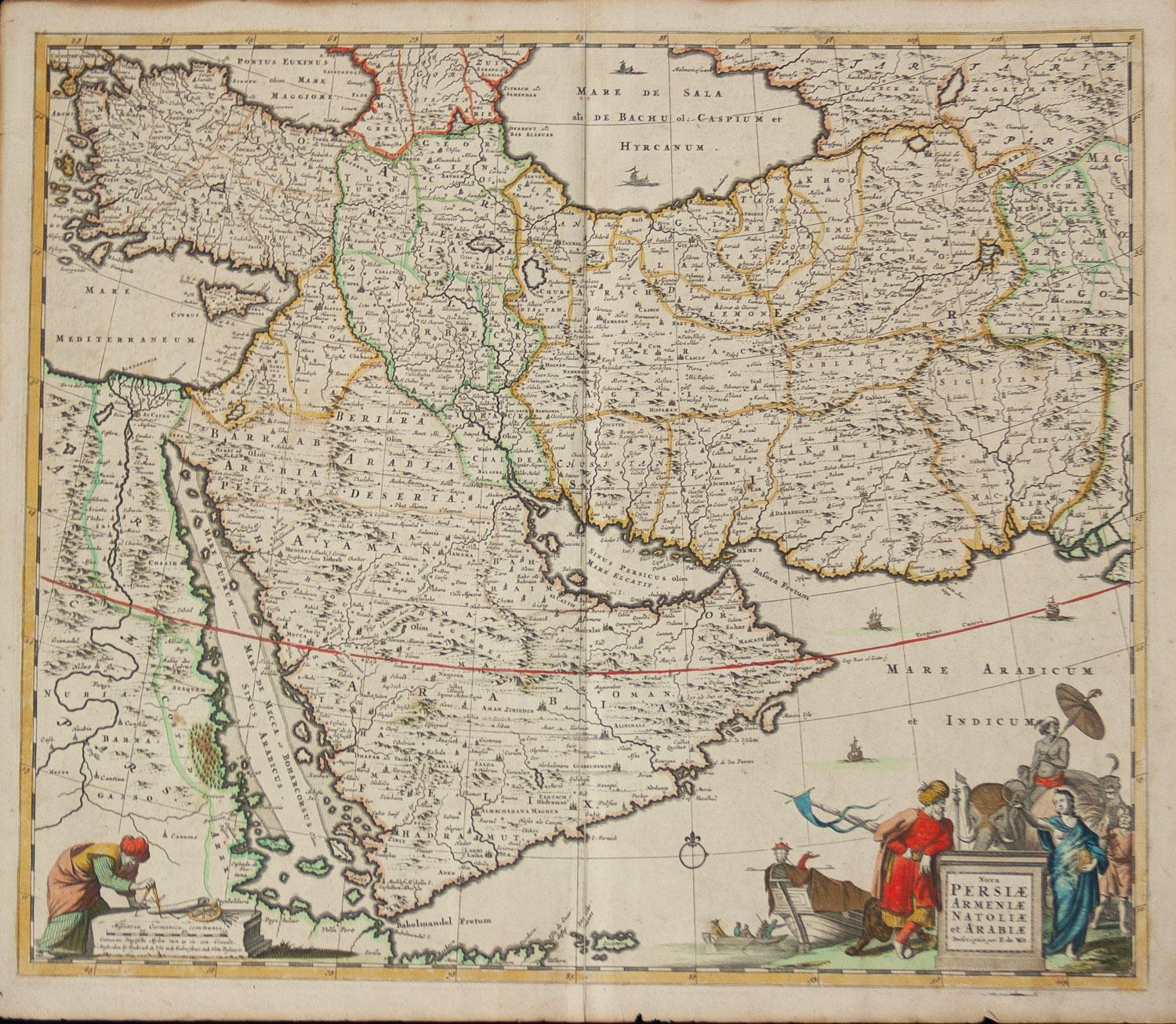
- Persiae, Armeniae, Natoliae et Arabiae Descriptio per Frederick deWit 1666 mapLocated in Paonia, COMap of Persiae, Armeniae, Natoliae et Arabiae Descriptio per F de Wit 1688 engraving from: Atlas Contractus Orbis Terrarum Praecipuas ac Novissimas Complectens Tabulas. Amsterdam, N. Visscher, 1656-77. (Koeman III, Vis5-8) This highly decorative map of the Middle East is by the Dutch engraver, publisher, and map seller...Category
1660s Realist Landscape Prints
MaterialsEngraving
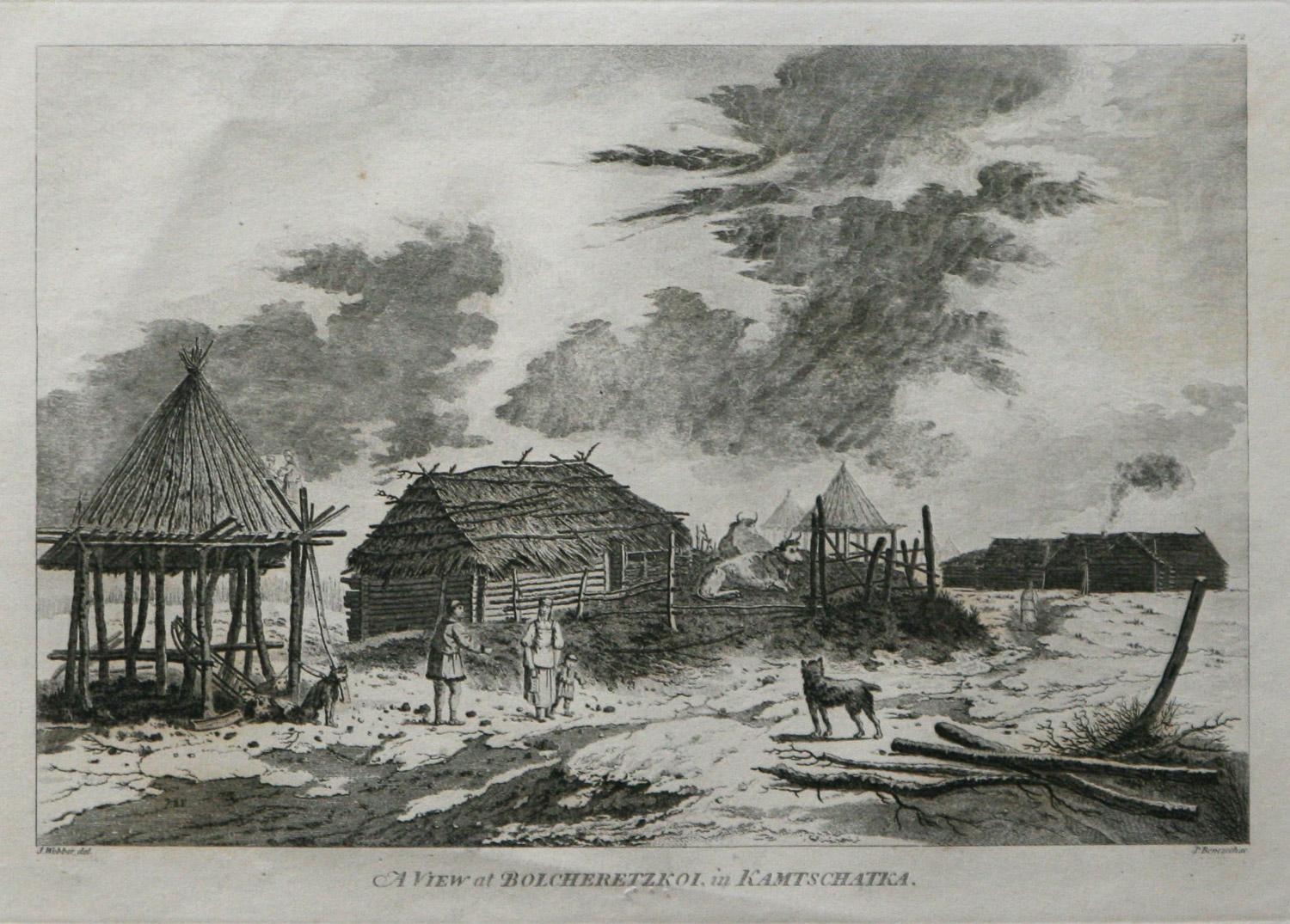
- A View at Bolcheretzko (Russia) 1784 Captains Cook Final Voyage by John WebberBy John WebberLocated in Paonia, COA View at Bolcheretzko (Russia) is from the 1784 First Edition Atlas Accompanying Capt. James Cook and King; Third and Final Voyage of Captain James Cook.John Webber (1752-1793) was ...Category
1780s Realist Landscape Prints
MaterialsEngraving
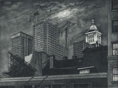
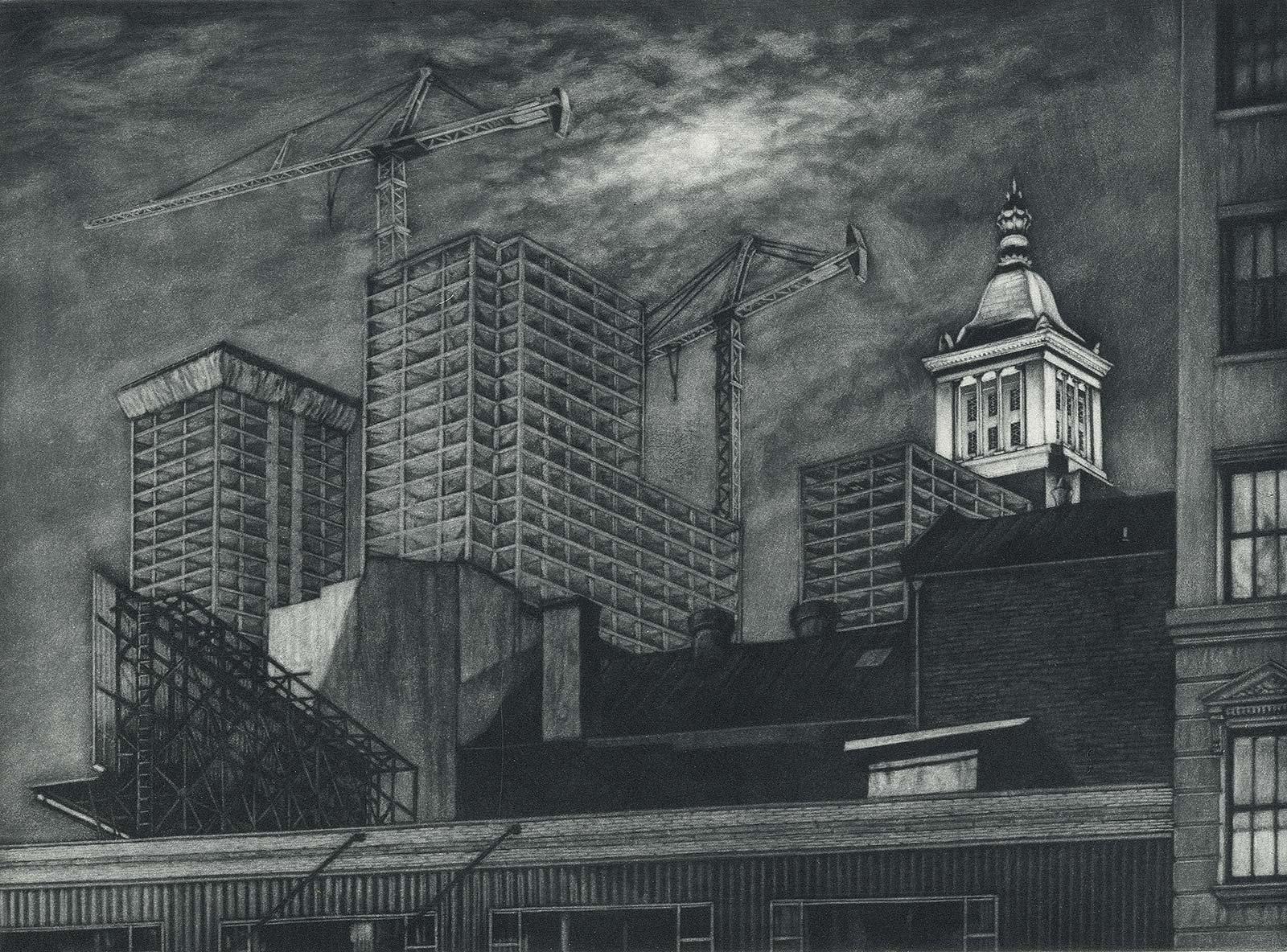
- Cranes and Concrete (in the 80s, a boom saw buildings racing into the sky?By Frederick MershimerLocated in New Orleans, LA"Cranes and Concrete" is Frederick Mershimer's mezzotint of the construction scene on Broadway between 13th and 14th streets. Mershimer is no strang...Category
1980s Contemporary Landscape Prints
MaterialsMezzotint
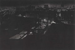
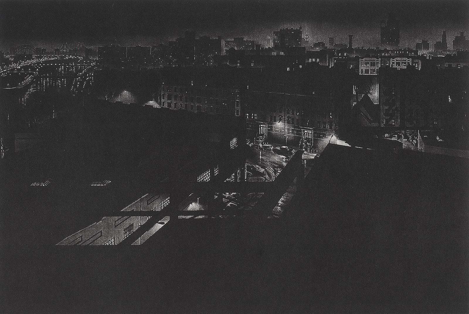
- Girders (rainy night view of artist's former studio in Washington HeightsBy Craig McPhersonLocated in New Orleans, LA"Griders" is Craig McPherson's rainy night scene showing the view from his former studio in Washington Heights in NYC. The image is the companion pi...Category
1980s Contemporary Landscape Prints
MaterialsMezzotint
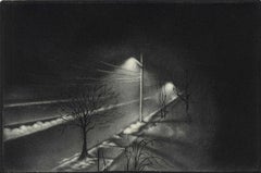
- Foggy Night (the way home or a Stephen King setting)By Carol WaxLocated in New Orleans, LAThis impression is #22 Carol Wax originally trained to be a classical musician at the Manhattan School of Music but fell in love with printmaking. Soon after she began engraving mez...Category
2010s American Modern Landscape Prints
MaterialsEngraving, Mezzotint
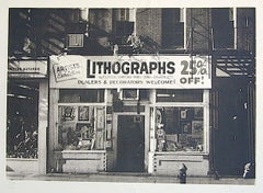
- LITHOGRAPHS Greenwich Village NYC, Signed Mezzotint, Art Gallery, PhotorealismBy John BaederLocated in Union City, NJLITHOGRAPHS Greenwich Village NYC by the American photorealist artist John Baeder is a limited edition mezzotint printed using hand printmaking techniques on archival, cream colored ...Category
1970s Photorealist Landscape Prints
MaterialsMezzotint