
John Mix Stanley'Distribution of Goods to the Gros Ventres' lithograph by John Mix Stanley ca. 1855
ca. 1855
About the Item
- Creator:John Mix Stanley (1814 - 1872)
- Creation Year:ca. 1855
- Dimensions:Height: 17 in (43.18 cm)Width: 20 in (50.8 cm)
- Medium:
- Movement & Style:
- Period:
- Condition:Print in overall good condition; some localized foxing and discoloration..
- Gallery Location:Milwaukee, WI
- Reference Number:
John Mix Stanley
John Mix Stanley was an artist-explorer, an American painter of landscapes, and Native American portraits and tribal life. Born in the Finger Lakes region of New York, he started painting signs and portraits as a young man, but in 1842 he traveled to the American West to paint Native American life. In 1846, he exhibited a gallery of 85 of his paintings in Cincinnati and Louisville. During the Mexican-American War, he joined Colonel Stephen Watts Kearney's expedition to California and painted accounts of the campaign, as well as aspects of the Oregon territory. Stanley continued to travel and paint in the West, and mounted a major exhibit of more than 150 works at the Smithsonian Institution in 1852. Although he had some Congressional interest in purchasing the collection, he was unsuccessful in completing a sale, and never recovered his expenses for a decade of intensive work and travel. In 1854, he exhibited a 42-scene panorama of western scenes in Washington, DC, Baltimore, New York and London, but it has been lost. More than 200 of his paintings, maps and other work being held at the Smithsonian were lost in an 1865 fire. The irreparable loss of most of his works cast an eclipse over Stanley's reputation in American art history for some time, but today a few of his surviving works are held by national and numerous regional museums.
- ShippingRetrieving quote...Ships From: Milwaukee, WI
- Return PolicyA return for this item may be initiated within 14 days of delivery.
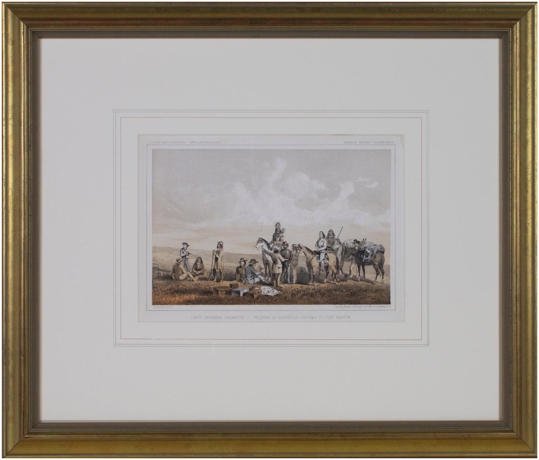
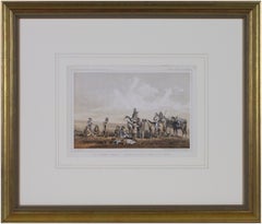
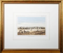
- 'Lieutenant Crovers Despatch – Return of Governor Stevens to Fort Benton'By John Mix StanleyLocated in Milwaukee, WIIn the mid-nineteenth century, the United States government set out to survey and document its newly acquired lands and territories west of the Mississippi. The goals of these surveys were manifold: to produce topographical maps, to document flora and fauna, and to document natural resources to build the emerging US economy. These surveys, and the images from them, also functioned to build the new sense of American identity with the landscape, condensing vistas into the 'picturesque' tradition of European image making. Thus, the entire span of US territory could be seen as a single, cohesive whole. This lithograph comes from one of six surveys commissioned by the Army's Topographic Bureau in 1853, which sought to find the best route to construct a transcontinental railroad. The result was a thirteen-volume report including maps, lithographs, and technical data entitled 'Explorations and Surveys to ascertain the most practicable and economical route for a Railroad from the Mississippi river to the Pacific Ocean.' In particular, the print comes from the northern survey, commanded by Isaac Stevens, which explored the regions between the 47th and 49th parallels. 5.75 x 8.75 inches, image 6.5 x 9.25 inches, stone 17 x 20 inches, frame Artist 'Stanley Del.' lower left Entitled 'Lieutenant Crovers Despatch – Return of Governor Stevens to Fort Benton' lower center margin Publisher 'Sarony, Major & Knapp. Lith.s 449 Broadway N.Y.' lower right Inscribed 'U.S.P.R.R. EXP. & SURVEYS — 47th & 49th PARALLELS' upper left Inscribed 'GENERAL REPORT — PLATE XXXVII' upper right Framed to conservation standards using 100 percent rag matting with French accents; glazed with UV5 Plexiglas to inhibit fading; housed in a gold reverse ogee moulding. Print in overall good condition; some localized foxing and discoloration; minor surface abrasions to frame. John Mix Stanley...Category
1850s Romantic Landscape Prints
MaterialsLithograph
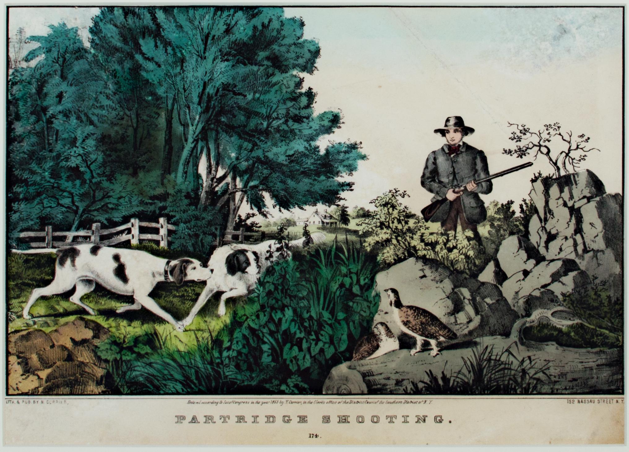
- 'Partridge Shooting' original hand-colored lithograph by Nathaniel CurrierBy Nathaniel CurrierLocated in Milwaukee, WIThe present hand-colored lithograph presents the viewer with a hunting scene in a picturesque landscape. In the foreground, a man approaches two partridges as his two pointers prepare to flush them out. Beyond, a white fence draws our eyes to the homestead in the distance. Images like this one show how people in the United States were trying to identify themselves as a new nation in the North American landscape - as separate from their European counterparts but with similar similar and specific wildlife and magesties of nature. It also identifies hunting in this landscape as an American pastime. 9.25 x 12.5 inches, artwork 18.38 x 22 inches, frame Entitled bottom center "Partridge Shooting...Category
Mid-19th Century Romantic Figurative Prints
MaterialsLithograph, Watercolor
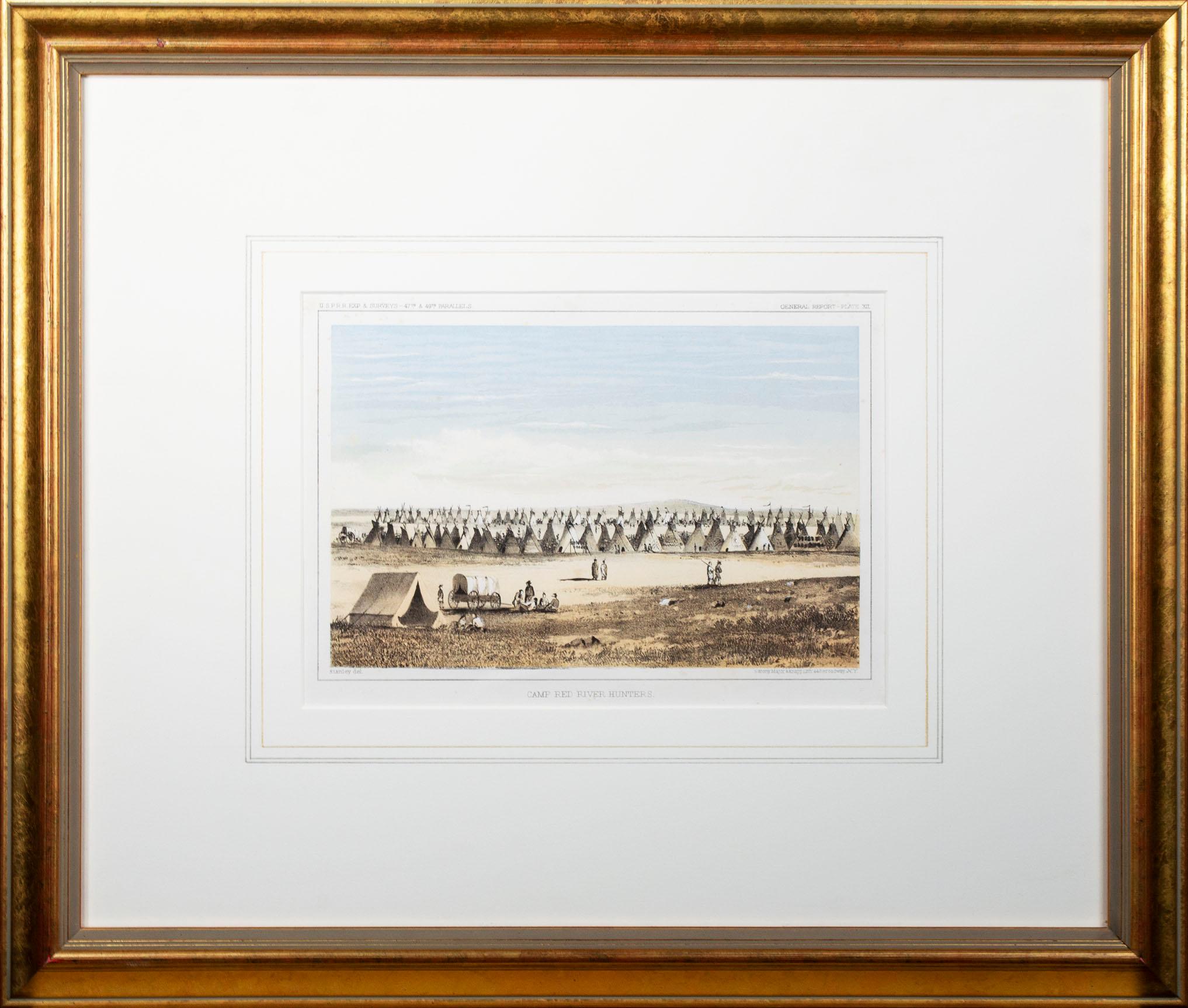
- 'Camp Red River Hunters' original lithograph by John Mix StanleyBy John Mix StanleyLocated in Milwaukee, WIIn the mid-nineteenth century, the United States government set out to survey and document its newly acquired lands and territories west of the Mississippi. The goals of these surveys were manifold: to produce topographical maps, to document flora and fauna, and to document natural resources to build the emerging US economy. These surveys, and the images from them, also functioned to build the new sense of American identity with the landscape, condensing vistas into the 'picturesque' tradition of European image making. Thus, the entire span of US territory could be seen as a single, cohesive whole. This lithograph comes from one of six surveys commissioned by the Army's Topographic Bureau in 1853, which sought to find the best route to construct a transcontinental railroad. The result was a thirteen-volume report including maps, lithographs, and technical data entitled 'Explorations and Surveys to ascertain the most practicable and economical route for a Railroad from the Mississippi river to the Pacific Ocean.' In particular, the print comes from the northern survey, commanded by Isaac Stevens, which explored the regions between the 47th and 49th parallels. In this image, Stanley shows an encampment of the people known as the Red River of the North hunters. They were generations of European and mixed-race trappers who lived on the frontier and had Indian wives and mixed-race children. They had come to the area for bison hunting, as the herds were still vast on the prairies. In the image, the figures and their encampment are dwarfed by the vast landscape around them, indicating the sublimity of these new American territories. 5.75 x 8.75 inches, image 6.5 x 9.25 inches, stone 17 x 20 inches, frame Artist 'Stanley Del.' lower left Entitled 'Camp Red River Hunters' lower center margin Publisher 'Sarony, Major & Knapp. Lith.s 449 Broadway N.Y.' lower right Inscribed 'U.S.P.R.R. EXP. & SURVEYS — 47th & 49th PARALLELS' upper left Inscribed 'GENERAL REPORT — PLATE XII' upper right Framed to conservation standards using 100 percent rag matting with French accents; glazed with UV5 Plexiglas to inhibit fading; housed in a gold reverse ogee moulding. Print in overall good condition; some localized foxing and discoloration; minor surface abrasions to frame. John Mix Stanley...Category
1850s Romantic Landscape Prints
MaterialsLithograph
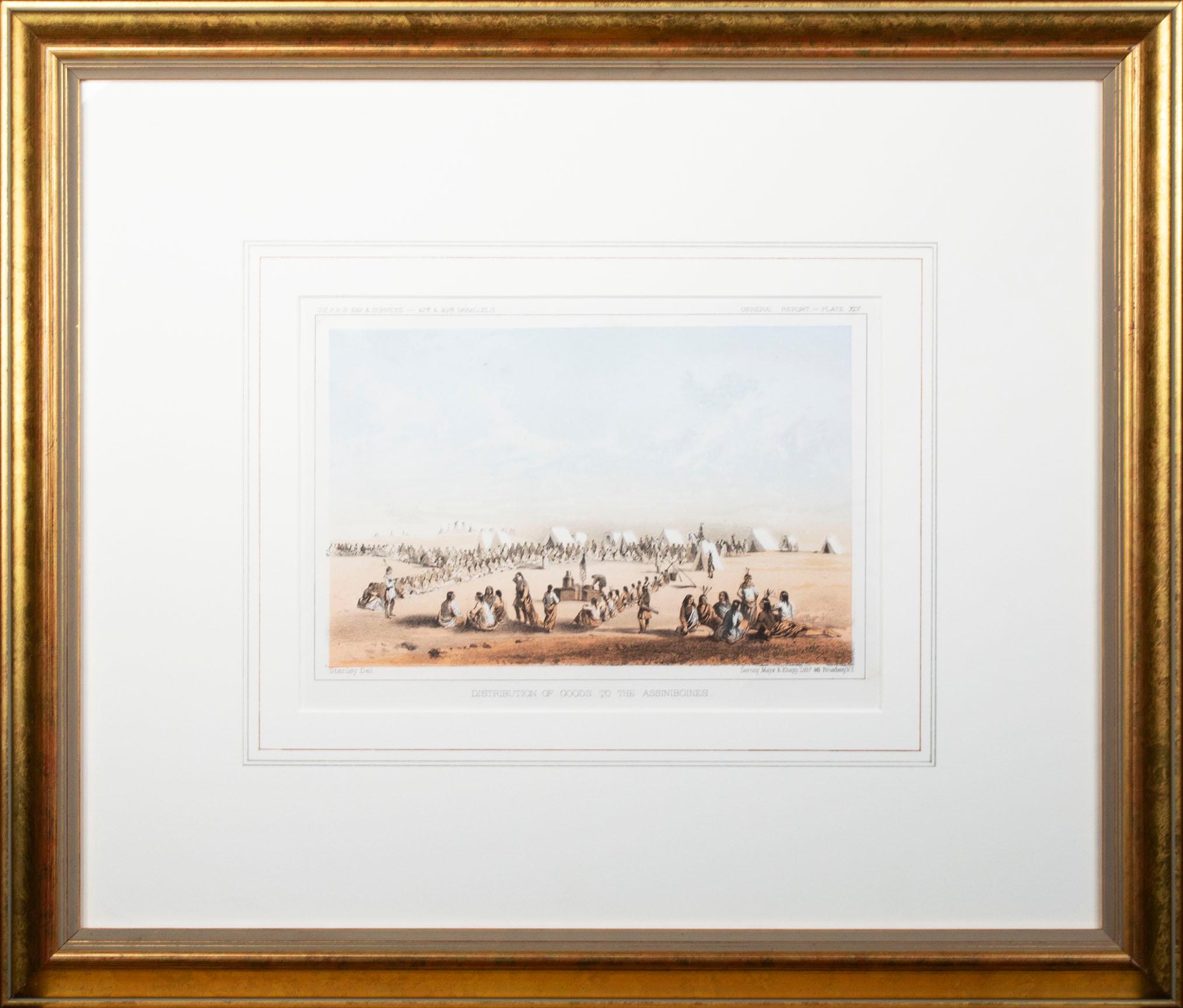
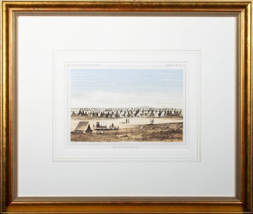
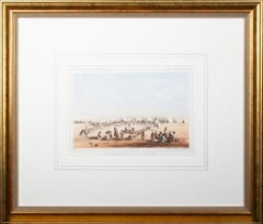
- 'Distribution of Goods to the Assiniboines' original John Mix Stanley lithographBy John Mix StanleyLocated in Milwaukee, WIIn the mid-nineteenth century, the United States government set out to survey and document its newly acquired lands and territories west of the Mississippi. The goals of these surveys were manifold: to produce topographical maps, to document flora and fauna, and to document natural resources to build the emerging US economy. These surveys, and the images from them, also functioned to build the new sense of American identity with the landscape, condensing vistas into the 'picturesque' tradition of European image making. Thus, the entire span of US territory could be seen as a single, cohesive whole. This lithograph comes from one of six surveys commissioned by the Army's Topographic Bureau in 1853, which sought to find the best route to construct a transcontinental railroad. The result was a thirteen-volume report including maps, lithographs, and technical data entitled 'Explorations and Surveys to ascertain the most practicable and economical route for a Railroad from the Mississippi river to the Pacific Ocean.' When it came to depicting the Assiniboine people, as seen in the present print, Stanley chose to juxtapose their encampment, marked by tipis in the distance, with the encampment of the Isaac Stevens survey party. In the foreground, commemorating this moment, Isaac Stevens can be seen presenting trade goods, which are known to include thirty two dressed skins and two robes. The survey leader Isaac Stevens noted being grateful for the generosity of the Assiniboine, commenting: "I felt very grateful indeed to those Indians, for their kindness to my men, their proffer of kind feeling and hospitality to myself and the survey." This description and this image, however, are arguably depicted through rose-colored glasses: to the Assiniboine people, this meeting may well have included stressful diplomatic relationships and have indicated a threat to the sovereignty over the territories agreed to be theirs by the 1851 Treaty of Fort Laramie. 5.75 x 8.75 inches, image 6.5 x 9.25 inches, stone 17 x 19.75 inches, frame Artist 'Stanley Del.' lower left Entitled 'Distribution of Goods to the Assiniboines' lower center margin Publisher 'Sarony, Major & Knapp. Lith.s 449 Broadway N.Y.' lower right Inscribed 'U.S.P.R.R. EXP. & SURVEYS — 47th & 49th PARALLELS' upper left Inscribed 'GENERAL REPORT — PLATE XIV' upper right Framed to conservation standards using 100 percent rag matting with French accents; glazed with UV5 Plexiglas to inhibit fading; housed in a gold reverse ogee moulding. Print in overall good condition; some localized foxing and discoloration; frame in excellent condition. John Mix Stanley...Category
1850s Romantic Landscape Prints
MaterialsLithograph
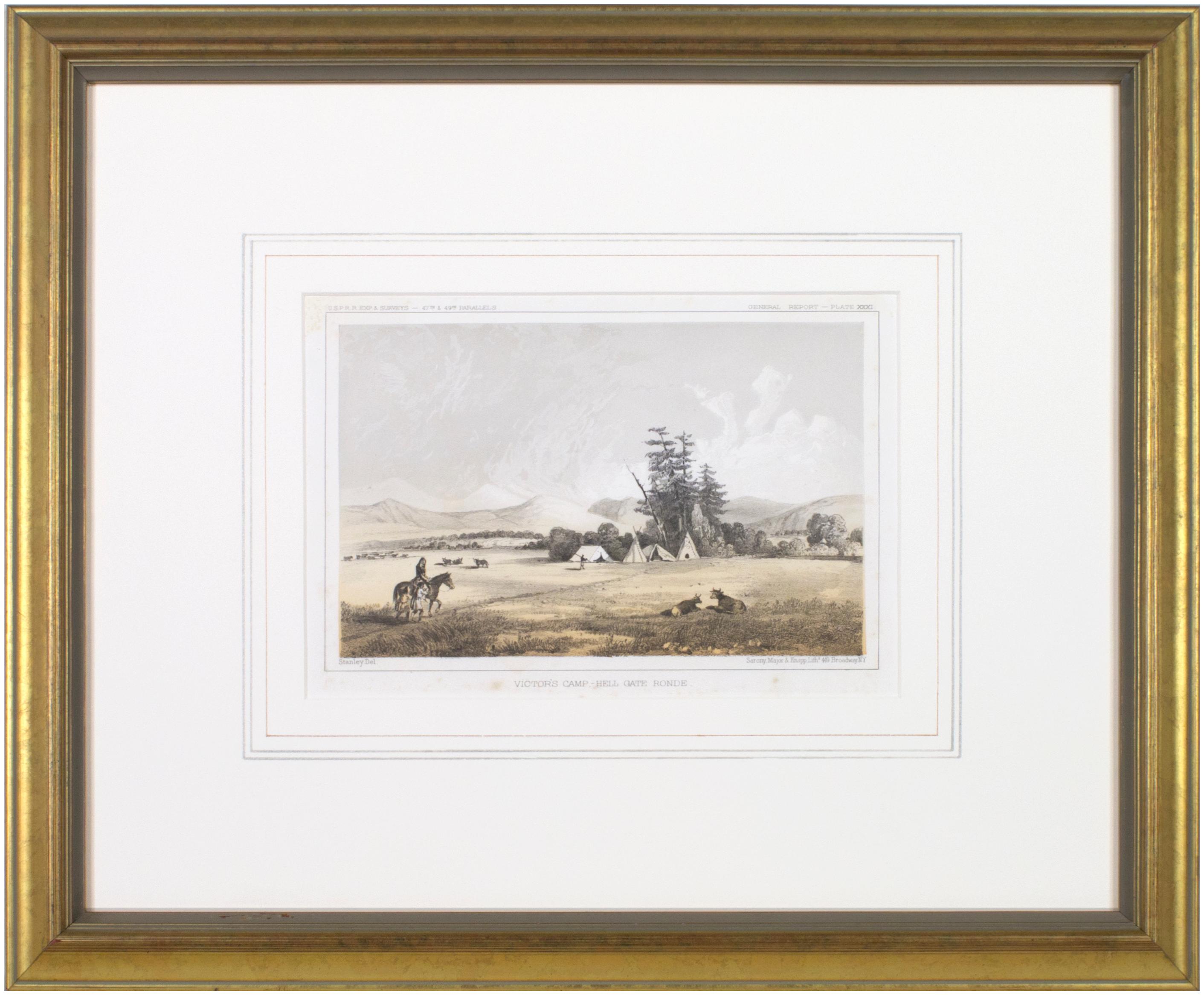
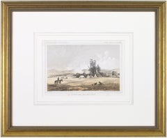
- 'Victor's Camp - Hell Gate Ronde' original John Mix Stanley lithographBy John Mix StanleyLocated in Milwaukee, WIIn the mid-nineteenth century, the United States government set out to survey and document its newly acquired lands and territories west of the Mississippi. The goals of these surveys were manifold: to produce topographical maps, to document flora and fauna, and to document natural resources to build the emerging US economy. These surveys, and the images from them, also functioned to build the new sense of American identity with the landscape, condensing vistas into the 'picturesque' tradition of European image making. Thus, the entire span of US territory could be seen as a single, cohesive whole. This lithograph comes from one of six surveys commissioned by the Army's Topographic Bureau in 1853, which sought to find the best route to construct a transcontinental railroad. The result was a thirteen-volume report including maps, lithographs, and technical data entitled 'Explorations and Surveys to ascertain the most practicable and economical route for a Railroad from the Mississippi river to the Pacific Ocean.' In particular, the print comes from the northern survey, commanded by Isaac Stevens, which explored the regions between the 47th and 49th parallels. Stanley shows here the stop the Stanley Party made at the junction of the Bitterroot and Hell Gate, in present day Montana. While there, the Party met with the Flathead Chief by the name Victor, as is shown in the image. The figures and their encampment are dwarfed by the vast landscape around them, indicating the sublimity of these new American territories. 5.75 x 8.75 inches, image 6.5 x 9.25 inches, stone 17 x 20 inches, frame Artist 'Stanley Del.' lower left Entitled 'Victor's Camp - Hell Gate Ronde' lower center margin Publisher 'Sarony, Major & Knapp. Lith.s 449 Broadway N.Y.' lower right Inscribed 'U.S.P.R.R. EXP. & SURVEYS — 47th & 49th PARALLELS' upper left Inscribed 'GENERAL REPORT — PLATE XXXI' upper right Framed to conservation standards using 100 percent rag matting with French accents; glazed with UV5 Plexiglas to inhibit fading; housed in a gold reverse ogee moulding. Print in overall good condition; some localized foxing and discoloration; minor surface abrasions to frame. John Mix Stanley...Category
1850s Romantic Landscape Prints
MaterialsLithograph
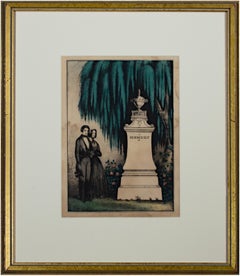
- 'In Memory of (66)' original Kellogg & Comstock hand-colored mourning lithographLocated in Milwaukee, WIThe present hand-colored lithograph was produced as part of the funeral and mourning culture in the United States during the 19th century. Before the printmaking boom of the 1830s, however, such inexpensive memorial images were not widely available. These prints became popular as ways of remembering loved ones, an alternative to portraiture of the deceased or to meticulous hand-embroidered memorials often made by female academy students. In the image, the urn-topped monument contains a space where a family could inscribe the name and death dates of a deceased loved one, though this example was never used. In the variations of this image type produced by the Kellogg...Category
Mid-19th Century Romantic Figurative Prints
MaterialsLithograph, Watercolor

- Apple OrchardBy Pati BannisterLocated in San Francisco, CAThis artwork titled "Apple Orchard" 1998, is a color off set lithograph by British/American artist Pati Bannister, 1929-2013. It is hand signed, titled a...Category
Late 20th Century Romantic Figurative Prints
MaterialsLithograph
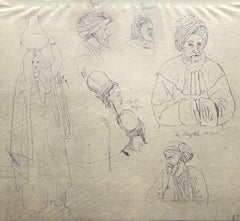
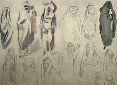
- Delacroix, Composition, Trente et un Dessins et Aquarelles du Maroc (after)By Eugène DelacroixLocated in Auburn Hills, MILithograph on fine vélin paper, mounted on archival mat-board, as issued. Unsigned and unnumbered, as issued. Good Condition; never framed or matted. Notes: From the folio, Eugène De...Category
1920s Romantic Landscape Prints
MaterialsLithograph
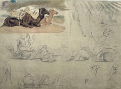
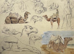
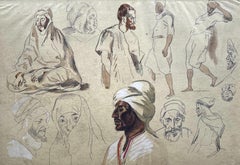