18th Century Map London
5
to
21
183
95
233
212
48
33
24
19
19
11
9
8
7
4
4
3
3
3
2
2
2
2
2
2
1
1
1
1
1
1
1
1
1
1
1
19
6
5
4
4
Sort By
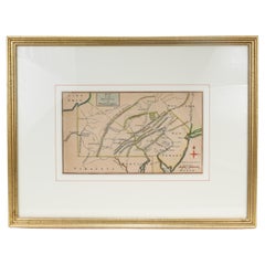
Antique 18th Century Map of the Province of Pensilvania 'Pennsylvania State'
Located in Philadelphia, PA
A fine antique of the colony of Pennsylvania.
Noted at the top of the sheet as a 'Map of the
Category
Antique 18th Century British American Colonial Maps
Materials
Paper
H 10.25 in W 13.25 in D 0.5 in
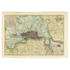
Antique Map of London by Tirion '1754'
Located in Langweer, NL
century, the introduction of turnpike roads and the increased coach-traffic in and out of London
Category
Antique Mid-18th Century Maps
Materials
Paper
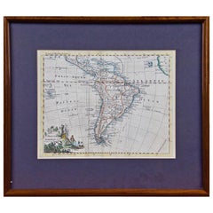
South America: Hand-colored 18th Century Framed Map by Thomas Jefferys
By Thomas Jefferys
Located in Alamo, CA
This detailed hand-colored map of South America by Thomas Jefferys was published in London in 1750
Category
Antique Mid-18th Century English Maps
Materials
Paper
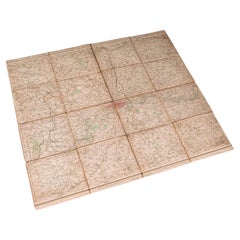
Antique Folding London Map, English, Cartography, Historic, Georgian, Dated 1783
Located in Hele, Devon, GB
.
Fascinating cartographic record of London in the late 18th century
Displays a desirable aged patina and in
Category
Antique Late 18th Century British Georgian Maps
Materials
Linen, Paper
H 6.3 in W 6.11 in D 0.6 in
Antique Map of Italy from the Latest Observation in the 18th Century, C.1745
Located in Langweer, NL
authentic antique maps from the 16th to the 20th centuries. Buying and collecting antique maps is a
Category
Antique 18th Century Maps
Materials
Paper
H 9.06 in W 7.68 in D 0 in
Antique Map of England and London with Two Large Allegorical Views, c.1720
Located in Langweer, NL
Antique map titled 'Nouvelle Carte du gouvernement civil d'Angleterre (..)'. Old plan of London
Category
Antique 18th Century Maps
Materials
Paper
H 16.54 in W 19.69 in D 0 in
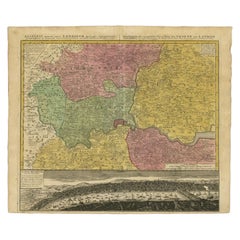
Antique Map of London Showing the Area from Essex to Surrey, England, 1741
Located in Langweer, NL
map showing the area from Essex to Surrey and shows a lovely view of London with a high level of
Category
Antique 18th Century Maps
Materials
Paper
H 24.89 in W 21.11 in D 0 in
Captain Cook's Exploration of Tahiti 18th C. Hand-Colored Map by Bellin
By Jacques-Nicolas Bellin
Located in Alamo, CA
This beautiful 18th century hand-colored copper plate engraved map is entitled "Carte de l'Isle de
Category
Antique Mid-18th Century French Maps
Materials
Paper
H 11.38 in W 17.5 in D 0.13 in
Antique Map of Gambia, West Africa
Located in Langweer, NL
Antique map titled 'Carte du Cours de la Riviere de Gambra ou Gambie (..)'. Detailed map of Gambia
Category
Antique Mid-18th Century Maps
Materials
Paper
18th Century Portugal Original Antique Engraving by Bowles
Located in Langweer, NL
& Carington Bowles' after 'Nolin'. Thomas Bowles, born around 1712, was map publisher and seller in London
Category
Antique 18th Century Maps
Materials
Paper
Original Antique Map of England and Wales
Located in Langweer, NL
Improvements'. Original antique map of England and Wales. Printed by Alex Hogg, London for George Henry
Category
Antique Late 18th Century Maps
Materials
Paper
Antique Map of the Coromandel Peninsula, 1754
Located in Langweer, NL
Coromandel printed for the London Magazine.
Artists and Engravers: This map is not attributed, so it may
Category
Antique 18th Century Maps
Materials
Paper
Antique Map of Asia by Guthrie, 1787
Located in Langweer, NL
authentic antique maps from the 16th to the 20th centuries. Buying and collecting antique maps is a
Category
Antique 18th Century Maps
Materials
Paper
Antique Map of France by Faden, 1792
Located in Langweer, NL
Antique map titled 'France divided into Metropolitan Circles (..)'. Large, original antique map of
Category
Antique 18th Century Maps
Materials
Paper
Antique Map of Portugal by Moll, 1727
Located in Langweer, NL
Antique map Portugal titled 'Portugal Agreeable to Modern History'. Detailed map of Portugal
Category
Antique 18th Century Maps
Materials
Paper
Antique Map of Suffren Island by Cook, 1784
Located in Langweer, NL
authentic antique maps from the 16th to the 20th centuries. Buying and collecting antique maps is a
Category
Antique 18th Century Maps
Materials
Paper
Antique Map of Turkey in Europe, c.1780
Located in Langweer, NL
collection includes a wide range of authentic antique maps from the 16th to the 20th centuries. Buying and
Category
Antique 18th Century Maps
Materials
Paper
Antique Map of Christmas Island by Cook, 1784
Located in Langweer, NL
centuries. Buying and collecting antique maps is a tradition that goes back hundreds of years. Antique maps
Category
Antique 18th Century Maps
Materials
Paper
Antique Decorative French Map of Java, Indonesia, 1718
Located in Langweer, NL
authentic antique maps from the 16th to the 20th centuries. Buying and collecting antique maps is a
Category
Antique 18th Century Maps
Materials
Paper
Antique Map of South America by Conder, c.1775
Located in Langweer, NL
English map engraver and bookseller active in London during the late 17th and early 18th centuries
Category
Antique 18th Century Maps
Materials
Paper
Antique Map of Port Pallisers & Kersmis by Cook, 1784
Located in Langweer, NL
the 20th centuries. Buying and collecting antique maps is a tradition that goes back hundreds of years
Category
Antique 18th Century Maps
Materials
Paper
Antique Map of the Caucasus by Seale, 1799
Located in Langweer, NL
Antique map titled 'Sarmatia'. Old map of the Caucasus with the Caspian and Black Sea. Originates
Category
Antique 18th Century Maps
Materials
Paper
Antique Map of Southeast Asia, China, Philippines and India
Located in Langweer, NL
immediately adjacent. The map was published in London by John Nicholson in 1711 as part of Philip Cluver’s
Category
Antique Early 18th Century Maps
Materials
Paper
Map Turkey in Europe & Hungary Thomas Kitchin, 1783
Located in BUNGAY, SUFFOLK
Thomas Kitchen (1718 - 1784) : Map of Turkey in Europe & Hungary 1783
Visible sheet within the
Category
Antique 18th Century English Georgian Maps
Materials
Paper
Large Antique Map of Denmark by Bowles, c.1780
By Thomas
Located in Langweer, NL
. Palairet'. Thomas Bowles, born around 1712, was map publisher and seller in London. The business was
Category
Antique 18th Century Maps
Materials
Paper
Antique Map of the East Indies by Guthrie, 1787
Located in Langweer, NL
antique maps from the 16th to the 20th centuries. Buying and collecting antique maps is a tradition that
Category
Antique 18th Century Maps
Materials
Paper
Antique Map of the Pacific Ocean by Anson, 1765
Located in Langweer, NL
capture of the Nostra the treasures were paraded through the streets of London. The map shows the pacific
Category
Antique 18th Century Maps
Materials
Paper
The Valley of Inspruck: An 18th-Century Engraved Perspective, 1792
Located in Langweer, NL
Title: "The Valley of Inspruck: An 18th-Century Engraved Perspective"
This elegant original
Category
Antique Late 18th Century Maps
Materials
Paper
Antique Map of South America by Gordon, c.1745
Located in Langweer, NL
Antique map titled 'South America according to the latest observations'. Antique map of South
Category
Antique 18th Century Maps
Materials
Paper
Decorative Original Antique Map of Southern Germany, c.1730
Located in Langweer, NL
-two maps (..)' by H. Moll. Artists and Engravers: Herman Moll (1654 - 1732), was a London cartographer
Category
Antique 18th Century Maps
Materials
Paper
Antique Map of West Russia, with Title a New Map of Moskovy, 1741
Located in Langweer, NL
engraver and map publisher in 18th century London who became a Fellow of The Royal Society and Geographer
Category
Antique 1740s Maps
Materials
Paper
Original Antique Map of the Cape Verde Islands, 1746
Located in Langweer, NL
Antique map titled 'Carte Des Isles Du Cap Verd.' Original antique map of the Cape Verde Islands
Category
Antique 18th Century Maps
Materials
Paper
Detailed Original Antique Map of Turkey in Europe, circa 1740
Located in Langweer, NL
to the 20th centuries. Buying and collecting antique maps is a tradition that goes back hundreds of
Category
Antique 18th Century Maps
Materials
Paper
Antique Map of Part of the Korean Archipelago, 1798
Located in Langweer, NL
Antique map titled 'Plan of Part of the Islands or Archipellago of Corea'. This map depicts part of
Category
Antique Late 18th Century Maps
Materials
Paper
Interesting Small Map of the British Isles with Hand Coloring
Located in Langweer, NL
Antique map titled 'Insularum Britannicarum Tabula'. Interesting small map of the British Isles by
Category
Antique Early 18th Century Maps
Materials
Paper
Antique Map of Germany by T. Kitchin, circa 1780
Located in Langweer, NL
Attractive map with decorative cartouche from "A New Geographical, Historical, and Commercial
Category
Antique Late 18th Century Maps
Materials
Paper
Map Shropshire Joseph Ellis Robert Sayer Carington Bowles Framed
Located in BUNGAY, SUFFOLK
London and was apprenticed to Richard William Seale in 1749. He is best know to county map collectors for
Category
Antique 18th Century English Georgian Maps
Materials
Paper
Antique Map of Portugal by P. Schenk, circa 1700
Located in Langweer, NL
Antique map titled 'Portugalliae et Algarbia'. Striking example of Schenk's rare map of Portugal
Category
Antique Early 18th Century Maps
Materials
Paper
Antique Map of the Southern Netherlands by Bowles, c.1780
Located in Langweer, NL
centuries. Buying and collecting antique maps is a tradition that goes back hundreds of years. Antique maps
Category
Antique 18th Century Maps
Materials
Paper
Antique Map of the Port of Acapulco in Mexico, 1749
Located in Langweer, NL
and at 108°.22'. western longitude from London. This map originates from 'Reize rondsom de Werreld
Category
Antique 18th Century Maps
Materials
Paper
Stunning Large Scale Antique Map of Martinique, Rare, Published 1758
Located in Langweer, NL
topographical and nautical detail makes this one of the major 18th century maps of Martinique. Source unknown
Category
Antique 18th Century Maps
Materials
Paper
Free Shipping
H 35.83 in W 23.23 in D 0 in
Antique Map of Spain and Portugal by Bowles, c.1780
Located in Langweer, NL
an anonymous artist. Thomas Bowles, born around 1712, was map publisher and seller in London. The
Category
Antique 18th Century Maps
Materials
Paper
Antique Map of Guadeloupe, Island in the Caribbean, c.1757
Located in Langweer, NL
centuries. Buying and collecting antique maps is a tradition that goes back hundreds of years. Antique maps
Category
Antique 18th Century Maps
Materials
Paper
Antique Map of Java and Madura Island, Indonesia, c.1760
Located in Langweer, NL
antique maps from the 16th to the 20th centuries. Buying and collecting antique maps is a tradition that
Category
Antique 18th Century Maps
Materials
Paper
Antique Map of Part of Germany by Moll, c.1740
Located in Langweer, NL
Antique map Germany titled 'The North West Part of Germany; Containing ye Dominions of ye Arch: and
Category
Antique 18th Century Maps
Materials
Paper
Antique Map of the Harbour of Tongatabu by Cook, C.1783
Located in Langweer, NL
range of authentic antique maps from the 16th to the 20th centuries. Buying and collecting antique maps
Category
Antique 18th Century Maps
Materials
Paper
Original Antique Map of the Harbour of Tongatabu by Cook, 1784
Located in Langweer, NL
collection includes a wide range of authentic antique maps from the 16th to the 20th centuries. Buying and
Category
Antique 18th Century Maps
Materials
Paper
Antique Map of France Divided into Departments, with Original Hand Coloring
Located in Langweer, NL
prolific London map seller, engraver, globe and scientific instrument maker.
Category
Antique Late 18th Century Maps
Materials
Paper
H 21.66 in W 25.36 in D 0.02 in
Antique Engraved Map of Hungary and Transylvania or Romania, c.1710
Located in Langweer, NL
.
Date: c.1710
Overall size: 36.5 x 24 cm.
Image size: 26 x 18 cm.
We sell original antique maps to
Category
Antique 18th Century Maps
Materials
Paper
New Map of North America from the Latest Discoveries, 1763
Located in Philadelphia, PA
A fine antique 18th century map of the North American seaboard.
Entitled "A New Map of North
Category
Antique Mid-18th Century English Georgian Maps
Materials
Paper
Antique Map of the Empire of Morocco by Kitchin, c.1760
By Thomas Kitchin
Located in Langweer, NL
mountains are indicated. This map originates from the 'London Magazine' circa 1760.
Artists and Engravers
Category
Antique 18th Century Maps
Materials
Paper
Antique Map of Eastern Tartary as Surveyed by the Jesuits, 1746
By Thomas Kitchin
Located in Langweer, NL
to the 20th centuries. Buying and collecting antique maps is a tradition that goes back hundreds of
Category
Antique 18th Century Maps
Materials
Paper
Antique Map of Fort Saint Louis and Santiago de Cuba, 1748
Located in Langweer, NL
Antique map titled 'A plan of the town, fort and harbour of St Louis in the Isle of Hispaniola, or
Category
Antique 18th Century Maps
Materials
Paper
Antique Map of the Shanxi Province of China by Du Halde, 1738
Located in Langweer, NL
authentic antique maps from the 16th to the 20th centuries. Buying and collecting antique maps is a
Category
Antique 18th Century Maps
Materials
Paper
Antique Map of the Northern Coast of Tongatapu by Benard, c.1785
Located in Langweer, NL
includes a wide range of authentic antique maps from the 16th to the 20th centuries. Buying and collecting
Category
Antique 18th Century Maps
Materials
Paper
Antique Map of the Huguang Province of China by Du Halde, 1738
Located in Langweer, NL
authentic antique maps from the 16th to the 20th centuries. Buying and collecting antique maps is a
Category
Antique 18th Century Maps
Materials
Paper
Antique Map of the Jiangxi Province of China by Du Halde, 1738
Located in Langweer, NL
antique maps from the 16th to the 20th centuries. Buying and collecting antique maps is a tradition that
Category
Antique 18th Century Maps
Materials
Paper
Antique Map of the Coast of Southwest Asia by Kitchin, c.1770
By Thomas Kitchin
Located in Langweer, NL
collection includes a wide range of authentic antique maps from the 16th to the 20th centuries. Buying and
Category
Antique 18th Century Maps
Materials
Paper
Antique Map of the Province of Quey-Chew by Du Halde, 1738
Located in Langweer, NL
to the 20th centuries. Buying and collecting antique maps is a tradition that goes back hundreds of
Category
Antique 18th Century Maps
Materials
Paper
Antique Map of the Province of Quang-Si by Du Halde, 1738
Located in Langweer, NL
antique maps from the 16th to the 20th centuries. Buying and collecting antique maps is a tradition that
Category
Antique 18th Century Maps
Materials
Paper
- 1
Get Updated with New Arrivals
Save "18 Th Century Map London", and we’ll notify you when there are new listings in this category.
18th Century Map London For Sale on 1stDibs
Choose from an assortment of styles, material and more with respect to the 18th century map london you’re looking for at 1stDibs. Frequently made of paper, wood and mahogany, every 18th century map london was constructed with great care. Whether you’re looking for an older or newer 18th century map london, there are earlier versions available from the 18th Century and newer variations made as recently as the 20th Century. A 18th century map london, designed in the Georgian, louis xv or Regency style, is generally a popular piece of furniture. A well-made 18th century map london has long been a part of the offerings for many furniture designers and manufacturers, but those produced by Herman Moll, Jacobus Houbraken and Cary’s are consistently popular.
How Much is a 18th Century Map London?
A 18th century map london can differ in price owing to various characteristics — the average selling price 1stDibs is $755, while the lowest priced sells for $65 and the highest can go for as much as $976,775.
More Ways To Browse
Jason Lewis
Religious18th Century
18th And 19 Th Century Portrait Paintings
19 Th C Portrait
Jason Anderson
Kentucky Sellers
18 Th Century Europe Map
Adventure Consultants Merchandise
Alexandra Kohl
Arthur James Stark
Cs Lewis
Eclipse Horse
Gary Indiana Love
Mid19th Century Oil Portraits
Paintings 18 And19 Th Century
Richard Gorman
Robert Madden
21c Penguin
