Items Similar to Antique Print of Various Island in French Polynesia, circa 1774

Want more images or videos?
Request additional images or videos from the seller
1 of 6
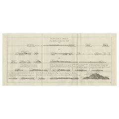
Antique Print of Various Island in French Polynesia, circa 1774
About the Item
Two antique maps on one sheet titled 'Havre d'Ohamaneno a Ulietea' and Havre d'Oopoa a Ulietea'. Also with German subtitles. The upper image depicts Ohamaneno (Vaiaau) Harbour Raiatea (Ulietea) - Leeward Islands. The lower image depicts Oopoa (Opoa) Harbour, Raiatea (Ulietea) - Leeward Islands. Both located in French Polynesia, South Pacific. By Capt James Cook during his first voyage of discovery in 1769. This print originates from 'An Account of the Voyages Undertaken by the Order of His Present Majesty for Making Discoveries in the Southern Hemisphere and Successively Performed by Commodore Byron, Captain Wallis, Captain Carteret, and Captain Cook, in the Dolphin, the Swallow, and the Endeavor, Drawn Up from the Journals Which Were Kept by the Several Commanders, and from the Papers of Joseph Banks'.
Artists and Engravers: Published by J. Hawkesworth, Paris.
Condition: Good, general age-related toning. Please study image carefully.
Date: 1774
Overall Size: 20 x 27 cm.
Image Size: 15 x 21.5 cm
Whilst cartography holds a special place in our collection, we also offer thousands of antique prints covering fields of interest as diverse as architecture, natural history, religion, ethnology and many more. Antique prints have long been appreciated for both their aesthetic and investment value. They were the product of engraved, etched or lithographed plates. These plates were handmade out of wood or metal, which required an incredible level of skill, patience and craftsmanship. Whether you have a house with Victorian furniture or more contemporary decor an old engraving can enhance your living space. We offer a wide range of authentic antique prints for any budget.
- Dimensions:Height: 10.63 in (27 cm)Width: 7.88 in (20 cm)Depth: 0 in (0.01 mm)
- Materials and Techniques:
- Period:
- Date of Manufacture:1774
- Condition:Condition: Good, general age-related toning. Please study image carefully.
- Seller Location:Langweer, NL
- Reference Number:
About the Seller
5.0
Platinum Seller
These expertly vetted sellers are 1stDibs' most experienced sellers and are rated highest by our customers.
Established in 2009
1stDibs seller since 2017
1,965 sales on 1stDibs
Typical response time: <1 hour
- ShippingRetrieving quote...Ships From: Langweer, Netherlands
- Return PolicyA return for this item may be initiated within 14 days of delivery.
More From This SellerView All
- Antique Map of the Island of Tahiti, Polynesia, 1803Located in Langweer, NLAntique map Tahiti titled 'Kaart van het Eiland Otahiti'. Antique map of the Island of Tahiti, Polynesia. Originates from 'Reizen Rondom de Waereld door James Cook (..)'. Art...Category
Antique Early 1800s Maps
MaterialsPaper
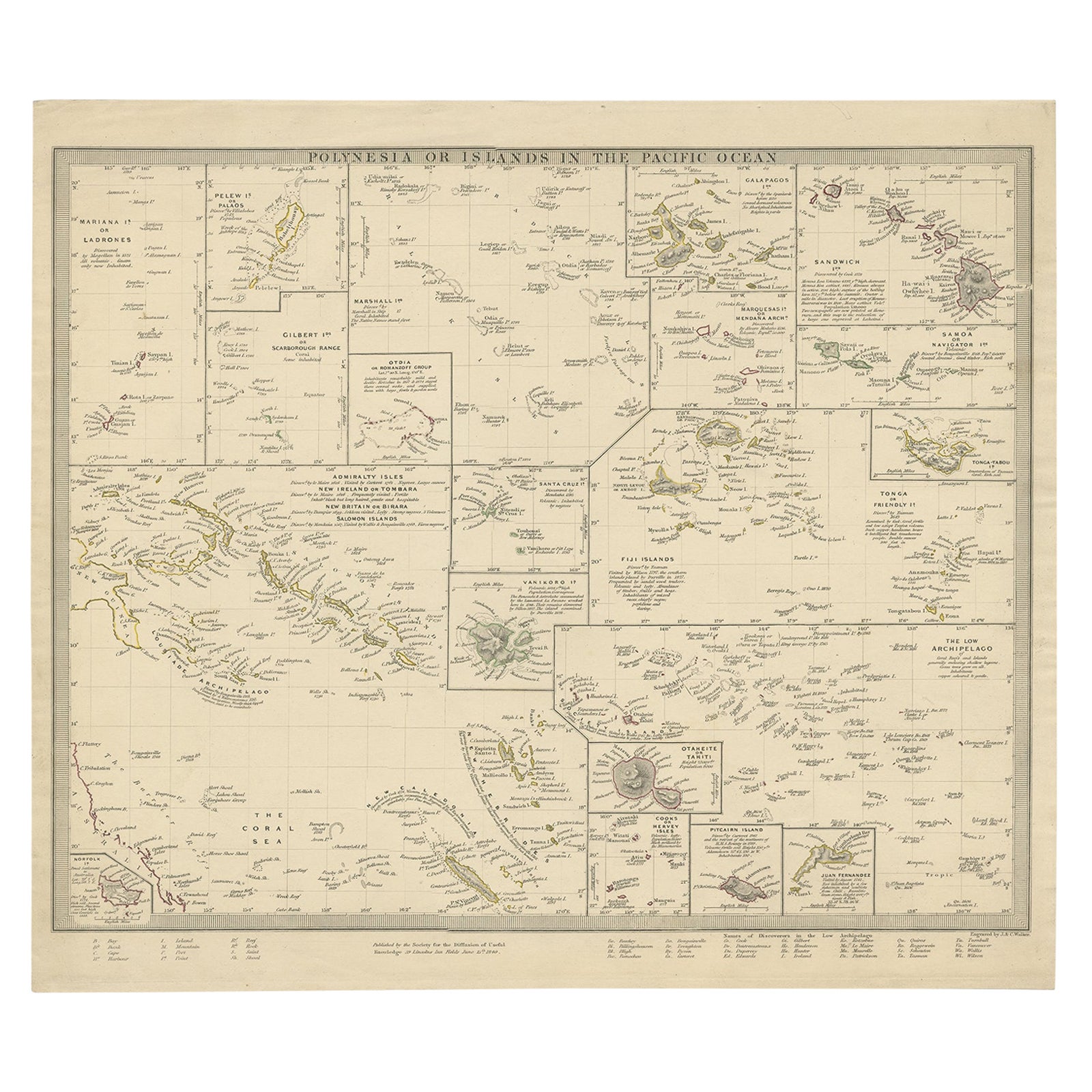
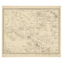
- Antique Map of Polynesia with Details of Many Islands, 1840Located in Langweer, NLAntique map titled 'Polynesia or Islands in the Pacific Ocean'. This map depicts various islands including the Lousiade Archipelago, Tahiti, Pitcairn Island, Juan Fernandez, The lo...Category
Antique 19th Century Maps
MaterialsPaper
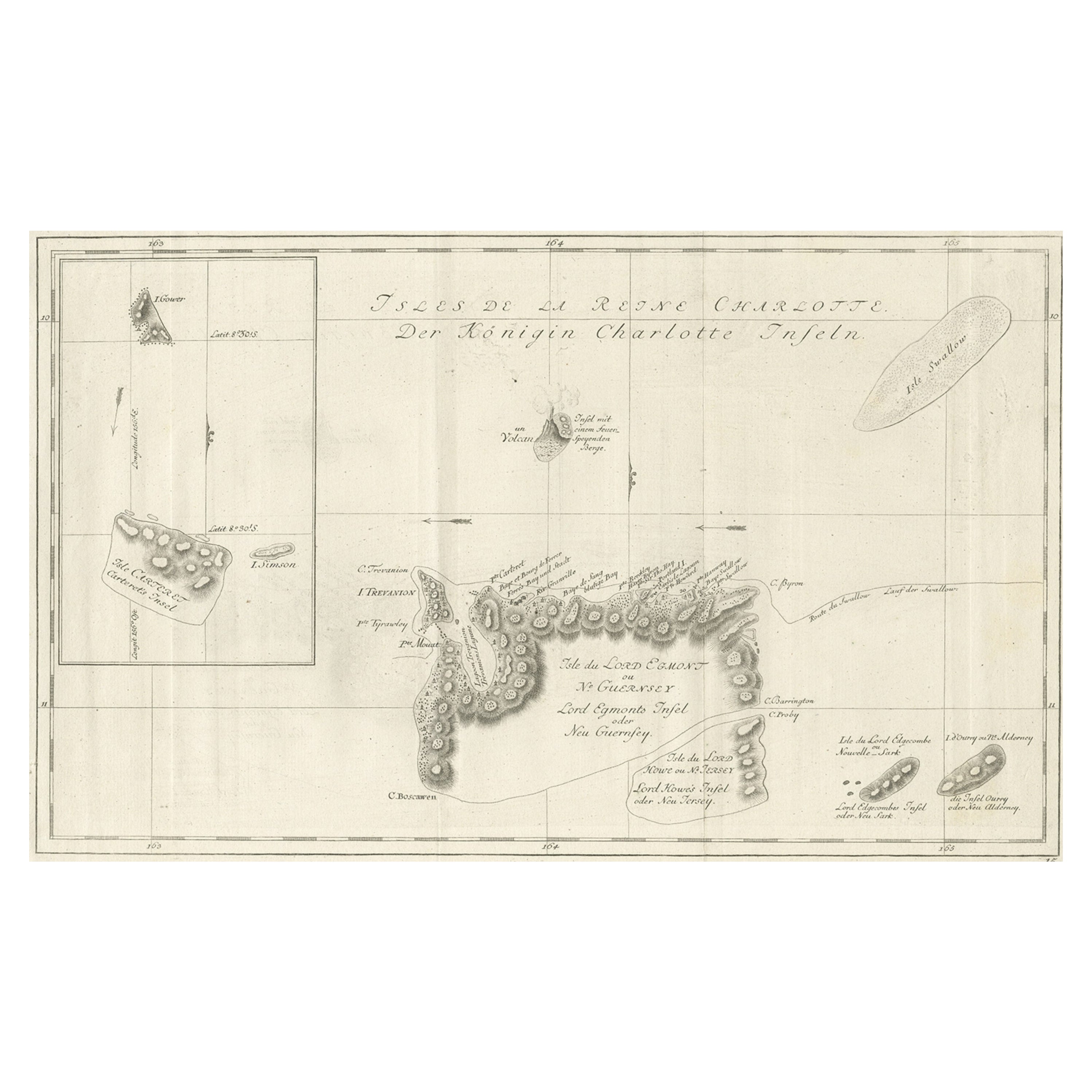
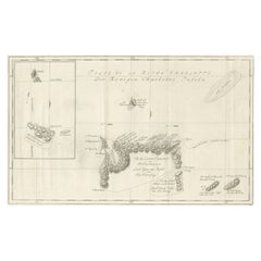
- Original Antique Chart of the Santa Cruz Islands, 1774Located in Langweer, NLAntique print titled 'Isles de la Reine Charlotte (..)'. A detailed chart of the Santa Cruz islands, to the north of the New Hebrides, with Carte...Category
Antique 1770s Maps
MaterialsPaper
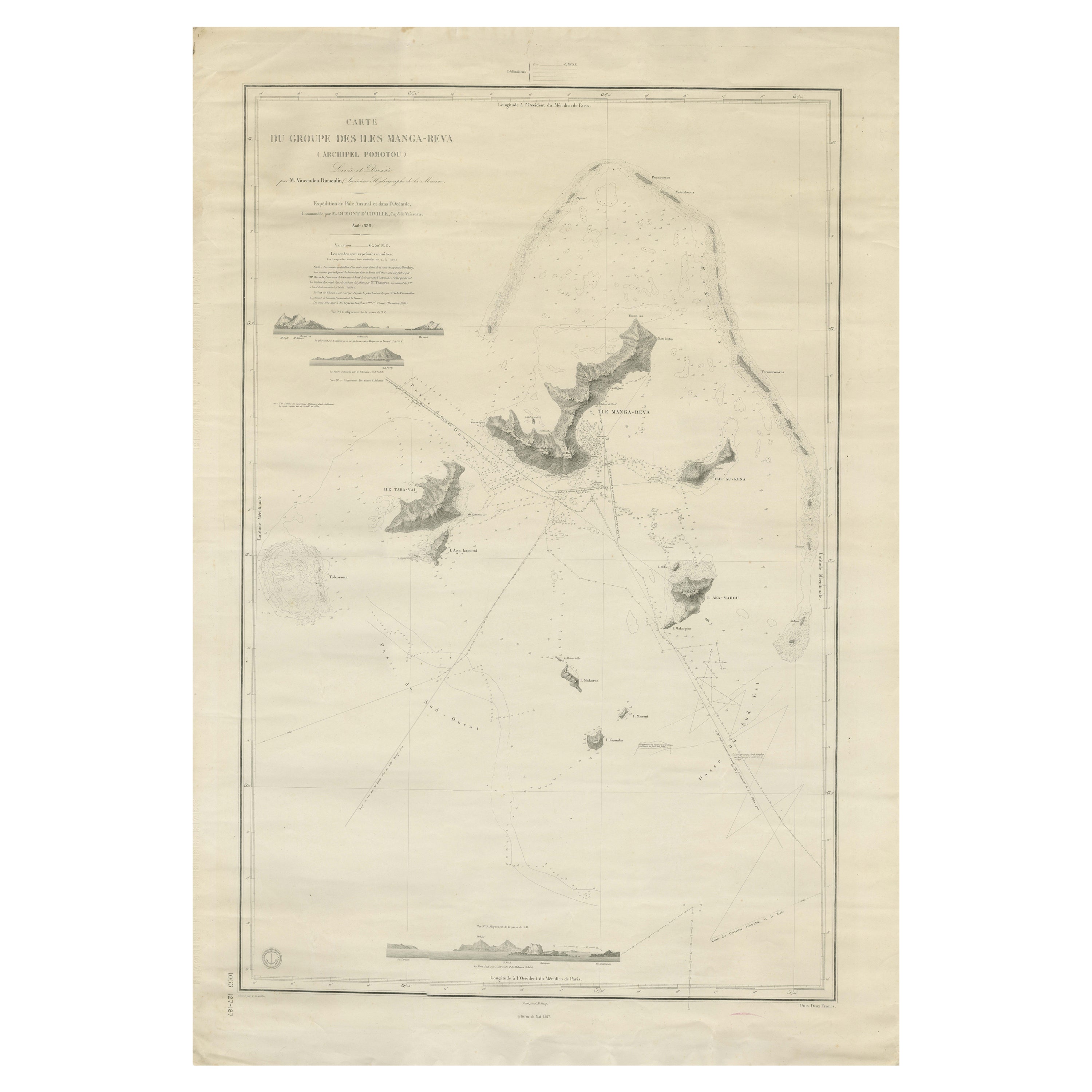
- Large Chart of the Gambier Islands, Tuamotu Archipelago, French PolynesiaLocated in Langweer, NLAntique map titled 'Carte du Groupe des Iles Manga-Reva (Archipel Pomotou)'. Large chart of the Tuamotu Archipelago, French Îles Tuamotu, also called Paumotu, island group of French ...Category
Antique Mid-19th Century Maps
MaterialsPaper
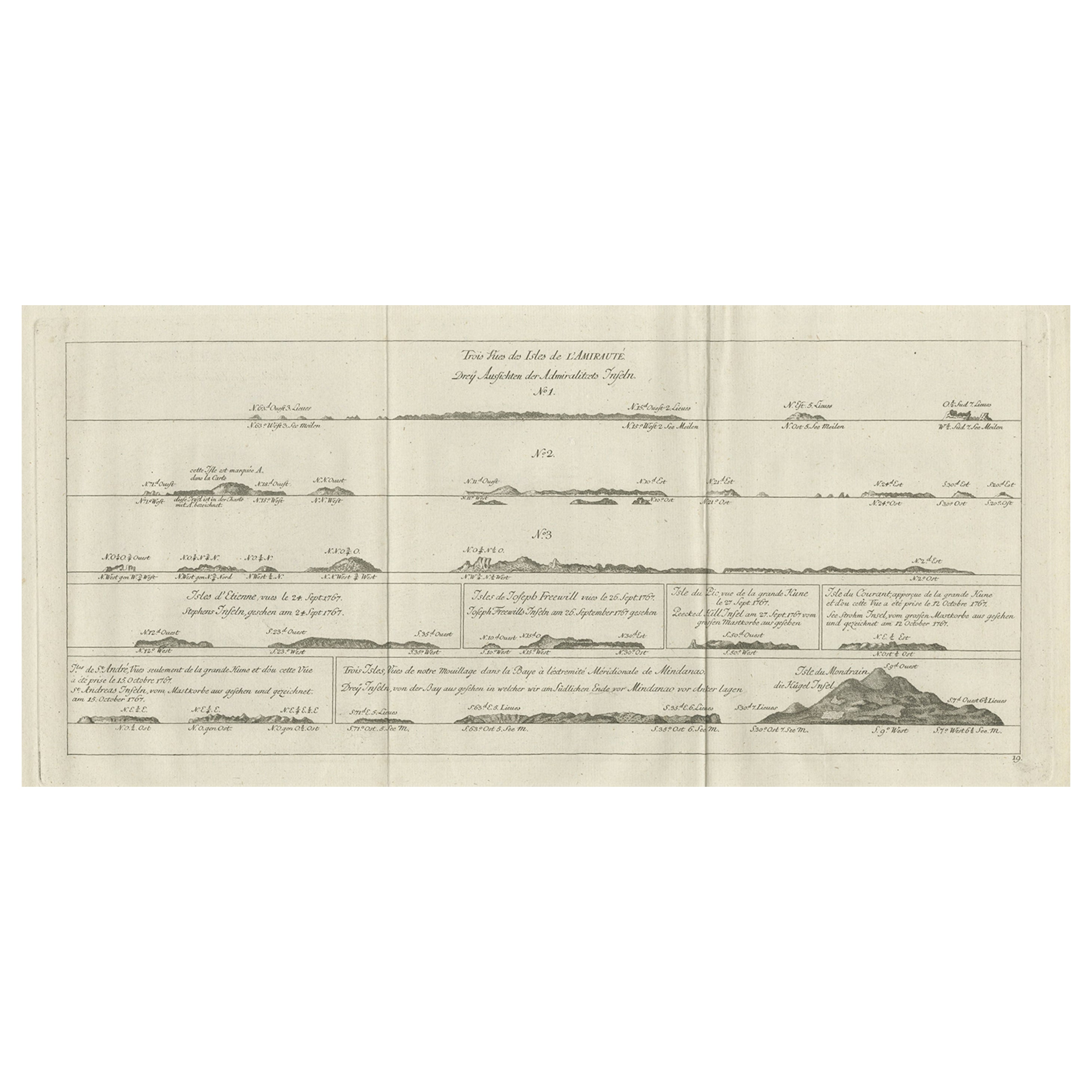
- Original Antique Engraving of the Admiralty Islands 'Bismarck Archipelago', 1774Located in Langweer, NLAntique print titled 'Trois Vues des Isles de l'Amirauté (..)'. Several coastal views of the Admiralty Islands. Originates from 'Geschichte der See-Reisen und Entdeckungen im Süd-Mee...Category
Antique 18th Century Prints
MaterialsPaper
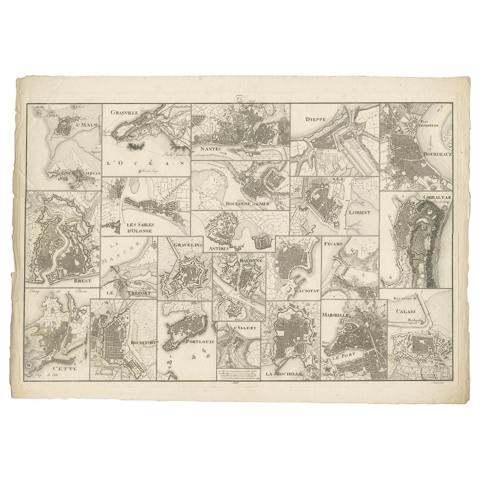
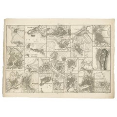
- Antique Map of Various Ports in France by Röder 'circa 1800'Located in Langweer, NLAntique print showing various ports in France. Including plans of St. Malo, Granville, Nantes, Dieppe, Bourdeauz, Gibraltar, Lorient, Boulogne sur Mer, Les Sables d'Olonne, Brest, Le Trèport, Antibes, La Ciotat...Category
Antique Early 19th Century Maps
MaterialsPaper

You May Also Like
- Original Antique Print, Portrait of Lord Nelson, circa 1850Located in St Annes, LancashireGreat image of Lord Nelson Fine steel engraving by H.Robinson After J.Hoppner Published circa 1850 Unframed.Category
Antique 1850s English Prints
MaterialsPaper
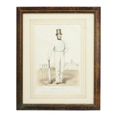
- Antique Cricket Print of Joseph Guy of NottinghamLocated in Oxfordshire, GBCricket print of Joseph Guy of Nottingham. A framed, tinted and hand colored lithographic portrait of the All- England cricketer Joseph Guy (1813 - 187...Category
Antique 1850s British Sporting Art Sports Equipment and Memorabilia
MaterialsPaper
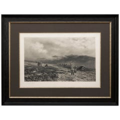
- Douglas Adams Signed Antique Print, Hunting Scene, Artist Proof, circa 1893By Douglas AdamsLocated in Colorado Springs, COThis is the artist proof edition of an untitled hunting scene by Douglas Adams. The print was issued in a limited, numbered edition of 300 and is signed by the artist in the margin. ...Category
Antique 1890s British Prints
MaterialsPaper
- Antique Billiard Print of a Player, John Roberts JuniorLocated in Oxfordshire, GBJohn Roberts Junior Photogravure. Late 19th century study of John Roberts Junior, billiards player, signed in pencil by John Roberts Junior and the artist Thomas Edward Gaunt. Robe...Category
Antique 1890s German Sporting Art Prints
MaterialsPaper
- Awash in Color: French and Japanese Prints Chelsea FoxwellLocated in valatie, NYAwash in Color: French and Japanese Prints by Chelsea Foxwell. University of Chicago, David and Alfred Smart Museum, 2012. First edition softcover cata...Category
2010s American Books
MaterialsPaper
- Original Antique Map of France, Arrowsmith, 1820Located in St Annes, LancashireGreat map of France Drawn under the direction of Arrowsmith. Copper-plate engraving. Published by Longman, Hurst, Rees, Orme and Brown, 1820 Unframed.Category
Antique 1820s English Maps
MaterialsPaper


Recently Viewed
View AllMore Ways To Browse
Victorian Dolphin
Commodores French
Antique Chest With Mirror
Antique Door Fittings
Antique Dutch Cabinet Oak
Antique Georgian Commode
Antique Mahogany Chippendale Cabinet
Cabinet With Butterflies
Carved Dutch Oak
Front Door Table With Cabinet
Glass Front Cabinet Large
Japanese Silk Panel Screen
Japanese Style Storage
Large Glass Fronted Cabinets
Pair Door Chests
Pendulum Clock Gilt Bronze
Round Door Pulls
Scroll Qing Dynasty