Items Similar to Map of Palestine or Judea, Illustrating the History of the New Testament
Want more images or videos?
Request additional images or videos from the seller
1 of 2
Rev. Nathan B. RogersMap of Palestine or Judea, Illustrating the History of the New Testament1843
1843
About the Item
Pen and ink on paper, laid down on canvas, mounted to wooden scroll bars
Signed and dated lower right: “Drawn by N. B. Rogers August. 1843”
Inscribed with an ownership inscription on the verso: Rev. E. D. Daniels, Palmer, Mass.
Provenance:
Rev. Eugene Davidson Daniels, Palmer, Massachusetts, 1871
This extraordinary manuscript map is a rare survivor of the devotional and educational culture of New England in the first half of the nineteenth century. Although at first glance resembling a large-scale engraving or printed publication, this precisely rendered wall map was entirely drawn by hand, the product of meticulous research by a minister working in isolation in rural Maine. The map shows New Testament era cities, towns, tribal areas, and political borders as well as physical features such as rivers, lakes, mountains, and hills (indicated by half-tone cross-hatching). On to this geographically accurate rendering of the Holy Land, Rogers has located and inscribed significant locales mentioned in the Gospels and has annotated these places with relevant citations from the Bible. He further records these by plotting the travels of Jesus on what resemble a series of trails across the Holy Land. Each is distinguished by a different pattern of dots and dashes – correlated to an explanatory table at the lower right. From this we know that these lines document the “Flight into Egypt and return,” “Travels of Christ from Nazareth to Jerusalem and return,” “Travels from the commencement of his Ministry to the first Passover,” “Travels from the first and the second Passover,” “Travels from Jerusalem to Galilee after the 2nd Passover,” and “Travels from the third Passover to the Crucifixion.”
An inset map of “Jerusalem and its Environs” appears at the upper left, again meticulously inscribed with buildings and sites from the time of Christ. Below that is a “Plan of the Temple with its court,” again thoroughly annotated.
For its time the map is geographically accurate. Rogers appears to have used printed maps of modern Palestine as a basis for his imagining of the ancient Holy Land, which he then augmented with information gleaned from the biblical chronicles. At the same time he subtracted modern roads, borders, and recent settlements. The map is thus an attempt to incorporate faith with science by plotting biblical stories in the idiom of modern cartography.
Presumably other large-format manuscript maps of this type were made in the nineteenth century. If so, they have not survived or have not been located. In scale and ambition, the Rogers map appears to be a pioneering effort in the field — the first produced in the United States, the first to focus on New Testament landscape, and possibly the first large hand-drawn map of this new scientific/biblical type anywhere. (Thus far our research has not found a larger hand-drawn Palestine map of any kind, or found an earlier printed one of this new type published in the U.S.) Contemporary with its creation were the first American archeological expeditions in the Middle East undertaken in the mid-19th century. These were privately funded by church groups intent on proving the scientific accuracy of the Bible. (As these expeditions often brought back objects, today from time to time a major Near Eastern antiquity will appear with a provenance from a small Midwestern church.) Of course, to plan such expeditions one must first consult a map.
The Rogers Palestine or Judea map is a unique achievement — an eloquent illustration of the mindset of the era, a fortunate survival of a large paper document, and a seamless marriage of science and faith.
About its Author and later Owner:
We have scant information about Reverend Nathan B. (“N.B.”) Rogers. He was born in 1828 and graduated Dartmouth College in the Class of 1844. He was married to Lydia G. Bailey, Mount Holyoke College, Class of 1844, and he died in 1849 at the age of 28 of typhoid fever. He completed our map of Palestine at the age of 22. Of his ecclesiastic career we know only that he had “had his own church” in Hallowell, Maine, for only 11 months, having been appointed to this position when another Dartmouth graduate retired. A (collective) obituary about the deaths of ministers in October 1849 briefly discusses N.B. Rogers:
"Died at Hallowell, Maine, after a short illness, of typhoid fever, Reverend Nathan Rogers, aged 28. Mr. Rogers was pastor of the Orthodox Church at Hallowell, recently under the charge of Reverend Mr. Thurston, and has been settled 11 months, and in that time won the respect and affection of all with whom he came in contact, of every denomination. He was married only three weeks before his death."
Rogers’s widow Lydia Bailey lived to be over 80 years old (b. 1819), and was still listed as living in New Hampshire in the U.S. Census of 1900. Unfortunately she did not make it to age 90 and a consequent listing in the U.S. Census of 1910.
The map’s later owner, Rev. E. D. Daniels (Eugene Davidson), was Pastor of the Second Baptist Church of Palmer, Mass., in 1871, having been previously Pastor in Leverett, Mass. In later life Daniels was Minister of the New Jerusalem Church (Swedenborgian) in Berlin, Ontario. Daniels was a biblical scholar and author of The divine order of degrees in man: exemplified in the order of the four Gospels (Boston: Alfred Mudge & Son, 1877). There is also mention of a publication by E. B. Daniels titled Historical Evidences of the Last Judgment -- but we have not been successful in locating a copy of this work.
- Creator:Rev. Nathan B. Rogers (1821 - 1849, American)
- Creation Year:1843
- Dimensions:Height: 50 in (127 cm)Width: 40 in (101.6 cm)
- Medium:
- Period:
- Condition:
- Gallery Location:New York, NY
- Reference Number:1stDibs: LU1026198572
About the Seller
5.0
Recognized Seller
These prestigious sellers are industry leaders and represent the highest echelon for item quality and design.
Established in 1997
1stDibs seller since 2012
17 sales on 1stDibs
Typical response time: 11 hours
- ShippingRetrieving quote...Ships From: New York, NY
- Return PolicyThis item cannot be returned.
More From This SellerView All
- The 1564 Medici Danti Map of CaliforniaBy Fra Egnazio DantiLocated in New York, NYFlorentine, Probably Seventeenth Century Titled L’ultime parti note nel Indie occidentali Dated on the edge of the cartouche: “M.D. LXIII. M.AG” [1564…the month of August] In the 1560s Cosimo I de’Medici, the powerful Duke of Florence, undertook a major renovation of the Palazzo Vecchio, the venerable palace that to this day dominates the city at the Piazza della Signoria. For the Sala della Guardaroba, literally the wardrobe room, but in fact the storeroom of the Duke’s most precious holdings, Cosimo conceived of a grand decorative project that was to reflect in one space the entire cosmos --both an indication of the Duke’s ambition and an allusion to his name. The plan, supervised by Giorgio Vasari, involved the construction of walnut cabinets to contain the Medici treasures, on the outside doors of which were to be placed large hand-painted maps specially commissioned to document and illustrate the current knowledge of the world. Portraits of famous men were to decorate the tops of the cabinets and two large globes –one representing the terrestrial world, the other celestial—were to descend from openings in the ceiling. The commission for the maps, inspired by Ptolemy’s Geographia, was given to the celebrated mathematician and cosmographer, Fra Egnazio Danti (Perugia 1536-1585 Alatri). Fifty-three maps were ultimately created. Thirty were conceived and executed by Danti between 1563 and 1575. The remaining twenty-three were completed by Stefano Bonsignori between 1576 and 1686. They remain in place in Florence in the room for which they were created. The present work is an exact-size painted, drawn and inscribed copy of Danti’s map of California...Category
17th Century Old Masters Drawings and Watercolor Paintings
MaterialsCanvas, Paper, Ink, Watercolor, Gouache, Pen
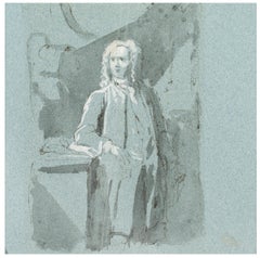
- Portrait of a GentlemanLocated in New York, NYPen, black ink, wash, and white heightening on blue paper Provenance: with F. R. Meatyard, London, around 1925; where acquired by: Dan Fellows Platt, Englewood, New Jersey; by descent to his wife: Ethel Bliss Platt; by whom given to: The Princeton University Art Museum; by whom consigned to: Schaeffer Galleries, New York, 1944; where acquired by: Wilhelm Suida; thence by descent to: Robert L. and Bertina Suida Manning, New York, 1959-1996 Private Collection, USA Literature: Janos Scholz, “Italian Drawings in The Art Museum, Princeton University,” The Burlington Magazine, vol. 109, no. 770 (May 1967), pp. 296, 299. Elaine Claye, “A Group of Portrait Drawings by Jacopo Amigoni...Category
18th Century Old Masters Portrait Drawings and Watercolors
MaterialsPaper, Ink, Pen
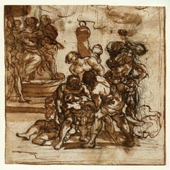
- The Martyrdom of the Santi Quattro CoronatiLocated in New York, NYProvenance: Private Collection, UK After initial training under Justus Suttermans and Vincenzo Dandini, in 1673 Anton Domenico Gabbiani embar...Category
17th Century Old Masters Figurative Drawings and Watercolors
MaterialsPaper, Chalk, Ink, Pen
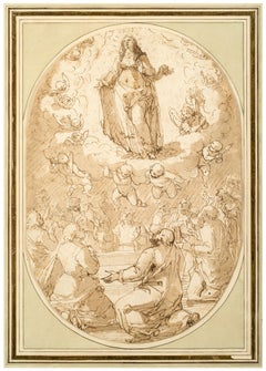
- The Assumption of the VirginLocated in New York, NYProvenance: Unidentified collector’s mark “D.G.R,” lower right (Lugt 757b) Wilhelm Suida (1877–1959), New York; by descent to: Robert L. and Bertina Suida Manning, New York, until 1996 Private Collection, USA This impressive drawing of the Assumption of the Virgin is the work of the Genoese artist Giovanni Battista Paggi. The son of a nobleman, Paggi received a humanist education and was a self-taught artist. According to Paggi’s first biographer, Raffaele Soprani, it was only after encountering Luca...Category
16th Century Old Masters Figurative Drawings and Watercolors
MaterialsPaper, Ink, Pen
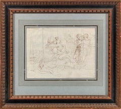
- A Mother and Child, Two Children, and a DogBy Stefano Della BellaLocated in New York, NYProvenance: Elsie de Woolfe, Lady Mendl, Paris; by whom given in 1950 to: Arlene Dahl, New York (until 2021) Inventive, whimsical, and fantastic; delightful, imaginative, and maca...Category
17th Century Old Masters Interior Drawings and Watercolors
MaterialsPaper, Ink, Pen
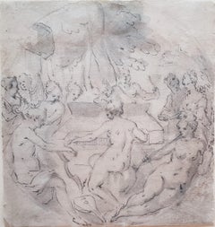
- A Musical PartyBy German SchoolLocated in New York, NYProvenance: Dr. George Hamilton, Massachusetts; and by descent. Private Collection, Ohio, until 2021. Exhibited: (Possibly) Clark Art Institute, Massachusetts (according to a handwritten inscription on the reverse). This drawing by an anonymous, 16th-century German hand presents a delightful scene of nymphs—mostly nude but some draped with cloth—making music in an outdoor setting. The composition is executed within a roundel and centers on the harpsichord played by the figure seen from behind. She is accompanied by a host of other instruments, including horns, a harp, and a lira da gamba played by figures gathered nearby, several of which are positioned along the curved edges of the visual field. Two satyrs observe the merrymaking—one leans on the harpsichord while the other holds aloft a cup, presumably of wine, adding a bacchic element to the revelry. The drawing was previously owned by Dr. George Hamilton, scholar of modern art and Director of the Sterling and Francine Clark Art Institute in Williamstown (1966–1977). Hamilton played...Category
16th Century Old Masters Landscape Drawings and Watercolors
MaterialsPaper, Ink, Pen
You May Also Like
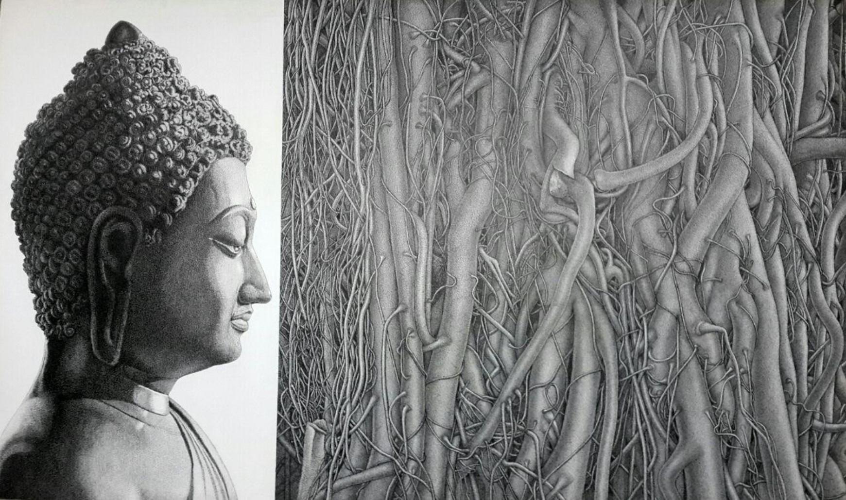
- Peace-17-IV, Pen & Ink on Canvas, Black & White by Indian Artist "In Stock"Located in Kolkata, West BengalPrakash Ghadge - Peace-17-IV Pen & Ink on Canvas, 36 x 60 inches, 2017 Inclusive of shipment in roll form. Prakash Ghadge (B. 1955) ) secured G.D.A. in painting from Sir J.J. School...Category
2010s Contemporary Figurative Paintings
MaterialsCanvas, Ink, Pen
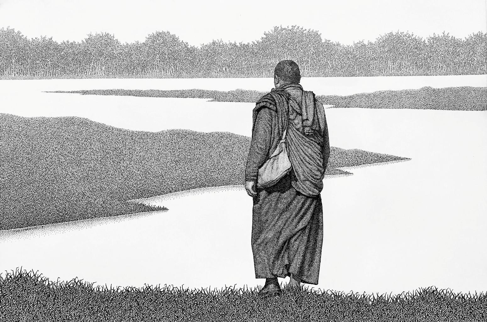
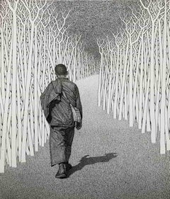
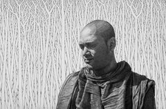
- Monk-19-II, Pen & Ink on Canvas, Black & White by Indian Artist "In Stock"Located in Kolkata, West BengalPrakash Ghadge - Monk-19-II Pen & Ink on Canvas, 18 x 27 inches, 2019 Inclusive of shipment in roll form. Prakash Ghadge (B. 1955) ) secured G.D.A. in painting from Sir J.J. School ...Category
2010s Contemporary Figurative Paintings
MaterialsPen, Canvas, Ink
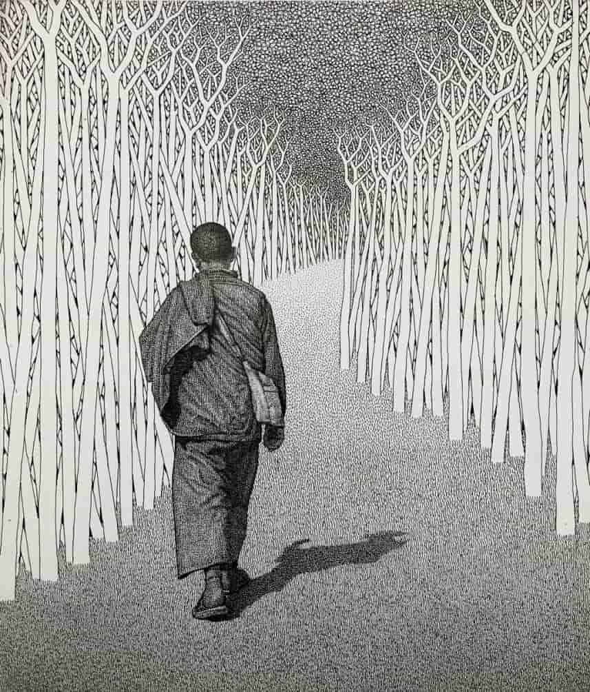
- Monk-19-I, Pen & Ink on Canvas, Black & White by Indian Artist "In Stock"Located in Kolkata, West BengalPrakash Ghadge - Monk-19-I Pen & Ink on Canvas, 19 x 22 inches, 2019 Inclusive of shipment in roll form. Prakash Ghadge (B. 1955) ) secured G.D.A. in painting from Sir J.J. School o...Category
2010s Contemporary Figurative Paintings
MaterialsCanvas, Ink, Pen
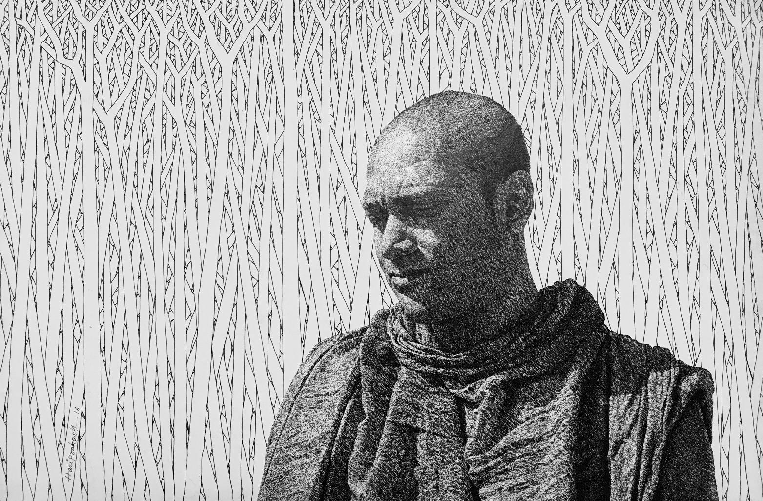
- Monk-16-XI, Pen & Ink on Canvas, Black & White by Indian Artist "In Stock"Located in Kolkata, West BengalPrakash Ghadge - Monk-16-XI Pen & Ink on Canvas, 20 x 30 inches, 2016 Inclusive of shipment in roll form. Prakash Ghadge (B. 1955) ) secured G.D.A. in painting from Sir J.J. School ...Category
2010s Contemporary Figurative Paintings
MaterialsCanvas, Ink, Pen
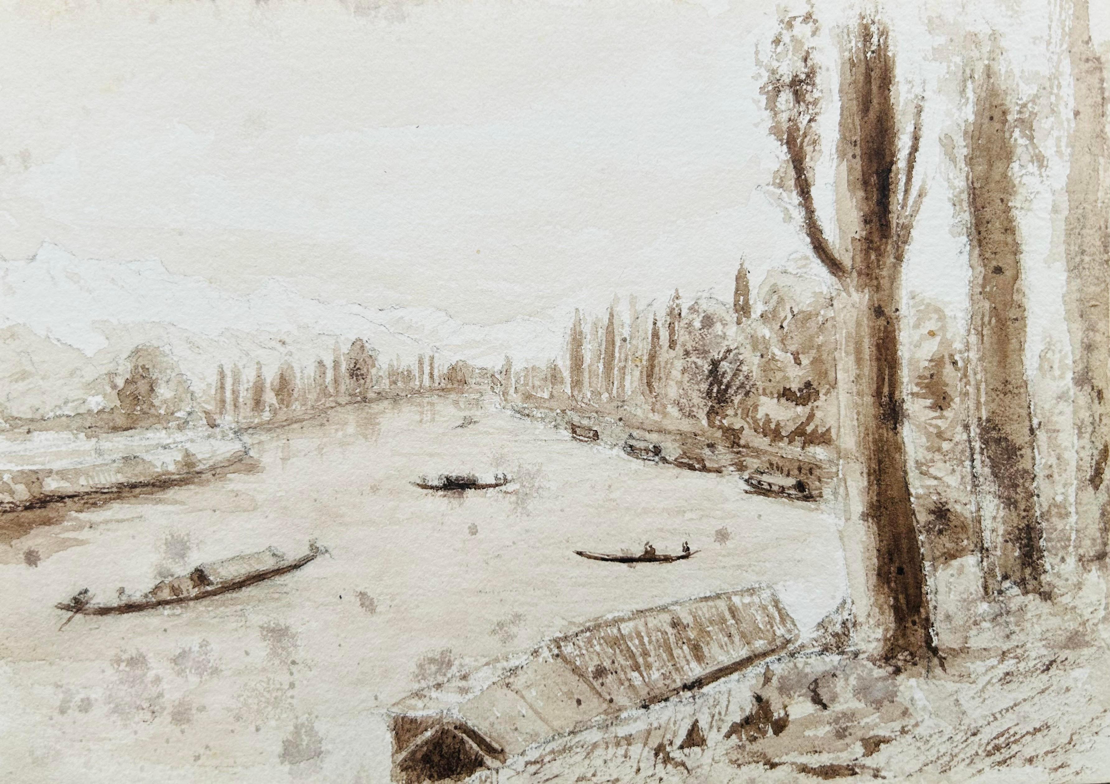
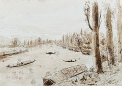
- India 3 X 19th century Kashmir NW Frontier Field Sketches Manasbal Lake, KashmirLocated in Norfolk, GB3 Field, on the spot Sketches NW Frontier India : Manasbal Lake, Kashmir Artist: Unknown Medium: Pen & Ink Created: 1890s Size: 13 x 18 cm each A charming set of on-the-spot sketch...Category
1910s Other Art Style Landscape Drawings and Watercolors
MaterialsPen, Ink, Paper
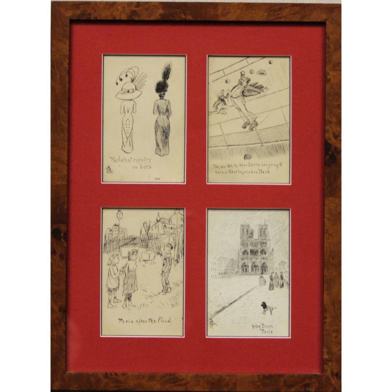
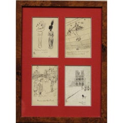
- Four c1910s Postcard Framed Pen & Ink DrawingsLocated in Bristol, CTSet of 4 hand-drawn by R. Weniger pen & ink c1910s postcards from Paris addressed to the philanthropist Seymour H. Knox of Buffalo, NY. Art Sz: 11 3/4"H x 7 3/4"W Frame Sz: 16 1...Category
1910s More Art
MaterialsPaper, Ink, Pen


Recently Viewed
View AllMore Ways To Browse
Antique Rogers
Antique Table Plans
Mid Century Record Table
Mass Church
Rare Bible
Wooden Man Table
Bar With Map
Antique Egyptian Antiquities
Alfred S Wall
Ancient Egyptian Table
Antique Ontario
Egypt Cross
Tribal Wall Mount
Mid Century Modern Record Table
Dior B22
Far Eastern Antique
Crucifixion Of Christ
Crucifixion Print