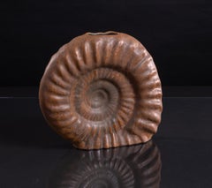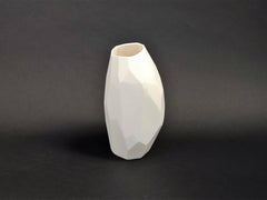
Vase from the Fragments series
View Similar Items


1 of 5
Vezzini & ChenVase from the Fragments series2018
2018
About the Item
- Creator:Vezzini & Chen (Italian, Taiwanese)
- Creation Year:2018
- Dimensions:Height: 9.85 in (25 cm)Width: 5.91 in (15 cm)
- Medium:
- Movement & Style:
- Period:
- Condition:
- Gallery Location:Milano, IT
- Reference Number:Seller: 7741stDibs: LU77332935681
You May Also Like
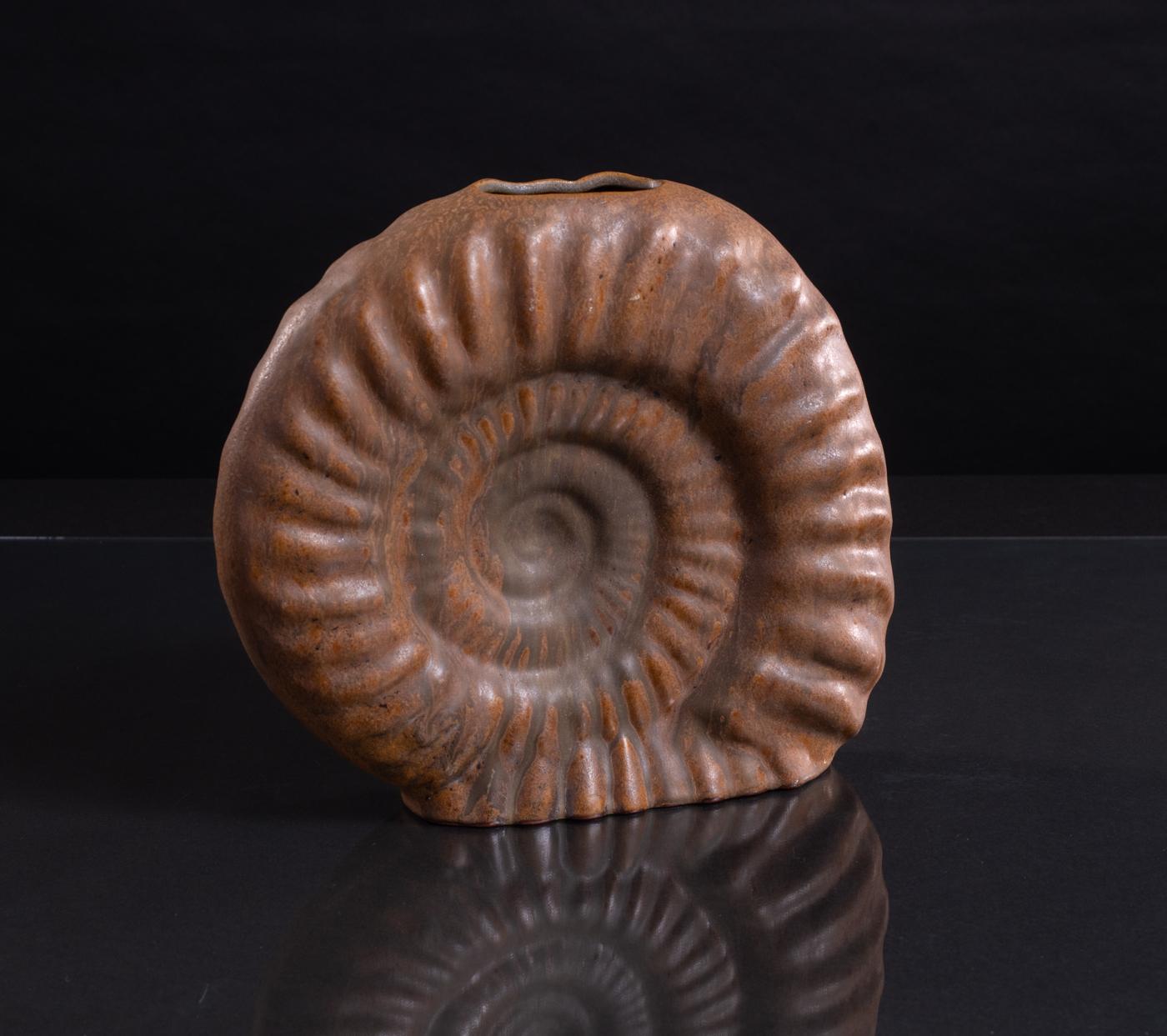
- Organic Ammonite Vase by Schäffenacker, Modernist c. 1950By Helmut Friedrich SchäffenackerLocated in Chicago, ILHand-glazed, ammonite-shaped vase in a deep rust color made by Helmut Schäffenacker. Numbered in the base. Form V-6. Helmut Schäffenacker founded Atelier Schäffenacker in West Germ...Category
1950s Naturalistic More Art
MaterialsCeramic
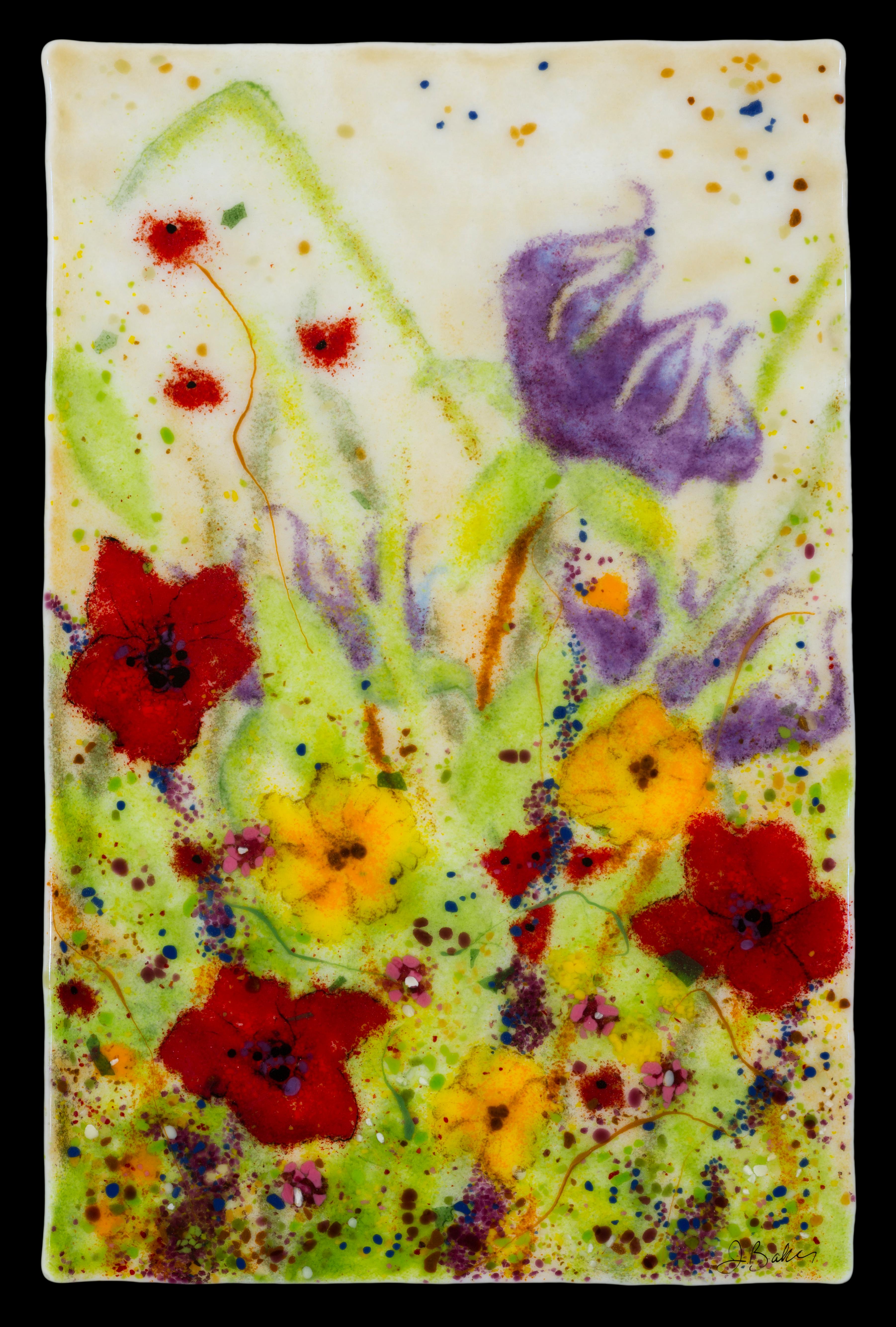
- Glass Wall art by Jennifer Baker Flower scene in Glass, Red, Purple, FloralBy Jennifer BakerLocated in Benahavis, ESThis floral, kiln formed glass artwork was created using layers of hand placed glass pieces. The piece is made to hang on a wall and is backed with a...Category
2010s Naturalistic More Art
MaterialsGlass
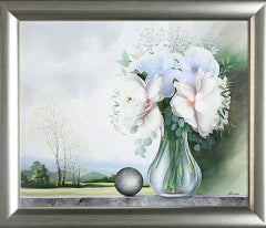
- Panorama - unique oil painting - Ready to HangLocated in Winterswijk, NLStill life with bouquet of flowers and landscape, in delicate cooling pastel colours. Hand-signed oil painting, unique. With suitable, silver frame, Ready to Hang. A beautiful art...Category
21st Century and Contemporary Naturalistic Paintings
MaterialsCanvas, Oil
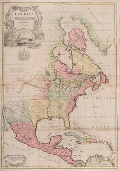
- one of the earliest large-scale English maps of North AmericaBy John SenexLocated in London, GBone of the earliest large-scale English maps of North America SENEX, John. North America Corrected from the Observations Communicated to the Royal Society at London, and the Royal Academy at Paris. By John Senex F.R.S. 1710. To the Honorable Anthony Hammond Esq. One of the Comissioners of Her Maj[es]ties Navy. This Map his humbly Dedicated and Presented by his Obliged Servants. John Senex F.R.S., 1710 [-1728]. A fine map of North and Central America, with the West Indies. One of the earliest large-scale English maps of North America. It represents a British attempt to consolidate new information about the region and borrows data from such recently published sources as Delisle’s landmark Carte du Mexique et de la Floride and Carte de la Canada. Senex improves upon De L'Isle's work with a fine depiction of the Great Lakes region and the most accurate definition of the lower Mississippi River and its delta by an English cartographer of the period. Several of the most important and controversial cartographic discoveries of the period are discussed at length, including Lahontan’s mythical Long River and the Salt Lake east of the Country of the Mozeemleck’s, both of which are also depicted in remarkable (albeit fanciful) detail. Sir William Phipps discovery of Spanish wrecks off the coast of the Caicos and Southern Bahamas is also noted. Senex also extended the map’s coverage to the Canadian Arctic and the Terra Incognita above Baffin’s Bay. Present-day Oklahoma and Texas are part of La Floride, considered at the time to be a possession of the French. The Red River and the Indian villages of East Texas are portrayed accurately, but Senex, following Delisle, incorrectly placed many Texas rivers...Category
1710s Naturalistic More Art
MaterialsWatercolor, Engraving
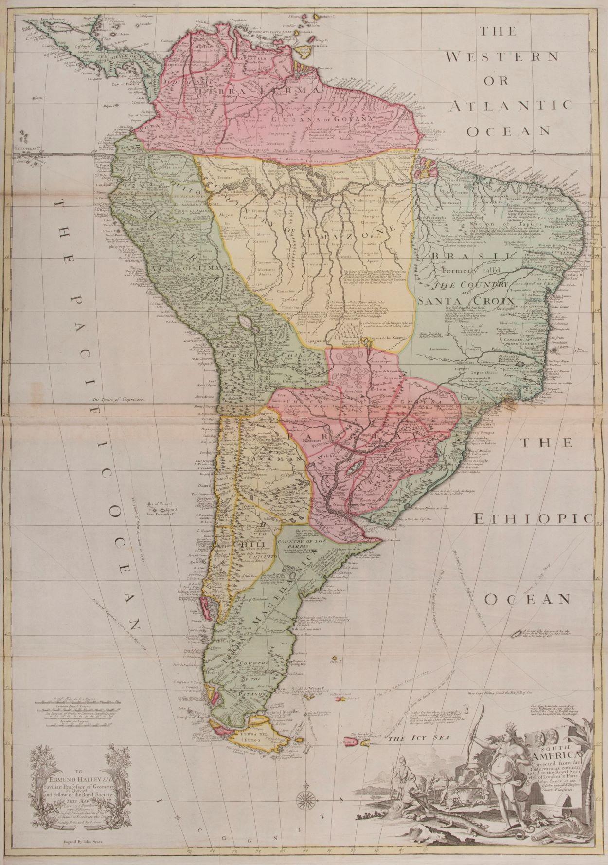
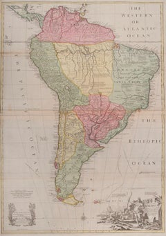
- South AmericaBy John SenexLocated in London, GBSouth America SENEX, John. South America Corrected from the Observations Communicated to the Royal Society’s of London & Paris. By John Senex. To Edmund Halley. LLD. Savilian Professor of Geometry in Oxford and Fellow of the Royal Society. This Map corrected from His own Discoveries In gratefull Acknowledgement of his Ready assistance to Encourage this Designe is Humbly Dedicated. John Senex, at the Globe against St Dunstans Church, Fleetstreet, London 1710 [-1728]. John Senex (1678-1740) was one of the foremost mapmakers in England in the early eighteenth century. He was also a surveyor, globemaker, and geographer. As a young man, he was apprenticed to Robert Clavell, a bookseller. He worked with several mapmakers over the course of his career, including Jeremiah Seller and Charles...Category
1710s Naturalistic More Art
MaterialsWatercolor, Engraving
 $3,779
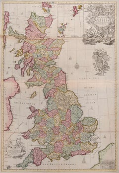
 - Great BritainBy John SenexLocated in London, GBGreat Britain SENEX, John. A New Map of Great Britain Corrected from the Observations communicated to the Royal Society at London. By John Senex F.R.S. To the Right Hono[ra]ble William Connelly ESQ. One of the Commissioners of His Maj[es]ties Revenue, Speakerof the Hono[a]ble House of Commons, and one of His Maj[es]ties most Hono[ra]ble Privy Council for Ye Kingdom of Ireland. This Map is dedicated by John Senex. John Senex F.R.S. 1710 [-1728]. John Senex (1678-1740) was one of the foremost mapmakers in England in the early eighteenth century. He was also a surveyor, globemaker, and geographer. As a young man, he was apprenticed to Robert Clavell, a bookseller. He worked with several mapmakers over the course of his career, including Jeremiah Seller and Charles Price...Category
1710s Naturalistic More Art
MaterialsWatercolor, Engraving