Items Similar to La Gironde, France. Antique map of a French department, 1856

Want more images or videos?
Request additional images or videos from the seller
1 of 5
Victor LevasseurLa Gironde, France. Antique map of a French department, 18561856
1856
About the Item
'La Gironde', steel engraving with original outline hand-colouring., 1856, from Levasseur's 'Atlas National Illustre'.
This coastal department is the seat of the Bordeaux wine region and produces many of the world's finest reds. Shows numerous vineyards and chateaux. The whole is surrounded by elaborate decorative engravings designed to illustrate both the natural beauty and trade richness of the land. There is a short textual history of the regions depicted on both the left and right sides of the map.
Levasseur was an important French engineer, cartographer, and engraver of the mid 19th century.
470mm by 330mm (sheet)
The map is loose and unframed.
- Creator:
- Creation Year:1856
- Dimensions:Height: 18.51 in (47 cm)Width: 13 in (33 cm)
- Medium:
- Movement & Style:
- Period:
- Condition:Spot in left hand margin. Faint waterstain top right margin.
- Gallery Location:Melbourne, AU
- Reference Number:
About the Seller
5.0
Platinum Seller
These expertly vetted sellers are 1stDibs' most experienced sellers and are rated highest by our customers.
Established in 2005
1stDibs seller since 2019
442 sales on 1stDibs
Typical response time: <1 hour
- ShippingRetrieving quote...Ships From: Melbourne, Australia
- Return PolicyA return for this item may be initiated within 14 days of delivery.
More From This SellerView All
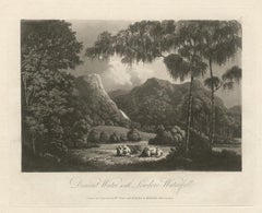
- Derwent Water and Lowdore Fall, Lake District scenery, C19th English aquatintLocated in Melbourne, Victoria'Derwent Water with Lowdore Waterfall' Aquatint by William Green, 1804 William Green of Ambleside was a Lake District draughtsman, soft ground etcher ...Category
Early 19th Century Naturalistic Landscape Prints
MaterialsEngraving, Aquatint
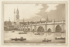
- London Bridge, C18th English aquatintLocated in Melbourne, Victoria'London Bridge' Aquatint by JC Stadler after J Farmington. Published c1795 for Boydell's 'History of the River Thames'. Joseph Constantine Stadler (fl London, 1780-1822) was an eng...Category
Late 18th Century Naturalistic Landscape Prints
MaterialsEngraving
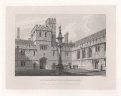
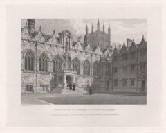
- Corpus Christi College. Oxford University. Antique English C19th engravingLocated in Melbourne, Victoria'Corpus Christi College' Engraving by John Le Keux after Frederick Mackenzie, 1837. From James Ingram's 'Memorials of Oxford'. 135mm by 175mm (platemark...Category
19th Century Naturalistic Landscape Prints
MaterialsEngraving
- St Alban Hall. Oxford University. Antique C19th engravingLocated in Melbourne, Victoria'St Alban Hall' Engraving by John Le Keux after Frederick Mackenzie, 1837. From James Ingram's 'Memorials of Oxford'. 135mm by 175mm (platemark) 200mm ...Category
19th Century Naturalistic Landscape Prints
MaterialsEngraving
- Quadrangle of Corpus Christi College. Oxford University. Antique C19th engravingLocated in Melbourne, Victoria'Quadrangle of Corpus Christi College' Engraving by John Le Keux after Frederick Mackenzie, 1837. From James Ingram's 'Memorials of Oxford'. 135mm by 17...Category
19th Century Naturalistic Landscape Prints
MaterialsEngraving
- The Hall & Chapel, Oriel College. Oxford University. Antique C19th engravingLocated in Melbourne, Victoria'The Hall & Chapel, Oriel College' Engraving by John Le Keux after Frederick Mackenzie, 1837. From James Ingram's 'Memorials of Oxford'. 135mm by 175mm ...Category
19th Century Naturalistic Landscape Prints
MaterialsEngraving


You May Also Like
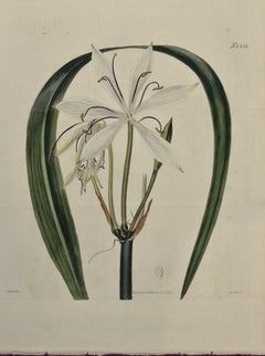
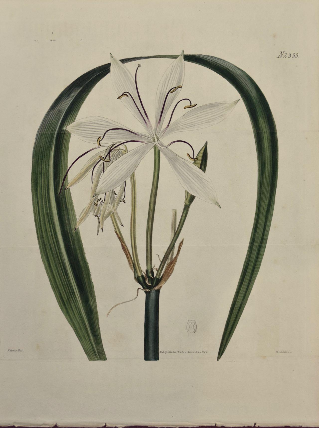
- Flowering Crinum Plant: A 19th C. Hand-colored Botanical Engraving by CurtisBy William CurtisLocated in Alamo, CAThis early 19th century hand-colored double fold-out botanical engraving is entitled "Crinum Arenarium" (Water-Island Sand Crinum), plate 2355, published in London in 1822 in William...Category
1820s Naturalistic Still-life Prints
MaterialsEngraving
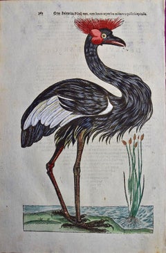
- Crowned Heron Bird: A 16th/17th Century Hand-colored Engraving by AldrovandiBy Ulisse AldrovandiLocated in Alamo, CAThis very rare, first edition, folio hand-colored engraving of a Crowned Heron bird is plate 362 from Ulisse Aldrovandi’s 'Opera Omnia', published be...Category
Early 17th Century Naturalistic Animal Prints
MaterialsEngraving
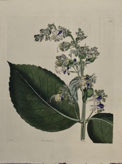
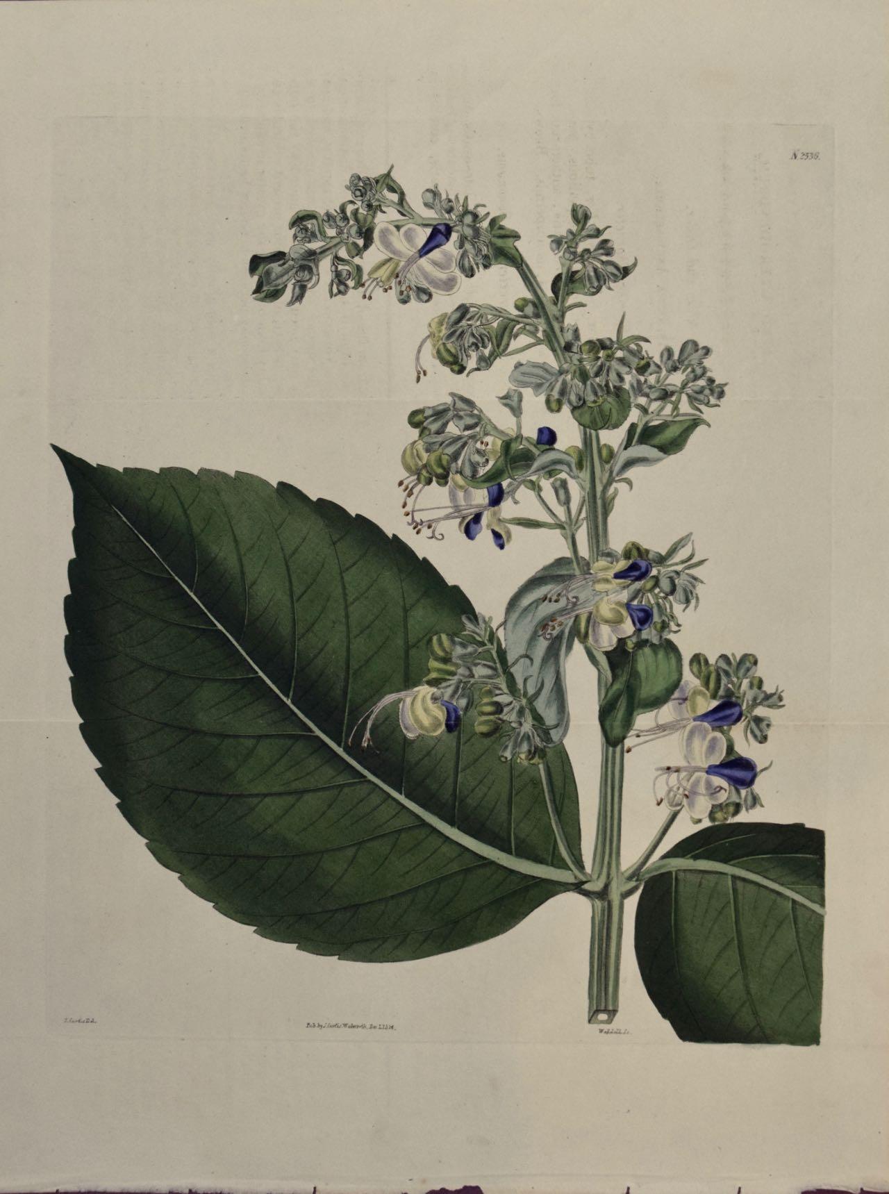
- A 19th Century Curtis Hand-colored Engraving of a Flowering Clerodendrum PlantBy William CurtisLocated in Alamo, CAThis early 19th century hand-colored double fold-out botanical engraving is entitled "Clerodendrum Macrophyllum" (Broad-Leaved Clerodendrum), plate 2356, published in London in 1824 ...Category
1820s Naturalistic Still-life Prints
MaterialsEngraving
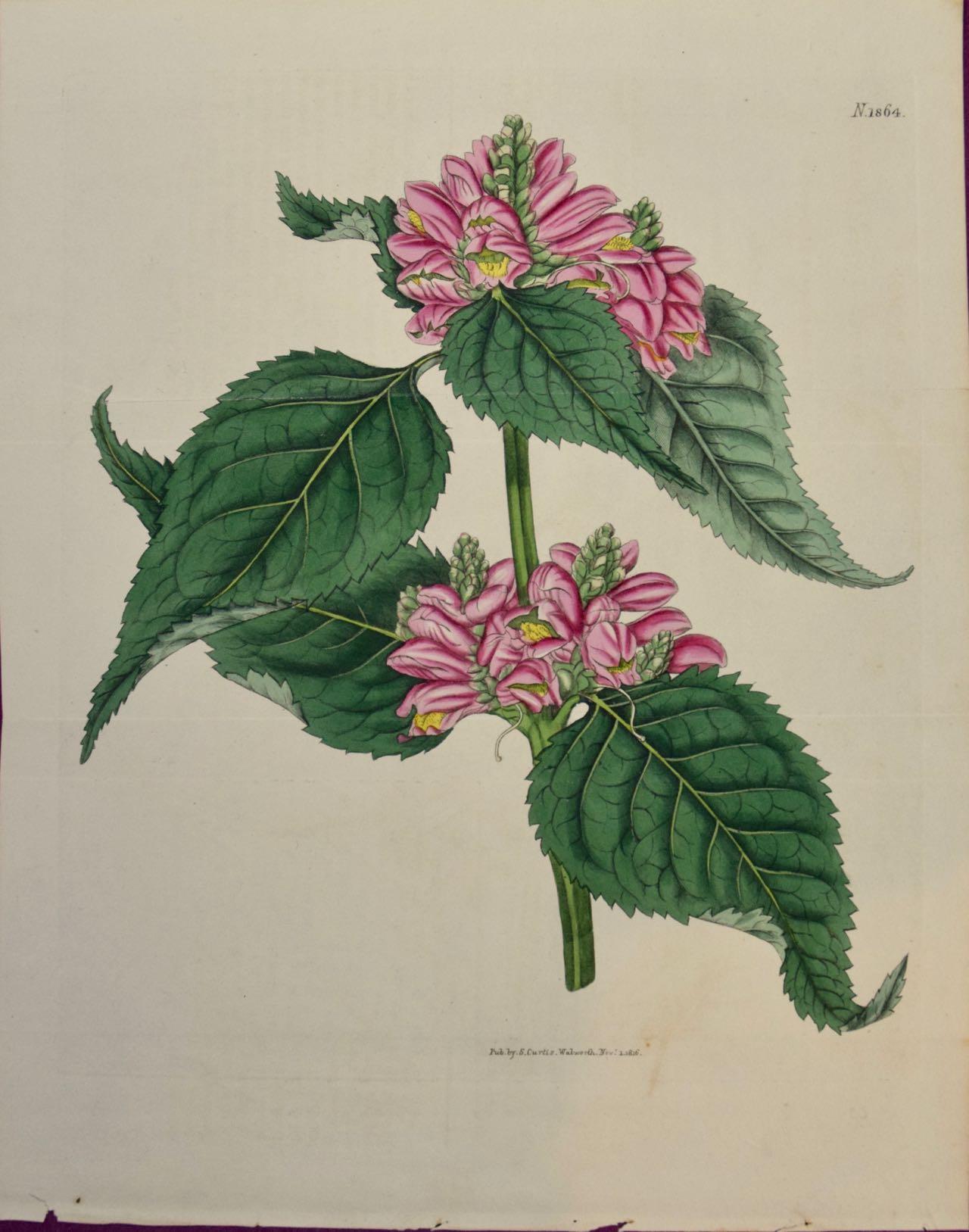
- Flowering Lyons' Chelone Botanical: A 19th C. Hand-colored Engraving by CurtisBy William CurtisLocated in Alamo, CAThis early 19th century hand-colored double fold-out botanical engraving is entitled "Chelone Major" (Flowering Lyons' Chelone plant), plate 1864, published in London in 1816 in Will...Category
1810s Naturalistic Still-life Prints
MaterialsEngraving
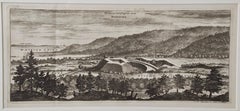
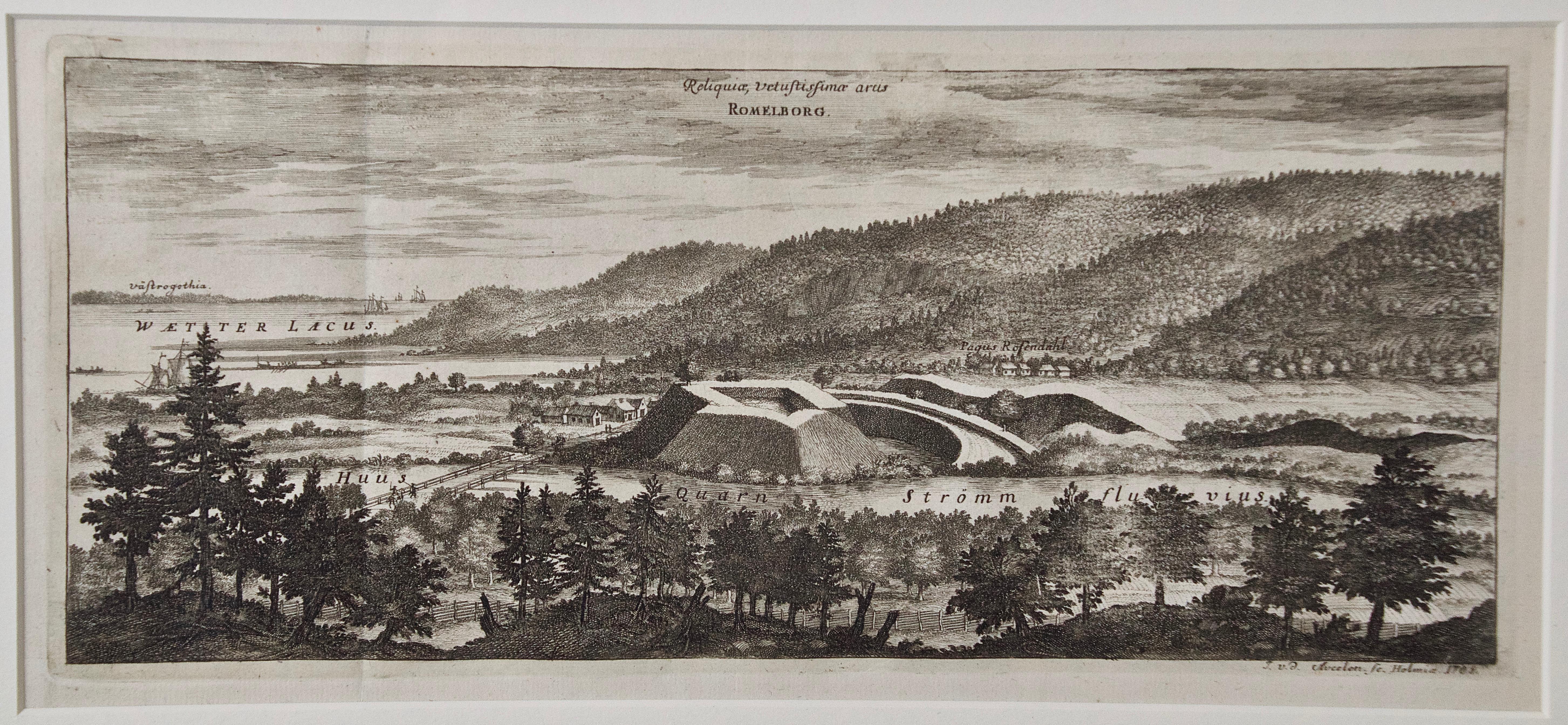
- An Antique Engraved View of "Romelborg", Sweden in the 17th C. by Erik DahlbergBy Erik DahlbergLocated in Alamo, CAAn antique engraved view of "Romelborg", Sweden in 1705 from "Sueciae Antiquae et Hodiernae"' published in Stockholm by Erik Dahlberg (1625-1703). The engraving was created by Johan...Category
Early 18th Century Naturalistic Landscape Prints
MaterialsLaid Paper, Engraving
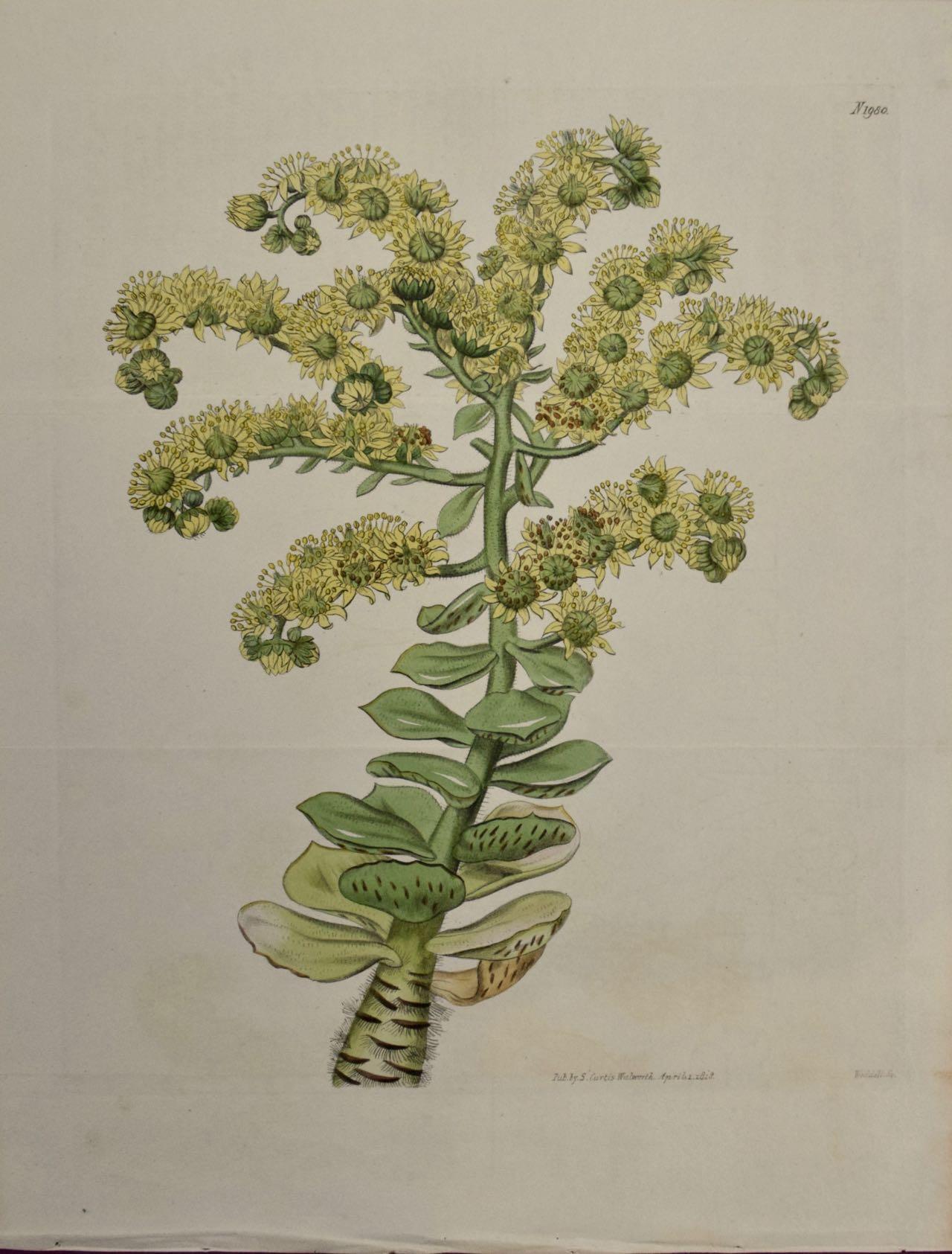
- Flowering Houseleek Plant: A 19th C. Hand-colored Botanical Engraving by CurtisBy William CurtisLocated in Alamo, CAThis early 19th century hand-colored double fold-out botanical engraving is entitled "Sempervivum Smithii" (Hispid-Stemmed Tree Houseleek), plate 1980, published in London in 1818 in...Category
1810s Naturalistic Still-life Prints
MaterialsEngraving