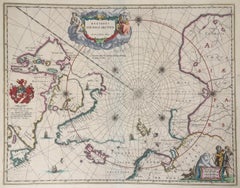
BLAEU MAP OF NORTH POLE and ARTIC
View Similar Items
Want more images or videos?
Request additional images or videos from the seller
1 of 9
Willem BlaeuBLAEU MAP OF NORTH POLE and ARTIC1640
1640
About the Item
- Creator:Willem Blaeu (1571 - 1638)
- Creation Year:1640
- Dimensions:Height: 20.75 in (52.71 cm)Width: 16.375 in (41.6 cm)
- Medium:
- Movement & Style:
- Period:
- Condition:
- Gallery Location:Santa Monica, CA
- Reference Number:1stDibs: LU41133020131
About the Seller
5.0
Recognized Seller
These prestigious sellers are industry leaders and represent the highest echelon for item quality and design.
Platinum Seller
These expertly vetted sellers are 1stDibs' most experienced sellers and are rated highest by our customers.
Established in 1977
1stDibs seller since 2016
262 sales on 1stDibs
Typical response time: 1 hour
Associations
International Fine Print Dealers Association
More From This SellerView All
- PERUBy Johannes JanssonLocated in Santa Monica, CAJOHANNES JANSSON (1588 - 1664) PERU, engraving with early coloring. Platemark 15 1/8 x 19 3/8 inches, sheet 17 x 20 1/2 A nice example of one of the earliest maps of Peru. From the ...Category
1630s Old Masters Landscape Prints
MaterialsEngraving
- AMERICAE - Sive Novi Orbis, Nova DescriptioBy Abraham OrteliusLocated in Santa Monica, CAABRAHAM ORTELIUS (1527 - 1598) AMERICAE SIVE NOVI ORBIS, NOVA DESCRIPTIO, 1587 (1603) (Van Den Broecke 11, Burden 64; Schwartz & Ehrenberg 69) Engraving. A very good, well printed...Category
16th Century Old Masters Landscape Prints
MaterialsEngraving
- AMERICABy John SpeedLocated in Santa Monica, CAIMPORTANT AMERICAN MAP - ONE OF THE FIRST TO SHOW CALIFORNIA as an ISLAND JOHN SPEED (1552-1629) AMERICA - With Those Known Parts In That Unknown Worlde (sic), 1626-(76) (Burden 217 iv/iv) Engraving, uncolored. Engraved by Abraham Goos and published by Thomas Basset and Richard Chiswell - 4th state of 4 in 1676 15 1/8 x 20 1/2” From “A Prospect of the Most Famous Parts of the World”. Generally good condition. A repaired split in lower centerfold. This is the most common version of this important map...Category
1620s Old Masters Landscape Prints
MaterialsEngraving
 $5,000 Sale Price41% Off
 - THE DRAGON ARUMBy Dr. Robert John ThorntonLocated in Santa Monica, CADR. ROBERT JOHN THORNTON (circa 1768- 1837) THE DRAGON ARUM, 1801 (Dunthorne plate 161, pg. 250 i/iii; Nissen 1 955) Mezzotint printed in Payne's grey...Category
Early 1800s Old Masters Landscape Prints
MaterialsMezzotint
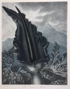 $716 Sale Price20% Off
 - New Map of the Terraqueous Globe - WORLD MAP - CALIFORNIA AS AN ISLANDBy Edward WellsLocated in Santa Monica, CAEDWARD WELLS (British 1667- 1727) A NEW MAP of the TERRAQUEOUS GLOBE - according to the latest Discoveries and most general Divisions of it into CONTINENTS and OCEANS, 1700-01 (Shirley 609) Engraved by Michael Burghers, Oxford. Hand-colored, Platemark 14 1/4 x 20 1/8 inches. Central cartouche flanked by figures representing the continents with dedication to William, Duke of Gloucester...Category
Early 1700s Old Masters Landscape Prints
MaterialsEngraving
- WORLD MAP - Planisphaerium Terrestre Sive Terrarum Orbis... 1696By Carel AllardLocated in Santa Monica, CACAREL ALLARD (1648 – 1709) PLANISPHAERIUM TERRESTRE SIVE TERRARUM ORBIS… 1696 (Shirley 578) Engraving, 20 ½ x 23 ½”, sheet 21 x 24 1/8". A stunning double hemisphere World Map...Category
17th Century Old Masters Landscape Prints
MaterialsEngraving


You May Also Like
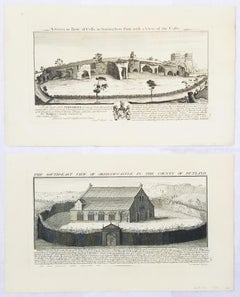
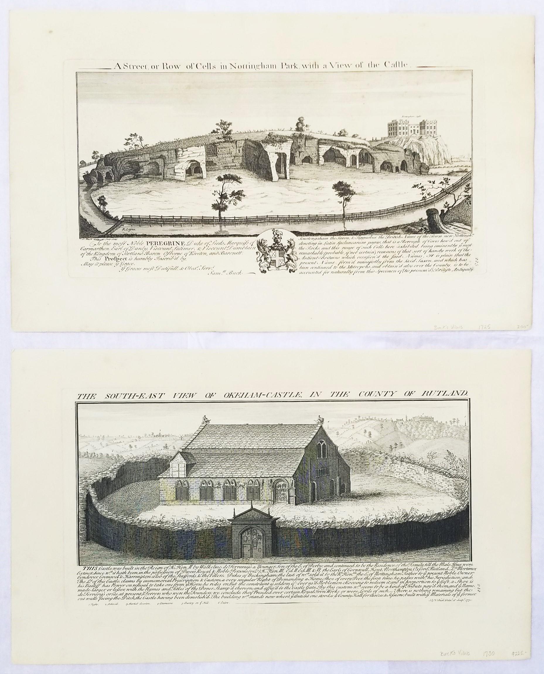
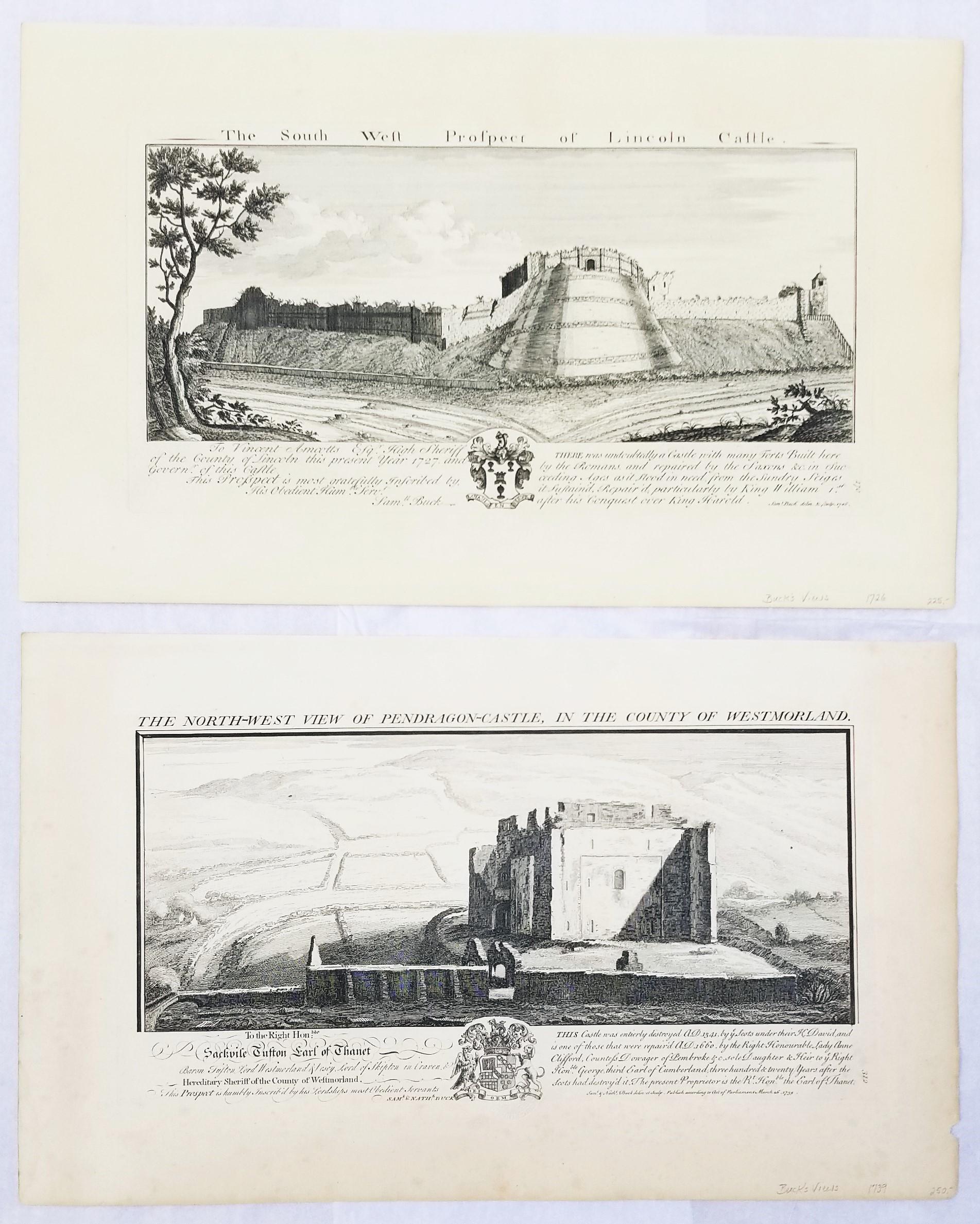
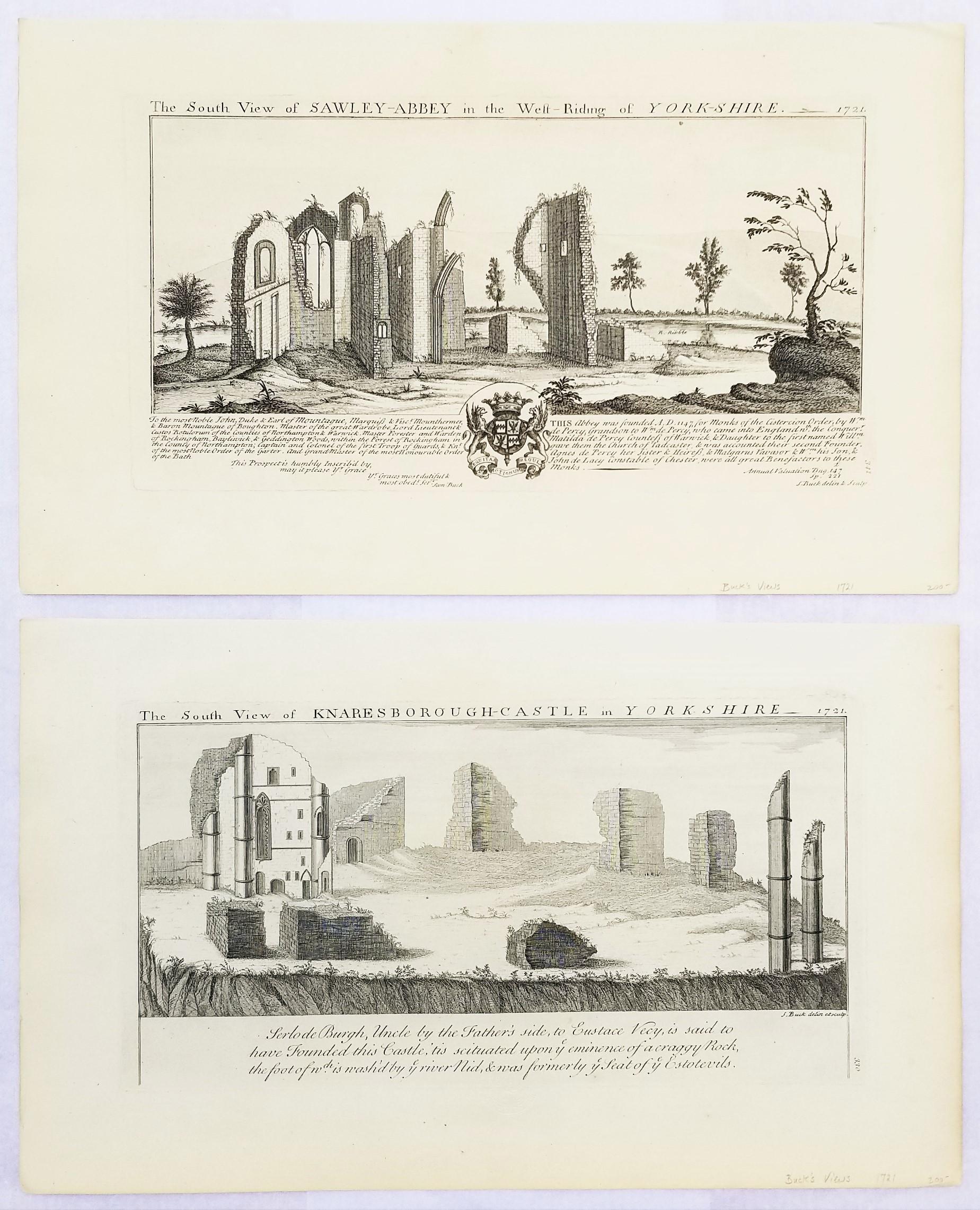
- "Oakham Castle" and "Nottingham Park/Castle" from "Buck's Antiquities" /// UKBy Samuel & Nathaniel BuckLocated in Saint Augustine, FLArtist: Samuel and Nathaniel Buck (English, 1696-1779) and (?-1759/1774) Title: "Oakham Castle" (Plate 242) and "Nottingham Park/Castle" (Plate 226) Portfolio: Buck's Antiquities or ...Category
1720s Old Masters Landscape Prints
MaterialsLaid Paper, Engraving, Intaglio
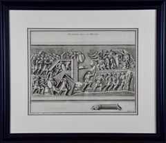
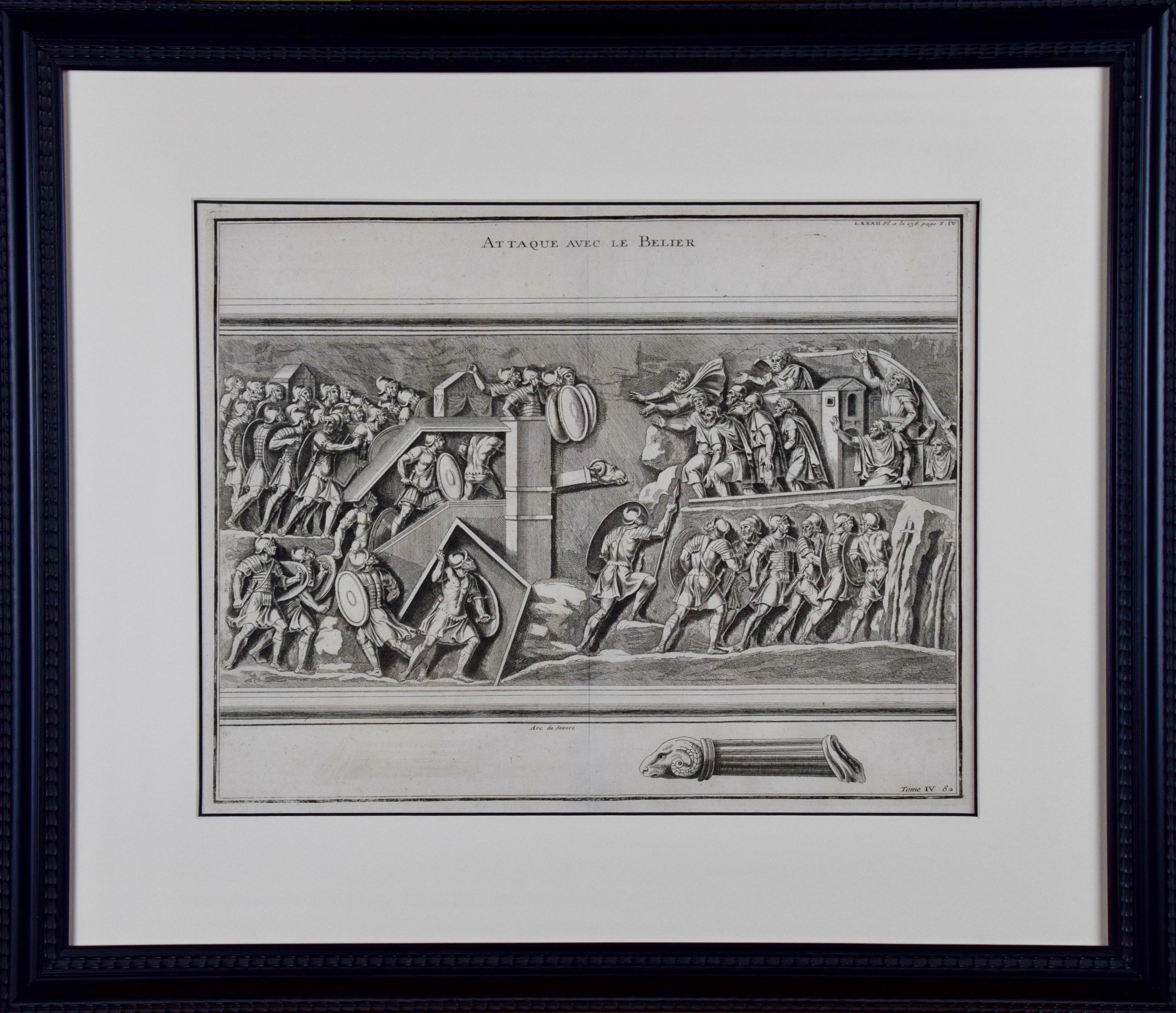
- 18th Century Engraving "Attack with a Battering Ram" by MontfauconLocated in Alamo, CAThis early original copper-plate engraving entitled "Attaque avec le Belier" from 'L'antiquité expliquée et représentée en figures' (Antiquity Explained and Represented in Diagrams), published in Paris in 1719 by Bernard de Montfaucon. It depicts an ancient...Category
Early 18th Century Old Masters Landscape Prints
MaterialsEngraving
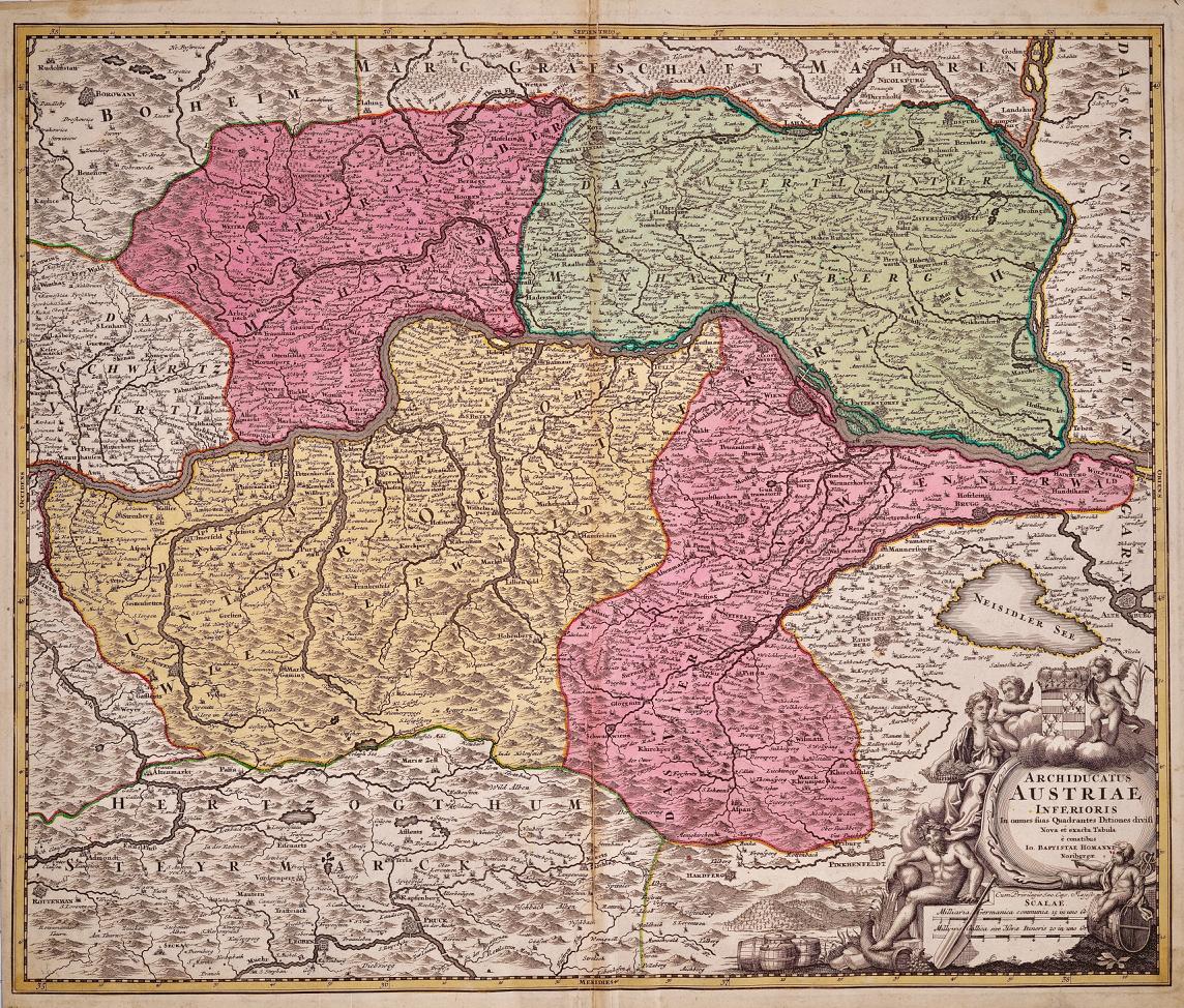
- Hand Colored 18th Century Homann Map of Austria Including Vienna & the DanubeBy Johann Baptist HomannLocated in Alamo, CA"Archiducatus Austriae inferioris" is a hand colored map of Austria created by Johann Baptist Homann (1663-1724) and published in Nuremberg, Germany in 1728 shortly after his death. ...Category
Early 18th Century Old Masters Landscape Prints
MaterialsEngraving
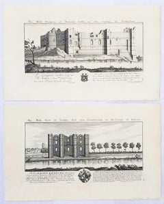
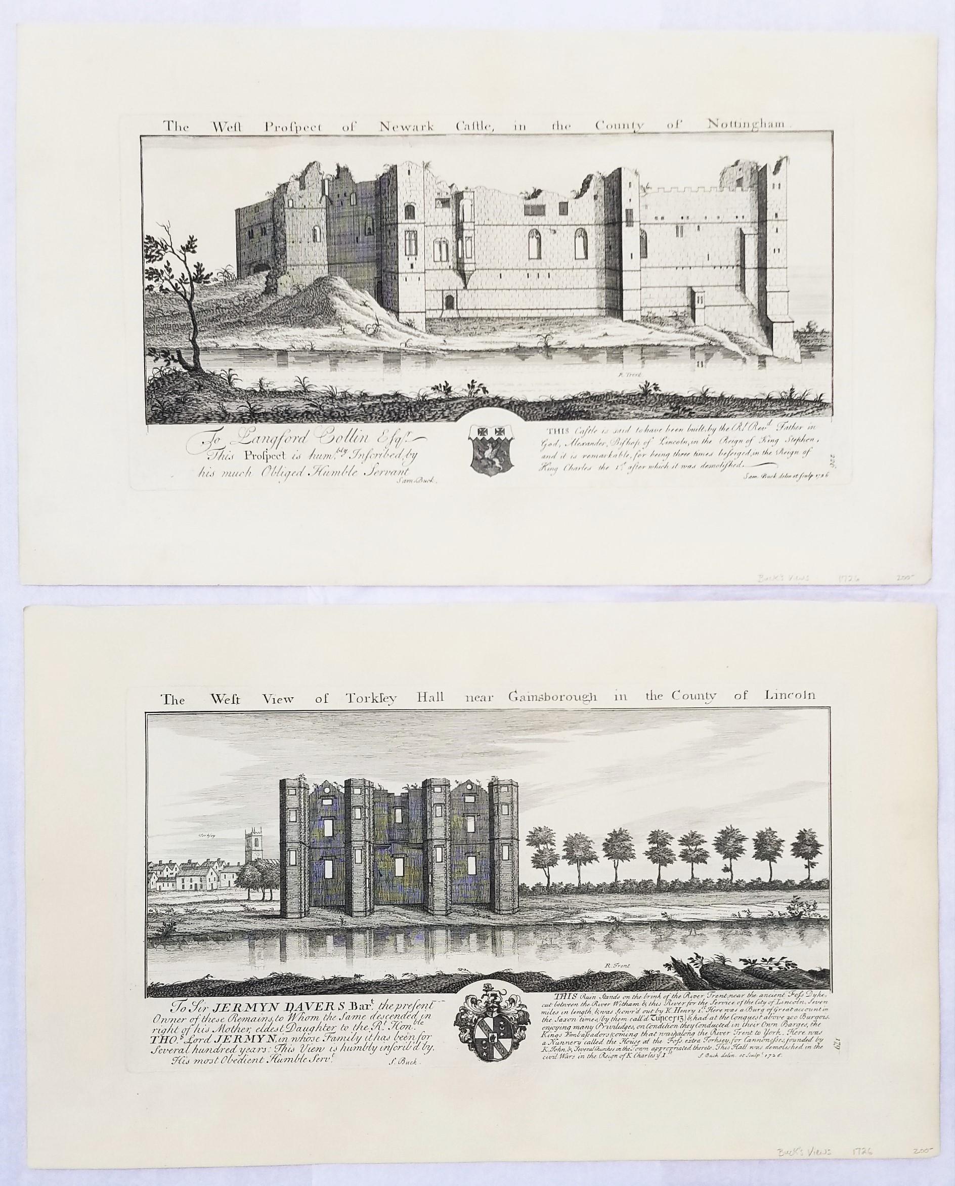
- "Torksey Hall" and "Newark Castle" from "Buck's Antiquities" /// Architecture UKBy Samuel & Nathaniel BuckLocated in Saint Augustine, FLArtist: Samuel and Nathaniel Buck (English, 1696-1779) and (?-1759/1774) Title: "Torksey Hall" (Plate 179) and "Newark Castle" (Plate 226) Portfolio: Buck's Antiquities or Venerable ...Category
1720s Old Masters Landscape Prints
MaterialsLaid Paper, Engraving, Intaglio
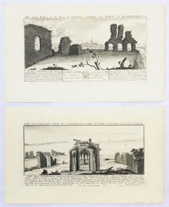
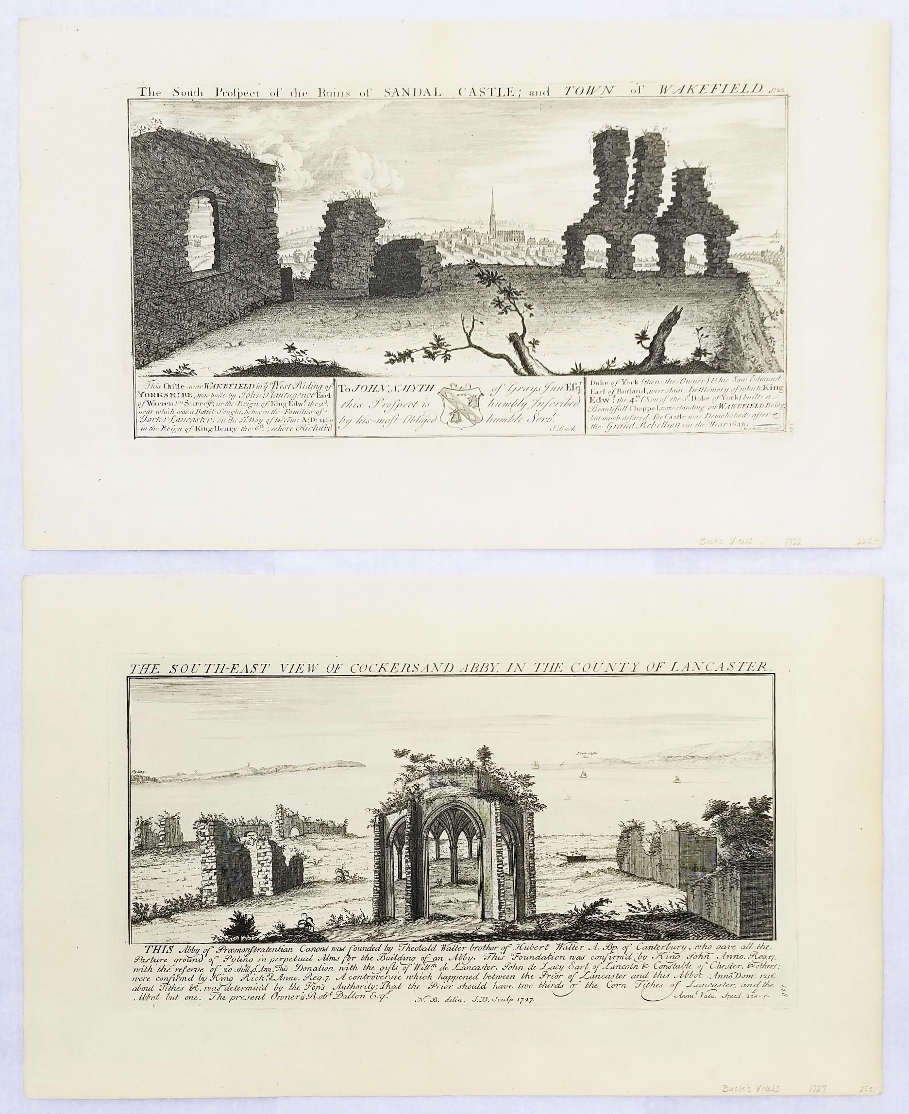
- "Cockersand Abbey" and "Sandal Castle" from "Buck's Antiquities" /// British ArtBy Samuel & Nathaniel BuckLocated in Saint Augustine, FLArtist: Samuel and Nathaniel Buck (English, 1696-1779) and (?-1759/1774) Title: "Cockersand Abbey" (Plate 148) and "Sandal Castle" (Plate 340...Category
1720s Old Masters Landscape Prints
MaterialsLaid Paper, Engraving, Intaglio
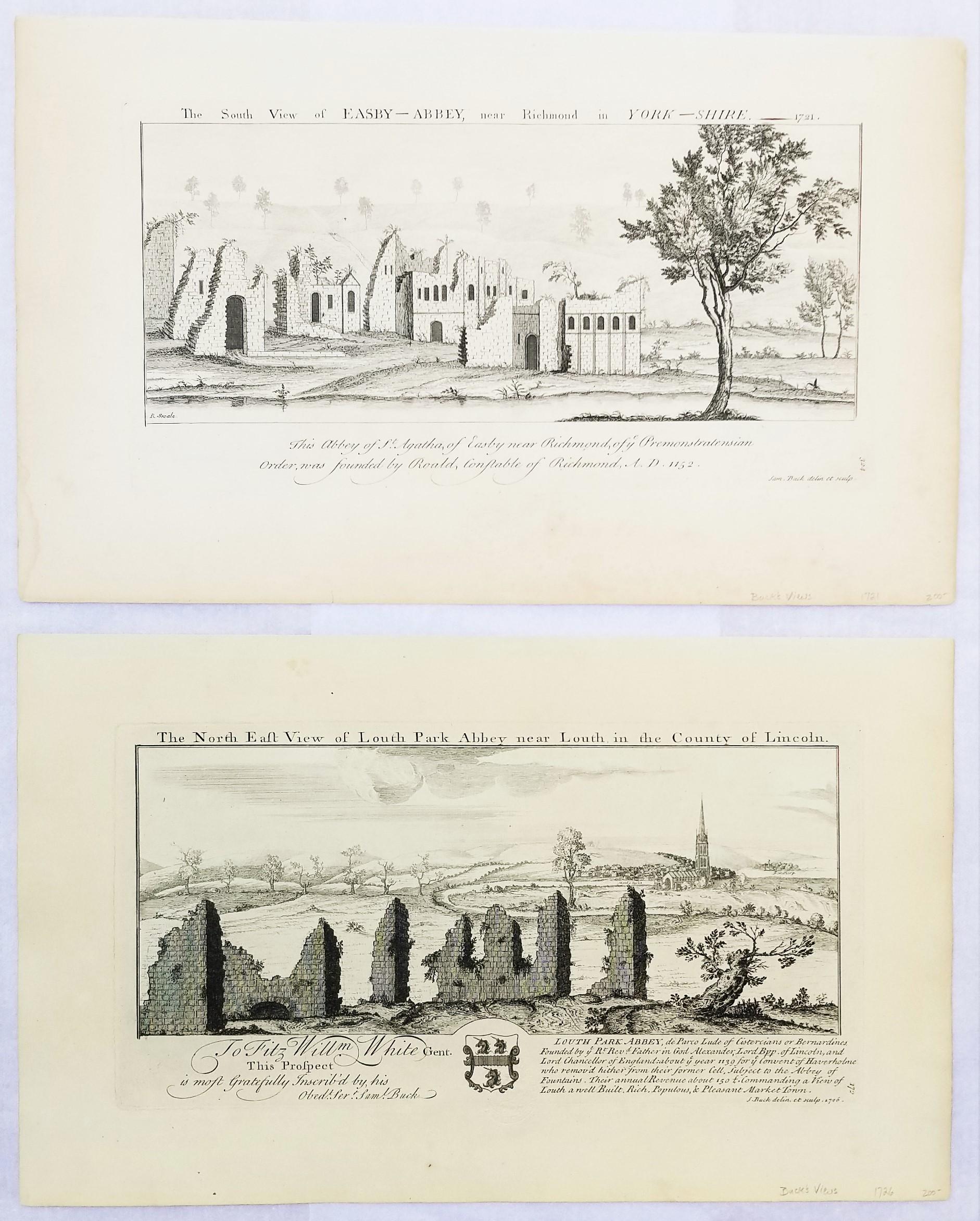
- "Louth Park Abbey" and "Easby Abbey" from "Buck's Antiquities" /// ArchitectureBy Samuel & Nathaniel BuckLocated in Saint Augustine, FLArtist: Samuel and Nathaniel Buck (English, 1696-1779) and (?-1759/1774) Title: "Louth Park Abbey" (Plate 172) and "Easby Abbey" (Plate 324) Portfolio: Buck's Antiquities or Venerabl...Category
1720s Old Masters Landscape Prints
MaterialsLaid Paper, Engraving, Intaglio