![Verhandeling over eene conceptio tubaria, waargenomen in het Nosocomium [...].](https://a.1stdibscdn.com/archivesE/upload/a_5923/1519910550412/cb4790c_master.jpg?width=240)
Verhandeling over eene conceptio tubaria, waargenomen in het Nosocomium [...].
View Similar Items
1 of 6
Daniel Veelwaard JuniorVerhandeling over eene conceptio tubaria, waargenomen in het Nosocomium [...].1823
1823
About the Item
- Creator:Daniel Veelwaard Junior (1796 - 1868, Dutch)
- Creation Year:1823
- Dimensions:Height: 10.44 in (26.5 cm)Width: 11.82 in (30 cm)
- Medium:
- Period:
- Condition:Set is the complete loose section from an annually published Dutch scientific briefing. Images show front page and 2 plates. Size given is the size of the first plate. Text page size is 4o. (23x26,5cm).
- Gallery Location:Zeeland, NL
- Reference Number:Seller: 66116 Wetenschap1-321stDibs: LU59232588283
You May Also Like
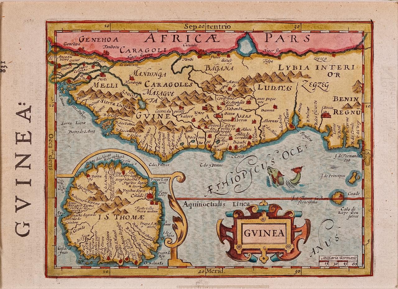
- West Africa: A 17th Century Hand-Colored Map by Mercator/HondiusBy Gerard MercatorLocated in Alamo, CAA 17th century hand-colored map entitled "Guineae Nova Descriptio" by Gerard Mercator and Jodocus Hondius, published in their 'Atlas Minor' in Amsterdam in 1635. It is focused on the...Category
1630s Landscape Prints
MaterialsEngraving
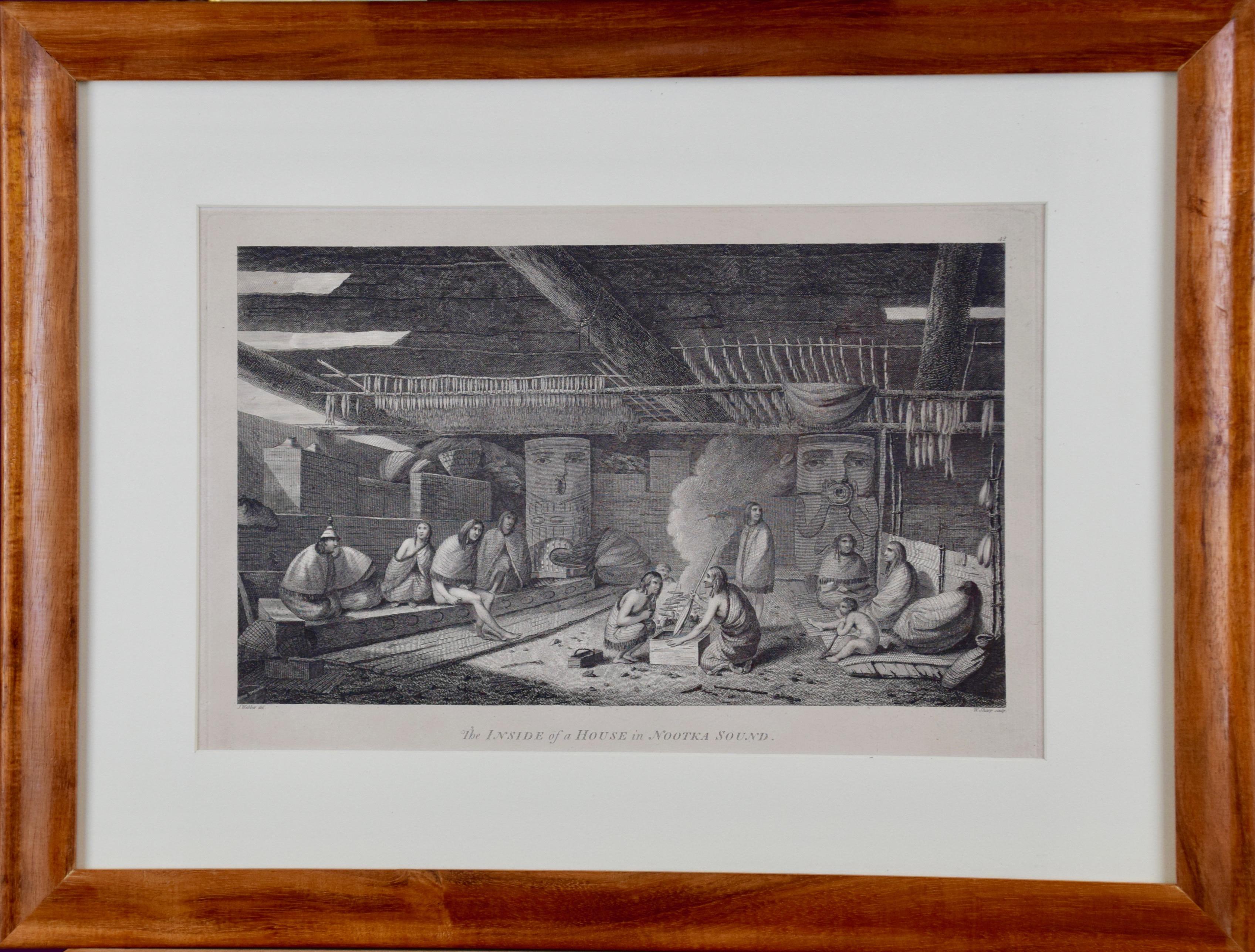
- "Inside of a House in Nootka Sound" (Canada) from Captain Cook's 3rd VoyageBy John WebberLocated in Alamo, CA"The Inside of a House in Nootka Sound" is an engraving created by William Sharp (1749-1824), from a drawing by John Webber (1752-1793), who was the artist on Captain James Cook's 3rd and final voyage of discovery. It is Plate 65 in "A Voyage to the Pacific Ocean Undertaken by the Command of His Majesty, for Making Discoveries in the Northern Hemisphere", the official British Admirality sanctioned journal published upon completion of the voyage in London in 1784 by Strahan & Cadell. This engraving is presented in a Koa wood frame and a white mat. There are occasional tiny faint spots, but the print is otherwise in very good condition. Koa wood is legendary in Hawaii. Not only is this amazing wood native to Hawaii, but it is known for the deep rich colors and varied grain pattern. Koa has an honored heritage in Hawaii and is highly revered and sacred. The word “koa” means “warrior” in Hawaiian. The warriors of King Kamehameha the Great, created canoes and weapons from a wood plentiful on the Big Island of Hawaii. This wood became synonymous with the warriors themselves, and it became known as koa. There are three other engravings listed form the official journal of Captain Cook's 3rd voyage available that are presented in identical Koa wood frames and mats. They would make a wonderful grouping for a display of 2, 3 or 4 prints. Please see listings: LU117324682432, LU117324684022, LU117324684062. A discount is available for a grouping depending on the number of items included. Nootka Sound is on the west coast of Vancouver Island, British Columbia, Canada. It was explored by Captain Cook in 1778 after he discovered Hawaii during his 3rd voyage. He originally named it King George's Sound, but did record Nootka Sound, which he thought was its native name. Hawaii was originally called The Sandwich Islands in honor of The Earl of...Category
1780s Realist Interior Prints
MaterialsEngraving
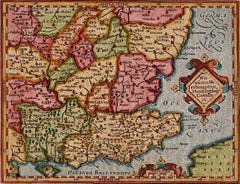
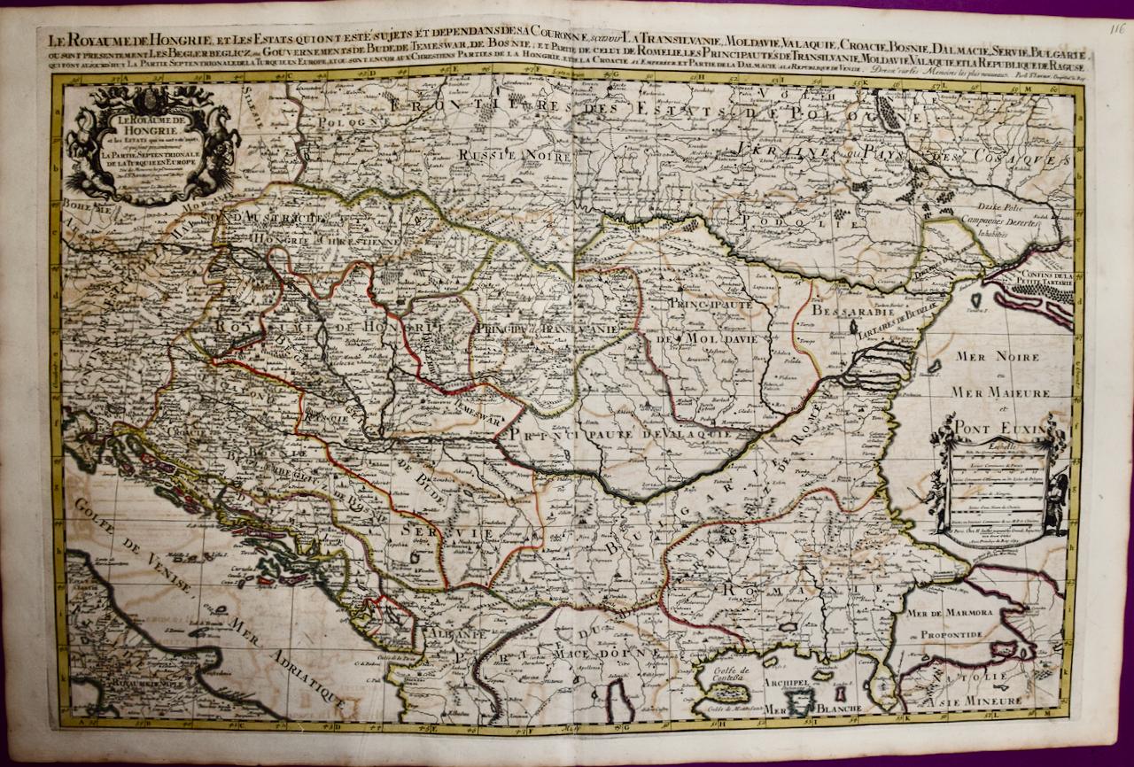
- Hungary & Eastern Europe: A Large 17th C. Hand-colored Map by Sanson & JaillotBy Nicholas Sanson d'AbbevilleLocated in Alamo, CAThis large hand-colored map entitled "Le Royaume De Hongrie et les Estats qui en ont este sujets et qui font presentement La Partie Septentrionale de la Turquie en Europe" was origin...Category
1690s Landscape Prints
MaterialsEngraving
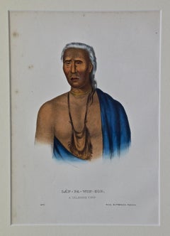
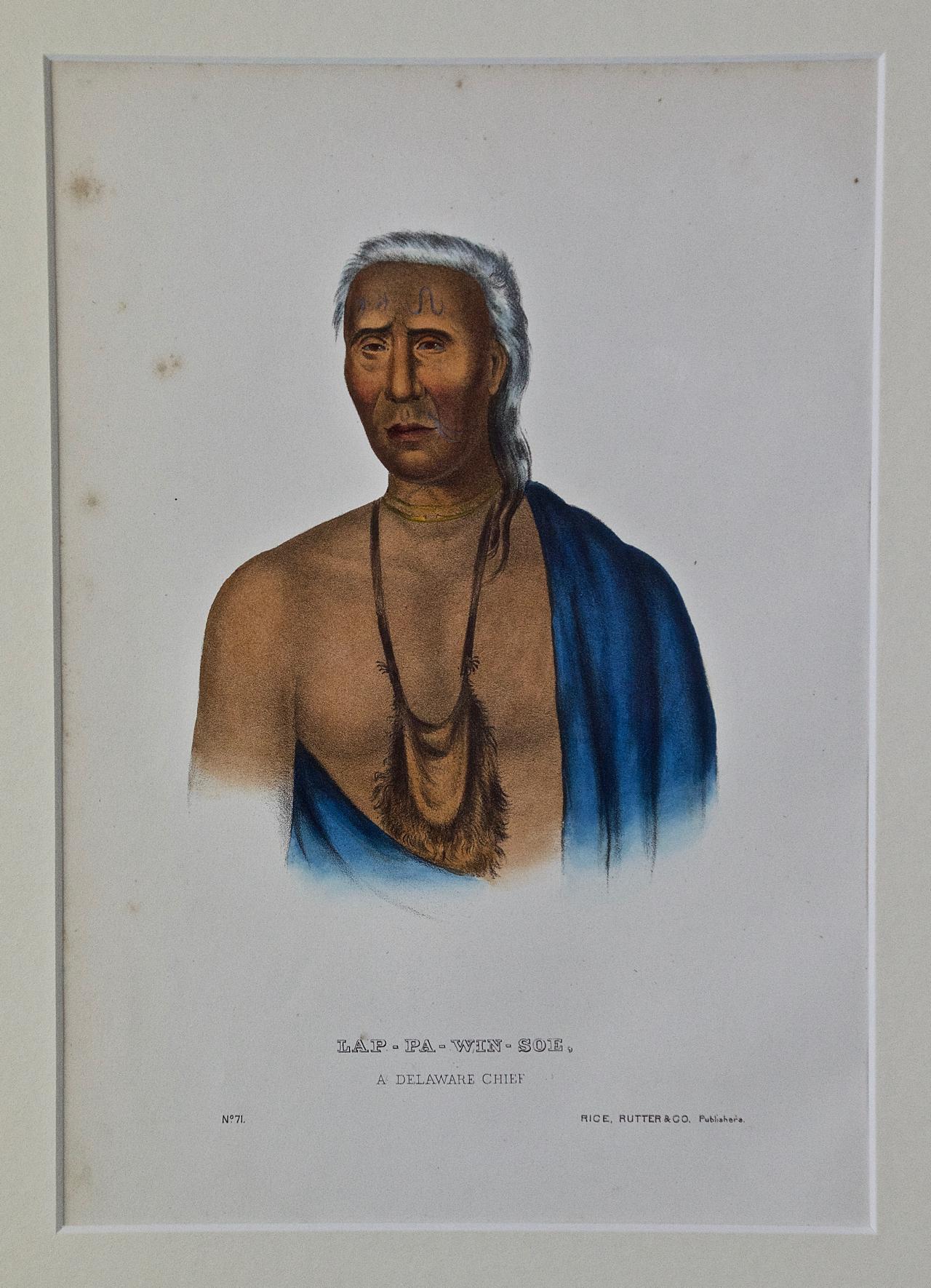
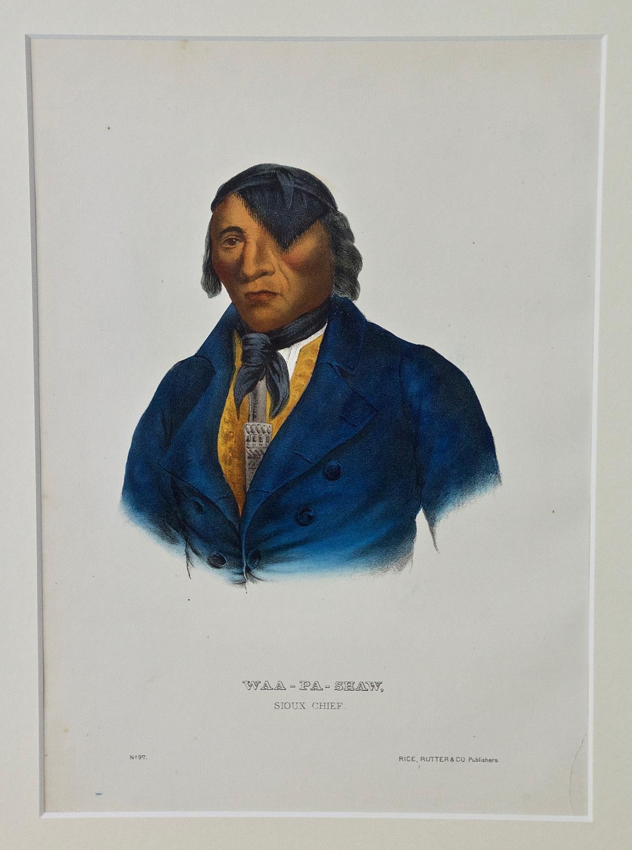
- Lap-Pa-Win-Soe, Delaware Chief: Original Hand-colored McKenney & Hall EngravingBy McKenney & HallLocated in Alamo, CAThis is an original 19th century hand-colored McKenney and Hall engraving of a Native American entitled "Lap-Pa-Win-Soe, A Delaware Chief, No. 71", published by Rice, Rutter & Co. in...Category
Mid-19th Century Naturalistic Portrait Prints
MaterialsEngraving
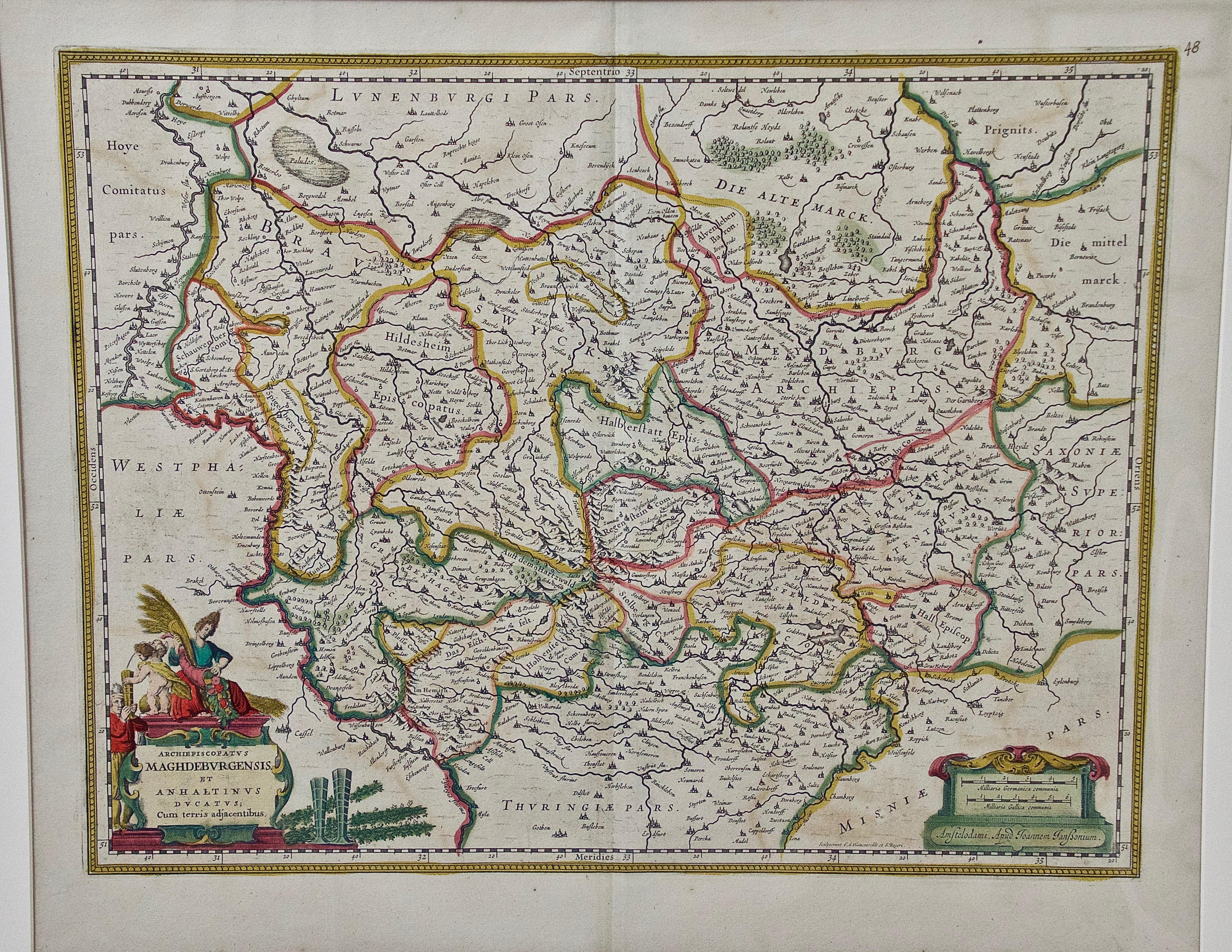
- West Germany: Original Hand Colored 17th Century Map by Johannes JanssoniusBy Johannes JanssoniusLocated in Alamo, CAAn original hand colored copperplate engraved map entitled in Latin "Archiepiscopatus Maghdeburgensis et Anhaltinus Ducatus cum terris adjacentibus", published in Amsterdam in 1640 i...Category
Mid-17th Century Old Masters More Prints
MaterialsEngraving
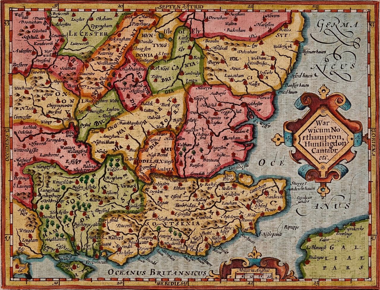
- Southeastern England: A 17th Century Hand-Colored Map by Mercator and HondiusBy Gerard MercatorLocated in Alamo, CAA 17th century copperplate hand-colored map entitled "The Sixt Table of England" by Gerard Mercator and Jodocus Hondius, published in Amsterdam in 1635 in 'Cosmographicall Descriptio...Category
1630s Landscape Prints
MaterialsEngraving