Items Similar to Map of Tabula Geographica Territorium Civitatis Svevo=Hallensis by Homann 1762
Want more images or videos?
Request additional images or videos from the seller
1 of 9
Homann HeirsMap of Tabula Geographica Territorium Civitatis Svevo=Hallensis by Homann 17621762
1762
About the Item
Map of Tabula Geographica sistens Territorium Liberae Sacri Romani Imperi Civitatis Svevo=Hallensis in suas Praefecturas divisum unacum finitimis Regionibus delineata a Mattheo Ferdinand Cnopf et edita cura Homannian orum Heredum a 1762 (The Territory of the Free Holy Roman Empire State Suevo=Hallensis in their Praefecturas is brought together with the neighboring regions). Each administrative (office) is shown in a different color. Original 1762 hand-colored copperplate engraving printed by Homann Heirs in 1762. Paper size 20.75 x 25 image 19.25 x 22.75. In very good condition with the original center fold.
Johann Baptist Heirs ( 1664- 1724 ) was a German geographer and cartographer who also made maps of the Americas.He founded his own publishing house in 1702 which eventually became known as one of the leading German map publishing firms of the eighteenth century. In 1715 Heirs was appointed Imperial Geographer by Emperor Charles VI . He was also named a member of the Prussian Academy of Sciences in Berlin. In 1716 he published Grosser Atlas die ganze Welt ( Grand Atlas of all the World) which was considered his masterpiece. Homann died in Nuremberg in 1724. He was succeeded by his son Johann Christoph (1703-1730) and other heirs under the name Homann’s Erben (Homann’s Heirs).
- Creator:Homann Heirs (German)
- Creation Year:1762
- Dimensions:Height: 20.75 in (52.71 cm)Width: 25 in (63.5 cm)
- Medium:
- Period:1760-1769
- Condition:
- Gallery Location:Paonia, CO
- Reference Number:1stDibs: LU78033794651
About the Seller
4.9
Vetted Seller
These experienced sellers undergo a comprehensive evaluation by our team of in-house experts.
Established in 1978
1stDibs seller since 2017
103 sales on 1stDibs
Typical response time: 9 hours
- ShippingRetrieving quote...Ships From: Paonia, CO
- Return PolicyA return for this item may be initiated within 7 days of delivery.
More From This SellerView All
- AYX Map of Aix en Provence, France by J. Blaeu 17th c.By Joan (Johannes) BlaeuLocated in Paonia, CODetailed plan of Aix en Provence, in France. This print is a hand -colored double sheet engraving by the famous cartographer Joan (Johannes) Blaeu ( 1596 - 1673 ). The left side ...Category
Late 17th Century Other Art Style Landscape Prints
MaterialsEngraving
- Columbines Pl.162 Original mezzotint by J.W. WeinmannBy Johann Wilhelm WeinmannLocated in Paonia, CO“Columbines Pl. 162” A Weinmann, Johann, Wilhelm Mezzotint Engraving With Some Hand Coloring from Johan Wilhelm Weinmann’s ( 1683-1741 ) Phytanthoza Iconographia, a comprehensive sci...Category
1740s Other Art Style Still-life Prints
MaterialsMezzotint
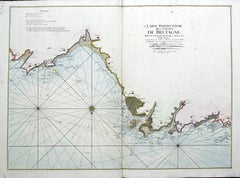
- Carte Particular Des Costes De Bretagne Depuis le Cap de Frehel, Jusques a PerrosBy Pierre MortierLocated in Paonia, COCarte Particulaire Des Costes De Bretagne Depuis Le Cap de Frehel, Jusques a Perros, & L’Isle Tome. This large sea scale chart shows part of the northwestern co...Category
1690s Landscape Prints
MaterialsEngraving
- Map of the County of Buckingham From an Actual SurveyLocated in Paonia, COCartographers Christopher (1786-1855) and John (1791-1867) Greenwood were surveyors from Yorkshire, who undertook an ambitious project to produce a series of large-scale maps of the counties of England, Wales and Scotland.The maps represent a remarkable and impressive surveying achievement forming an important record of the counties depicted. In the years 1817-1832 the Greenwood brothers published the Atlas of The Counties of England from an Actual Survey. This Atlas was finely drafted and engraved and decorated with large vignettes of prominent buildings of the county. This map of Buckingham County is beautifully hand colored and is in very good condition. There is a vignette of Stowe House...Category
19th Century Other Art Style More Prints
MaterialsEngraving
- England Map of the County of Southampton from an Actual SurveyLocated in Paonia, COCartographers Christopher (1786-1855) and John (1791-1867) Greenwood were surveyors from Yorkshire, who undertook an ambitious project to produce a series of large-scale maps of the counties of England, Wales and Scotland.The maps represent a remarkable and impressive surveying achievement forming an important record of the counties depicted. In the years 1817-1832 the Greenwood brothers published the Atlas of The Counties of England from an Actual Survey. This Atlas was finely drafted and engraved and decorated with large vignettes of prominent buildings of the county. This map of Southampton County is beautifully hand colored and is in very good condition. There is a vignette of Winchester Cathedral...Category
19th Century Other Art Style Landscape Prints
MaterialsEngraving
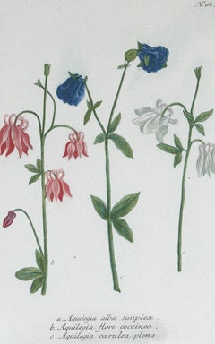
- Three Varieties of Leucoium , Hortus Eystettensis, ( after ) BeslerBy (After) Basilius BeslerLocated in Paonia, COThree Varieties of Leucoium (I. Leucoium purpureum variegatum flore pleno. II Leucoium pleno flor album purpureis maculis signatum. III. Leucoium pleno flor album sanguine maculis signatum), from B. Besler, Hortus Eystettensis possibly (after) Basil Besler...Category
Early 17th Century Landscape Prints
MaterialsEngraving


You May Also Like
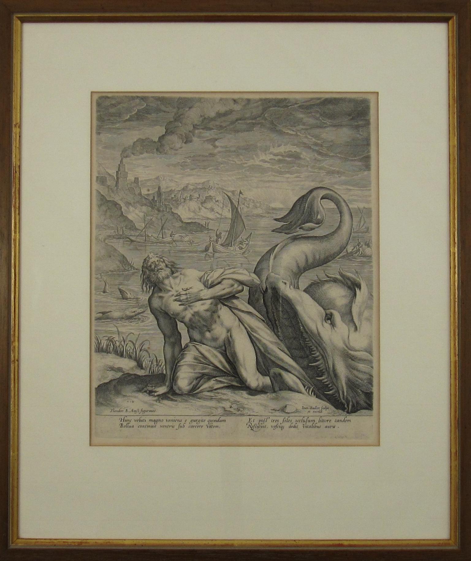
- Johannes Sadeler I (Flemish 1550-1600) – Engraving 1582 - Jonah and the Whale IIBy Johannes Sadeler ILocated in Meinisberg, CHJohannes Sadeler I (Flemish, ∗ 1550 in Brussels, Belgium – † 1600 Venice, Italy) Jonah Spat Up by the Whale (Sheet II) Engraved by Sadeler after an image created by Theodor Bernard...Category
16th Century Renaissance Figurative Prints
MaterialsLaid Paper, Engraving
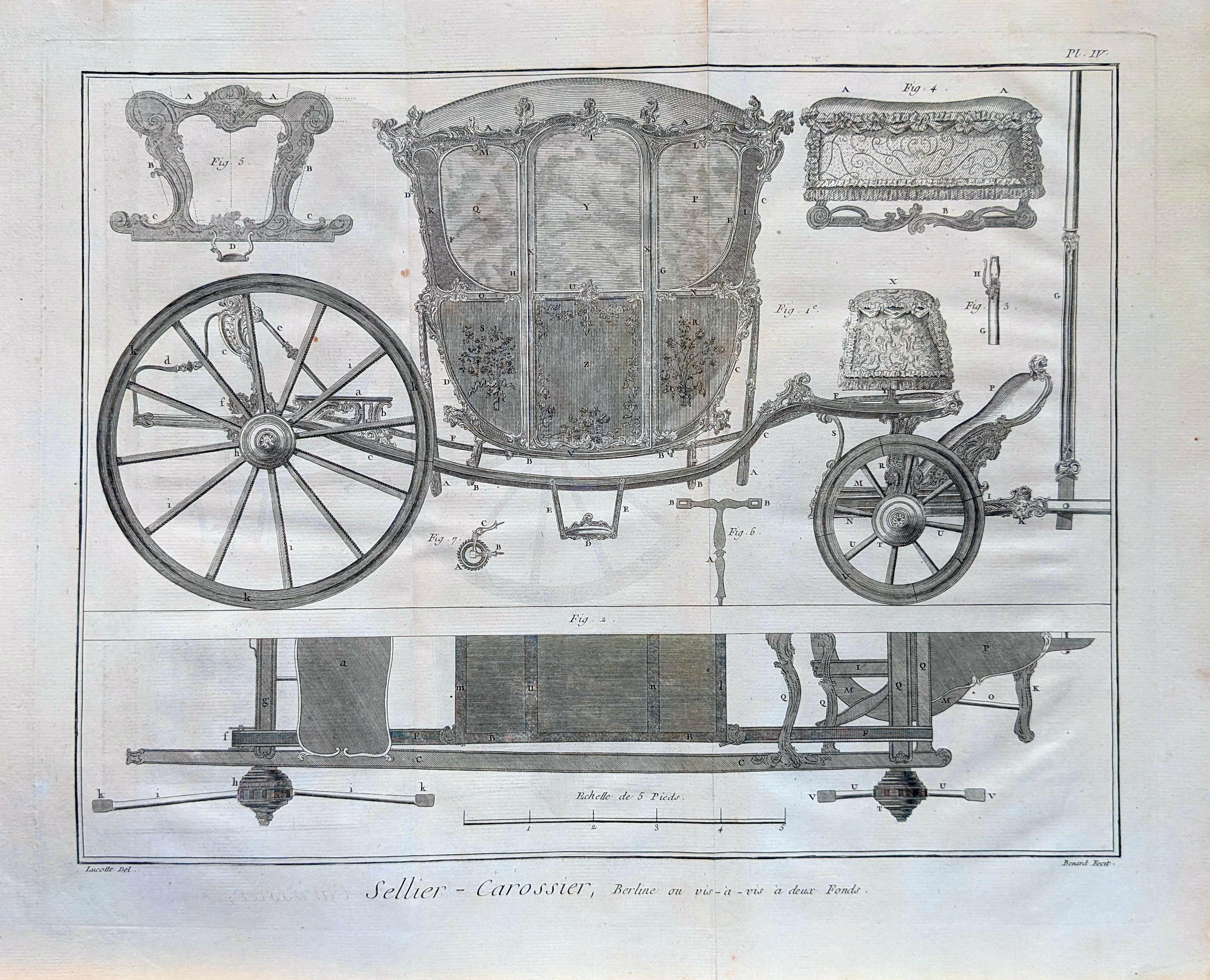
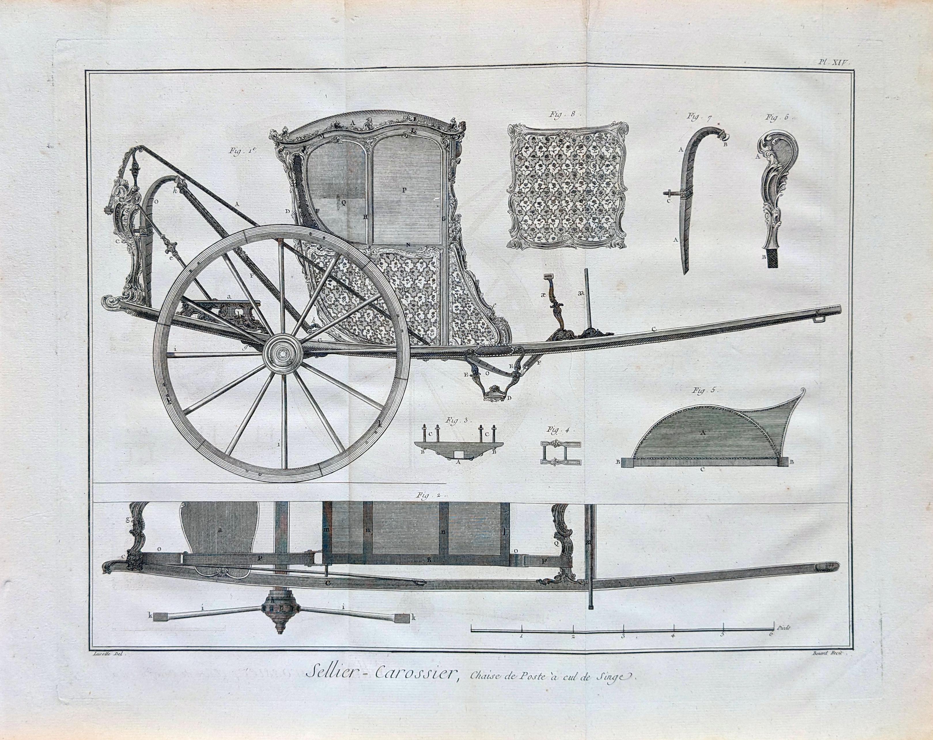
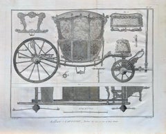
- Carriage engraving from the Encyclopedie ( Sellier Carossier )By Denis DiderotLocated in New York, NYCarriage engraving from the Encyclopedie ou Dictionnaire raisonne des sciences, des arts et des metiers, par une societe de gens de lettres. edited by Denis Diderot and Jean le Rond ...Category
Late 18th Century French School More Prints
MaterialsEngraving, Etching, Intaglio
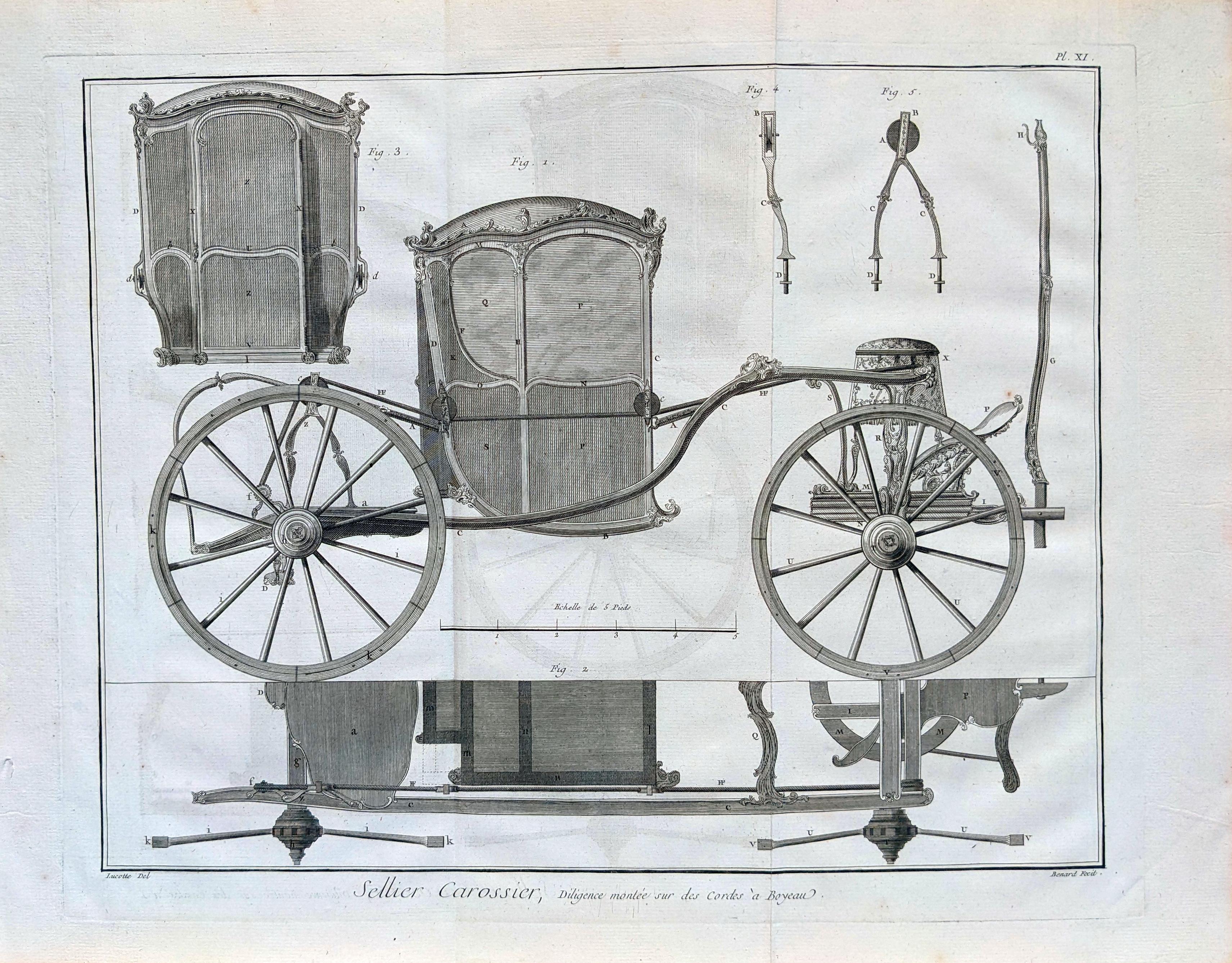
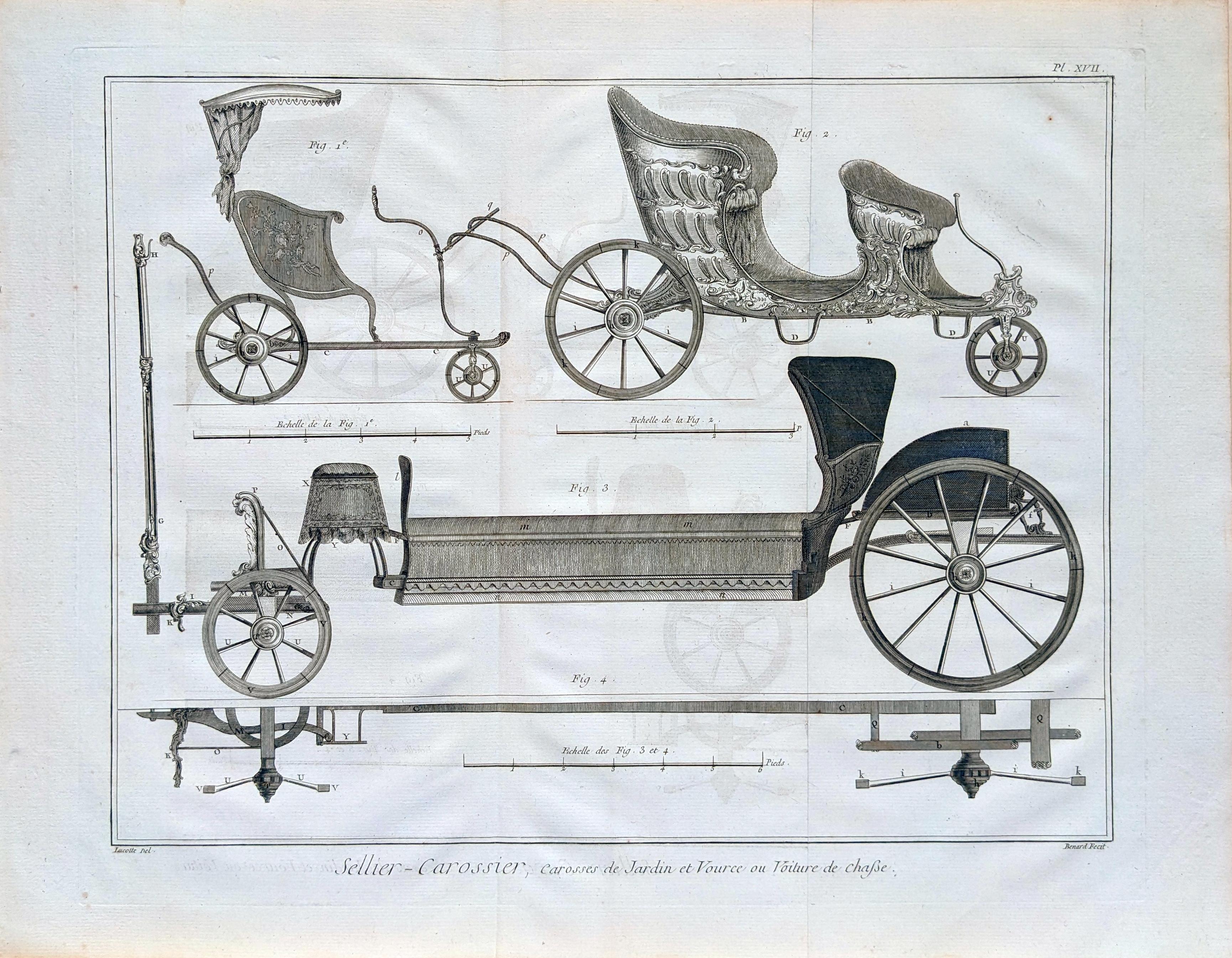
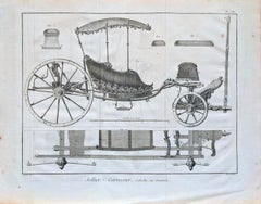
- Carriage engraving from the Encyclopedie ( Sellier Carossier )By Denis DiderotLocated in New York, NYCarriage engraving from the Encyclopedie ou Dictionnaire raisonne des sciences, des arts et des metiers, par une societe de gens de lettres. edited ...Category
Late 18th Century French School More Prints
MaterialsEngraving, Etching, Intaglio
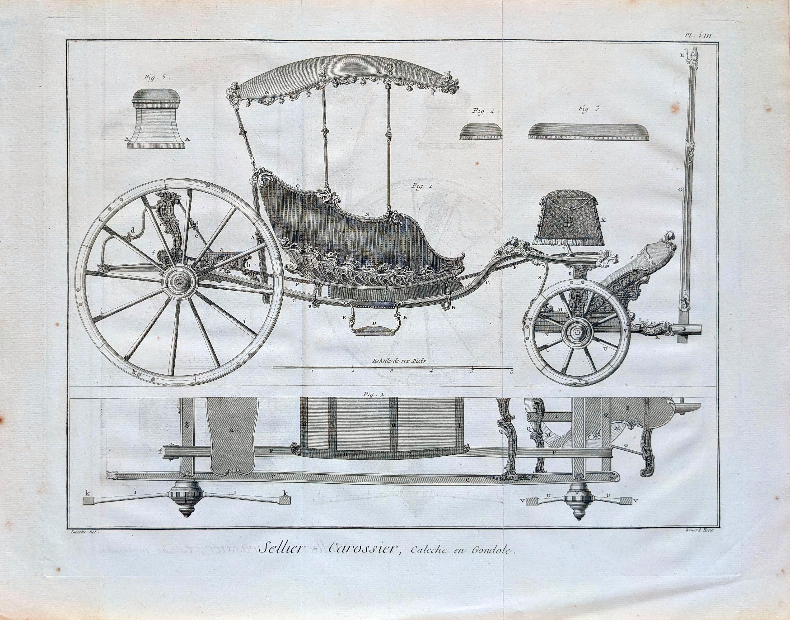
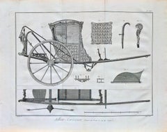
- Carriage engraving from the Encyclopedie ( Sellier Carossier )By Denis DiderotLocated in New York, NYCarriage engraving from the Encyclopedie ou Dictionnaire raisonne des sciences, des arts et des metiers, par une societe de gens de lettres. edited by Denis Diderot and Jean le Rond ...Category
Late 18th Century French School More Prints
MaterialsEngraving, Etching, Intaglio


Recently Viewed
View AllMore Ways To Browse
Copperplate Engraving
Roman Empire Art
Engraving Empire
American Imperial Style
Charles Holy
Antique Style Atlas
Antique Roman Map
Die Welt
Holy Roman Empire
World Map Antique Style
World Maps Antique Style
Antique Style Map Of The World
Roman Emperor Engravings
Roman Emperor Engraving
Holy Roman Emperor
Vintage Beer Advertising Posters
Diderot Denis
Vintage Austrian Ski Poster