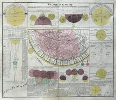
Theoria Eclipsium, Atlas Novus Coelestis Johanne Dopplemayr 1742 engraving
View Similar Items
Want more images or videos?
Request additional images or videos from the seller
1 of 5
Johann Gabriel Doppelmayr 1Theoria Eclipsium, Atlas Novus Coelestis Johanne Dopplemayr 1742 engraving1742
1742
About the Item
- Creator:Johann Gabriel Doppelmayr 1 (1677 - 1750, German)
- Creation Year:1742
- Dimensions:Height: 21 in (53.34 cm)Width: 24.25 in (61.6 cm)
- Medium:
- Period:1740-1749
- Condition:
- Gallery Location:Paonia, CO
- Reference Number:1stDibs: LU78032420143
About the Seller
4.9
Vetted Seller
These experienced sellers undergo a comprehensive evaluation by our team of in-house experts.
Established in 1978
1stDibs seller since 2017
103 sales on 1stDibs
Typical response time: 10 hours
More From This SellerView All
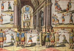
- Academie de l’Espee Tabula XXI by Girard Thibault 17thc fencing engravingBy Pierre ThibaultLocated in Paonia, COHand colored original engraving from the Academie de l’Espee ( full title can be translated as Academy of the Sword: wherein is demonstrated by mathematical rules on the foundation of a mysterious circle the theory and practice of the true and heretofore unknown secrets of handling arms on foot and horseback ) by Girard Thibault...Category
17th Century Other Art Style Figurative Prints
MaterialsEngraving
- Persiae, Armeniae, Natoliae et Arabiae Descriptio per Frederick deWit 1666 mapLocated in Paonia, COMap of Persiae, Armeniae, Natoliae et Arabiae Descriptio per F de Wit 1688 engraving from: Atlas Contractus Orbis Terrarum Praecipuas ac Novissimas Complectens Tabulas. Amsterdam, N. Visscher, 1656-77. (Koeman III, Vis5-8) This highly decorative map of the Middle East is by the Dutch engraver, publisher, and map seller...Category
1660s Realist Landscape Prints
MaterialsEngraving
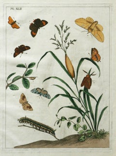
- The Aurelian, A Natural History of English Moths and Butterflies Plate XLIIBy Moses HarrisLocated in Paonia, COMoses Harris ( British 1731-1785 ) The Aurelian, A Natural History of English Moths and Butterflies Plate XLII 1778 edition hand colored edition 17.88 x 11.00 good condition Pla...Category
1770s More Prints
MaterialsEngraving
- AYX Map of Aix en Provence, France by J. Blaeu 17th c.By Joan (Johannes) BlaeuLocated in Paonia, CODetailed plan of Aix en Provence, in France. This print is a hand -colored double sheet engraving by the famous cartographer Joan (Johannes) Blaeu ( 1596 - 1673 ). The left side ...Category
Late 17th Century Other Art Style Landscape Prints
MaterialsEngraving
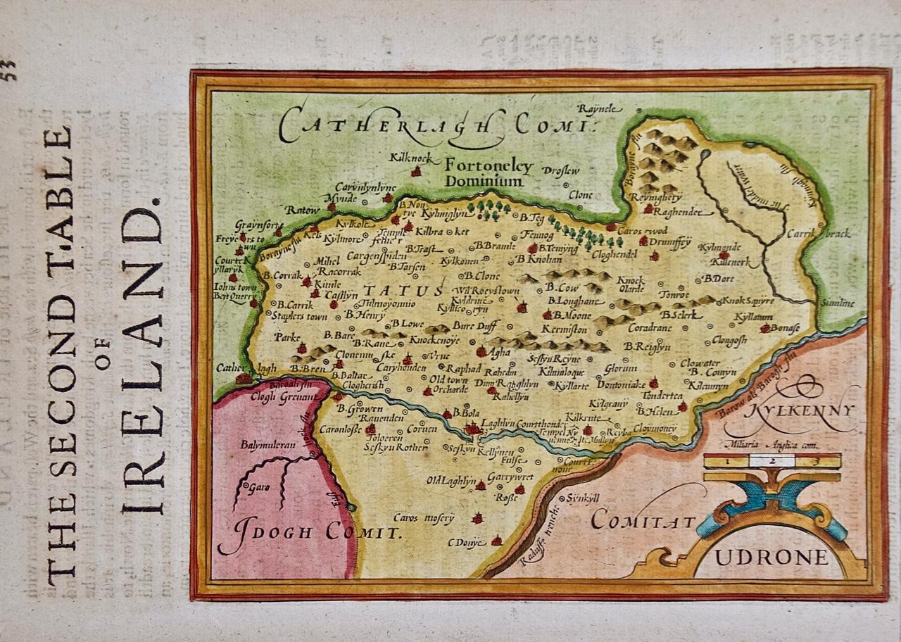
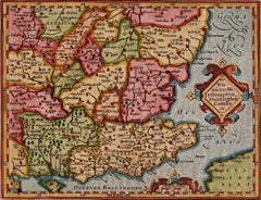
- Map of the County of Buckingham From an Actual SurveyLocated in Paonia, COCartographers Christopher (1786-1855) and John (1791-1867) Greenwood were surveyors from Yorkshire, who undertook an ambitious project to produce a series of large-scale maps of the counties of England, Wales and Scotland.The maps represent a remarkable and impressive surveying achievement forming an important record of the counties depicted. In the years 1817-1832 the Greenwood brothers published the Atlas of The Counties of England from an Actual Survey. This Atlas was finely drafted and engraved and decorated with large vignettes of prominent buildings of the county. This map of Buckingham County is beautifully hand colored and is in very good condition. There is a vignette of Stowe House...Category
19th Century Other Art Style More Prints
MaterialsEngraving
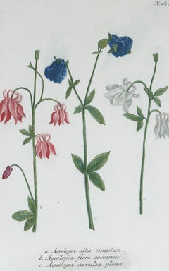
- Columbines Pl.162 Original mezzotint by J.W. WeinmannBy Johann Wilhelm WeinmannLocated in Paonia, CO“Columbines Pl. 162” A Weinmann, Johann, Wilhelm Mezzotint Engraving With Some Hand Coloring from Johan Wilhelm Weinmann’s ( 1683-1741 ) Phytanthoza Iconographia, a comprehensive sci...Category
1740s Other Art Style Still-life Prints
MaterialsMezzotint


You May Also Like
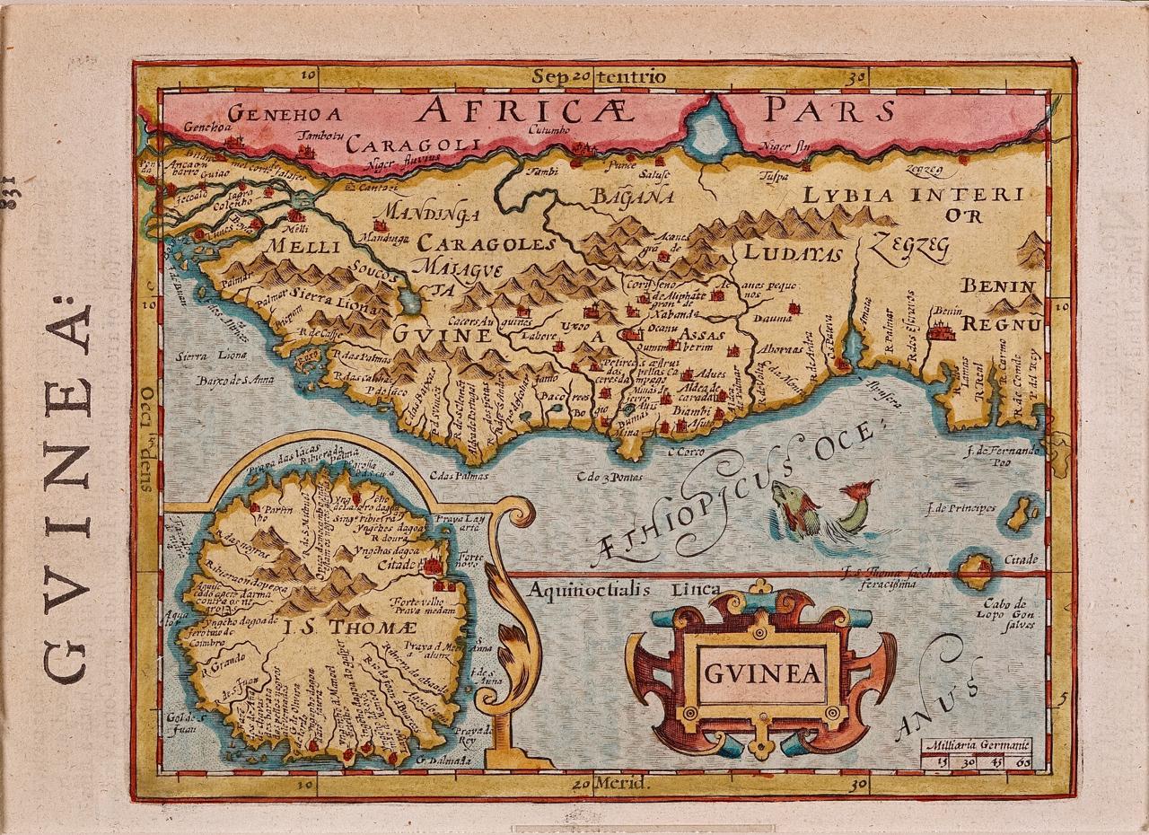
- West Africa: A 17th Century Hand-Colored Map by Mercator/HondiusBy Gerard MercatorLocated in Alamo, CAA 17th century hand-colored map entitled "Guineae Nova Descriptio" by Gerard Mercator and Jodocus Hondius, published in their 'Atlas Minor' in Amsterdam in 1635. It is focused on the...Category
1630s Landscape Prints
MaterialsEngraving
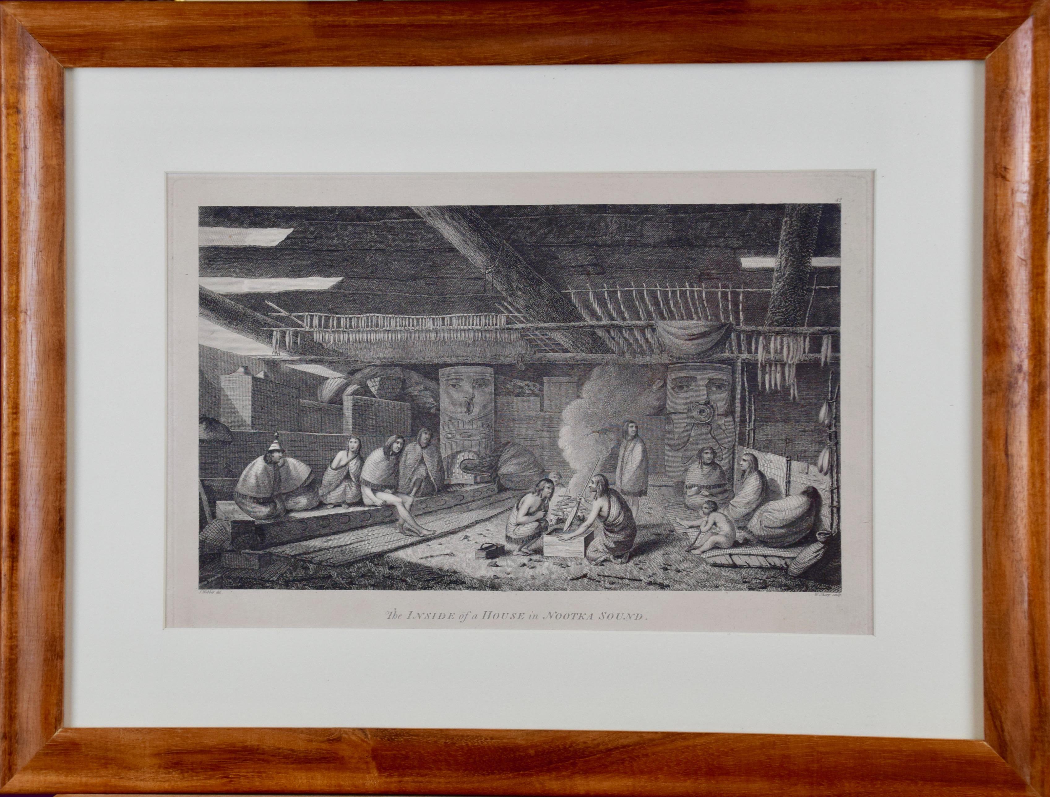
- "Inside of a House in Nootka Sound" (Canada) from Captain Cook's 3rd VoyageBy John WebberLocated in Alamo, CA"The Inside of a House in Nootka Sound" is an engraving created by William Sharp (1749-1824), from a drawing by John Webber (1752-1793), who was the artist on Captain James Cook's 3rd and final voyage of discovery. It is Plate 65 in "A Voyage to the Pacific Ocean Undertaken by the Command of His Majesty, for Making Discoveries in the Northern Hemisphere", the official British Admirality sanctioned journal published upon completion of the voyage in London in 1784 by Strahan & Cadell. This engraving is presented in a Koa wood frame and a white mat. There are occasional tiny faint spots, but the print is otherwise in very good condition. Koa wood is legendary in Hawaii. Not only is this amazing wood native to Hawaii, but it is known for the deep rich colors and varied grain pattern. Koa has an honored heritage in Hawaii and is highly revered and sacred. The word “koa” means “warrior” in Hawaiian. The warriors of King Kamehameha the Great, created canoes and weapons from a wood plentiful on the Big Island of Hawaii. This wood became synonymous with the warriors themselves, and it became known as koa. There are three other engravings listed form the official journal of Captain Cook's 3rd voyage available that are presented in identical Koa wood frames and mats. They would make a wonderful grouping for a display of 2, 3 or 4 prints. Please see listings: LU117324682432, LU117324684022, LU117324684062. A discount is available for a grouping depending on the number of items included. Nootka Sound is on the west coast of Vancouver Island, British Columbia, Canada. It was explored by Captain Cook in 1778 after he discovered Hawaii during his 3rd voyage. He originally named it King George's Sound, but did record Nootka Sound, which he thought was its native name. Hawaii was originally called The Sandwich Islands in honor of The Earl of...Category
1780s Realist Interior Prints
MaterialsEngraving
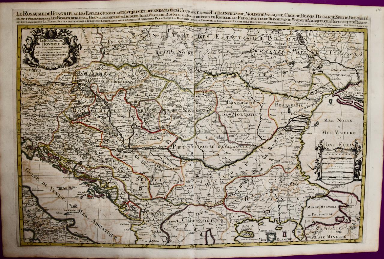
- Hungary & Eastern Europe: A Large 17th C. Hand-colored Map by Sanson & JaillotBy Nicholas Sanson d'AbbevilleLocated in Alamo, CAThis large hand-colored map entitled "Le Royaume De Hongrie et les Estats qui en ont este sujets et qui font presentement La Partie Septentrionale de la Turquie en Europe" was origin...Category
1690s Landscape Prints
MaterialsEngraving
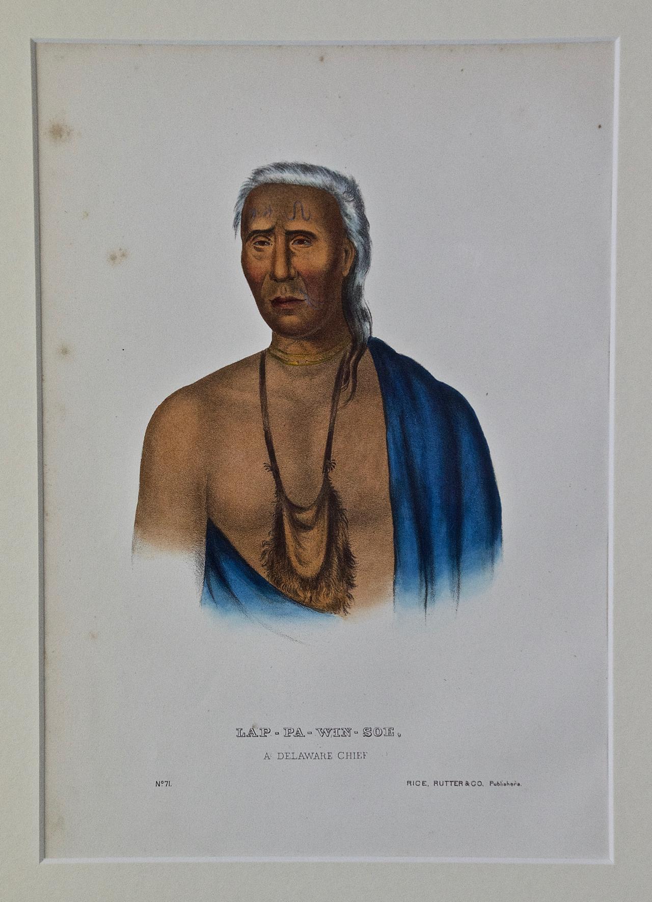
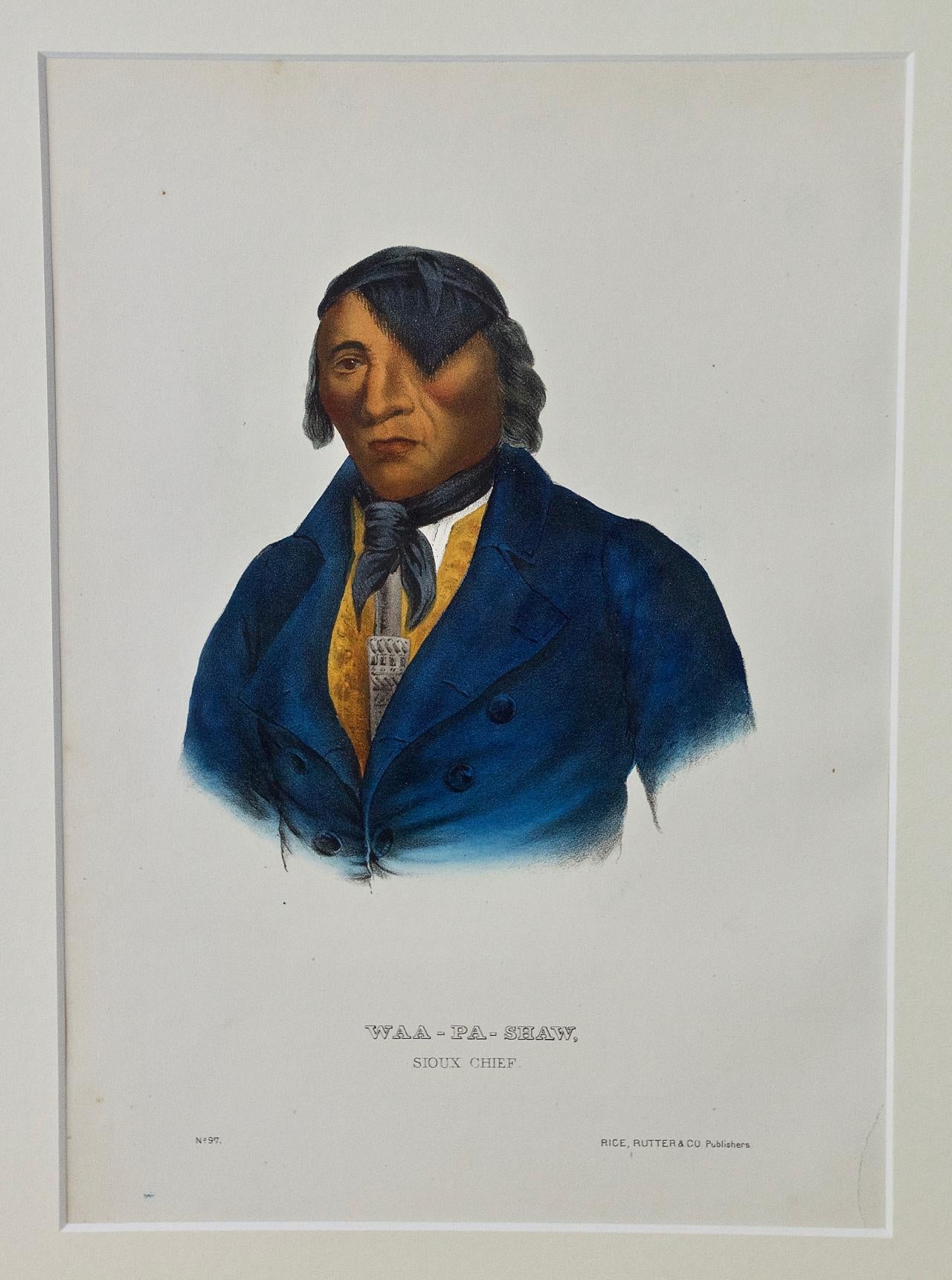
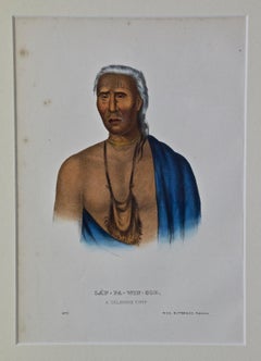
- Lap-Pa-Win-Soe, Delaware Chief: Original Hand-colored McKenney & Hall EngravingBy McKenney & HallLocated in Alamo, CAThis is an original 19th century hand-colored McKenney and Hall engraving of a Native American entitled "Lap-Pa-Win-Soe, A Delaware Chief, No. 71", published by Rice, Rutter & Co. in...Category
Mid-19th Century Naturalistic Portrait Prints
MaterialsEngraving
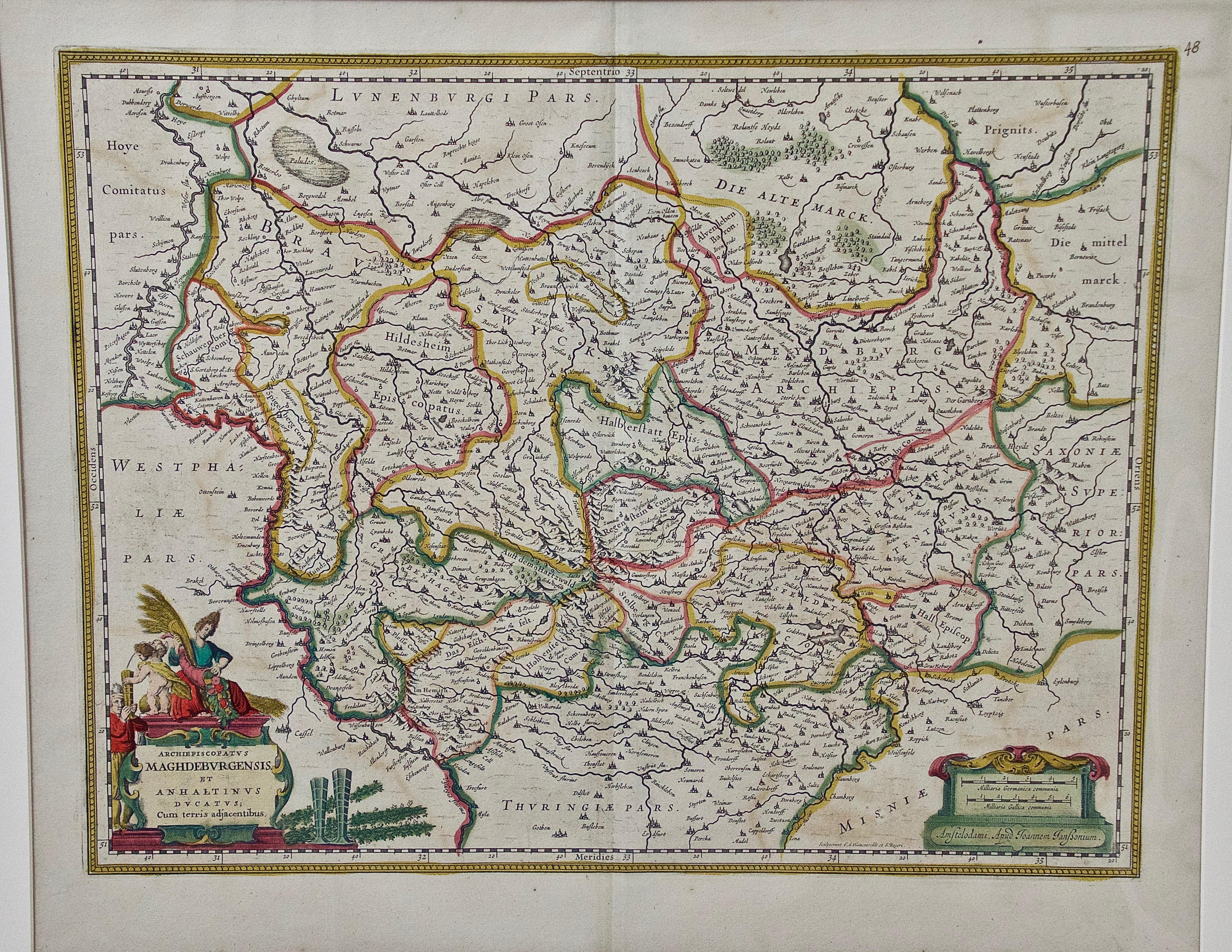
- West Germany: Original Hand Colored 17th Century Map by Johannes JanssoniusBy Johannes JanssoniusLocated in Alamo, CAAn original hand colored copperplate engraved map entitled in Latin "Archiepiscopatus Maghdeburgensis et Anhaltinus Ducatus cum terris adjacentibus", published in Amsterdam in 1640 i...Category
Mid-17th Century Old Masters More Prints
MaterialsEngraving
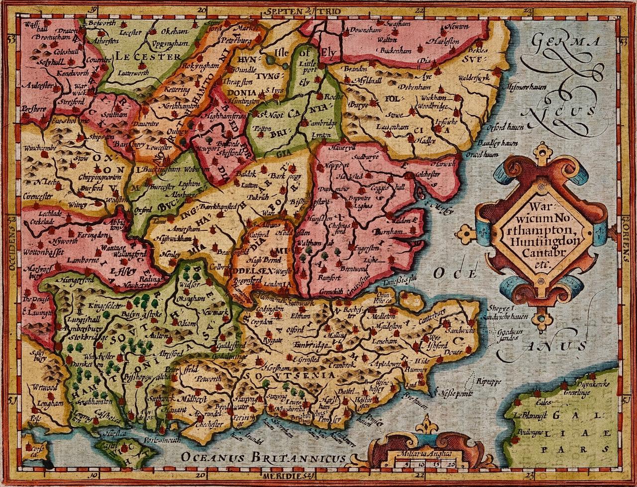
- Southeastern England: A 17th Century Hand-Colored Map by Mercator and HondiusBy Gerard MercatorLocated in Alamo, CAA 17th century copperplate hand-colored map entitled "The Sixt Table of England" by Gerard Mercator and Jodocus Hondius, published in Amsterdam in 1635 in 'Cosmographicall Descriptio...Category
1630s Landscape Prints
MaterialsEngraving


Recently Viewed
View AllMore Ways To Browse
Map Of Constellations
Map Of The Constellations
Lunar Eclipse
Antique Constellation Map
Pierre Redoute
Vintage Fruit Print
Angel Fire
Vintage British Maps
Vintage British Map
Moscow Olympics
British Airways Vintage Poster
Retro Wine Poster Art
Vintage Boat Car
Vintage Tennis Print
Ww2 Poster
Vintage Map Of Britain
Palestine Wall Art
Fleur Belle