Antique Map Of Poland

4
to
14
50
22
47
25
21
19
10
8
7
7
7
6
6
5
4
3
2
2
2
2
2
2
1
1
1
1
1
1
1
1
1
1
1
1
1
4
3
2
2
2
Sort By
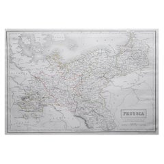
Large Original Antique Map of Poland by Sidney Hall, 1847
Located in St Annes, Lancashire
Great map of Poland Drawn and engraved by Sidney Hall Steel engraving Original colour
Category

1840s Scottish Antique Map Of Poland

Materials

Paper

Large Original Antique Map of Poland by Sidney Hall, 1847
No Reserve
H 12.25 in W 17.25 in D 0.07 in
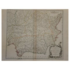
1751 Map of Spain Castilla Robert De Vaugondy 1st Edition, Ric.a001
Located in Norton, MA
(1752). He is credited with a map of Poland, a map test of the Arctic Polar Sea. Father and son
Category

18th Century Unknown Antique Map Of Poland

Materials

Paper

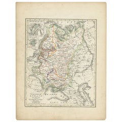
Antique Map of Russia and Poland by Petri, 1852
Located in Langweer, NL
Antique map titled 'Europeesch Rusland en Polen'. Map of Russia in Europe and Poland. This map
Category

19th Century Antique Map Of Poland

Materials

Paper

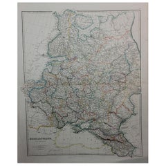
1832 Large Map "Russian & Poland" Ric. R0012
Located in Norton, MA
Large map 1832 "Russian & Poland" Ric.r0012 Russia & Poland, by J. Arrowsmith. London, pubd
Category

19th Century Unknown Antique Map Of Poland

Materials

Paper

1853 Map of "Russia in Europe Including Poland" Ric.r016
Located in Norton, MA
Description Russia in Europe incl. Poland by J Wyld c.1853 Hand coloured steel engraving
Category

19th Century Unknown Antique Map Of Poland

Materials

Paper

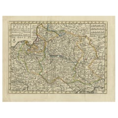
Antique Map of the Kingdom of Poland by Keizer & de Lat, 1788
Located in Langweer, NL
Antique map titled 't Koninkryk Polen (..)'. Uncommon original antique map of the Kingdom of Poland
Category

Late 18th Century Antique Map Of Poland

Materials

Paper

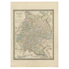
Antique Map of Russia in Europe and Poland by Wyld '1845'
Located in Langweer, NL
Antique map titled 'Russia in Europe including Poland'. Original antique map of Russia in Europe
Category

Mid-19th Century Antique Map Of Poland

Materials

Paper

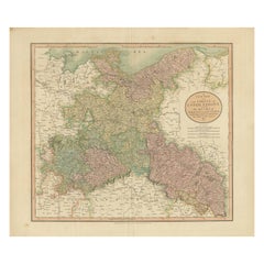
Antique Map of the Eastern Part of Germany, with Parts of Poland and Slovakia
Located in Langweer, NL
parts of Poland and Slovakia. This map originates from Cary's 'New Universal Atlas'. Published 1811
Category

Early 19th Century Antique Map Of Poland

Materials

Paper

Old Map of Southern Russia, Incl the Extent of the Kingdom of Poland, 1882
Located in Langweer, NL
the Kingdom of Poland. This map originates from 'The Royal Atlas of Modern Geography, Exhibiting, in a
Category

1880s Antique Map Of Poland

Materials

Paper

Antique Map of Silesia, Southwest Poland and a City View of Wroclaw, c 1720
By Johann Baptist Homann
Located in Langweer, NL
Antique map titled 'Superioris et Inferioris ducatus Silesiae (..)'. Detailed map of Silesia by
Category

Early 18th Century Antique Map Of Poland

Materials

Paper

Antique Map of Germany, Bohemia, Hungary and Part of Poland by R. Bonne ‘1780’
Located in Langweer, NL
Antique map titled "L'Allemagne, La Bohême, et la Hongrie avec une partie de la Pologne" by
Category

Late 18th Century Antique Map Of Poland

Materials

Paper

Antique Map of Russia in Europe and Poland from an d Old Dutch Atlas, 1852
Located in Langweer, NL
Poland. This map originates from 'School-Atlas van alle deelen der Aarde' by Otto Petri. Artists and
Category

1850s Antique Map Of Poland

Materials

Paper

Prussia, Poland, N. Germany, Etc: A Hand-colored 17th Century Map by Janssonius
By Johannes Janssonius
Located in Alamo, CA
in 1664. This very detailed map from the golden age of Dutch cartography includes present-day Poland
Category

Mid-17th Century Dutch Antique Map Of Poland

Materials

Paper

1849 Map of "Europaische Russland", 'Meyer Map of European Russia', Ric. R017
Located in Norton, MA
1849 Map of "Europaische Russland" ( Meyer Map of European Russia) Ric.r017 A lovely map of
Category

19th Century Unknown Antique Map Of Poland

Materials

Paper

Antique Map of Swabia, 1685
Located in Langweer, NL
Antique map titled 'Sueviae quae cis Codanum fuit finum Antiqua defcriptio.' Miniature map of
Category

17th Century Antique Map Of Poland

Materials

Paper

Antique Map of Swabia, 1685
H 5.12 in W 5.79 in D 0 in
Antique Map of Germany including surrounding countries
Located in Langweer, NL
Antique map titled 'Tabula Germaniae'. Orginal antique map of Germany by Claes Jansz. Visscher
Category

Mid-17th Century Antique Map Of Poland

Materials

Paper

Antique Map of Silesia centered on Glogau
Located in Langweer, NL
Antique map titled 'Ducatus Silesiae Glogani vera delineatio'. This decorative map shows the Odra
Category

Mid-17th Century Antique Map Of Poland

Materials

Paper

Antique Map of Silesia centered on Glogau
H 19.97 in W 23.51 in D 0.02 in
Antique Map of Sweden by Bowen, 1747
Located in Langweer, NL
Antique map titled 'A New & Accurate Map of Sweden'. This map covers Sweden and Finland (shown as
Category

18th Century Antique Map Of Poland

Materials

Paper

Antique Map of Sweden by Bowen, 1747
H 14.57 in W 10.24 in D 0 in
Original Antique Map of the Northern Baltic Region
Located in Langweer, NL
Title: "Livonia: Antique Map of the Northern Baltic Region" Description: This antique map, titled
Category

Early 17th Century Antique Map Of Poland

Materials

Paper

Antique Map of Oberlausitz by Homann Erben, '1746'
Located in Langweer, NL
Antique map titled 'Geographische Verzeichnung des Budissinischen Creises (..) - Carte du Cercle de
Category

Mid-18th Century Antique Map Of Poland

Materials

Paper

Antique Map of Germany by Hederichs 'circa 1740'
Located in Langweer, NL
Venice and from Holland and Belgium to Poland. This map originates from 'Anleitung Zu den fürnehmsten
Category

Mid-18th Century Antique Map Of Poland

Materials

Paper

Antique Map of Pomerania by Schenk, circa 1750
Located in Langweer, NL
straddles the modern border between northeastern Germany and Poland. Crafted with ornamental flair, this map
Category

Mid-18th Century Antique Map Of Poland

Materials

Paper

Antique Map of Pomerania by Schenk, circa 1750
H 20.67 in W 24.02 in D 0.02 in
17th Century Nicolas Visscher Map of Southeastern Europe
Located in Hamilton, Ontario
A beautiful, highly detailed map of southeastern Europe by Nicolas Visscher. Includes regions of
Category

17th Century Dutch Antique Map Of Poland

Materials

Paper

Antique Map of Southern Russia by Johnston, 1882
Located in Langweer, NL
Kingdom of Poland. This map originates from 'The Royal Atlas of Modern Geography, Exhibiting, in a Series
Category

19th Century Antique Map Of Poland

Materials

Paper

Antique Map of Northern Europe by Bonne, c.1780
Located in Langweer, NL
Antique map titled 'Le Nord de L'Europe, Contenant Le Danemark, La Norwege; La Suede et La Laponie
Category

18th Century Antique Map Of Poland

Materials

Paper

Antique Map of Germany with the Empire of Austria by Wyld '1845'
Located in Langweer, NL
of Prussia and Poland'. Original antique map of Germany with the Empire of Austria. This map
Category

Mid-19th Century Antique Map Of Poland

Materials

Paper

Original Hand-coloured Antique Map of Pomerania by Sanson '1684'
By Nicolas Sanson
Located in Langweer, NL
between Poland and Germany. This map exists of two joined sheets.
Category

Late 17th Century Antique Map Of Poland

Materials

Paper

Original Antique Map of the Northwestern Part of Russia in Europe, 1753
Located in Langweer, NL
Antique map titled 'Partie septentrionale de la Russie Européenne'. Detailed map of the
Category

1750s Antique Map Of Poland

Materials

Paper

Antique Map of Northern Europe and European Russia, ca.1780
Located in Langweer, NL
Antique map titled 'Le Nord de L'Europe, Contenant Le Danemark, La Norwege; La Suede et La Laponie
Category

1780s Antique Map Of Poland

Materials

Paper

Detailed Antique Map of the Southern Part of European Russia and Ukraine, 1752
Located in Langweer, NL
Antique map titled 'Partie meridionale de la Russie Européenne'. Detailed map of the southern
Category

1750s Antique Map Of Poland

Materials

Paper

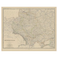
Antique Map of South-West Russia by A.K. Johnston, 1865
Located in Langweer, NL
Antique map titled 'South-West Russia showing the extent of the Kingdom of Poland previous to its
Category

Mid-19th Century Antique Map Of Poland

Materials

Paper

Antique Map of South-West Russia by A.K. Johnston, 1865
No Reserve
H 19.1 in W 24.41 in D 0.02 in
Antique Map of Ukraine, Bulgaria, Romania, Servia & Surroundings by N. Visscher
Located in Langweer, NL
Antique map titled 'Exactissima Tabula qua tam Danubii Fluvii Pars Inferior, a Belgrado Urbe usq ad
Category

Early 18th Century Antique Map Of Poland

Materials

Paper

Antique Map of the Surroundings of the Baltic Sea by A.K. Johnston, 1865
Located in Langweer, NL
Antique map titled 'Basin of the Baltic'. Depicting, Denmark, Sweden, Finland, Estonia, Poland
Category

Mid-19th Century Antique Map Of Poland

Materials

Paper

Scandinavia & Portions of Eastern Europe: 18th Century Hand-Colored Homann Map
By Johann Baptist Homann
Located in Alamo, CA
An early 18th century hand-colored copper-plate map entitled "Regni Sueciae in omnes suas
Category

Early 18th Century German Antique Map Of Poland

Materials

Paper

Antique Map of the Baltic Region by Homann Heirs, c.1730
Located in Langweer, NL
Friderici III (..).' Detailed map of the Baltic region from Memel to Pomerania, extending south to Poland
Category

18th Century Antique Map Of Poland

Materials

Paper

Antique Map of the German Empire, Johannes Janssonius van Waesbergen, circa 1670
Located in Langweer, NL
Antique map titled 'Nova Totius Germaniae Descriptio'. Uncommon map of the German Empire including
Category

Late 17th Century Antique Map Of Poland

Materials

Paper

Antique Map of Germany During the Mid-18th Century, Published in 1747
Located in Langweer, NL
Antique map Germany titled 'A New & Accurate Map of Germany'. It covers Germany during the mid-18th
Category

18th Century Antique Map Of Poland

Materials

Paper

18th Century Hand-Colored Homann Map of Germany, Including Frankfurt and Berlin
By Johann Baptist Homann
Located in Alamo, CA
An 18th century hand-colored map entitled "Tabula Marchionatus Brandenburgici et Ducatus Pomeraniae
Category

Early 18th Century German Antique Map Of Poland

Materials

Paper

1790 Thomas Stackhouse Map, Entitled "Russia in Europe, " , Ric.a004
Located in Norton, MA
1790 Thomas Stackhouse map, entitled "Russia in Europe" Ric.a004 Stackhouse, Thomas Russia
Category

17th Century Unknown Antique Map Of Poland

Materials

Paper

California, Alaska and Mexico: 18th Century Hand-Colored Map by de Vaugondy
By Didier Robert de Vaugondy
Located in Alamo, CA
This an 18th century hand-colored map of the western portions of North America entitled "Carte de
Category

1770s French Antique Map Of Poland

Materials

Paper

Persia, Armenia & Adjacent Regions: A 17th Century Hand-colored Map by De Wit
By Frederick de Wit
Located in Alamo, CA
A large 17th century hand colored copperplate engraved map entitled "Novissima nec non
Category

Late 17th Century Dutch Antique Map Of Poland

Materials

Paper

Southern & Eastern Europe: A Large 17th C. Hand-colored Map by Sanson & Jaillot
By Nicolas Sanson
Located in Alamo, CA
This large hand-colored map entitled "Estats de L'Empire des Turqs en Europe, ou sont les
Category

1690s French Antique Map Of Poland

Materials

Paper

A Hand Colored 17th Century Janssonius Map of Prussia: Poland, N. Germany, etc.
By Johannes Janssonius
Located in Alamo, CA
. This very detailed map from the golden age of Dutch cartography includes present-day Poland, Latvia
Category

Mid-17th Century Old Masters Antique Map Of Poland

Materials

Engraving

Handcolored Print of a Lady from Silesia in Poland or the Czech Republic, 1805
Located in Langweer, NL
of Silesia. Silesia is a historical region of Central Europe located mostly in Poland, with small
Category

19th Century Antique Map Of Poland

Materials

Paper

California: 18th Century Hand-colored Map by de Vaugondy
By Didier Robert de Vaugondy
Located in Alamo, CA
This is an 18th century hand-colored map of the western portions of North America entitled "Carte
Category

1770s Antique Map Of Poland

Materials

Engraving

Southern & Eastern Europe: A Large 17th C. Hand-colored Map by Sanson & Jaillot
By Nicholas Sanson d'Abbeville
Located in Alamo, CA
This large hand-colored map entitled "Estats de L'Empire des Turqs en Europe, ou sont les
Category

1690s Antique Map Of Poland

Materials

Engraving

Hungary & Eastern Europe: A Large 17th C. Hand-colored Map by Sanson & Jaillot
By Nicholas Sanson d'Abbeville
Located in Alamo, CA
This large hand-colored map entitled "Le Royaume De Hongrie et les Estats qui en ont este sujets et
Category

1690s Antique Map Of Poland

Materials

Engraving

First Edition Guthrie's Geographical Grammmar in Miniature, 1807
Located in Langweer, NL
First edition of 'Guthrie's Geographical Grammar in Miniature'. 358 p. 13 fold. engr. maps, contemp
Category

Early 19th Century Antique Map Of Poland

Materials

Paper

A beautiful Celestial Table Globe produced by Gerard & Leonard Valk
By Gerard and Leonard Valk
Located in ZWIJNDRECHT, NL
Gerard began his publishing firm producing maps and atlases in co-operation with Petrus Schenk about 1680
Category

Early 18th Century Dutch Dutch Colonial Antique Map Of Poland

Materials

Other

Ecce Homo Plate X
By Werner Drewes
Located in Fairlawn, OH
painting at Columbia and held two other positions: director of the WPA/FAP Graphic Arts Project and map
Category

1920s Bauhaus Antique Map Of Poland

Materials

Woodcut

Ecce Homo VII
By Werner Drewes
Located in Fairlawn, OH
painting at Columbia and held two other positions: director of the WPA/FAP Graphic Arts Project and map
Category

1920s Expressionist Antique Map Of Poland

Materials

Woodcut

Antique Brass Art Deco Étagères or Night Tables with Marble Tops, 1900, Set of 2
Located in Warsaw, PL
Deco design map. They were creating the highest quality, simple and functional furniture from precious
Category

Early 20th Century Polish Art Deco Antique Map Of Poland

Materials

Marble, Brass

One of the Earliest Views of Moscow
By Georg Braun and Frans Hogenberg
Located in La Jolla, CA
is depicted with its many churches. The map shows illustrations of people riding horse-drawn sleighs
Category

16th Century German Northern Renaissance Antique Map Of Poland

Materials

Paper

One of the Earliest Views of Moscow
H 14 in W 19.5 in D 1 in
Antique Map of Poland and Lithuania, c.1744
Located in Langweer, NL
Antique map titled 'A New and Accurate Map of Poland, Lithuania & c'. Old map of Poland and
Category

18th Century Antique Map Of Poland

Materials

Paper

Decorative Antique Map of Pomerania, in Germany and Poland, ca.1730
Located in Langweer, NL
Antique map titled 'Ducatus Pomeraniae'. Decorative map of the area of Pomerania, in present
Category

1730s Antique Map Of Poland

Materials

Paper

Antique Map of Danube River 'Lower Part, Former Yugoslavia' by N. Visscher
Located in Langweer, NL
Antique map titled 'Exactissima Tabula qua tam Danubii Fluvii Pars Inferior, a Belgrado Urbe usq ad
Category

Late 17th Century Antique Map Of Poland

Materials

Paper

Map of River Danube, from Regensburg, Passau and Vienna to the Black Sea, c.1660
Located in Langweer, NL
Antique map titled 'Totius Regni Hungariae Maximaeque Partis Danubii Fluminis una cum adjacentibus
Category

1660s Antique Map Of Poland

Materials

Paper

A Hand Colored 17th Century Map of Scandinavia by Frederick de Wit
By Frederick de Wit
Located in Alamo, CA
A large 17th century hand colored copperplate engraved map entitled "Novissima nec non
Category

Late 17th Century Old Masters Antique Map Of Poland

Materials

Engraving

Hand Colored 18th Century Homann Map "Bohemiae" of the Modern Day Czech Republic
By Johann Baptist Homann
Located in Alamo, CA
This is a hand colored 18th century map of the modern day Czech Republic and the southern portions
Category

Early 18th Century Other Art Style Antique Map Of Poland

Materials

Engraving

Original Antique WWI Poster Map War Is The National Industry Of Prussia Octopus
Located in London, GB
Original antique World War One map poster portraying Prussia as an octopus stretching its tentacles
Category

1910s French Antique Map Of Poland

Materials

Paper

  • 1
Get Updated with New Arrivals
Save "Antique Map Of Poland", and we’ll notify you when there are new listings in this category.

Antique Map Of Poland For Sale on 1stDibs

Choose from an assortment of styles, material and more with respect to the antique map of poland you’re looking for at 1stDibs. Each antique map of poland for sale was constructed with extraordinary care, often using paper. Whether you’re looking for an older or newer antique map of poland, there are earlier versions available from the 18th Century and newer variations made as recently as the 19th Century. You’ll likely find more than one antique map of poland that is appealing in its simplicity, but Johann Baptist Homann and Johannes Janssonius produced versions that are worth a look.

How Much is a Antique Map Of Poland?

An antique map of poland can differ in price owing to various characteristics — the average selling price 1stDibs is $379, while the lowest priced sells for $101 and the highest can go for as much as $1,392.

Read More

Pamela Shamshiri Shares the Secrets behind Her First-Ever Book and Its Effortlessly Cool Interiors

The sought-after designer worked with the team at Hoffman Creative to produce a monograph that beautifully showcases some of Studio Shamshiri's most inspiring projects.

Moroccan Artworks and Objects Take Center Stage in an Extraordinary Villa in Tangier

Italian writer and collector Umberto Pasti opens the doors to his remarkable cave of wonders in North Africa.

Montecito Has Drawn Royalty and Celebrities, and These Homes Are Proof of Its Allure

Hollywood A-listers, ex-pat aristocrats and art collectors and style setters of all stripes appreciate the allure of the coastal California hamlet — much on our minds after recent winter floods.

Whaam! Blam! Pow! — a New Book on Pop Art Packs a Punch

Publishing house Assouline and writer Julie Belcove have teamed up to trace the history of the genre, from Roy Lichtenstein, Andy Warhol and Yayoi Kusama to Mickalene Thomas and Jeff Koons.

The Sparkling Legacy of Tiffany & Co. Explained, One Jewel at a Time

A gorgeous new book celebrates — and memorializes — the iconic jeweler’s rich heritage.

What Makes a Gem-Encrusted Chess Set Worth $4 Million?

The world’s most opulent chess set, weighing in at 513 carats, is literally fit for a king and queen.

Tauba Auerbach’s Geometric Pop-Up Book Is Mighty Rare, Thanks to a Hurricane

This sculptural art book has an epic backstory of its own.

Step inside the Storied Mansions of Palm Beach’s Most Effervescent Architect

From Spanish-style courtyards to fanciful fountains, these acclaimed structures abound in surprising and elegant details.