Antique Map Series
7
to
36
294
98
213
154
88
53
50
44
37
34
27
27
25
23
20
16
15
12
11
9
8
8
6
6
5
5
4
4
3
3
2
2
2
2
2
1
1
1
1
1
1
1
1
1
39
12
7
4
4
Sort By
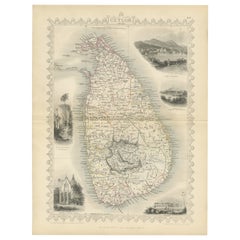
19th Century Illustrated Map of Ceylon (Sri Lanka) with Notable Landmarks
Located in Langweer, NL
the places on the map.
The map of Ceylon, now known as Sri Lanka, from Tallis's series would be a
Category
1850s Antique Map Series
Materials
Paper
H 14.26 in W 10.71 in D 0 in
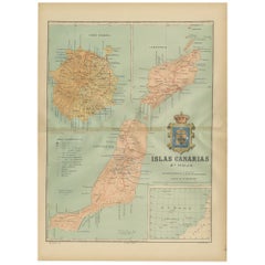
Volcanic Eden: The Canary Islands’ Tapestry of Land and Sea in 1902
Located in Langweer, NL
The map is the second sheet (2ª HOJA) of a historical map series of the Canary Islands from 1902
Category
Early 1900s Antique Map Series
Materials
Paper
Free Shipping
H 20.08 in W 14.77 in D 0 in
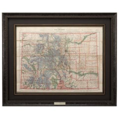
1907 Map of Colorado, Antique Topographical Map, by Louis Nell
Located in Colorado Springs, CO
he settled there and published a series of maps of the state between the years 1880 and 1907. He
Category
Early 1900s American Antique Map Series
Materials
Paper
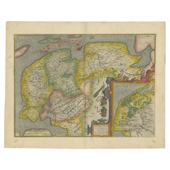
Antique Map of Friesland Also Know as the Peacock Map, C.1580
Located in Langweer, NL
different languages. Beside the Theatrum, Ortelius compiled a series of historical maps and published it in
Category
18th Century Antique Map Series
Materials
Paper
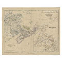
Antique Map of Eastern Canada with an inset Map of Newfoundland, 1882
Located in Langweer, NL
Newfoundland. This map originates from 'The Royal Atlas of Modern Geography, Exhibiting, in a Series of
Category
19th Century Antique Map Series
Materials
Paper
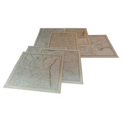
1844 Map "Russia in Eurpoe, Part II to Part VIII", 7 Maps Ric.r023
Located in Norton, MA
. in 1829, and published the maps in parts, haltingly, over the next 15 years, completing the series in
Category
19th Century Unknown Antique Map Series
Materials
Paper
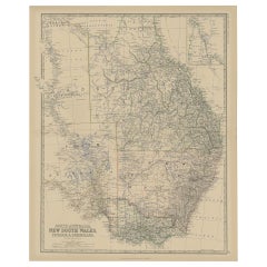
Old Map of Southern Australia, with an Inset Map of Cape York Peninsula, 1882
Located in Langweer, NL
Modern Geography, Exhibiting, in a Series of Entirely Original and Authentic Maps, the Present Condition
Category
1880s Antique Map Series
Materials
Paper
H 24.22 in W 19.53 in D 0 in
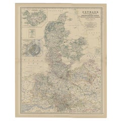
Antique Map of Denmark with Inset Maps of Iceland, Copenhagen and the Elbe, 1882
Located in Langweer, NL
Geography, Exhibiting, in a Series of Entirely Original and Authentic Maps, the Present Condition of
Category
19th Century Antique Map Series
Materials
Paper
H 24.22 in W 19.53 in D 0 in
Antique World Map by Johnston, 1882
Located in Langweer, NL
Antique map titled 'The World in Hemispheres'. Old double-hemisphere world map. This map originates
Category
19th Century Antique Map Series
Materials
Paper
Antique Map of Britain in Roman Times
Located in Langweer, NL
Antique map titled 'Britannia Romana collected from Ptolemy (..)'. Map of Britain in Roman times
Category
Early 19th Century Antique Map Series
Materials
Paper
1875 "North America" Map by J. Bartholomew
Located in Colorado Springs, CO
Presented is an original 1875 map of “North America.” The map was issued in Volume 1 of the Ninth
Category
1870s Scottish Antique Map Series
Materials
Paper
Antique Map of the European Continent, 1882
Located in Langweer, NL
Atlas of Modern Geography, Exhibiting, in a Series of Entirely Original and Authentic Maps, the Present
Category
19th Century Antique Map Series
Materials
Paper
Antique Map of the Atlantic Islands, 1817
Located in Langweer, NL
Antique map titled 'Atlantic Islands'. Large map of the Atlantic Islands include the Cape Verde
Category
Early 19th Century Antique Map Series
Materials
Paper
1814 Map of "Russian Empire" Ric.r032
Located in Norton, MA
1814 Map of
"Russian Empire"
Ric.r032
Russian Empire. Description: This is an 1814 John
Category
19th Century Unknown Antique Map Series
Materials
Paper
Antique Map of Oceania by Johnston, 1882
Located in Langweer, NL
New Zealand. This map originates from 'The Royal Atlas of Modern Geography, Exhibiting, in a Series of
Category
19th Century Antique Map Series
Materials
Paper
Antique Map of Spain and Portugal, 1882
Located in Langweer, NL
'The Royal Atlas of Modern Geography, Exhibiting, in a Series of Entirely Original and Authentic Maps
Category
19th Century Antique Map Series
Materials
Paper
Antique Map of Switzerland by Johnston, 1882
Located in Langweer, NL
, in a Series of Entirely Original and Authentic Maps, the Present Condition of Geographical Discovery
Category
19th Century Antique Map Series
Materials
Paper
Antique Map of the Region near Cologne, Germany
Located in Langweer, NL
map originates from a series of maps made after Ferraris. Published by Etablissement Geographique de
Category
Mid-19th Century Antique Map Series
Materials
Paper
Antique Map of Central Asia, Finely Engraved, 1841
Located in Langweer, NL
had produced a series of maps for William Pinnock, a part series of Diocese maps for the British
Category
19th Century Antique Map Series
Materials
Paper
Antique Map of Holland with Colorful Vignettes, 1851
Located in Langweer, NL
of the last series of decorative world maps ever produced. The maps were engraved by John Rapkin, a
Category
19th Century Antique Map Series
Materials
Paper
Antique Map of South Australia by Tallis, 1851
By Thomas Kitchin
Located in Langweer, NL
published the Illustrated World Atlas, one of the last series of decorative world maps ever produced. The
Category
19th Century Antique Map Series
Materials
Paper
Antique Map of North America by Johnston, 1882
By Alexander Keith Johnston
Located in Langweer, NL
Atlas of Modern Geography, Exhibiting, in a Series of Entirely Original and Authentic Maps, the Present
Category
19th Century Antique Map Series
Materials
Paper
Old Original Antique Map of Western Canada, 1882
Located in Langweer, NL
'The Royal Atlas of Modern Geography, Exhibiting, in a Series of Entirely Original and Authentic Maps
Category
1880s Antique Map Series
Materials
Paper
Antique Map of Italy and Corsica, c.1860
Located in Langweer, NL
Royal Atlas Of Modern Geography Exhibiting, In A Series Of Entirely Original And Authentic Maps, The
Category
19th Century Antique Map Series
Materials
Paper
Antique Map of South America by Johnston, 1861
Located in Langweer, NL
Isles. This map originates from 'The Royal Atlas of Modern Geography, Exhibiting, in a Series of
Category
19th Century Antique Map Series
Materials
Paper
Antique Map of South America by Johnston, 1882
Located in Langweer, NL
Isles. This map originates from 'The Royal Atlas of Modern Geography, Exhibiting, in a Series of
Category
19th Century Antique Map Series
Materials
Paper
Antique Map of South Australia by Johnston, 1882
By Thomas Kitchin
Located in Langweer, NL
Geography, Exhibiting, in a Series of Entirely Original and Authentic Maps, the Present Condition of
Category
19th Century Antique Map Series
Materials
Paper
Antique Map of Northern India by Johnston, 1882
Located in Langweer, NL
'The Royal Atlas of Modern Geography, Exhibiting, in a Series of Entirely Original and Authentic Maps
Category
19th Century Antique Map Series
Materials
Paper
Antique Map of Southern Scotland by Johnston, 1882
Located in Langweer, NL
Atlas of Modern Geography, Exhibiting, in a Series of Entirely Original and Authentic Maps, the Present
Category
19th Century Antique Map Series
Materials
Paper
Antique Map of South America, Southern Part, 1882
Located in Langweer, NL
Atlas of Modern Geography, Exhibiting, in a Series of Entirely Original and Authentic Maps, the Present
Category
19th Century Antique Map Series
Materials
Paper
Antique Map of Northern Scotland by Johnston, 1882
Located in Langweer, NL
Atlas of Modern Geography, Exhibiting, in a Series of Entirely Original and Authentic Maps, the Present
Category
19th Century Antique Map Series
Materials
Paper
Antique Map of Southern Russia by Johnston, 1882
Located in Langweer, NL
Kingdom of Poland. This map originates from 'The Royal Atlas of Modern Geography, Exhibiting, in a Series
Category
19th Century Antique Map Series
Materials
Paper
Antique Map of Turkey in Asia by Johnston, 1882
Located in Langweer, NL
Minor). This map originates from 'The Royal Atlas of Modern Geography, Exhibiting, in a Series of
Category
19th Century Antique Map Series
Materials
Paper
Old Engraved Map of Hungary with Decorative Vignettes, 1851
Located in Langweer, NL
the last series of decorative world maps ever produced. The maps were engraved by John Rapkin, a
Category
19th Century Antique Map Series
Materials
Paper
Antique Map of the North Pole by Johnston, 1882
Located in Langweer, NL
political boundaries. This map originates from 'The Royal Atlas of Modern Geography, Exhibiting, in a Series
Category
19th Century Antique Map Series
Materials
Paper
Antique Map of the German Empire by Johnston, 1882
By Alexander Keith Johnston
Located in Langweer, NL
and Potsdam. This map originates from 'The Royal Atlas of Modern Geography, Exhibiting, in a Series of
Category
19th Century Antique Map Series
Materials
Paper
1633 Map Entitled "Beauvaisis Comitatus Belova Cium, Ric.0002
Located in Norton, MA
1633 map entitled
"Beauvaisis Comitatus Belova Cium,"
Hand Colored
Ric.0002
Description
Category
17th Century Dutch Antique Map Series
Materials
Paper
Antique Map of England and Wales by Johnston, 1882
Located in Langweer, NL
Islands. This map originates from 'The Royal Atlas of Modern Geography, Exhibiting, in a Series of
Category
19th Century Antique Map Series
Materials
Paper
Map Bedfordshire WilliamSchmollinger Dunstable Priory Woburn Abbey Moules Gothic
Located in BUNGAY, SUFFOLK
Artist William Schmollinger (1811-1869)
London : George Virtue, 1832. A highly attractive map in
Category
19th Century English Victorian Antique Map Series
Materials
Paper
H 37 in W 29 in D 2 in
Map Bedfordshire WilliamSchmollinger Dunstable Priory Woburn Abbey Moules Gothic
Located in BUNGAY, SUFFOLK
ARTIST William Schmollinger (1811-1869)
London : George Virtue, 1832. A highly attractive map in
Category
19th Century English Victorian Antique Map Series
Materials
Paper
H 14.18 in W 11.03 in D 0.79 in
Antique Map of East Frisia by Ortelius, c.1595
Located in Langweer, NL
different languages. Beside the Theatrum, Ortelius compiled a series of historical maps and published it in
Category
16th Century Antique Map Series
Materials
Paper
Antique Map of Sweden and Norway by Johnston, 1882
Located in Langweer, NL
Stockholm. This map originates from 'The Royal Atlas of Modern Geography, Exhibiting, in a Series of
Category
19th Century Antique Map Series
Materials
Paper
Antique Map of Persia and Afghanistan by Johnston, 1882
Located in Langweer, NL
Antique map titled 'Persia and Afghanistan'.
Old map of Persia and Afghanistan. This map
Category
19th Century Antique Map Series
Materials
Paper
Road Map, John Ogilby, No 54, London, Yarmouth, Britannia
By John Ogilby
Located in BUNGAY, SUFFOLK
70 miles. Longer roads, such as London to Lands End, were depicted on a series of sheets. On each map
Category
1670s English Baroque Antique Map Series
Materials
Paper
Map of Polynesia Highlighting Cultural Landscapes and Maritime Activities, 1851
Located in Langweer, NL
outposts would be highlighted.
The Tallis series of maps are important historical documents that capture a
Category
1850s Antique Map Series
Materials
Paper
H 10.71 in W 14.26 in D 0 in
Black Sea in Antiquity: Pontus Euxinus Map, Published in 1880
Located in Langweer, NL
This map, titled "PONTUS EUXINUS," depicts the Black Sea region, historically known as the Pontus
Category
1880s Antique Map Series
Materials
Paper
Free Shipping
H 15.56 in W 18.51 in D 0 in
Antique Map of Russia in Asia by Tallis, c.1851
Located in Langweer, NL
of the last series of decorative world maps ever produced. The maps were engraved by John Rapkin, a
Category
19th Century Antique Map Series
Materials
Paper
Old Map of Southern India and Ceylon 'Sri Lanka', 1882
Located in Langweer, NL
Modern Geography, Exhibiting, in a Series of Entirely Original and Authentic Maps, the Present Condition
Category
1880s Antique Map Series
Materials
Paper
Antique Map of England and Wales with Decorative Vignettes, 1851
Located in Langweer, NL
Antique map titled ‘England and Wales’. Includes decorative vignettes titled The grand stand on the
Category
19th Century Antique Map Series
Materials
Paper
Beautiful Decorative Hand-Colored Antique Map of West Canada, 1851
Located in Langweer, NL
Description: Antique map of Canada titled 'West Canada'.
With decorative vignettes titled
Category
1850s Antique Map Series
Materials
Paper
No Reserve
H 10.63 in W 14.38 in D 0 in
Antique Map of, Northern England and Wales by Johnston, 1882
Located in Langweer, NL
'The Royal Atlas of Modern Geography, Exhibiting, in a Series of Entirely Original and Authentic Maps
Category
19th Century Antique Map Series
Materials
Paper
Antique Map of Belgium and the Netherlands by Johnston, 1882
By Alexander Keith Johnston
Located in Langweer, NL
Antique map titled 'Belgium and the Netherlands'. Old map of Belgium and the Netherlands. This map
Category
19th Century Antique Map Series
Materials
Paper
Antique Map of Central America and the West Indies, 1882
Located in Langweer, NL
West Indies. This map originates from 'The Royal Atlas of Modern Geography, Exhibiting, in a Series of
Category
19th Century Antique Map Series
Materials
Paper
Antique Map of New Zealand by Scottish Geographer Johnston, 1882
Located in Langweer, NL
Atlas of Modern Geography, Exhibiting, in a Series of Entirely Original and Authentic Maps, the Present
Category
19th Century Antique Map Series
Materials
Paper
Antique Map of Southern Italy and Sardinia by Johnston, 1882
Located in Langweer, NL
Modern Geography, Exhibiting, in a Series of Entirely Original and Authentic Maps, the Present Condition
Category
19th Century Antique Map Series
Materials
Paper
Antique Map of North and South Africa by Johnston, 1882
Located in Langweer, NL
, Exhibiting, in a Series of Entirely Original and Authentic Maps, the Present Condition of Geographical
Category
19th Century Antique Map Series
Materials
Paper
Antique Map of the 'Southern' German Empire by Johnston, 1882
Located in Langweer, NL
map originates from 'The Royal Atlas of Modern Geography, Exhibiting, in a Series of Entirely Original
Category
19th Century Antique Map Series
Materials
Paper
Map of Independent Tartary with Vignettes of the Region's Culture, 1851
Located in Langweer, NL
The map of Independent Tartary is part of the collection by John Tallis & Company, which were
Category
1850s Antique Map Series
Materials
Paper
An Illustrated Map of Kabul, Punjab, and Baluchistan by Tallis, 1851
Located in Langweer, NL
This map, attributed to John Tallis and featuring the work of Robert Montgomery Martin, is part of
Category
1850s Antique Map Series
Materials
Paper
Antique Map of the Eastern Hemisphere by Valk & Chenk '1708'
Located in Langweer, NL
Antique map titled 'Hemispherium Orbis Antiqui, Cumzonis Circulis, Et Sity populorum Diverso
Category
Early 18th Century Antique Map Series
Materials
Paper
- 1
Get Updated with New Arrivals
Save "Antique Map Series", and we’ll notify you when there are new listings in this category.
Antique Map Series For Sale on 1stDibs
An assortment of antique map series is available at 1stDibs. Each of these unique antique map series was constructed with extraordinary care, often using paper, fabric and glass. Antique map series have been made for many years, and versions that date back to the 18th Century alongside those produced as recently as the 21st Century. There are many kinds of antique map series to choose from, but at 1stDibs, modern and Victorian antique map series are of considerable interest. Many antique map series are appealing in their simplicity, but Thomas Kitchin, Joe Eula and Pieter Van Der Aa produced popular antique map series that are worth a look.
How Much are Antique Map Series?
Prices for antique map series start at $64 and top out at $275,000 with the average selling for $487.
