Antique Maps New Mexico

4
to
6
79
27
81
40
33
19
17
14
11
9
9
8
6
5
5
4
4
3
3
3
3
2
2
2
2
1
1
1
1
1
1
8
7
3
2
2
Sort By
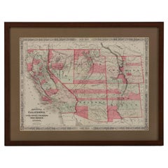
1865 "Johnson's California, Utah, Nevada, Colorado, New Mexico, Arizona" Map
Located in Colorado Springs, CO
, New Mexico, and Arizona” map. First published in 1864, this map was issued as pages 66 and 67 in the
Category

Mid-19th Century Antique Maps New Mexico

Materials

Paper

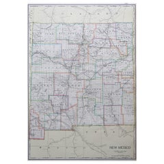
Large Original Antique Map of New Mexico, Usa, C.1900
Located in St Annes, Lancashire
Fabulous map of New Mexico. Original color. Engraved and printed by the George F. Cram Company
Category

1890s American Antique Maps New Mexico

Materials

Paper

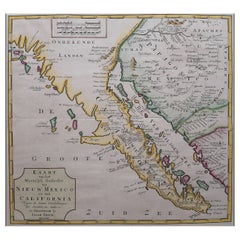
Original Antique Map of the Western Part of NEW MEXICO & CALIFORNIA
Located in Langweer, NL
Title: "Map of the Western Part of NEW MEXICO and CALIFORNIA According to the Latest Discoveries by
Category

1760s Antique Maps New Mexico

Materials

Paper

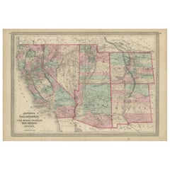
Antique Map of California, Utah, Nevada, Colorado, New Mexico & Arizona '1872'
Located in Langweer, NL
, New Mexico and Arizona. This map originates from 'Johnson's New Illustrated Family Atlas of the World
Category

Late 19th Century Antique Maps New Mexico

Materials

Paper

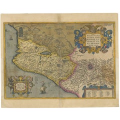
Antique Map of Mexico by Ortelius, circa 1602
By Abraham Ortelius
Located in Langweer, NL
Antique map titled 'Hispaniae Novae Sivae Magnae Recens Et Vera Descriptio 1579'. Map of western
Category

Early 17th Century Belgian Antique Maps New Mexico

Materials

Paper

Antique Map of Mexico by Ortelius, circa 1602
H 16.93 in W 20.87 in D 0.02 in
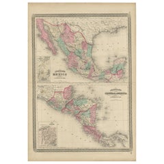
Antique Map of Mexico and Central America by Johnson '1872'
Located in Langweer, NL
Antique map titled 'Johnson's Mexico (..)'. Two maps one one sheet showing Mexico and Central
Category

Late 19th Century Antique Maps New Mexico

Materials

Paper

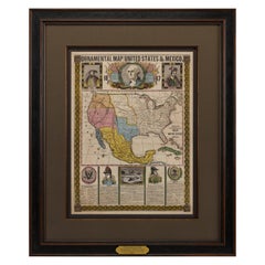
1847 Ornamental Map of the United States & Mexico by H. Phelps
Located in Colorado Springs, CO
States & Mexico" by Humphrey Phelps. The map was issued as an act of Congress by Phelps on Fulton Street
Category

1840s American Antique Maps New Mexico

Materials

Paper

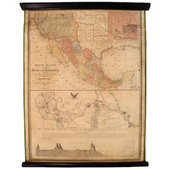
1847 Antique Map of Mexico, Texas and California by Samuel Augustus Mitchell
By Samuel Augustus Mitchell 1
Located in Colorado Springs, CO
Presented is the second edition of Samuel Augustus Mitchell's Map of Mexico, Including Yucatan
Category

1840s American Antique Maps New Mexico

Materials

Paper

Victorian Visions of the New World: A Detailed Tallis Map of North America, 1851
Located in Langweer, NL
The map presented here is an intricate example from the series of maps produced by John Tallis
Category

1850s Antique Maps New Mexico

Materials

Paper

1864 Map of North America, Antique Hand-Colored Map, by Adolphe Hippolyte Dufour
Located in Colorado Springs, CO
. New Mexico depicted is above Arizona (Baylor line) and the Territory of Shoshone is shown (pre-Idaho
Category

1860s French Antique Maps New Mexico

Materials

Paper

1875 "North America" Map by J. Bartholomew
Located in Colorado Springs, CO
Presented is an original 1875 map of “North America.” The map was issued in Volume 1 of the Ninth
Category

1870s Scottish Antique Maps New Mexico

Materials

Paper

1908 "Map of Texas" by The Kenyon Company
Located in Colorado Springs, CO
prominently on this fantastic map. Although uncolored, the bordering states of New Mexico, Oklahoma, Arkansas
Category

Early 1900s American Antique Maps New Mexico

Materials

Paper

America "Amérique Septentrionale": A 19th Century French Map by Delamarche
By Maison Delamarche 1
Located in Alamo, CA
eventual English names. These territories in modern day Colorado, Arizona, New Mexico, Texas, Washington
Category

Mid-19th Century American Other Antique Maps New Mexico

Materials

Paper

Louisiana: A Framed 19th Century Map by O. W. Gray
By Gray and Co
Located in Alamo, CA
Mexico and towns and cities, such as New Orleans, Baton Rouge and Lafayette. Ormando Wyllis (O.W.) Gray
Category

Mid-19th Century American Other Antique Maps New Mexico

Materials

Paper

"The United States from the Latest Authorities" Antique Wall Map, 1835
Located in Colorado Springs, CO
"Oregon District" and several engraved city views and two portraits. The primary map extends to Mexico
Category

1830s American Antique Maps New Mexico

Materials

Paper

1899 Poole Brothers Antique Railroad Map of the Illinois Central Railroad
Located in Colorado Springs, CO
lead to the creation of the Louisville, New Orleans, and Texas Railway. This map was first produced by
Category

1890s American Antique Maps New Mexico

Materials

Paper

1859 "Map of the United States of America..." by J. H. Colton
By J.H. Colton
Located in Colorado Springs, CO
. The southern borders of Arizona and New Mexico reflect the recent Gadsden Purchase. The map also
Category

1850s American Antique Maps New Mexico

Materials

Paper

Antique Map of The United States of North America, Pacific States, 1882
Located in Langweer, NL
Mexico would remain territories until 1912. 6. **Natural Features**: The map would showcase significant
Category

1880s Antique Maps New Mexico

Materials

Paper

1889 "The Pacific States and Territories"
Located in Colorado Springs, CO
, Idaho, Wyoming, Utah, Colorado, Arizona, and New Mexico. They are bordered by British America to the
Category

1880s American Antique Maps New Mexico

Materials

Paper

1889 "The Pacific States and Territories"
H 16.25 in W 14.25 in D 1 in
1879 "United States of America, Western Part" by O. J. Stuart
Located in Colorado Springs, CO
by O. J. Stuart in New York. The map depicts the Western states of the United States at the time
Category

1870s American Antique Maps New Mexico

Materials

Paper

Arizona and New Mexico. USA. Century Atlas state antique vintage map
Located in Melbourne, Victoria
'The Century Atlas. Arizona and New Mexico.' Original antique map, 1903. Central fold as issued
Category

Early 20th Century Victorian Antique Maps New Mexico

Materials

Lithograph

Map Tabula Asiae IX Pakistan Afghanistan Iran Indian Ocean
Located in Florham Park, NJ
, Brazil, Mexico, Baja California, the Gulf Coast of Florida. New England with parts of Labrador, Africa
Category

16th Century Realist Antique Maps New Mexico

Materials

Copper

Louisiana: A Framed 19th Century Map by O.W. Gray
Located in Alamo, CA
Mexico and towns and cities, such as New Orleans, Baton Rouge and Lafayette. Ormando Wyllis (O.W.) Gray
Category

1870s Antique Maps New Mexico

Materials

Engraving

Set of 6 Original Vintage Maps of American States, circa 1900
Located in St Annes, Lancashire
Wonderful set of 6 vintage maps. Random American states including Maine, Utah, New Hampshire
Category

Early 1900s American Edwardian Antique Maps New Mexico

Materials

Paper

North America: A Framed Hand-colored 19th Century German Map by Adolph Stieler
By Adolf Stieler
Located in Alamo, CA
, Arizona, New Mexico and much of Texas are still part of Mexico. The "Oregon District" includes the modern
Category

1830s Antique Maps New Mexico

Materials

Engraving

Personal Memoirs of U. S. Grant, Two-Volume Set, 1885-86
Located in Colorado Springs, CO
frontispiece portraits, illustrations, maps, and facsimile letters, several as fold-outs. With a new custom
Category

1880s American Antique Maps New Mexico

Materials

Leather, Paper

Wonderful and extremely rare Dutch pocketglobe
By Dementz Family DEUR Art Company
Located in ZWIJNDRECHT, NL
still appears misshapen; North America comprises only regions named ‘Florida’, ‘Nova Francia’, and ‘New
Category

Early 18th Century Dutch Dutch Colonial Antique Maps New Mexico

Materials

Hardwood, Paper

Wonderful and extremely rare Dutch pocketglobe
Free Shipping
H 2.5 in Dm 2.5 in
Art Forms in Nature (Plate 79 - Basiliscus) — 1899 Celebration of Nature
Located in Myrtle Beach, SC
discovered, described and named thousands of new species, mapped a genealogical tree relating all life forms
Category

1890s Realist Antique Maps New Mexico

Materials

Lithograph

English Pocket Globe, London, Circa 1775-1798
By Herman Moll
Located in Milano, IT
Ocean there is a cartouche with the inscription: A Correct Globe with the new Discoveries. The
Category

Late 18th Century English George III Antique Maps New Mexico

Materials

Shagreen, Paper

A truly delightful miniature terrestrial pocket globe
By Nathaniel Mills
Located in ZWIJNDRECHT, NL
southerly tips of Australia, New Zealand, and South America. North America shows California, New Mexico
Category

Mid-18th Century British Dutch Colonial Antique Maps New Mexico

Materials

Other

'Victor's Camp - Hell Gate Ronde' original John Mix Stanley lithograph
By John Mix Stanley
Located in Milwaukee, WI
: to produce topographical maps, to document flora and fauna, and to document natural resources to
Category

1850s Romantic Antique Maps New Mexico

Materials

Lithograph

'Lieutenant Crovers Despatch – Return of Governor Stevens to Fort Benton'
By John Mix Stanley
Located in Milwaukee, WI
Washington, DC: Baltimore, New York and London, but it has been lost. More than 200 of his paintings, maps
Category

1850s Romantic Antique Maps New Mexico

Materials

Lithograph

'Maple River' original color lithograph by John Mix Stanley
By John Mix Stanley
Located in Milwaukee, WI
: to produce topographical maps, to document flora and fauna, and to document natural resources to
Category

1850s Romantic Antique Maps New Mexico

Materials

Lithograph

'Kettle Falls, Columbia River' original color lithograph by John Mix Stanley
By John Mix Stanley
Located in Milwaukee, WI
: to produce topographical maps, to document flora and fauna, and to document natural resources to
Category

1850s Romantic Antique Maps New Mexico

Materials

Lithograph

'Camp Red River Hunters' original lithograph by John Mix Stanley
By John Mix Stanley
Located in Milwaukee, WI
: to produce topographical maps, to document flora and fauna, and to document natural resources to
Category

1850s Romantic Antique Maps New Mexico

Materials

Lithograph

'Distribution of Goods to the Assiniboines' original John Mix Stanley lithograph
By John Mix Stanley
Located in Milwaukee, WI
: to produce topographical maps, to document flora and fauna, and to document natural resources to
Category

1850s Romantic Antique Maps New Mexico

Materials

Lithograph

'Distribution of Goods to the Gros Ventres' lithograph by John Mix Stanley
By John Mix Stanley
Located in Milwaukee, WI
: to produce topographical maps, to document flora and fauna, and to document natural resources to
Category

1850s Romantic Antique Maps New Mexico

Materials

Lithograph

Art Deco Fortune Magazine Cover October 1938
Located in Dallas, TX
November 1904 — 4 February 1957) was a Mexican painter, caricaturist, illustrator, ethnologist and art
Category

Early 20th Century American Art Deco Antique Maps New Mexico

Materials

Paper

The 1564 Medici Danti Map of California
By Fra Egnazio Danti
Located in New York, NY
in New Mexico, Quivira –visited by Coronado in 1541 and placed on the map as if it were in California
Category

17th Century Old Masters Antique Maps New Mexico

Materials

Canvas, Paper, Ink, Watercolor, Gouache, Pen

1719 Chatelain Map of Mexico, Southeast North America and the Caribbean
By Henri-Abraham Chatelain
Located in New York, NY
Original first edition 1719 engraved map, full title in French "Carte contenant royaume mexique et
Category

1710s Realist Antique Maps New Mexico

Materials

Engraving

Richardson's New Map of the State of Texas
By Charles Desilver, Willard Richardson 1
Located in Houston, TX
). Richardson's New Map of the State of Texas Including part of Mexico Compiled from Government Surveys and Other
Category

Mid-19th Century American Other Antique Maps New Mexico

Richardson's New Map of the State of Texas
H 22.75 in W 30.25 in D 0.5 in
1762 Map of North America
By Thomas Kitchin
Located in New York, NY
"An Accurate Map of the British Empire in North America as settled by the Prelimmnaries in 1762" by
Category

1760s Realist Antique Maps New Mexico

Materials

Engraving

Cirica 1860 Map of North America
By George Virtue
Located in New York, NY
Temple, Mexico, Falls of Niagara, Indian Chief and Hunting the Buffalo. Published by George Virtue in
Category

Mid-19th Century Antique Maps New Mexico

Materials

Engraving

1874 Antique Map of Colorado, Utah, New Mexico, and Arizona
Located in Colorado Springs, CO
Presented is an original map of Colorado, Utah, New Mexico, and Arizona from 1874. This authentic
Category

1870s American Antique Maps New Mexico

Materials

Paper

1858 "Mitchell's New National Map Exhibiting the United States" Hanging Wall Map
By Samuel Augustus Mitchell 1
Located in Colorado Springs, CO
fall of small-scale territorial rebellions. On this map we see New Mexico in its late 1850s form, with
Category

1850s American Antique Maps New Mexico

Materials

Paper

Mitchell's New National Wall Map Exhibiting the United States, circa 1856
Located in Colorado Springs, CO
"Mitchell's New National Map of the United States, North American British Provinces, Sandwich
Category

1850s American Antique Maps New Mexico

1854 "New Map of That Portion of North America" Published by Jacob Monk
Located in Colorado Springs, CO
“New Map of that Portion of North America, exhibiting the United States and Territories, The
Category

1850s American Antique Maps New Mexico

Materials

Paper

1856 a New Map of the Union with the Adjacent Islands and Countries
Located in Colorado Springs, CO
fully titled "A New Map of the Union with the Adjacent Islands & Countries, from Authentic Sources and
Category

1850s American Antique Maps New Mexico

1854 Map of Partial North America, Antique Wall Map by Jacob Monk
Located in Colorado Springs, CO
. The map also features very large, early configurations of Washington, Oregon, Utah, and New Mexico
Category

1850s American Antique Maps New Mexico

Materials

Paper

Texas Civil War Map, circa 1863
Located in Colorado Springs, CO
of adjacent New Mexico, Arkansas, and the Indian Territory (Oklahoma). The map shows the Elevated
Category

1860s American Antique Maps New Mexico

Texas Civil War Map, circa 1863
H 20 in W 29 in D 1.5 in
Map of the Denver & Rio Grande Railroad System by S.K. Hooper, Antique Map, 1895
Located in Colorado Springs, CO
“Tourists’ Hand Book of Colorado, New Mexico and Utah” were just the beginning of a lengthy canon of words
Category

1890s American Antique Maps New Mexico

Materials

Paper

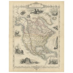
Antique Map of North America by Tallis 'c.1850'
Located in Langweer, NL
Antique map titled 'North America'. Decorative map of North America. Includes vignettes of the
Category

Mid-19th Century Antique Maps New Mexico

Materials

Paper

Antique Map of North America by Tallis 'c.1850'
Free Shipping
H 13.78 in W 10.44 in D 0.02 in
1828 "Map of the United States" by T. Ensign
Located in Colorado Springs, CO
North America. Because this map predates the Texas Revolution, the Mexican American War, and the
Category

1820s American Antique Maps New Mexico

Materials

Paper

Atwood's Pictorial Map of the United States, circa 1854
Located in Colorado Springs, CO
nations are identified throughout. A smaller map of Mexico appears on the lower left quadrant. True its
Category

1850s American Antique Maps New Mexico

1848 "Pictorial Map of the United States" by Ensign & Thayer
Located in Colorado Springs, CO
Offered is a scarce map of the United States and Mexico by Ensign and Thayer, dating to 1848. This
Category

1840s Antique Maps New Mexico

Materials

Paper

1877 General Geological Map of Colorado by F. V. Hayden
Located in Colorado Springs, CO
Colorado, as well as portions of Utah, Arizona and New Mexico. This particular map shows Colorado, color
Category

1870s American Antique Maps New Mexico

Materials

Paper

1857 Wall Map of the United States by Fanning, Bridgman & Ensign
By Thayer, Bridgman and Fanning
Located in Colorado Springs, CO
Presented is a scarce American wall map of the United States and Mexico issued by Ensign, Bridgman
Category

1850s American Antique Maps New Mexico

Materials

Paper

1856 Map of the State of Texas by J. H. Colton
Located in Colorado Springs, CO
publisher J.H.Colton. The map, titled “Colton’s New Map of the State of Texas," was compiled from the famous
Category

1850s American Antique Maps New Mexico

Materials

Paper

1847 "Pictorial Map of the United States" by Ensign and Thayer
Located in Colorado Springs, CO
Offered is a scarce map of the United States and Mexico by Ensign and Thayer. This pictorial map
Category

1840s American Antique Maps New Mexico

Materials

Paper

1856 Hanging "Map of the United States from the Latest Authorities"
Located in Colorado Springs, CO
classic map of the “Manifest Destiny” era, showing rapid westward expansion and new territories. Even the
Category

1850s American Antique Maps New Mexico

Materials

Linen, Wood, Paper

  • 1
Get Updated with New Arrivals
Save "Antique Maps New Mexico", and we’ll notify you when there are new listings in this category.

Antique Maps New Mexico For Sale on 1stDibs

Choose from an assortment of styles, material and more with respect to the antique maps new mexico you’re looking for at 1stDibs. An antique maps new mexico — often made from paper, animal skin and leather — can elevate any home. Whether you’re looking for an older or newer antique maps new mexico, there are earlier versions available from the 18th Century and newer variations made as recently as the 20th Century. An antique maps new mexico is a generally popular piece of furniture, but those created in Georgian, Art Deco and Baroque styles are sought with frequency. Ulysses S. Grant, Samuel Augustus Mitchell and Herman Moll each produced at least one beautiful antique maps new mexico that is worth considering.

How Much is a Antique Maps New Mexico?

Prices for an antique maps new mexico start at $1 and top out at $135,000 with the average selling for $2,000.

Read More

Pamela Shamshiri Shares the Secrets behind Her First-Ever Book and Its Effortlessly Cool Interiors

The sought-after designer worked with the team at Hoffman Creative to produce a monograph that beautifully showcases some of Studio Shamshiri's most inspiring projects.

Moroccan Artworks and Objects Take Center Stage in an Extraordinary Villa in Tangier

Italian writer and collector Umberto Pasti opens the doors to his remarkable cave of wonders in North Africa.

Montecito Has Drawn Royalty and Celebrities, and These Homes Are Proof of Its Allure

Hollywood A-listers, ex-pat aristocrats and art collectors and style setters of all stripes appreciate the allure of the coastal California hamlet — much on our minds after recent winter floods.

Whaam! Blam! Pow! — a New Book on Pop Art Packs a Punch

Publishing house Assouline and writer Julie Belcove have teamed up to trace the history of the genre, from Roy Lichtenstein, Andy Warhol and Yayoi Kusama to Mickalene Thomas and Jeff Koons.

The Sparkling Legacy of Tiffany & Co. Explained, One Jewel at a Time

A gorgeous new book celebrates — and memorializes — the iconic jeweler’s rich heritage.

What Makes a Gem-Encrusted Chess Set Worth $4 Million?

The world’s most opulent chess set, weighing in at 513 carats, is literally fit for a king and queen.

Tauba Auerbach’s Geometric Pop-Up Book Is Mighty Rare, Thanks to a Hurricane

This sculptural art book has an epic backstory of its own.

Step inside the Storied Mansions of Palm Beach’s Most Effervescent Architect

From Spanish-style courtyards to fanciful fountains, these acclaimed structures abound in surprising and elegant details.