Antique Maps Scandinavia
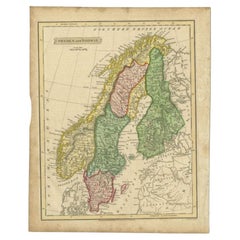
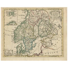
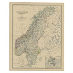
Antique Map of Sweden and Norway by Russell, 1814
Located in Langweer, NL
Antique map Scandinavia titled 'Sweden & Norway'. Antique map of Scandinavia with a focus on Sweden
Category
19th Century Antique Maps Scandinavia
Materials
Paper
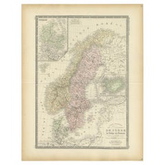
Antique Map of Scandinavia by Levasseur, 1875
Located in Langweer, NL
Scandinavia. This map originates from 'Atlas de Géographie Moderne Physique et Politique' by A. Levasseur
Category
Late 19th Century Antique Maps Scandinavia
Materials
Paper
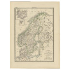
Antique Map of Scandinavia by Lapie, 1842
Located in Langweer, NL
Danemark'. Map of Scandinavia including Sweden, Norway and Denmark. With inset maps of Iceland and the
Category
Mid-19th Century Antique Maps Scandinavia
Materials
Paper
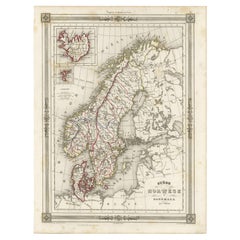
Antique Map of Scandinavia: Norway, Sweden and Denmark
Located in Langweer, NL
Antique map titled 'Suède, Norwège & Danemark'. Attractive map of Scandinavia, with Sweden, Norway
Category
Mid-19th Century Antique Maps Scandinavia
Materials
Paper
Antique Map of Scandinavia by T. Jefferys, circa 1750
Located in Langweer, NL
engraved antique map of Scandinavia by Thomas Jefferys. Published circa 1750 by Thomas Salmon in his
Category
Mid-18th Century Antique Maps Scandinavia
Materials
Paper
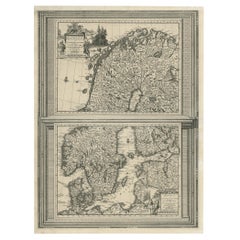
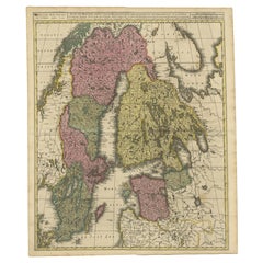
Antique Map of Scandinavia by Van der Aa 'circa 1710'
Located in Langweer, NL
with two maps on one sheet. The upper map depicts Northern Scandinavia with Norway, Sweden and Finland
Category
Early 18th Century Antique Maps Scandinavia
Materials
Paper
Scandinavia & Portions of Eastern Europe: 18th Century Hand-Colored Homann Map
By Johann Baptist Homann
Located in Alamo, CA
in Nuremberg, Germany, initially in 1710 and again in 1730. The map depicts Scandinavia, including
Category
Early 18th Century German Antique Maps Scandinavia
Materials
Paper
H 20.75 in W 23.5 in D 0.07 in
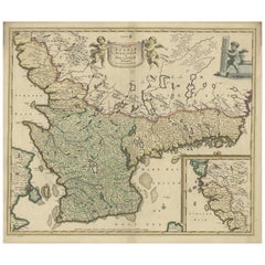
Antique Map of South Sweden 'Scandinavia' by F. de Wit, 1680
Located in Langweer, NL
Antique map titled 'Accurata Scaniae, Blekingae et Hallandiae Descriptio per F. de Wit Amstelodami
Category
Late 17th Century Antique Maps Scandinavia
Materials
Paper
Antique Map of Scandinavia and the Baltic Region by Valk, circa 1690
Located in Langweer, NL
Antique map titled 'Sueciae Magnae, totius orbis regni antiquissimi (..)'. Map of Scandinavia and
Category
Late 17th Century Antique Maps Scandinavia
Materials
Paper
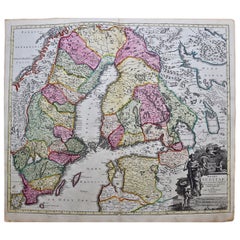
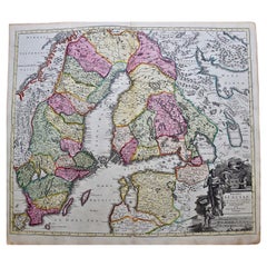
Sweden & Adjacent Portions of Scandinavia: A Hand-Colored 18th C. Map by Homann
By Johann Baptist Homann
Located in Alamo, CA
This hand-colored map of Sweden and adjacent portions of Scandinavia entitled "Regni Sueciae in
Category
1720s German Antique Maps Scandinavia
Materials
Paper
H 21 in W 23.38 in D 0.07 in
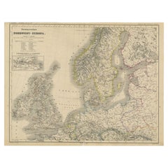
Antique Map of Northwest Europe by Kiepert, c.1870
Located in Langweer, NL
United Kingdom, Ireland, the Netherlands, Germany, Scandinavia and surroundings. This map originates from
Category
19th Century Antique Maps Scandinavia
Materials
Paper
Antique Map of Sweden and Norway by Johnston, 1882
Located in Langweer, NL
Antique map titled 'Sweden & Norway (Scandinavia)'. Old map of Sweden and Norway, with inset map of
Category
19th Century Antique Maps Scandinavia
Materials
Paper
1633 Map Entitled "Beauvaisis Comitatus Belova Cium, Ric.0002
Located in Norton, MA
the Elder (see under Gerard Mercator (Atlas Minor) for further detail) * 1613 Map of Scandinavia
Category
17th Century Dutch Antique Maps Scandinavia
Materials
Paper
Antique Map of Sweden & Norway by A.K. Johnston '1865'
Located in Langweer, NL
Antique map titled 'Sweden & Norway (Scandinavia)'. With an inset map of Stockholm and environments
Category
Mid-19th Century Antique Maps Scandinavia
Materials
Paper
1859 Denmark and Schleswig-Holstein Map: A Historical View from Blackie's Atlas
Located in Langweer, NL
The "Antique Map of Denmark with Schleswig & Holstein" from 'The Imperial Atlas of Modern Geography
Category
Mid-19th Century Antique Maps Scandinavia
Materials
Paper
H 14.57 in W 10.63 in D 0.02 in
Persia, Armenia & Adjacent Regions: A 17th Century Hand-colored Map by De Wit
By Frederick de Wit
Located in Alamo, CA
attractive map of Scandinavia, which includes the Baltic Sea, Norway, Sweden, Finland, Denmark and portions
Category
Late 17th Century Dutch Antique Maps Scandinavia
Materials
Paper
H 23.5 in W 27 in D 1.325 in
Antique Map of the North Pole by V.M. Coronelli, circa 1692
By Vincenzo Coronelli
Located in Langweer, NL
, Scandinavia and Siberia, and is decorated with pictorial scenes of bear, seal and whale hunters. The globe
Category
Late 17th Century Antique Maps Scandinavia
Materials
Paper
Sweden and Adjacent Portions of Scandinavia: A Hand-colored 18th C. Homann Map
By Johann Baptist Homann
Located in Alamo, CA
This hand-colored copper-plate map of Sweden and adjacent portions of Scandinavia entitled "Regni
Category
Early 18th Century Old Masters Antique Maps Scandinavia
Materials
Engraving
Europe: An Original 18th Century Hand-colored Map by E. Bowen
Located in Alamo, CA
Complete Collection of Voyages and Travels". The map depicts Europe from Scandinavia in the north to the
Category
Mid-18th Century Old Masters Antique Maps Scandinavia
Materials
Engraving
Original Antique Poster Norvege Norway Midnight Sun Stavkirke Church Travel Map
Located in London, GB
and the building reflected in the calm water next to a route map marking travel over the Atlantic
Category
1610s Norwegian Antique Maps Scandinavia
Materials
Paper
H 38.98 in W 25.6 in D 0.04 in
Europa Regnorum Provinciarum: 18th Century Hand-colored Map of Europe by Lotter
By Tobias Conrad Lotter
Located in Alamo, CA
This is an 18th century hand-colored copperplate engraved map entitled "Europa Regnorum
Category
Mid-18th Century Antique Maps Scandinavia
Materials
Engraving
First Edition Guthrie's Geographical Grammmar in Miniature, 1807
Located in Langweer, NL
worldmap and maps of Scandinavia, the Russian dominions, Great Britain and Ireland, France, Belgium ("The
Category
Early 19th Century Antique Maps Scandinavia
Materials
Paper
A truly delightful miniature terrestrial pocket globe
By Nathaniel Mills
Located in ZWIJNDRECHT, NL
; to the area concerning the British Isles, and also to parts of Europe and Scandinavia (with some loss
Category
Mid-18th Century British Dutch Colonial Antique Maps Scandinavia
Materials
Other
Original Antique Poster Norvege Norway Midnight Sun Stavkirke Church Travel Map
Located in London, GB
and the building reflected in the calm water next to a route map marking travel over the Atlantic
Category
Early 1900s Antique Maps Scandinavia
Materials
Paper
People Also Browsed
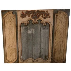
18th Century Painted Boiserie Panel
Located in Washington, DC
A 18th century painted boiserie panel.
Category
18th Century French Antique Maps Scandinavia
Materials
Wood, Paint
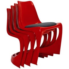
Space Age Red Plastic Vintage Dining Chairs Steen Ostergaard, 1966, Denmark
By Steen Ostergaard
Located in Vienna, AT
Space Age four ( 4 ) red plastic vintage dining chairs by Steen Ostergaard 1966 for Cado Norway 1971.
These wonderful red 4 ( four ) dining chairs from plastic show a black textil u...
Category
Late 20th Century Danish Space Age Antique Maps Scandinavia
Materials
Fabric, Plastic
H 29.53 in W 20.87 in D 19.3 in
Large Original Vintage Map of Greece, circa 1920
Located in St Annes, Lancashire
Great map of Greece
Original color.
Good condition
Published by Alexander Gross
Unframed.
Category
1920s English Antique Maps Scandinavia
Materials
Paper
Antique Map of Northern Africa "Barbary Coast" by R. Bonne, circa 1780
Located in Langweer, NL
A fine example of Rigobert Bonne and Guilleme Raynal’s 1780 map of northwestern Africa or the Barbary Coast. Includes the modern day countries of Morocco, Algeria, Tunisia, Libya, an...
Category
Late 18th Century Antique Maps Scandinavia
Materials
Paper
H 10.24 in W 15.08 in D 0.02 in
Gallant Scene Painting by Philippe Mercier, 18th Century
Located in Lisbon, PT
An 18th century painting of a gallant scene in a park.
Attributed with seal of painter's studio to Philippe Mercier (1689 to 1760) from the circle of the french painter Nicolas Lanc...
Category
18th Century French Baroque Antique Maps Scandinavia
Materials
Canvas
Rare Art Deco Hook beside the Door for Shopping Bags
Located in Wien, AT
Rare Art Deco hook beside the door for shopping bags
Nickel-plated.
Category
1920s Austrian Art Deco Antique Maps Scandinavia
Materials
Brass, Nickel
Antique Map of the Ancient Greek Colonization
Located in Langweer, NL
Antique map titled 'Map I containing the Western Division of the Grecian Colonies & Conquests'. Original antique map of the ancient Greek colonization. Frontispiece map of 'The Histo...
Category
Late 18th Century Antique Maps Scandinavia
Materials
Paper
Antique Map of Egypt, '1875'
Located in Langweer, NL
Antique map titled 'Carte des l'Égypte'. Large map of Egypt. This map originates from 'Atlas de Géographie Moderne Physique et Politique' by A. Levasseur. Published 1875.
Category
Late 19th Century Antique Maps Scandinavia
Materials
Paper
Balkan Convergence: A Map of Turkey and Greece with the Balkan States, 1882
Located in Langweer, NL
This map, "TURKEY AND GREECE including ROUMANIA, SERVIA, BULGARIA, BOSNIA & MONTENEGRO," extracted from Blackie & Son's 1882 atlas, captures the complex political and geographical la...
Category
1880s Antique Maps Scandinavia
Materials
Paper
H 22.45 in W 14.97 in D 0 in
Original Lithograph - Henri Matisse - Apollinaire
By Henri Matisse
Located in Collonge Bellerive, Geneve, CH
Original Lithograph - Henri Matisse - Apollinaire
Artist : Henri MATISSE
13 x 10 inches
Edition: 151/330
References : Duthuit-Matisse Catalogue raisonné 31
MATISSE'S BIOGRAPHY
YO...
Category
1930s Modern Antique Maps Scandinavia
Materials
Linocut
10 French Orchies Faience Majolica Asparagus and Artichoke Plates with Platter
By Orchies
Located in Birmingham, AL
A rare and exceptional 19th century set of 10 majolica glazed French faïence barbotine artichoke and asparagus plates complete with oval shaped master server or platter by Orchies, c...
Category
19th Century French Art Nouveau Antique Maps Scandinavia
Materials
Ceramic, Earthenware, Faience, Majolica
French 19th Century Oil on Canvas "Venus Disarming Cupid" after François Boucher
By François Boucher
Located in Los Angeles, CA
A large French 19th century oil on canvas laid on board painting in the manner of François Boucher (French, 1703-1770). The oval framed canvas depicting a version of Boucher's "Venus...
Category
Late 19th Century French Romantic Antique Maps Scandinavia
Materials
Canvas, Wood, Plywood
H 44.38 in W 56.38 in D 2 in
Stunning Arts and Crafts Enameled 830 Silver Vase by Silversmith Thune of Oslo
Located in Lisse, NL
One of a kind, enameled silver vase.
For the collectors of rare and handcrafted silver object from the Arts & Crafts era, we proudly offer this stunning vase. This hand-hammered and...
Category
Early 20th Century Norwegian Arts and Crafts Antique Maps Scandinavia
Materials
Silver
Free Shipping
H 8.66 in Dm 4.12 in
Norwegian Tankard
Located in San Francisco, CA
A fine and important Norwegian tankard in birch burl wood with carved lion motif on top of lid, thumb piece and feet. Beautiful color, ceremonial markings on inside, lovely metal str...
Category
Early 18th Century Norwegian Baroque Antique Maps Scandinavia
Materials
Wood
Drawing Attributed to Jean-Baptiste Pillement
By Jean-Baptiste Pillement
Located in Kittery Point, ME
Two-faced drawing.
Studies of characters and harbor scene.
With an inscription stating it is from the sketchbook in the collection of Dr. Manuel de Espirito Santo in Lisbon.
Ink a...
Category
Late 18th Century French Neoclassical Antique Maps Scandinavia
Materials
Paper
Three Kähler vases with luster glaze, Karl Hansen Reistrup.
Located in Copenhagen, DK
Three Kähler vases with luster glaze, Karl Hansen Reistrup.
With the three Danish lions, the Norwegian lion and the three Swedish crowns.
Signed at the bottom.
Height 13 cm. (highest...
Category
1920s Danish Art Deco Antique Maps Scandinavia
Recent Sales
Rare 1710 Hand-Colored Map of Europe
By Frederick de Wit
Located in La Jolla, CA
chart that shows an area from Morocco to the Scandinavian island of Spitsbergen and Iceland. The map
Category
1710s Dutch Northern Renaissance Antique Maps Scandinavia
Materials
Paper
Rare Nova Et Accurata Orbis Arctoi Tabula Geographica, Scandinavian Map, 1680
By Erik Von Dahlberg
Located in Drottningholm, SE
Swedish 17th c Map of Scandinavia made by Erik Von Dahlberg in the late 17th century. This is a copper
Category
1680s Swedish Antique Maps Scandinavia
Materials
Paper
H 16.34 in W 20.48 in D 0.6 in
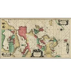
Carte reduite des Mers du Nord [...].
By Jacques-Nicolas Bellin
Located in Zeeland, Noord-Brabant
Carte reduite des Mers du Nord [...] - Detailed map of the Northern Oceans ... Highly decorative
Category
Mid-18th Century Antique Maps Scandinavia
Materials
Engraving
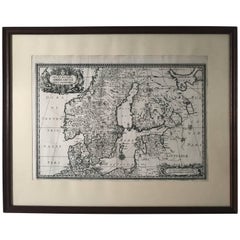
Great Old Map of Scandinavia Incl Finland, Eastern Russia and the Baltics, C1680
Located in Langweer, NL
Antique map Scandinavia titled 'Exactissima Totius Scandinaviae Tabula, qua tam Sueciae, Daniae, et
Category
1680s Antique Maps Scandinavia
Materials
Paper
H 20.87 in W 25.2 in D 0 in
A Hand Colored 17th Century Map of Scandinavia by Frederick de Wit
By Frederick de Wit
Located in Alamo, CA
attractive map of Scandinavia, which includes the Baltic Sea, Norway, Sweden, Finland, Denmark and portions
Category
Late 17th Century Old Masters Antique Maps Scandinavia
Materials
Engraving
H 24 in W 26.5 in D 0.13 in
Antique Map of Scandinavia by G.A. Magini, 1596
Located in Langweer, NL
Striking example of Magini's modern map of Scandinavia and the North Atlantic regions. Magini bases
Category
16th Century Antique Maps Scandinavia
Materials
Paper
Scandinavia a Hand Colored 17th Century Map by Frederick de Wit
By Frederick de Wit
Located in Alamo, CA
attractive map of Scandinavia, which includes the Baltic Sea, Norway, Sweden, Finland, Denmark and portions
Category
Late 17th Century European Antique Maps Scandinavia
Materials
Paper
Original Antique Map of Sweden, Norway, Denmark and Finland, circa 1790
Located in St Annes, Lancashire
Super map of Scandinavia
Copper plate engraving by A.Bell
Published, circa 1790.
Unframed.
Category
1790s English Other Antique Maps Scandinavia
Materials
Paper
1 bid
No Reserve
H 8.25 in W 11 in D 0.07 in
Antique Map of Northern and Eastern Europe by Stieler, 1855
Located in Langweer, NL
Oesterreichischen u. Preussischen Staats.' Large-scale map of Eastern and Northern Europe, with focus on Scandinavia
Category
19th Century Antique Maps Scandinavia
Materials
Paper
The Atlantic Ocean, Americas, Africa and Europe: Hand-colored 18th C. Bowen Map
Located in Alamo, CA
This is an original 18th century hand-colored map entitled "A New & Accurate Chart of the The
Category
Mid-18th Century Old Masters Antique Maps Scandinavia
Materials
Engraving
Original Antique Poster Norway The Land Of The Midnight Sun Stavkirke Travel Art
Located in London, GB
map marking travel over the Atlantic Ocean from America and Canada, Europe, Scandinavia and North
Category
Early 1900s Norwegian Antique Maps Scandinavia
Materials
Paper
H 38.98 in W 25.99 in D 0.04 in
Original Antique Poster Norway The Land Of The Midnight Sun Stavkirke Travel Art
Located in London, GB
map marking travel over the Atlantic Ocean from America and Canada, Europe, Scandinavia and North
Category
Early 1900s Antique Maps Scandinavia
Materials
Paper
1735 Johan Homann Hand Colored Scandinavian Map Extremely Rare
By Johann Baptist Homann
Located in Drottningholm, SE
A beautifully detailed circa 1735 J. B. Homann map of Scandinavia. "Scandinavia compectens
Category
1730s German Antique Maps Scandinavia
Get Updated with New Arrivals
Save "Antique Maps Scandinavia", and we’ll notify you when there are new listings in this category.
Antique Maps Scandinavia For Sale on 1stDibs
With a vast inventory of beautiful furniture at 1stDibs, we’ve got just the antique maps Scandinavia you’re looking for. Each antique maps Scandinavia for sale was constructed with extraordinary care, often using paper. Whether you’re looking for an older or newer antique maps Scandinavia, there are earlier versions available from the 18th Century and newer variations made as recently as the 19th Century. A well-made antique maps Scandinavia has long been a part of the offerings for many furniture designers and manufacturers, but those produced by Vincenzo Coronelli are consistently popular.
How Much is a Antique Maps Scandinavia?
Prices for an antique maps Scandinavia start at $97 and top out at $1,489 with the average selling for $595.
More Ways To Browse
Antique Map Background
Finnish 18th
Map Baltics
Night Sky Map
Finland Map
Map Of Eastern Europe
Map Of Finland
Map Of Norway
Carte Ancienne
Antique Map Ortelius
Antique Maps Ortelius
Norway Antique Map
Antique Canadian Maps
Antique Map Of Canada
Middle Eastern Plate
Atlantic Ocean Antique Map
Antique Sinclair
Lisbon Poster
